Hidden gems along the Alaska Highway
The Alaska Highway is on many people’s “bucket list”, and it would be easy to spend an entire summer exploring along it. Few of us have that much time, though, and it can be tough to prioritize what to see, especially if you want to get off the beaten track even more than you already are just by being on the Alaska Highway. While there are many sites along the highway that are well known and heavily visited, notably the Mile “0” signpost, Liard Hot Springs and the Signpost Forest, many other wonderful sites close to the highway see few visitors, including a wind park, old sections of the highway, some intriguing canyons, and a beautiful waterfall.
Bear Mountain Wind Park
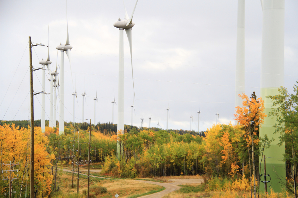
Just a few kilometers from the Mile “0” signpost in Dawson Creek is the very impressive Bear Mountain Wind Park, BC’s first commercial wind facility. Construction by Peace Energy and Aeolis Wind Power began in 2007, and it went into operation in October 2009, with the ability to power up to 1,000 homes. The 34-turbine project is now owned by AltaGas.
The steel towers, made in Saskatchewan, are 78 meters (256 feet) high and weigh 21 tonnes (236 tons). On top of each is a 3 million watt (3 MW) turbine built in Germany by Enercon. They are among the largest wind turbines in the world.
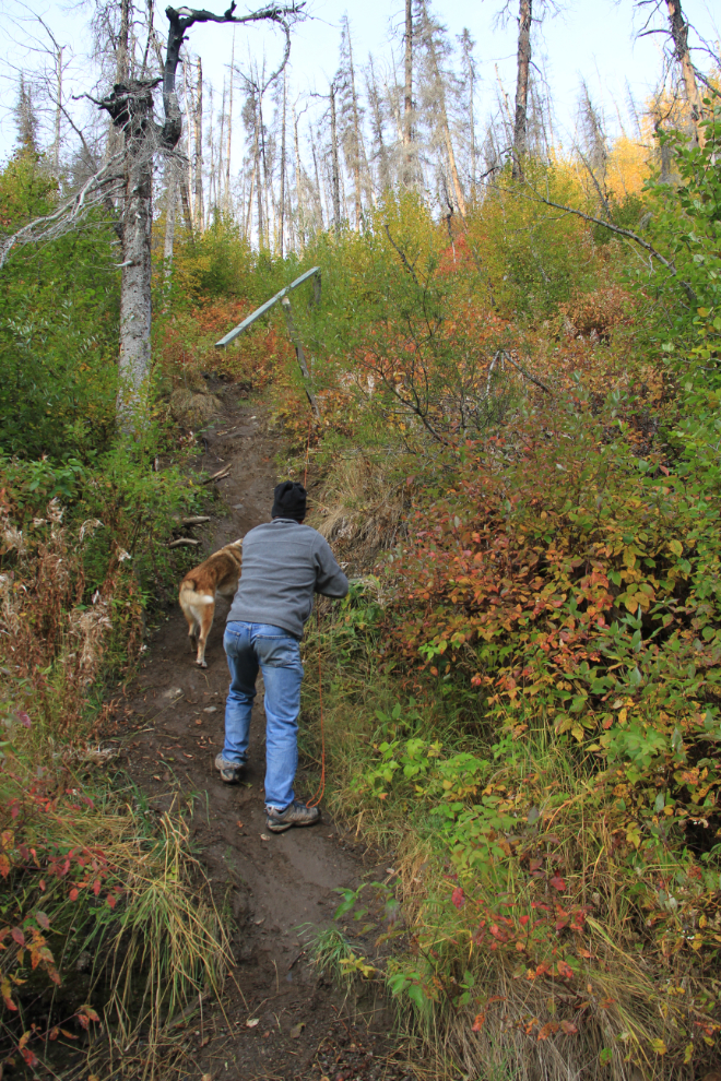
One of the best and easiest to access viewpoints to the west is located a short walk from Tower 10, but the Rim Rocks hiking trail runs about 6 km (3.7 mi) between Towers 25 and 0.
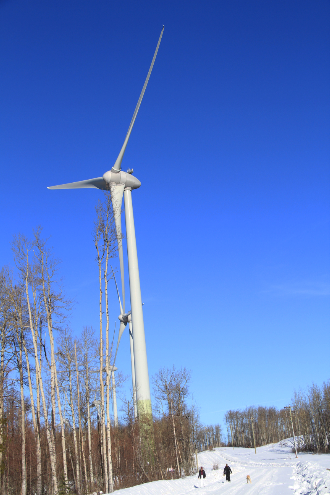
The road into and along the park is maintained year round, and in the winter, snowshoeing, cross-country skiing and just walking along the road are great ways to enjoy a bright day.
To reach the park, turn south onto 17th Street, at the truck scales just west of downtown Dawson Creek. Follow 17th to Adams Road and turn right, then left at 223rd Road after about 1.5 km (0.9 mi). From Adams and 223rd, it’s about 11 km to the first of the turbines, Tower 34. A sharp turn to the right to enter the park at about km 9 isn’t well signed and is fairly easy to miss.
Old Alaska Highway Hikes
The Alaska Highway is a very different road than it was even 20 years ago. As well as changes in the communities and lodges along it (see a 1950 guide to the highway), many sections of the highway have been re-routed since it was first built in 1942. Some sections are only a few hundred meters long, others are several kilometers. Some of the original sections of highway that have been bypassed are driveable, some have completely grown over, and two along the BC section of the highway now provide opportunities for exceptionally scenic short hikes.
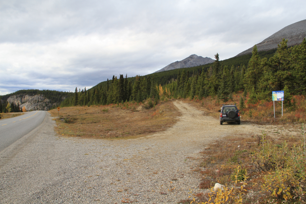
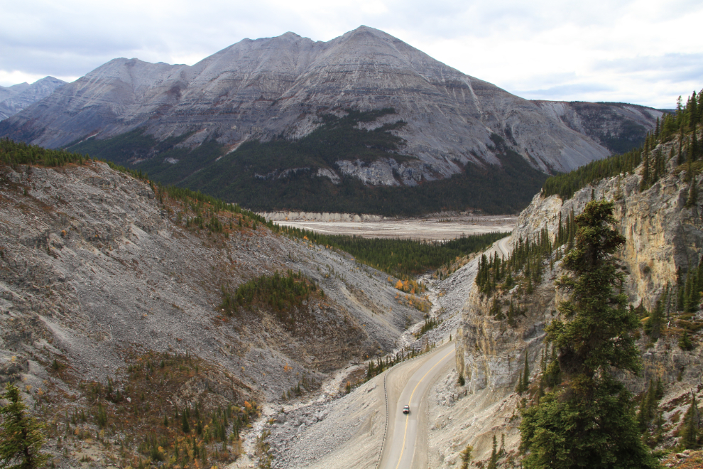
The first, signed as The Cut Trail, is found at about Km 603 of the Alaska Highway. Seen in the photo below, the original road goes straight ahead while the modern roads drops steeply down into the MacDonald River valley through a very impressive gorge (“The Cut”). The old road is cut by a ditch which some high-clearance vehicles do manage to cross, but it’s meant to be a trail from that point. There is lots of parking at the trailhead for even smaller RVs.
About 900 meters (half a mile) from the trailhead, a trail to the left leads to a spectacular view over The Cut to the MacDonald River. Stone sheep are often seen on the cliffs below. From that trail junction, the old road runs another 2 kilometers (1¼ miles), then joins the modern highway again. The very pleasant 6-km (3¾-mi) return hike can be done in 2-3 hours. Caribou are occasionally seen on the old road.
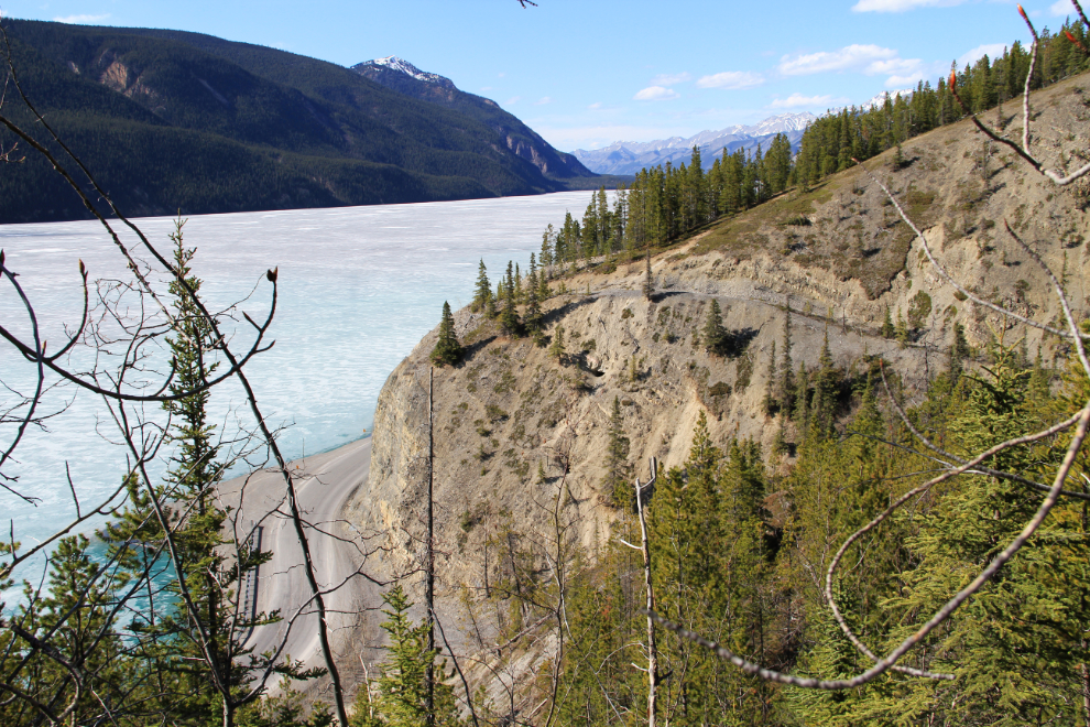
The next trail is signed as the Old Alaska Highway Trail. It starts across from the Strawberry Flats Campground on Muncho Lake at Km 700.5. You begin by walking up a wide canyon that offers other possibilities, then the old road grade climbs up the far side of the canyon, back towards the lake. The old road runs along the lake, with many good viewpoints, for about 2 kilometers (1¼ miles) and then connects to the modern highway again. The trail gets less use at the north end, and there are some small landslides that take care to cross.
Canyons of Muncho Lake
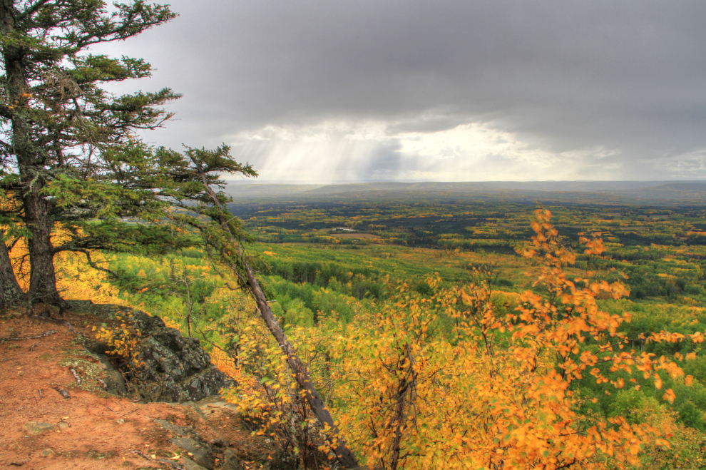
Muncho Lake is one of the most beautiful road-accessible lakes in northern BC, and few travellers pass by without taking a photo or ten. On the opposite side of the highway from the lake are a dozen or so canyons that get little attention, but provide great off-trail walks and hikes of any duration, from a few minutes to several days. Each of the canyons is different in size and character – the one thing that they all have in common is spectacular scenery.
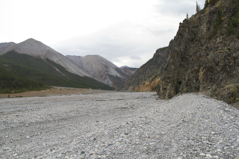
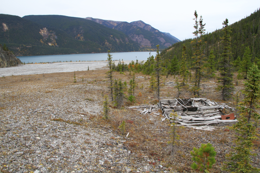
At Km 704.4 is a very large pullout with interpretive signs about Stone sheep, and a walk up the north side of the alluvial fan there takes you to the remains of what I believe to be a logging camp from 1942-43. Above the camp, 2 canyons head off in different directions. In the right-hand canyon, a creek appears – long before reaching the lake, it drains into the gravel and vanishes except at very high flow levels.
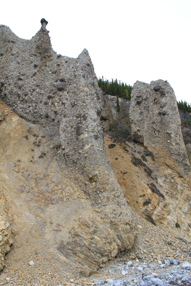
The geology in this area is fascinating, with alluvial fans, sheer cliffs, and even coal seams to be found. Several of the canyons have hoodoos (erosion pillars), and some of them are every bit as impressive as the ones along the highway that get noted by signs. A couple in the group below are over 30 meters high (100 feet).
Smith River Falls
The last but certainly not the least of the gems I want to show you this time is Smith River Falls.
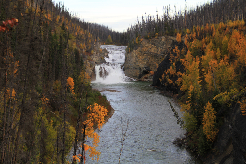
Just north of the Smith River bridge at Km 792.3 of the Alaska Highway, a narrow, winding gravel road leads 2½ kilometers (1½ miles) to a parking lot and outhouse at the trailhead to the falls. Neither the road nor the parking lot are suitable for large RVs. The photo below, however, shows the view as you reach the parking lot, for those with smaller vehicles who don’t feel like a hike.
There used to be a series of very long stairs to reach the base of the falls, but they were destroyed by a forest fire in 2009. The trail now starts with a steep drop, then at the bottom of that slope, 2 trails branch off. The one to the right gives fairly easy access to the river below the falls, but as of September 2015, the river channel and a cliff block access to the base of the falls. Back at the fork, the trail to the left offers a pleasant walk to another viewpoint above but much closer to the falls, but the trail to the base of the falls is extremely steep. The pools below the falls apparently offer good fishing for Dolly Varden.
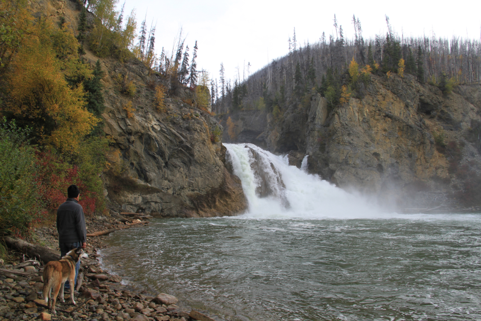
To help hikers get back up from the base of the falls, 3 ropes have been installed, and they come in very handy. To drive off the highway and then hike both the trails at Smith River Falls, allow about an hour. In the winter, the road is closed, but hiking in to the parking lot to see the frozen waterfall is wonderful, though the trail beyond that should probably be considered impassable for most people.