A wildfire evacuation, and driving the Alaska Hwy back home
In my last post, we had all laid down for a late afternoon nap at the Snag Junction Campground on the Alaska Highway. After leaving my regular readers hanging in my last post, I apologize for the delay in posting this one. Cathy brought a nasty bug home from Ontario with her, and I’ve caught it – I’m off to the doctor’s this morning.
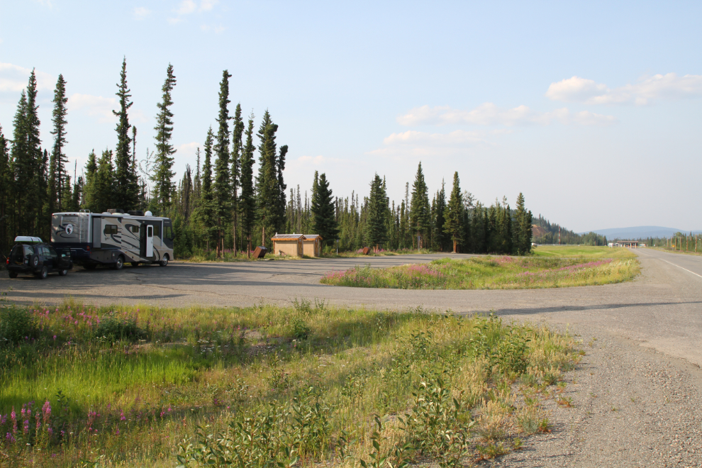
Bella and Tucker and Molly and I had snuggled up for our nap at 3:30, and were enjoying the last bit of it when all hell broke loose just before 5:00 pm. There was very loud pounding on the RV door. Still half asleep, I threw on a pair of shorts, went to the door and opened it, to be told that we had to leave right away because of a wildfire. I asked where it was and his reply was “It’s right here!”
I leaned out and looked up. OMG!! He said that Beaver Creek was safe, so I fired up the RV, pulled the slides in, secured everything, and pulled out to the campground ring road where I could hook the Tracker up.
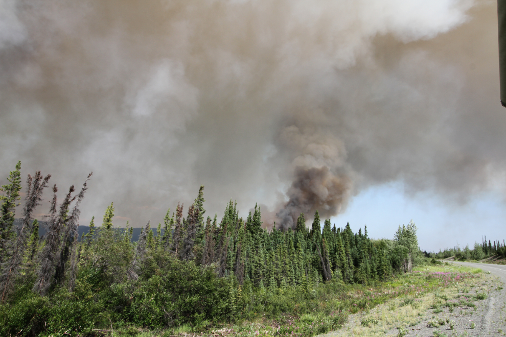
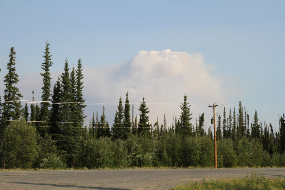
At 5:15, we pulled out onto the Alaska Highway. A helicopter was circling the campground to make sure everyone was out. The next photo shows the view out my windshield at 5:20 as we started toward Beaver Creek.
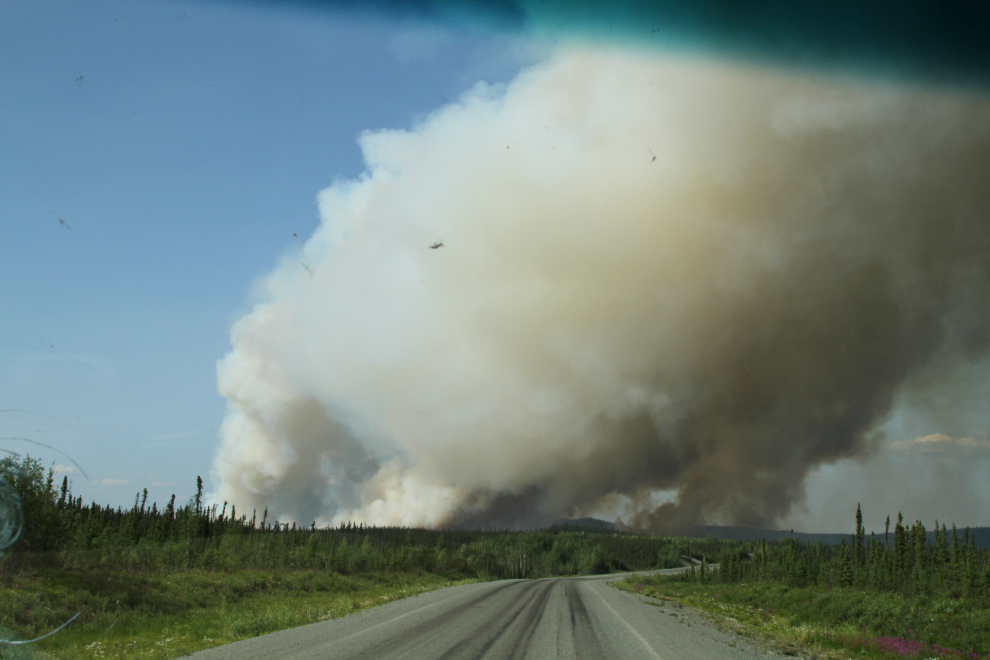
5:22
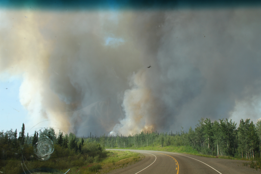
At 5:25, unsure of whether Beaver Creek actually was the best direction to be driving, I pulled over, took some photos and gave the situation some thought.
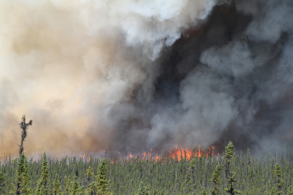
I decided that the wildfire was very likely to close the highway, and I wanted to be on the Whitehorse side of the fire if that was possible. At 5:31 I came to a garbage bin pullout and turned around. I sat there for a few minutes…
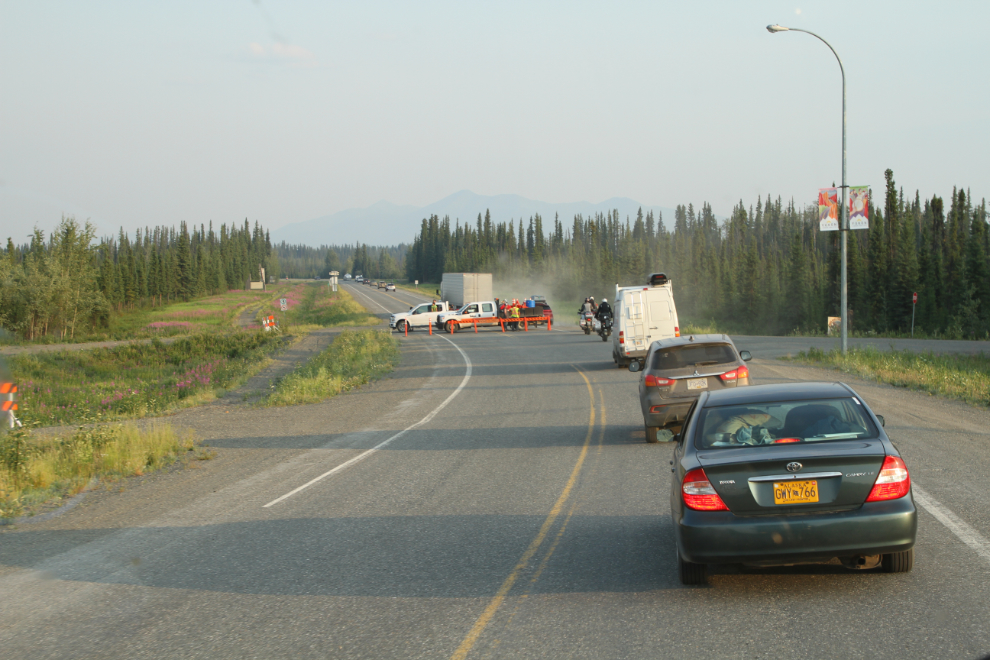
5:38 – vehicles were still getting through, so I decided to head south.
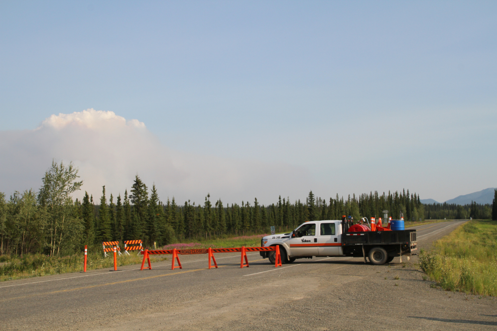
5:40 – roadblock! I had a brief conversation with the RCMP officer. A couple of minutes later, he returned and said we had to get out of there as the wildfire was closing in on us and he had to move the roadblock north (back towards Beaver Creek) a few miles.
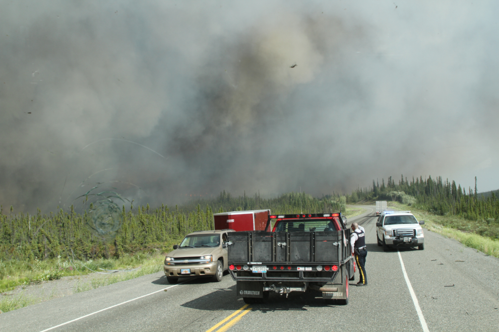
At 51 feet in length, I’m not able to do a U-turn on the highway. It took a few minutes to disconnect the Tracker, get both vehicles turned around, and get pointed north. A helicopter hovered low overhead and I gave the pilot the thumbs up just before pulling away.
A semi that had been ahead of me, also unable to make a U-turn, backed up past me as I was getting the Tracker unhooked. He would have to back up some 3 miles to the pullout where I turned around.
I eventually went around the semi, then waited for him at the pullout to be sure he was okay. As he pulled in, I continued on towards Beaver Creek. When I reached the second roadblock, the RCMP officer was just closing it to move the roadblock right back to Beaver Creek.
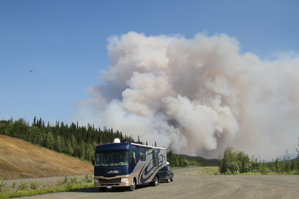
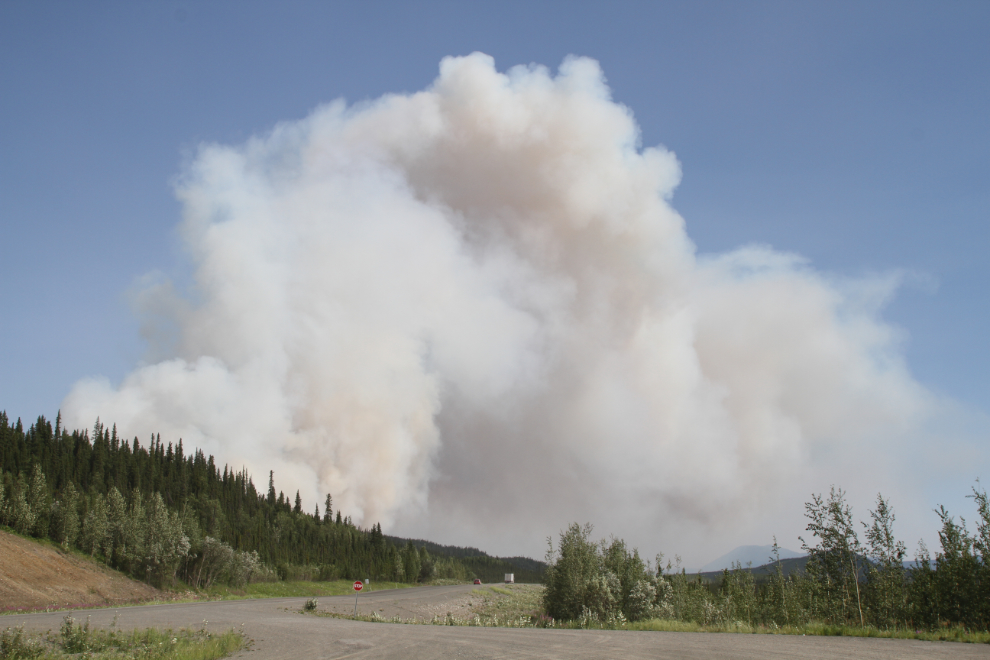
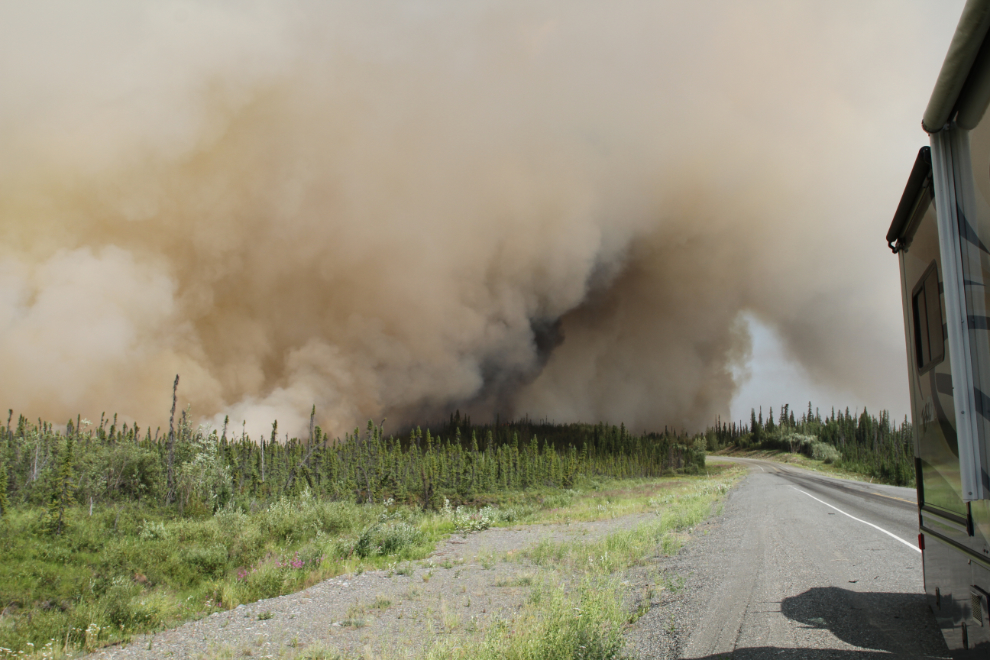
By around 6:20 we were set up at the rest area by the Beaver Creek airport, from where there was a pretty good view of the fire. From what I had seen, I didn’t expect to be going anywhere for a couple of days.
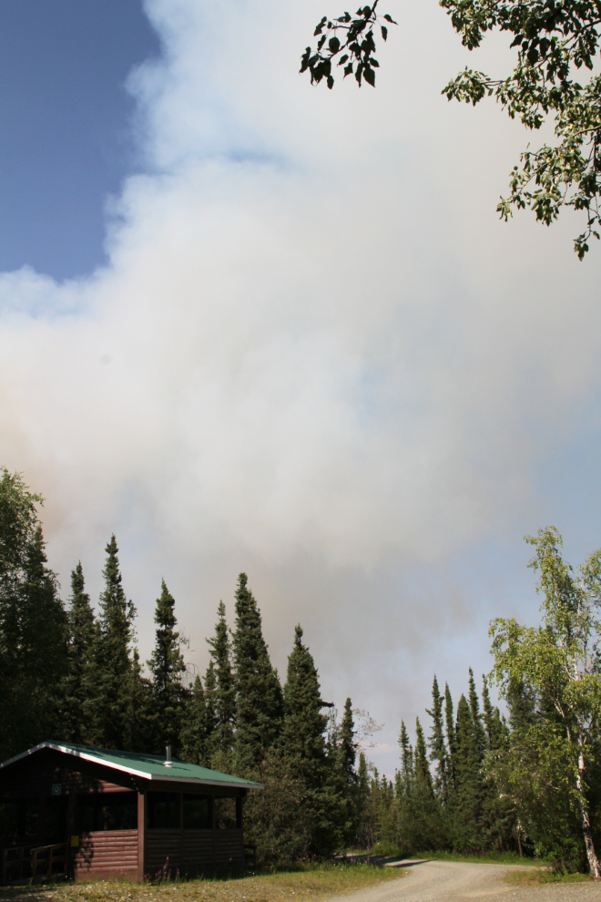
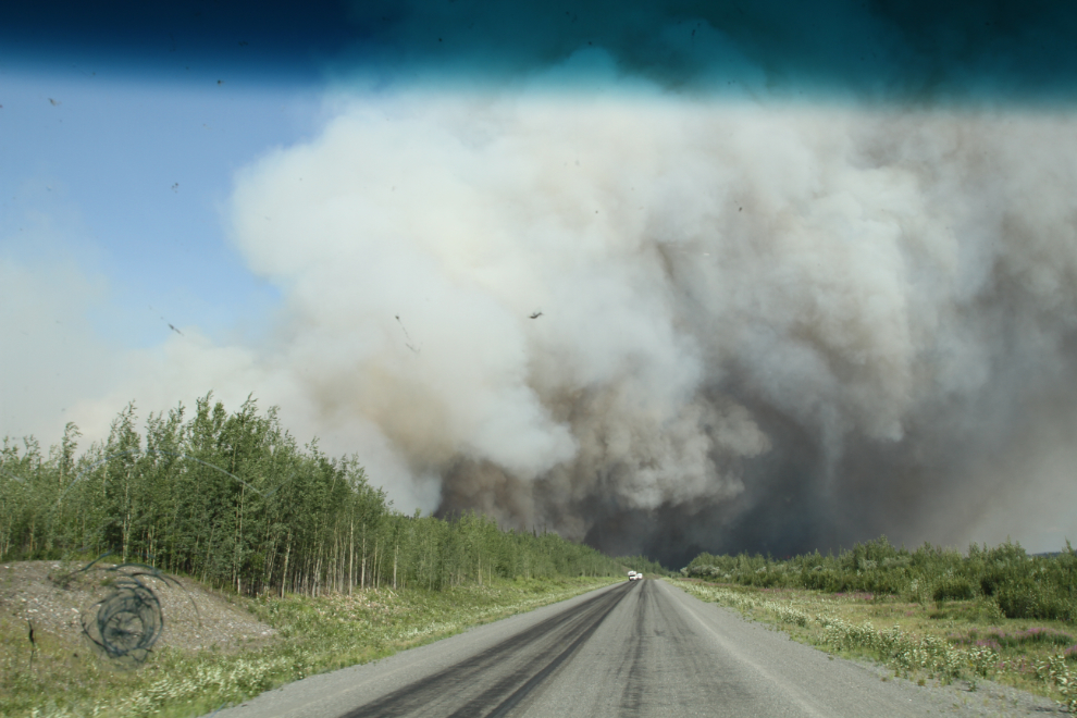
At 7:30 I unhooked the Tracker and drove back into Beaver Creek to take some photos, and to chat with the Highways guy manning the roadblock. I didn’t expect to get any information, and that was correct – everybody at this point was just guessing. A couple towing an Airstream trailer walked over and suggested that they might go around via the Taylor Highway and Dawson. I said I expected that waiting it out at Beaver Creek would be cheaper, easier, and ultimately just as fast.
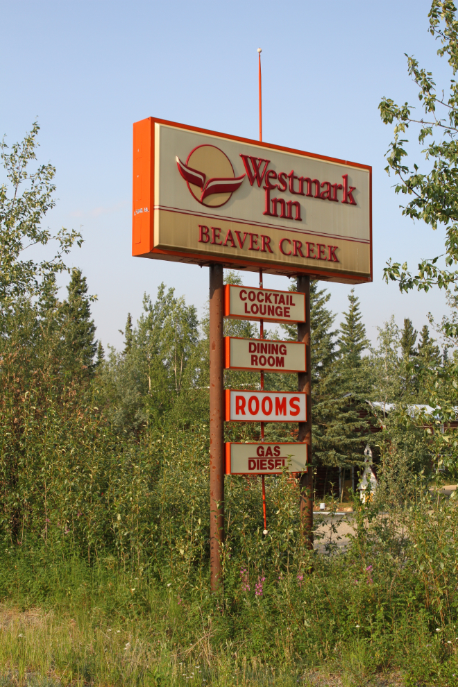
I took a few more photos on the way back to the rest area where the RV was parked. Once one of the largest hotels in the Yukon, the Beaver Creek Westmark was closed in 2013, though rooms are available in a tiny corner of it now, run by the people who own the Beaver Creek RV Park next door.
I was nicely settled in for the night, reading a book, when there was more pounding on the door at 9:30 pm. An RCMP officer said he thought I was heading north but just in case that was wrong, he wanted to let me know that they were going to run a convoy through the fire zone in 10 minutes if I wanted to join. Yes, I did want to join! I got everything slid in, secured, and hooked up again, and was back to the roadblock a couple of minutes before the convoy of about 15 vehicles, from motorcycles to the semi, at 9:45 pm.
I wish I could have gotten some photos as we drove through the fire zone with RCMP escorts front and rear. It was wild, with very thick smoke, and fire on both sides of the highway for a couple of miles.
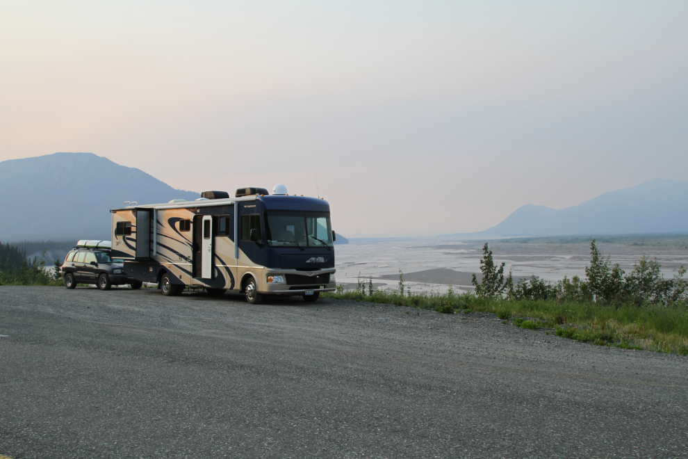
Every pullout was full of vehicles that had been northbound – and it was almost 10:30 pm when I finally found a spot to park for the night, with a broad view across the White River.
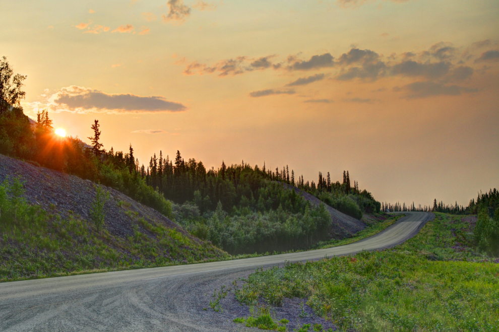
Wildfires do create some spectacular sunsets. The next photo was shot at 10:32 pm.
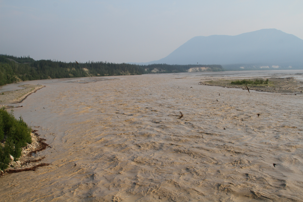
The next morning, I was in no hurry to leave. Bella and Tucker were happy playing here, and there was no traffic on the highway. There’s no cell service in that area, so I had no idea what was going on with the fire now. The White River was sure raging due to the recent hot weather.
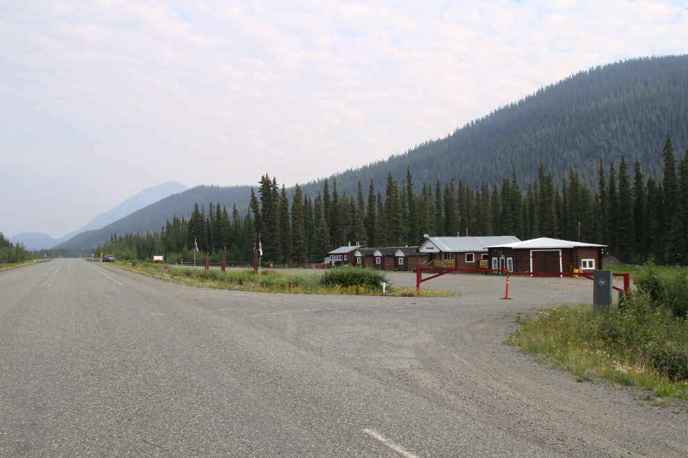
At about 9:30 am, we continued down the Alaska Highway, with the idea that I’d probably go home. I stopped briefly at the Koidern River Lodge, which was operated by Jim and Dorothy Cook until about 2010.
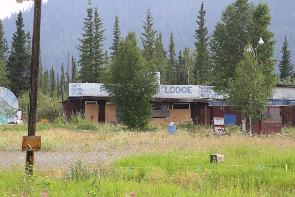
The former Pine Valley Lodge at Historic Mile 1147 has been bought by the Kluane First Nation to be used as a culture camp, so I stopped and took quite a few photos of its current state.
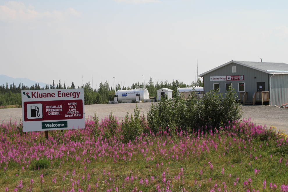
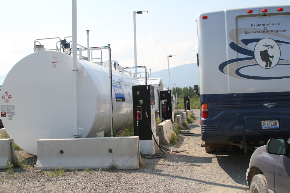
A friend had recently told me that the Kluane Energy gas station at Burwash Landing was a good choice for fuel, and it was indeed. At $1.429 per liter it was 4 cents cheaper than the Talbot Arm a few miles away in Destruction Bay, but it’s also a 24-hour cardlock instead of having to leave your credit card with an attendant inside as at the the Talbot Arm.
We stopped at the Kluane Lake pullout where we’d just spent 3 nights and played on the beach with the dogs for a bit. The smoke and heat wiped out the former good vibes, though, and I decided to go home.
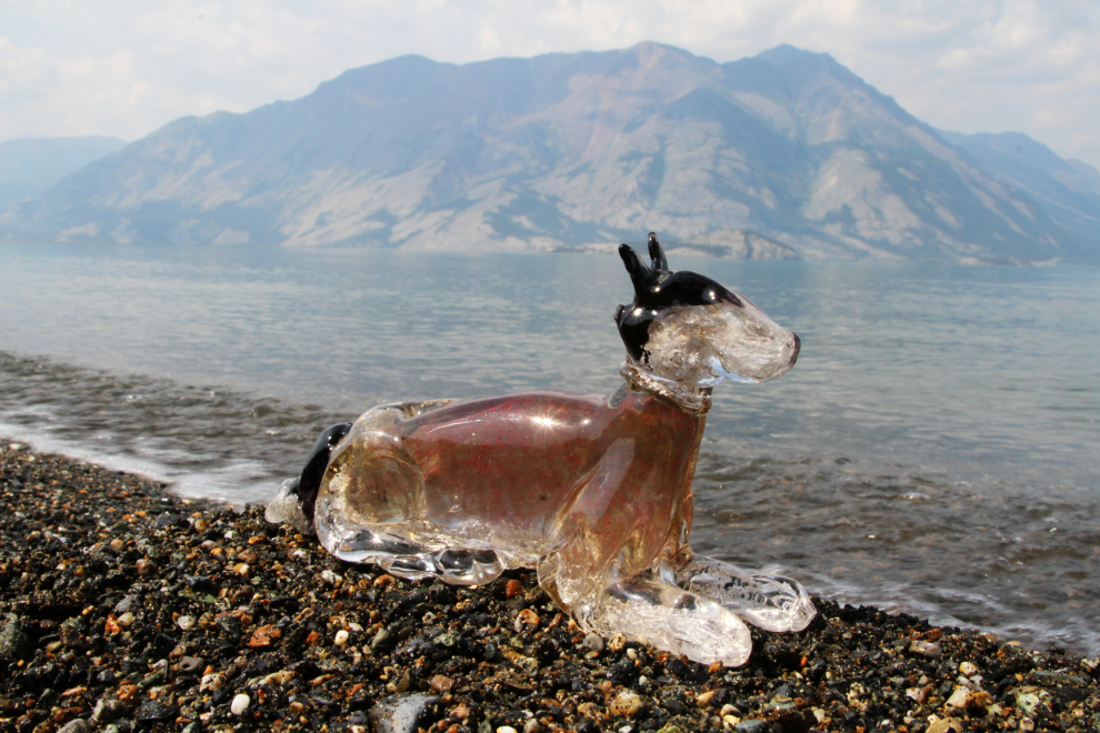
Before leaving, though, I took Glass Monty down to the beach to shoot a few photos. I gathered up a small bag of fine gravel to take home, with the idea of building a base of it for Glass Monty.
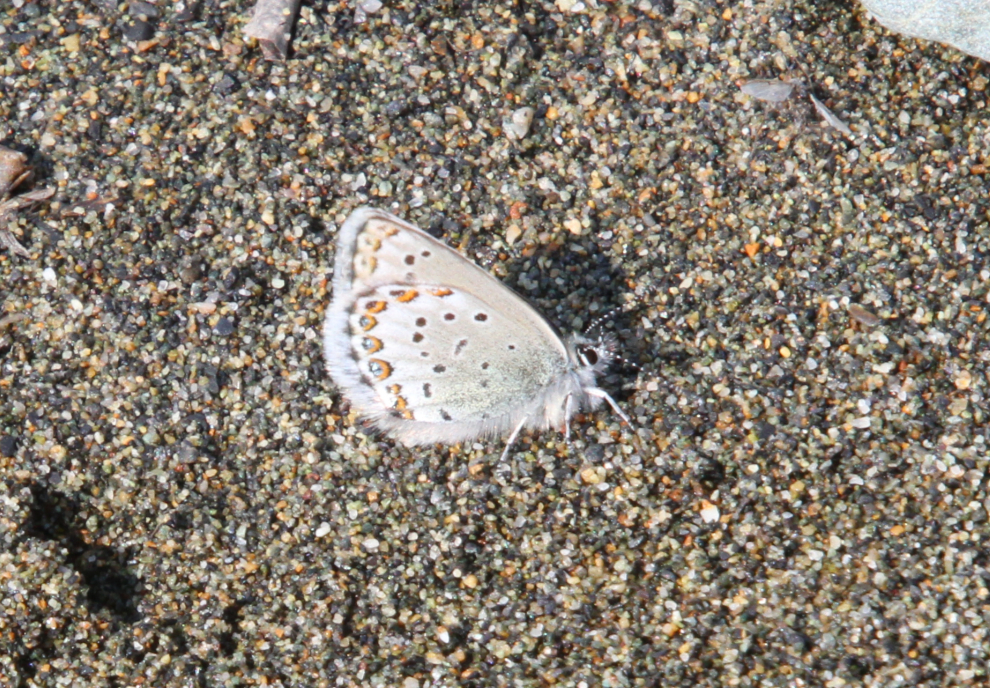
When I arrived at the water with Glass Monty, I was met by about 20 tiny Western tailed Blue butterflies (Cupido amyntula). Their upper wing surfaces are a lovely blue colour, but I wasn’t able to get any photos of that.
We got home at about 6:00 pm – that had been quite an adventure!
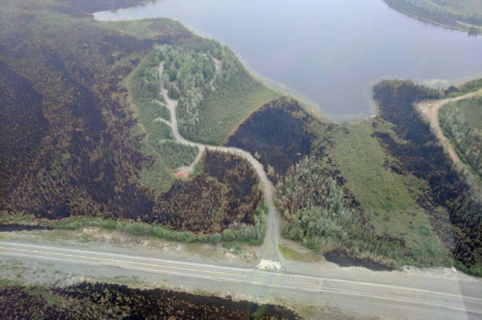
A followup – on July 12th, Yukon Protective Services posted this aerial photo of Snag Junction Campground. When I got evacuated and saw what was bearing down on us, I thought there was no way they could save it. Pretty amazing work.