Up the Alaska Highway by motorcycle – Manning, Alberta to Whitehorse, Yukon
The past 2 days have been primarily a process of getting home after my Northwest Territories adventure, but I did a reasonably good job of “stopping to smell the roses” along the way – and there really are a lot of those roses!
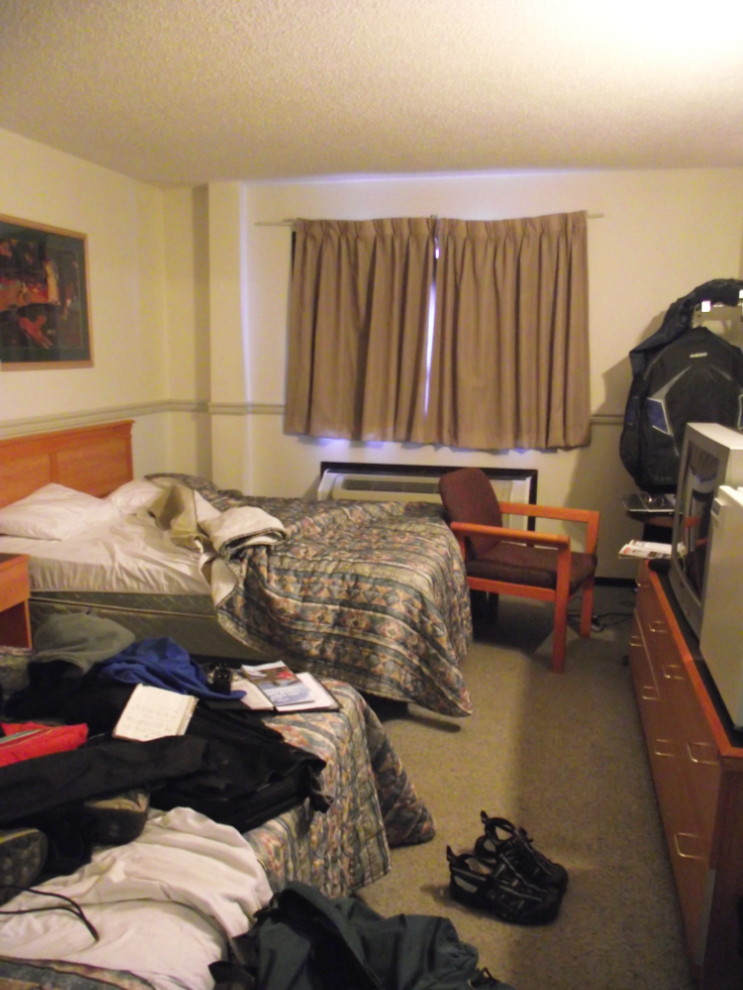
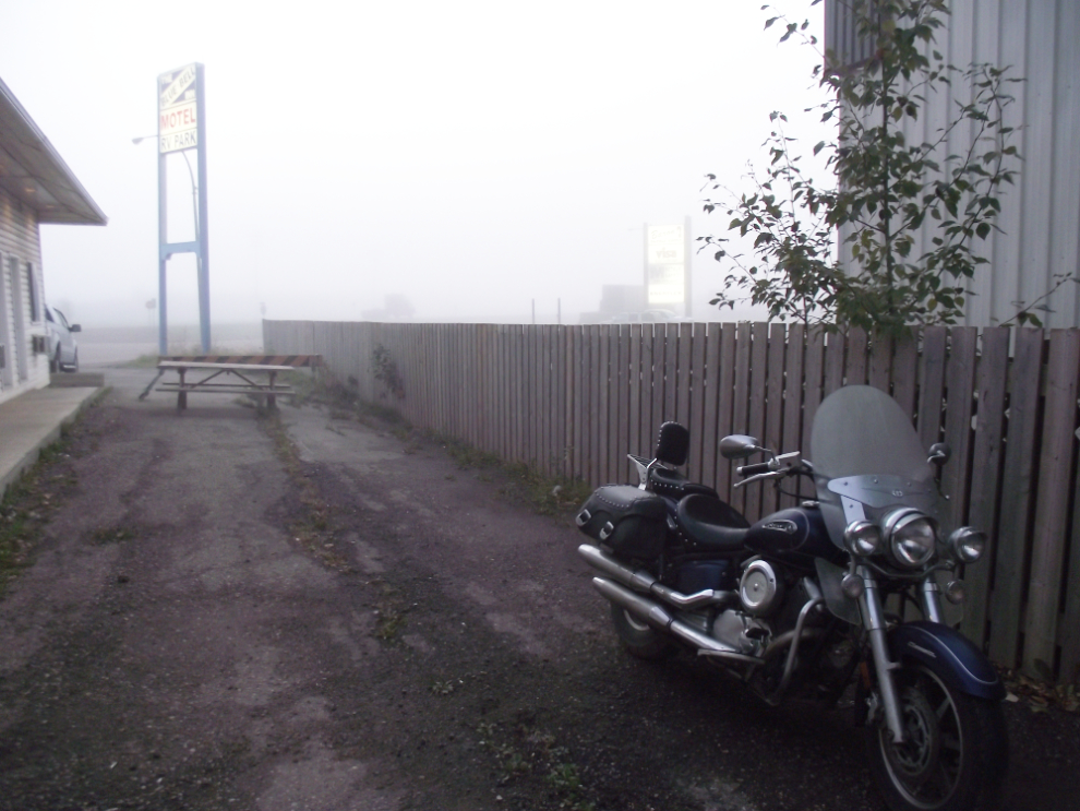
I’m usually a fairly neat hotel resident, but with all the stuff I’m carrying on the bike, I trash a hotel room in a hurry! In this case, the Manning Motor Inn, which is used to worse things judging by the posted requests asking guests to not use the white towels “…to clean anything oily or muddy (including boots)”.
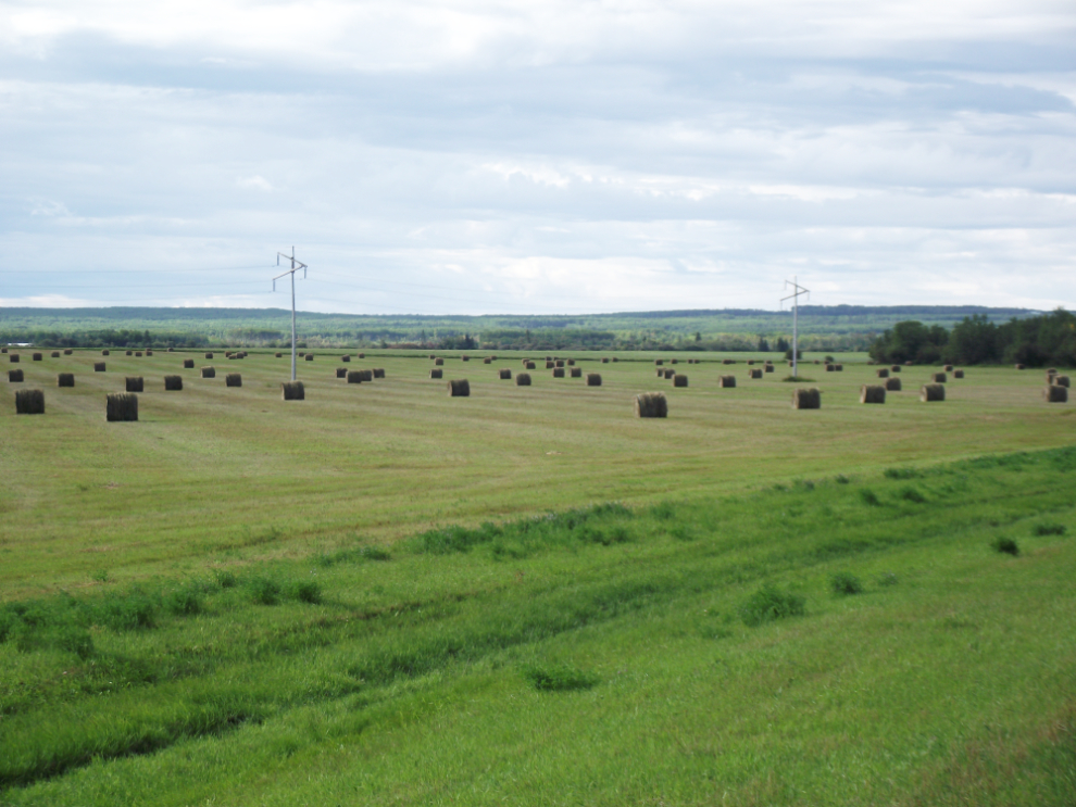
Along Highway 35, the Mackenzie Highway, just south of Manning.
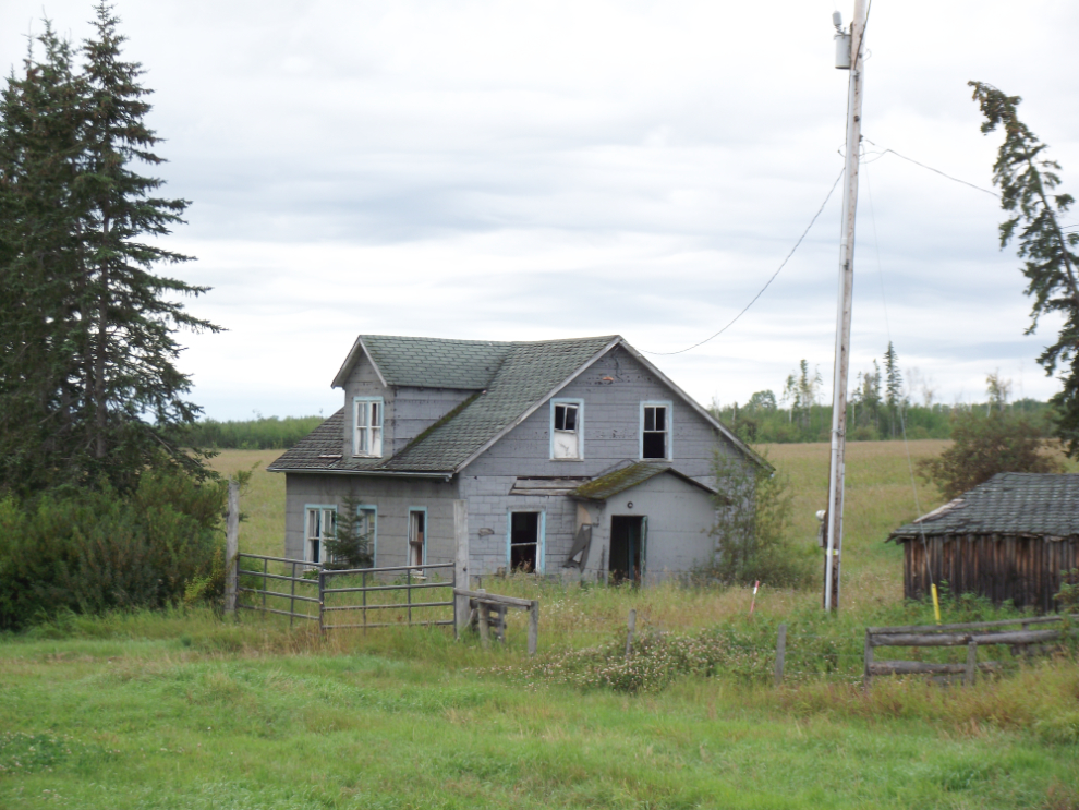
I find abandoned farms and homesteads so sad. I always wonder what happened for a dream to end up looking like this.
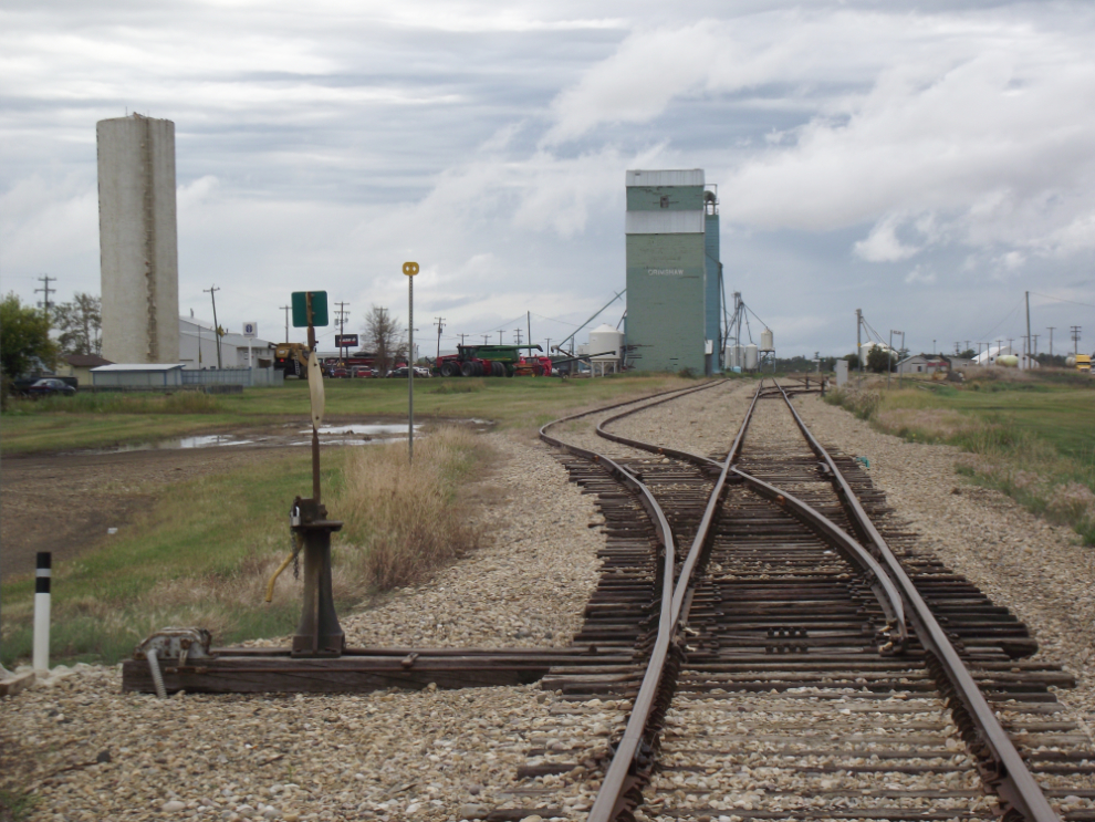
My stop at Grimshaw was much longer than planned (actually, I hadn’t planned on stopping at all) due to their excellent new Mackenzie Highway Mile 0 park and interpretive center. Nicely done.
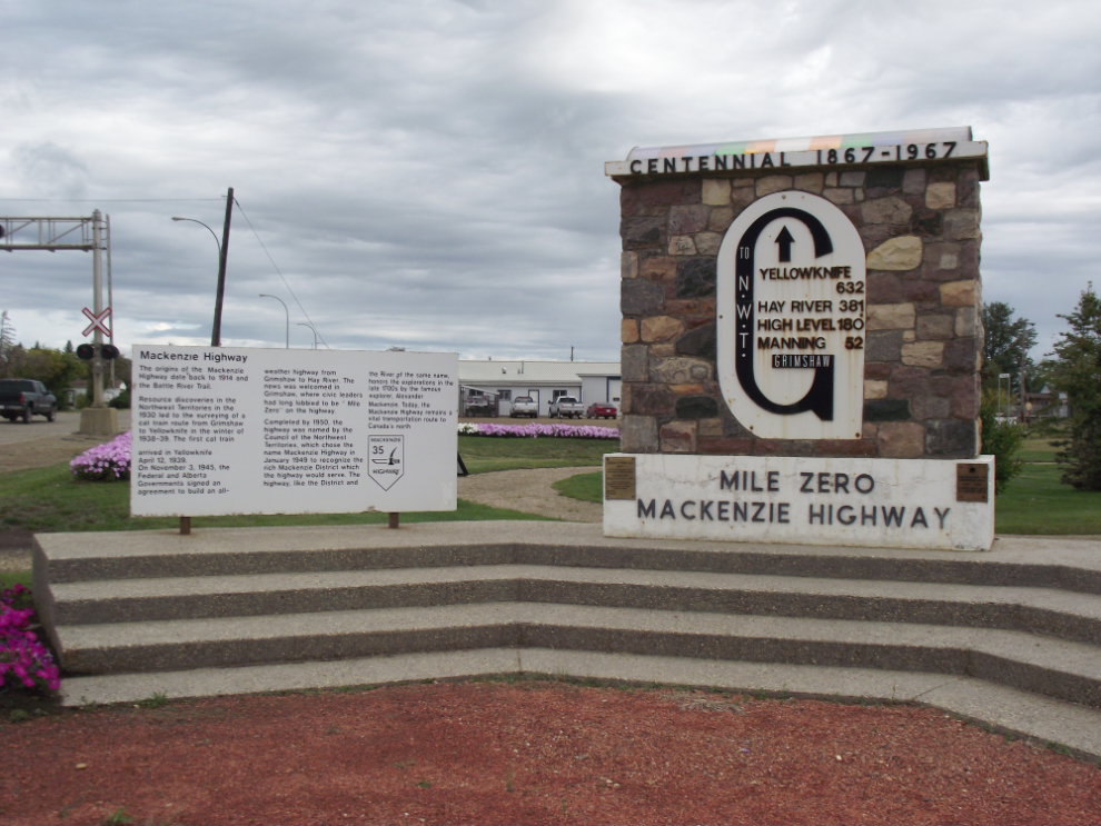
Grimshaw, Alberta.
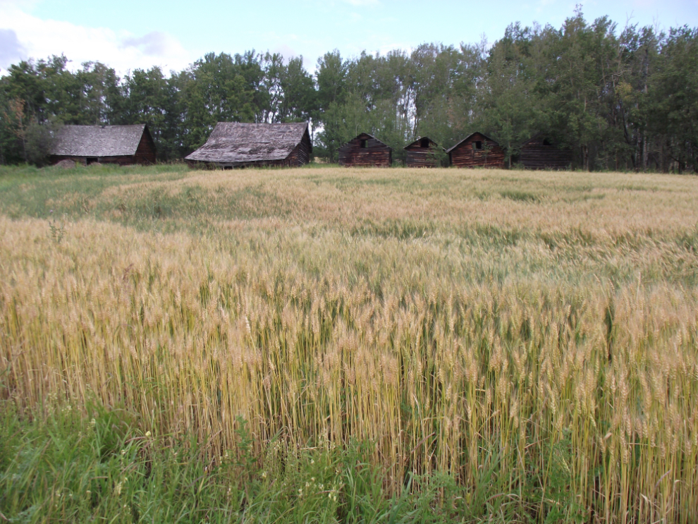
Another abandoned farm, brightened a bit by a field of healthy wheat. This is along Highway 2 south of Grimshaw.
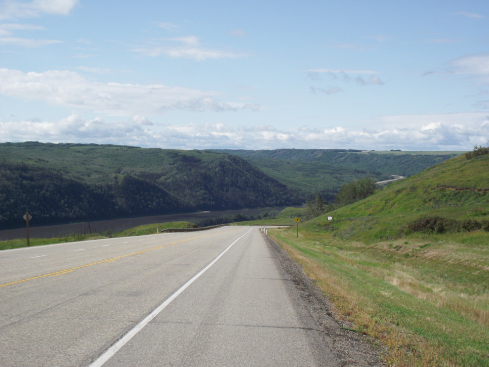
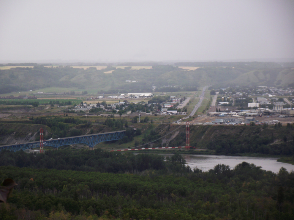
Southbound on Highway 2, dropping into the Peace River valley.
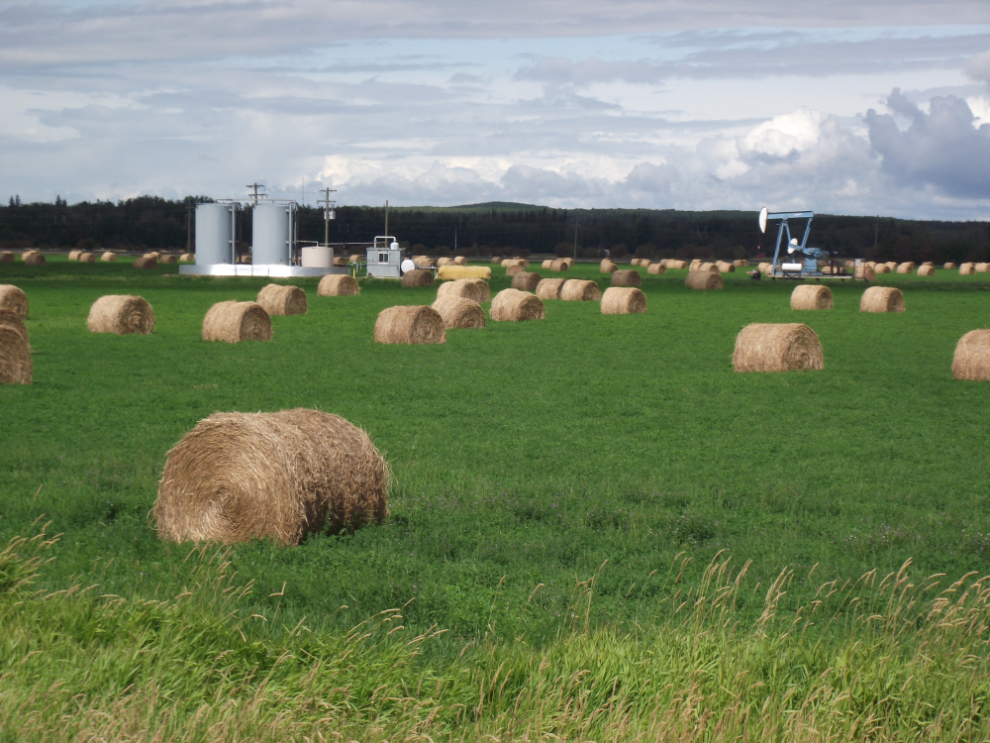
The modern Alberta farm, with oil and/or gas as well as hay.
I reached Dawson Creek about 1:00 and went to Alaska Highway House (behind the famous “Mile 0” signpost) to meet with Dustin Bodnaryk, who manages the center and runs a Mile 0 Alaska Highway page on Facebook as part of his marketing.
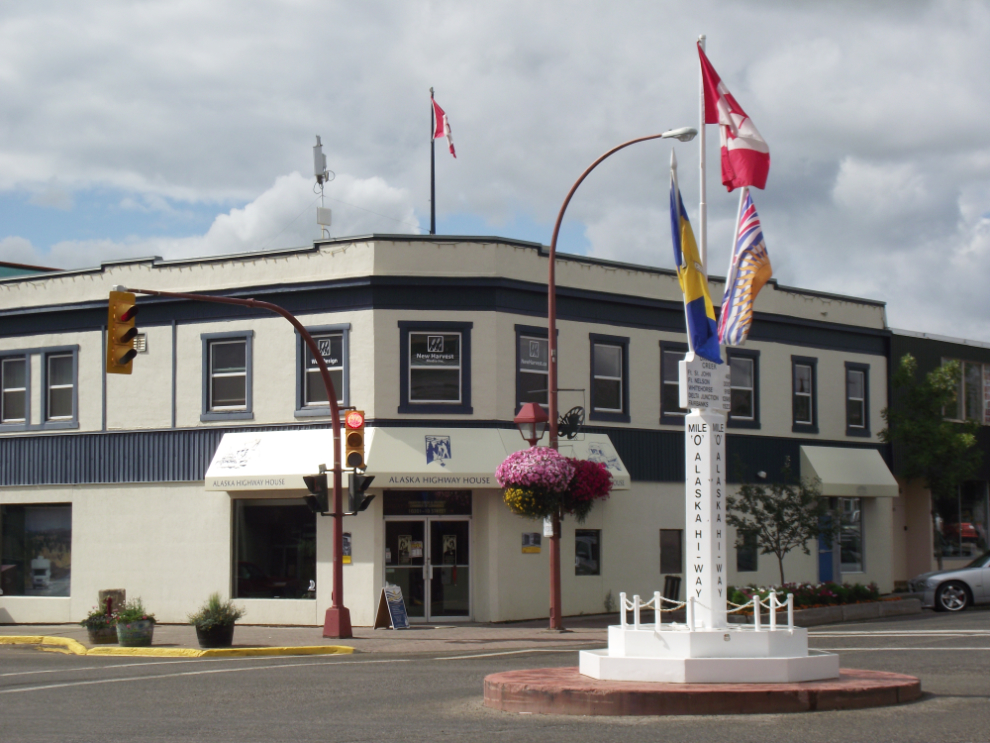
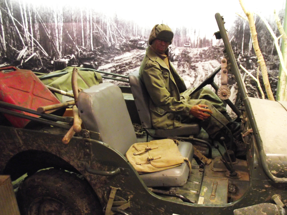
The displays in Alaska Highway House are excellent – I highly recommend this stop for anyone coming up the highway. I was pleased to see one of my photos among the many on display.
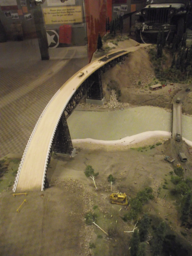
This is a large, very detailed scale model (1:57) of the Kiskatinaw Bridge when it was being built and the temporary bridge down low was still in place.
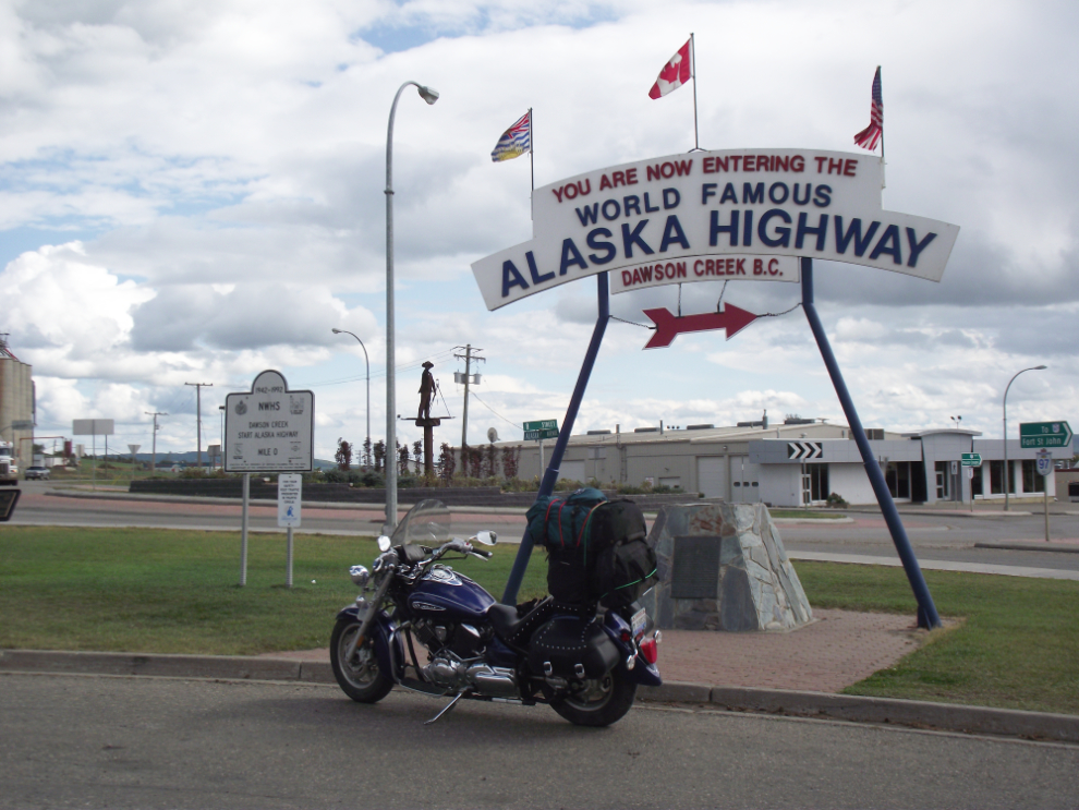
This is certainly not my first shot of this sign, but it’s the first one taken as I was heading up the highway on a bike 🙂 Why are there 2 “Mile 0s”? See my article about that here.
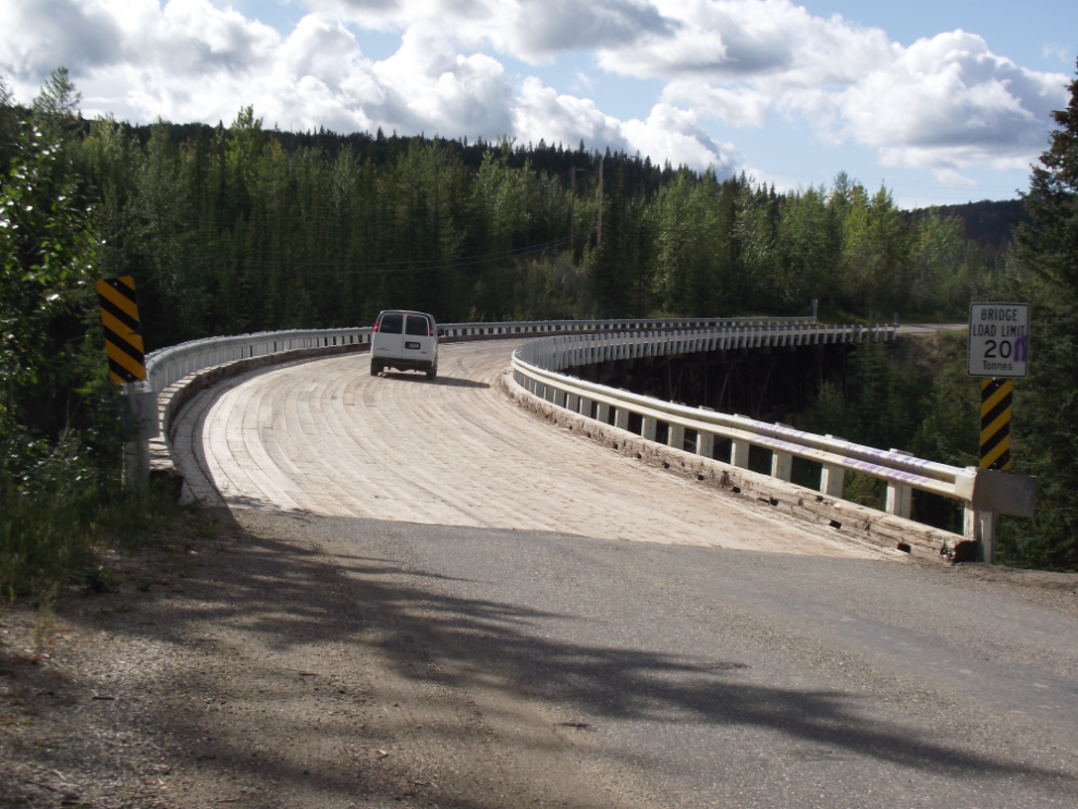
This is the Kiskatinaw Bridge today – a detour from the modern Alaska Highway just north of Km 17 takes you across it.
I headed north in the sunshine at about 3:00, but 15 minutes later the skies looked much less welcoming!
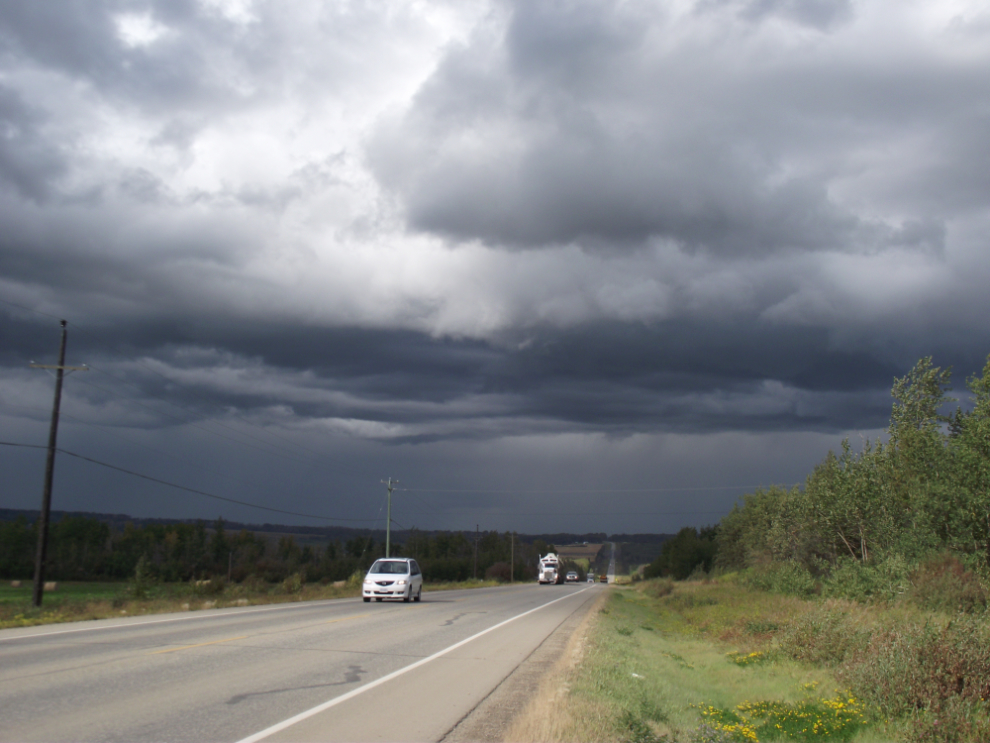
The community of Taylor seen through the rain, on the far side of the Peace River Bridge.
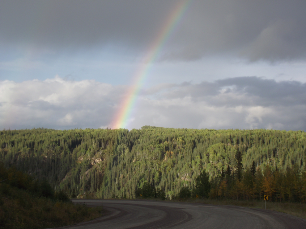
The pot of gold at the end of this rainbow was the spectacular scenery along the highway as it drops steeply down to cross the Sikanni Chief River.
I reached Fort Nelson at about 9:30, and checked into the Blue Bell Inn again. I again got a room that I could park the bike right outside – not much of a room, but perfect. 🙂
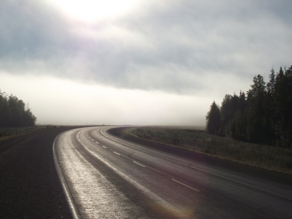
The next morning, this is what I woke up to – 6 degrees C (43° F) and heavy fog. Just dandy riding weather 🙁
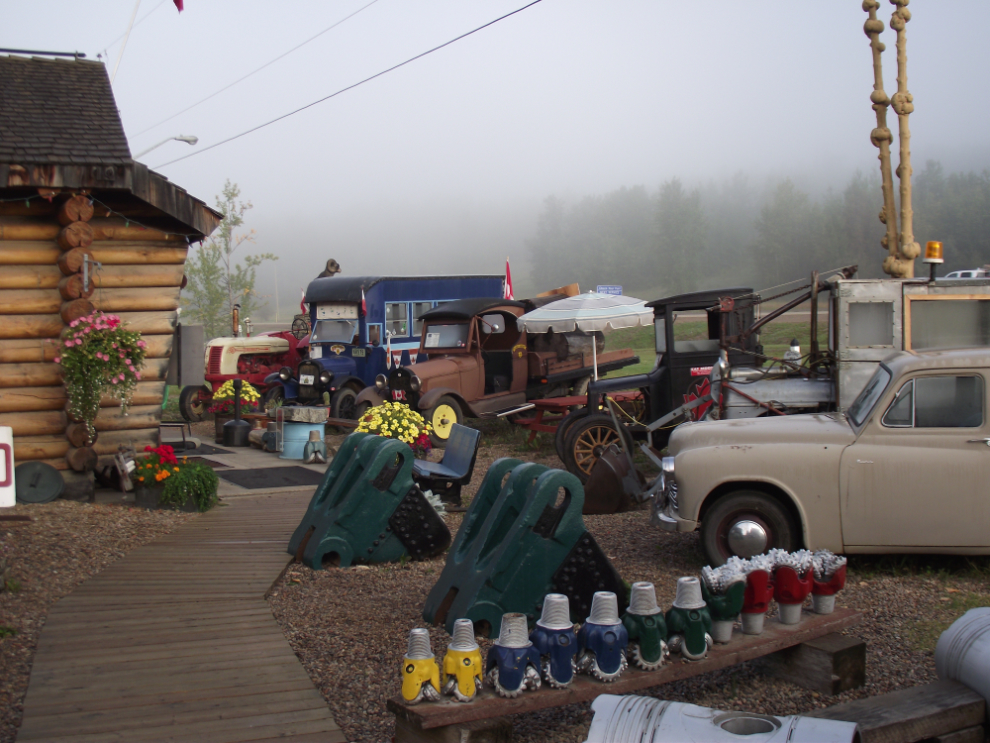
I decided that shooting some of the old vehicles at the Fort Nelson Museum in the fog would be an interesting effect so I loaded up and headed up the highway without breakfast. The fog was already thinning, though, so the photos didn’t work the way I’d planned.
About 5 miles out of town I rode out of a wall of fog – this is looking back at it.
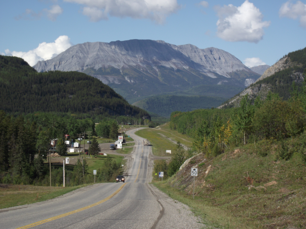
The view north from Steamboat Summit (Km 537) just after 9:00.
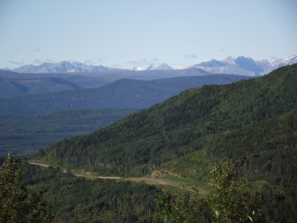
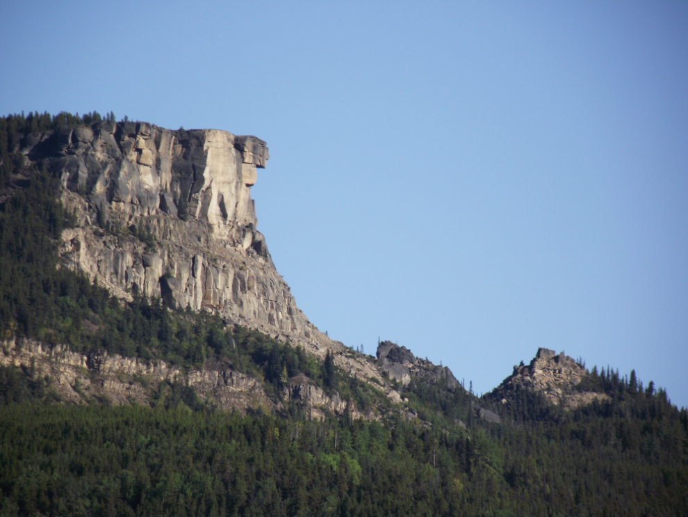
Indian Head Mountain, seen from the north side of Steamboat. Back when I started driving the highway, Steamboat was a legendary bad piece of road – steep, narrow and twisting. You’d sure never know it now, though!
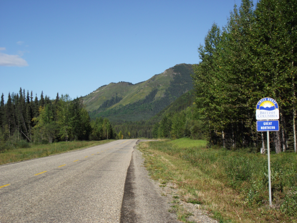
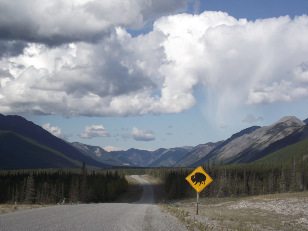
There are a lot of signs along the highway denoting it as part of BC Tourism’s Great Northern Circle Route, a route that I both enjoy myself and recommend to others
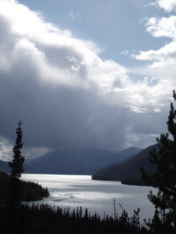
This was certainly a 10/10 day at Summit Lake!
There are a few of these special markers along the highway, but I don’t know why. Most are at 100-km points, but not all.
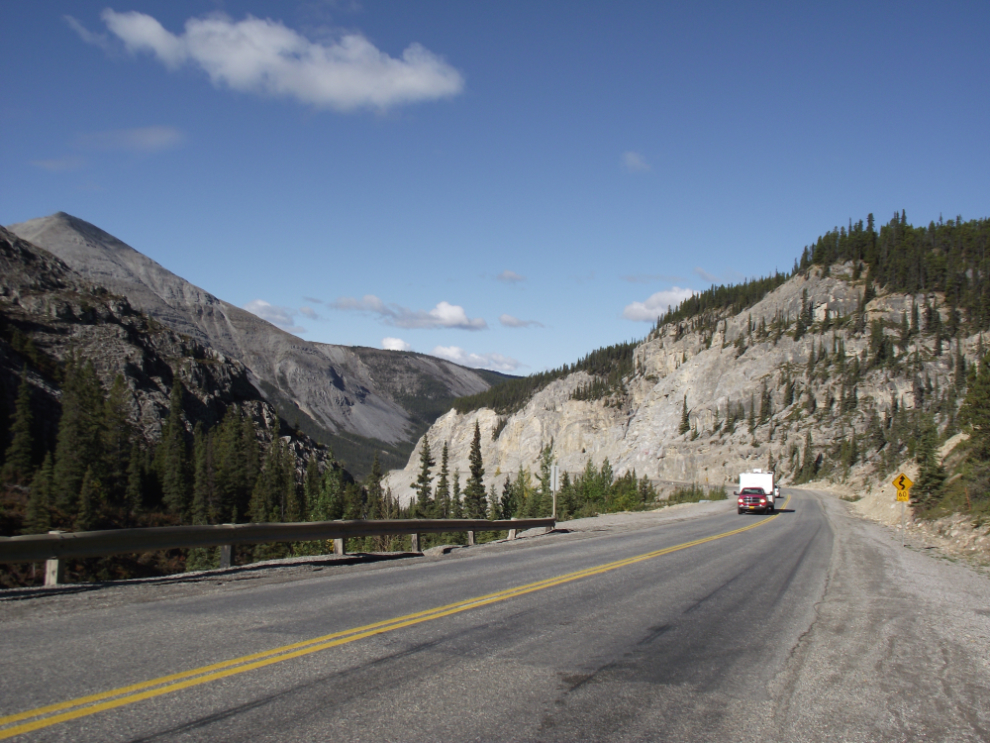
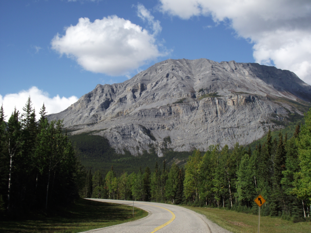
This has always been one of my favourite spots along the Alaska Highway, where it drops down to the broad MacDonald River valley. Stone sheep are commonly seen here, but there were none yesterday.
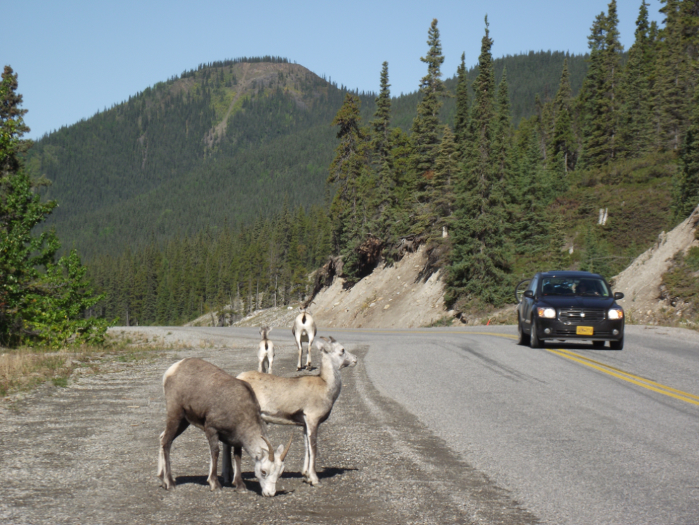
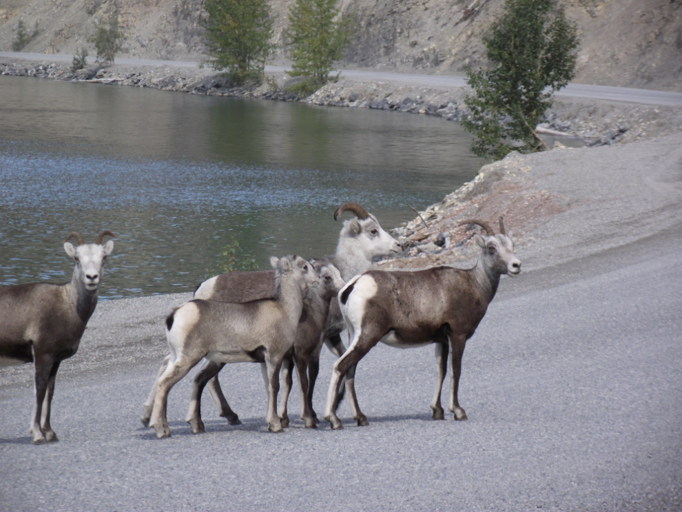
Six k further along, though, there were Stone sheep 🙂 I find that I can get closer to wildlife on the bike than I can with a car, though I’m not sure why.
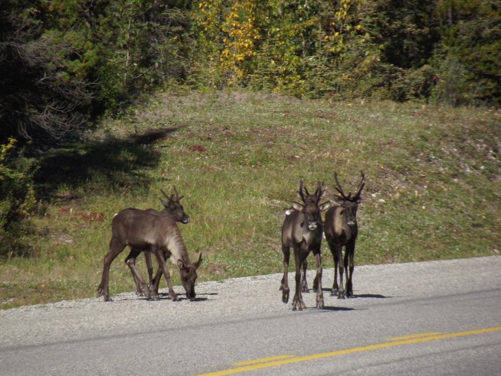
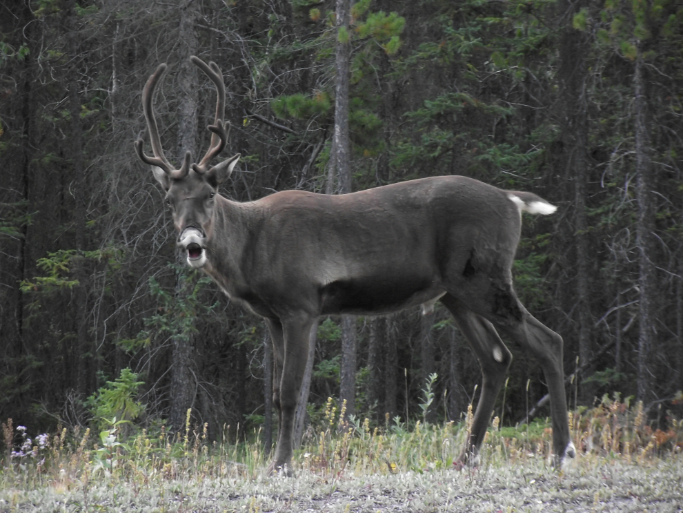
And just 4 k further, these caribou appeared to be quite curious about what I might be.
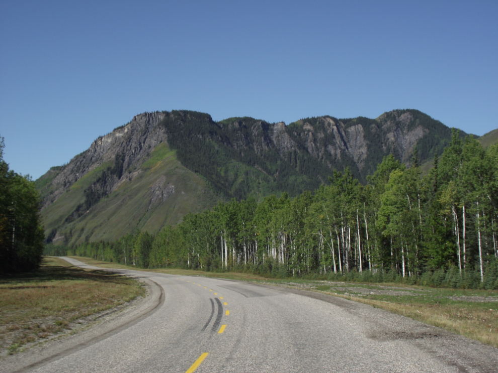
Northbound at Km 635, south of the Racing River Bridge.
The Racing River, a much cleaner and more colourful stream than it had been just 9 days before.

The community of Toad River. Toad River Lodge on the left of the highway was my fuel and long-overdue-meal stop.
While I was having breakfast/lunch, 3 vehicles towing railway motorcars pulled in! I got chatting with them, of course – they’re part of a group of 30 or so motorcar owners who are going to Anchorage for a series of runs on the Alaska Railroad.
As the day progressed, I kept telling myself that the photo stops needed to get much fewer in number – to no effect!
More Stone sheep, along Muncho Lake.
A dramatic thunderstorm at the south end of Muncho Lake. I got hit by a few showers from small storms, but nothing much until the late afternoon.
I met 2 more caribou just north of Muncho, and this young bull seemed to also be more curious than afraid. I believe that the open mouth is like sheep, an attempt to get more information about what it’s seeing.
The view north from Km 717.
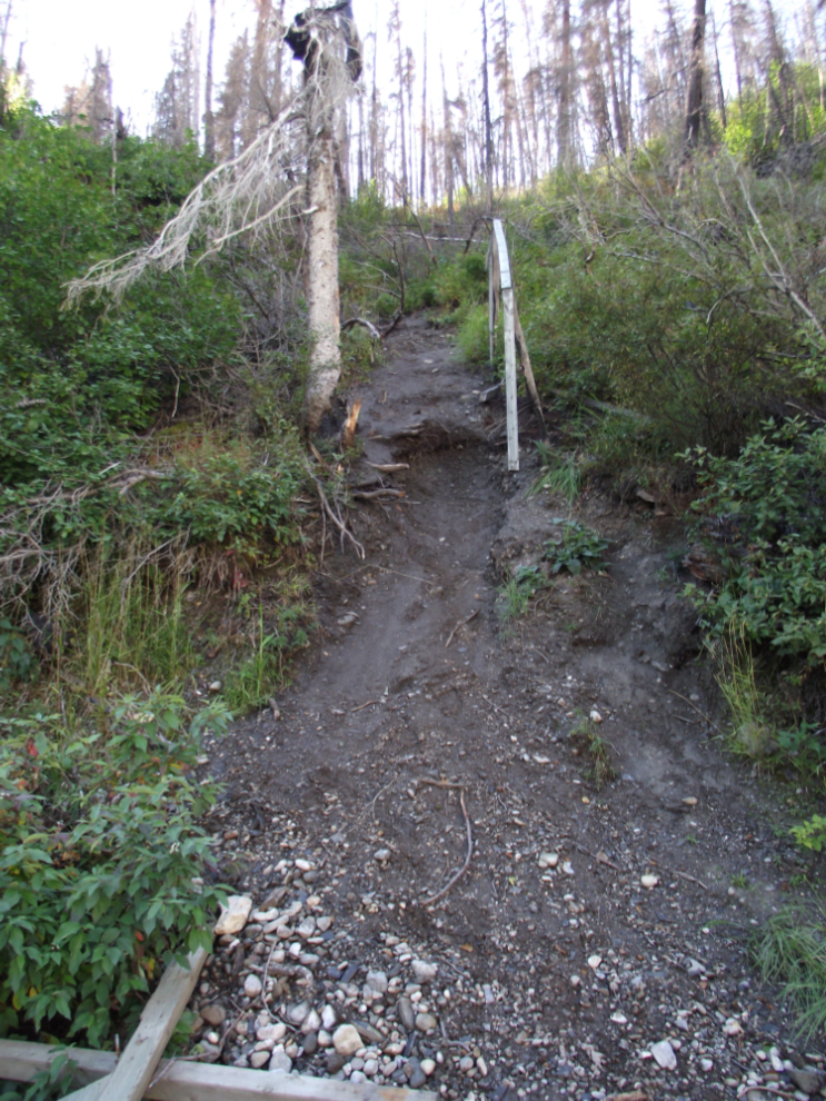
I hadn’t been in to Smith River Falls since a forest fire went through (about 3 years ago?). It’s 2 km off the highway at Km 792.
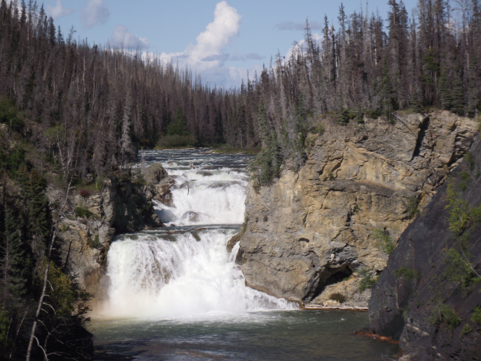
There used to be a pair of lengthy sets of stairs (perhaps 100 steps in total) that took hikers down to the base of the falls, but the forest fire burned them and they haven’t been replaced. Some people do still scramble down, but it’s a hazardous undertaking. This the view of one of the routes/slides from the bottom 🙂
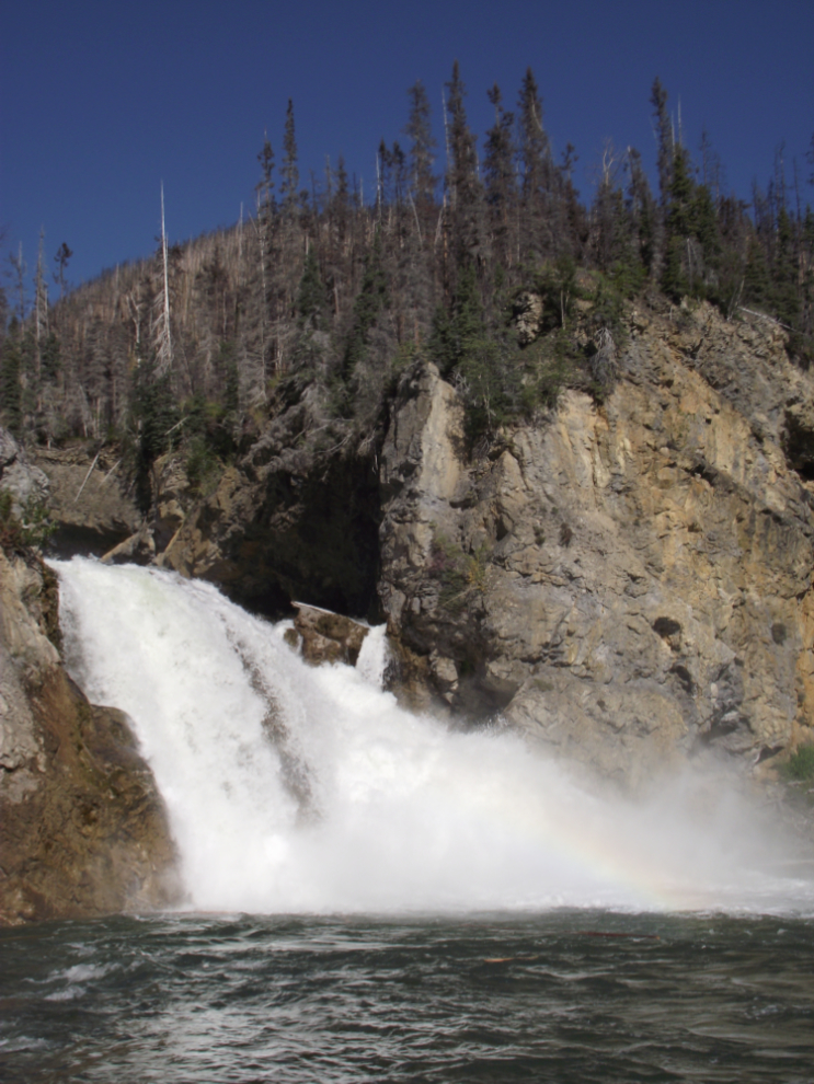
Even with the burned trees, Smith River Falls is a dramatic waterfall, quite different than any I’d seen in the NWT, both for the clean water and the double fall.
After my lengthy stop at Smith River, I did stick to my plan to make only fuel stops (at Rancheria and Teslin).
And that’s it – the adventure is over. I got home at 10:30pm, after 9 days on the road, during which I rode 5,127 kilometers. I have 1,166 photos in my file after editing, and have memories of more wonderful sights and people than I can count!
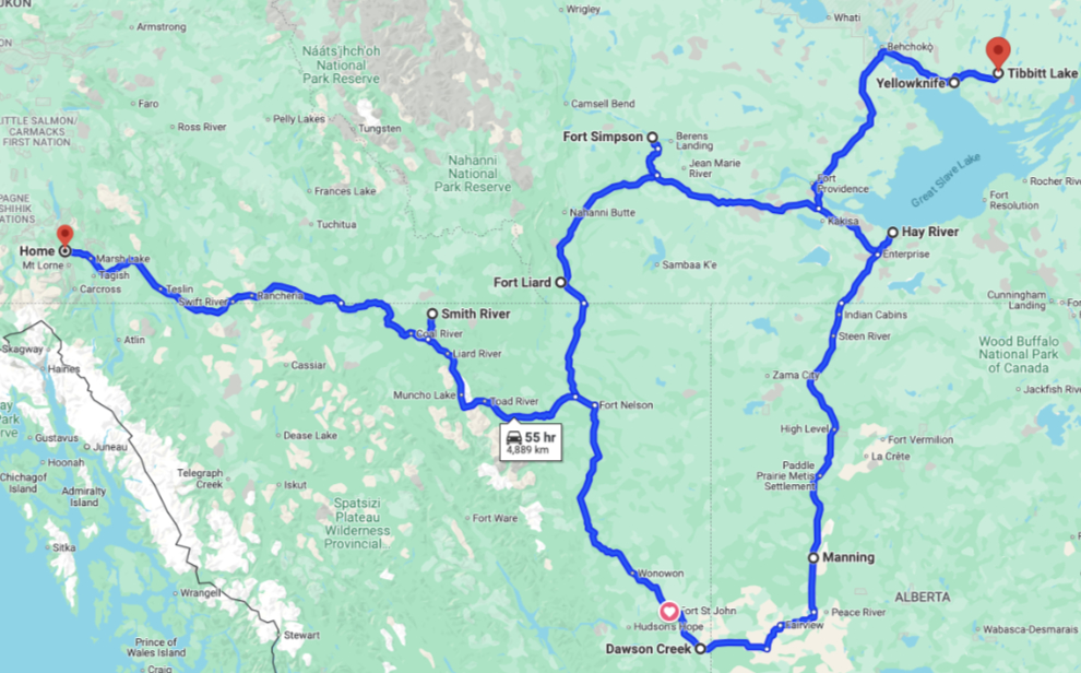
Here is a map of the basic route – click here for an interactive version in a new window.
This trip from Whitehorse to Yellowknife and back is covered in 9 blog posts with a total of 221 photos:
- Whitehorse to Fort Nelson (10 photos)
- Fort Nelson to Fort Simpson (27 photos)
- Fort Simpson to Sambaa Deh Falls Park (18 photos)
- Sambaa Deh Falls Park to Yellowknife (21 photos)
- Exploring Yellowknife (24 photos)
- Exploring the Ingraham Trail at Yellowknife (22 photos)
- From Yellowknife to Hay River (30 photos)
- Hay River to Manning, Alberta (29 photos)
- Manning to Whitehorse (40 photos)