Bridal Veil Falls, and progress on the new William Moore Bridge
On Tuesday, August 6th, day 6 of my White Pass RV-based hiking trip, I had a plan to hike to the canyons up Summit Creek. But I started the day off early by driving the Tracker south on the South Klondike Highway at 06:30 to do some low-light shooting of Bridal Veil Falls and then a major update on the new William Moore Bridge which is nearing completion.
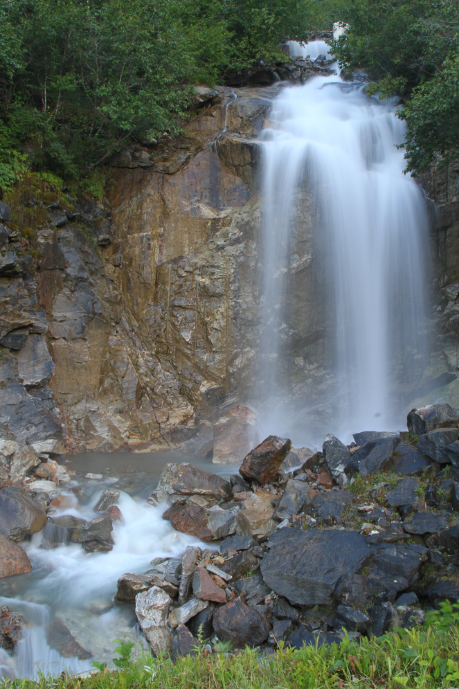
At Mile 10.0 of the highway is a particularly nice and accessible waterfall with a large paved parking area. The water is pure enough to drink. Most people call it Bridal Veil Falls, but narrators on the WP&YR railway call a much larger fall on the same creek but below the highway Bridal Veil Falls. The creek doesn’t seem to have a name. The first photo was shot tripod-mounted at 24mm, ISO 100, f20 and 0.8 of a second. Simulated low-light shooting can be done with a set of ND (neutral density) filters, but mine are for an old lens I had – I need to get a new set or 2 to fit my current lenses.
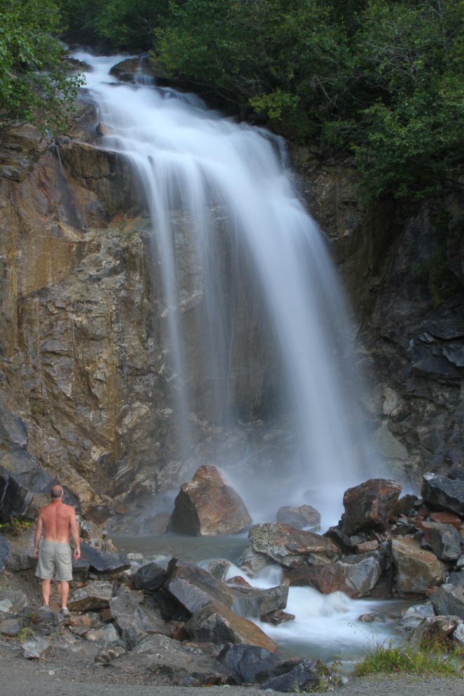
The next photo was shot tripod-mounted at 35mm, ISO 100, f20 and 0.6 of a second, with a 10-second delay to allow me to get into the photo. The spray was going a long way, and it was cold! A nice invigorating start to the day 🙂
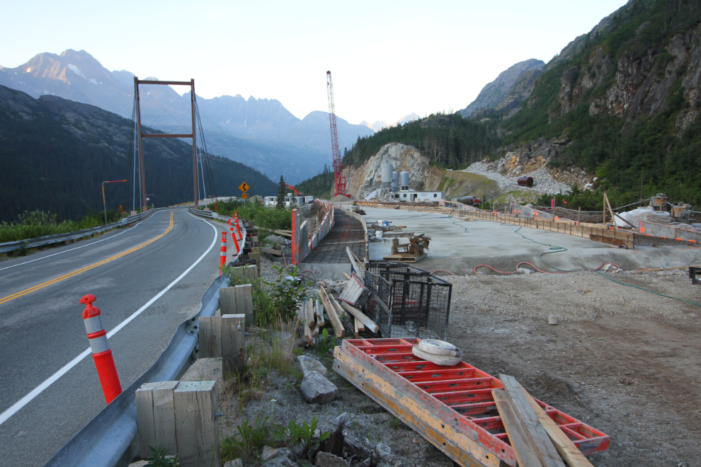
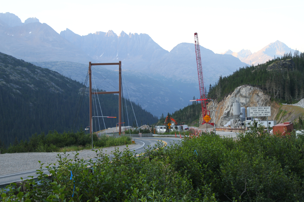
I arrived at the William Moore Bridge project at 07:10 with the idea of compiling a fairly thorough record of its current state. Work began on the new crossing on May 17, 2017, starting with extensive blasting at the south end. It should be open in the next few weeks. It had originally been scheduled to open at the end of August 2018.
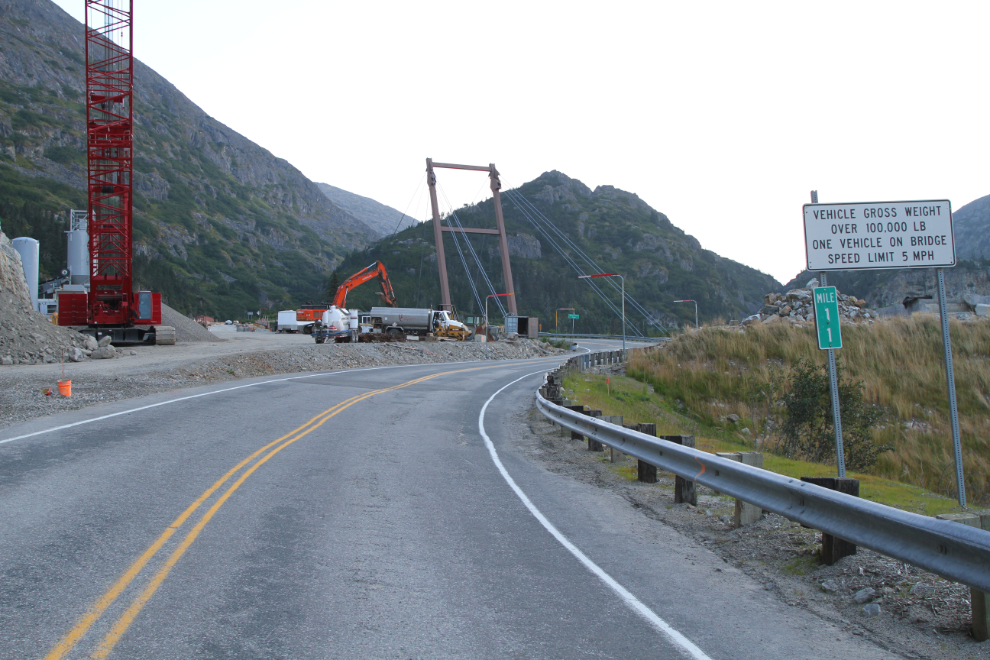
The next panoramic photo shows much of the project site. I haven’t found many details about the project yet – the initial proposal call estimated $10-20 million, then there was a budget allocation of $13.4 million.
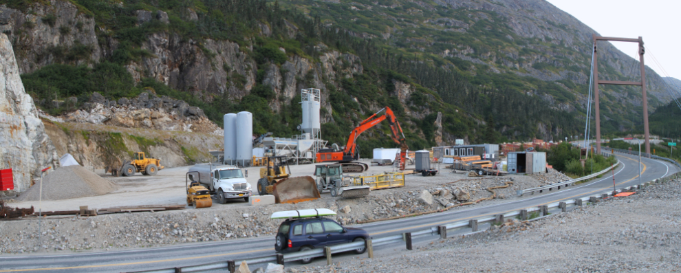
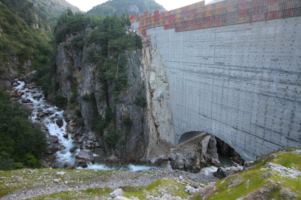
The new crossing (more of a dam than a bridge, to me) has been constructed with roller-compacted concrete, with a 75-foot-span arched-steel culvert placed over the natural bed of William Moore Creek.
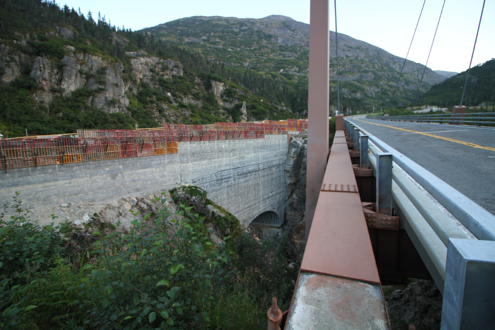
I was surprised to see the rough concrete well above grade, with the final smooth concrete yet to be laid.
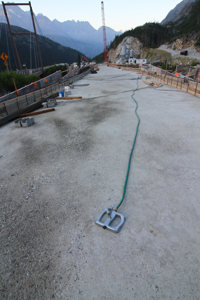
One of the sprinklers that slow the concrete curing time down on warm days.
The form on the right appears to be the first of several for the final smooth concrete layer – the rough concrete is very uneven.
The next photo is a better look at the culvert that left the natural bed on William More Creek untouched.
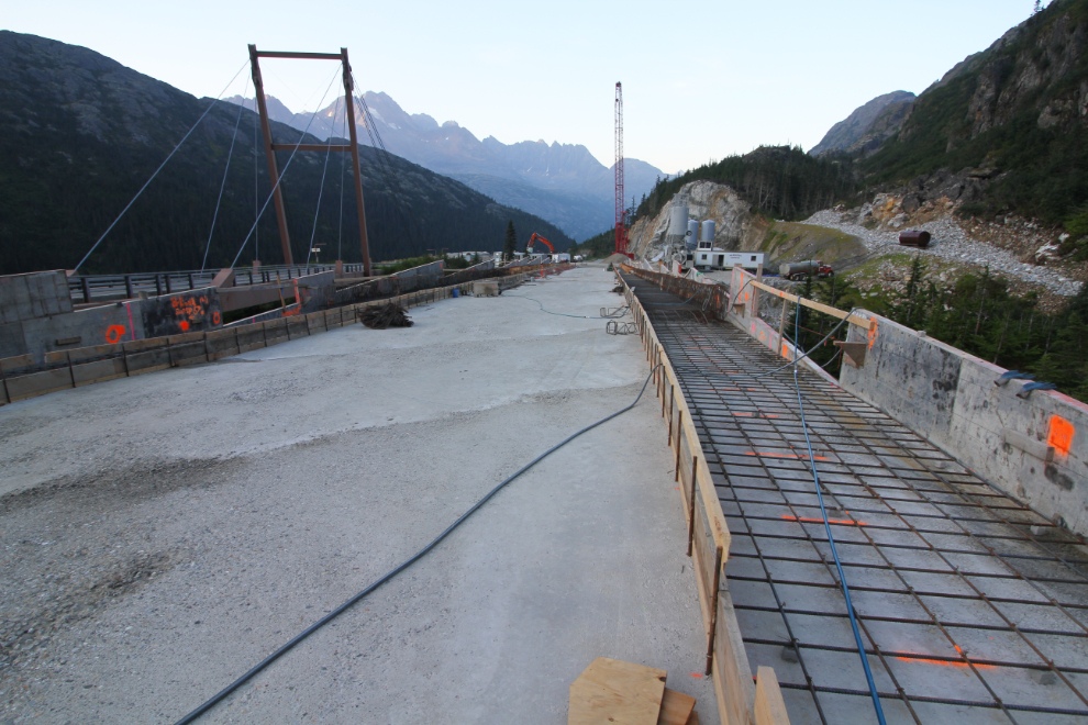
A final overview of the project site, looking downhill this time.
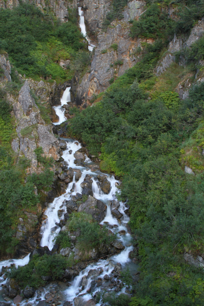
Just a few meters above the project, Mother Nature is completely in charge, presenting this lovely cascade on William Moore Creek for us to enjoy.
Just after 07:30, I headed back to the motorhome to get the rest of the day organized.