Hiking to the canyons of Summit Creek in the White Pass
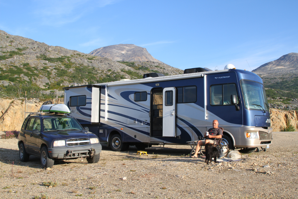
On Tuesday, August 6th, my main outing was a mostly off-trail hike to the spectacular canyons of Summit Creek. The creek crosses the South Klondike Highway just a few hundred meters from where my motorhome was parked for a week of exploring.
After getting back from an early-morning outing to photograph Bridal Veil Falls and the William Moore Bridge project, I put a pot of coffee on and just sat outside and soaked up the majesty of the White Pass.
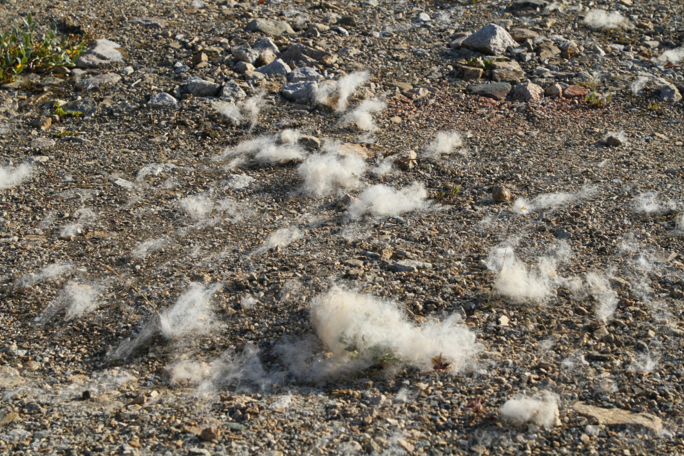
I started pulling tufts of loose undercoat from Bella, then decided to give her a proper brushing. Her coat is incredible, and when she’s done some swimming as she has on a coupole of hikes during this week, she starts shedding profusely. I hope that the local rodents can use it for a warm winter nest 🙂
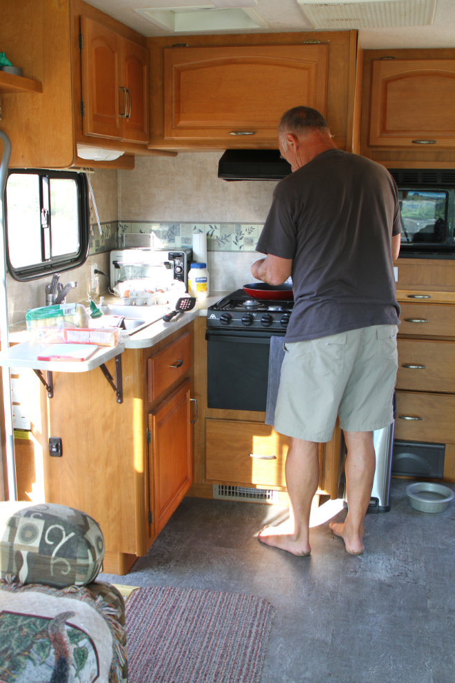
09:30 – time to make a good breakfast for what I expected to be a fairly strenuous hike. The terrain I was going into is rough enough that I was leaving Bella and Tucker in the RV.
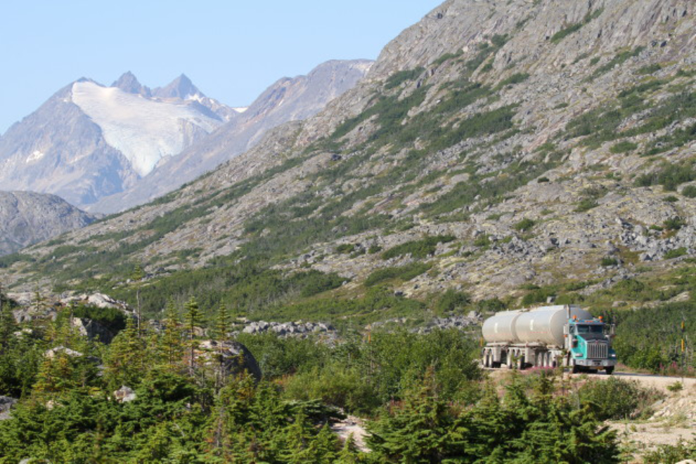
There are a couple of busy periods on the highway, but even at its busiest, the South Klondike is a pretty quiet road. This North 60 B train tanker hauling fuel from Skagway into the Yukon came by at 10:10.
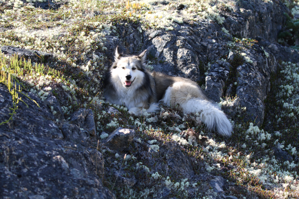
Bella hadn’t yet recovered from our difficult ending to the Bryant Lake hike the day before. Instead of going for a walk, she went up onto the ridge, dug a nest, and settled down.
Two very different ways of seeing this country – cruise ship passengers in their tour bus zipping by our motorhome parked there for a week.
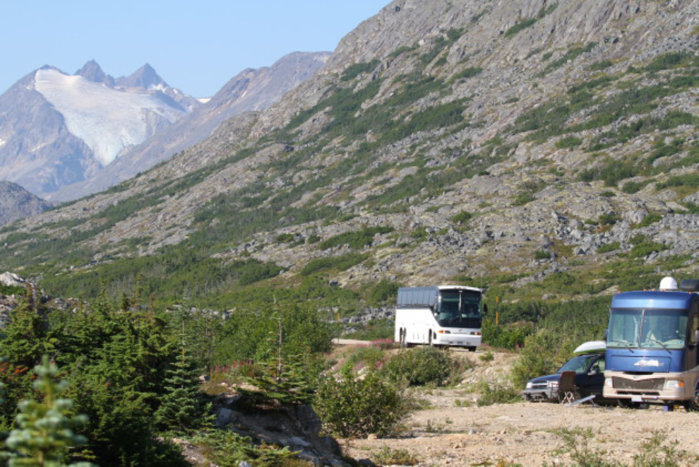
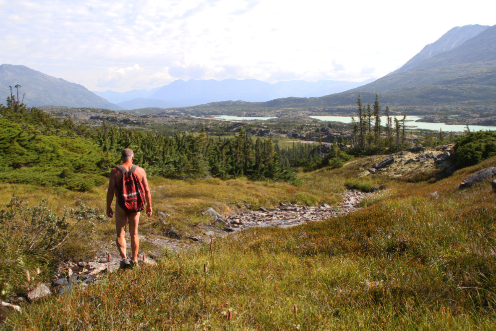
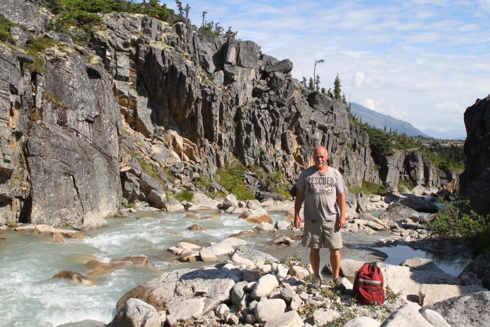
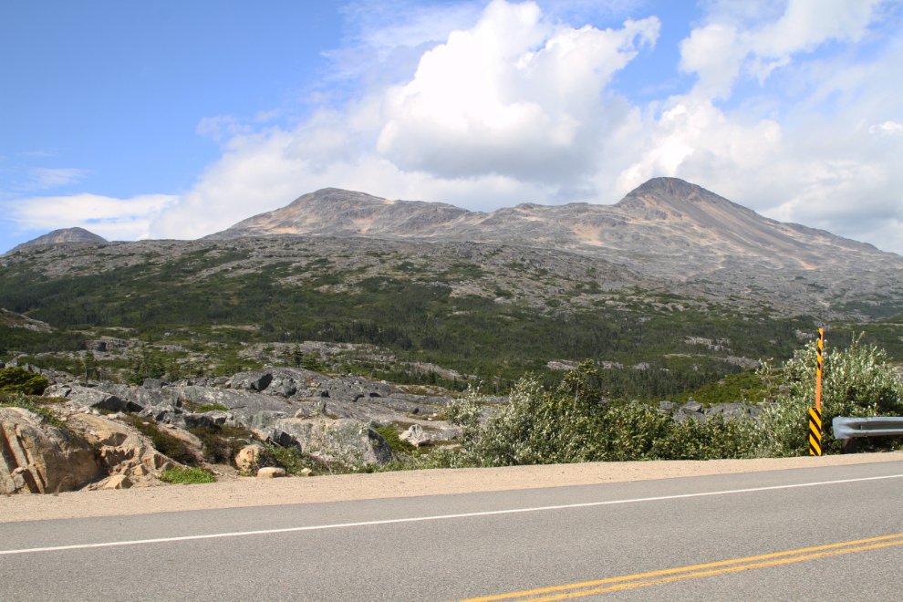
At 11:15 I headed out on the hike. I had started up Summit Creek on Saturday, but it was a very short hike. I had re-injured my Achilles, and that tendon quickly made it abundantly clear that I wasn’t going anywhere. This time I was wearing boots to protect it, and tried a different route, on the south side of the creek instead of the north. My motorhome can be seen just left of centre in the next photo.
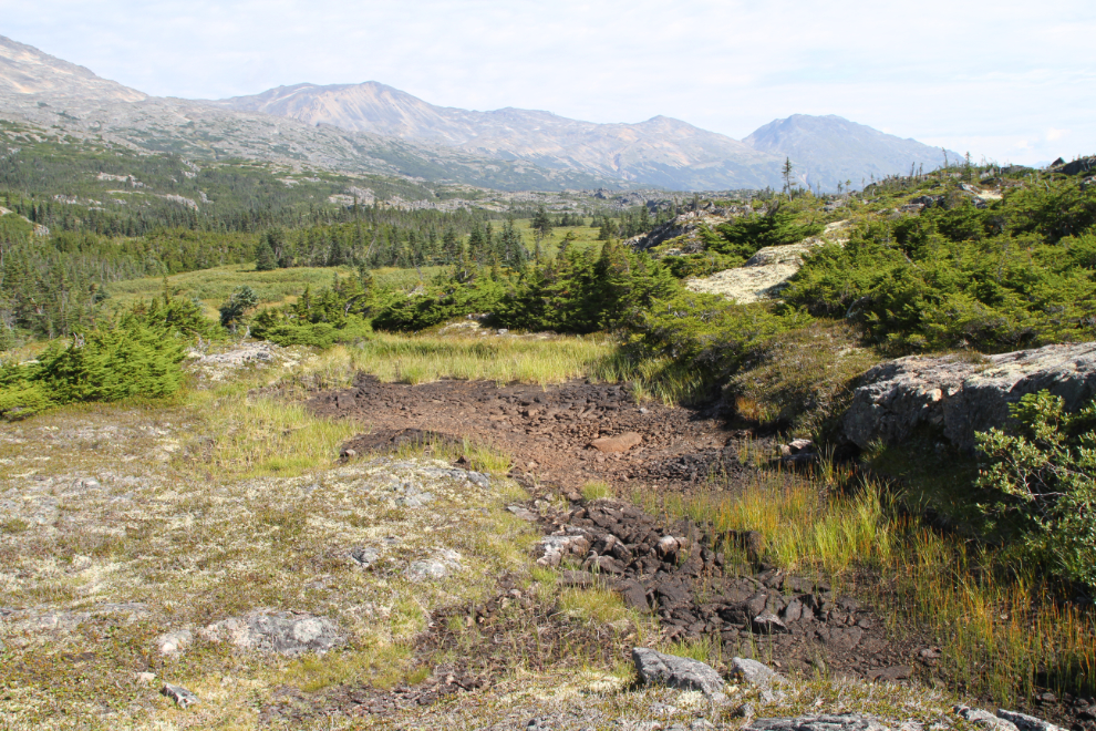
The first challenge was to find a good way across a wide wet area. I plotted one out and dropped down into the mini-valley.
Almost all of the normally wet areas (ponds, streams, and marshes) were dry – that made the crossing easy 🙂
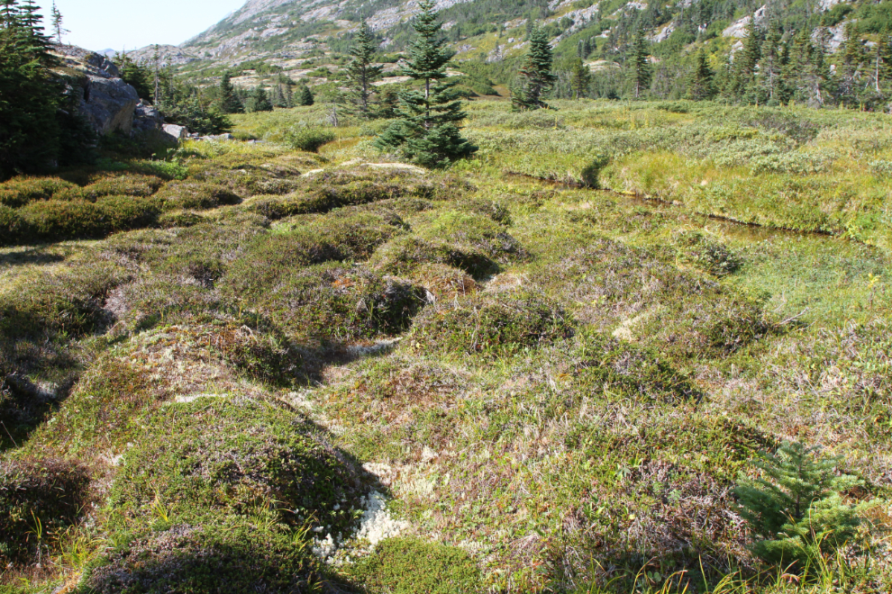
I don’t know what causes these intriguing bumps – they’re only in one small area about 100 feet square.
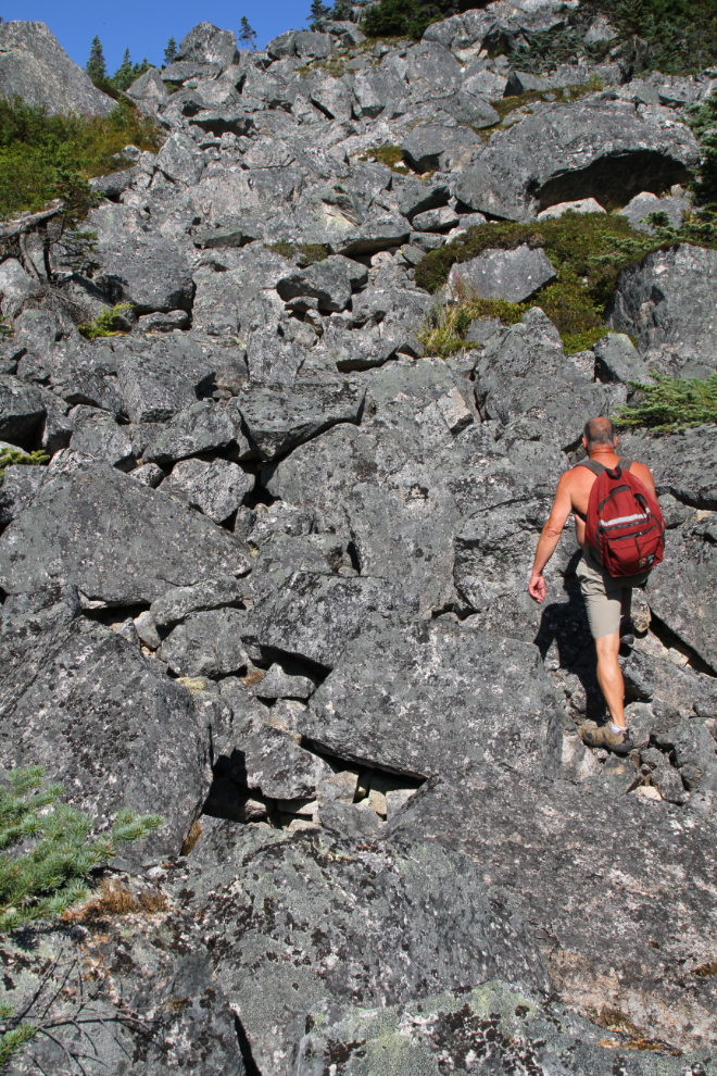
I picked a large rock slide as the best way to start up the low ridge to the west, at the north base of Summit Creek Hill. At 11:35, 20 minutes from the RV, I started the short climb.
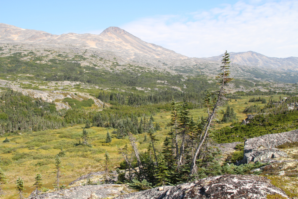
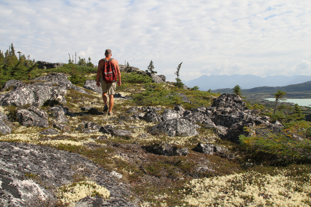
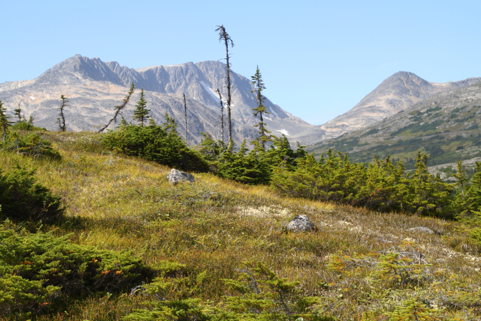
The wandering ridge tops are my favourite places to be, and there’s no direct route to the lower canyon where I wanted to start in any case, due to both terrain and vegetation.
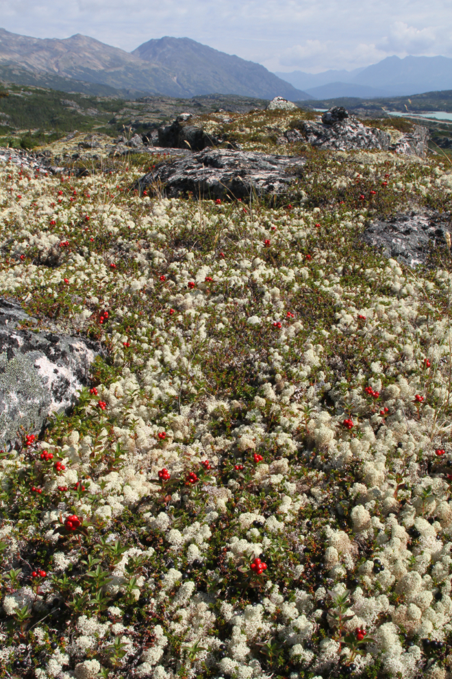
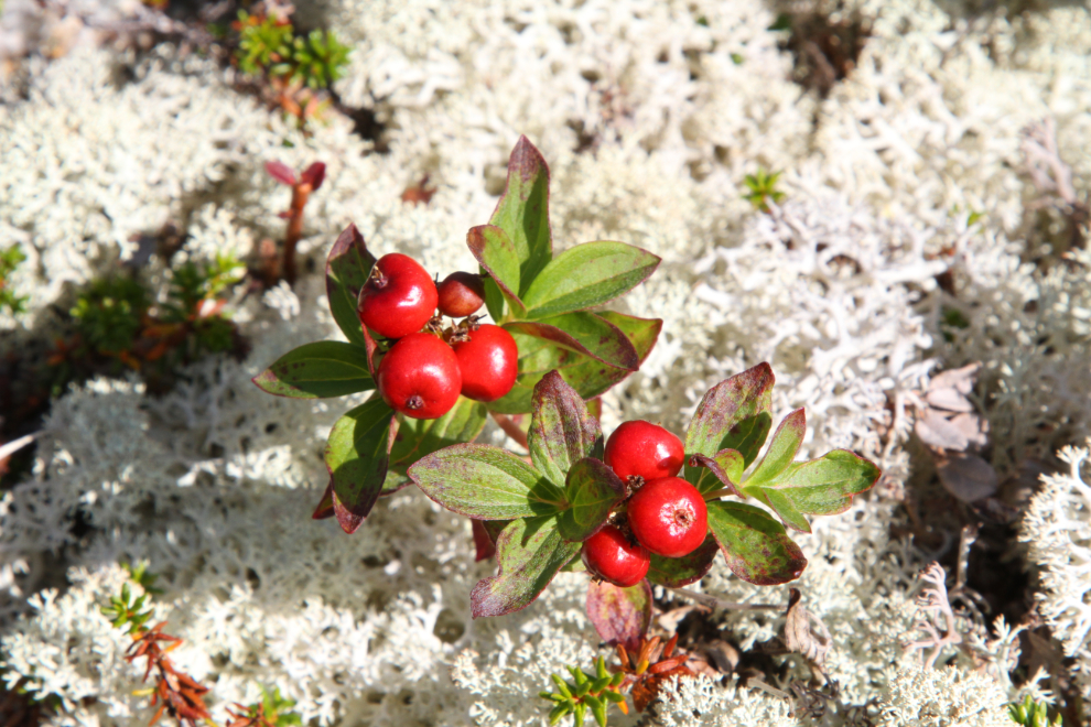
Mother Nature’s bounty in the White Pass. I don’t yet know what the berries are – I don’t have access to my plant books and can’t find them online. But it’s beautiful in any case. In areas like this, I try hard to only walk on the rocks.
After climbing up, I had follow a creek back down a little way to reach a spot where I could get through very thick evergreens to the left. I shot this a couple of minutes before noon.
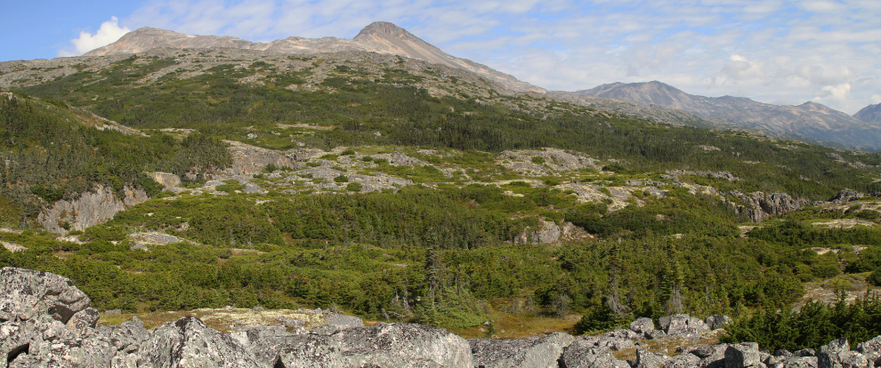
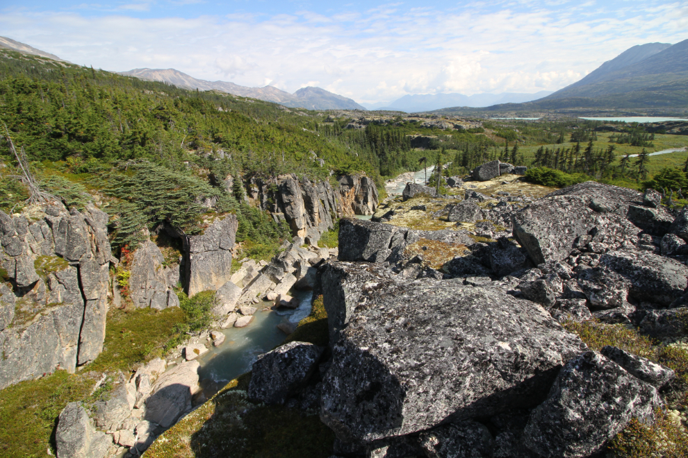
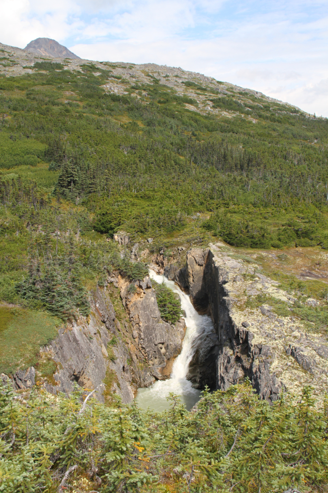
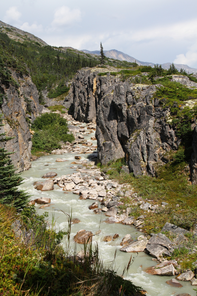
All of the lower canyon and the first part of the uper canyon can be seen in the next panoramic photo, which looks north. Summit Creek flows in at the upper left, makes two right-angle turns then continues along just below the middle of the photo.
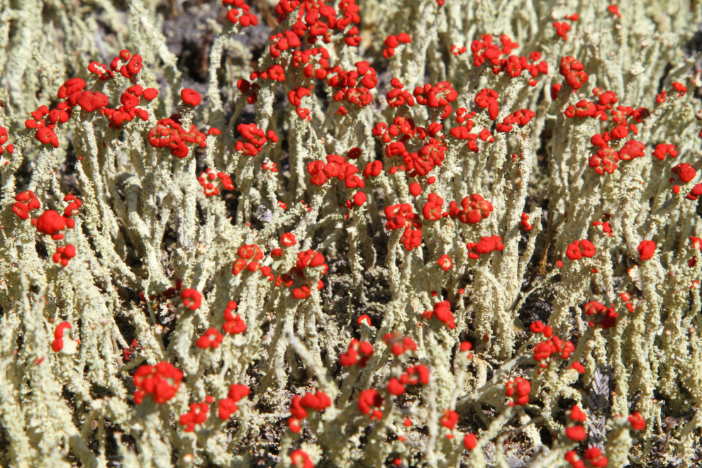
My favourite lichen are called British soldiers (Cladonia cristatella). I see them occasionally on my hikes, but I’ve never seen a patch as large and healthy as this one. They’re tiny – a little over an inch high.
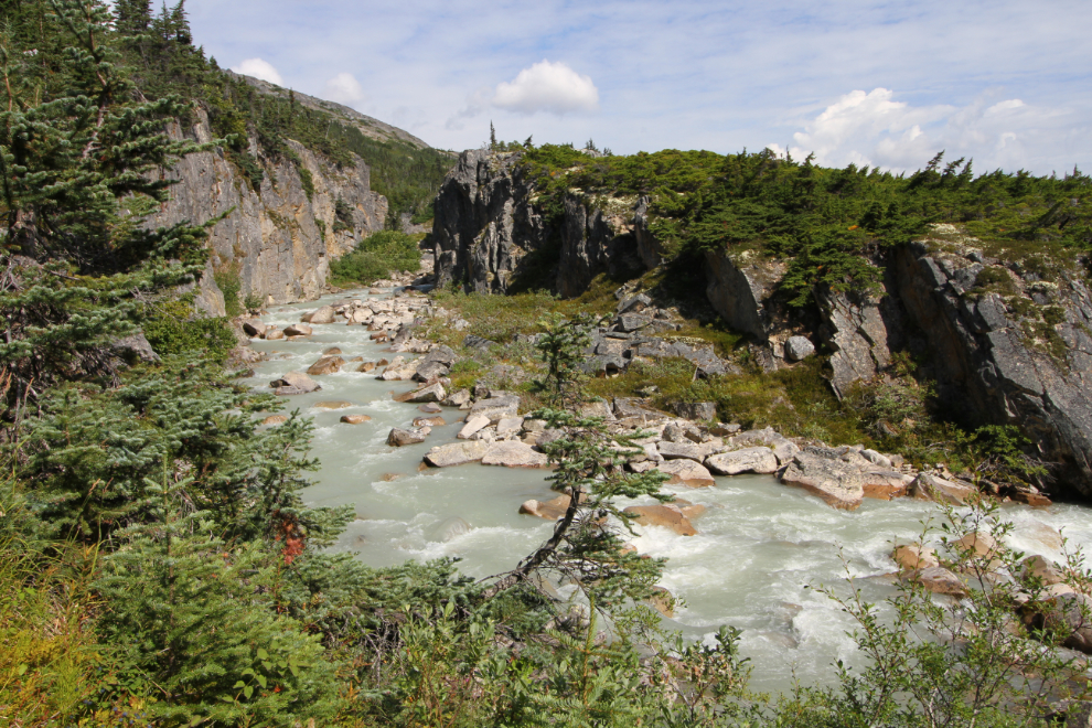
There are two good routes down into the lower canyon – one around the middle and one at the upper end. The next photo was shot near the middle one, at 12:20.
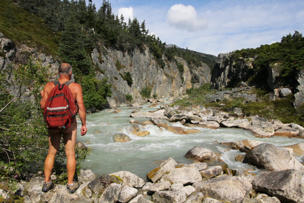
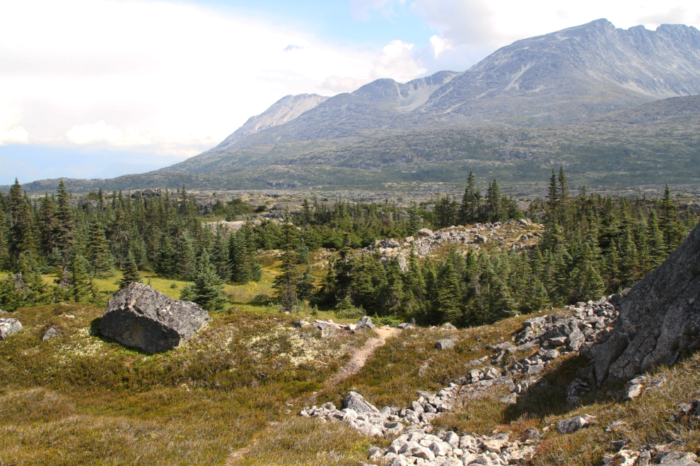
Back up top, looking down the lower canyon. Between the lower canyon and the highway, Summit Creek swings wide and flows through a wet area with lots of willow and other brush that makes hiking along it all but impossible. Part of that area can be seen towards the upper right of the next photo.
Looking up the lower canyon from the same spot.

I had a bad fall at the spot where I took the two photos above. My tripod started to fall, and in grabbing it, I twisted and fell backwards, landing on a small boulder with my tailbone. The pain was literally blinding, but after a few minutes recovery and some test movements, I decided I could continue with the hike.
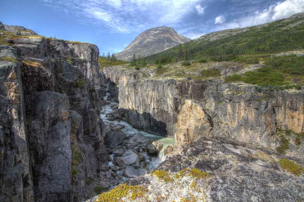
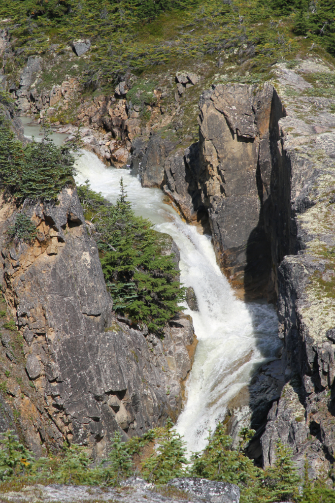
The next photo looks up the upper canyon, which is much more spectacular than the lower canyon. Summit Creek does a 90-degree turn here, and another 90-degree to the left just past the furthest point the photo shows.
I was extremely surprised to find a little-used trail as I climbed up from the spot where I shot the last photo. The next photo looks down to that spot.
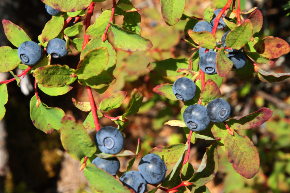
If you got here, you sure wouldn’t starve – the blueberry crop this year is bountiful (as is the case with most berries here).
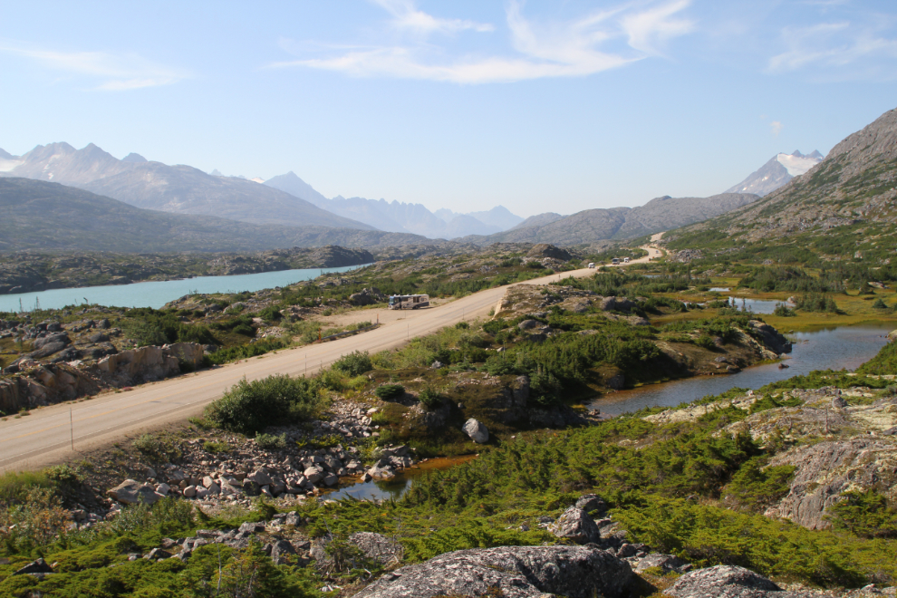
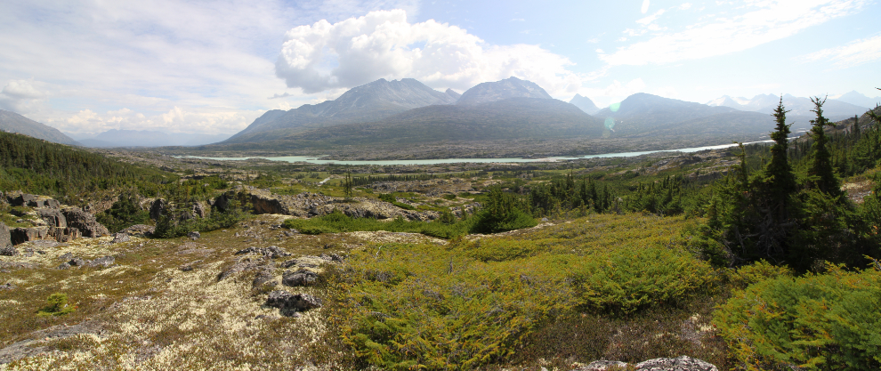
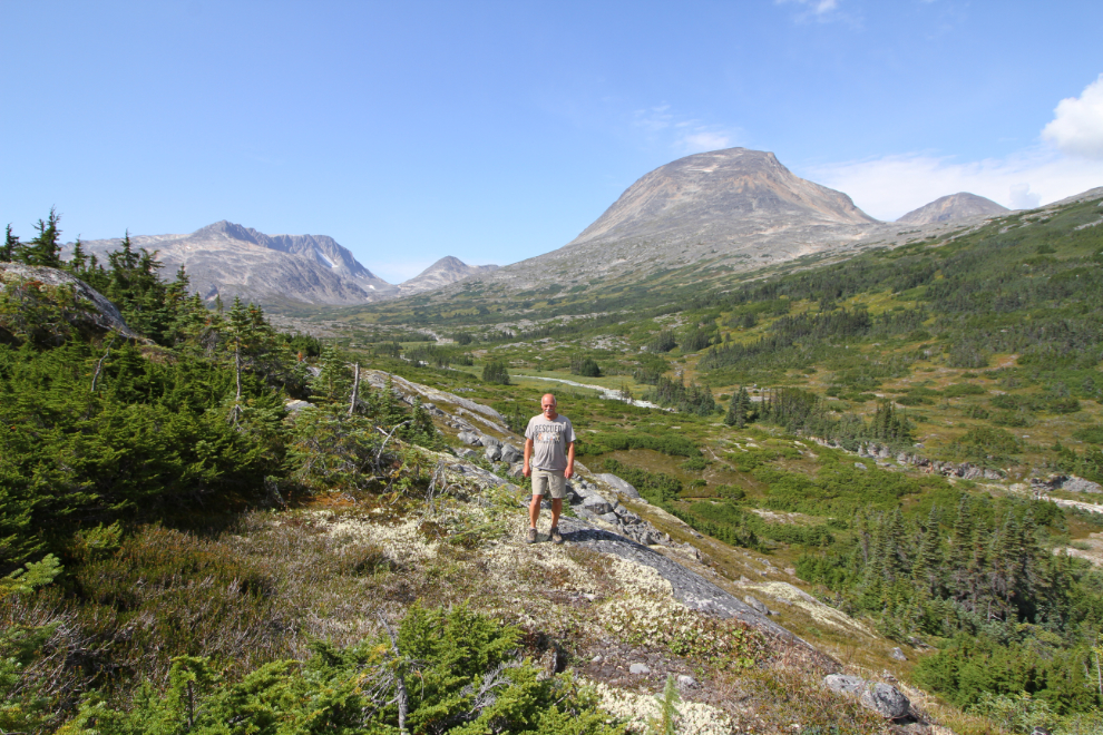
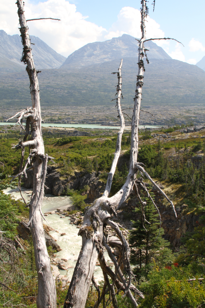
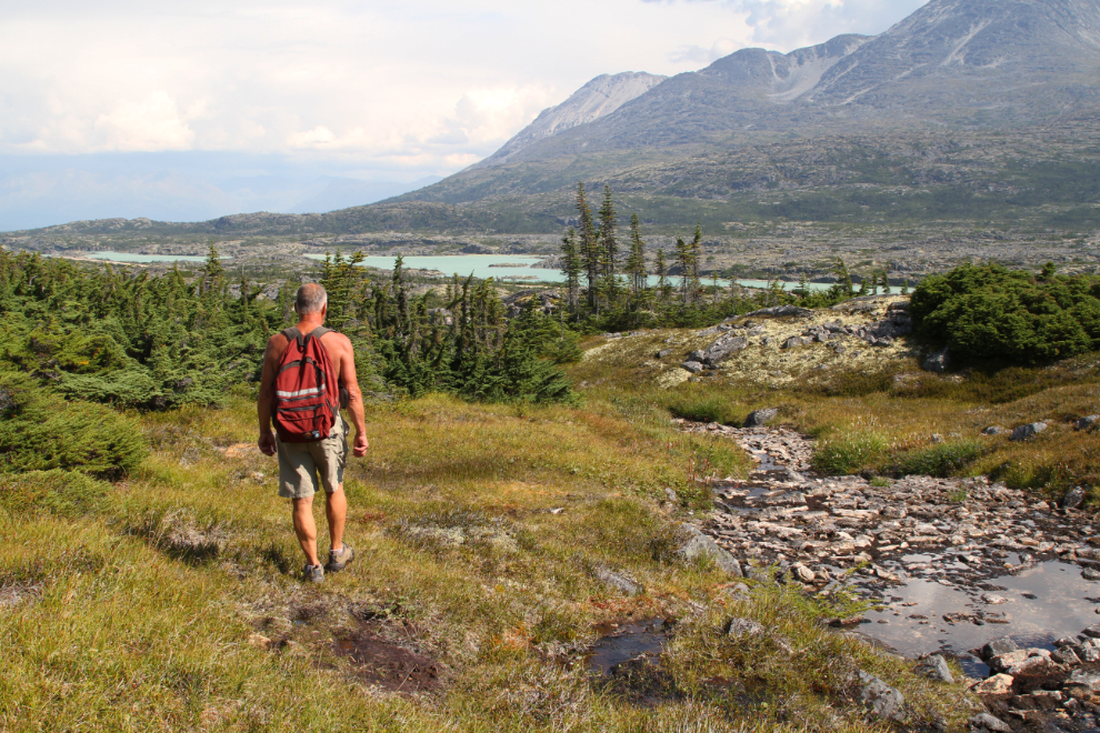
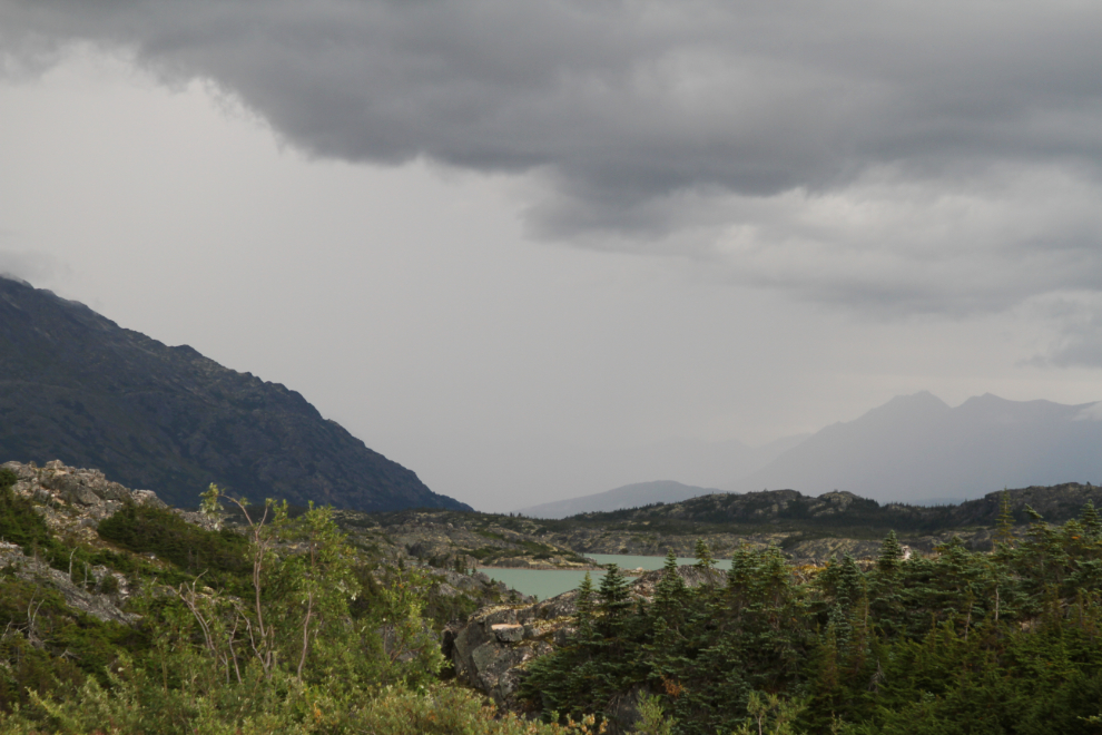
A panoramic shot of the view back down to Summit Lake and the highway, at 1:20 pm.
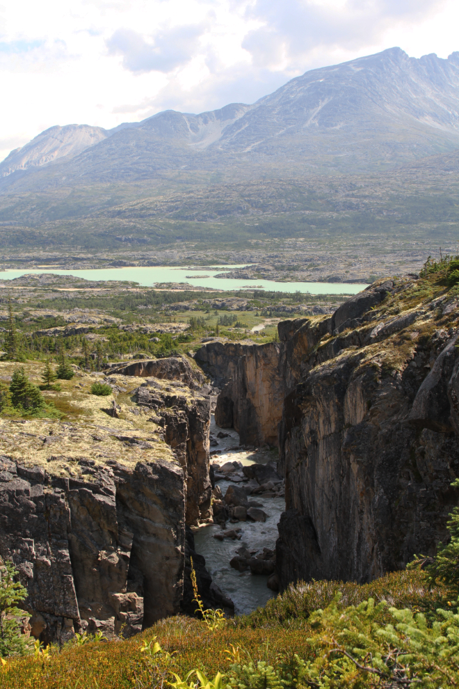
Here’s the first good look at the upper canyon, processed as an HDRI to bring out details in the deep shadows. If there’s a way down into the canyon, I didn’t see it.
Right below the spot where I shot the next photo, Summit Creek makes another 90-degree turn. This is at the upper end of the upper canyon.
I climbed high above the head of the upper canyon (up Summit Creek Hill) to see if I could get a broad view of the canyons and the upper Summit Creek valley.
Here is where I turned around, at 1:45. From there I could see a trail running up the north side of Summit Creek. It looks like it would be an amazing backpacking trip, though I have no idea where that trail begins. I guess I need to do more exploring there 🙂
On the hike out, I dropped down closer to the canyon lip to get some clearer views. Very impressive! This photo also hints at one of the reasons I turned around – though it was beautiful at Summit Creek, storm clouds were rapidly building to the north.
This is the start of the upper canyon. This is some wild country – I love it!!
The trail I had found at the bottom of the upper canyon was fragmented, but was marked with tape at a couple of spots where it was a great aid in getting through tough sections. The next photo is right above the bottom of the upper canyon.
Back at the bottom of the upper canyon, at 2:10.
I stopped down at the creek for a few minutes to rest – my back where I fell was getting pretty sore.
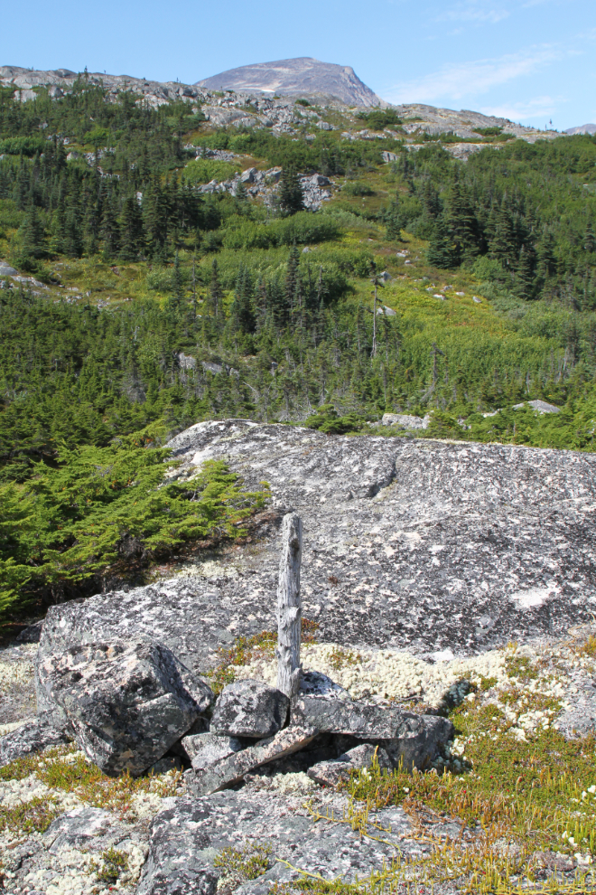
This appears to be a trail marker that’s been there for a very long time, but there’s no sign of a trail anymore, and I can’t imagine why there would be one in that area.
Although the route I chose to come in on was pretty good, I decided to take a different route out, starting at the creek where I had been just before noon.
And what do you know, I ran into another trail down almost at highway elevation, this one quite well travelled.
At 2:40 I had to change footwear…
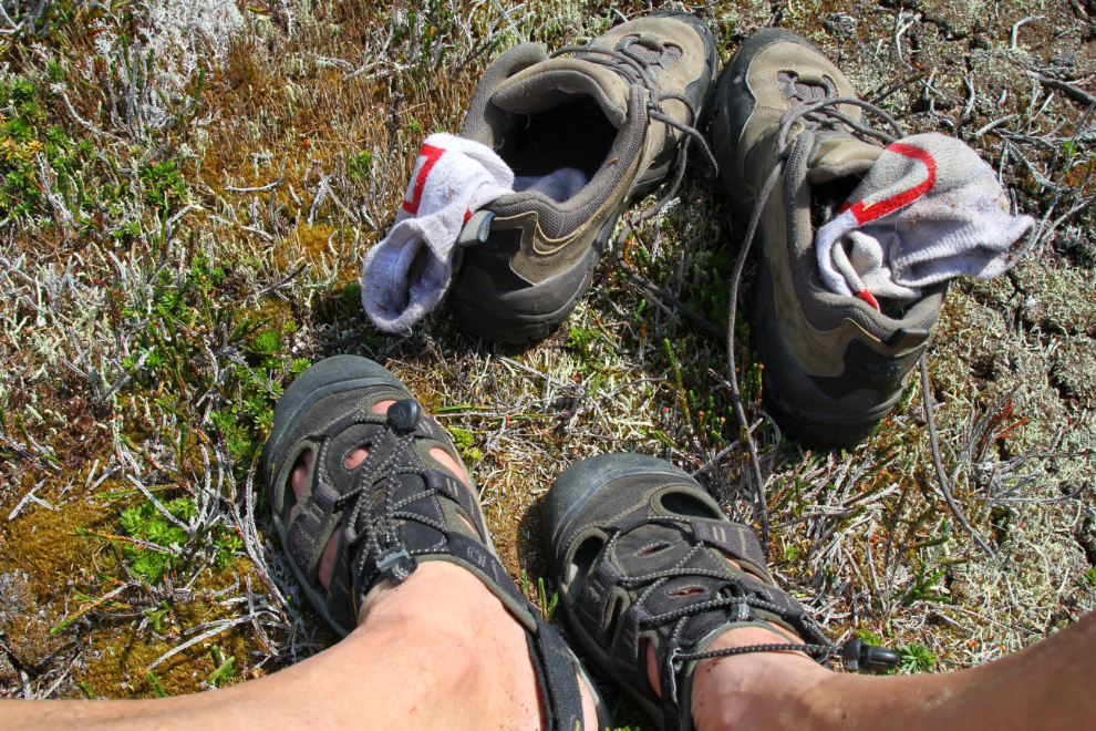
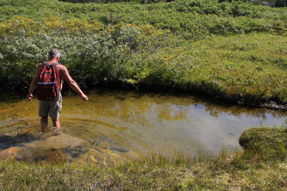
…just to cross one little creek. I was so close to highway that I didn’t change back again – my Achilles hadn’t given me any problems during the hike.
With a couple of breaks in it, I followed the trail right to the highway. It begins at the southern end of the guardrail at the Summit Creek bridge.
I got back to the motorhome right at 3:00 and took Bella and Tucker for a walk. Tucker was enthusiastic but Bella was still out of sorts – there was no hint that she had any physical problem, she just didn’t want to walk with me.
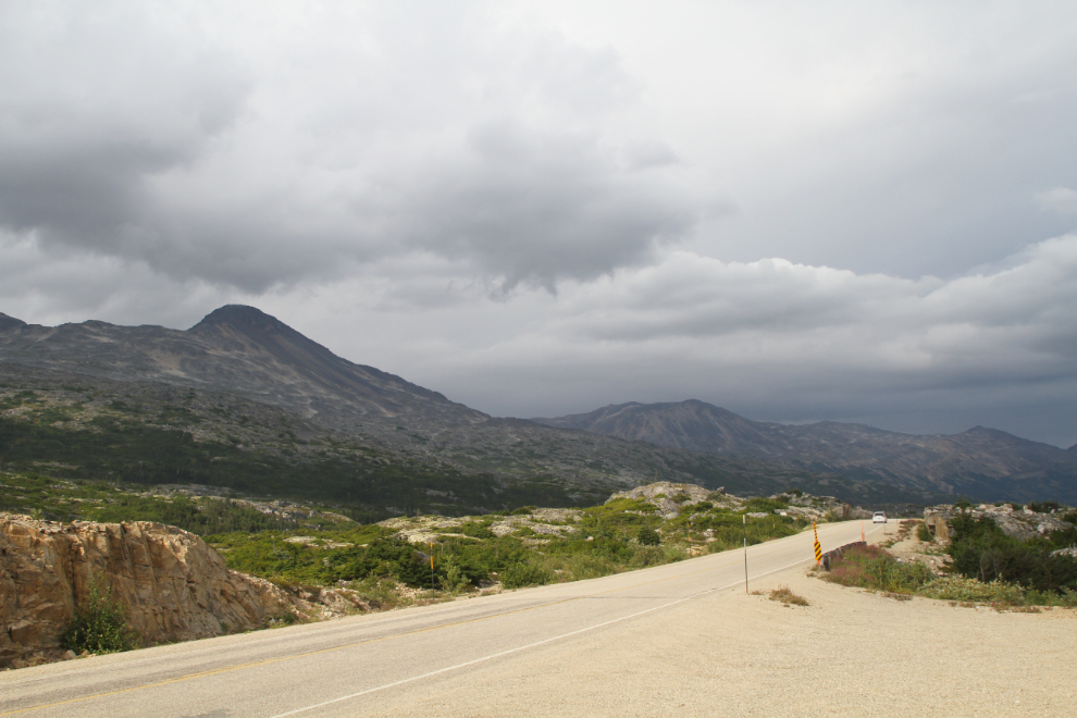
By 5:00, the skies to the north were pretty much promising rain.
At 6:35 I could see that it was raining hard just north of Fraser, perhaps 15 miles north of our location.
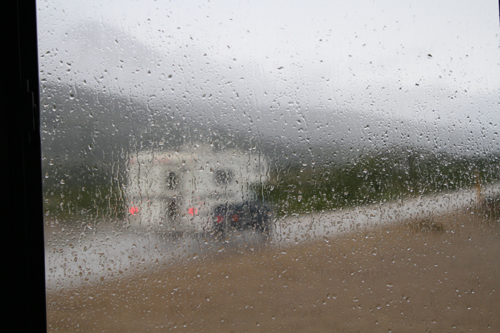
The rain arrived a few minutes later, and when I shot the next photo at 7:10 it was torrential.
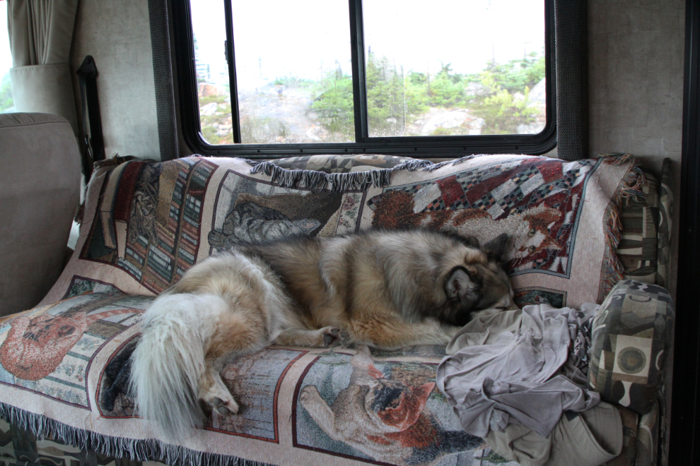
“Let it rain, let it pour, we don’t care,” said Bella 🙂
We of course had a quiet night, and I hadn’t really made any plans for Wednesday except to do some early-morning low-light waterfall shooting on the International Falls trails.