Exploring to and around Grande Cache, Alberta
Well, I had planned to stay home yesterday, but when I saw sunshine instead of the forecast clouds at Hinton, those plans changed. I started driving west with the intention of making it a short day in Jasper in case the snow arrived, but as I neared the junction with Alberta Highway 40 (the Bighorn Highway), I could see clouds ahead, and sunshine towards Grande Cache. New plan – I haven’t spent enough time in that area over the years I’ve been driving through on the way to the Yukon, and this was the perfect opportunity.
Crossing over the Athabasca River reminded me of a funny comment I saw in the Hinton Parklander newspaper. A representative of a group trying to get a park established along the river in town said that “Visitors to Hinton are ‘in awe’ of the Athabasca”. Really? In awe?? 🙂 I do think that a riverfront park is a great idea, though.
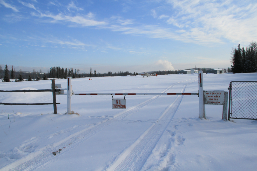
I turned off to have a look at the Hinton-Entrance airport, and was surprised to find “No Trespassing” signs. Run by the Hinton Flying Club, it is a licensed airport, though (code CEE4).
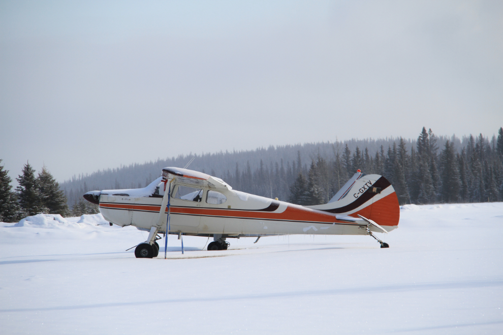
With a telephoto lens, though, I did add C-GXTV, a 1952 Cessna 170B, to my collection at Airport-Data.com.
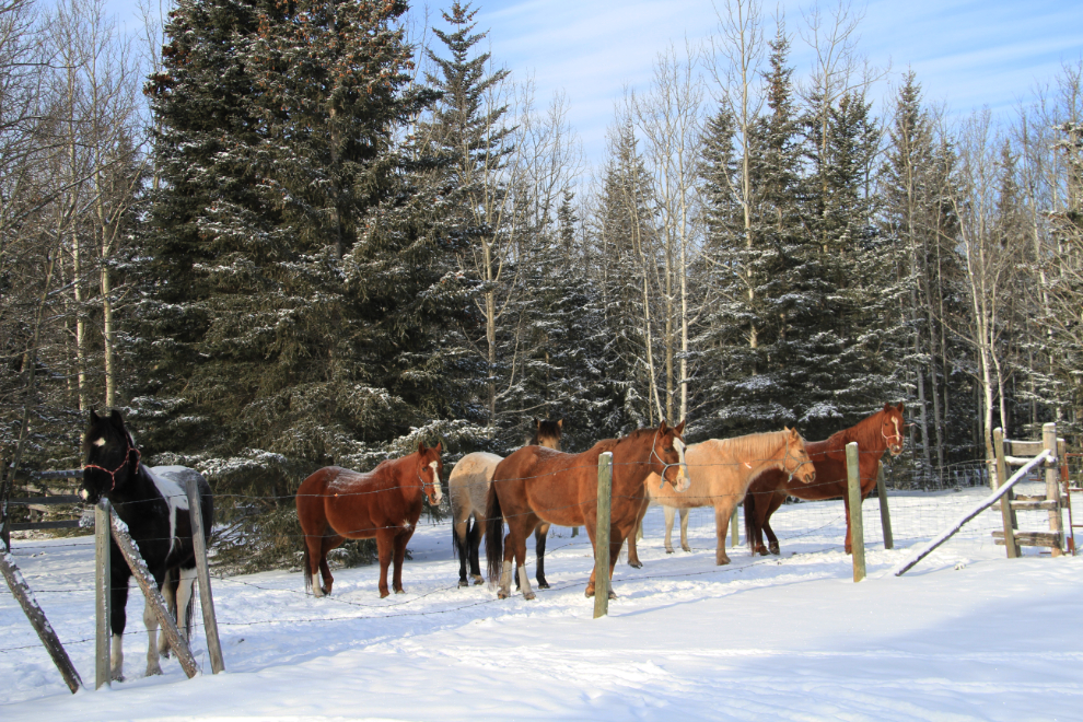
Heading back to the highway, I stopped to chat with this very friendly band of horses, who seemed to enjoy the company 🙂
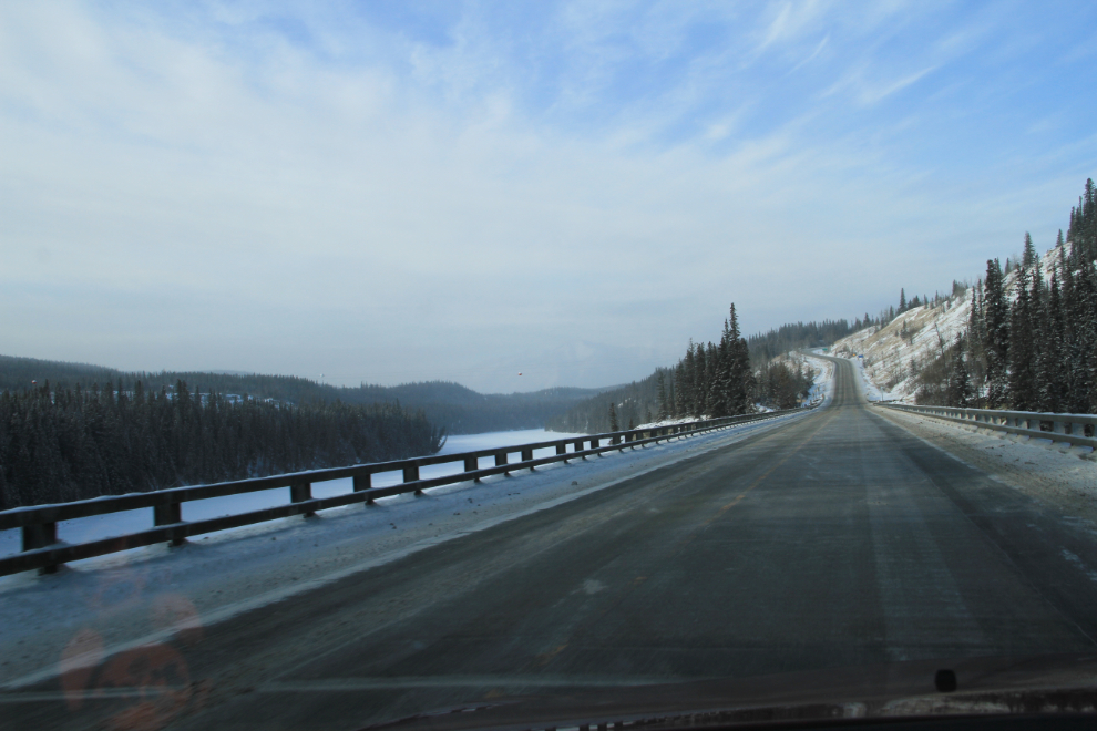
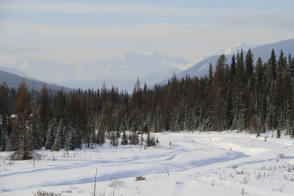
Highway 40 needs many more passing lanes, and many more scenic pullouts. Only because there was almost no traffic could I get a photo of spots like this.
How could I not stop at a park called Kelley’s Bathtub??
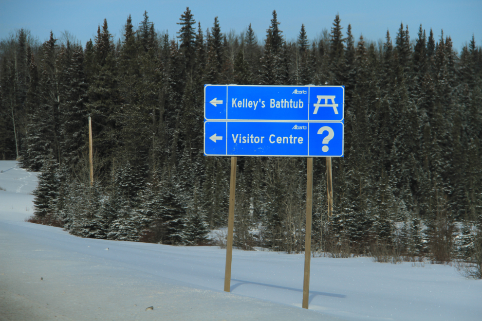
Kelley’s Bathtub is as lovely as the name is cute.
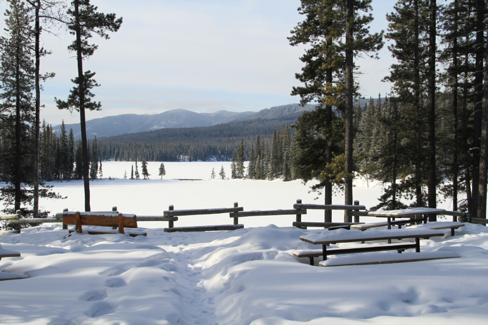
Yes, that’s the sort of view that just keeps me going!
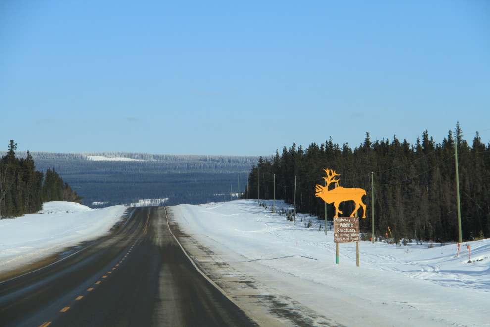
There’s a 40-kilometer stretch of the highway signed as a Wildlife Sanctuary, but hunting is allowed as long as you’re more than 365 meters from the highway. HUH?? Officially it’s the Highway 40 / Little Smoky / Simonette Road Corridor Wildlife Sanctuary. I’ve seen caribou in this area on previous trips, but not today.
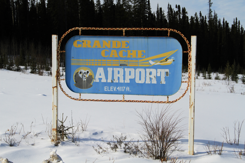
I’ve visited the Grande Cache Airport before, but never had a good look around.
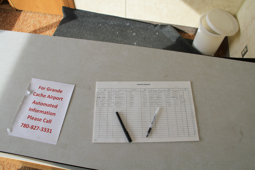
Ah, wonderful – another of my favourite type of airport. This is the registration desk for pilots. The small terminal is open and unmanned.
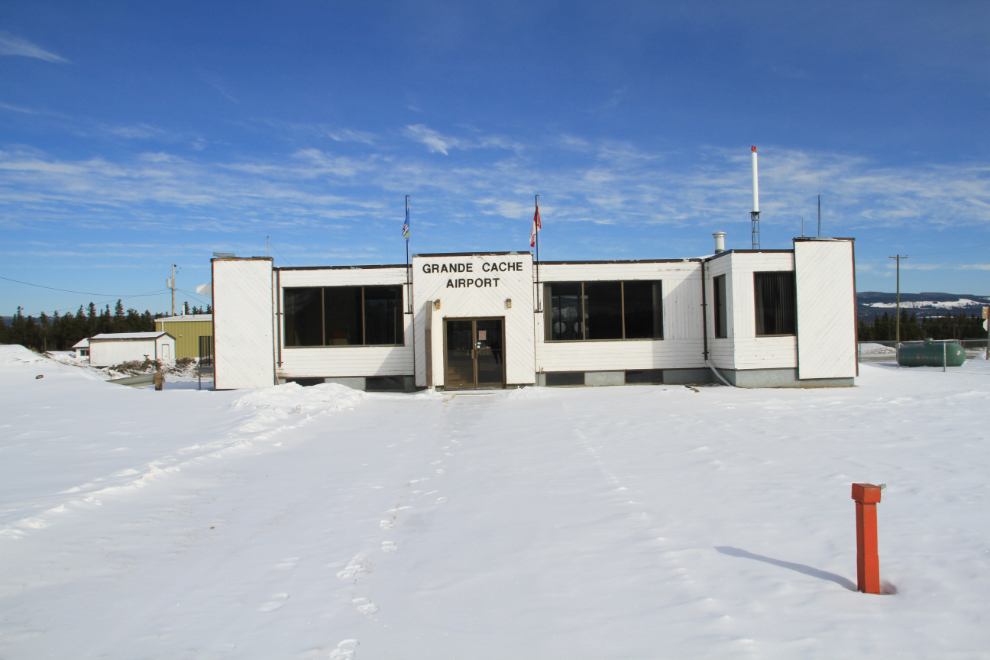
The terminal from the air side. There were no aircraft to see today.
The other big attraction along the airport road for transportation geeks like me is a very large railway bridge. This line was begun by the Alberta Resources Railway Corporation, incorporated by the Government of Alberta in April 1965, but was leased and then in 1994 bought by CNR. I had hoped for a clear distant view of it by walking up the creek but didn’t find a break in the trees…
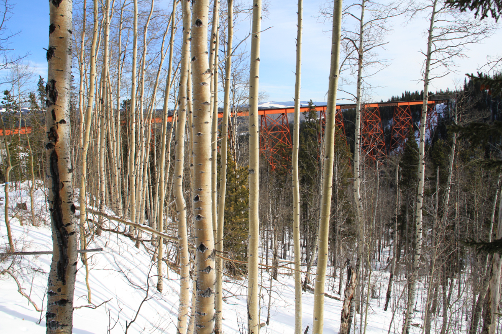
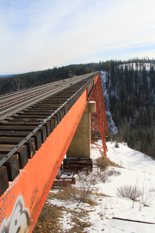
…so ended up shooting from the bridge itself. I haven’t found any specs on the bridge, but it’s impressive.
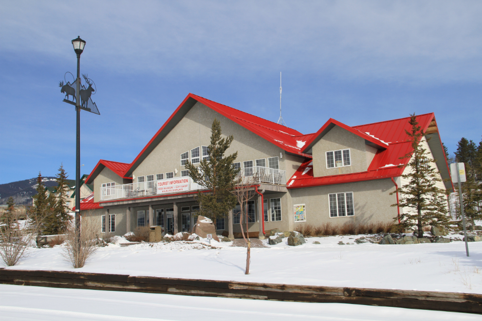
I was surprised to see an “Open” sign on the Grande Cache Tourism & Interpretive Centre, and went for a look.
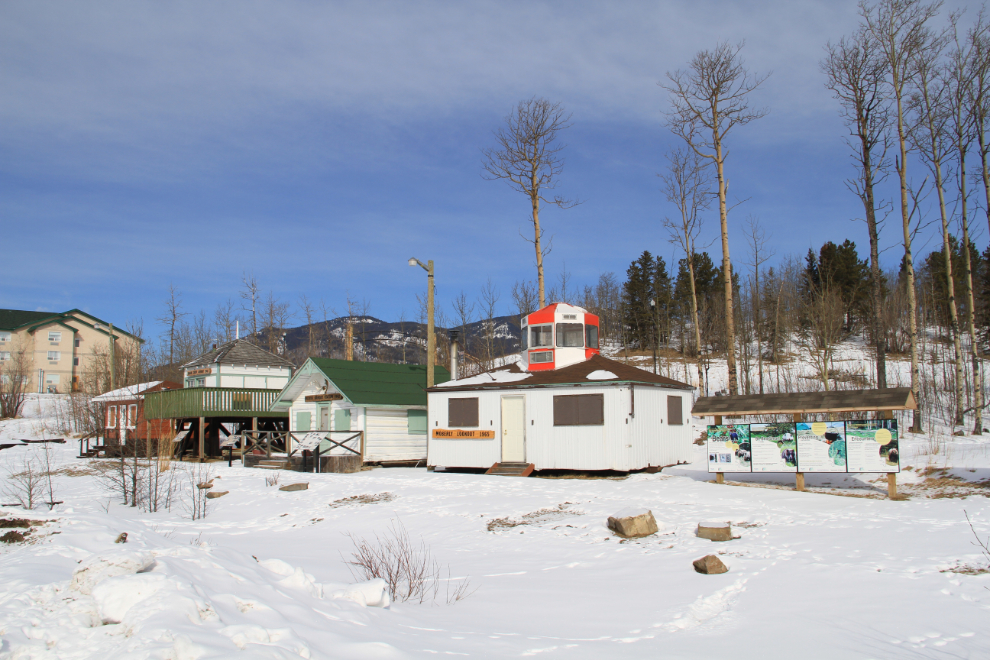
The line of old forestry cabins and lookout towers, with plenty of interpretive signage, was interesting.
Although it took me a while to get up to this level, I’ll start with this photo to show you how impressive this facility is. It really is a must-stop.
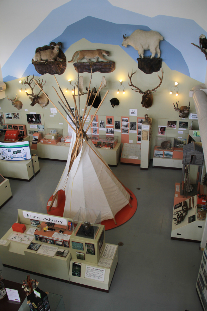
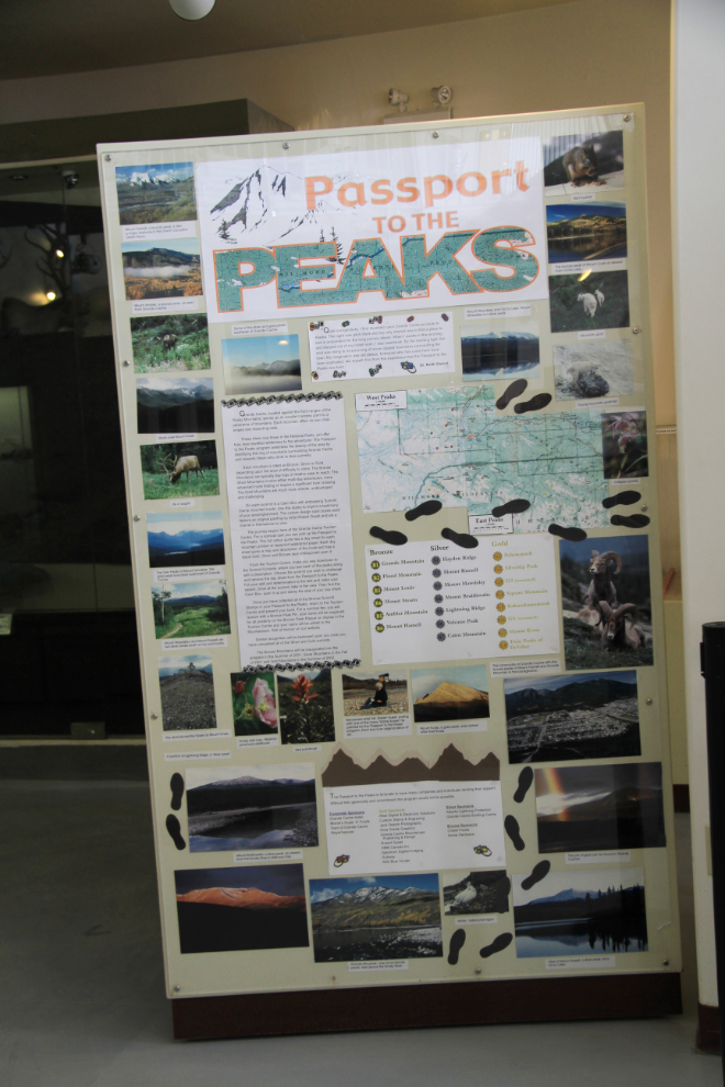
I spent a long time chatting with Elesa, the Tourism Hostess who was on duty. I thoroughly enjoy talking to people who are passionate about their community, and Elesa certainly made me understand how much I’ve been missing by passing quickly through on previous trips. One of the indicators of the backcountry experiences that are available is their “Passport to the Peaks” program, which has bronze, silver and gold levels for the difficulty and number of peaks hikers have climbed. Only a handful have achieved gold.
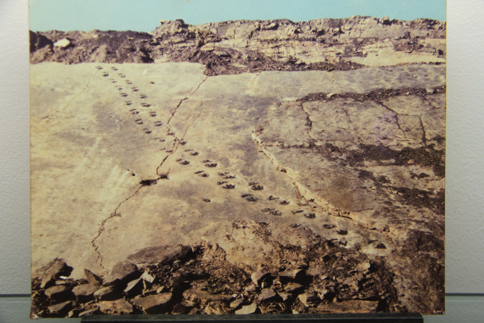
This photo, displayed in the centre, shows a dinosaur trail that is out in the coalfields nearby. There’s no public access as it’s only accessible by a private mining road, but I’m okay with just knowing that such amazing features exist out there.
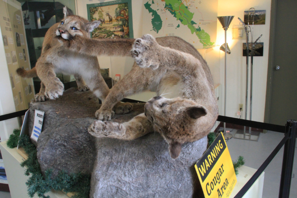
I love the way these cougars have been displayed 🙂
Elesa also showed me the meeting rooms that contribute to the centre being able to stay open year-round. The large windows and wonderful views make the artists’ studio simply stunning.
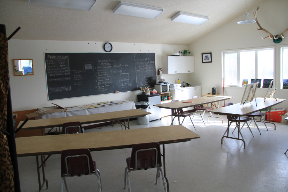
This is one of the views from the corporate meeting room.
I went for a very good lunch in town, then was back to exploring. This is the miners’ memorial, which has the names of 28 miners killed between 1969 and 1999 in local coal mines.
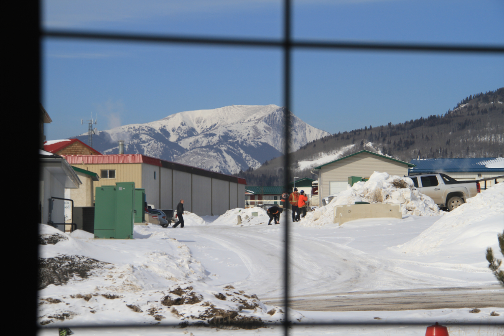
Driving through a residential neighbourhood on the way to the next attraction.
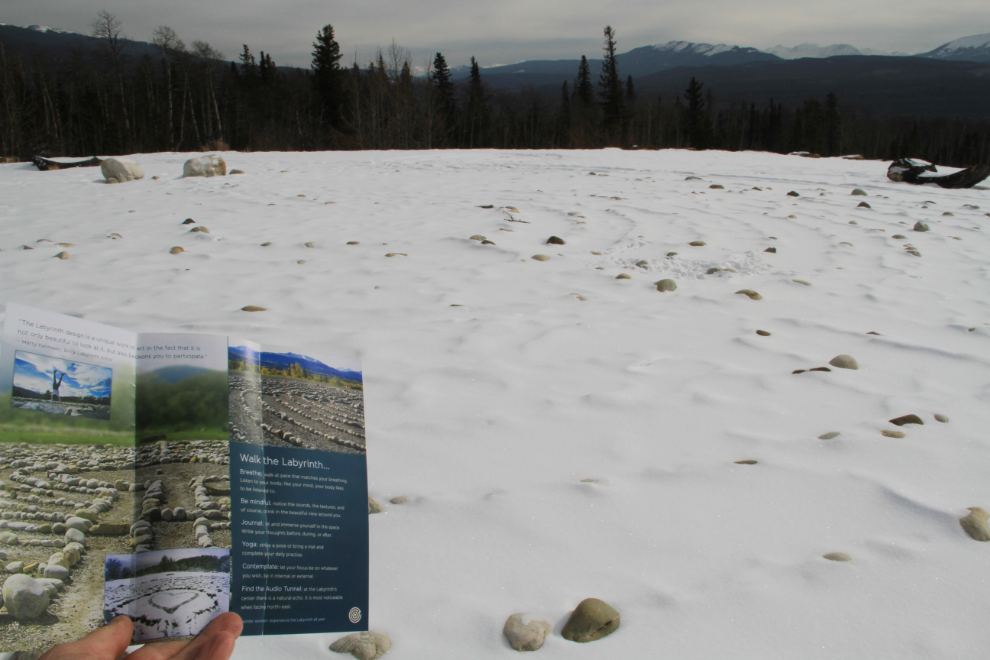
I really like labyrinths, but unfortunately the snow was deep enough to pretty well hide it. It’s a gorgeous location to have a Labyrinth Park, though. The labyrinth I was going to build in the former corral at home didn’t progress very far – it’s an enormous amount of work.
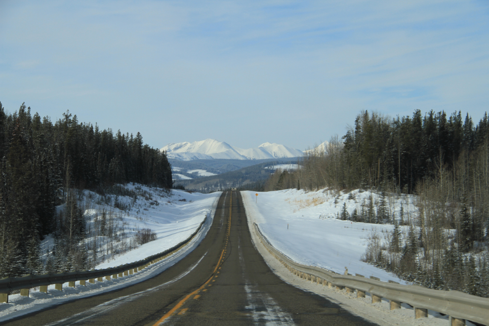
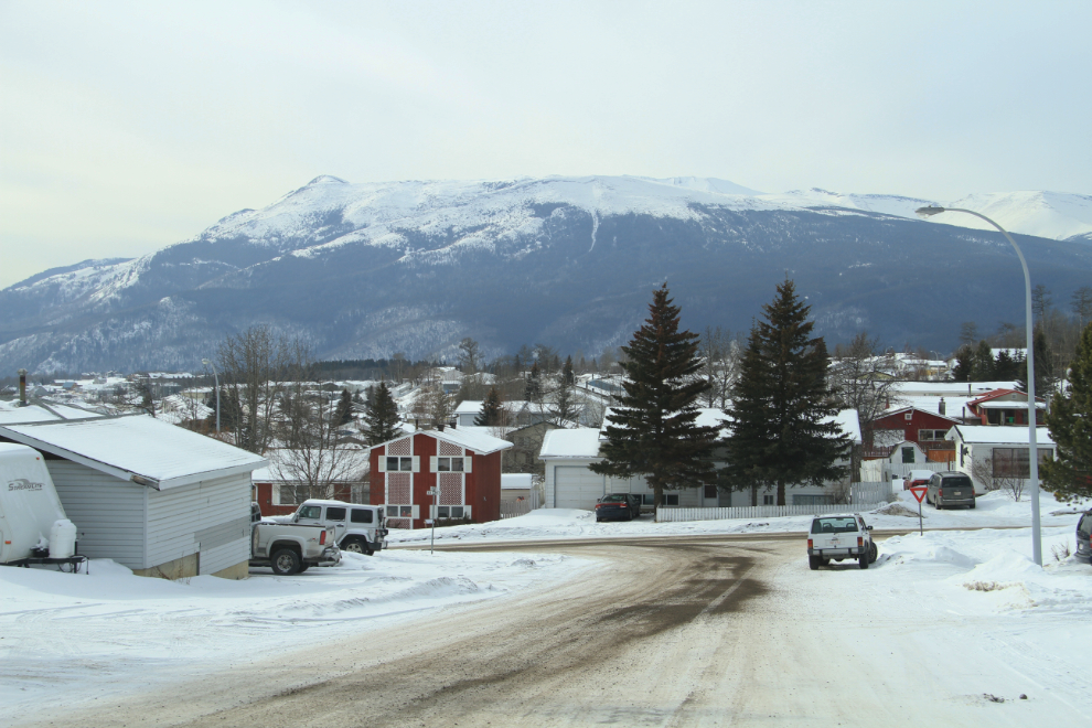
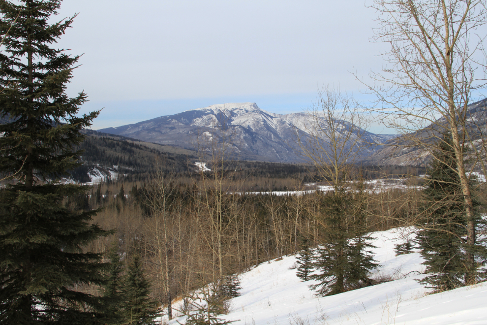
Back on Highway 40 (and at 2:30, now very conscious of fast the day was disappearing), this was the view down the Smoky River Valley just north of town.
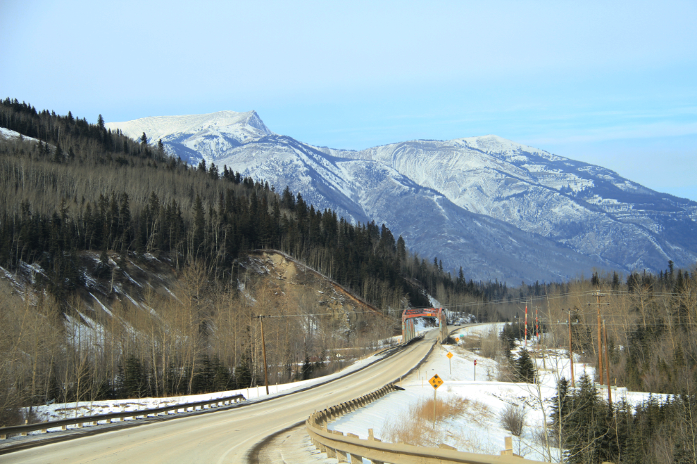
The highway crosses the Smoky River.
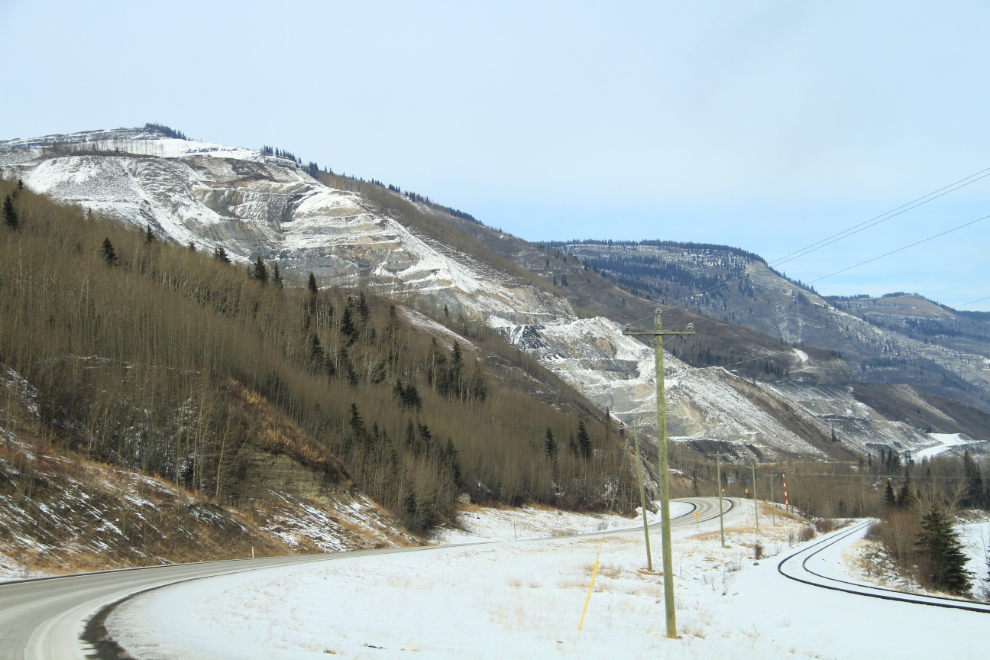
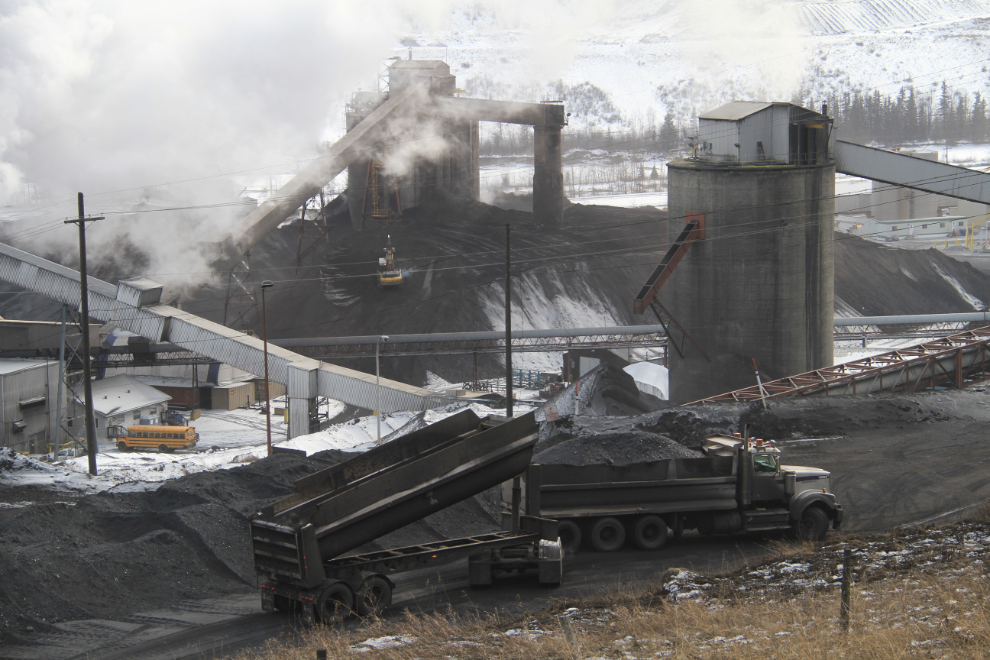
This is by far the largest of the coal mines that’s visible from the highway. [Edit: Grande Cache Coal had some photos of current operations on their Web site – while the company is history, the website has been archived.
Among other things, the coal being mined powers the H.R. Milner Generating Station, a 150 MW power station located along the highway and railway.
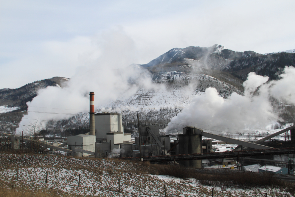
A closer look at the coal operations.
From industry to wilderness. My next and final stop was 7km off the highway at the edge of the Willmore Wilderness Park, a 4,600 square kilometre pure wilderness area (no motorized access any time) that adjoins Jasper National Park. On the way in, I was a bit nervous about meeting one of the vehicles that were in there already, and the road was only well-plowed one lane wide.
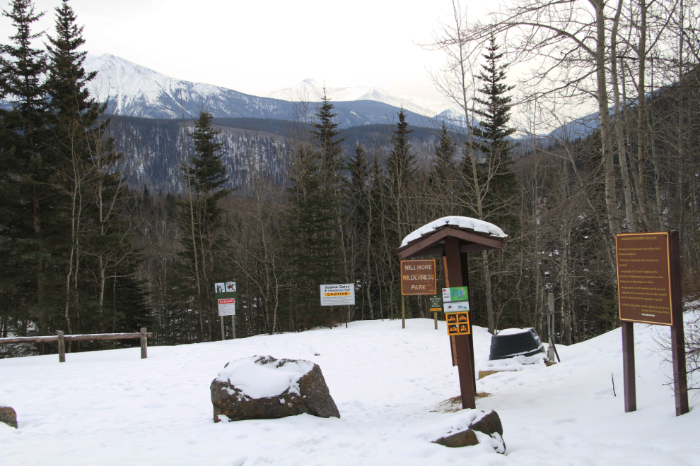
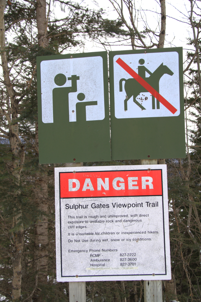
My focus here was the Sulphur Gates Viewpoint Trail, which this sign describes: “This trail is rough and unimproved, with direct exposure to unstable rock and dangerous clidd edges. It is unsuitable for children or inexperienced hikers. Do not use during wet, snow or icy conditions.” There were a couple of pickups with 4 men just about to leave, and the oldest of them, about 20 years my junior, advised me on some elementary precautions to take. If I’d seen a vehicle like mine in a place like that, I’d probably also have assumed that I was talking to a city-slicker who was out of his depth, so I just thanked him, showed him the emergency beacon that was already strapped to my arm, and continued getting my gear on. 🙂
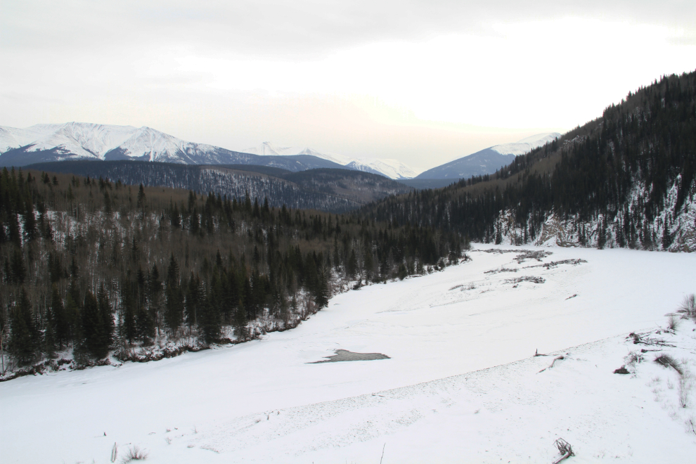
It’s a very short trail, and despite the warnings on the “welcome” sign, very much improved, with steel railings along much of it. The first of the excellent steel viewing platforms offered this view up the Smoky River.
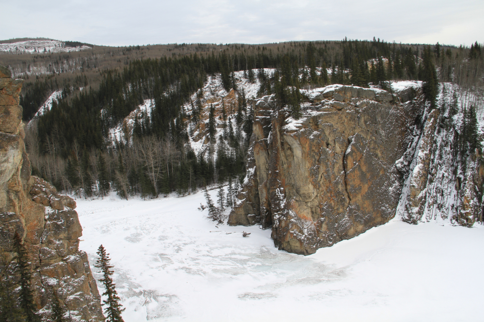
Approaching Sulphur Gates. Stunning – I can imagine what it’s like on a day with clear blue skies.
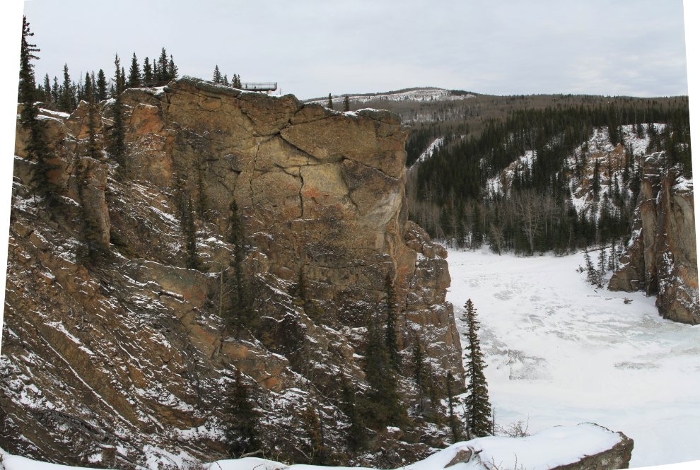
This is a panorama created by stitching 3 vertical images, shot with an 18mm wide angle lens, together. You can see the highest of the viewing platforms at the upper left.
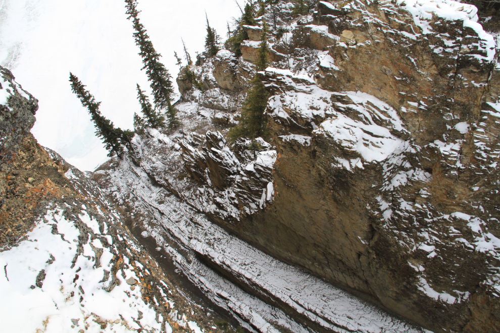
The viewing platforms all hang over the edges of the cliffs, and anyone with a fear of heights is not likely to go to the end of them! This one, the highest one, looks straight up Sulphur Creek through the Gates. You’d think that the warning signs would be unnecessary, but apparently not – I saw some old graffiti in a location that just left me shaking my head at the stupidity, never mind the insensitivity.
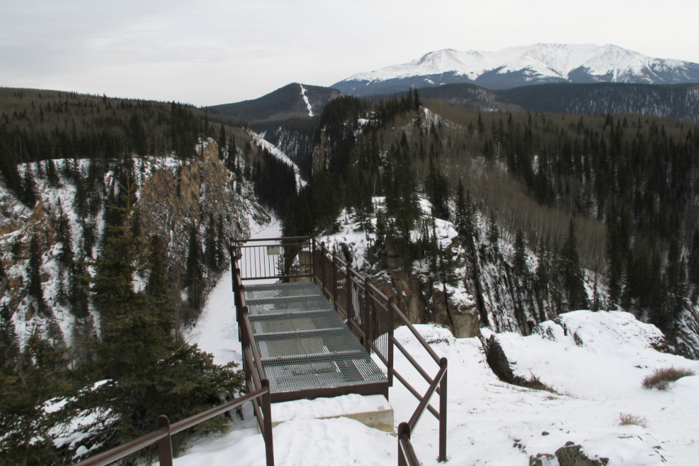
This is the view from the next viewing platform down. That’s a view that I certainly would never have gotten before the trail improvements were made.
A few minutes before 4:00, I was back at the highway. I brushed the snow off the back of the car so I could be seen, and started the 160-odd-km drive back to Hinton. The day had certainly taught me a lot about this area, to the point that I’ve added Grande Cache to my RV Destinations board at Pinterest. As well as the links I’ve posted above, you can keep up with local attractions and events at the community Facebook page.
It started to snow about a half-hour out of Hinton, and today we have a snowy, dreary day. It’s a good day to curl up with the fur-kids, do some reading and enjoy some down time – my first since leaving Whitehorse 10 days ago.