Flight to Yukon history
As much as I enjoy hiking into some of the fascinating historic sites we have in the Whitehorse-Skagway area backcountry, there are times when I think that it would be great to have some mechanical assist, whether that be an ATV, a boat, a helicopter or a float plane. A few days ago, I got a call from friends who asked me to join them on Saturday for a day exploring an old logging camp that they were going to get near in their float plane and then hike to. Yes, I’d love to!
I was able to give them a basic history of the camp, which is located at the south end of Windy Arm of Tagish Lake, with a sawmill at Wynton (at the mouth of Dail Creek). Run by brothers Al and Eugene LaRose, it initially supported the operations of the Conrad and other silver mining companies in the area starting in 1906, and when the mines died, they tried to supply Whitehorse with wood. On June 20, 1908, however, while testing the waters of Miles Canyon and Whitehorse Rapids in a canoe to see if a raft of logs would make it through, the canoe upset and both men were drowned. I’d been to the sawmill site and had been up the main logging road a ways, but had never seen the stable or other camp sites that Kyle and Casey had found.
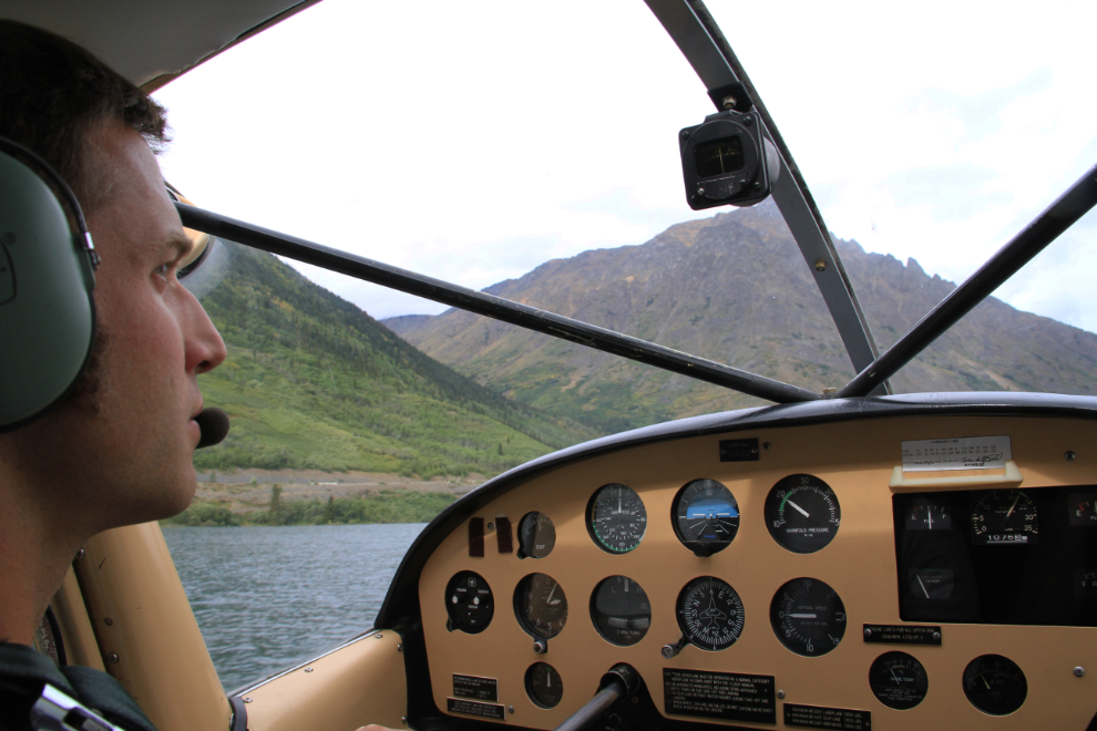
I met them at Schwatka Lake at 10:00 on Saturday morning, and within half an hour we were on our way southeast. Even while we were getting ready, the feeling that I knew would come, did – I would sure like to have my own airplane again. I love flying, and being around other pilots.
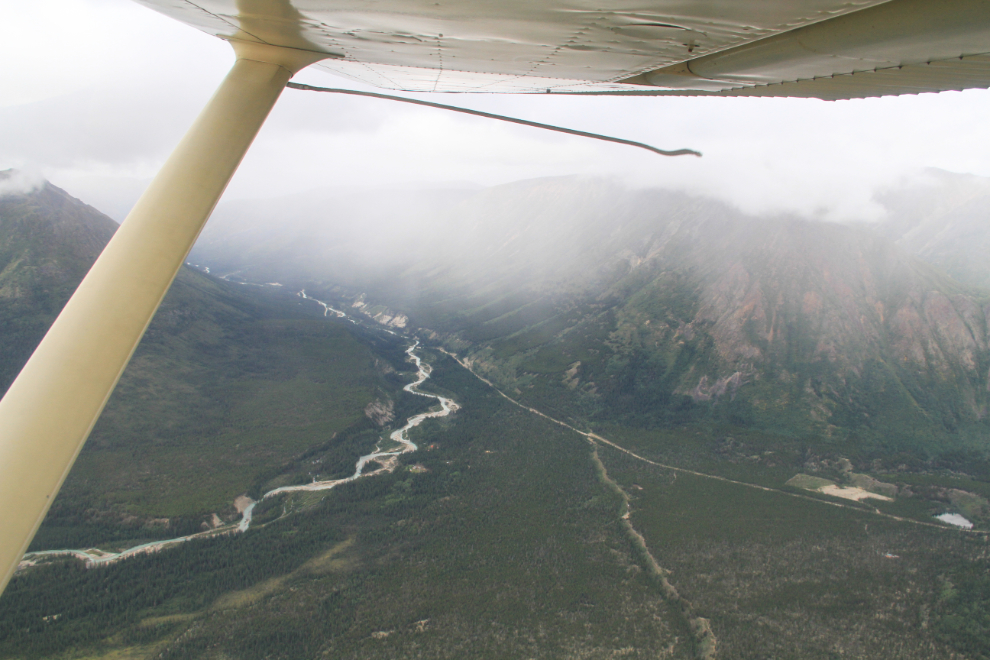
It wasn’t clear what the weather was going to bring – there was certainly some ugly stuff up the Wheaton River valley. One of the things that makes floatplanes safer to fly up here is that there are lots of rivers and lakes where you can land if the weather shuts down or you have other problems – for aircraft on wheels, there are only a handful of emergency strips.
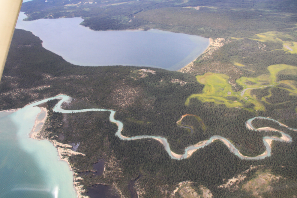
That’s the Wheaton River where it empties into Lake Bennett, with Millhaven Bay at the top. Just out of the bottom of the photo is the site of the Klondike-era camp of the Bennett Lake & Klondyke Navigation camp, where the small sternwheelers Ora, Nora and Flora were built. Not much remains, but enough to intrigue anyone with an interest in history, and enough for me to identify it many years ago.
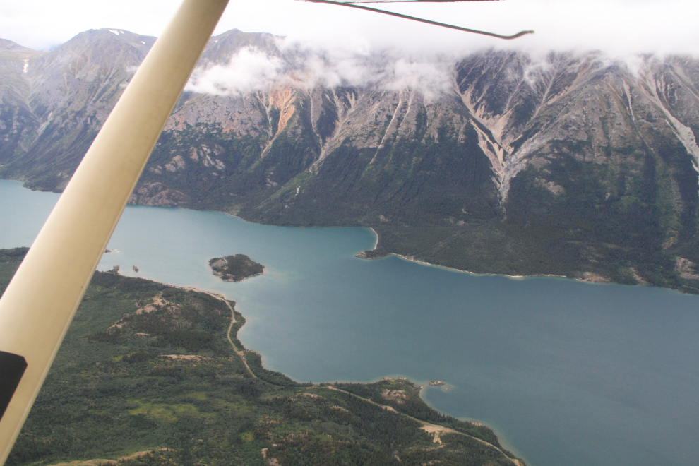
The BC/Yukon border runs across Lake Bennett right at the little island partially hidden by the wing strut.
We cut across to Tutshi Lake through a valley that gave us a look at Paddy Peak, where all 3 of us spent some time by truck and on foot in recent days.
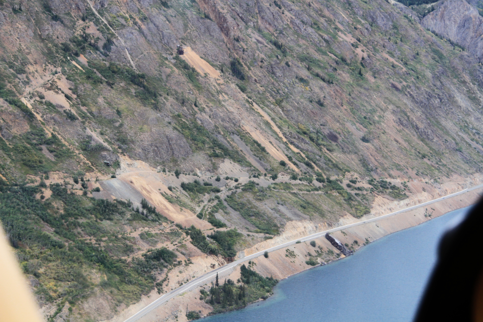
An aerial view gives the opportunity to spot trails and ruins that are easily missed on ground searches. This is the main Venus silver mine property, with the South Klondike Highway running along Windy Arm. I also got a shot looking up Pooley Canyon to the Vault silver mine that confirms my memory of the final bit of the hiking route into that one.
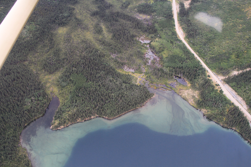
Before landing at the south end of Windy Arm, we spotted, and I photographed, the location of the logging-camp stables that were our first target. The photo showing its position in relation to a small aspen forest area was very useful in actually finding it.
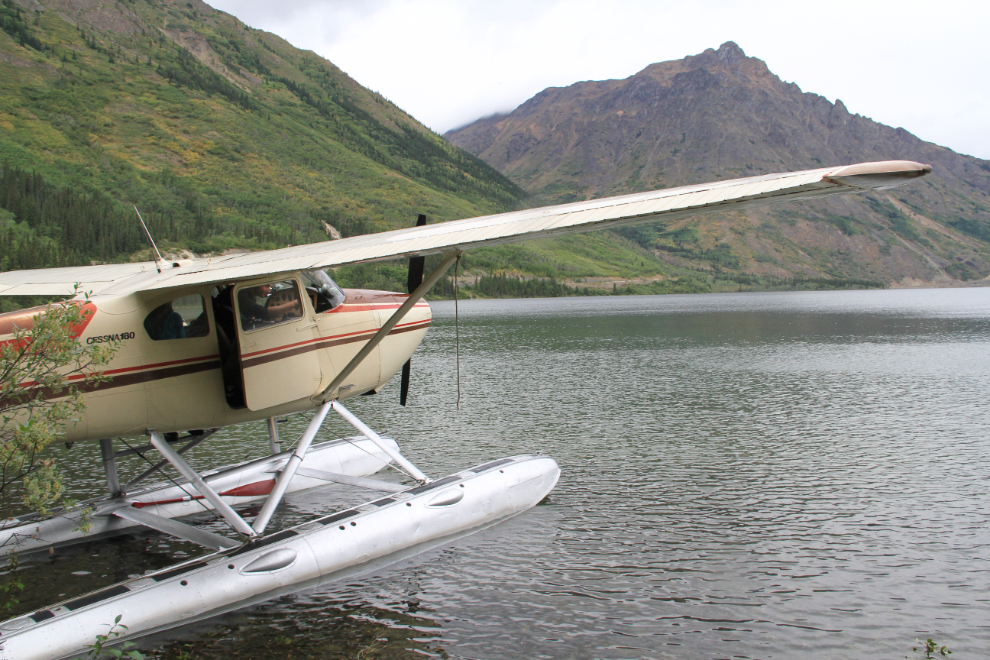
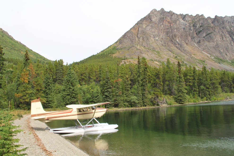
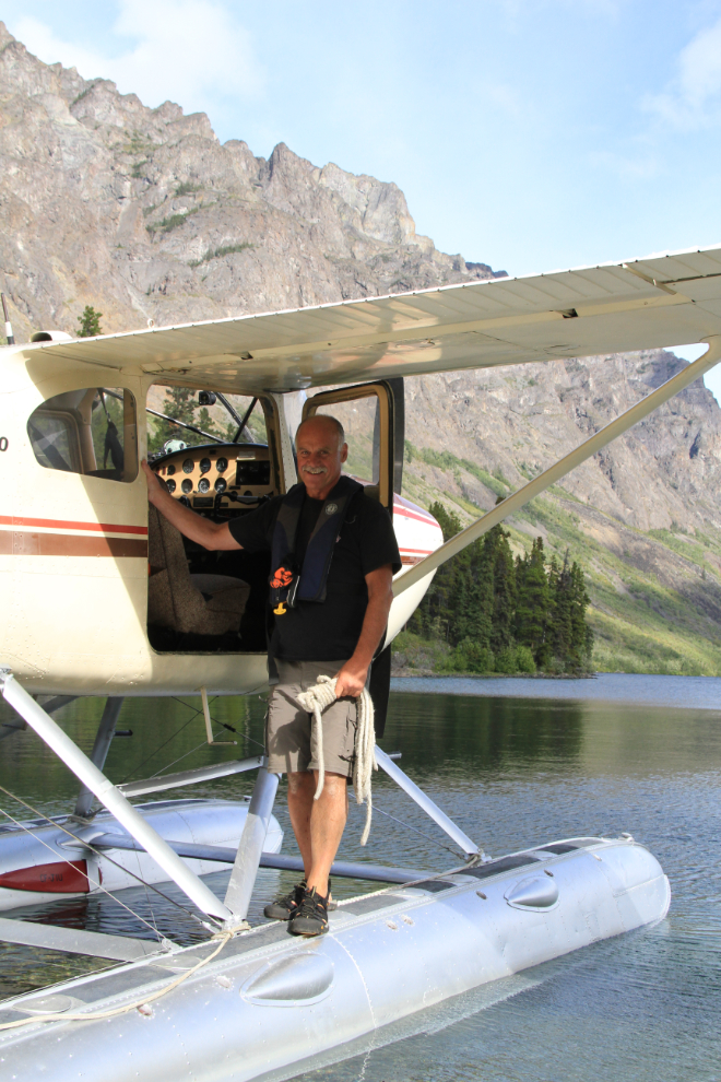
The gravel beach, sheltered from the south winds that were blowing, offered a perfect parking spot for the plane. I initially met Kyle because because he’d found a photo of his plane, a 1957 Cessna 180A, on my Yukon Aircraft Photos page, and we soon realized that we have much more in common than a love of aviation.
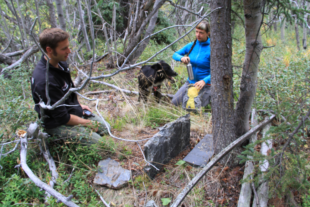
Our first stop was at a small cemetery where the only marked grave is that of Jonas Fred Whitcomb Jr. of New Hampshire, who died near here in May 1898 while en route to the Klondike to seek his fortune.
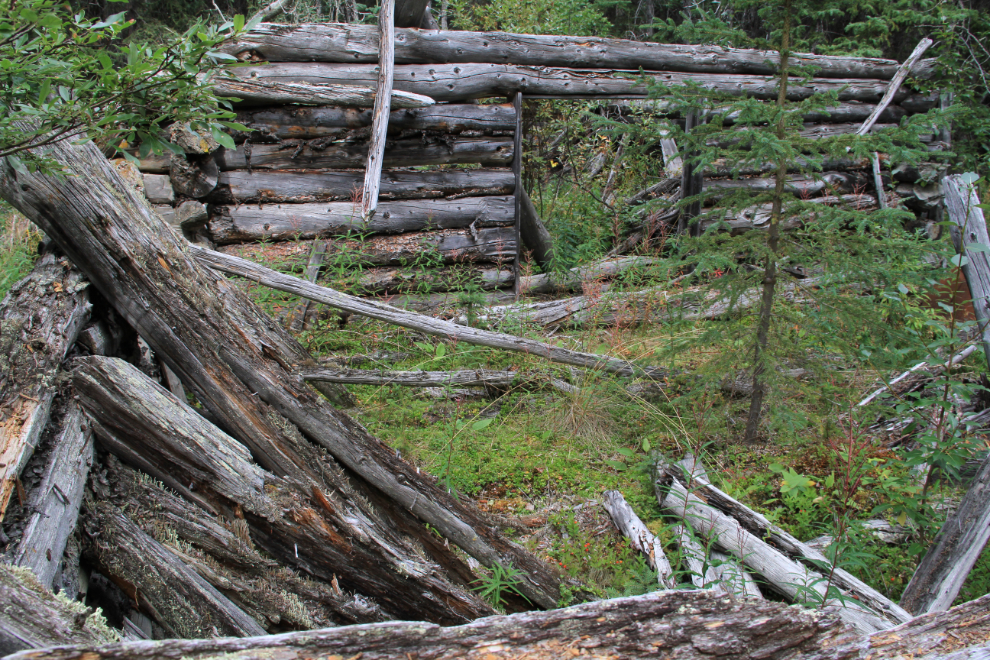
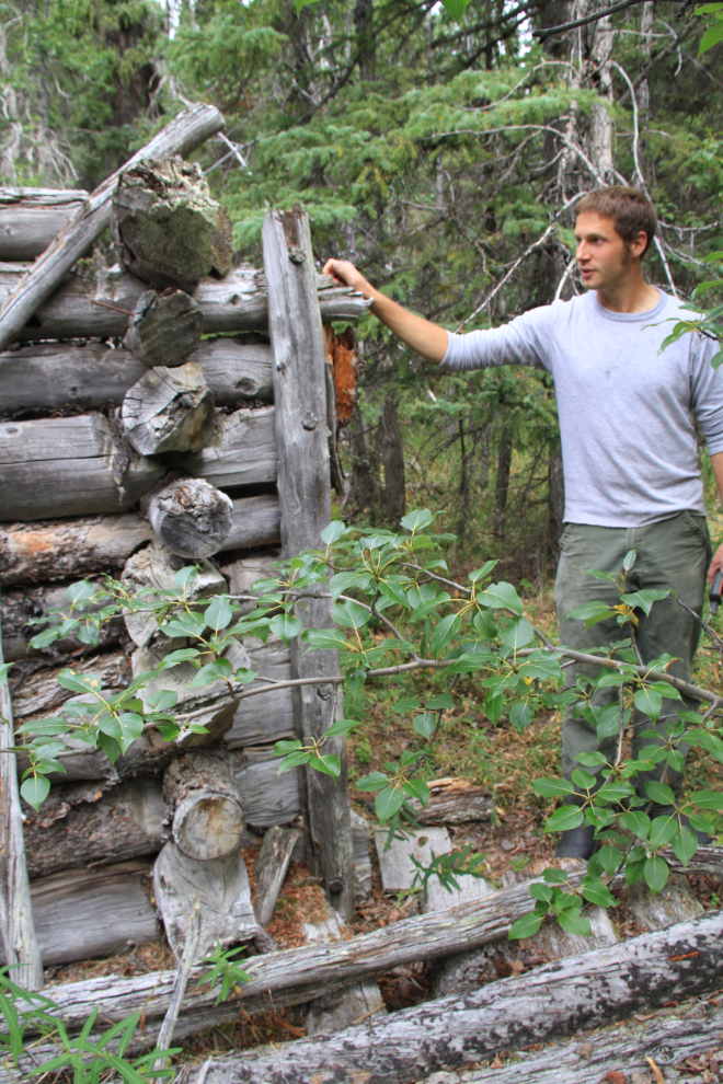
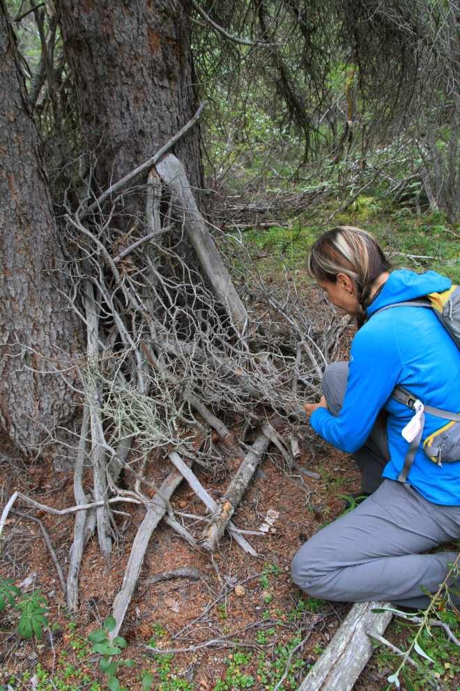
It only took us a few minutes to find the logging stables, though our route to it was far from straight 🙂 I was surprised by the size and quality of the structure, which appears to be stables joined to a cabin that was built first.
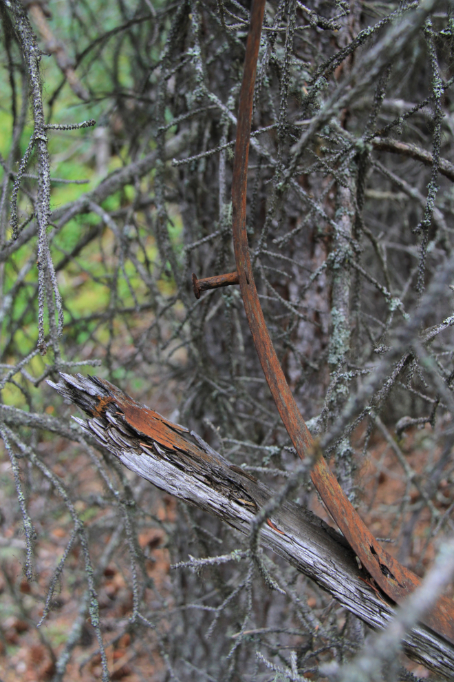
Some of the construction details. The angled piece sticking out was probably to hang a saddle or tack on.
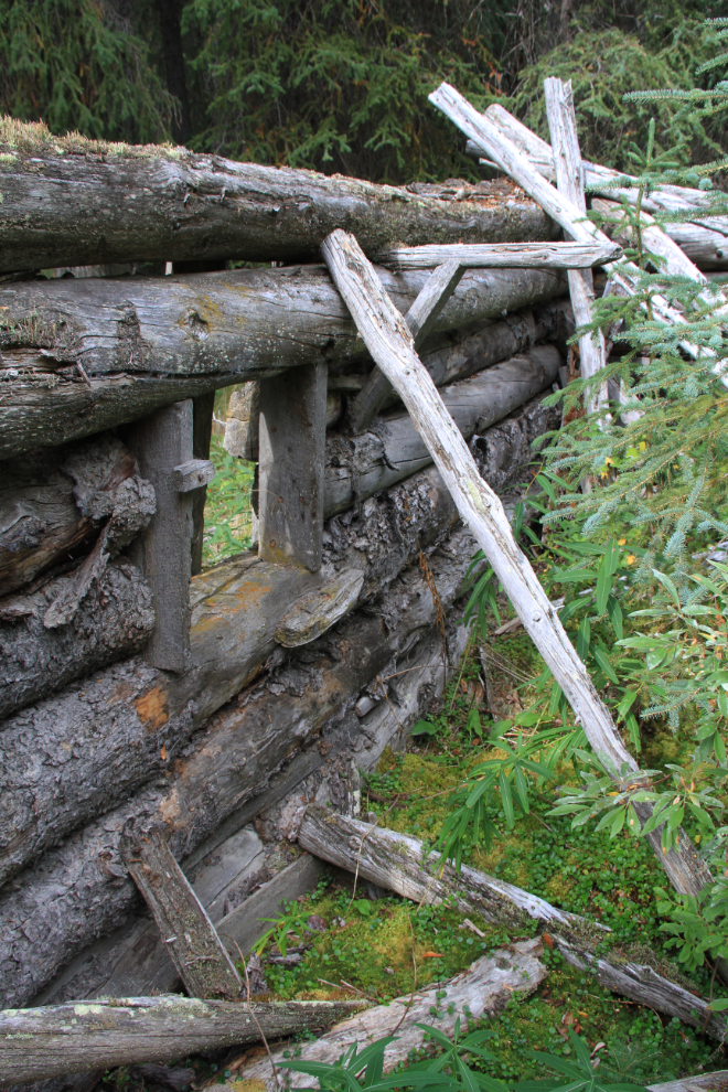
To save building one wall of the stable, it was built against the cabin, with vertical logs on the cabin holding the two connecting stable walls in place. That was eventually the weak point that allowed one of the stable walls to collapse.
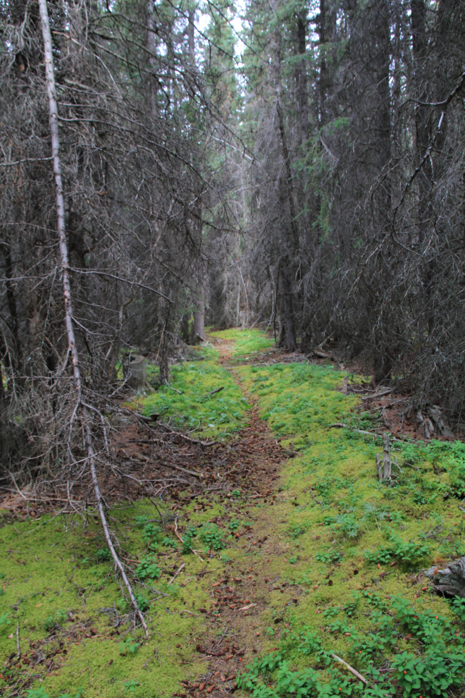
After inspecting what we assume to be the main camp site, we headed for the logging road that we’d all been on before. Getting there was rather tough, with fallen trees, brush, and a thigh-deep slough to get through – the slough was clearly not there a century ago, or the logging and camp areas wouldn’t have been built on opposite sides of it. The road is still wide open, and well used by animals (although it looks like a hiking trail, very few people come here). The very old stumps of trees, some very large by local standards, are all along it and other trails branching off it, attesting to its original use.
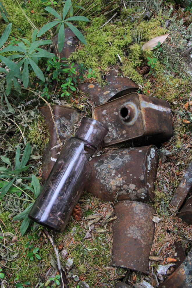
It took a bit of searching to find the can midden that Kyle and Casey had found, but I’d never seen. Very impressive, as they’d said 🙂 We spent quite a while in the area, looking for related sites – there are several dump sites, this one being quite large, indicating an operation much larger than I had thought.
This appears to be the support for a tool-sharpening wheel – certainly one of the most unique old tools I’ve ever seen in the bush.
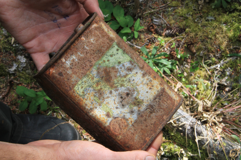
Another of the garbage-dump gems, an olive oil can with a map centred on Italy. To answer the question that I know some of you are asking, nothing was removed from any of the sites we visited.
Along the main trail, an old trap set for small animals – there was a trap in it, but it had been triggered many years ago by a branch.
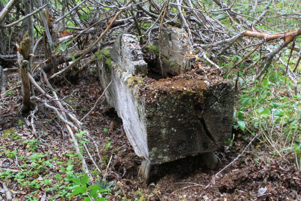
On the way back to the plane, we detoured to the remains of a sleigh. Although there may be much more on it buried in the deep forest litter there, only this runner is visible.
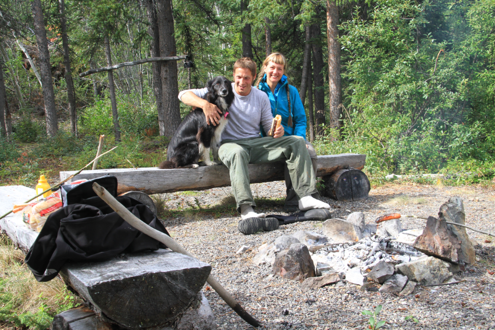
Well satisfied with what we’d seen, it was time for lunch, and we departed for a beach that Kyle and Casey had been to before.
Oh yeah, that works!
This picnic was as perfect as I hope this photo makes it look. I haven’t mentioned Wednesday before, but she is a sweetie, and a wonderful adventure-dog 🙂
Me in heaven. Thanks for taking this photo, Kyle – the mood I see in it is precisely the way I was feeling.
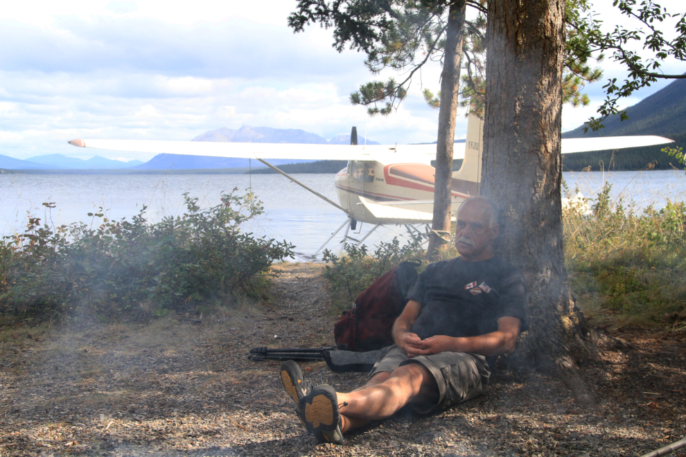
Time to head home – “okay, Lundberg, get up there and pretend to be doing something useful” 🙂
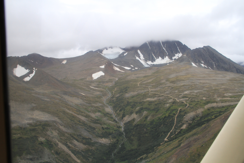
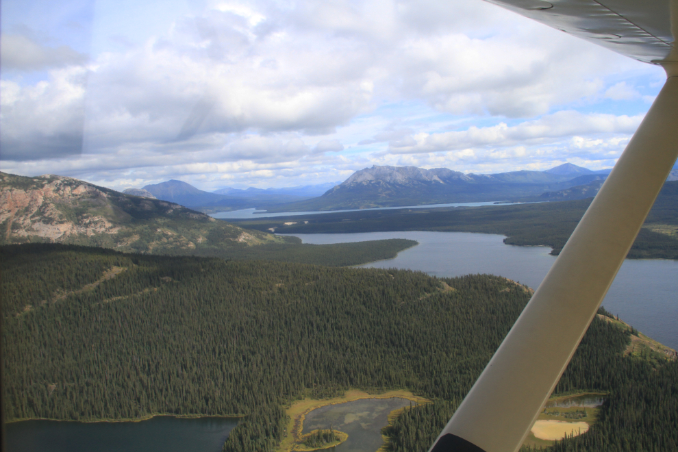
What can you say about a view like that one to the northeast?
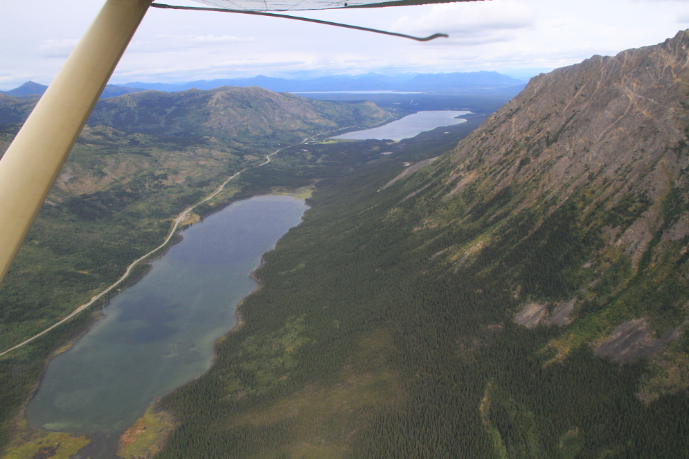
Looking down on Striker Lake. The only cabin on this fly-in lake southeast of Carcross can be seen at the upper right of the beach.
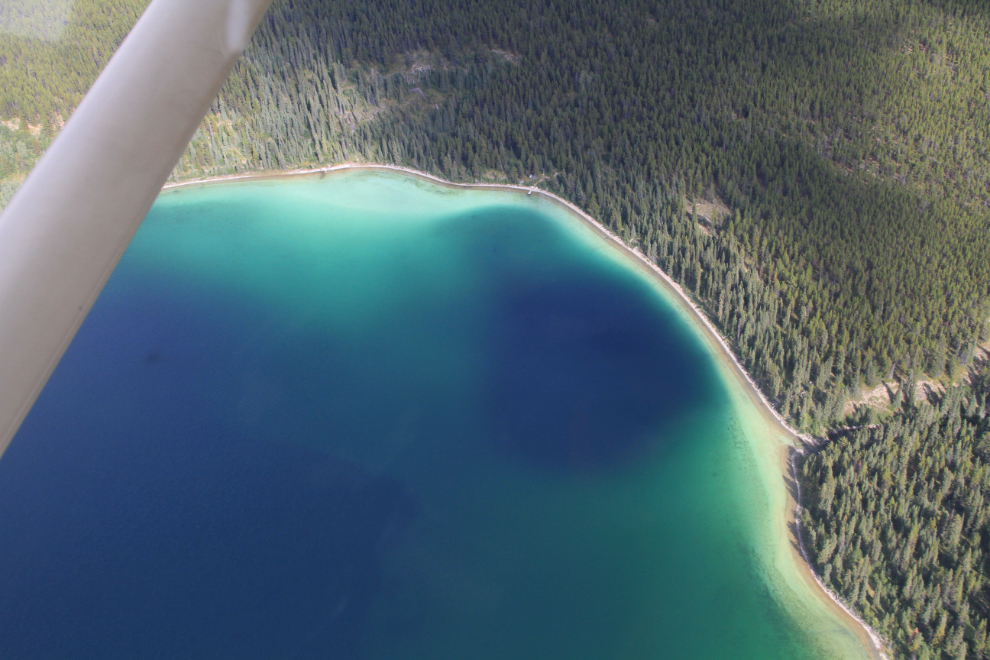
The view towards Tagish, over Choutla and Crag Lakes.
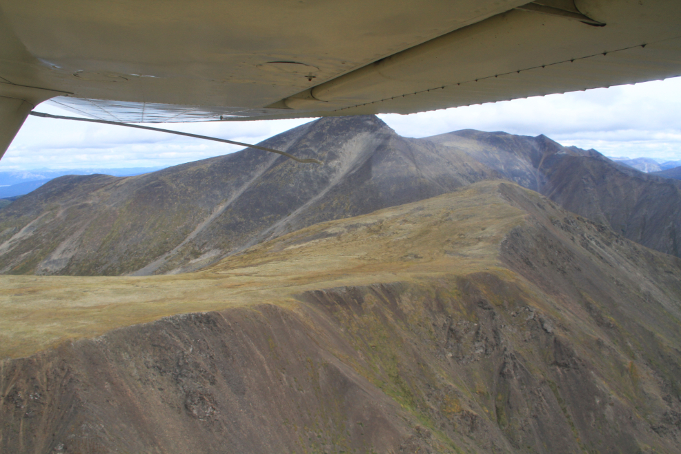
At this point, we were directly over Spirit Lake. I had no idea that the top of the craggy cliffs overlooking the lake looked like this! I tried to hike up here twice quite a few years ago, but both times a bear we called the “Dry Creek grizzly” asserted control of the trail and I didn’t argue his claim. Seeing this, however, I am getting up there this year!
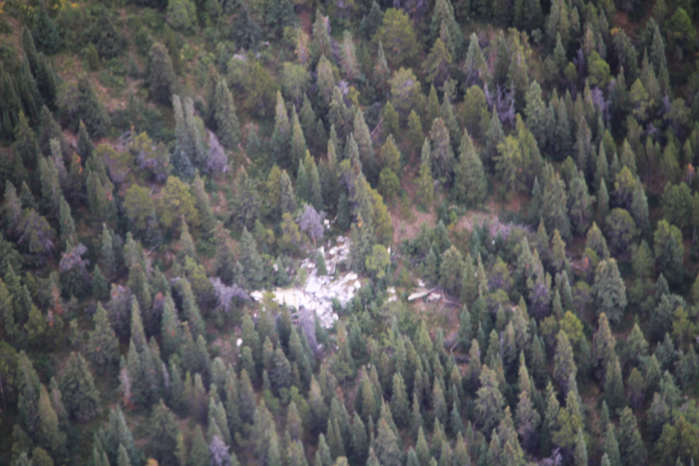
That scrap metal on the western slopes of Mount Lorne was a DC-3 that crashed in the 1950s. Some people might think that it’s odd for pilots to look at crash sites, but seeing and talking about crashes keeps you aware of what making mistakes, even little ones, can result in.
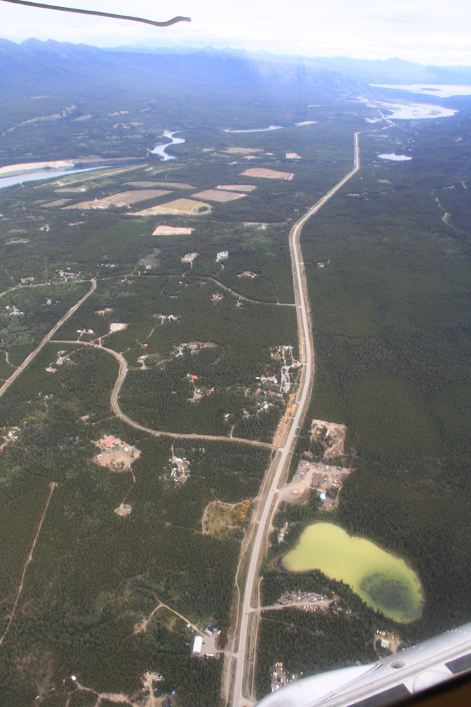
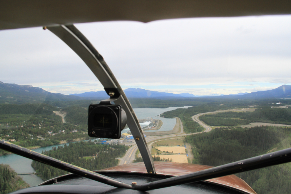
The Alaska Highway stretches towards Marsh Lake in the distance, with Shaddow Lake below.
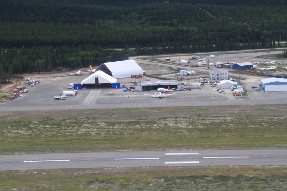
A look at Air North’s base of operations as we were on final approach. It doesn’t seem that long ago that it was just that little hangar that the 2 planes (Hawker Siddeley HS 748s) are sitting in front of.
In just a minute we’d be back on the water.
The day had turned out to be as perfect as I’d imagined it could be. And there is so much more to see! But no, I’m not shopping for a float plane – well, not yet at least 🙂