Exploring the Granduc Road to the Salmon Glacier and beyond
On Day 57 of the trip – Thursday, June 21st – the dogs and I drove past Stewart, through Hyder, and up the spectacular Granduc Road. Most people turn around at the Salmon Glacier viewpoint, but we continued on to the site of the Granduc copper mine where I worked 43 years ago. A memorable encounter with a family of grizzly bears changed my plans for a long hike above the Salmon Glacier. This was the most thorough look I’ve yet had at sites along the Granduc Road, and there are 59 photos in this post.
There used to be a high-quality 13-page brochure available for the Granduc Road drive, but it went out of print a few years ago. I’ve scanned a copy and posted it here (pdf, 2.3 MB). My focus for this day was the area beyond the Salmon Glacier viewpoint at Km 37.0 from downtown Stewart. Snow or mining activity had prevented me from getting to the Granduc Mine site since 2002.
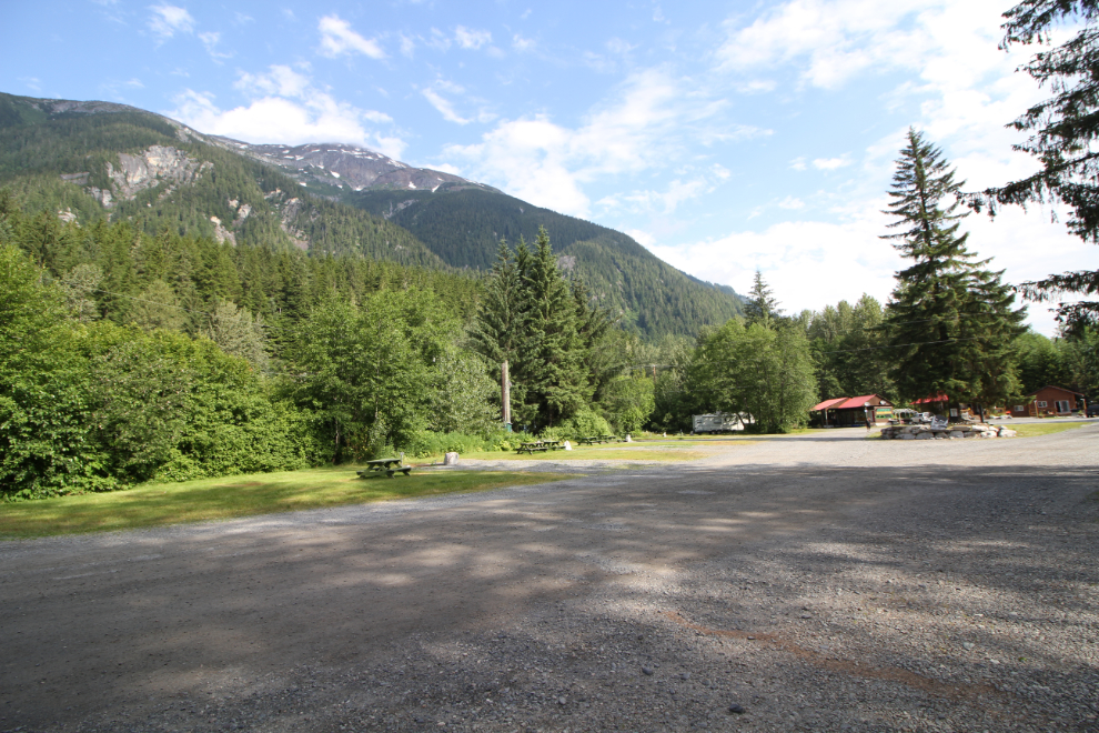
By 09:30 as we were ready to leave for the day’s adventures, the Bear River RV Park had largely emptied out. Most people just come into Stewart for a quick look, stay one night, and continue on.
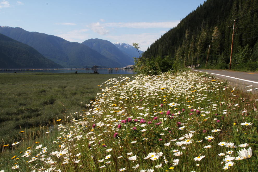
The weather forecast was calling for cloudy with showers, but this is the way the drive began, along the large estuary.
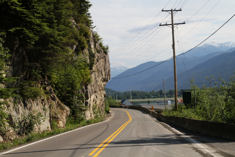
This is the view back towards Stewart from the marina. The road for a couple of hundred feet at that point is called the Hyder Bridge because it’s completely built on pilings.
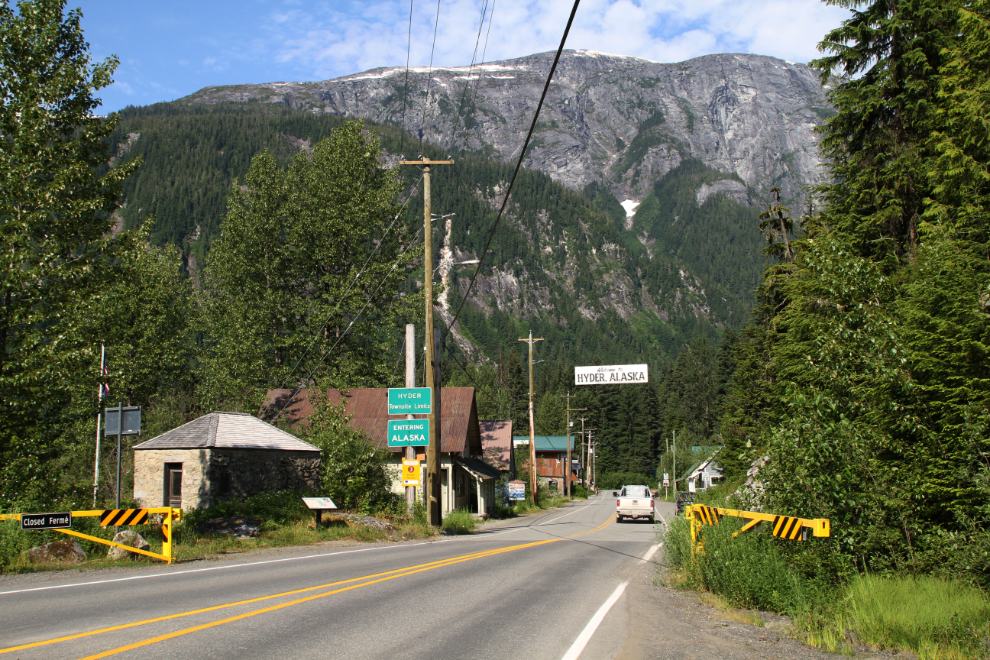
Entering Hyder, Alaska. There is no border post for the entry into the United States there, but Canada Customs has a post to return to Canada.
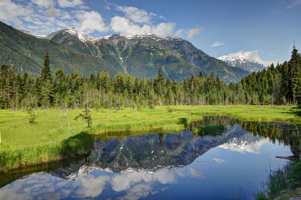
Our first stop was a quick one at this very scenic beaver-heightened marsh just past Hyder. I took a couple of photos with the 24-105mm lens that’s normally on my camera, then got out of “lazy” mode and switched to my 10-18mm lens to get it all in.
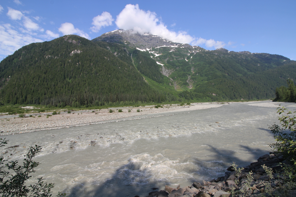
A few days of very warm weather had helped the Salmon River reach a substantial flow level. Periodic releases of a glacier-dammed lake used to fill the channel every few years, but that seems to have not happened for many years.
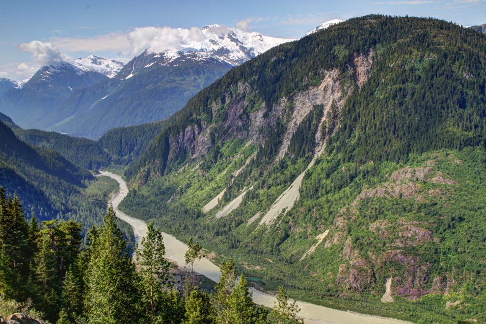
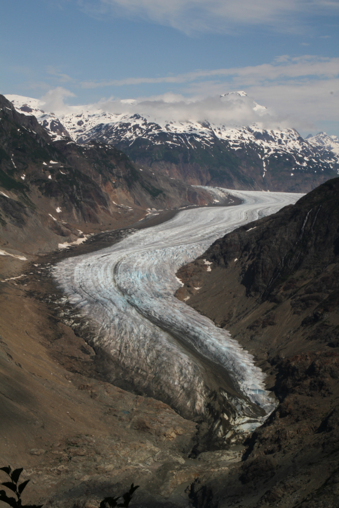
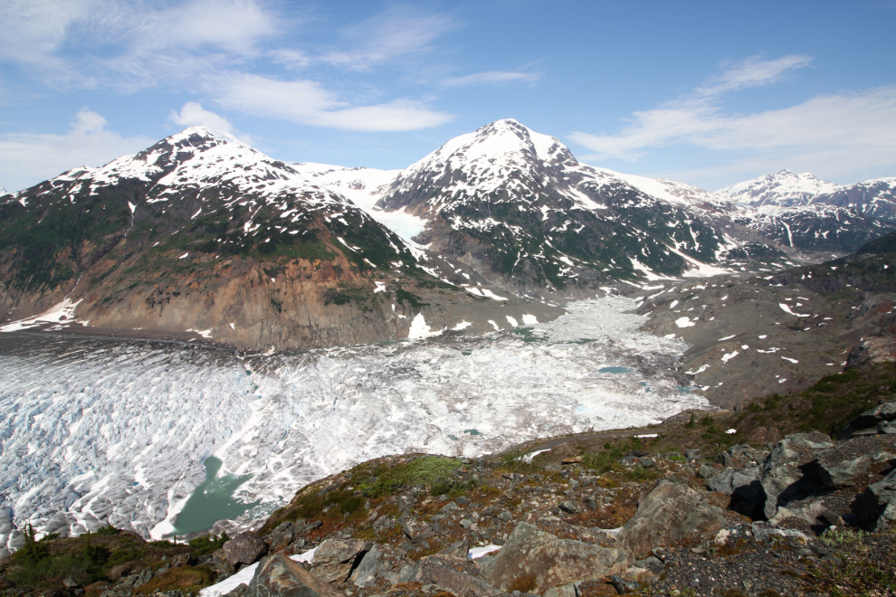
At 10:45 we were nearing the Salmon Glacier, and the view back down the valley was very impressive. It’s hard to believe now that this was my daily route to work on a bus every day in 1975.
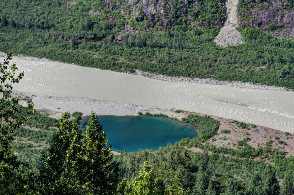
That lovely clear blue kettle pond beside the silty Salmon River has always intrigued me, but it would be extremely difficult to get down to it. A kettle pond is formed by a huge block of ice that melts away over a period of several years, during which time river gravels have built up around it.
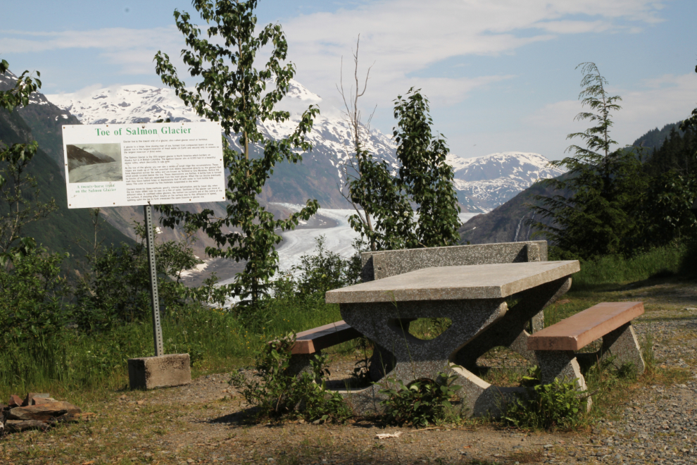
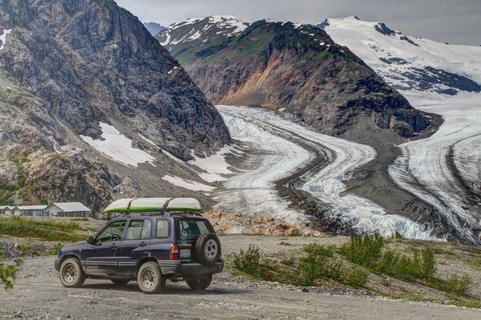
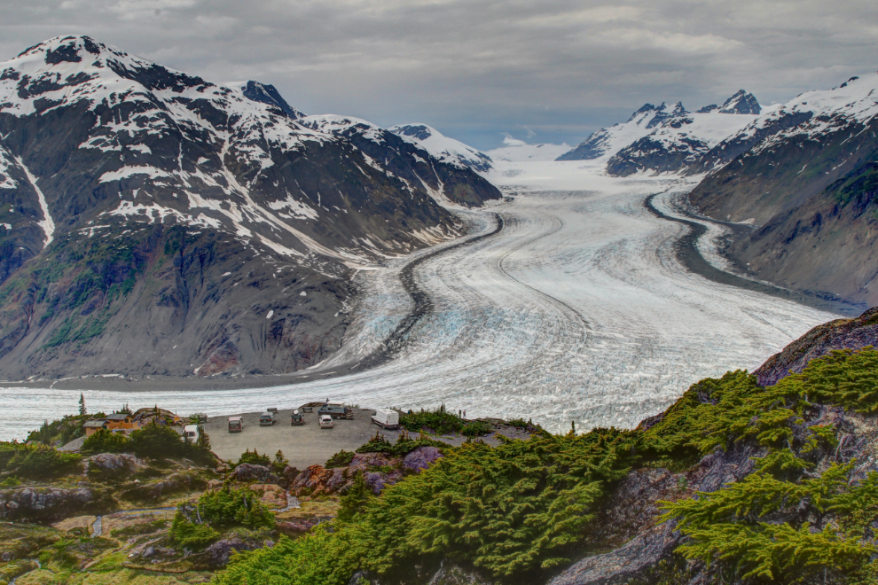
The “Toe of Salmon Glacier” viewpoint is 27.7 km from Stewart. The toe, also known as the glacier’s snout or terminus, is the lowest point on the glacier.
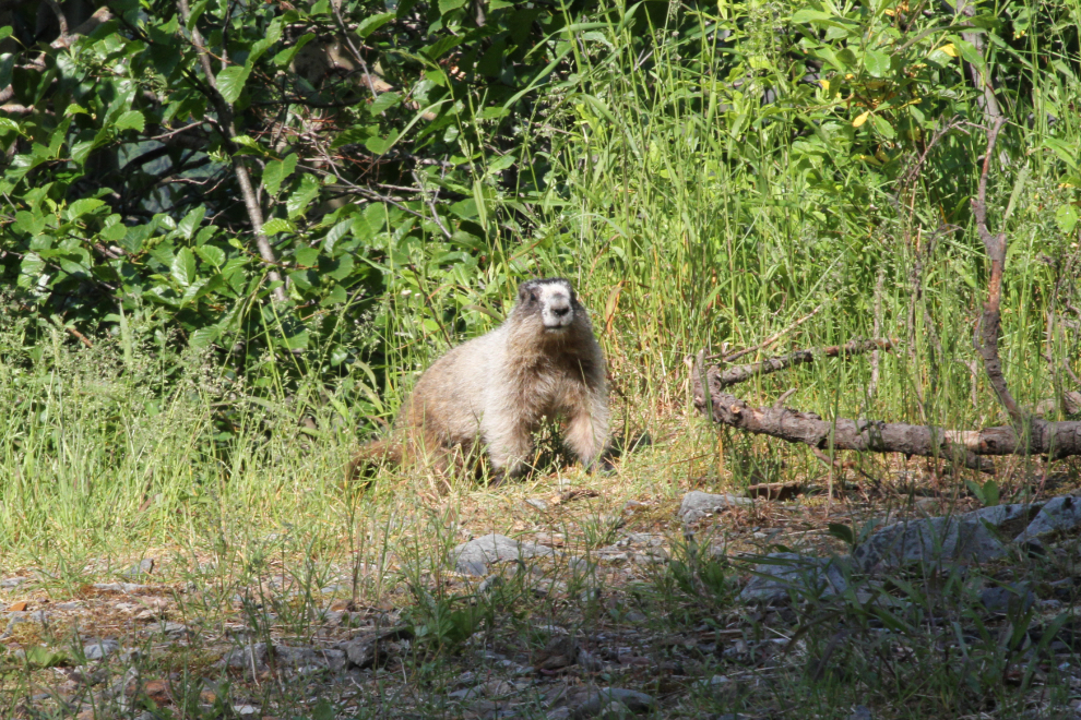
A marmot joined us for a couple of minutes at that viewpoint. Tucker sometimes goes crazy barking and even screaming in response to animals showing up, but he’s extremely good when I tell him softly to be quiet (and keep reminding and praising him). Even with his window open and the marmot 20 feet away, Tucker didn’t make a sound.
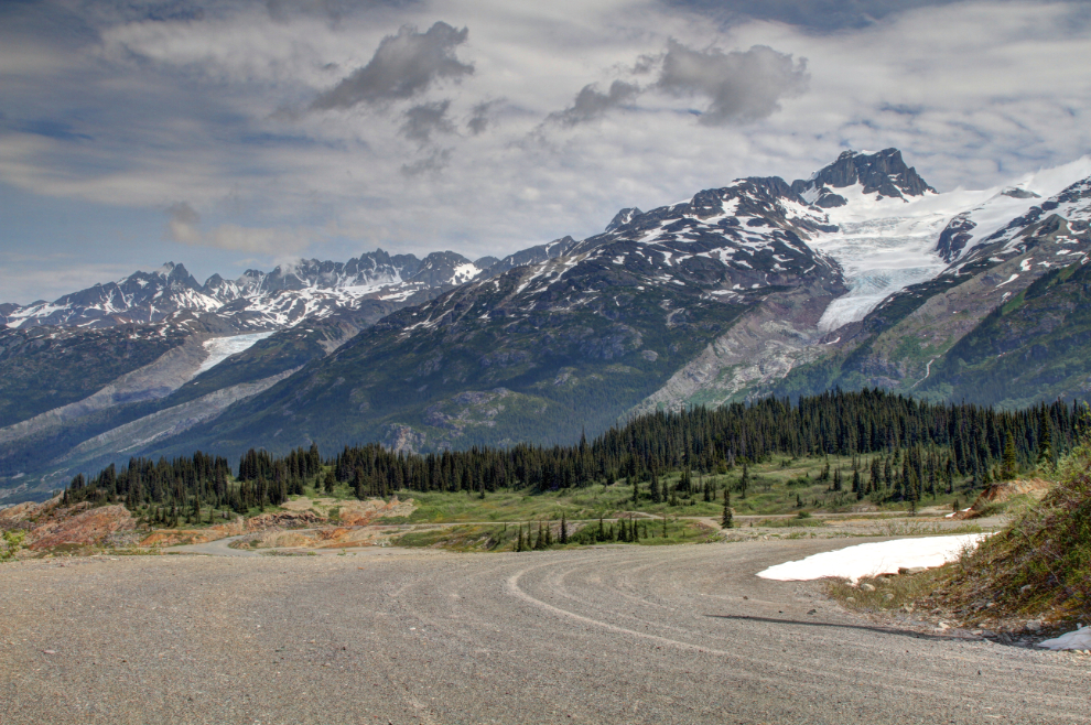
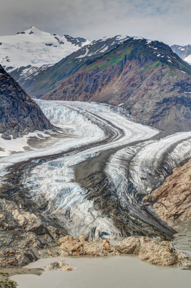
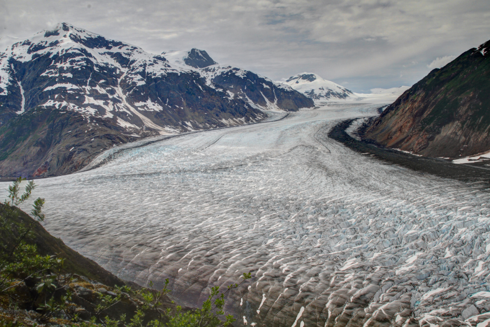
The Salmon Glacier is the fifth largest in North America, though it has shrunk dramatically since I first saw it. I’ve posted two photos from 1975 and two from 2015 to show that retreat – see “Retreat of BC’s Salmon Glacier, 1975 – 2015“.
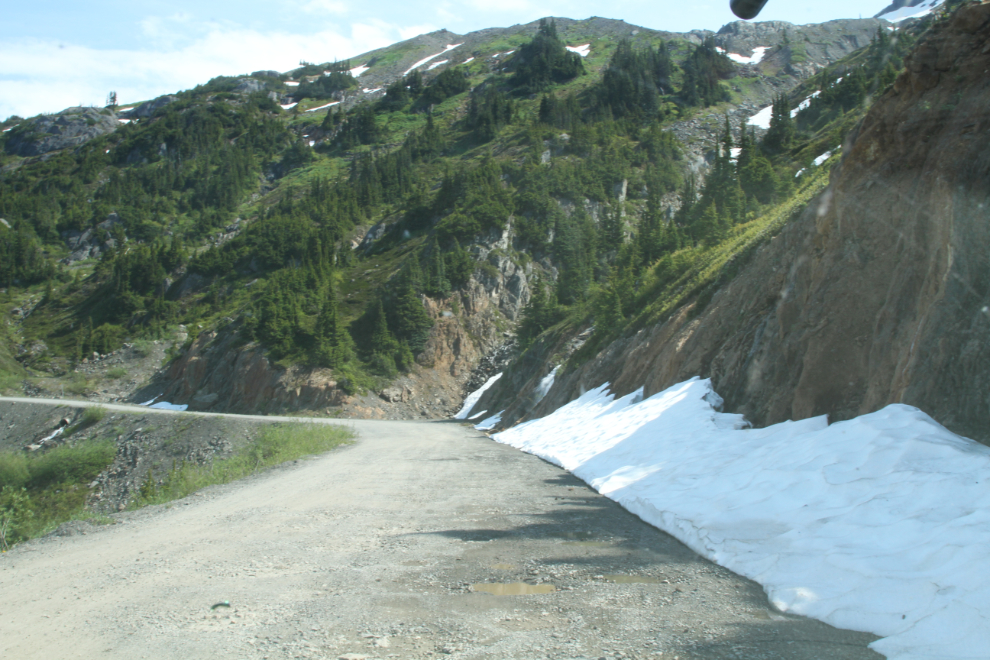
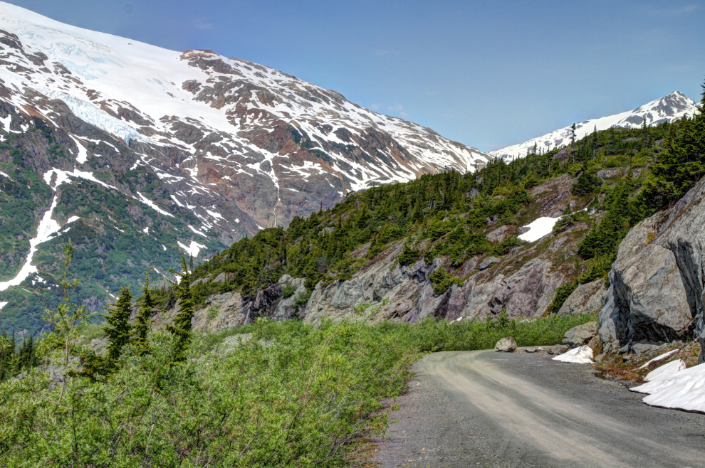
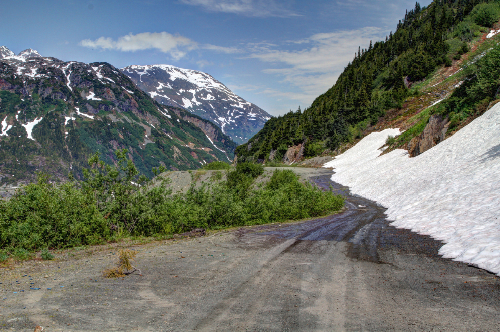
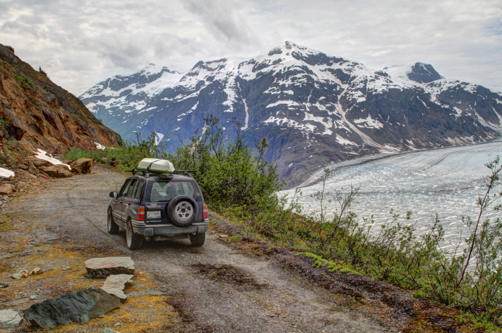
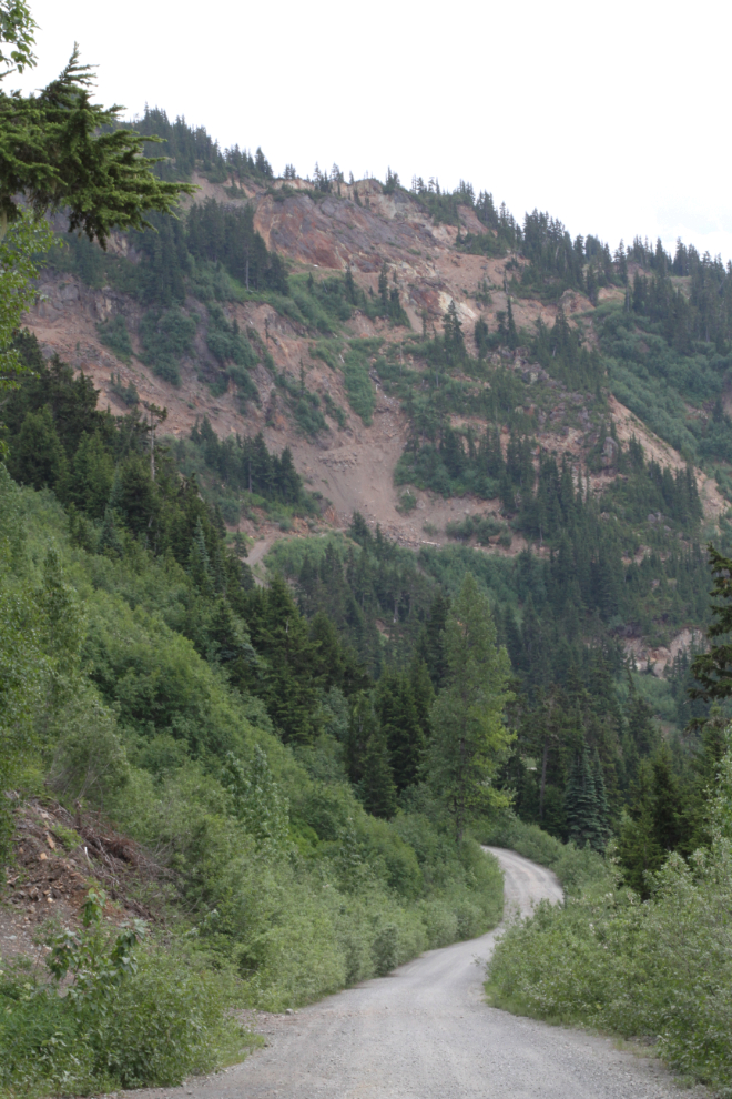
The road was in the worst condition I’d seen it, with long stretches of deep potholes. I’d seen tire tracks of some people turning around, and the snow that we reached at 11:15 prompted more U-turns. A rental motorhome from Alaska, though, was still pounding up the hill.
We continued on past the main Salmon Glacier viewpoint – we’d stop there on the way back.
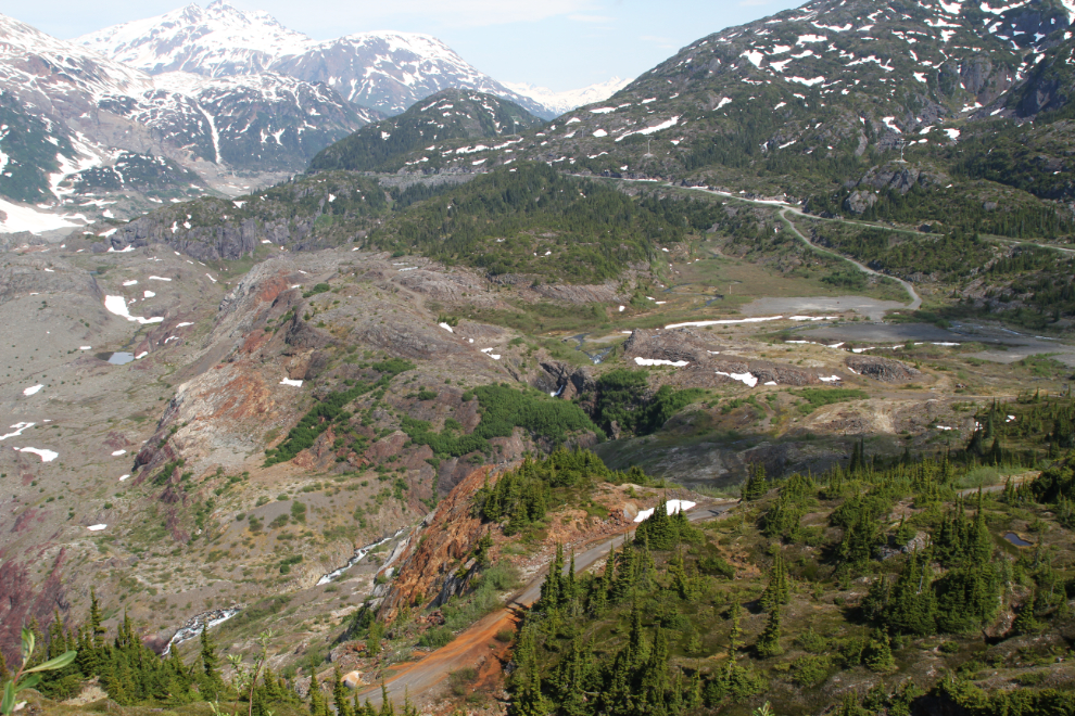
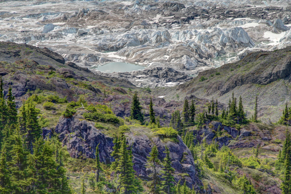
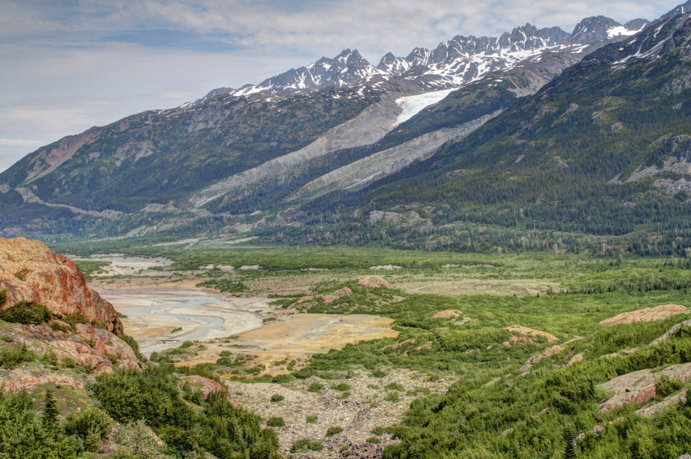
Meltwater from the northern tongue of the glacier, as well as several creeks, creates Summit Lake. In the next photo, Summit Lake in the distance is completely filled or covered with glacial ice. It used to break through the glacier so regularly that it was called Tide Lake when I worked here.
One of the sites that I wanted to have a good look at was the old mining exploration camp site where John Carpenter’s science-fiction thriller The Thing was filmed.
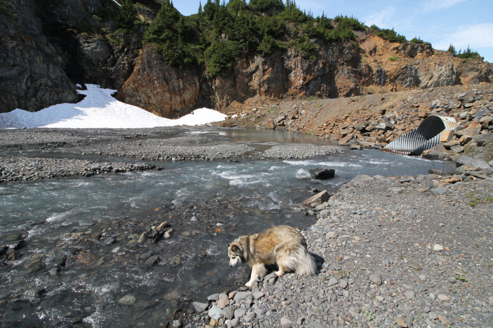
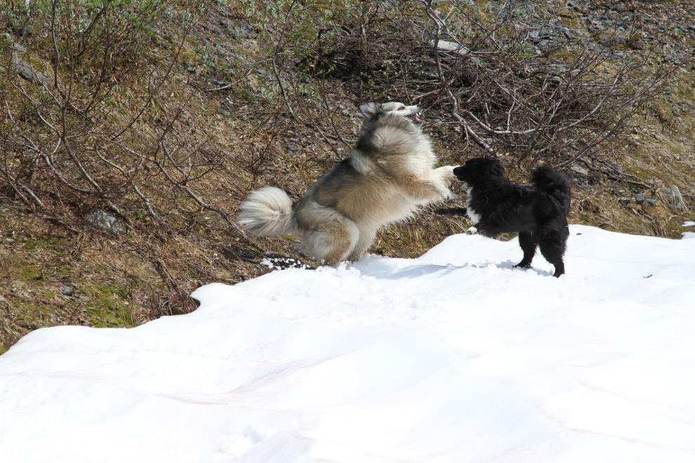
Bella and Tucker were due for a play, and this little canyon served that purpose perfectly. I carried Tucker across the main braid of the creek so they could play in a large patch of snow.
I decided to have a brief look at part of the filming site next. I hadn’t planned on going very far, so didn’t put the kids on leash, nor did I take my bear spray. Do you see where this is going?
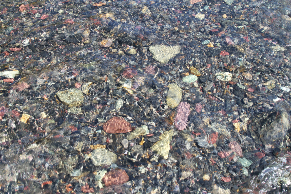
The old road lured me on, through a small creek with particularly colourful rocks…
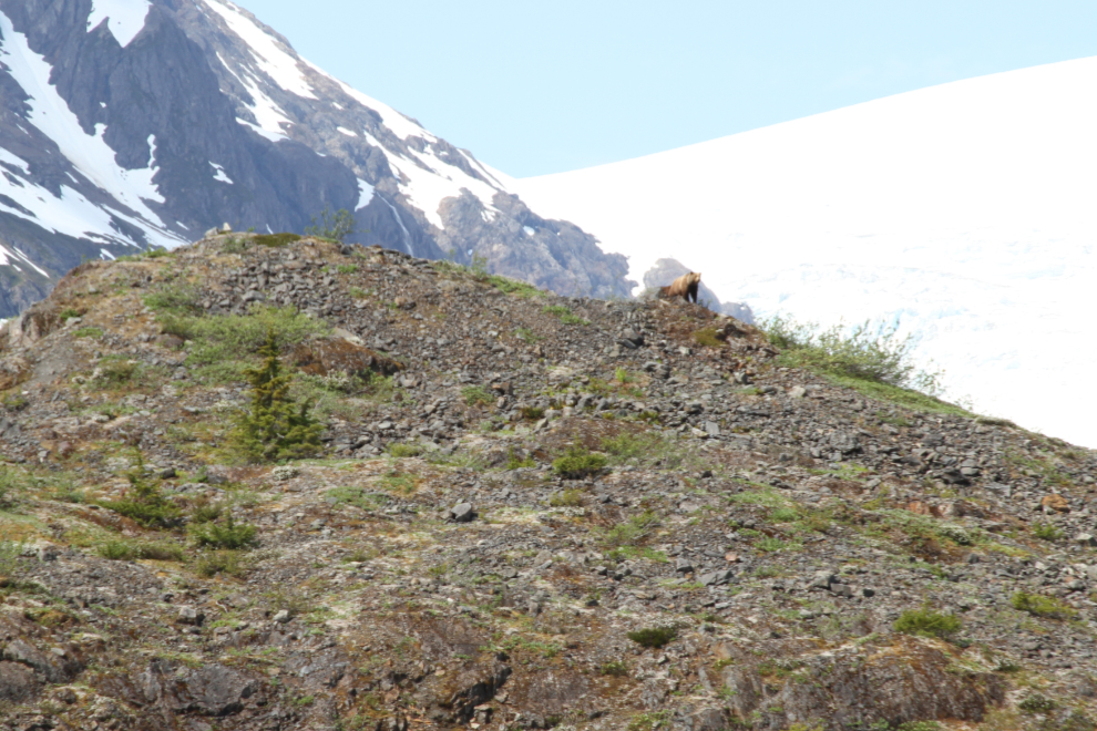
I looked up at the ridge beside us as a sow grizzly and two second-year cubs came over it. They were perhaps 200 feet away. I started yelling at Bella and Tucker and waving my arms over my head as I backed away, and they came to me immediately. The cubs both quickly disappeared off the ridgeline but mom stayed there while she assessed what all the noise was about. After a minute or so, she went back behind the ridge as well. Bella and Tucker were so focussed on me that they never did see the bears, which is exactly what I wanted. When we were about halfway back to the car, not even close to being safe yet, mom appeared over the ridge again, and I took the next photo.
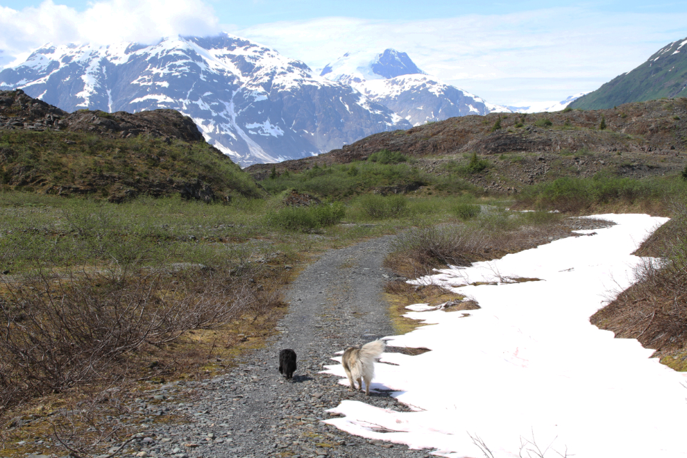
Once we were a hundred feet or so from the Tracker, I let the kids have a good play while I calmed down. Because I wasn’t planning to go far from the car, I had done two things that I never do – go into an area like that with the dogs off-leash, and go without bear spray. A month ago, a woman in Whitehorse had both of her off-leash dogs killed by a bear she encountered on a trail. We got lucky, and I’ll never put us in that situation again – we meet bears far too often.
The next photo shows the filming site as we drove back up to the Granduc Road.
Along the access road is this “powder magazine” (for explosives) from the mining days, in the late 1970s, I believe.
Looking in the opposite direction from the powder magazine, this was the view.
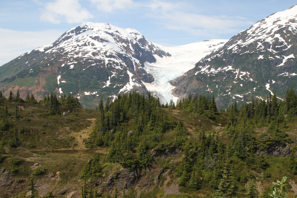
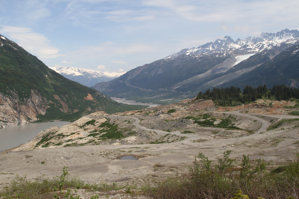
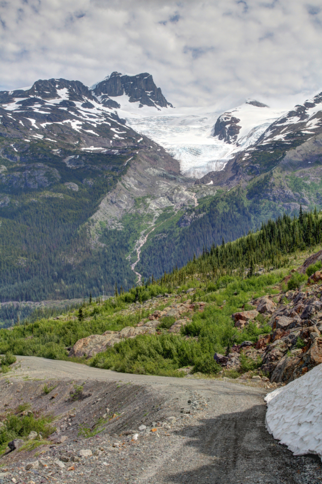
Continuing north along the Granduc Road, I made photo stops often. This was the view looking back to the Salmon Glacier from above Summit Lake.
It looked like we might get stopped by a rockfall, but there was room to get by.
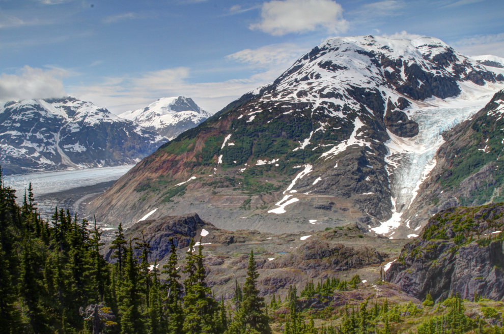
Looking down on Summit Lake. The textures of this country are incredible.
In the lower right of the next photo, you can see one of the most memorable parts of the bus ride – a mile-long tunnel.
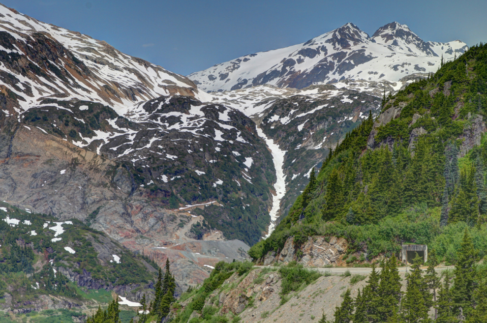
Because of extremely deep snow accumulations along the slopes to the left, this tunnel was cut in about 1970 to get vehicles through.
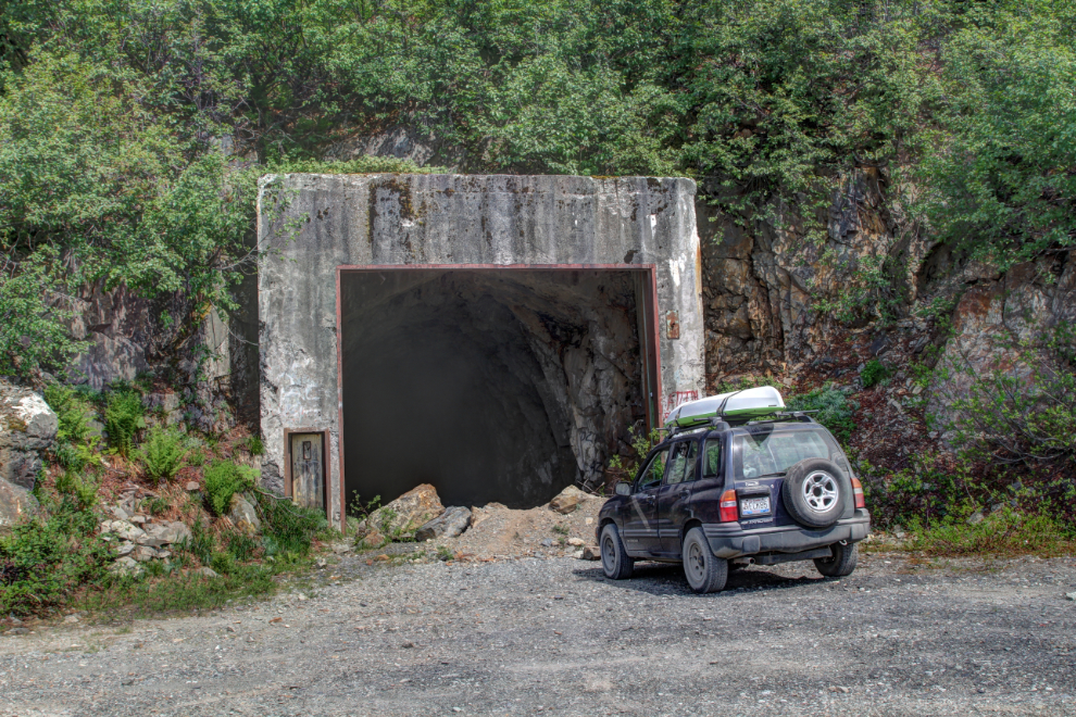
Driving around the tunnel, those deep snow accumulations still happen. There was just barely enough room to get by, and that probably just opened in the past few days. Many vehicles had clearly turned around here.
Between the tunnel and the Granduc Mine, there are at least two other old mines, probably from the 1970 or ’80s. I need to pull the BC Ministry of Mines reports to find some information about them before my next visit.
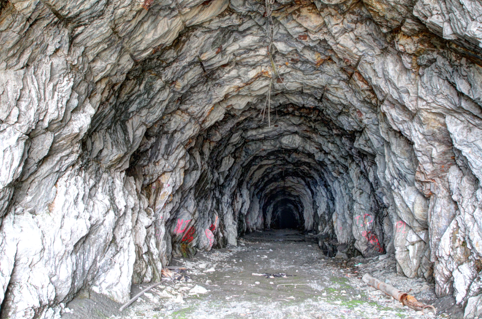
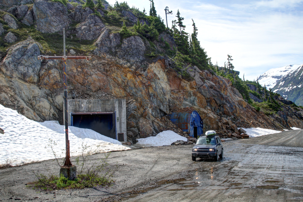
This is the north end of the vehicle tunnel. From the “T” in the foreground, cords hung that drivers would pull to open air-powered doors which sealed the tunnel. The blue building blasted into the cliff behind the Tracker housed the compressors that powered those doors.
Here’s a closer look at the second of the two mines I need to research. Access to them is fairly easy.
It looked like I might be able to drive right to the adit seen below us in the next photo.
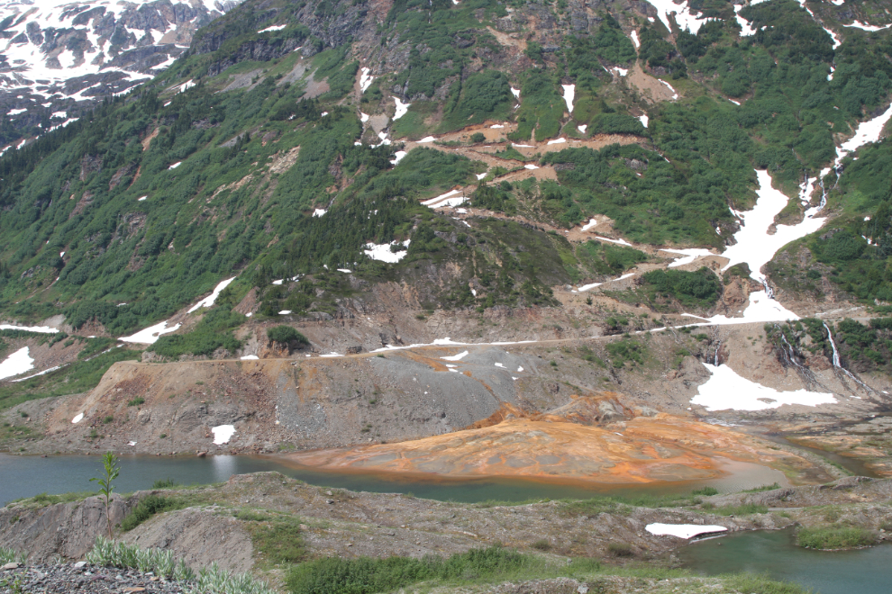
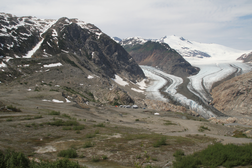
The Granduc copper mine is below the road to the left here.
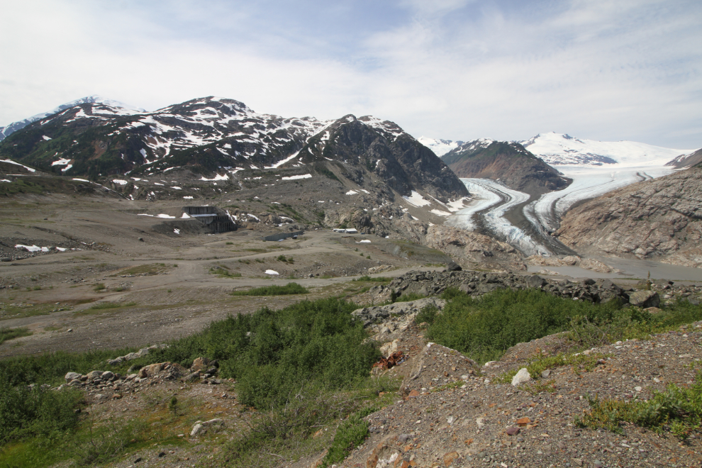
At this location, there was a man-camp that housed about 500 people. Many of the employees with families chose to live in Stewart as I did – the company had apartments, townhouses, and single-family homes available, most of which have been abandoned since the mine closed in the mid-1980s.
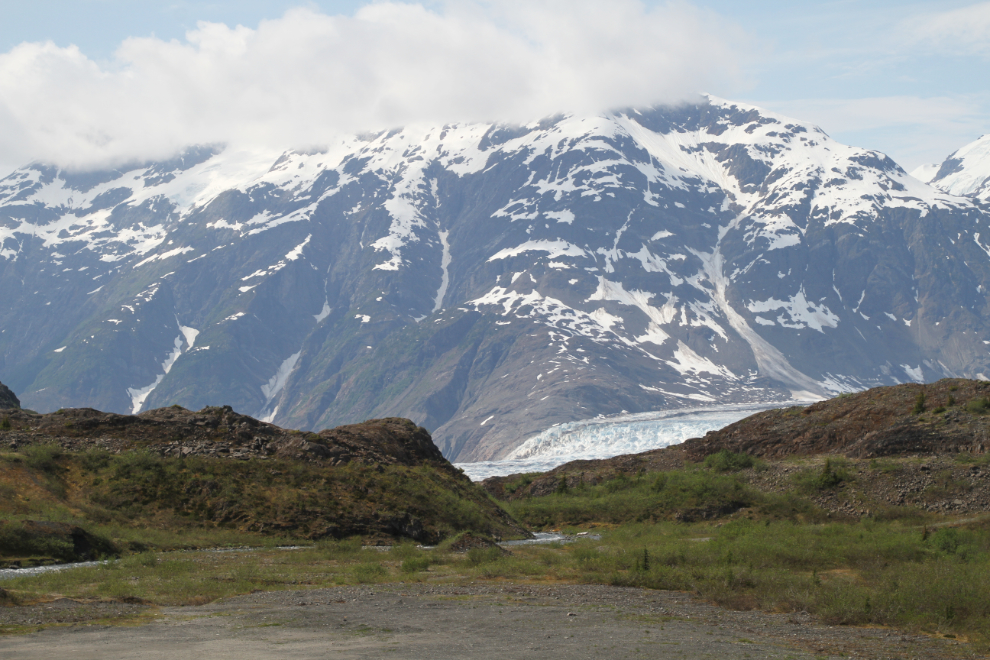
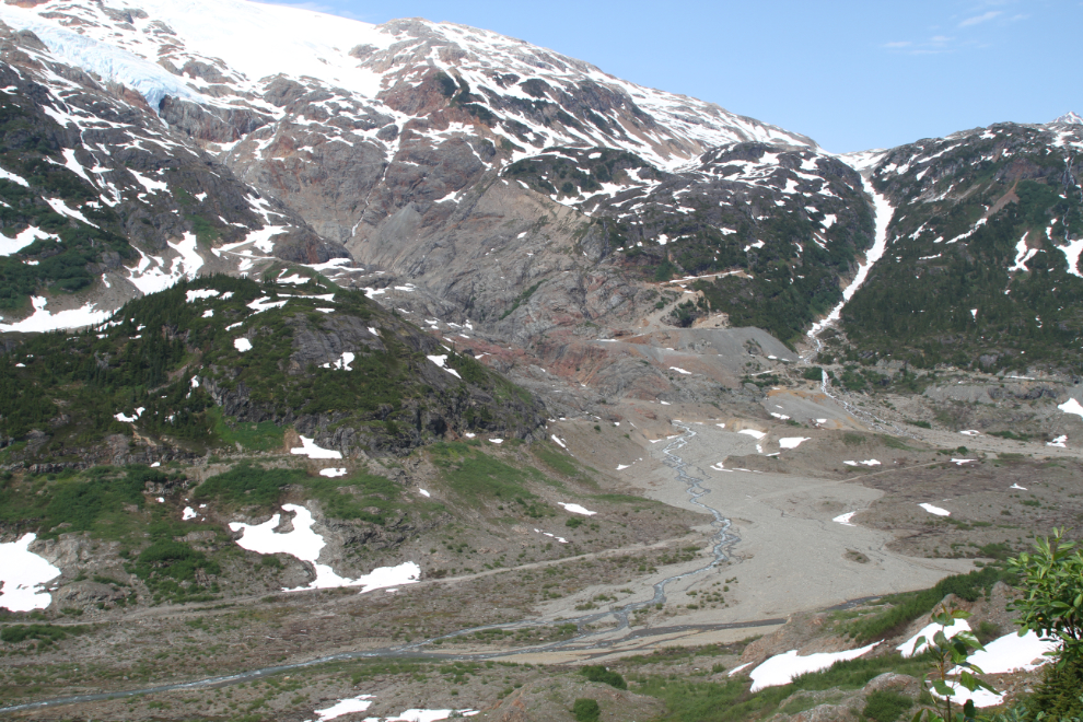
From the slope above where the man-camp was, this was the view of the mine access tunnel and mill, and the Berendon Glacier.
Another mine exploration camp opened in fairly recent years, but appears to be abandoned as well, though there are “No Trespassing” signs.
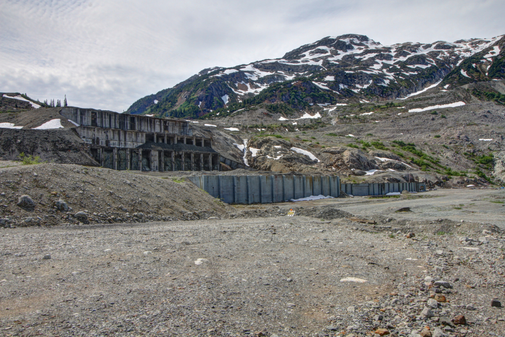
This was the Granduc mill, and the buildings where we got ready to board an underground railway that took us some 15 miles – under 7 glaciers, if I remember correctly – to the work areas.
The Berendon Glacier is the arm on the left – the one on the right, flowing from a different icefield, has no name.
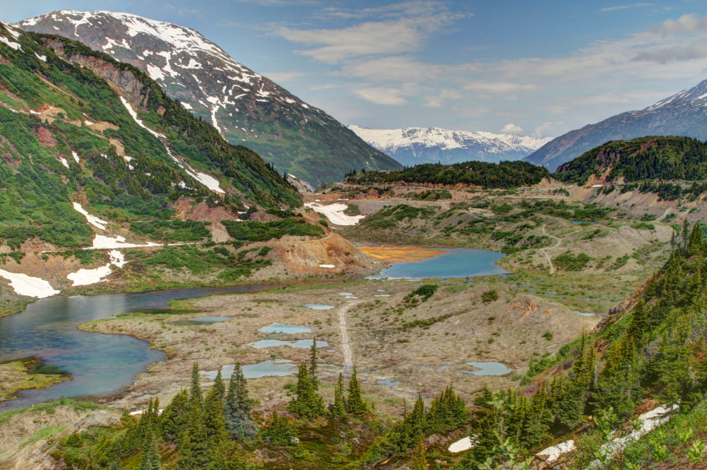
I drove past the Granduc Mine a mile or so, then decided that there was no point. There’s a vast area of relatively little interest, and it’s more suitable for a multi-day exploration. I was in that area a couple of times in 1975, as that’s where the Granduc airfield was, and where the best grizzly viewing consistently was, so I took a couple of visitors there. I’d seen all the grizzlies I cared to this day.
The swath along the distant slope is a power line built about 5 years ago.
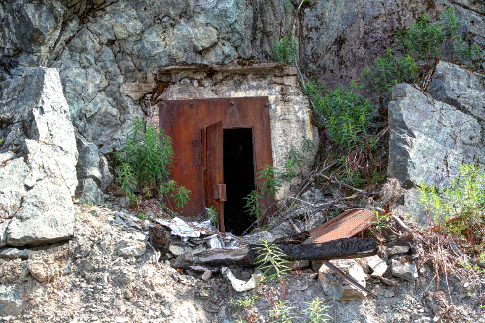
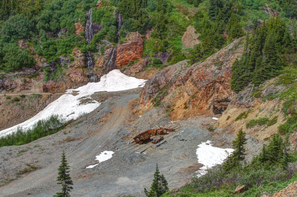
Heading back towards Stewart, I drove down to the adit I’d seen. All of the old mines close to Stewart have been stripped of equipment by collectors – only the extra distance has left this one fairly intact for now.
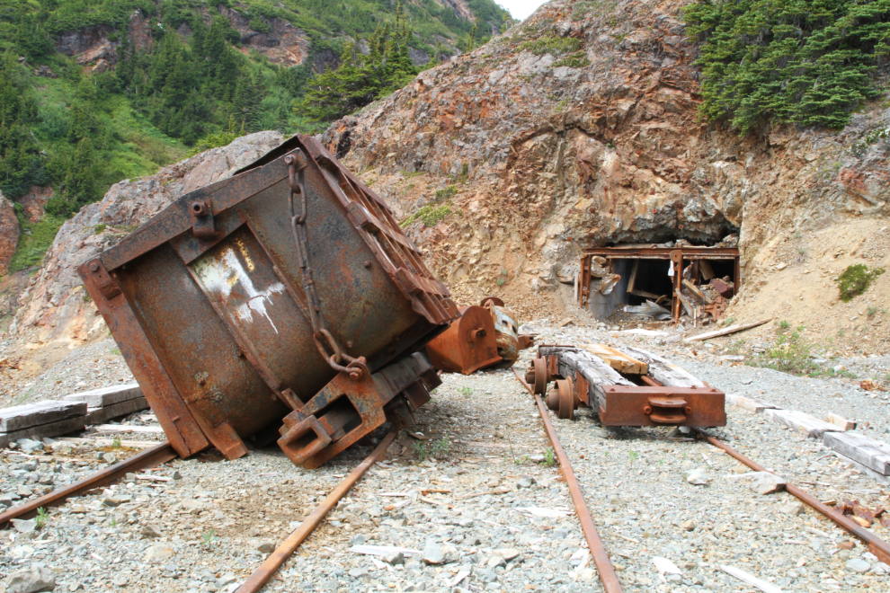
Judging by the thickness of that concrete base, this mine was doing basic processing of the ore before shipping it. My guess at this point, judging from the scale of the mines, is that they were mining gold or silver.
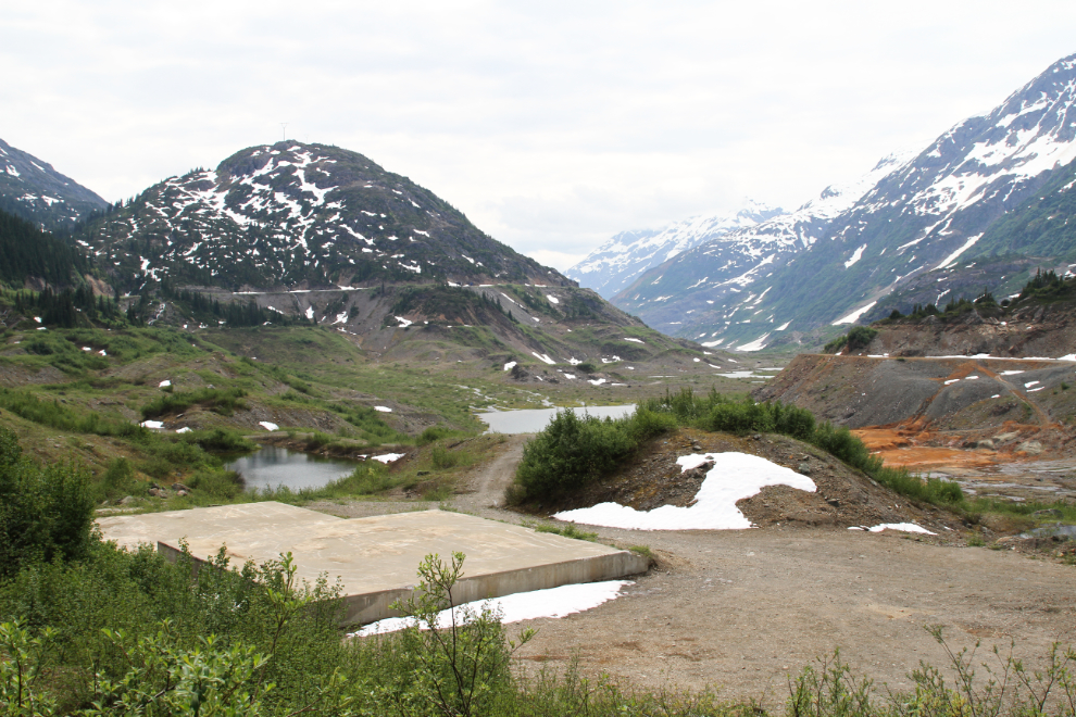
This twin waterfall forms the backdrop to the mine seen in the two photos above. I could easily spend an entire day exploring here.
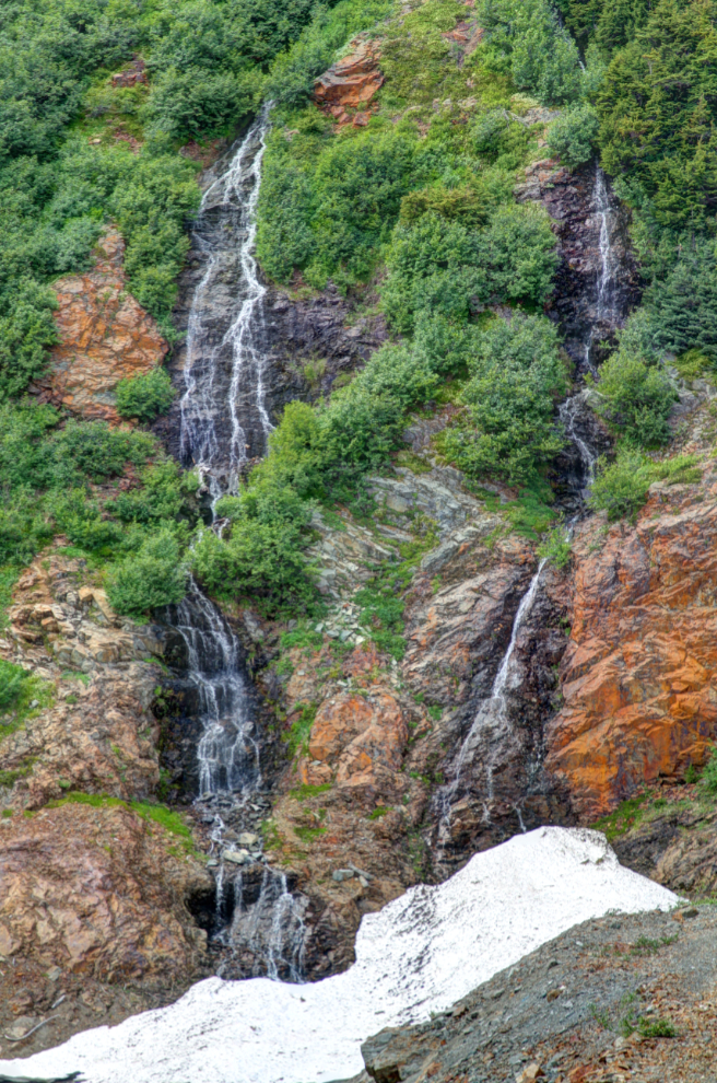
With my major goals for the day well in hand, it was time to start looking at the smaller things. Like waterfalls, of which there are many, even beside the road. Some emerge from canyons that offer intriguing exploration possibilities when water and snow levels are lower.
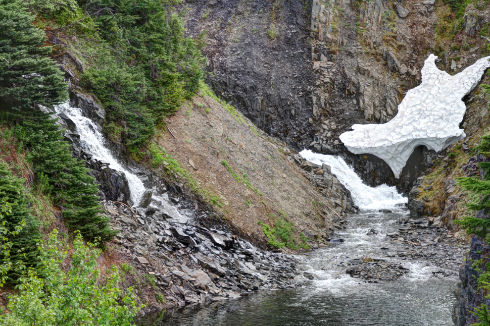
Other waterfalls just drop from cliffs, both natural and man-made, beside the road.
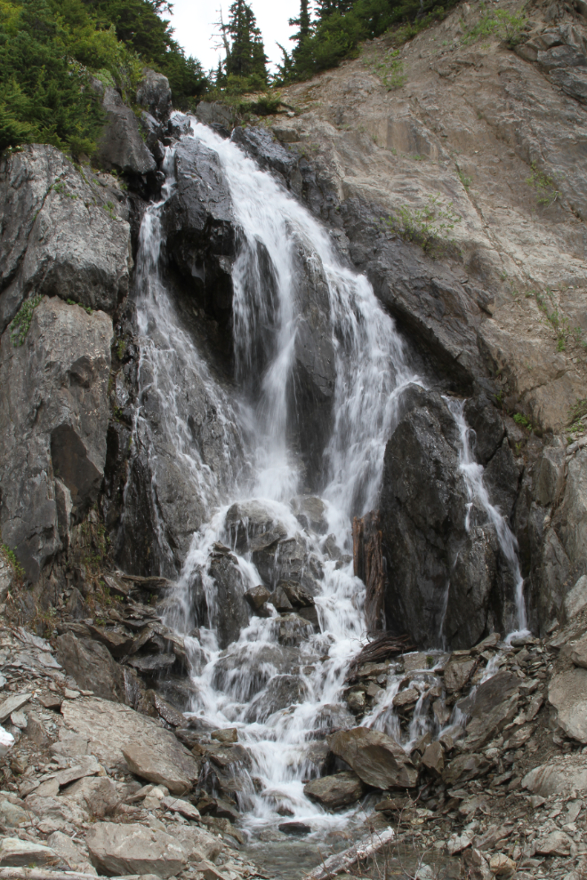
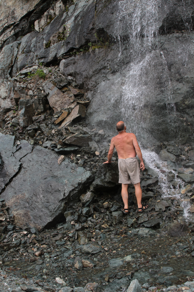
One of the waterfalls offered a shower that I just couldn’t resist. Yes, it was cold! 🙂
The long hike that I’d planned before the grizzly encounter was along the original Granduc Road, which is much lower on the slopes above the Salmon Glacier. The access to the old road is from the filming location I’d been exploring. The road was moved higher because of the number of avalanches on the lower slopes. I’ve looked for but been unable to find a date for that relocation, but I can see by the angle of the photos I’ve shot that in 1975, we were still driving the lower road. A rockslide made driving beyond this point impossible, and I’d rather lost interest in a hike anyway – among other things, we’d already been on the go for over 5 hours by then.
What a place! After a long stop and short dog-walk, I was able to get the Tracker turned around right at the rockslide, and we headed back to the main Granduc Road.
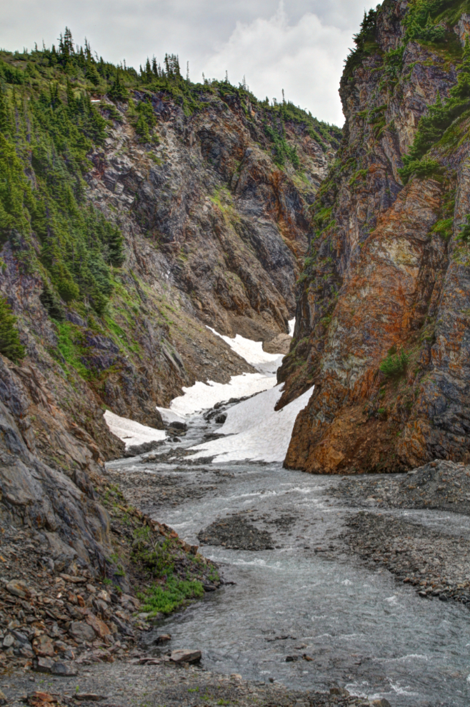
This dramatic little canyon is along the old road. That would be a great walk later in the summer.
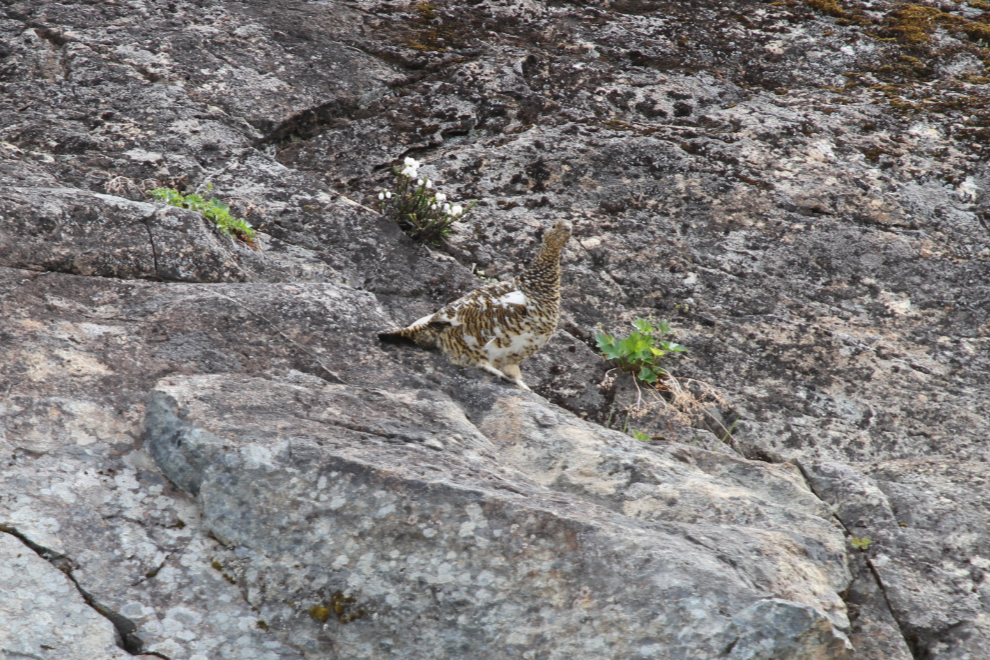
A well-camouflaged ptarmigan on a cliff just above the road.
At the main Salmon Glacier viewpoint, I spent quite a while talking to the wife of the new doctor in Stewart. Many doctors pass quickly through remote communities like Stewart, staying only long enough to get the immigration credits they need to move to a larger centre. I was really pleased to hear that they plan to stay – Stewart deserves people who have that as their goal. The dogs and I then climbed up above the viewpoint.
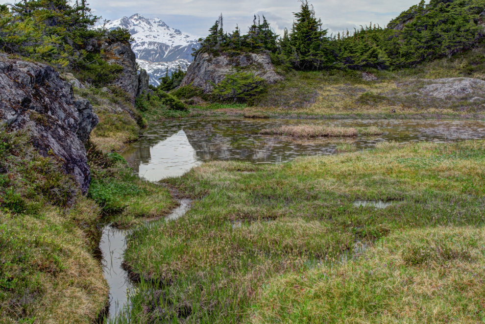
Among the granite above the viewpoint is this pleasant little meadow, which I expect would soon be filled with wildflowers.
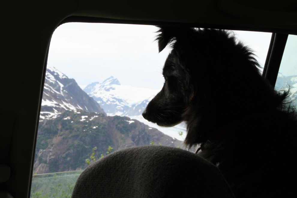
Bella hates gravel roads, so wasn’t having a good time driving back to Stewart, but little Tucker never tires of Adventure.
Another mine, or mine exploration property, that I want to have a good look at is this one at about Km 23. If nothing else, those roads may offer great hiking.
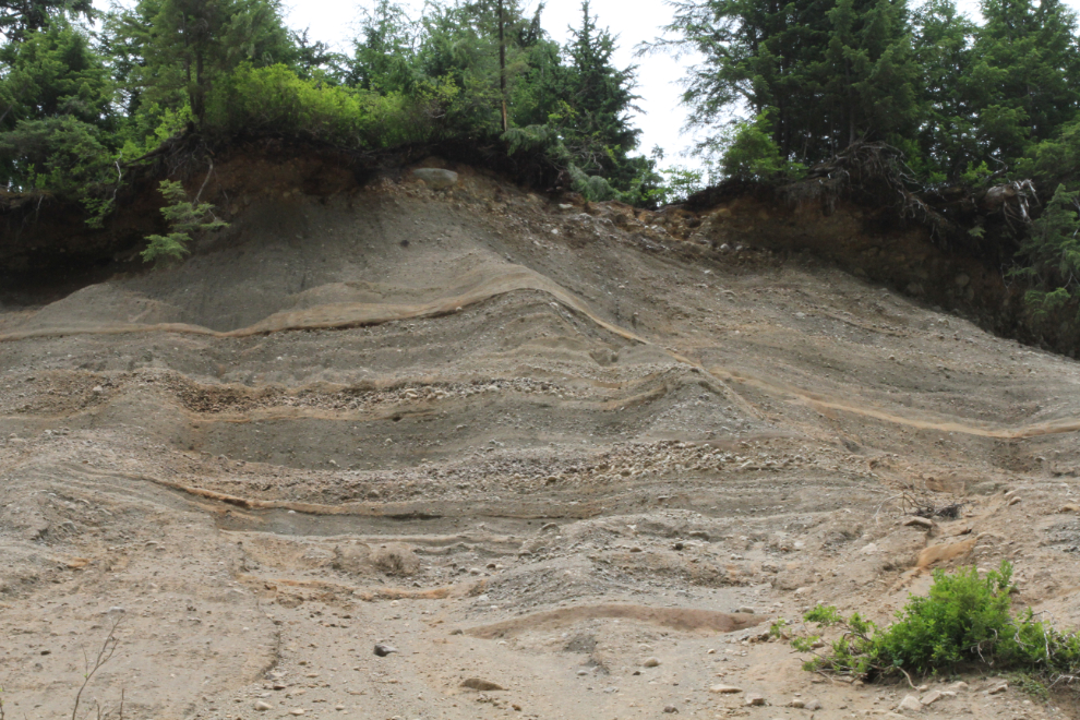
One area on the Granduc Road has always been bad for slides. The next photo shows the layers of gravels above it, from when the bed of the creek was some 400 higher than it is now.
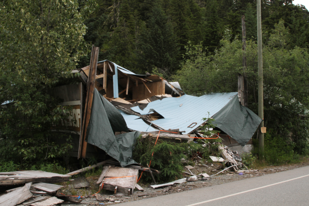
Back in Hyder, I stopped just long enough to get a photo of this store that didn’t survive last winter’s snow load.
The crossing back into Canada was quick and simple. The officer asked what took me to Hyder and I replied that I simply passed through Hyder to get to the mine I worked at 43 years ago. “Have a nice day.” 🙂
The next day would be our push to get home. It might be a one-day drive, maybe two.