Experiencing a bit of Bella Coola
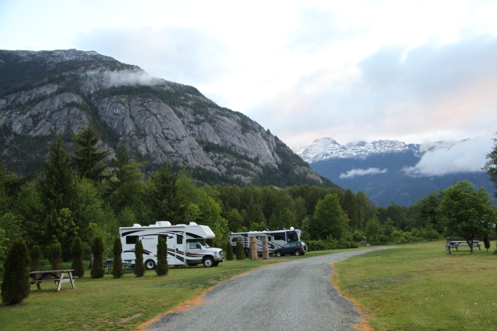
Day 12 of the trip, Tuesday, May 4th, started off early as usual, with a spectacular mountain view out every window from my spot at the Rip Rap Campsite in Hagensborg, a few miles up the valley from Bella Coola. For some reason I had thought about just staying one night – perhaps because nobody I asked really had any suggestions about what to do this time of year.
By the time I shot this photo at 6:10, I had decided that I’d be spending another night, and could find something to do for the day.
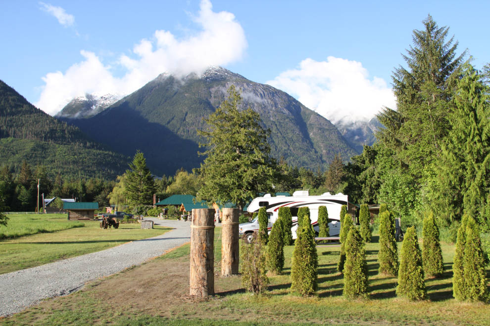
By 8:00 it was clear that the weather was going to cooperate with my day’s exploring of the area. The campsite is beautiful, in every way except for dismal wi-fi. Unable to even check my email sitting right under the router at the showerhouse, I had gone to the office the night before to ask if there was somewhere in town I could get a solid connection. It eventually came out that there are are 2 networks on the property and I had hooked up to the wrong one (though it was the one showing the strongest signal). The proper network gave me a signal, but a very poor one.
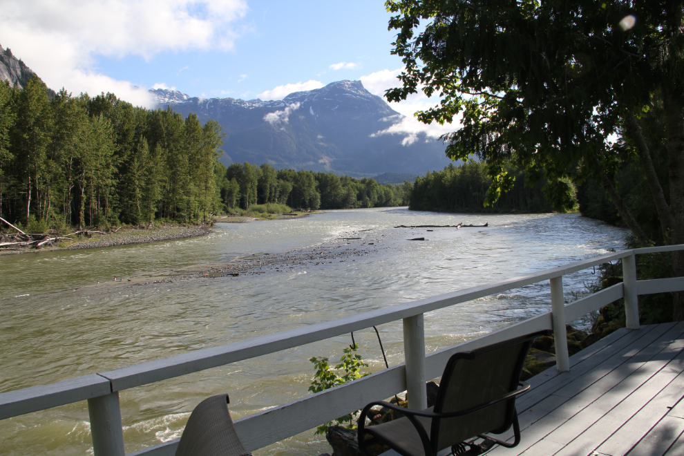
The dog-walking on the Rip Rap property is excellent, and this deck on the Bella Coola River is superb. If Cathy was with me, I expect that we would have spent a lot of time on it, drinking coffee and wine. By myself, though, I just had a look and continued on.
Once I looked at the Bella Coola Trail Guide, I knew that I could stay here for several days – or many days later in the season when the high country was free of snow. It would get me a look at some of the options today, at least.
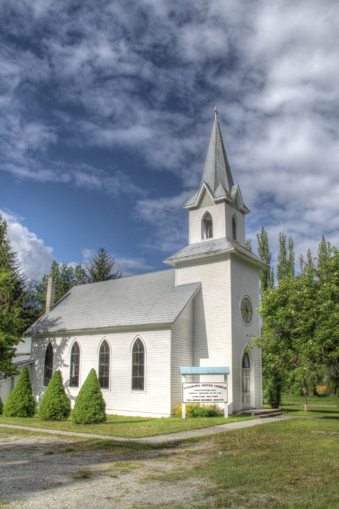
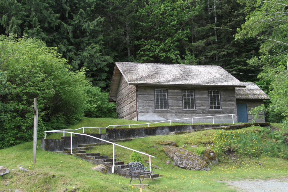
By 09:30, the dogs and I were on our wandering way, starting at the Augsburg United Church in Hagensborg, which was built in 1904. Memory BC says that: “Augsburg Lutheran Church was founded as part of the Norwegian settlement at Hagensborg in 1894. In 1949, it joined the United Church of Canada and became Augsburg United Church, part of the Bella Coola Pastoral Charge. In 1983, the congregation closed.”
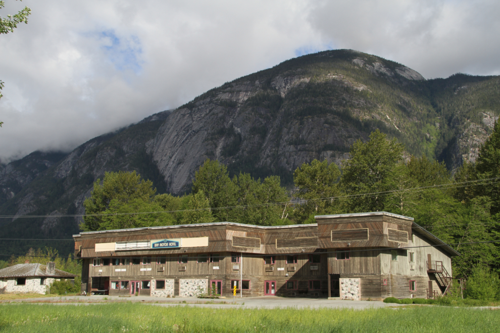
For some reason I had though that Hagensborg was bigger than Bella Coola, but it’s just tiny, and the largest building by far, the Bay Motor Hotel, looks like it’s been closed for many years. [Edit: it had been closed since being damaged in a flood in 2010, and the building was totally destroyed in a fire on November 21, 2020]
I went to the airport next. I flew here in my Cessna in 1985, but didn’t see much of the community. I don’t think we even stayed the night. This time, flightseeing (to Hunlen Falls in particular) was one of the possibilities for the day, but none of the buildings looked welcoming in a “Come Fly With Us” sort of way.
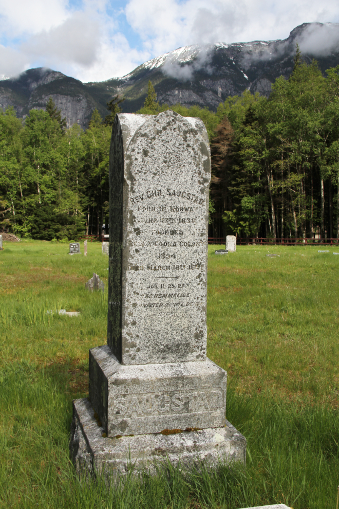
Cemeteries are often on my list of places to see in a community, and I went to 2 here. This monument is for the Reverend Christian Saugstad, who the museum says initiated Norwegian settlment in the Bella Coola Valley. He was born in Norway on June 13, 1838, and died in “Bella Coola Colony” on March 13, 1897.
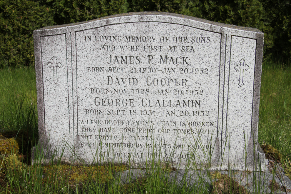
I stopped at this cross and monument beside the highway to see what the significance was. The monument marks the death at sea of 3 young men on January 20, 1952. James P. Mack was 21 years old, David Cooper was 23, and George Clallamin was 20.
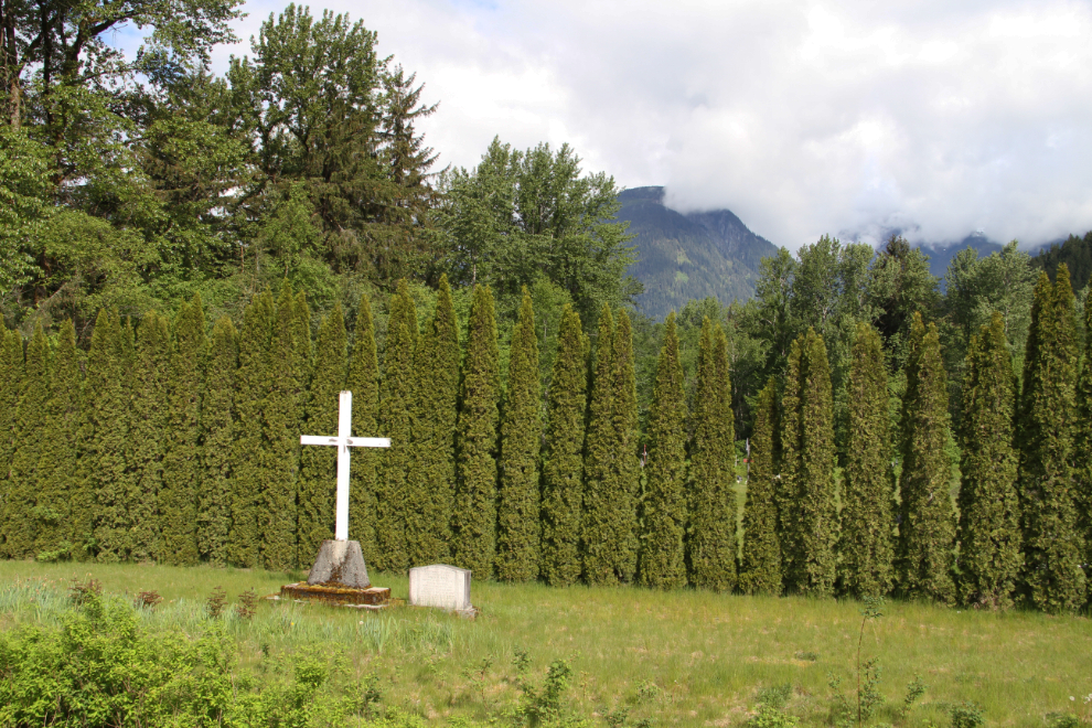
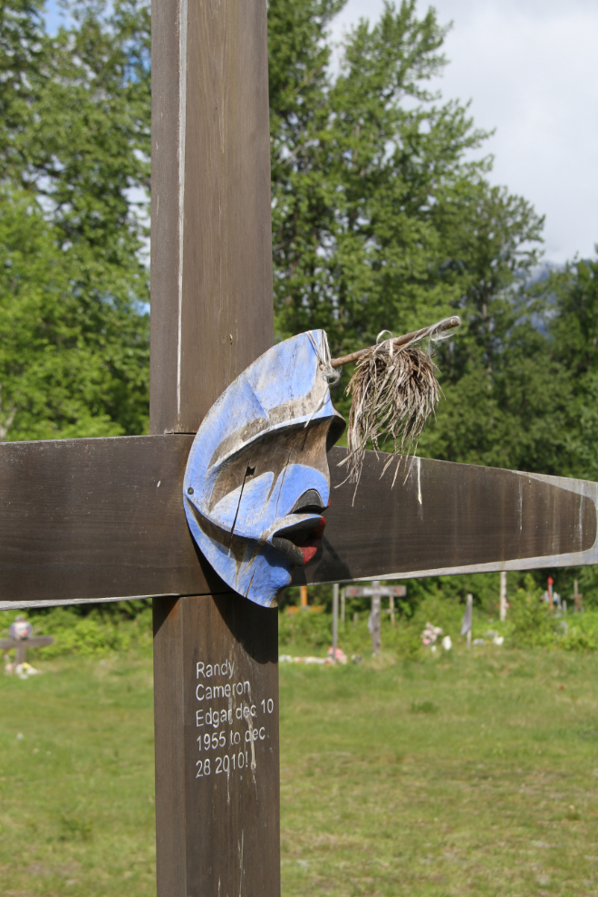
Behind the hedge seen in the photo above is a Native cemetery with some spectacular artwork. The Bella Coola valley is the home of the Nuxalkmc people, organized as the Nuxalk Nation.
This building from about 1892 houses the Bella Coola Museum, but it doesn’t open for a few weeks yet.
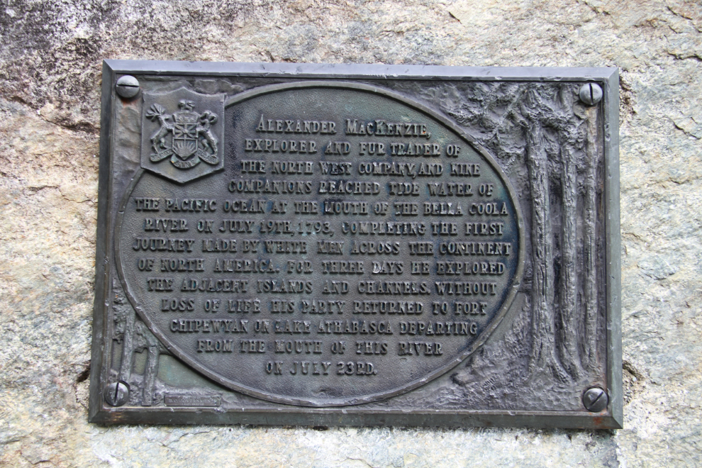
On the drive out to the end/start of Highway 20, I came across the site where I took one of the only 2 non-airport photos from my 1985 visit – the Alexander Mackenzie monument (at the lower left of the photo).
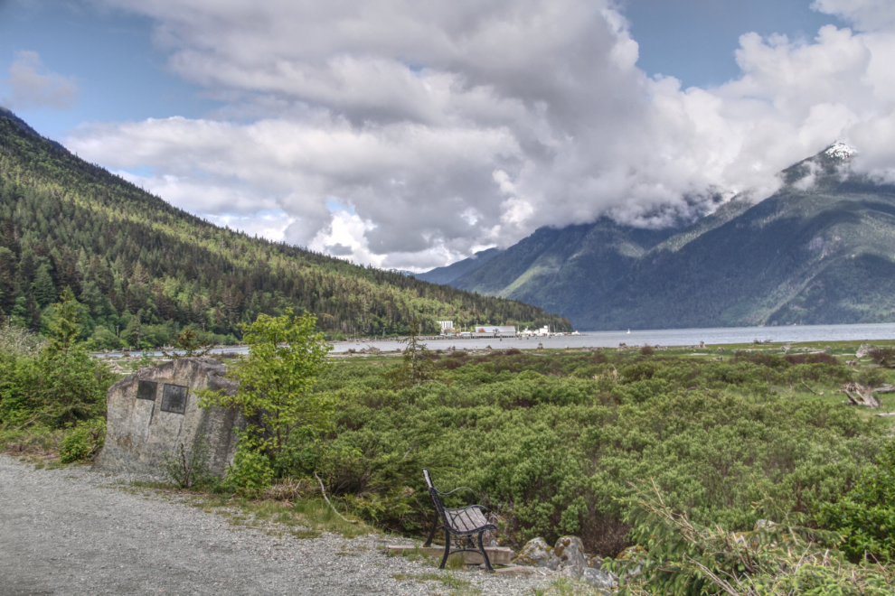
The plaque on the monument reads: “Alexander MacKenzie, explorer and fur trader of the North West Company, and nine companions reach tide water of the Pacific Ocean at the mouth of the Bella Coola River on July 19, 1793, completing the first journey made by white men across the continent of North America. For three days he explored the adjacent islands and channels. Without loss of life his party returned to Fort Chipewyan on Lake Athabasca departing from the mouth of this river on July 23rd.”
The actual site of his furthest-west achievement, near Elcho Harbour on Dean Channel, and the rock he wrote on (“Alex Mackenzie from Canada by land 22nd July 1793“), are protected by Sir Alexander Mackenzie Provincial Park.
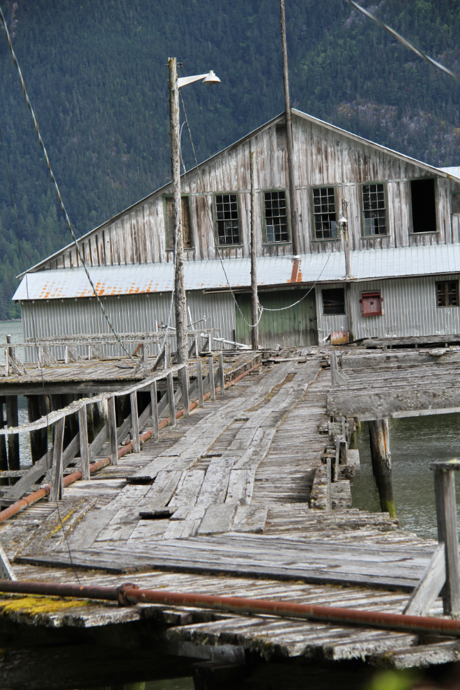
This old building in the harbour must have plenty of stories.
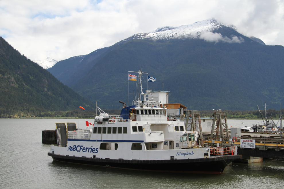
The 16-car ferry MV Nimpkish, “the oldest, smallest, and slowest vessel in the entire BC Ferries fleet”, provides occasional service to Port Hardy on Vancouver Island. Complaints abound.
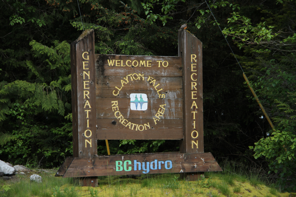
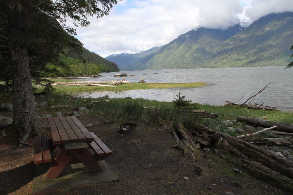
The Clayton Falls Recreation Area, the only ocean-front park in the Bella Coola area, looked like a good place to at least walk the dogs. It’s located at BC Hydro’s Clayton Falls Hydroelectric Generating Station, just past the harbour.
The picnic area on the shore of North Bentinck Arm is lovely. Despite the presence of garbage bins 10 feet away, one of the firepits was overflowing with vodka cooler cans – smh…
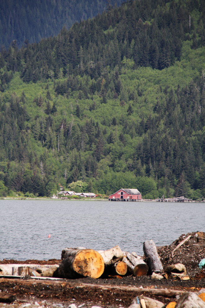
On the opposite side of the arm is the historic Tallheo Cannery, built in 1916. Part of it is now a 12-room, boat-access-only B&B, the Tallheo Cannery Guest House.
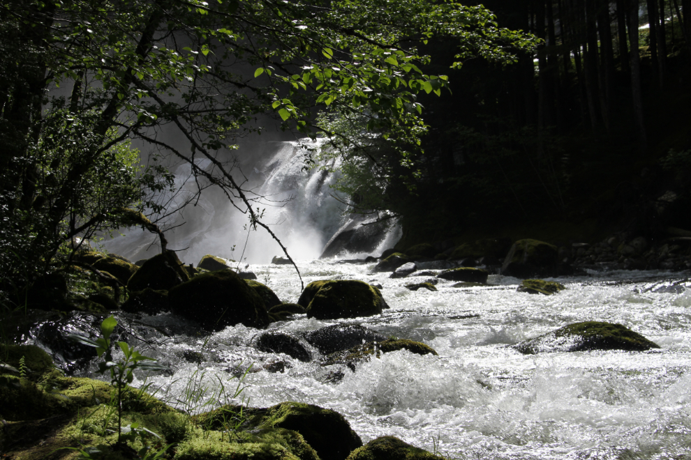
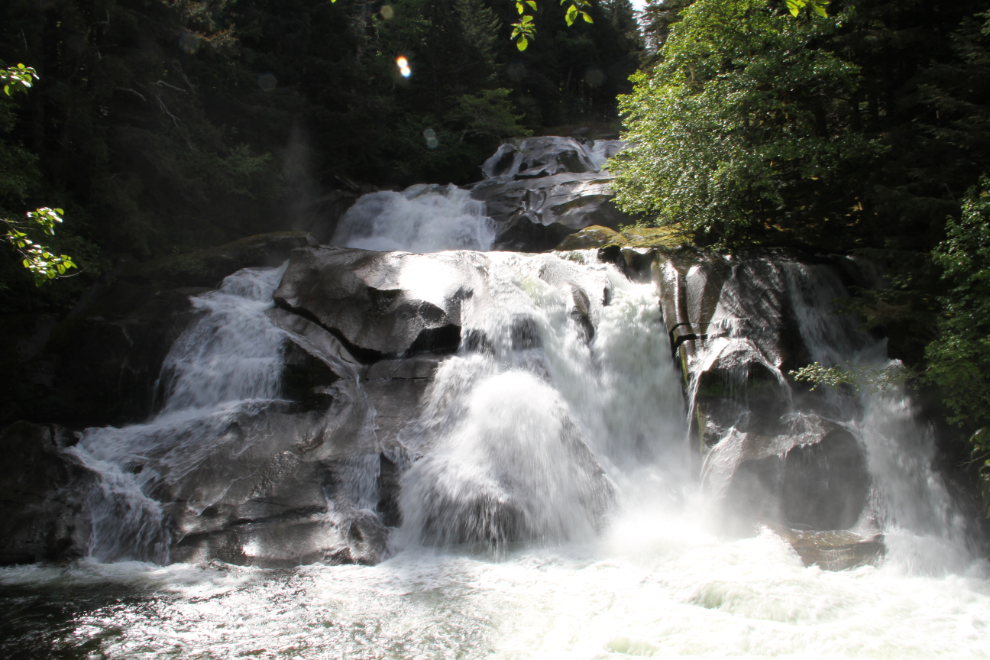
Clayton Falls.
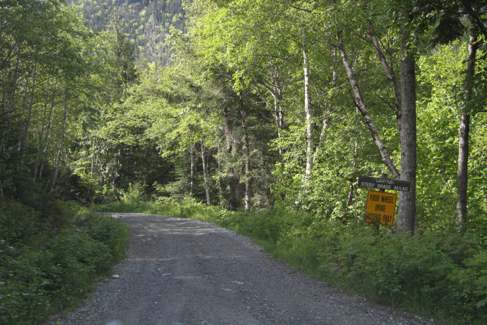
An old logging road leading up Clayton Creek, signed “Four Wheel Drive Access Only” and “Caution Steep Grade Ahead”, looked promising. The trail guide says that it goes 17 km to some alpine lakes – while I expected to get stopped by snow, it might offer some good views and some fun for the fur-kids. We started up it right at 11:00.
We passed by a few creeks, some of which were very photogenic.
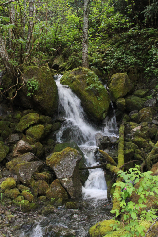
This waterfall would be hard to resist on a hot day!
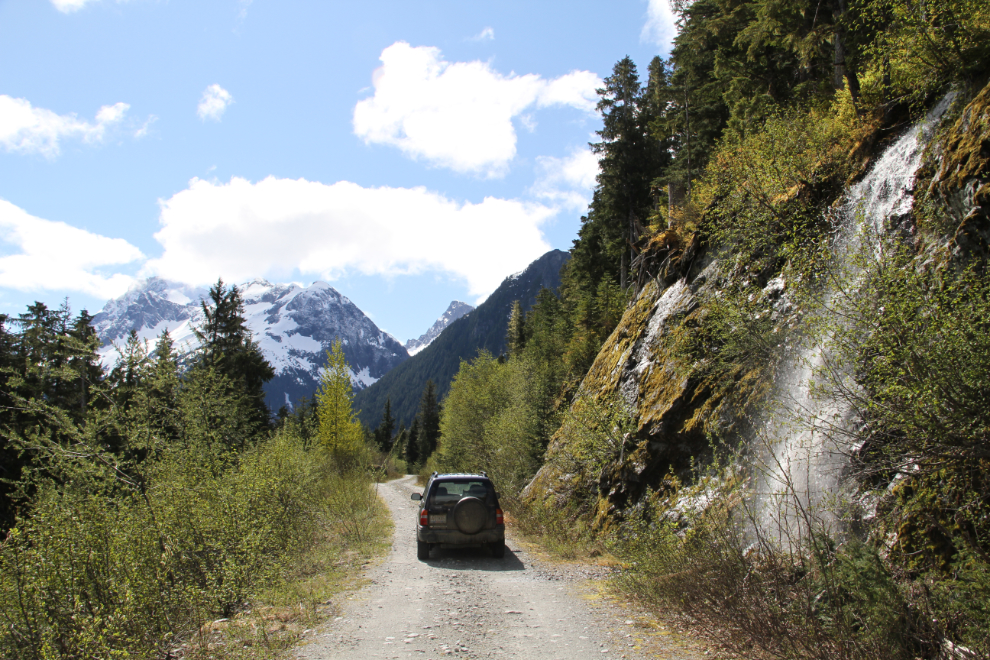
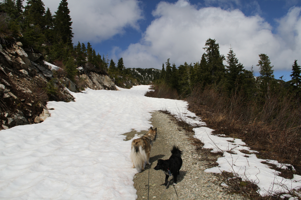
Forty minutes from the bottom, we got stopped by snow. If I had winter tires on, I could have made it through, but it wasn’t that important – we wanted a walk and some snow-play anyway. Right at noon, the snow got too deep to continue – we were perhaps half a kilometer from the short trail to the alpine lakes.
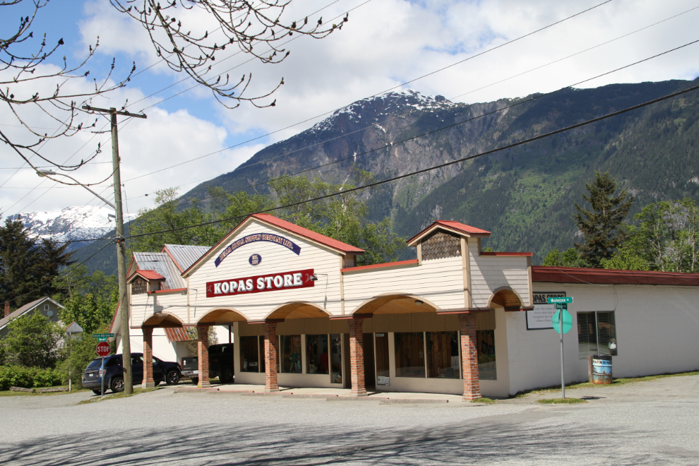
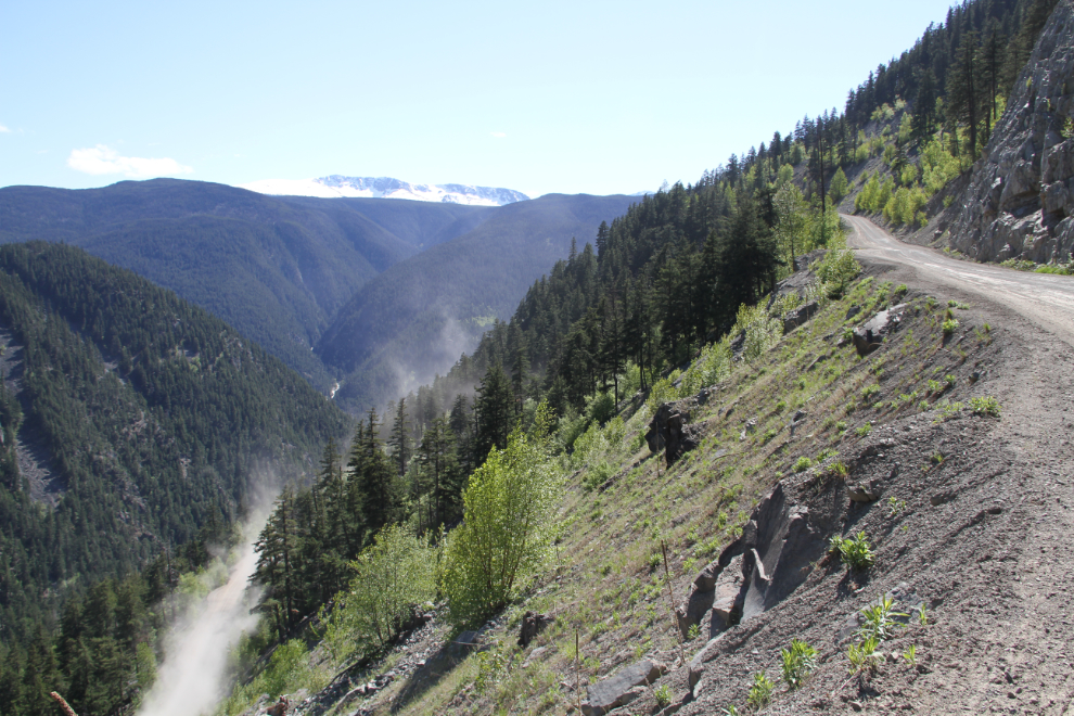
I decided that because there is so much misinformation about The Hill online, I’d take the Tracker out and do a survey of it. The first stop was at the Kopas Store for the two 1:50:000 topographical maps that cover it.
The kids were ready for a nap, so I went back to the motorhome, had lunch, and headed for The Hill without them. I spent an hour and a half going up and back down it, making notes and taking 62 photos. It took me a while to process that all into a useful page, but it’s now posted as “Driving ‘The Hill’ into and out of Bella Coola, BC“.
The next day, we’d return to William Lake to have dinner with my high school friend Sharon, and overnight at a highway pullout there.