Driving BC Highway 37A, the Glacier Highway, to Stewart
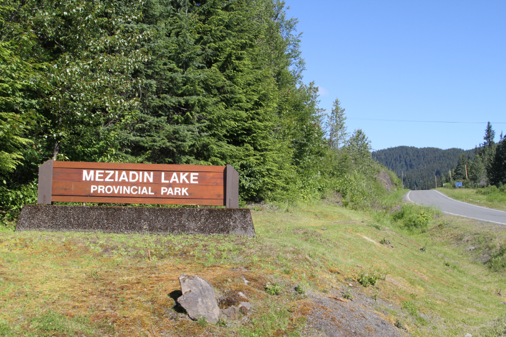
On Day 59 of the trip, June 23rd, I made the 60-km drive from Meziadin Lake Provincial Park along BC Highway 37A, the Glacier Highway, to Stewart. I had enough to see and do in Stewart for at least 2 nights, and was open to extending that for another night or two if the weather cooperated for my exploring.
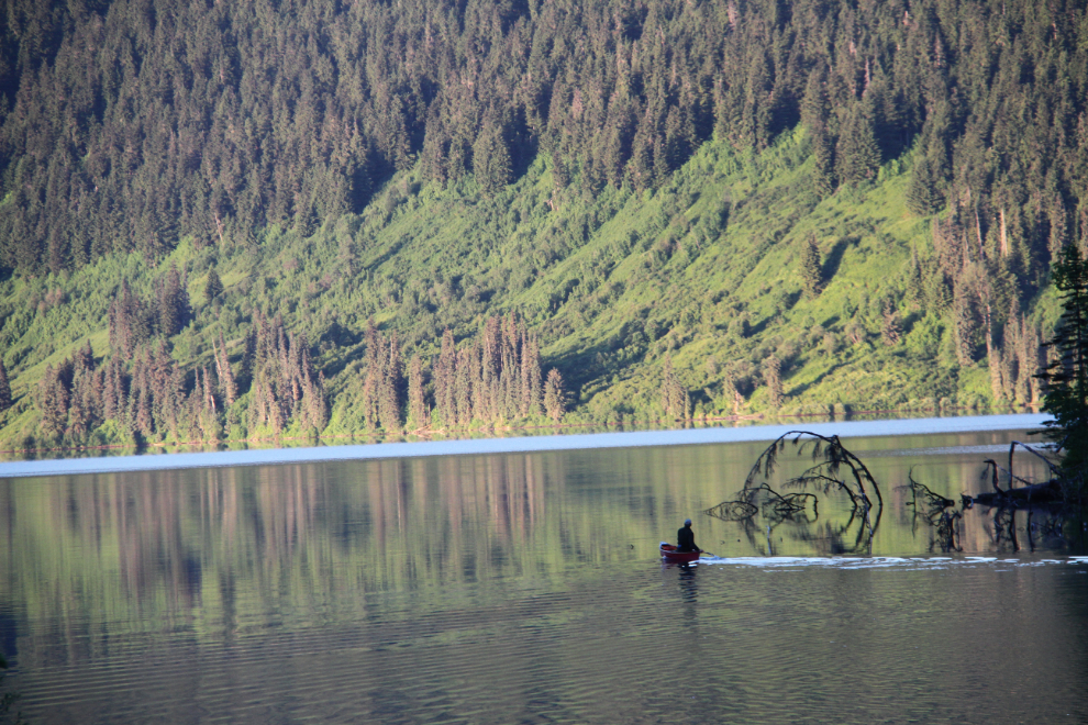
It was a gorgeous dawn at my campsite on the shore of Meziadin Lake. At 05:25, one of my neighbours was already heading out across the lake in a canoe.
We were in no big hurry to leave. After a couple of long walks and leisurely breakfasts for us all, we pulled onto the Stewart-Cassiar Highway at 10:35. The junction with Highway 37A is just a few hundred meters to the left (north).
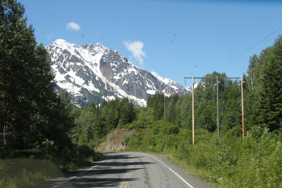
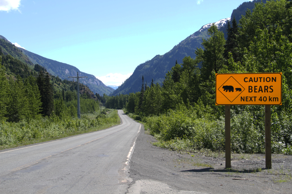
Right after turning onto the Glacier Highway, a mom grizzly and her yearling cub greeted me. There was unfortunately no place to pull off and spend some time with them (and perhaps get a photo or two). The incredible scenery starts almost immediately – the next photo was shot about 6 minutes after turning onto the highway, at about Km 58. Mileposts are measured from the Canada-US border, which is 5.6 km past the “Welcome to Stewart” sign at the Bear River bridge.
A large pullout at Km 52 is a chain-up area for Windy Hill, and a convenient place to stop and contemplate your surroundings.
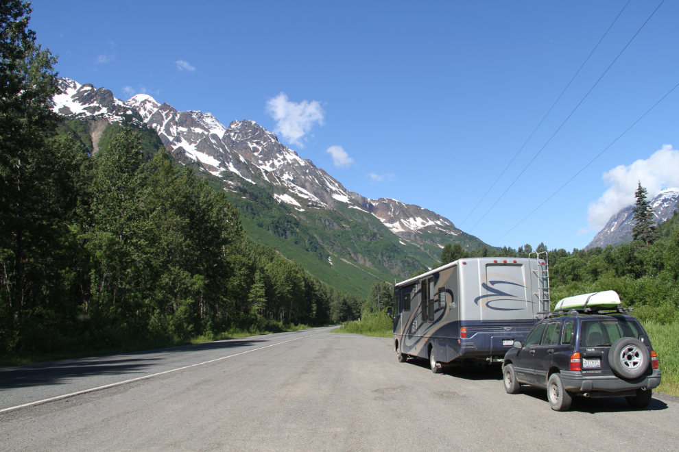
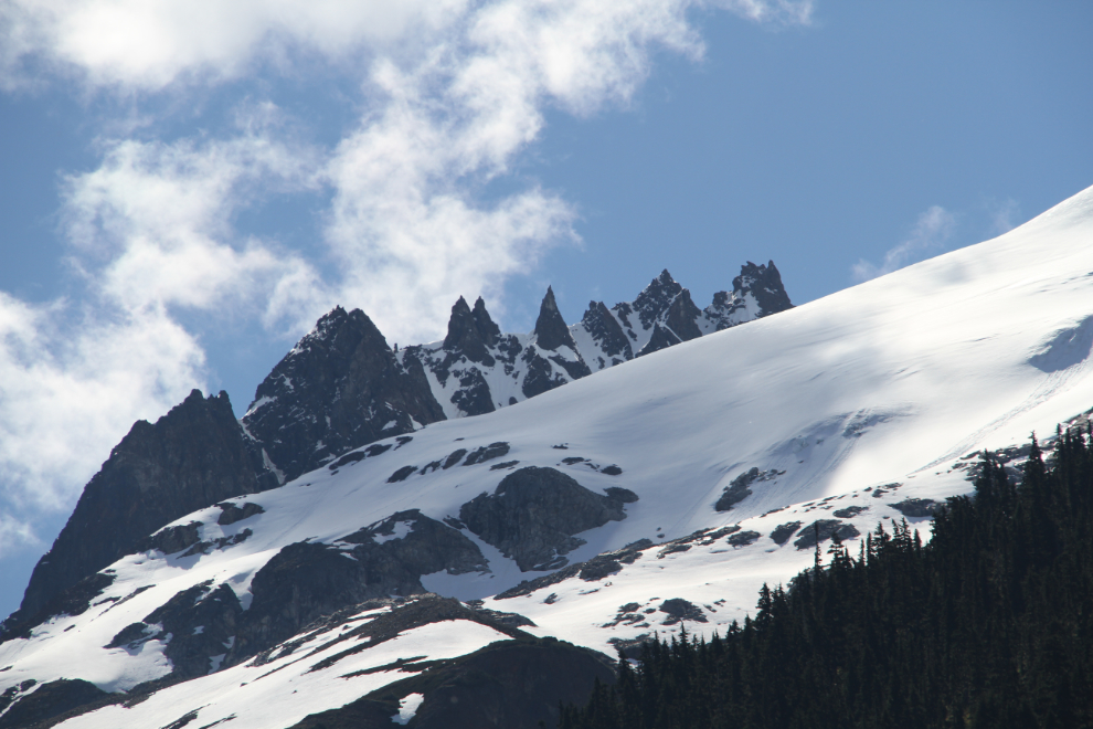
The retreat of all of the glaciers in this region has been dramatic in the 42 years I’ve been coming here.
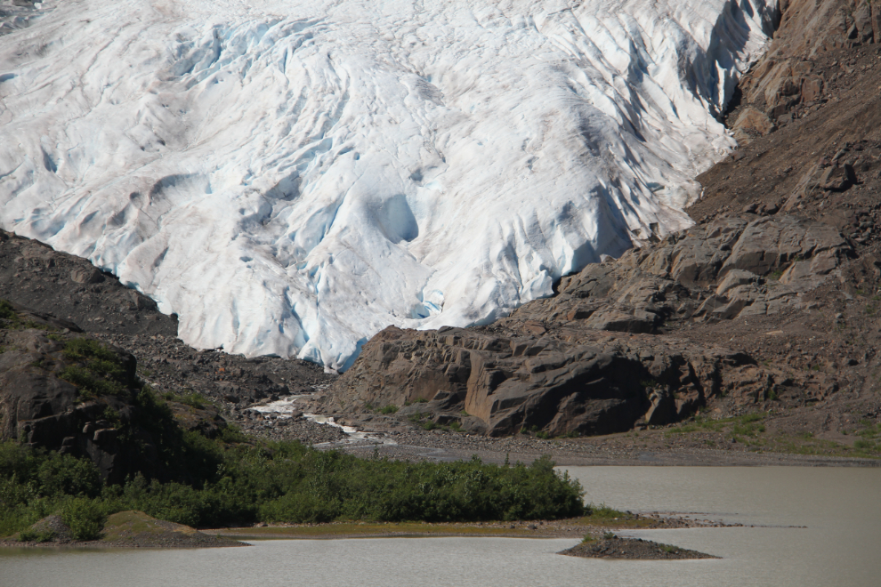
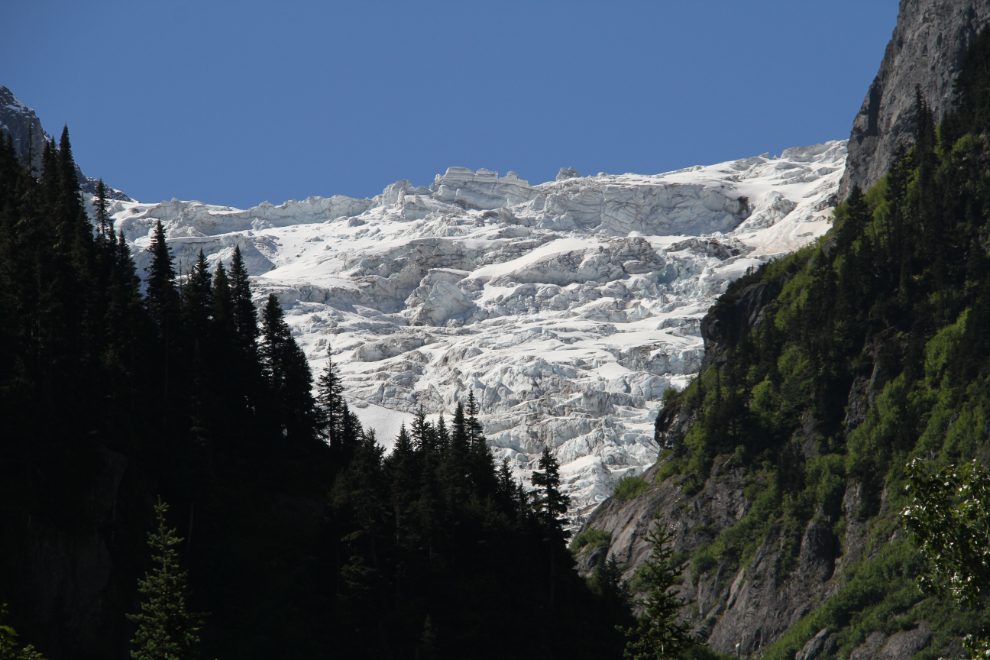
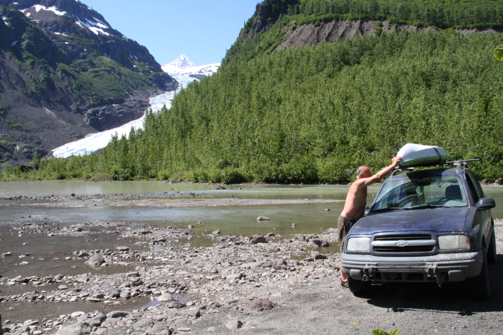
The star attraction of the Glacier Highway, the Bear Glacier, pops into view at about Km 40.5.
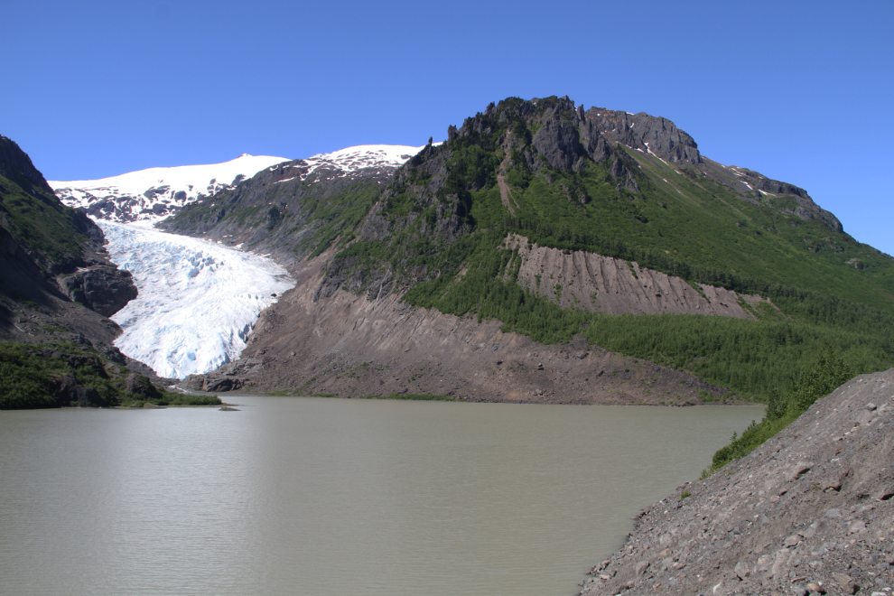
My plan was to launch my kayak and paddle across Strohn Lake to the toe of the glacier, and then to go hiking. I disconnected the Tracker, but before going down the short road to the lake shore, headed back up the highway to do some photography.
For northbound travellers, this sign could just as well warn of bears for the next 600 km or so. The Stewart-Cassiar is the best highway in BC for seeing bears. The next 40 km along the Glacier Highway, though, is good for grizzly bears, while beyond that it’s always black bears.
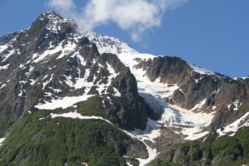
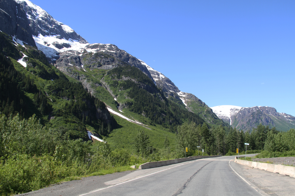
Granite and ice in spectacular combinations make this one of the finest short pieces of road in British Columbia.
Driving slowly when that’s reasonable, taking advantage of pullouts, and keeping your head swivelling will reward you with sights like this. This massive glacier is only visible for a few seconds between the peaks.
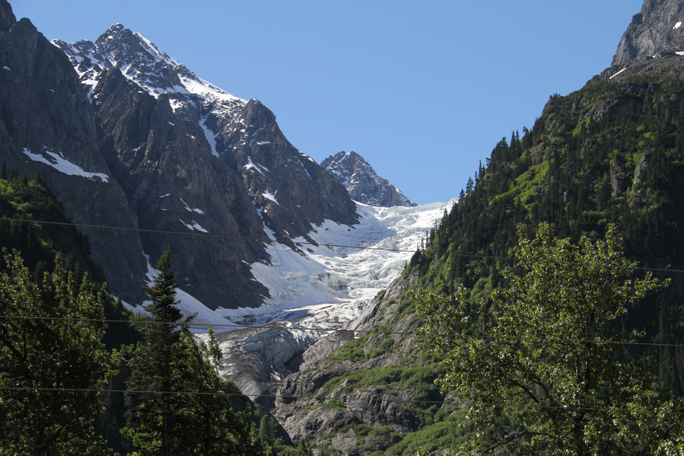
Very few of the glaciers have names.
Southbound with the Strohn Creek bridge ahead.
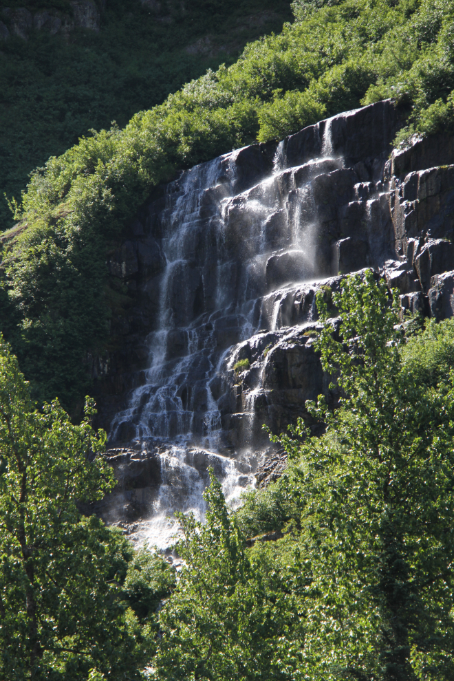
At the bear warning sign, a small side road leads to an old gravel pit, at the far side of which is this lovely waterfall. Thick brush makes getting to it difficult enough that I haven’t tried it yet.
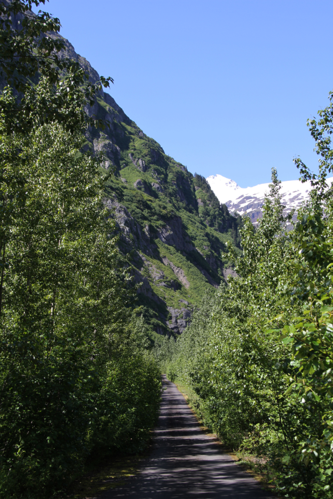
The narrow little side road, which is paved, continues on to the south, paralleling the highway.
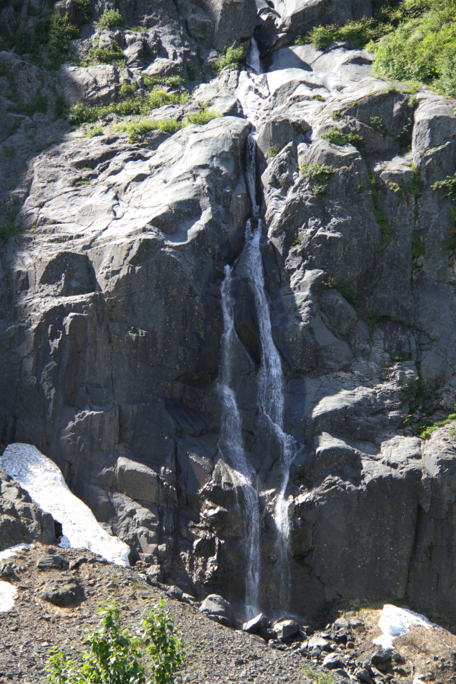
Another waterfall along the side road.
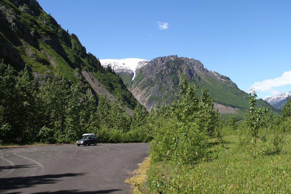
The road ends at this large parking area. Very odd. It’s a long-abandoned rest area, though. It was built in the 1960s, when the Bear Glacier could be seen from here. Now, the glacier has retreated so far that it can’t be seen. It’s also possible that avalanche and rockslide dangers caused the closure of the rest area.
Back at the Bear Glacier, I launched the kayak right at noon, but within a few minutes, a strong wind blew in. I returned to shore and waited a half hour or so to see what might develop, and finally decided not to take a chance of having to deal with wind and waves on a glacial lake in a boat that I had no experience with. [I wasn’t able to complete that paddle until June the following year – see “Kayaking to the Bear Glacier near Stewart“]
I didn’t take any more photos between the Bear Glacier and Stewart, because there are few places to get my rig off the road. I hoped to come back and do some shooting with the Tracker, but the weather went sour.
By about 1:30, I was set up at the Bear River RV Park. The wifi didn’t work at my site, which was one of the furthest from the office, so I took my laptop up to the deck at the office to work. While chatting with the manager there, we realized that a friend of mine in Whitehorse is her daughter-in-law! I haven’t met my friend’s husband, which is why I phrased it that way. I love small towns 🙂
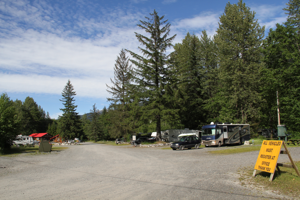
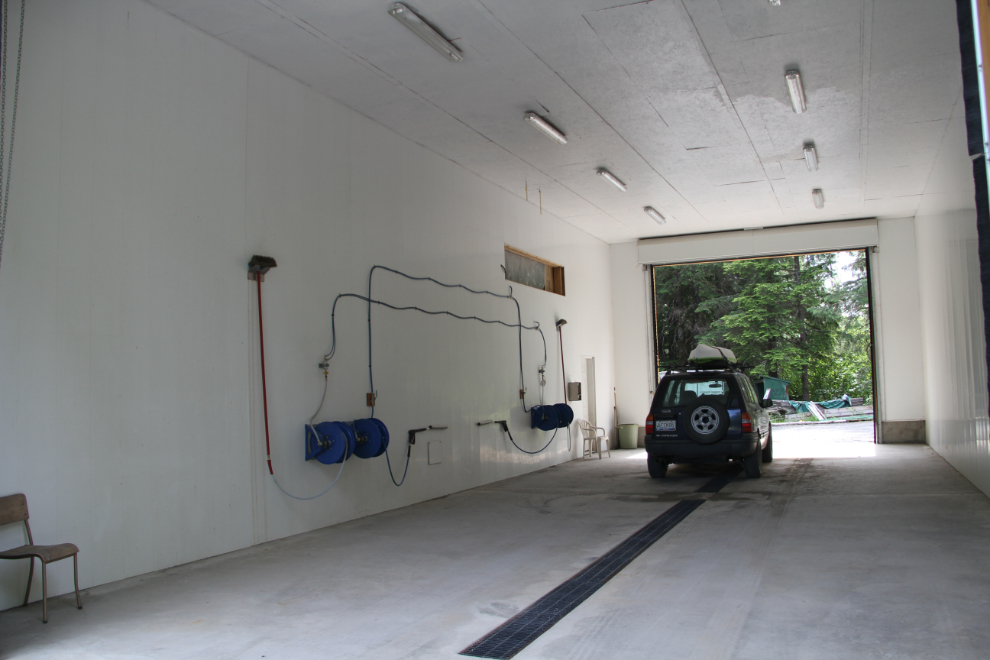
With my computer stuff taken care of, the next order of business was to clean the Tracker. The RV park has built a car wash, and is it ever nice! For $6, the outside of the Tracker was soon shiny again, and I even got the engine compartment clean. Ready to go exploring…