Kayaking to the Bear Glacier near Stewart
Once I reach Smithers, I always feel like I’m almost home. With the right motivation, I could make that drive in one day. I was going to spend 2, possibly 3, more nights on the road, though. On Day 56 of the trip – Wednesday, June 20th – I drove to Stewart for 2 nights. On the way, I stopped at the Bear Glacier and launched my kayak to get up to and on it.
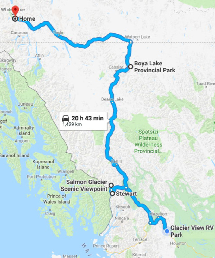
The map shows the entire route home from Smithers, with the side trip into Stewart. Prince Rupert had been on the draft itinerary as well, but I had decided that Prince Rupert is the sort of place where I want Cathy with me to get the best experience. Click here to open an interactive version of the map in a new window.
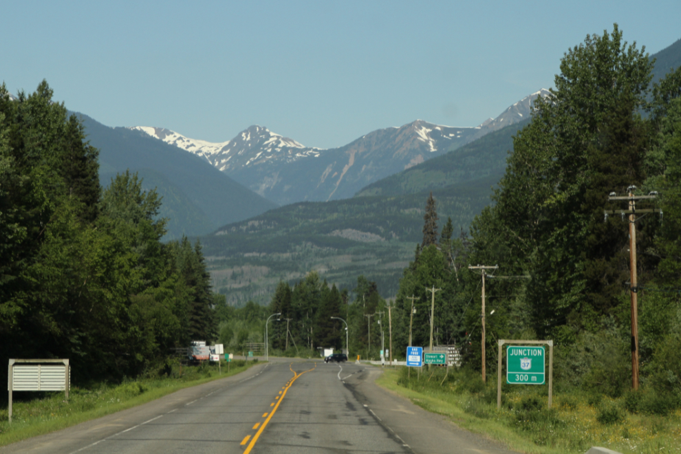
I had gotten away from the Glacier View RV Park fairly early, and at 09:45 was at Kitwanga, ready to turn north from Highway 16 onto Highway 37, the Stewart-Cassiar. I topped off my gas tank at the Petro-Canada station at the junction – that would get me to Dease Lake.
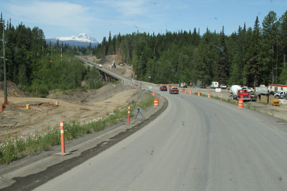
Work is progressing well to replace the wonderful one-lane logging bridge over the Nass River. The new concrete structure will be safe and efficient, but will have none of the current bridge’s character.
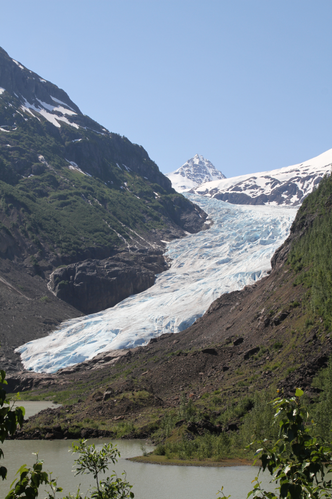
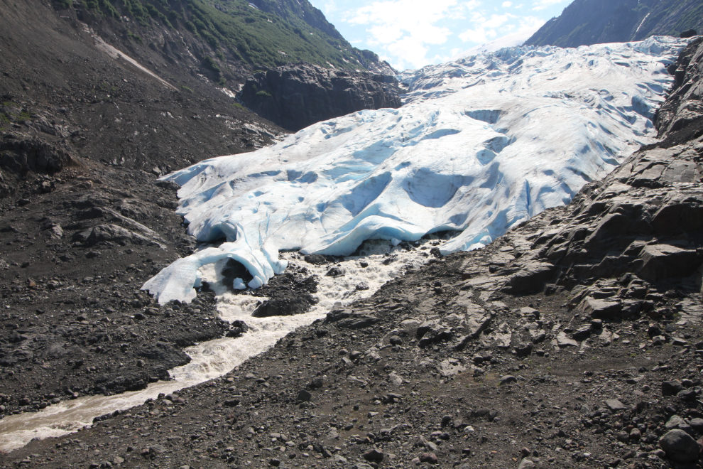
At 12:20, I reached the Bear Glacier. Although it filled the valley not that many decades ago, it’s now separated from the highway by Strohn Lake.
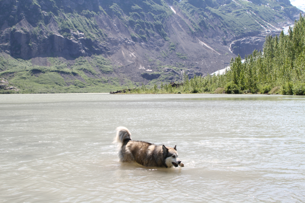
The first thing on the schedule was playing in Strohn Lake with Bella and Tucker. It’s pretty easy to get Bella swimming, but I was quite amazed when Tucker swam briefly to fetch a stick as well. The water come from the Bear Glacier a kilometer away from where we were playing, so yes, it’s very cold!
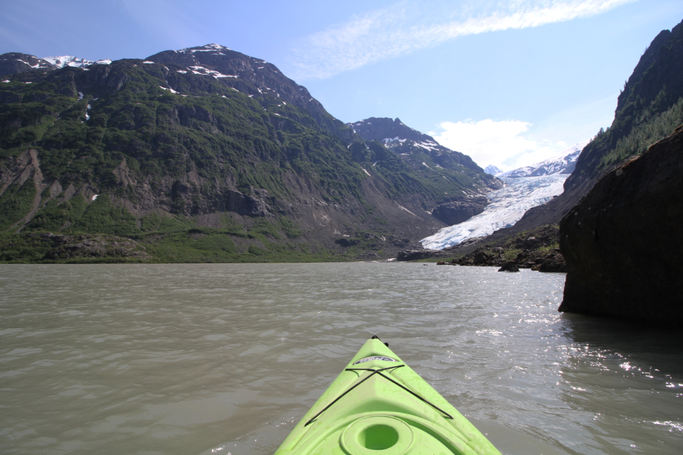
With the kids wet and happy, an afternoon nap was in order before I set off on my little adventure. Just after 3:00, I pulled the kayak off the roof of the Tracker and launched it. The temperature was about 28°C.
It doesn’t show in the next photo, but there was a fairly strong wind blowing from the glacier, and I had to keep clearing spray from my camera lens. The boat launching spot is right where Strohn Creek drains the lake – at full Spring flow now, the current was strong enough that I had to paddle up the lake away from the creek a few hundred feet before crossing. This felt so incredibly good – it had been on my list of things that needed to be done for a few years.
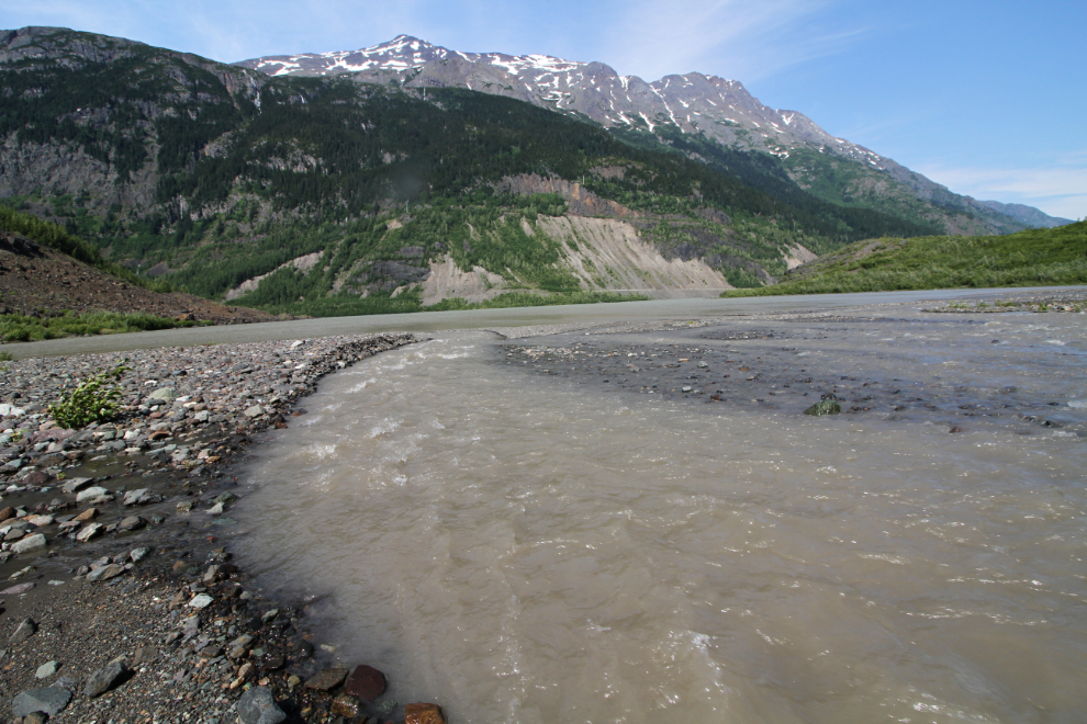
In less than 15 minutes, the kayak was securely stowed behind some alder and I was at the outflow creek from the glacier. Someone had recently beached a canoe where I landed – probably the previous day. It’s been many years since I’ve seen a boat on Strohn Lake, so having 2 boats in 2 days is funny.
The retreat of the Bear Glacier in the 43 years I’ve been watching it is quite incredible. When I first saw it in 1975, it reached into Strohn Lake. Now, it’s quite a walk to reach the ice.
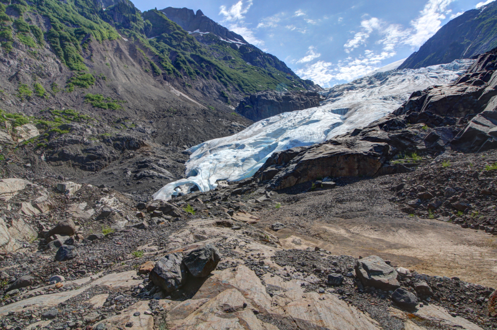
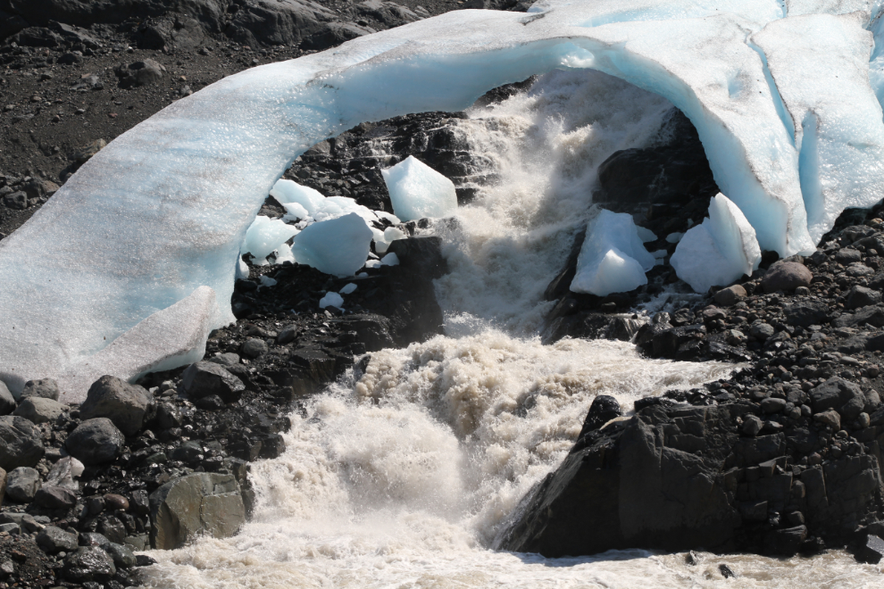
This was the view I’d been wanting to get. The ice has now pulled back into a partial canyon – on the side I was on, the walls were too steep to get down to the creek for the photos I wanted.
On the side furthest away from me, this ice arch has formed. The opening is about 30 feet across, and the chunks of ice show that it’s rapidly falling apart. These arches are signs of a retreating glacier – a dying glacier. The high water content of the ice around the under-glacier steams makes it the densest, so it’s the last to melt away as the glacier retreats.
This short video gives a better idea of the scene, with the strong wind and raging creek making a great deal of noise – so much that you can’t hear what I was saying.
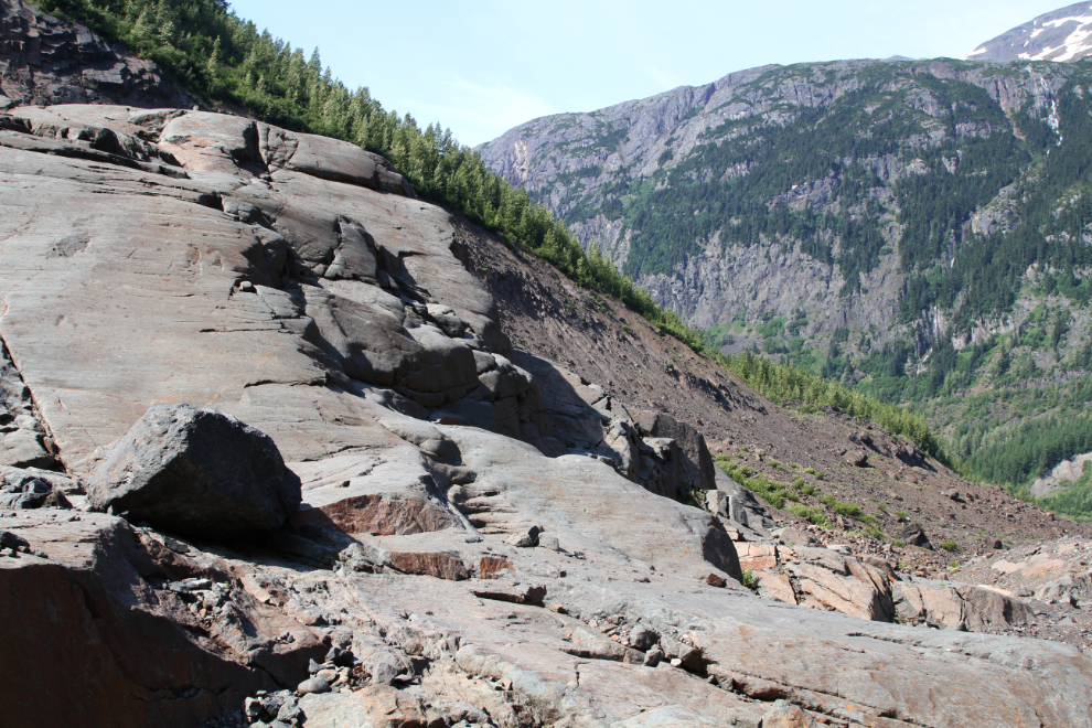
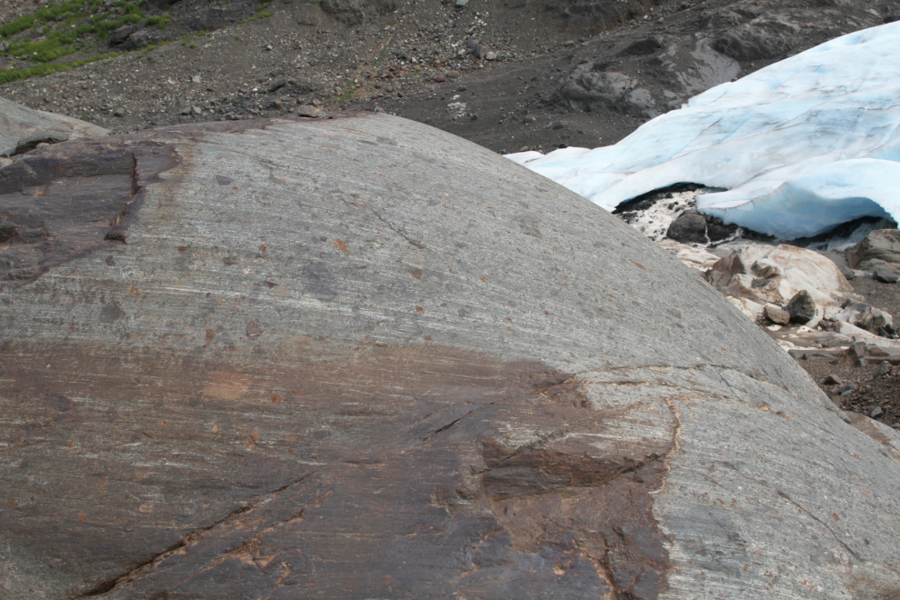
The ice-scoured granite is great to walk on. Much of it is too steep, though, so I more often walked up the gravels and rocks of the lateral moraine as I made my way up alongside the glacier.
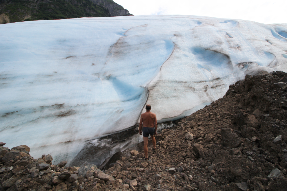
The first couple of places where I was able to reach the ice were too steep to climb, but I eventually found a spot here I could get up on the glacier. A short walk showed the fairly small section of the lower part of the glacier where I was to be a safe place to do that – there’s no hint of cracking or crevasses.
I wanted to get much higher alongside the glacier, up to the area of crags and crevasses, but the higher I got, the stronger and colder the wind got, so I turned back well below that area.
One final photo of ice-carved rock near the toe of the glacier. My plan is now to get back to the Bear Glacier later this summer – I’m not nearly finished with it yet.
I reached Stewart at about 5:30, and was soon set up at the Bear River RV Park. The next day, I planned a full day for the dogs and I up the Granduc Road past the massive Salmon Glacier.