Driving the Dempster Highway, Inuvik to Fort McPherson
It took me a while to figure out how to show you the Dempster Highway, as I shot 197 photos on the day we drove it, April 10th. I hope that two posts will be reasonable – Inuvik to Fort McPherson, then Fort McPherson to Dawson City. Actually only Fort McPherson to Tombstone Park, I suppose, since that’s where it unfortunately got dark. It was a long day – almost 15 hours – and I wish we could have overnighted at Eagle Plains Lodge. Anyway, here we go! There are 39 photos in this post, over 50 in the next one.
First, another map – the interactive version is here. Part of the reason the first post only covers 186 km is that we went into two communities – Tsiigehtchic (formerly Arctic Red River) and Fort McPherson.
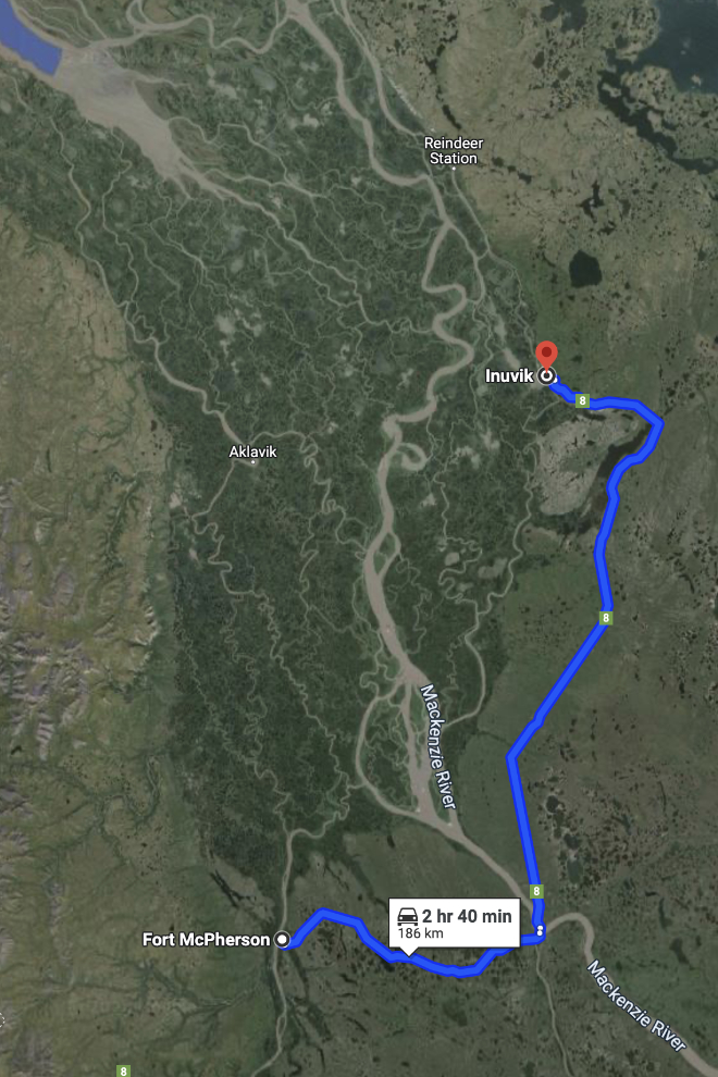
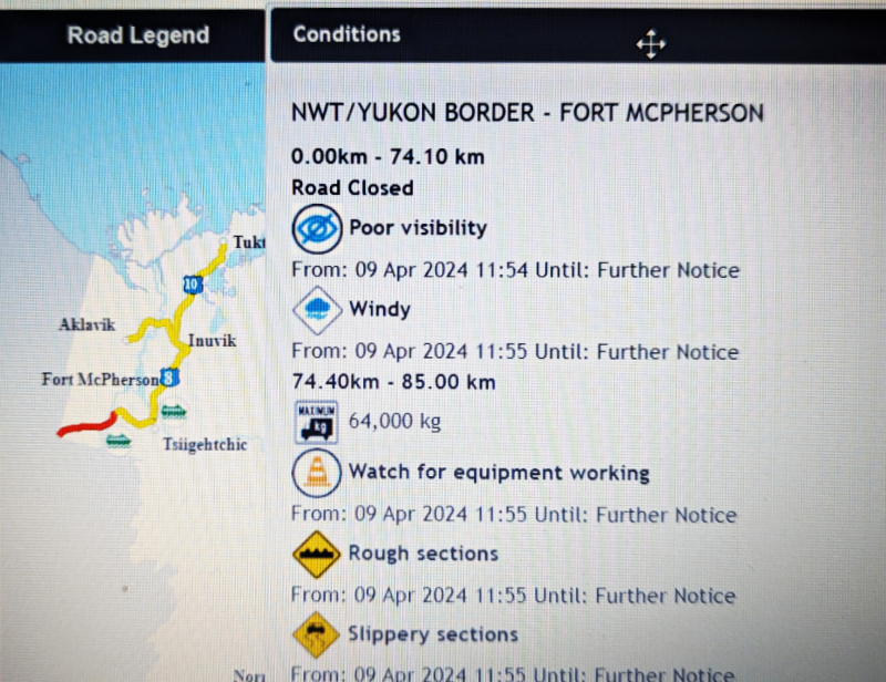
The first challenge Tyson and I had was deciding whether or not to go. The NWT road report showed that their side of the highway was closed south of Fort McPherson, and the Yukon report showed a Travel Advisory on their side. Looking at the weather conditions the morning of the 10th, though, we saw sunshine and fairly light winds, and since snowstorms and highs winds that cause drifting and ground blizzards are usually what closes the highway, we decided to go and see what happened.
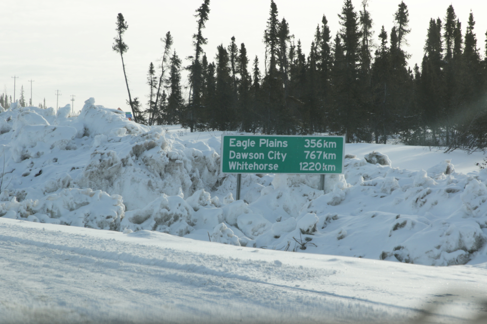
The Dempster Highway mileage sign at its junction with the Inuvik airport road, at 09:55. Fuel at Eagle Plains Lodge, 356 km; overnight booked at the Downtown Hotel in Dawson City, 767 km; home in Whitehorse tomorrow, 1,220 km.
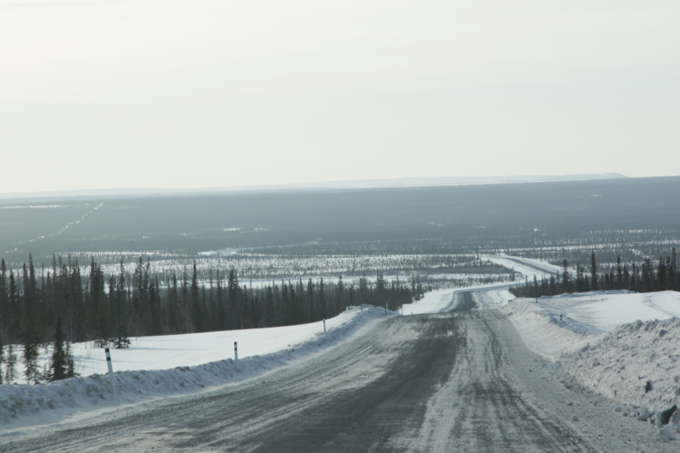
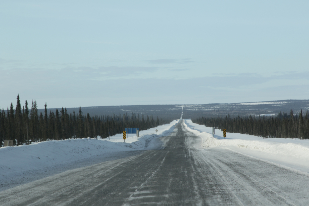
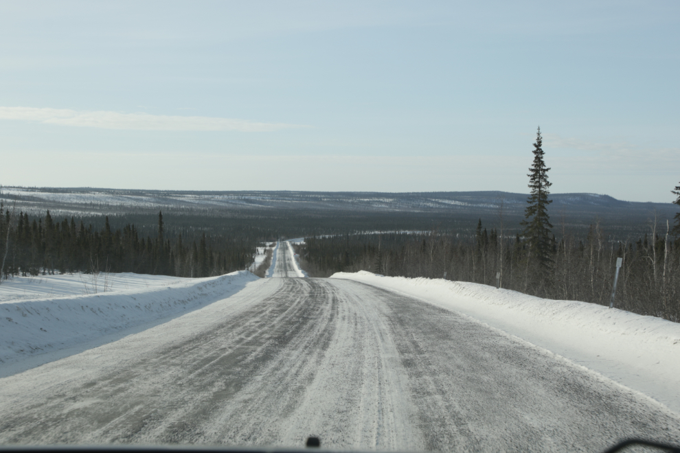
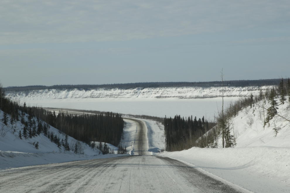
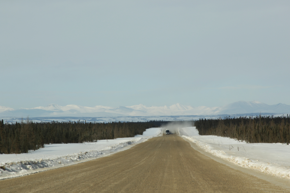
Some of the highway this morning wandered through the low hills east of the Mackenzie Delta, and some went straight for many miles across sections of the delta. The next photo was shot 8 minutes from the airport junction.
09:07 – there was almost no traffic, possibly lending credence to the highway being closed. Oh well, nice day for a drive to wherever…
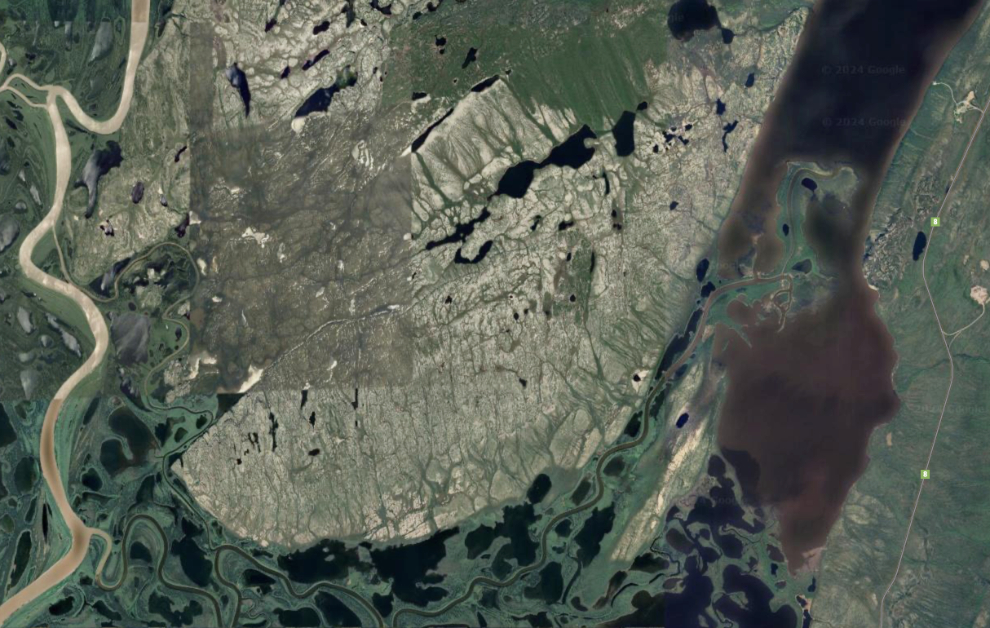
The next photo shows part of Campbell Lake, which features an unusual reverse delta. Normally, the stream drains water from Campbell Lake into the Mackenzie River. But during the spring flood when the water level in the river is high, the flow reverses, bringing silt-laden water from the river into the lake. Over time the silt has built up a reverse delta, filling up the centre of the lake at its southwest corner.
This aerial view shows that reverse delta to the right. The Dempster Highway is to the right of the lake, a small channel of the Mackenzie River is to the far left of the photo, and a large exposure of various sedimentary rock between.
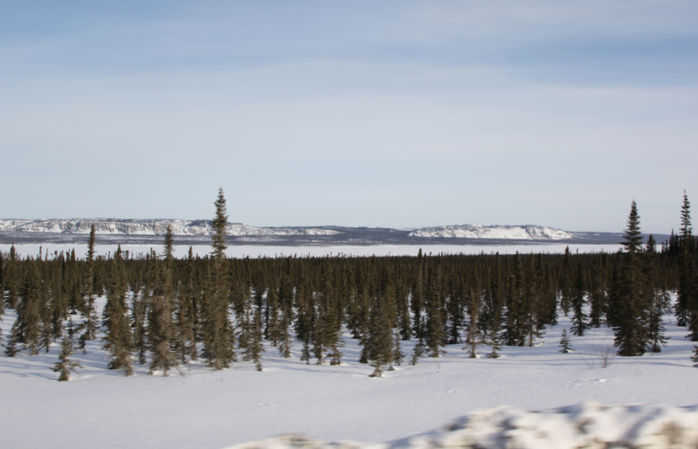
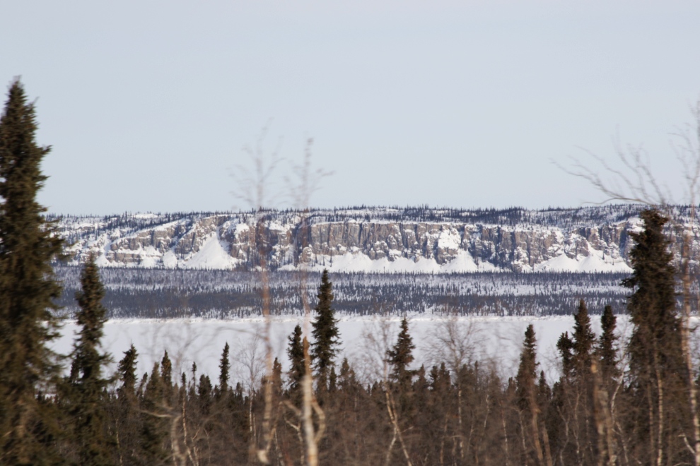
There are some impressive cliffs along the eastern shore of the lake.
This country isn’t dramatic, and many casual tourists don’t see or feel its beauty and power. On my tours, we stopped often to look closely. I decided a while back that I had driven the Dempster 30 times (15 round trips), so this was drive #31.
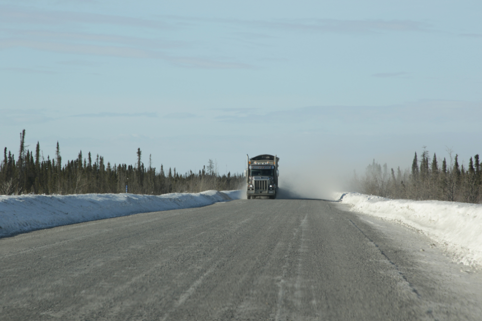
Time to move over and slow down to try to keep the windshield intact. Seeing him increased our positivity that the road was open.
The culvert crossing of the Rengling River at about Km 644 from the North Klondike junction, Km 179 from the Yukon-NWT border.
That truck was in much more of a hurry than we were, so the highway was almost certainly open.
It’s quite a drop down to the Mackenzie River.
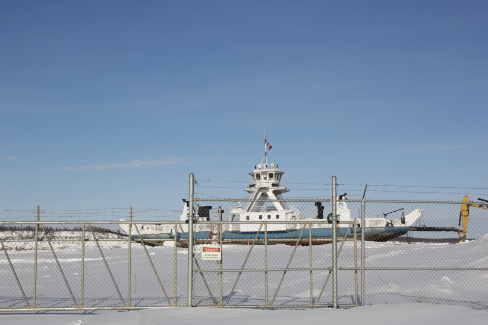
The ferry Louis Cardinal takes warm-weather visitors across the river.
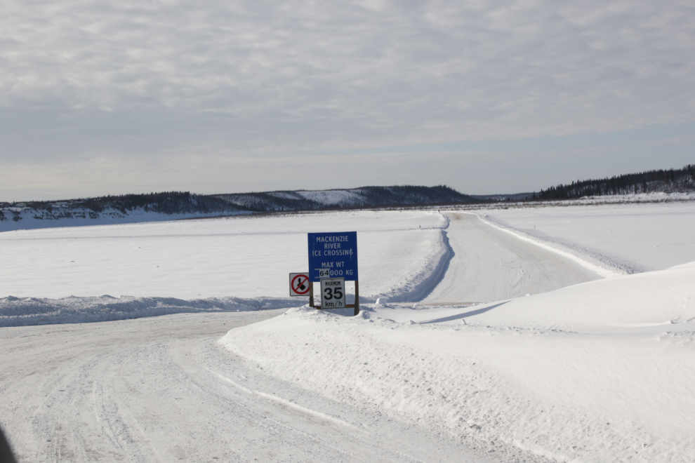
Right at 11:30 we reached the Mackenzie River Ice Crossing, rated for 64,000 kg / 141,100 lbs. The river runs in a single channel, half a mile wide, at this point.
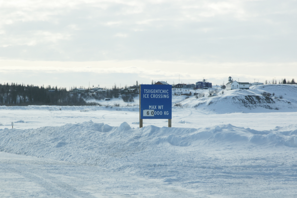
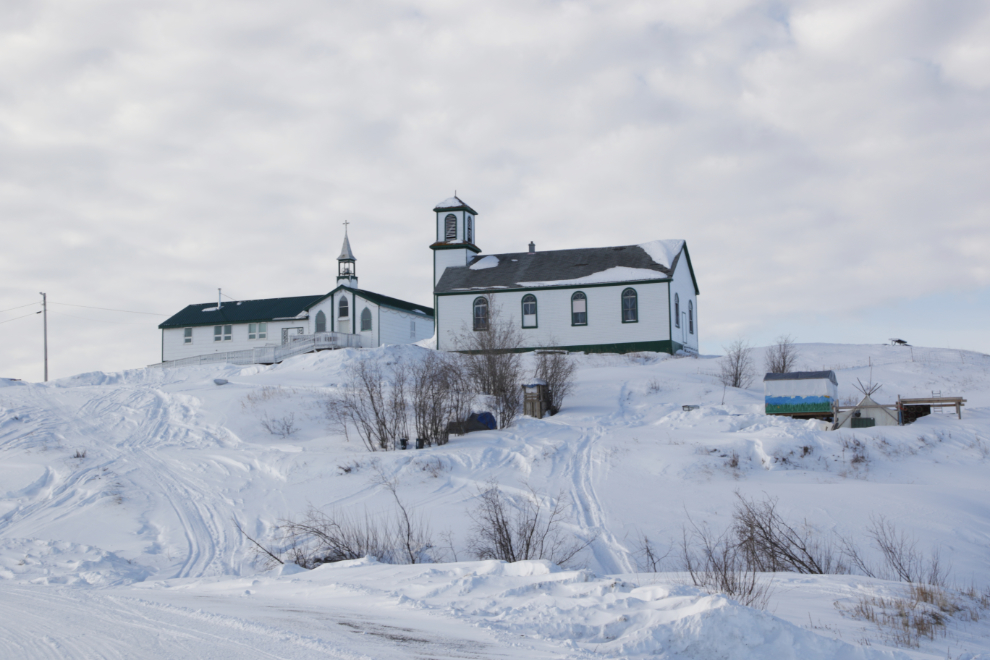
Oh wow – I hadn’t even though about being able to visit Tsiigehtchic! (there’s no road to the community)
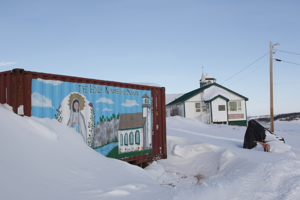
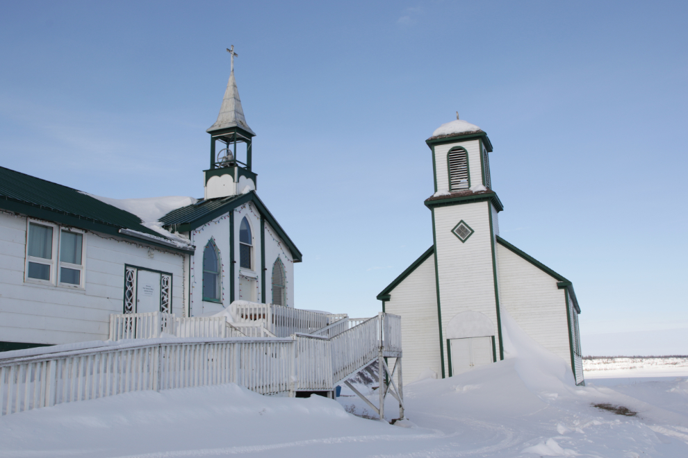
The Catholic Church of the Holy Name of Mary is the most visible structure in Tsiigehtchic, both from the Dempster Highway and from the ice crossing approach.
The mural on a sea can is an interesting touch.
The church was built in the late 1920s. Father Jean Séguin (1833-1902) visited the Gwich’in at Tsiigehtchic every summer for nearly 30 years beginning in 1862 and a small house was constructed for his use, but a chapel-house wasn’t built until 1896.
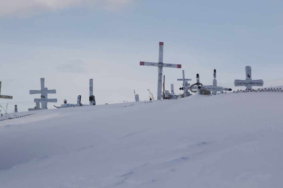
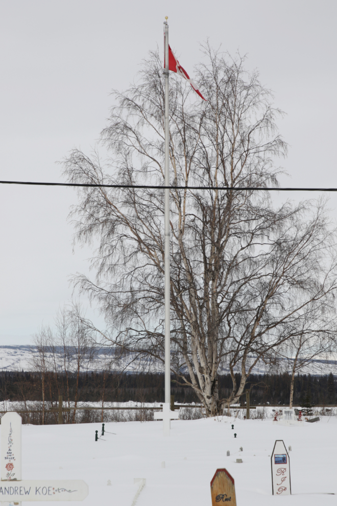
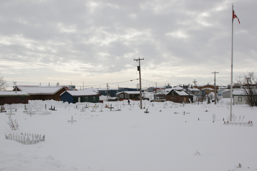
A cemetery covers the hill above the church.
We didn’t even make a loop around town for a look for some reason. Oh well, next time 🙂 In the summer, the ferry will make a detour to Tsiigehtchic on request.
A look back from the ice crossing, at 11:50.
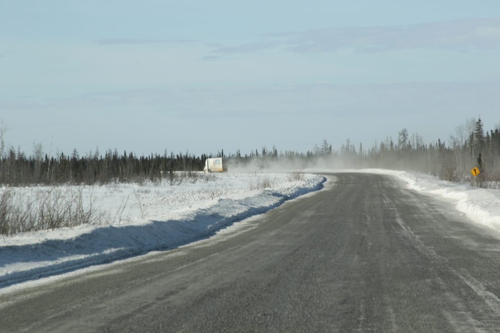
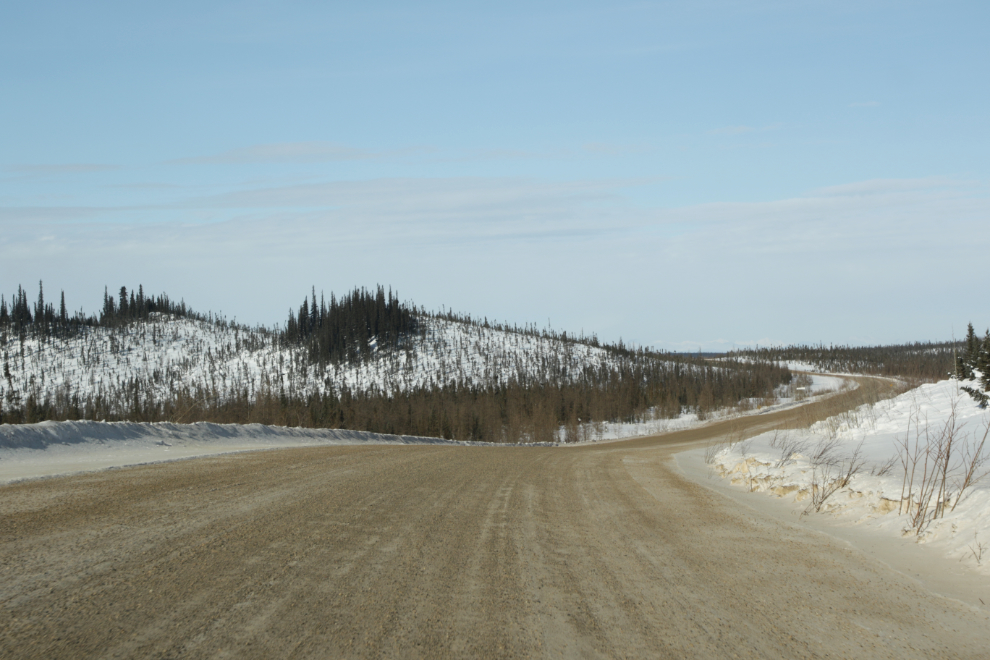
Back on gravel, wandering through the low hills.
We saw ptarmigan at several places during the day.
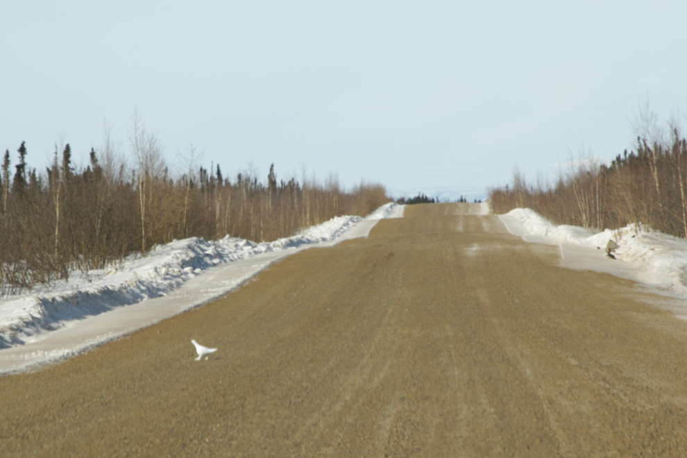
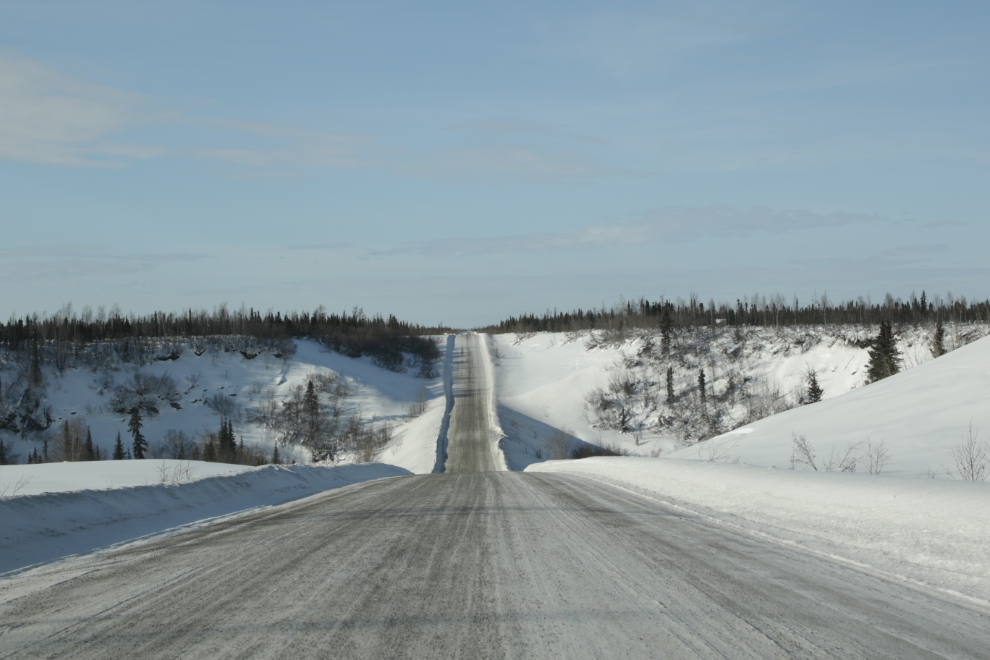
A classic Dempster Highway view.
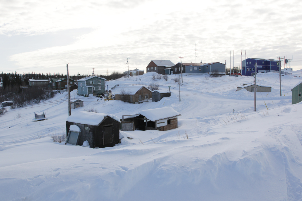
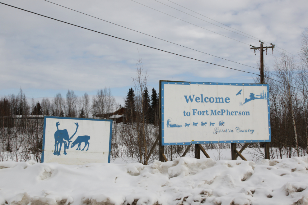
We reached the short access road into Fort McPherson at 12:38, and the first thing we saw was confirmation that the road was open, that our gamble had paid off.
“Welcome to Fort McPherson. Gwich’in Country.”
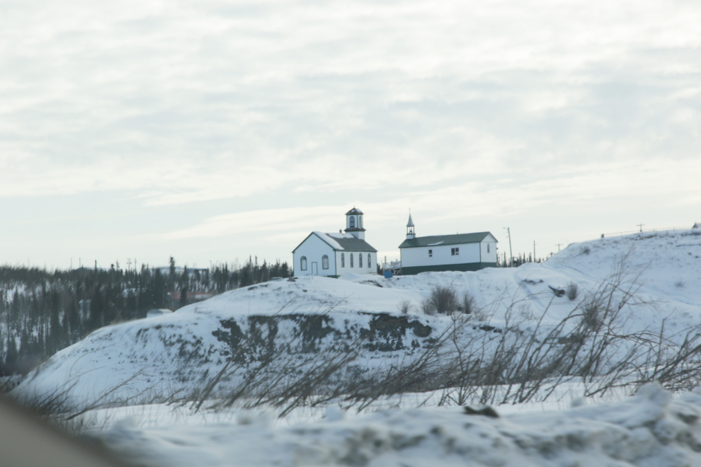
St. Matthews Fort McPherson was established by the Anglicans in 1860, and this lovely little church was built in 1910.
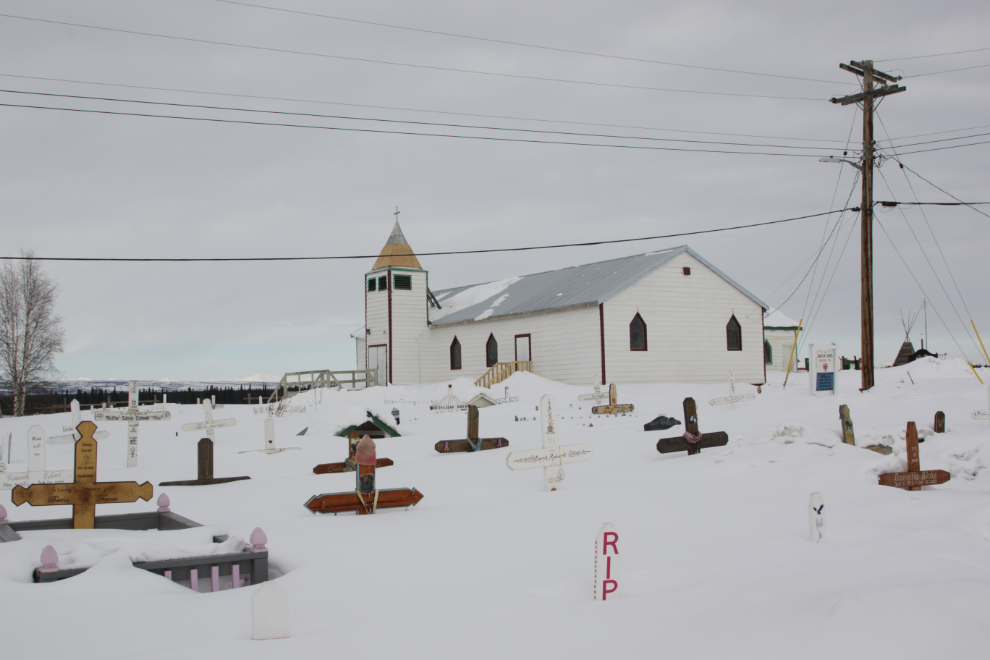
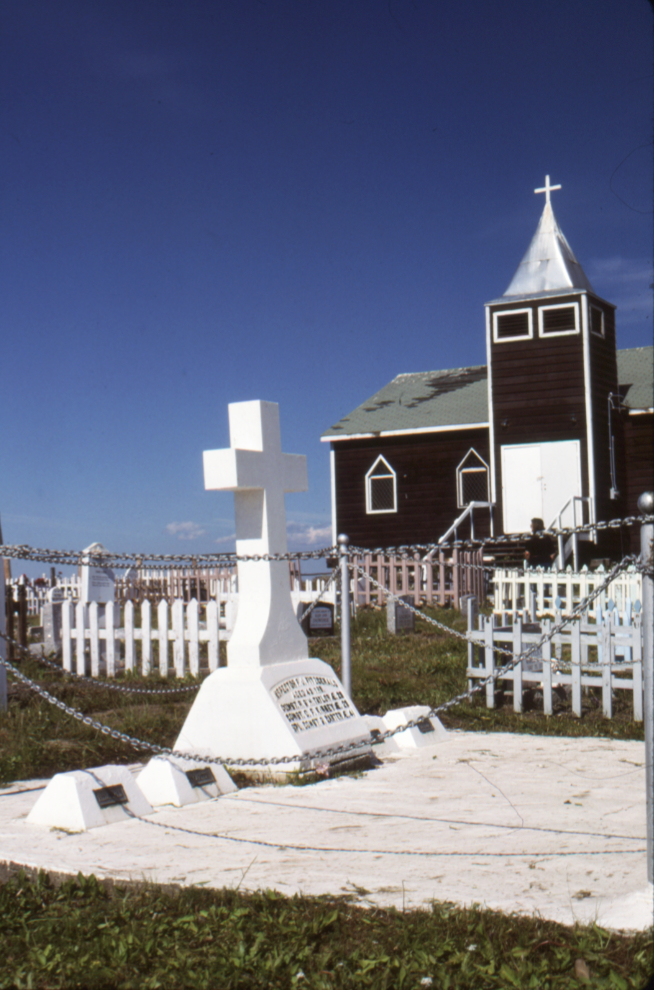
In the distance, the memorial to The Lost Patrol of the Royal Northwest Mounted Police can be seen. On December 21, 1910, Inspector Francis Joseph Fitzgerald, Constable Richard O’Hara Taylor, Constable George Francis Kinney and their guide, Special Constable Sam Carter set out from McPherson on a 620-mile dog sled journey to Dawson City, but they never made it. Once their bodies had all been found, all four men were buried here.
This is what the Lost Patrol memorial looks like in the summer – I shot this photo while there guiding a tour on July 20, 1991. The church sure looks better in white, doesn’t it?
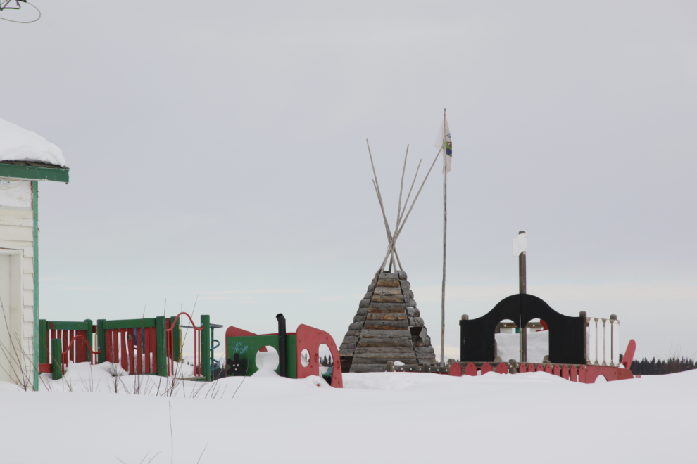
That looked like a great playground but deep snow prevented a closer look.
At the approach to the church is a Parks Canada plaque. It reads:
This hill called Chii tsal dik, with its exceptional views, has been part of traditional TeetBit Gwich’in lands for many generations. In 1840, the Hudsons Bay Company established the first trading post north of the Arctic Circle six kilometres upriver from here, to trade meat and furs with the Gwich’in and Inuit. Moved to this location in 1848, Fort McPherson was the principal trading post in the Mackenzie Delta region for over 50 years. The settlement that grew around the fort became a centre of missionary activity after 1860, and the site of the Western Arctic’s first North-West Mounted Police post in 1903.
Fort McPherson was designated a national historic site in 1969. Fort McPherson National Historic Site of Canada consists notably of the remains of the Hudson’s Bay Company trading post as it was in the 19th and early 20th centuries and of the post of the Royal North-West Mounted Police as well as the existing Anglican and a Roman Catholic missions. Official recognition refers to the boundaries of the community of Fort McPherson as it was mapped in 1898.
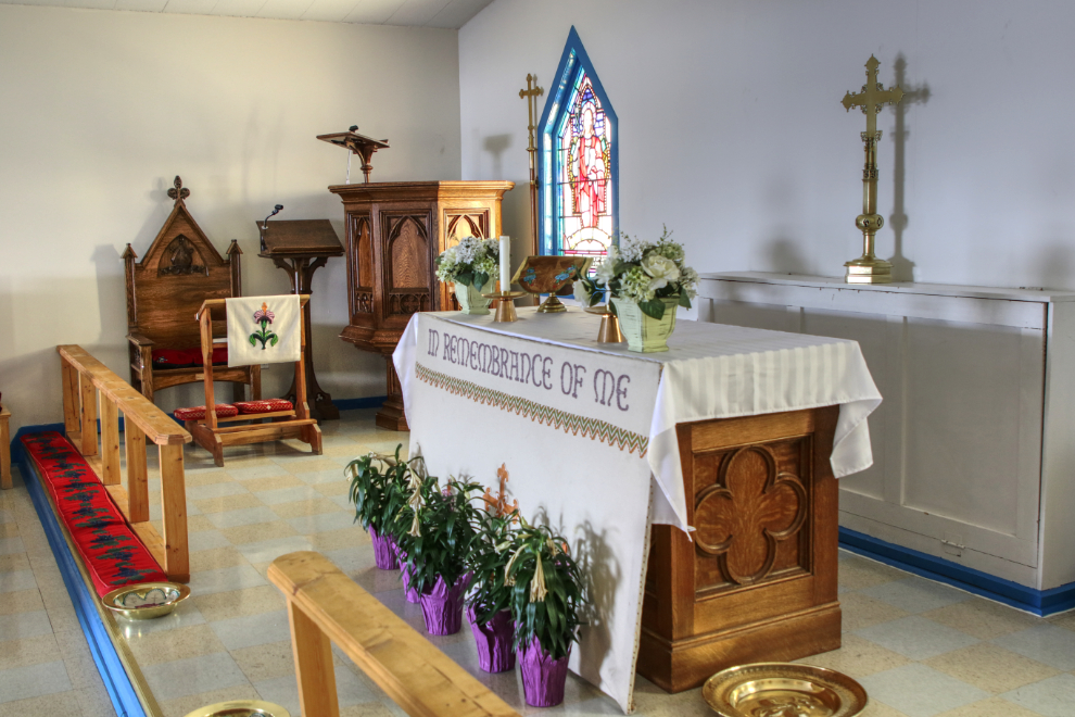
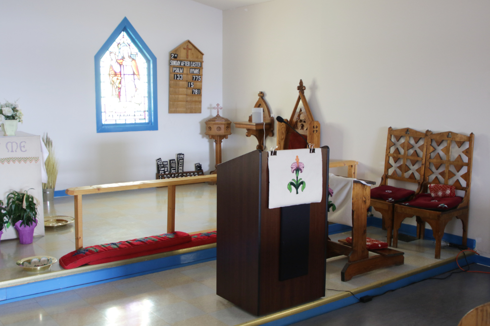
Finding the church welcoming with a shovelled sidewalk and unlocked door, I of course went for a look.
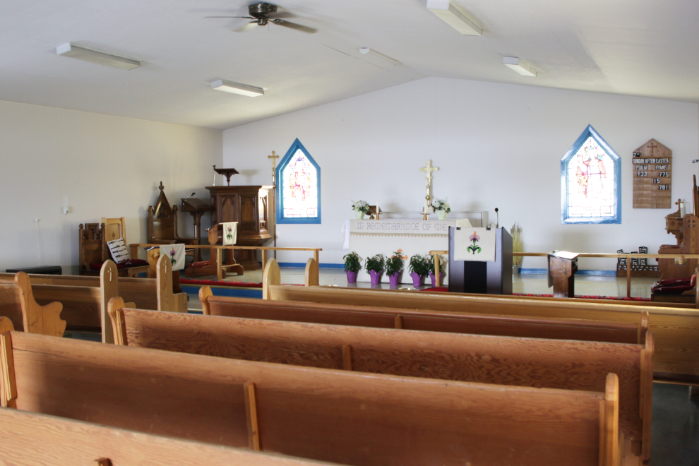
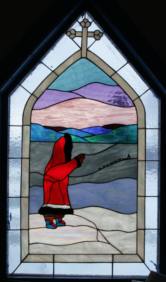
There are some very nice stained glass windows.
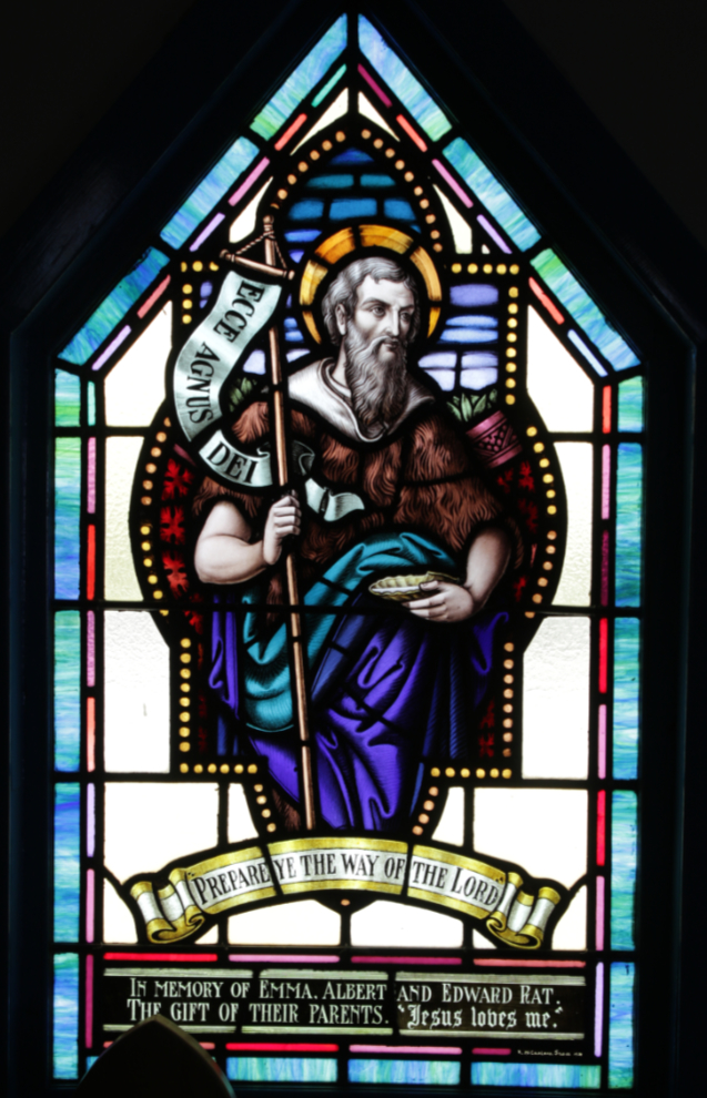
Among the traditional designs is this one. Those of you who know me won’t wonder about which is my favourite 🙂
The church is very plain yet has some wonderful details. I’m grateful that I got to see the inside.
A general view of the residential area from the church steps.
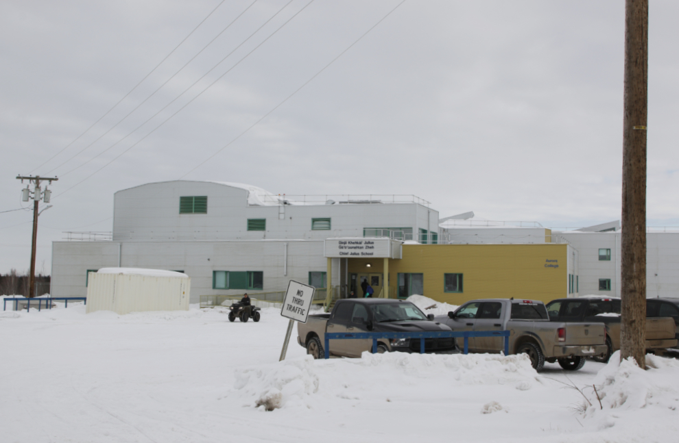
The Chief Julius School.
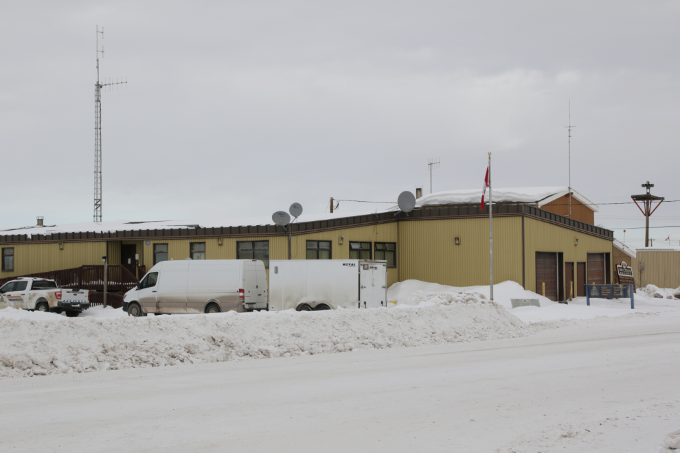
The RCMP detachment.
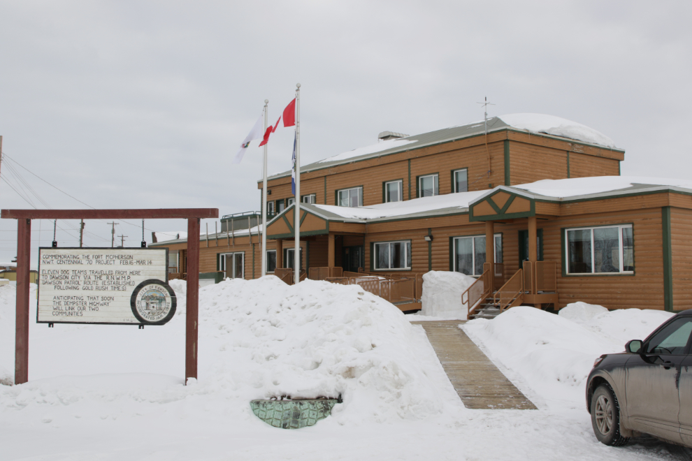
In front of the Fort McPherson Hamlet Office is a sign commemorating the 1970 event that saw 11 sled dog teams travel from there to Dawson City in 26 days, “anticipating that soon the Dempster Highway will link our two communities.”
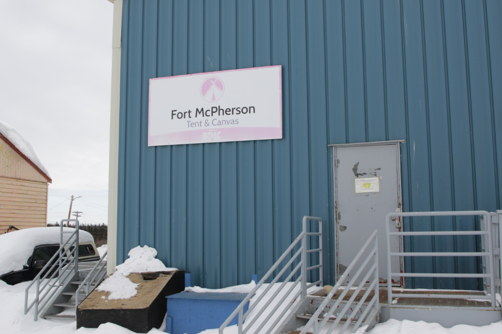
Back in the day, the Fort McPherson Tent & Canvas place was very welcoming, with a large display area and gift shop, and the ability to watch people make the wide variety of products they made. Now none of those things is true and their focus is canvas wall tents and tipis. In the early ’90s I almost bought one of their incredibly soft musk ox leather attache cases as a piece of art, not to use, and I’ve been regularly using one of their day packs for 32 years now, only replacing the main zipper a few years ago.
At 1:05 we were back on the Dempster Highway, headed for Dawson City.
All the snow in your wonderful photo display makes me think, 95 degrees in Ft. McPherson on 8/7/2024? Hotter there than in parts of Florida? What a beautiful, yet bizarre place. Thank you for opening my eyes to this beautiful place. So much history.
Thanks for commenting, Phil – I’m glad that you enjoyed discovering Fort McPherson. Those super-hot days seem to be getting more and more common, in an area where they would prefer to have none of them.
Great post, and loved the photos in town and on the road.. SO MUCH OPEN SPACE !!! (That highway mileage sign says everything, distance wise). Would love to have this journey on my bucket list, fall maybe for the colors and a drier road. Even your old buddy kicking in that story about the full moon reveal… wonderful. Another nature boy.
Thank you. The Dempster Highway is good drive to have on a bucket list – the Fall colours are incredible, but come early (mid August).
Paul has no end of good stories from those days 🙂
Another amazing job, seeing the Dempster in the wintertime beautiful, Fort McPhoo is a nice little stop on tour, with the tent and canvas, graveyard and the northern store, you have 31 trips and it reminded me that my number was 25 Horizon holidays trips times 2 = 50 total, those were the days eh Murrster, remember that day I was jogging on the dempster having a overnight at Eagle plains , hearing a vehicle coming I saw you dead heading southbound with the Atlas coach and hung the moon to celebrate your arrival, then jumped out of the way just as you were cruising by dusting out my moon, those were the days Eh 🙈🍻
Those were indeed the days, my friend. We were very lucky to experience the things we did on those busses. Yes, I remember the full moon at Eagle Plains! 🙂