Driving from Lillooet to Goldbridge and Bralorne
One of my aims for our visit to Lillooet was to spend a day on “the road much less travelled”, to the historic gold mining towns of Goldbridge and Bralorne. What a day it was! There are 58 photos and a map in this post.
Click here to open an interactive version of the map in a new window.
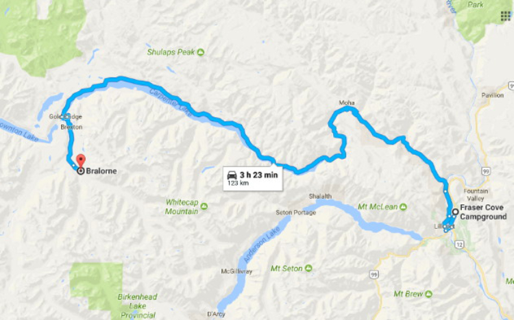
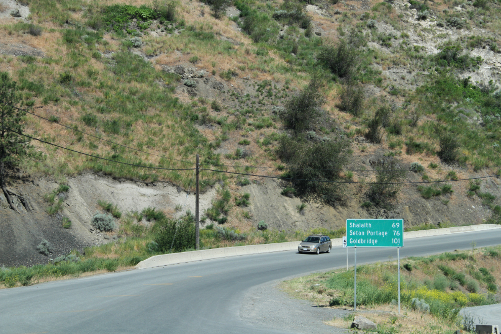
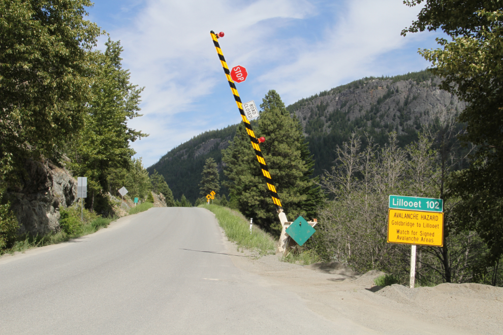
At 10:15, we pulled away from downtown Lillooet. The distance sign says “Shalath 69; Seton Portage 76; Goldbridge 101.”
The route to Bralorne is one road as you drive it, but the sections as you go west are called the Moha Road, Bridge River Road, and Lillooet-Pioneer Roads (Road 40). In the next photo, we’re dropping back down to the Fraser River, 5 minutes from Lilloett.
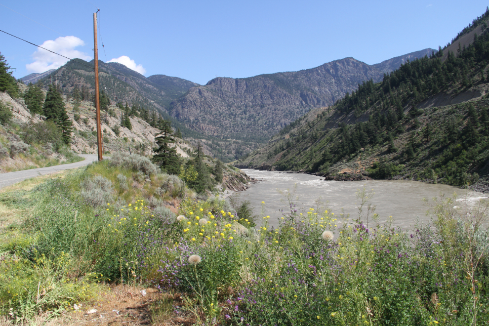
A pullout along the Fraser River called for a photo stop.
At 10:30, the first of the day’s one-lane bridges is just ahead. It crosses the Bridge River, which we’d be close to for most of the day.
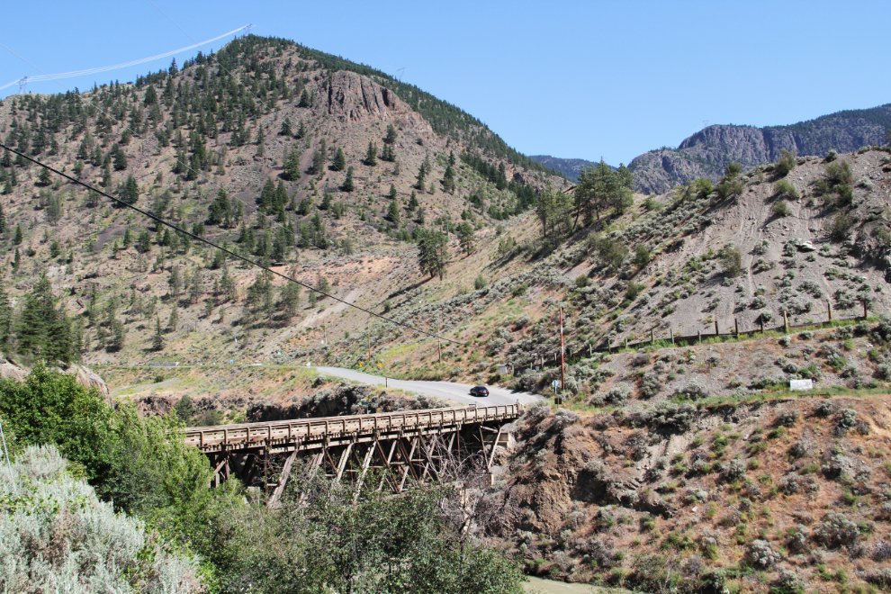
A little canyon on the Bridge River, just above the first bridge.
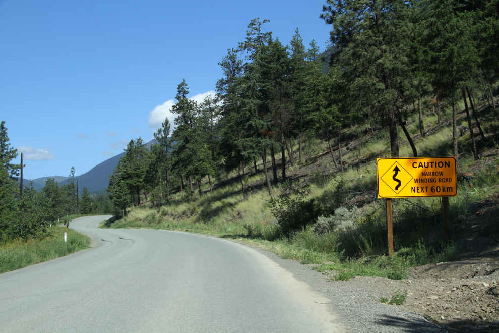
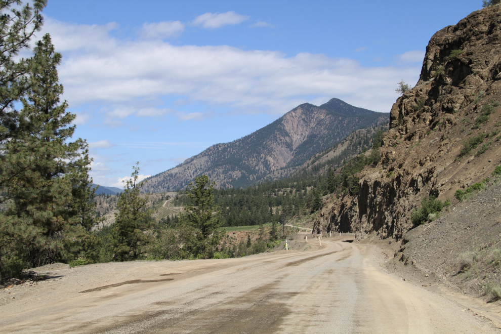
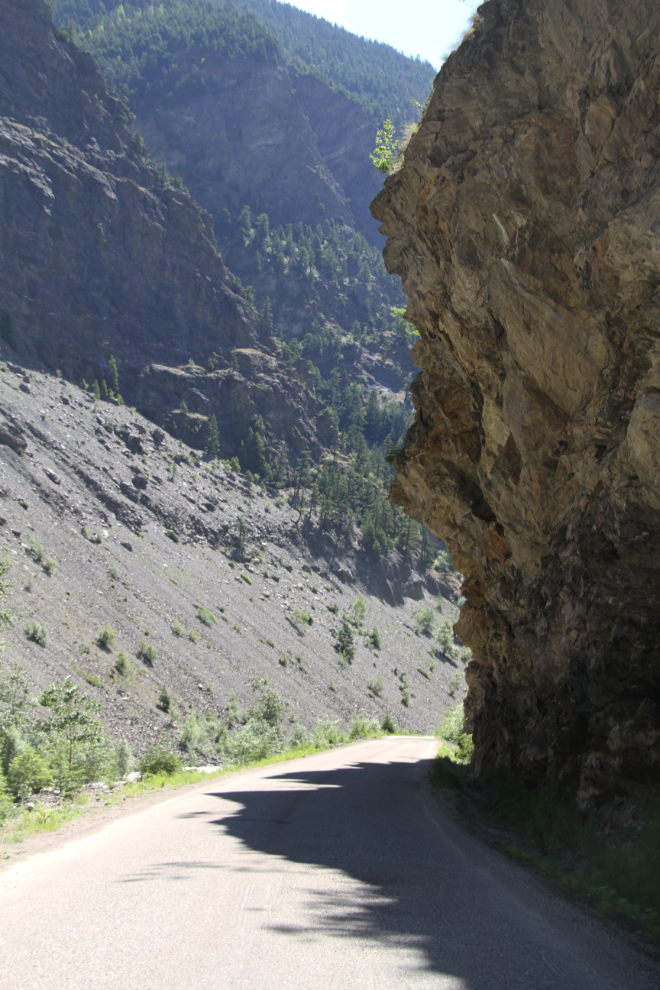
At 10:35, the sign says: “Caution, narrow winding road next 60 km.”
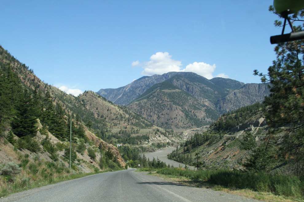
The country changes quite rapidly as you climb to the northwest away from the Fraser River. This was shot at 10:45 – only 30 minutes from downtown Lillooet.
Looking back to the east at 10:50.
11:00
Far down along the river at 11:03, a mineral spring?
Looking back to the east again, from the same spot I took the photo above from.
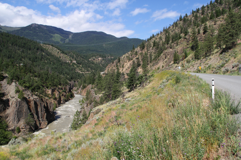
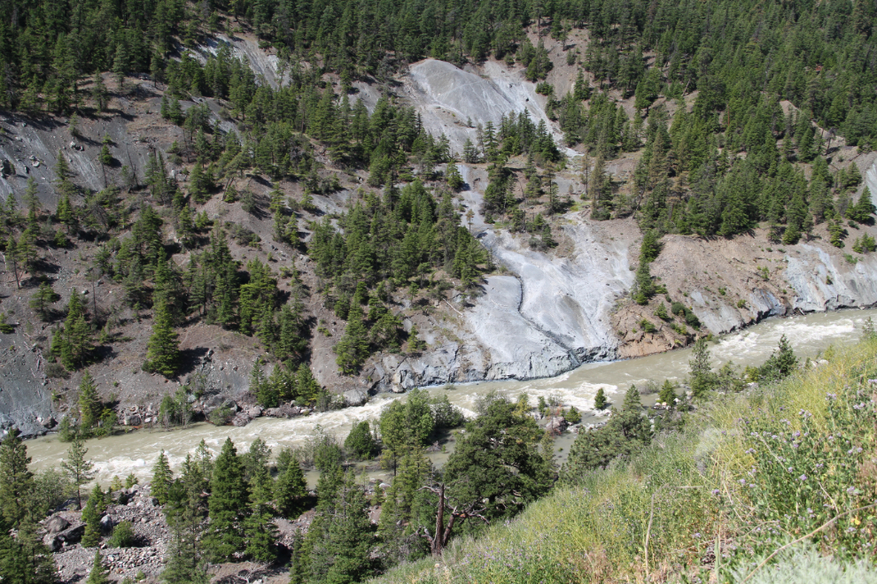
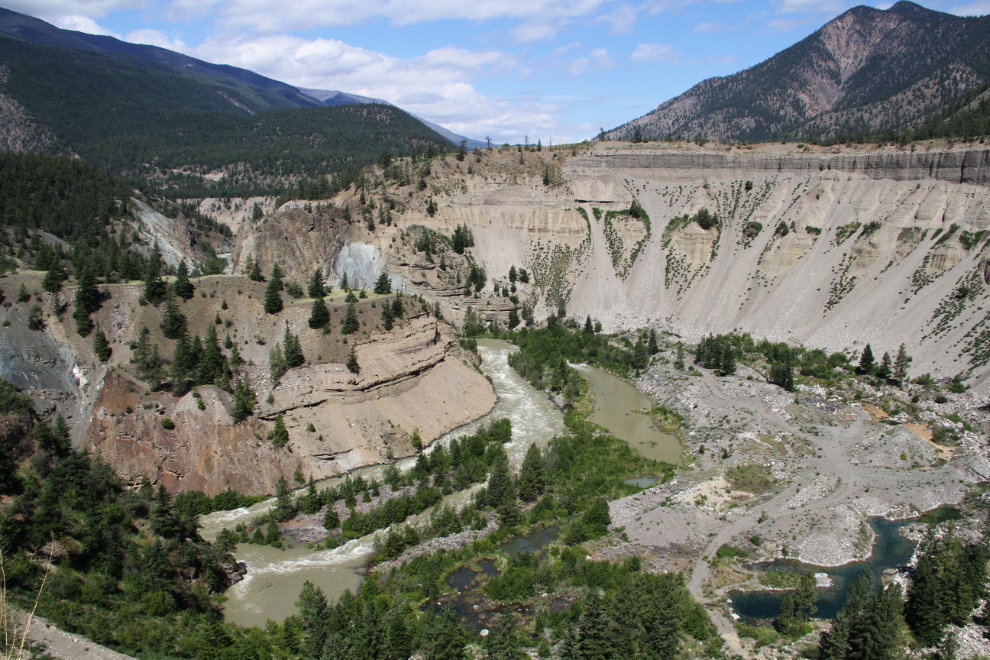
The power of even a fairly small river is shown by this horseshoe canyon left as the river cut a shorter path.
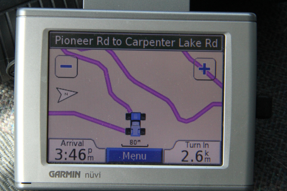
A GPS look at the series of switchbacks that drop the road back down to the Bridge River, at 11:15.
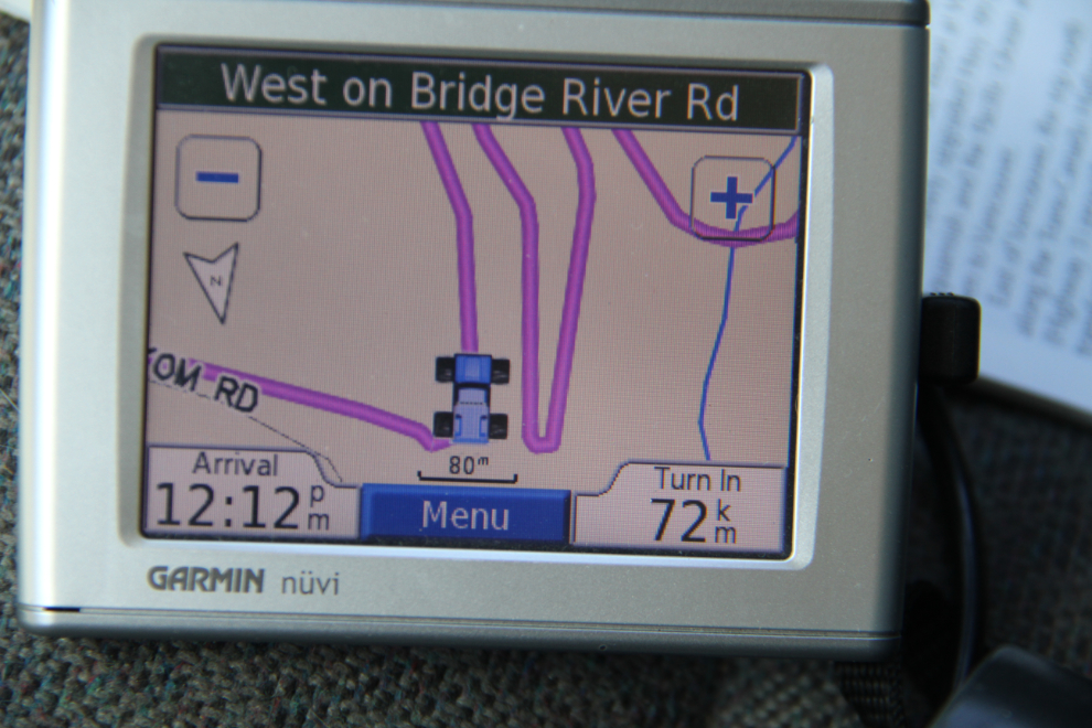
This is what that series of switchbacks looks like in real life.
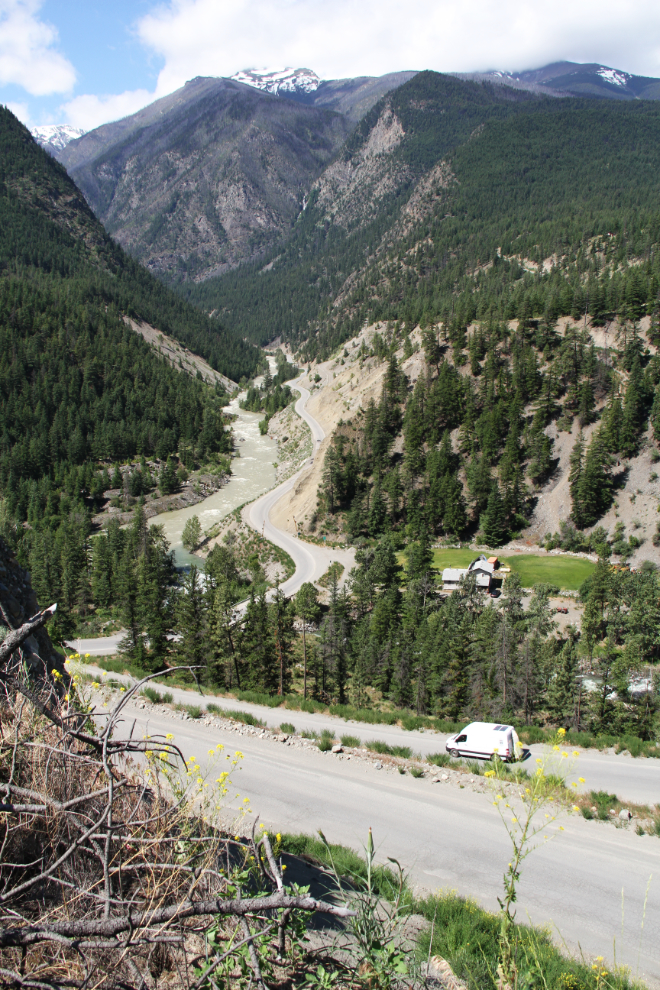
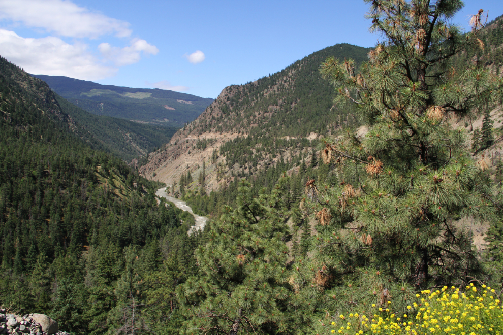
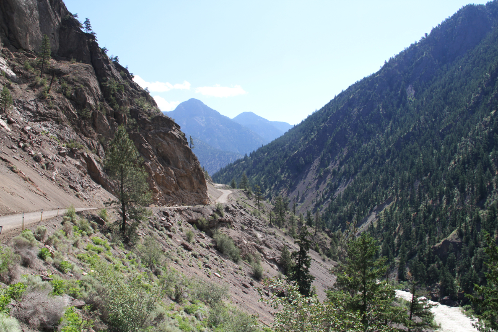
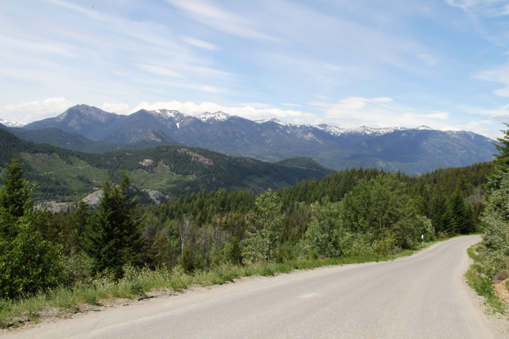
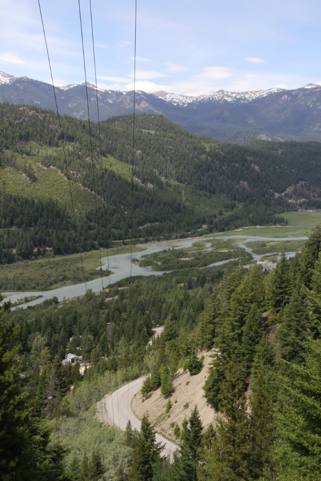
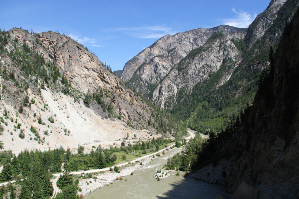
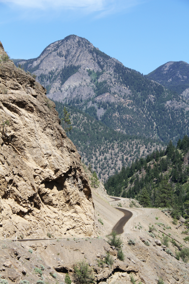
By 11:23, the drive had taken a major jump in impressiveness!
The view ahead, 3 minutes later.

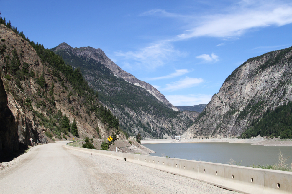
The Terzaghi Dam came into view at 11:35. Built in 1948, this is a major component of the Bridge River Hydro System.
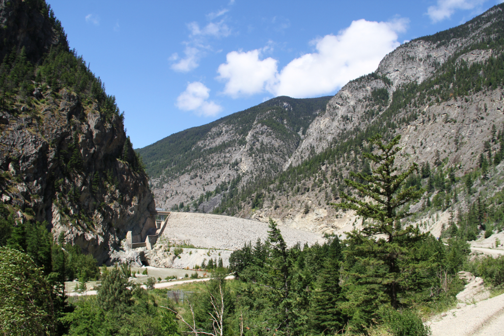
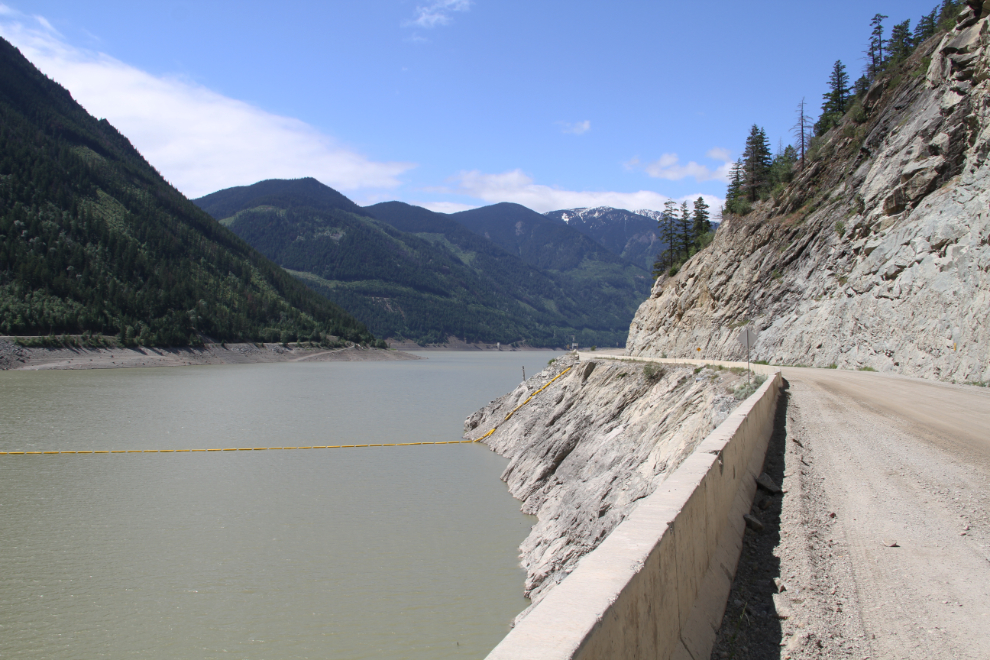
Carpenter Lake was formed by the Terzaghi Dam. With the Bridge River as high as it was, I was surprised to see the lake so low. Water from Carpenter Lake, though, is used to keep the level of Seton Lake up by means of penstocks drilled through the mountain between the two lakes.
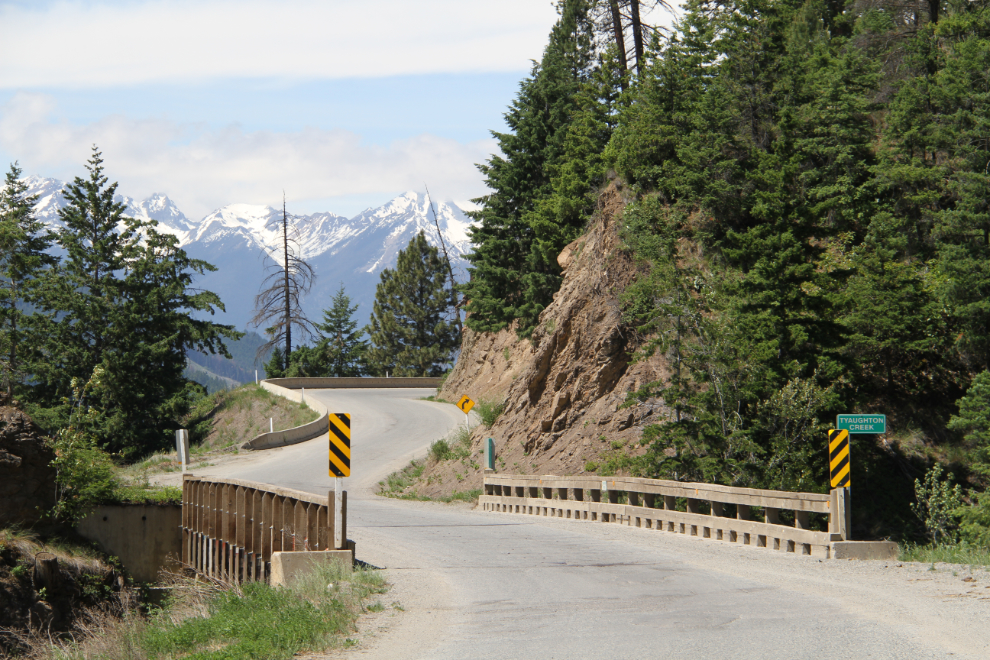
At 12:15, Tyaughton Creek empties into Carpenter Lake.
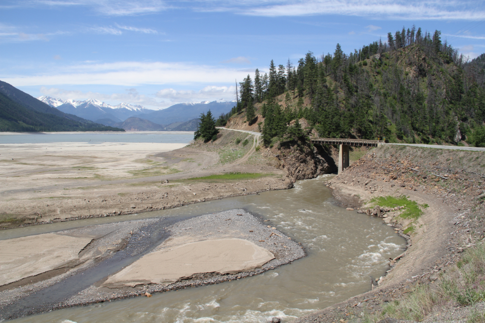
Another one-lane bridge, over Tyaughton Creek.
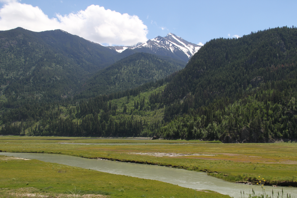
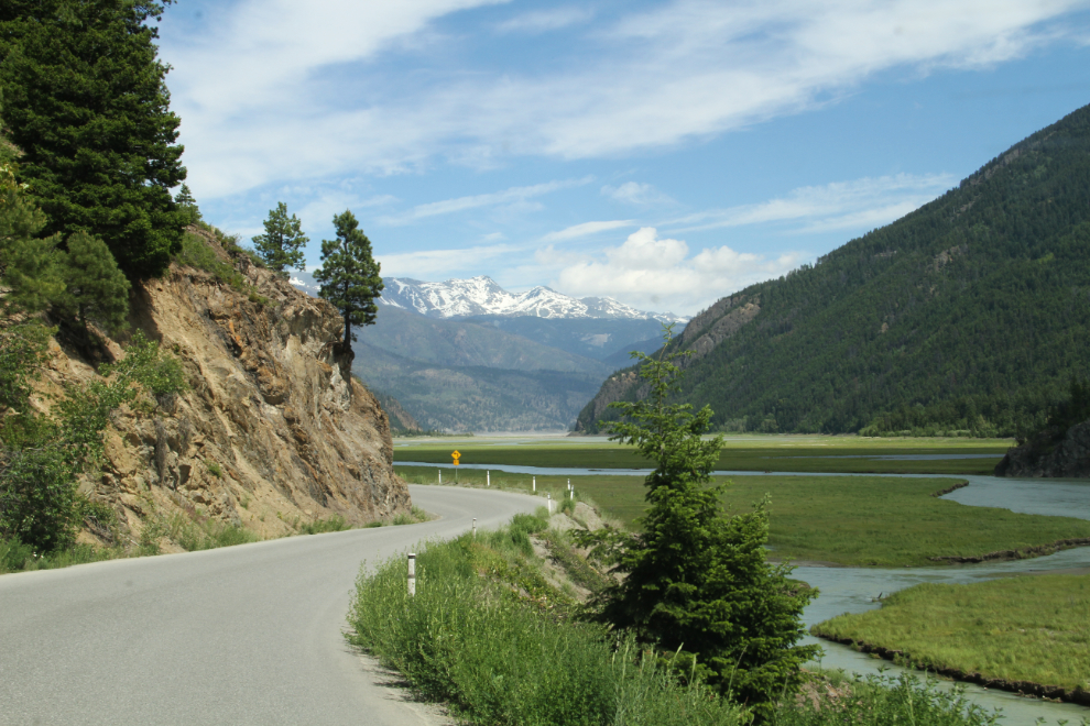
At 12:30, we had reached the head of Carpenter Lake.
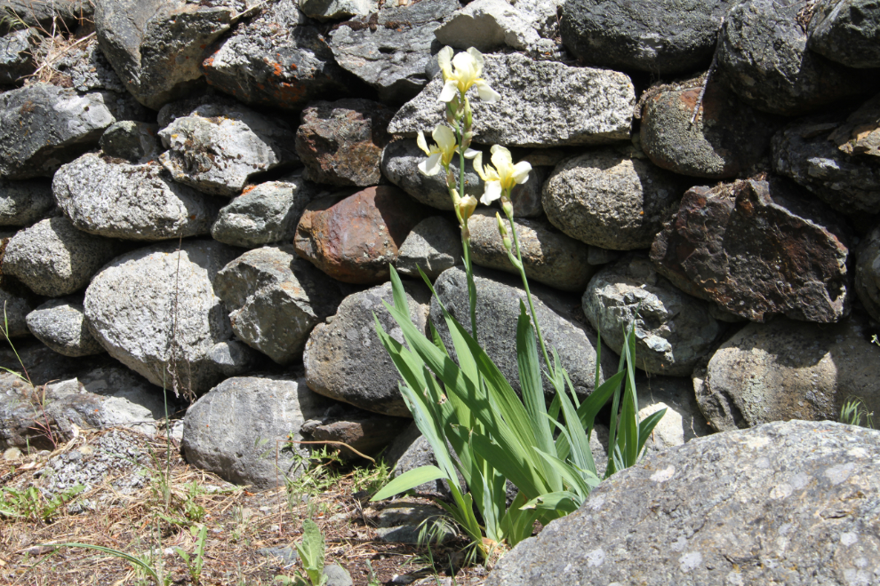
Approaching Goldbridge a few minutes later, I stopped at a historic site that the community is trying to develop. Haylmore was the home of the Mining Recorder in the early 1900s, and when men didn’t have the money to record a claim they wanted to stake, he would have them build rock walls. While there are a lot of rock walls, photos from that period show many more, and in much better condition. A little craft store and visitor centre is being operated on the site – one of their home-made scones was just what Bella and Tucker and I needed.
A botanist who visited the site has just let the community know that this iris may be one originally planted by Mr. Haylmore more than a century ago.
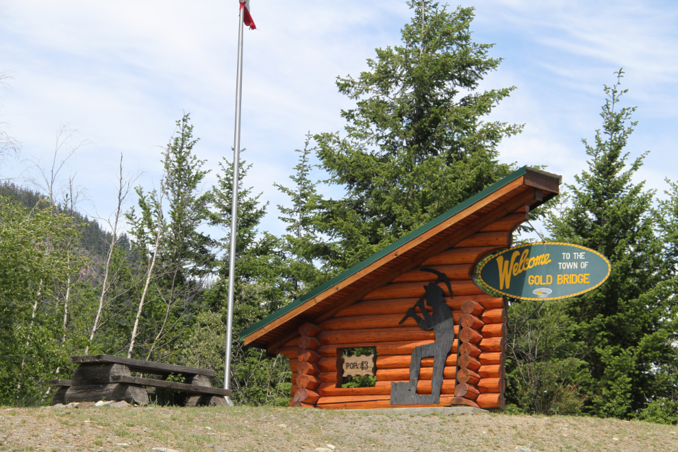
“Welcome to Gold Bridge.” Note that two words are used. Even in official ways, even within the community, “Gold Bridge” and “Goldbridge” are used interchangeably. On this sign, the population is noted as 43, making it the service capital of the region 🙂
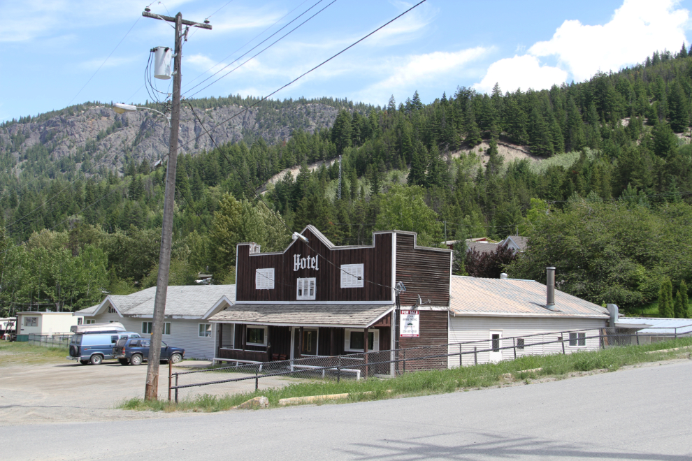
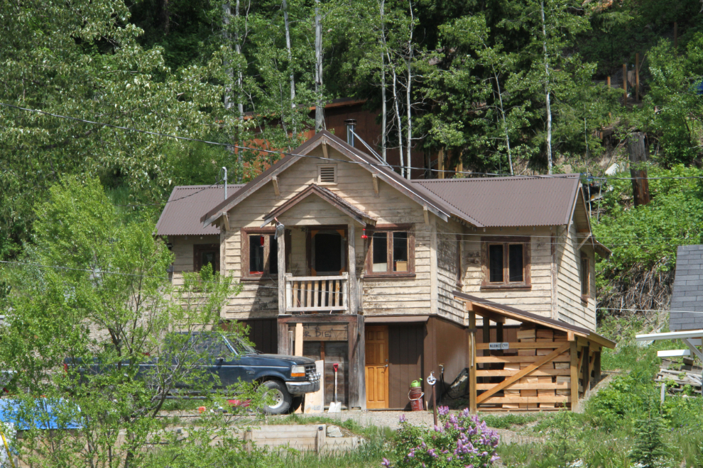
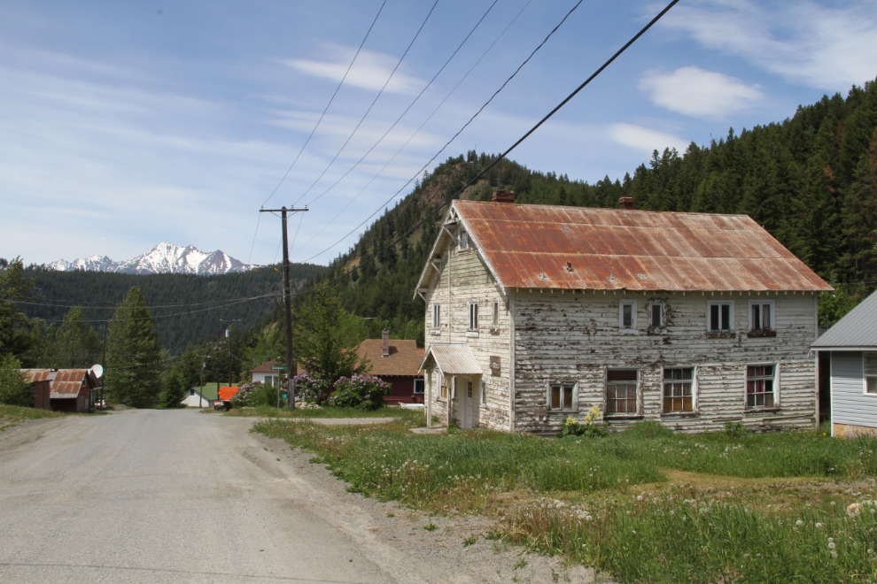
The Goldbridge Hotel, at 1:20. It’s for sale, as are a high percentage of properties in the region.
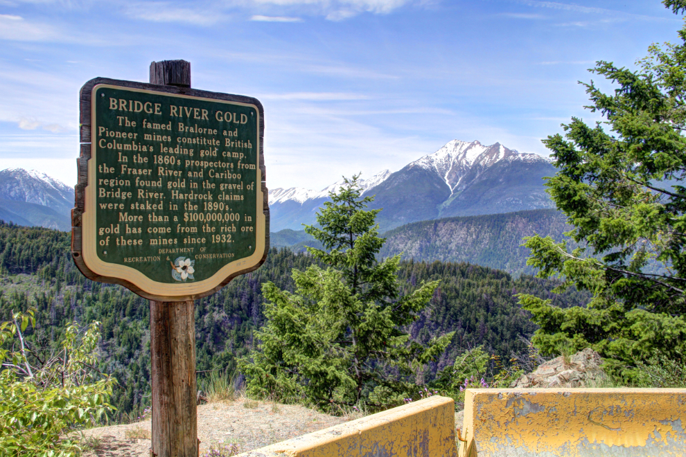
A heritage sign on the steep climb up to Bralorne, at 1:30. “Bridge River Gold. The famed Bralorne and Pioneer mines constitute British Columbia’s leading gold camp. In the 1860s, prospectors from the Fraser River and Cariboo region found gold in the gravel of Bridge River. Hardrock claims were staked in the 1890s. More than $100,000,000 in gold has come from the rich ore of these mines since 1932.
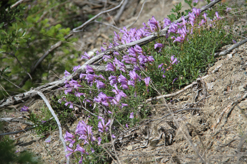
Below the heritage sign, some brilliant wildflowers.
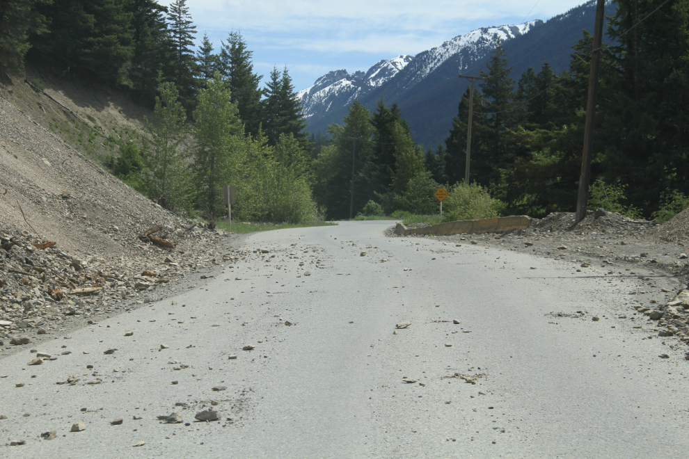
Although it doesn’t show in the photo, those rocks on the road are very sharp, and could puncture a tire.
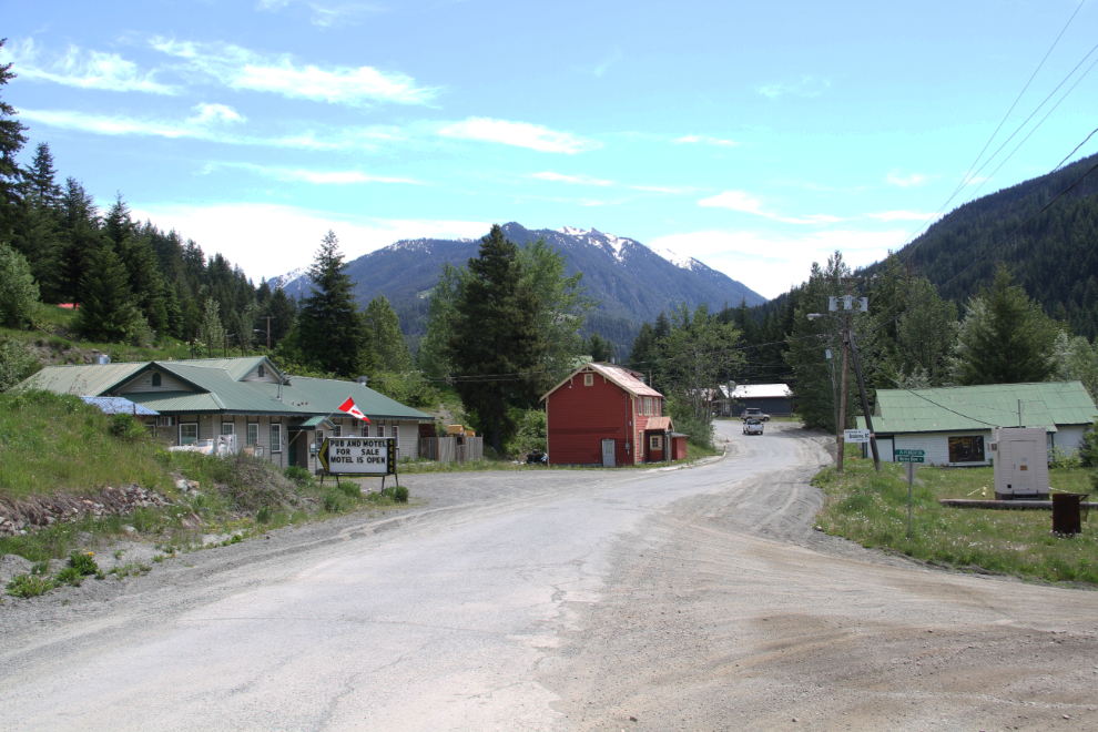
Bralorne, at 1:40. Made it! My Dad brought me here in 1964 during one of our old-mine exploring trips, and this was my first visit since. A sign on the left says: “Pub and Motel For Sale. Motel is Open.” The sign on the door of the motel with no apparent name said: “Closed”.
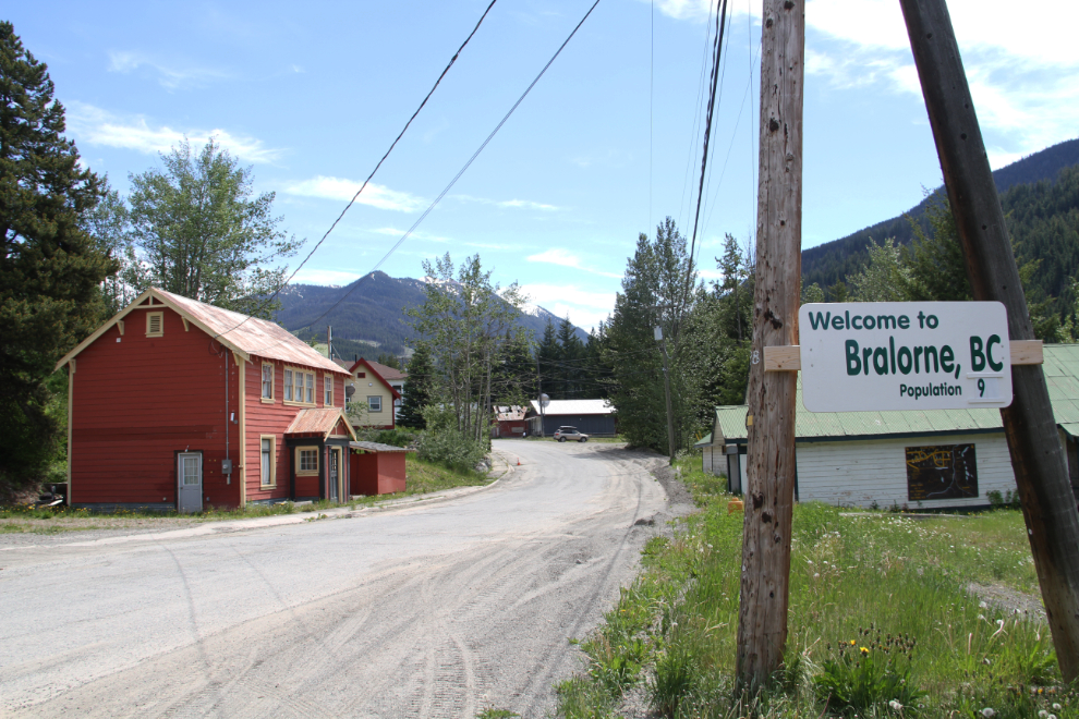
“Welcome to Bralorne, BC. Population 9.” I had been chatting with 1/9 of the entire population of Bralorne at the Haylmore historic site 🙂
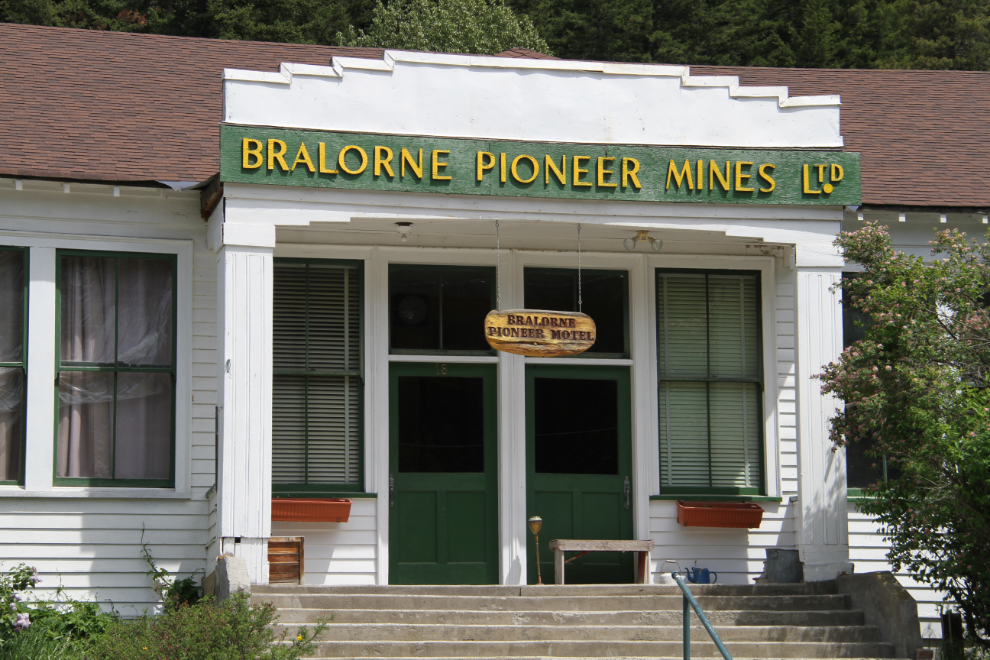
The former offices of the Bralorne Pioneer Mine has a small sign that it’s now the Bralorne Pioneer Motel, but it didn’t seem to be open.
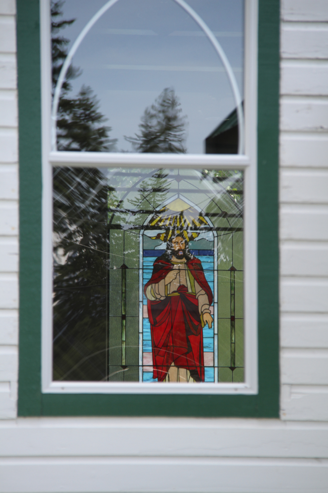
The old Bridge River Valley Community Church is lovely – one of the very few well-maintained buildings in Bralorne.
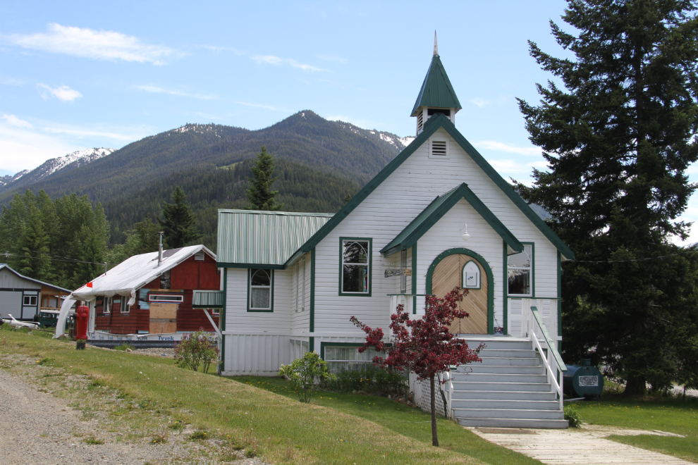
Peeking through a window at a stained glass panel.
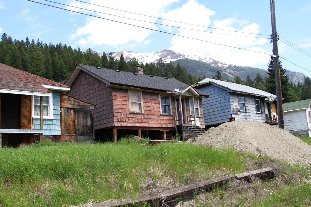
Across the street from the church, someone’s plan that died – they’re all for sale. A fairly nice home nearby had $139,900 posted on their For Sale sign.
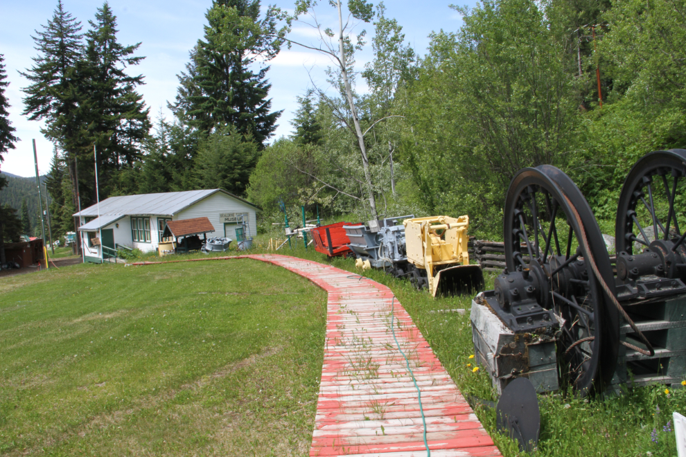
A roadside sign said that the Bralorne Museum was open. It wasn’t. A car outside the museum hadn’t moved in many months.
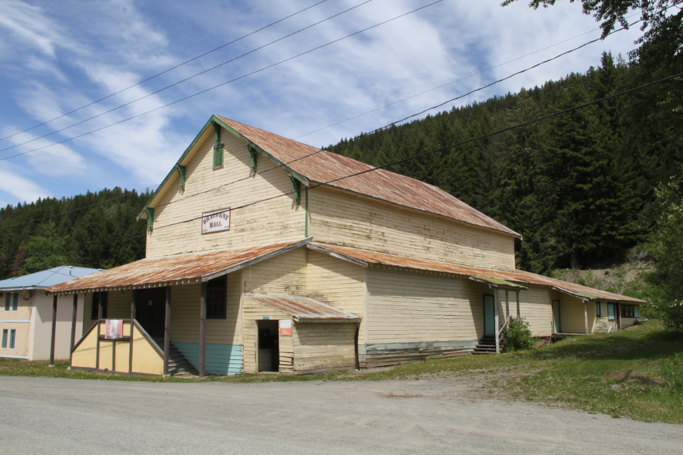
The Bralorne Hall. A sign beside the door on the right indicates that it was (maybe still is) the post office. Canada Post doesn’t acknowledge Bralorne as a community, though – the post office name is “Gold Bridge, V0K 1P0.” The Bralorne resident I was talking to at Haylmore had told me that.
The only person that I saw in Bralorne was on the porch of this house.
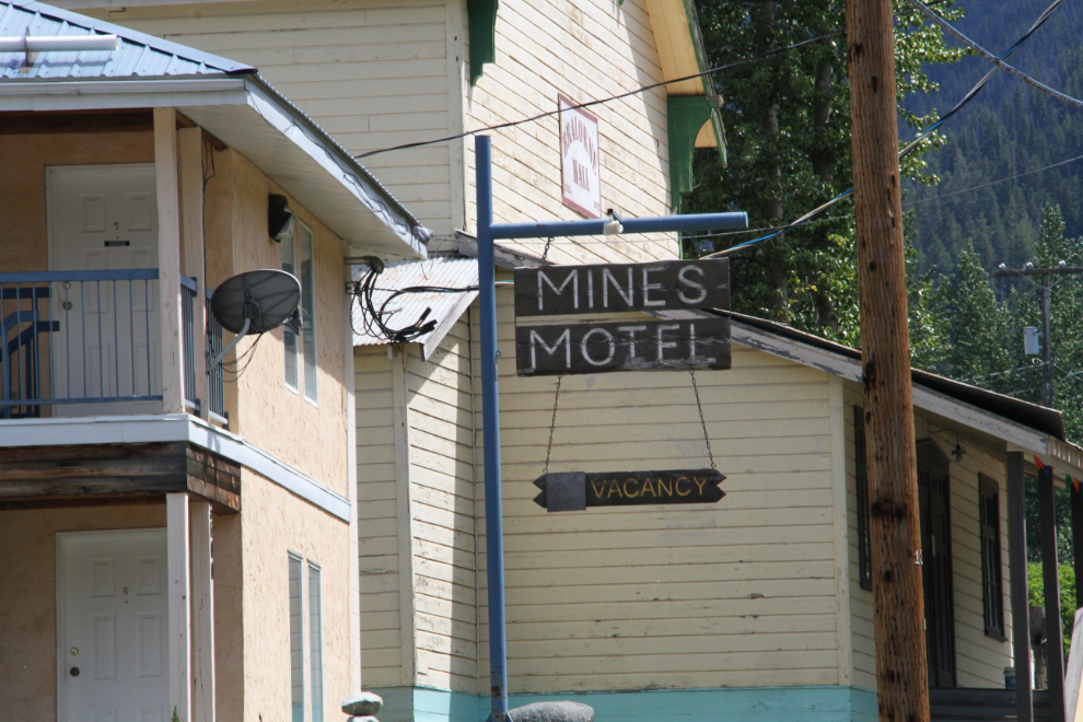
“Mines Motel. Vacancy.” Well, there would be a vacancy if it was open. It wasn’t.
A barely-legible small sign on the front of this building indicates that it was last open as the Bralorne Inn.
I only spent a little over 20 minutes at Bralorne. There is a lot to see and do in the area, but you need to go with a plan, and I didn’t have one beyond getting there. The road in to Bralorne is so rough that I don’t know if I’d take the RV in – it will certainly be a slow trip if I do. Bralorne can be seen as sad, but it’s really just the reality of what was basically a company town. They virtually all die. Attempts have been made to turn Bralorne (and Goldbridge) into tourist towns, but with no luck. Communities like these attract a certain type of strong, independent people that I really admire. They’re always very interesting places to get into a conversation – preferably in a pub, but a historic site works, too.
Heading back down towards Goldbridge, at 2:10.
The steep final drop to Goldbridge is done with a series of switchbacks…
…as the GPS verifies.
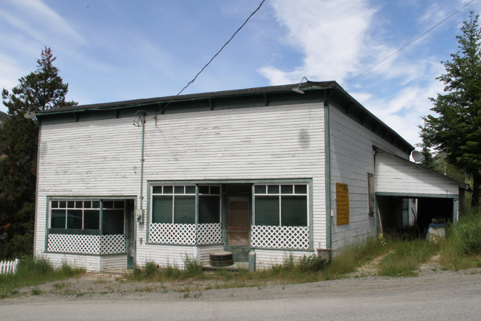
I just passed quickly through Goldbridge on the way to Bralorne, but had a look around the community on the return. This building was The Model Bakery back in the day. Kay and Bill Bean opened it in 1934, and ran it until 1967. They sold their first batch of bread – 50 loaves – for 5 cents each or 6 loaves for 25 cents. In the 1950s, they were baking 6,000 loaves of bread each week! As well as lot of other buns, cakes, pies, and so on.
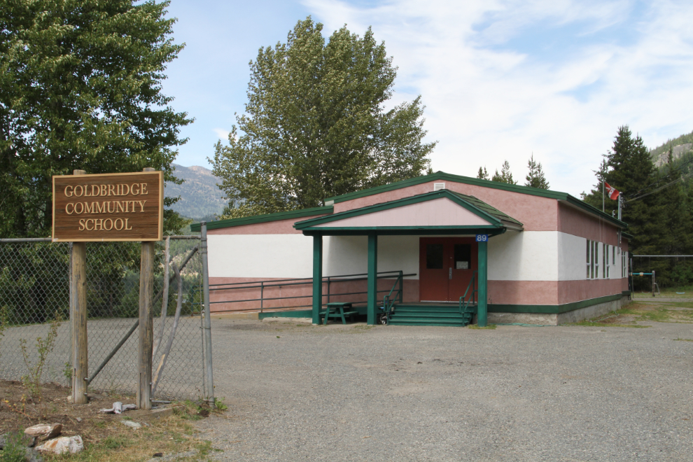
The Goldbridge Community School.
At 2:25, we were back on the road towards Lillooet, though still with some exploring to do.
The head of Carpenter Lake.
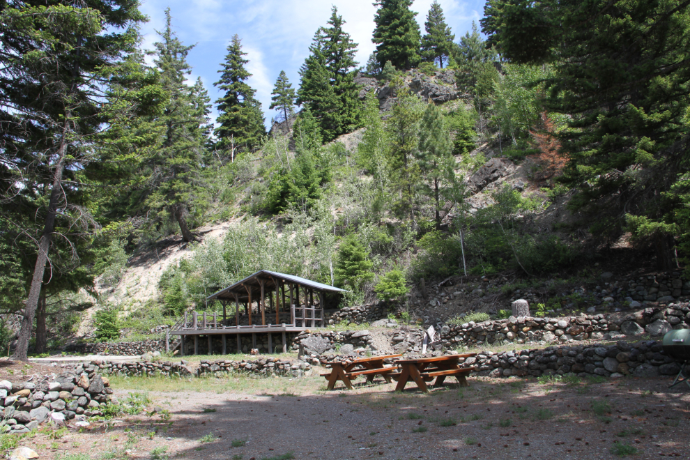
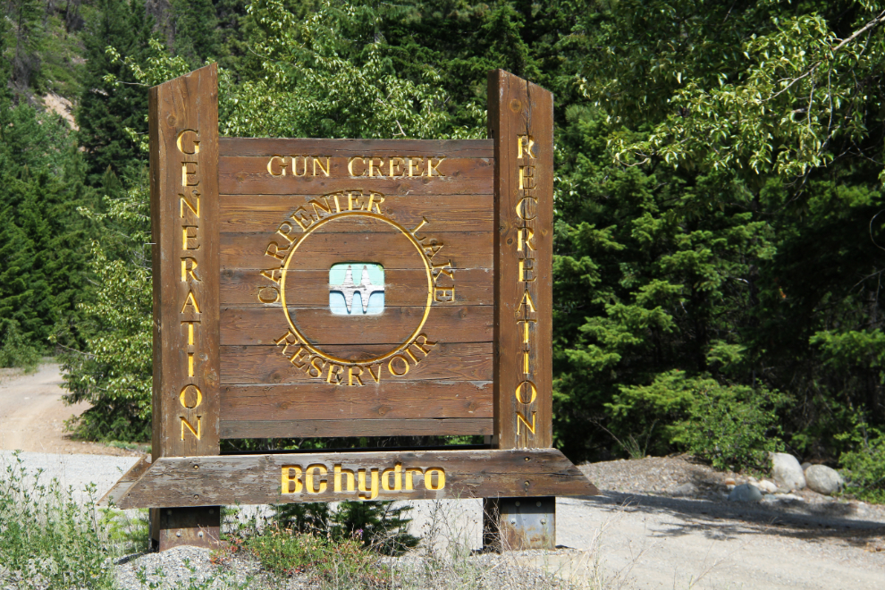
I stopped at BC Hydro’s Gun Creek Recreation Site for a look. The campground is beautiful, and suitable for a rig my size – only one of the 20 or so sites was occupied.
Across the road from the Recreation Site is “A. Kerik Camp”. I noticed it on the way but didn’t think anything about it. This time, I noticed the word “memorial”, and stopped for a look.
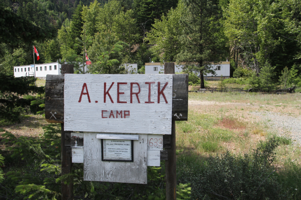
This large boulder (a volcanic bomb?), complete with a cave in it, has been turned into “A memorial to all prospectors who have lived and died looking for the elusive minerals.”
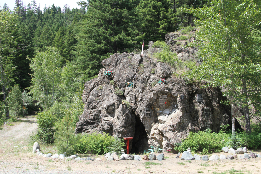
The founding plaque is dated 2011, and below it are plaques for Albert Kerik: “November 25, 1929 – . A love of prospecting is to be as close to Nature and God at the same time.” and Vimy Ida May (McEwen) Kerik: “Being a Prospector’s Wife was not always easy!”
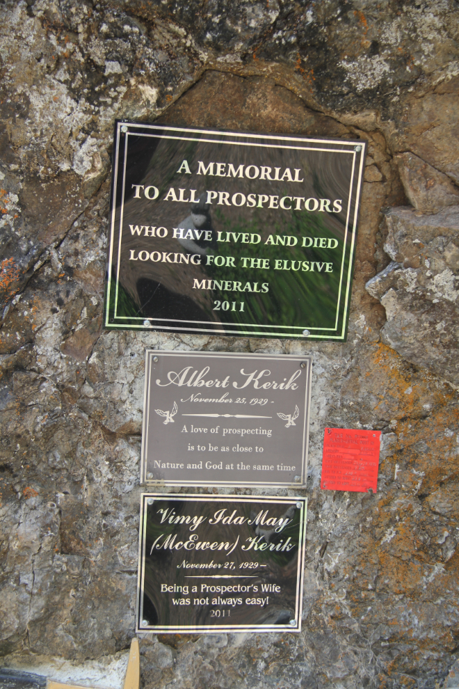
As well as memorial plaques, there are all manner of mining memorabilia on the memorial. There is a handwritten note from “Bert” – Albert Kerik, no doubt – offering to mount plaques for anyone who wants one added. I was pleased to add my name with “Granduc 1975” in the guest book.

At 3:40 we were back at the Terzaghi Dam.
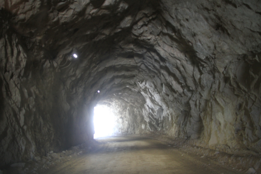
I really wanted to see the community of Seton Portage, on Seton Lake, but the time was too late. The tunnel that the road to Seton Portage starts with, though, was irresistible!
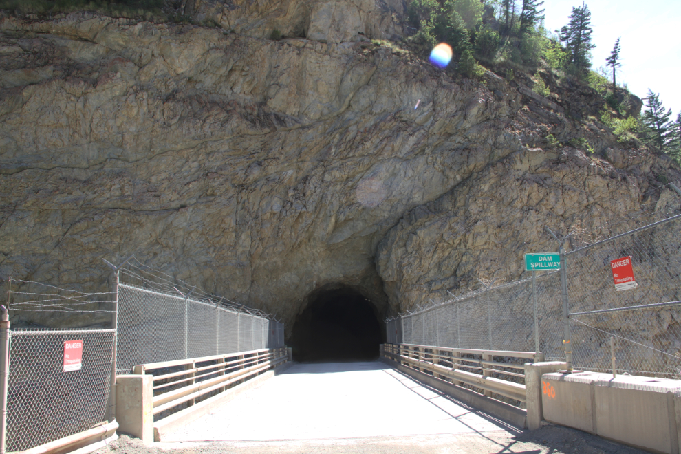
I love tunnels. That was probably a mandatory requirement for the job working underground at the Granduc copper mine.
Looking down the Bridge River from the top of the Terzaghi Dam.
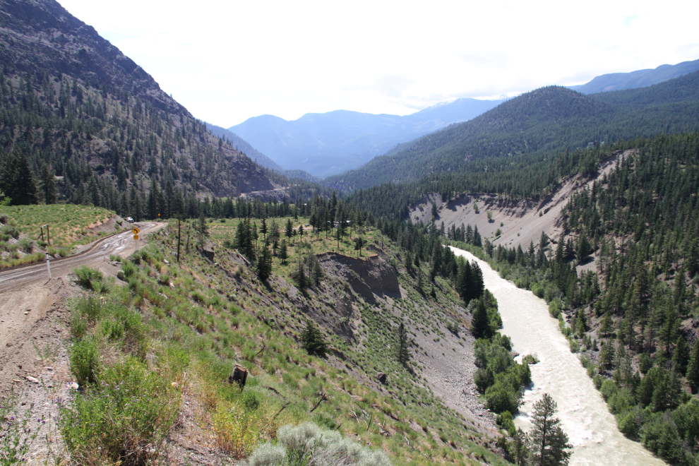
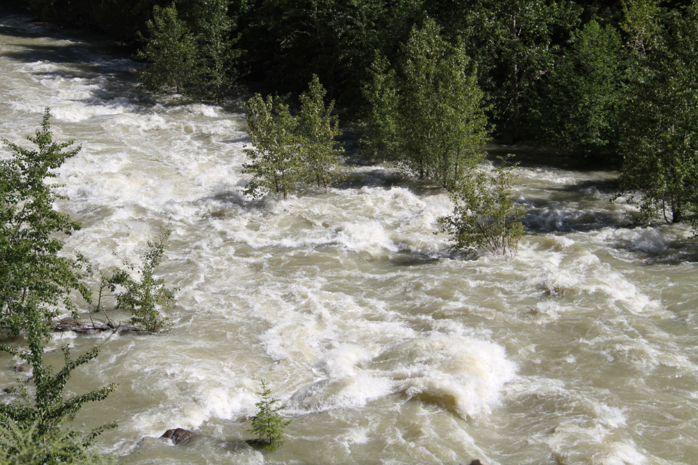
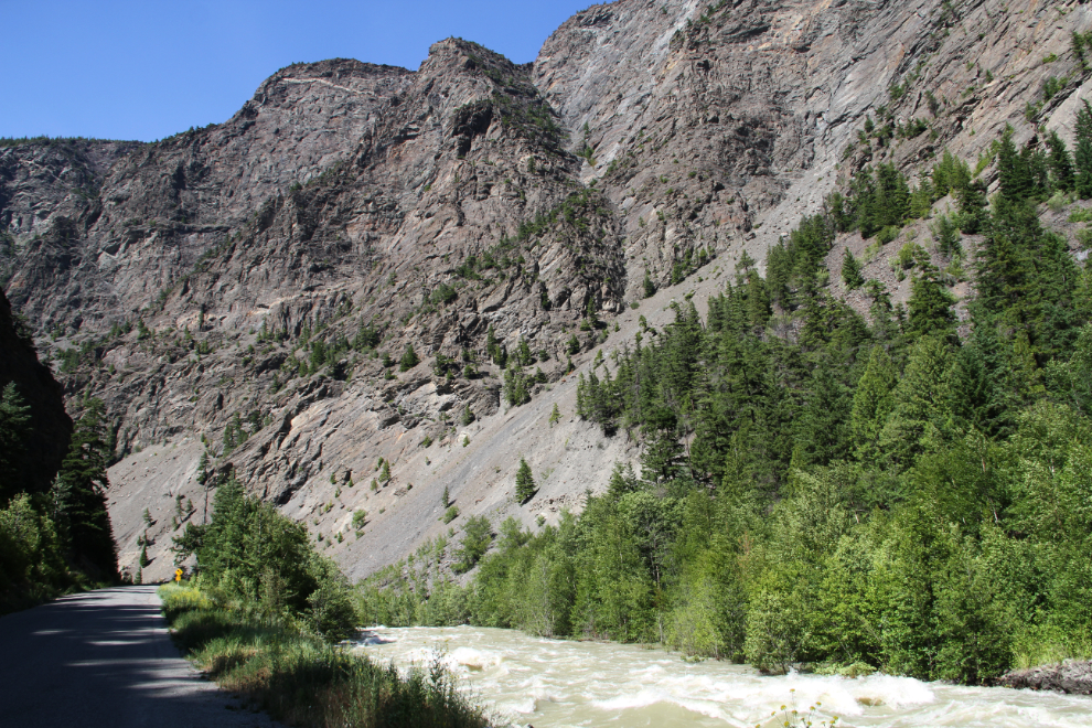
The Bridge River was really raging, going through the trees in many places.
Back at the most impressive few miles of the road, at 4:00.
One final shot, at 4:20.
For a few reasons, the drive to Bralorne and back will remain one of the most memorable days of the trip. I know that Dad was with me, and that he enjoyed it, too – it was very much in the style that he taught me…