Coastal BC from 35,000 feet
This article was originally written for the Destination BC Blog, and was re-posted here under the same date when that blog was closed.
The coast of BC, from the sea to the eastern side of the Coast Mountains, is a region so rugged that it needs to be seen from the air to really be understood. Flying is one of my passions, and I use any excuse to get into the amazing geography classroom commonly called “a window seat”. I had my own little plane for a few years and saw a lot of the coast and Coast Mountains in it, but the high-altitude air routes from Whitehorse to Vancouver, and Juneau to Seattle, are the ones that I fly the most now. They each provide quite different views of the coast, from the eastern and western sides of the Coast Mountains respectively.
Very few of the aircraft I fly the coast in now, usually Boeing 737s operated by Air North or Alaska Airlines, have the flight maps that are pretty much standard equipment in aircraft used on longer flights. Although there are GPS-enabled cameras and camera add-ons that make discovering the location of the photos you shoot much easier, and data logging is another option, I still do things the old way – checking the photos with maps and Google Earth. It’s not always successful, but it’s very educational regardless of the photo-identification result.
Departing southbound from Whitehorse, the Yukon/BC border is just a few minutes away. The lake at upper left in the first photo is Tutshi Lake, which is wholly in BC. The largest lake in the photo is Tagish Lake, whose Windy Arm straddles the border, as does Lake Bennett, the one at upper right.
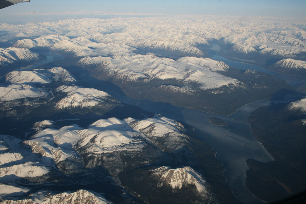
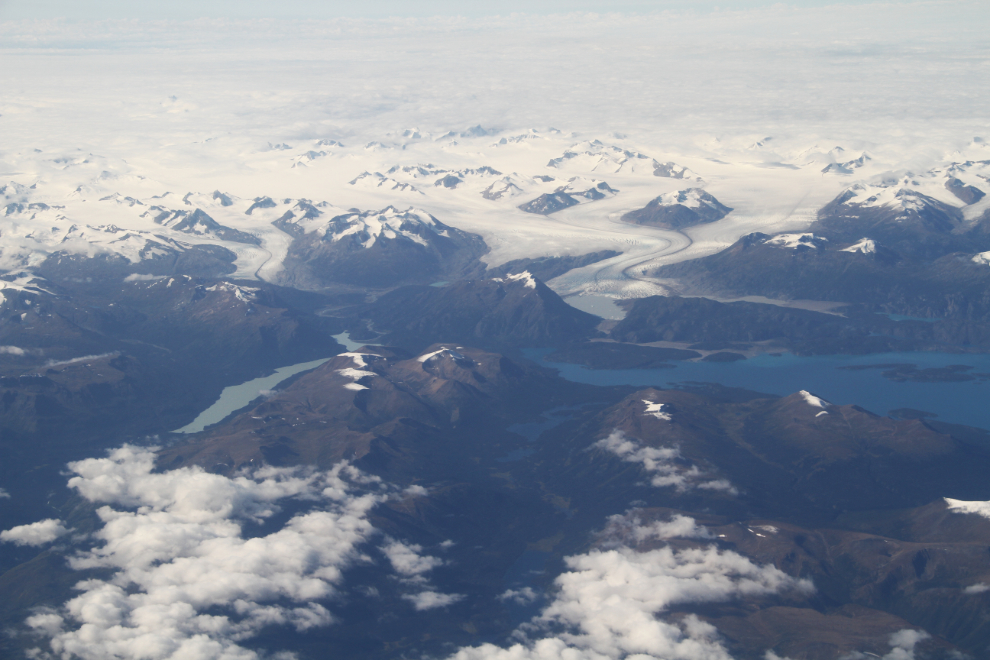
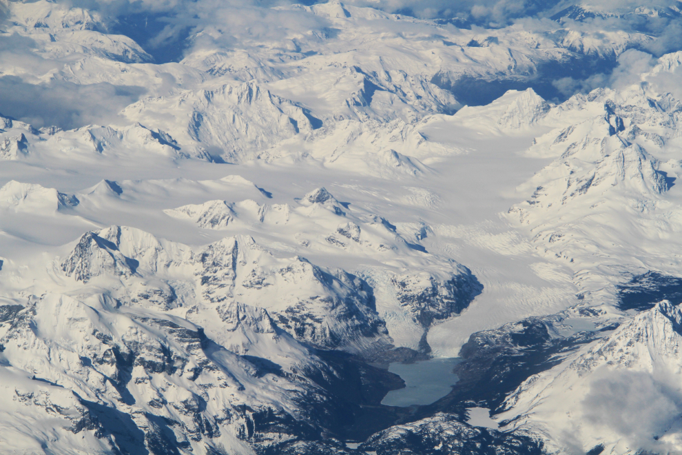
The furthest-northwest community in BC, Atlin, is seen from about the point where you reach your cruising altitude of 35,000 feet or so. At the south end of Atlin Lake, seen in the next photo, is the Llewelyn Glacier, which flows from the massive Juneau Icefield, most of which is in Alaska. The smaller milky-coloured lake to the left is Sloko Lake. This photo shows one of the advantages of flying on the east side of the Coast Mountains, in the rain shadow where clouds are less common.
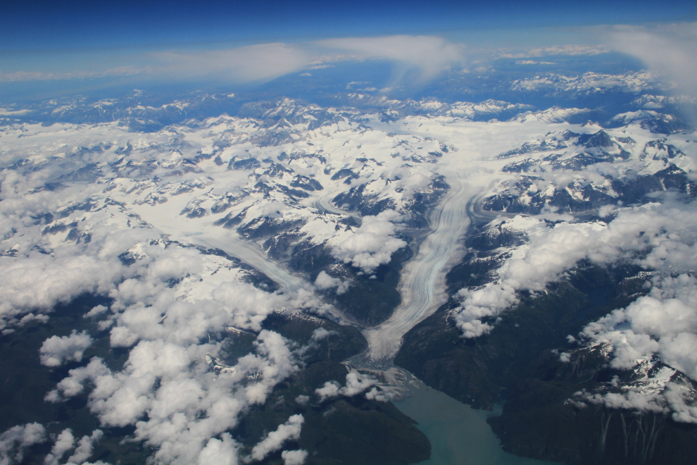
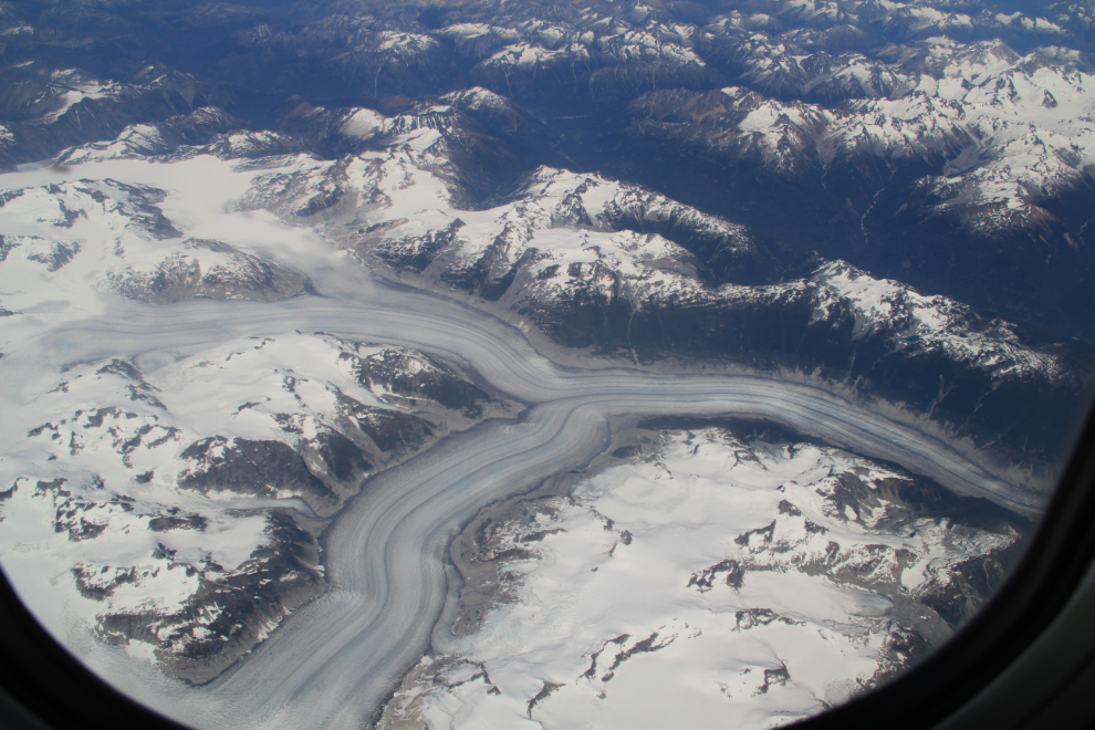
Departing from Juneau, you fly just west of the Alaska/BC border en route to Seattle. At the head of Thomas Bay just north of Petersburg are the Baird Glaciers, seen in the next photo. The North Baird Glacier is the smaller one to the left, with the main Baird Glacier being the main glacier flowing from the west side of the Stikine Icefield. While most glaciers around the world are retreating, many at dramatic rates, the Baird Glacier hasn’t retreated significantly since 1960. The BC border cuts across the photo slightly above the middle of it.
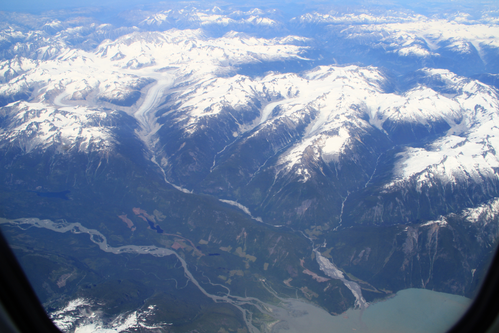
As grand as the broad views often are, it’s the details of the world that really fascinate me, and I use telephoto lenses a fair bit. The creeks, cliff, butte, and other landforms seen in the next photo are at the southern edge of the Stikine Plateau.
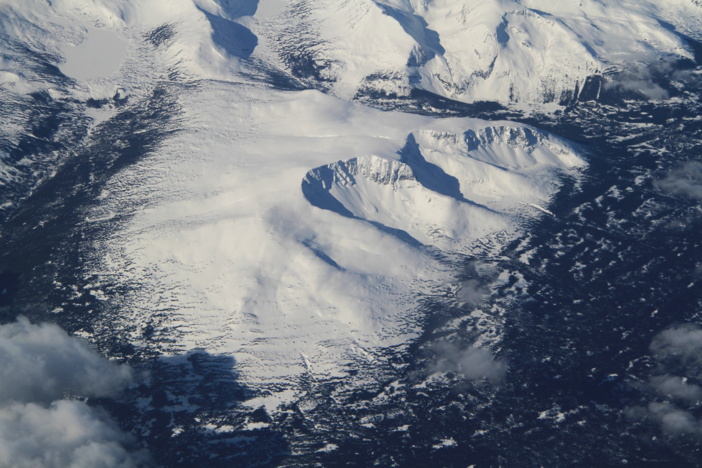
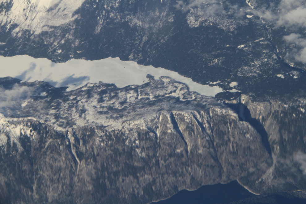
The rounded mountain in the next photo is clearly the result of a glacier flowing over it, but the dramatic cliffs have me still searching for an explanation.
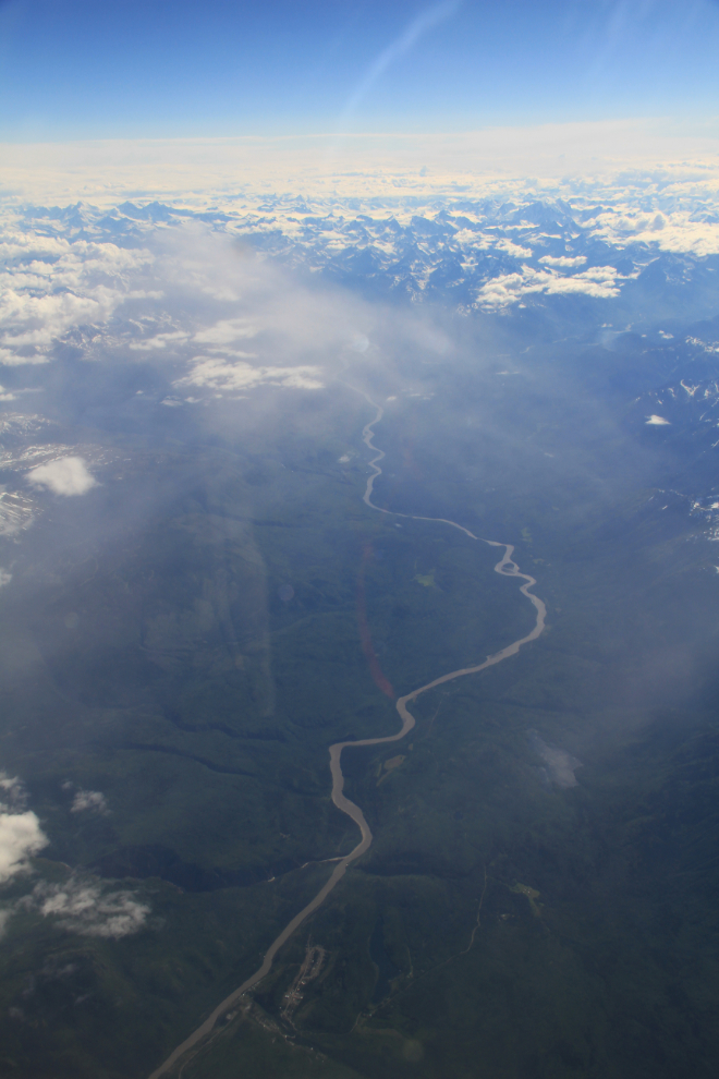
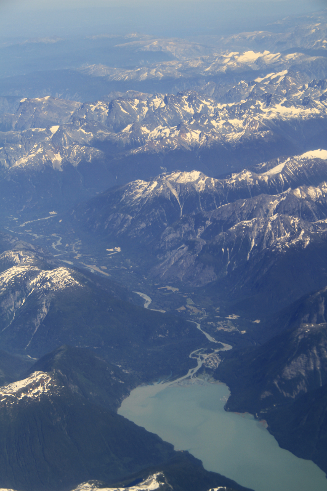
One of the features that makes confirming your location on the Whitehorse-Vancouver route much easier is the Stikine River, with the village of Telegraph Creek at the bottom of the next photo, which is looking downriver towards Wrangell, Alaska.
Along the north coast, there are many pinpoints of man-made facilities. Most are fishing and logging operations, many of them long abandoned, but the next photo shows a small mining operation at Bradfield River, near the BC/Alaska border southeast of Wrangell.
The view up the Skeena River, with Highway 16, the Yellowhead Highway, running along the north (left) side of it.
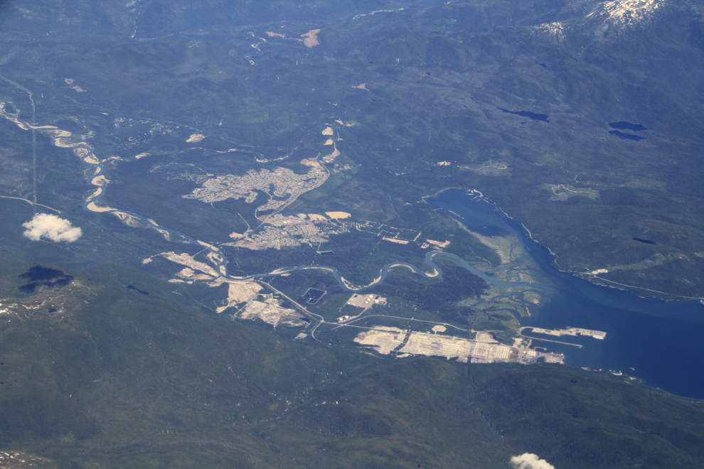
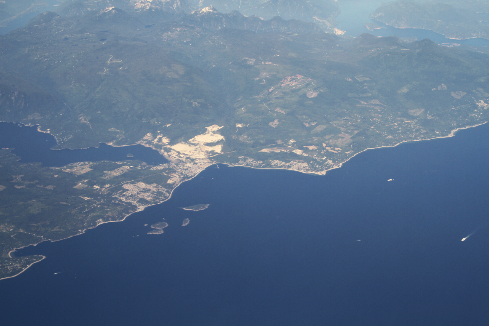
A look at Kitimat. On these flights, I’m always looking for places to go by road – I visited Kitimat a few times when I drove charter bus, but it’s a beautiful area and it’s time to get back for a more relaxed visit.
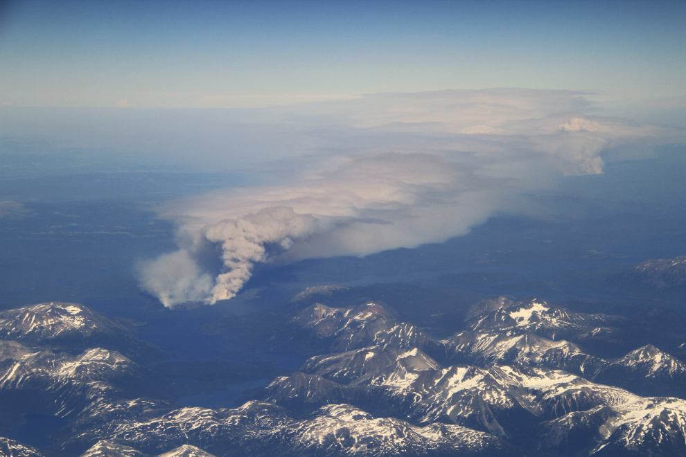
With the right wind conditions, incredible views of forest fires are possible. The closer fire in the next photo was near Eutsuk Lake, south of Terrace, the further one was at the Chelaslie River. This photo was taken in July 2014.
Hunlen Falls, draining out of the Turner Lakes in the next photo, is one of the many scenes in this article that are only available from the air. It is the third highest waterfall in Canada, or the highest unbroken-drop waterfall in the country, at 401 meters (1,316 feet).
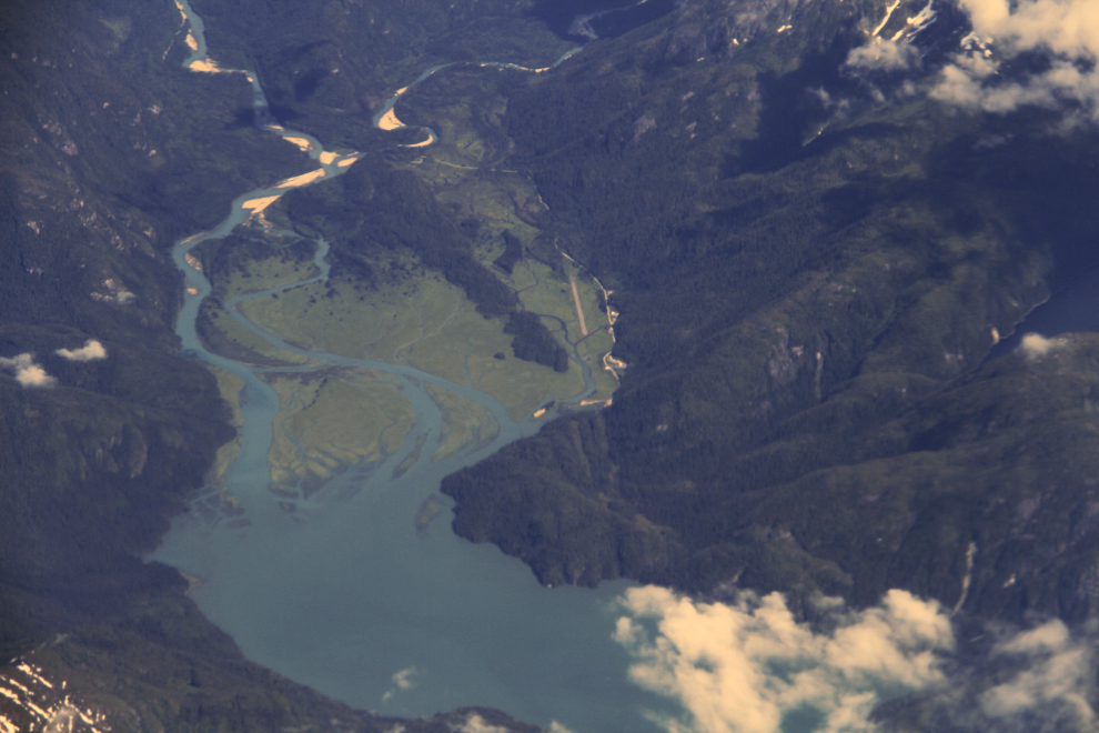
The waters of Hunlen Falls flow into the Atnarko River and then the Bella Coola River on their way to the sea. The next photo looks from the sea up the Bella Coola River, over the village of Bella Coola.
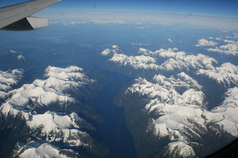
About halfway between Bella Coola and Mount Waddington is the Jacobsen Glacier, seen on the right in the next photo. At the head of the glacier is Ogre Mountain, 2,949 meters (9,675 feet) high. The highest peak just above and to the left of centre is Cerberus Mountain, 3,138 meters (10,295 feet) high.
The Klinaklini Glacier, west of Mount Waddington.
At the lower right is the head of Knight Inlet, one of the longest fjords in BC at about 125 km (78 miles). At the head of the Dais Glacier feeding it (the smaller of 2) is the highest peak in BC’s Coast Mountains, Mount Waddington, at 4,019 meters (13,186 feet).
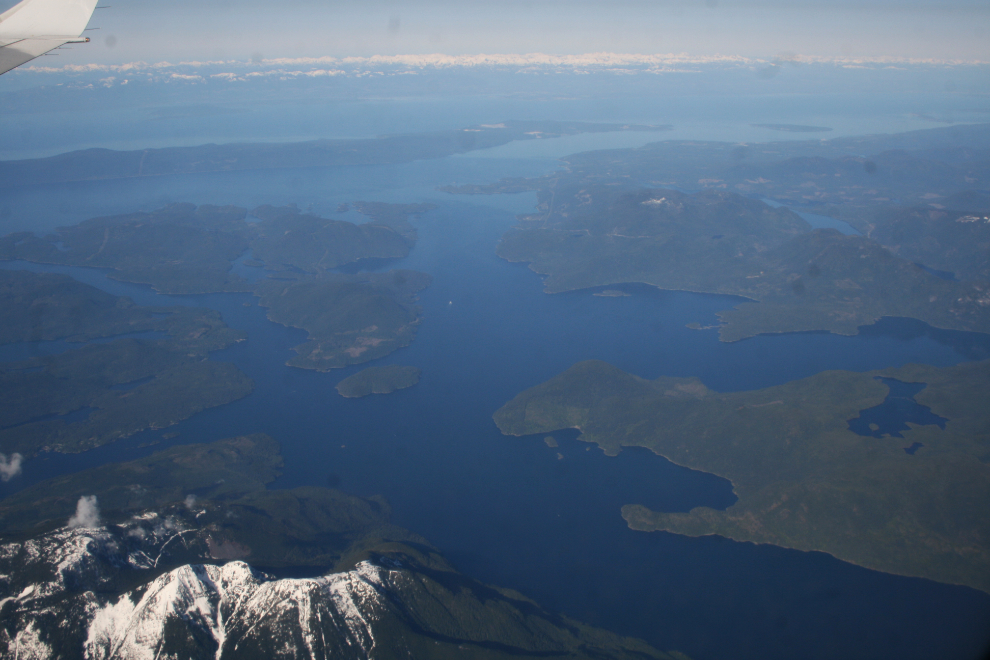
The longest arm in the next photo is Toba Inlet, northeast of Campbell River.
Another look at Toba Inlet, this time from near the head of the fjord.
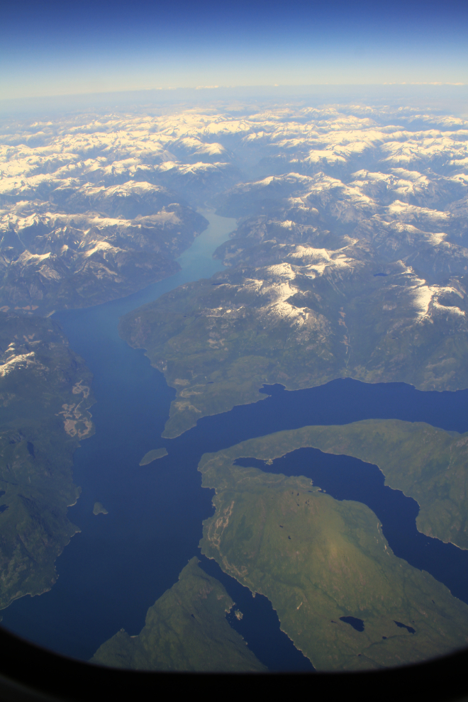
Jervis Inlet, which empties into the Strait of Georgia just south of Powell River.
After seeing little human impact on the ground below for a couple of hours, it gets increasingly busy from Sechelt south.
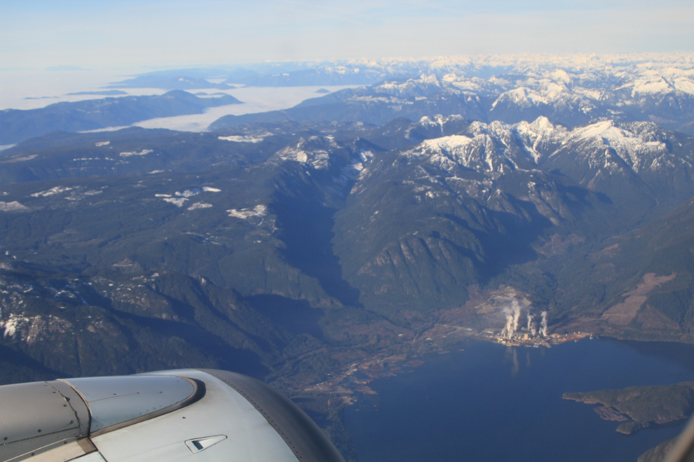
The various descent routes into Vancouver allow for closer views of some of BC’s busier areas, where I lived for 40 years and where change is constant, even at relatively remote places such as Woodfibre on Howe Sound, seen in the next photo.
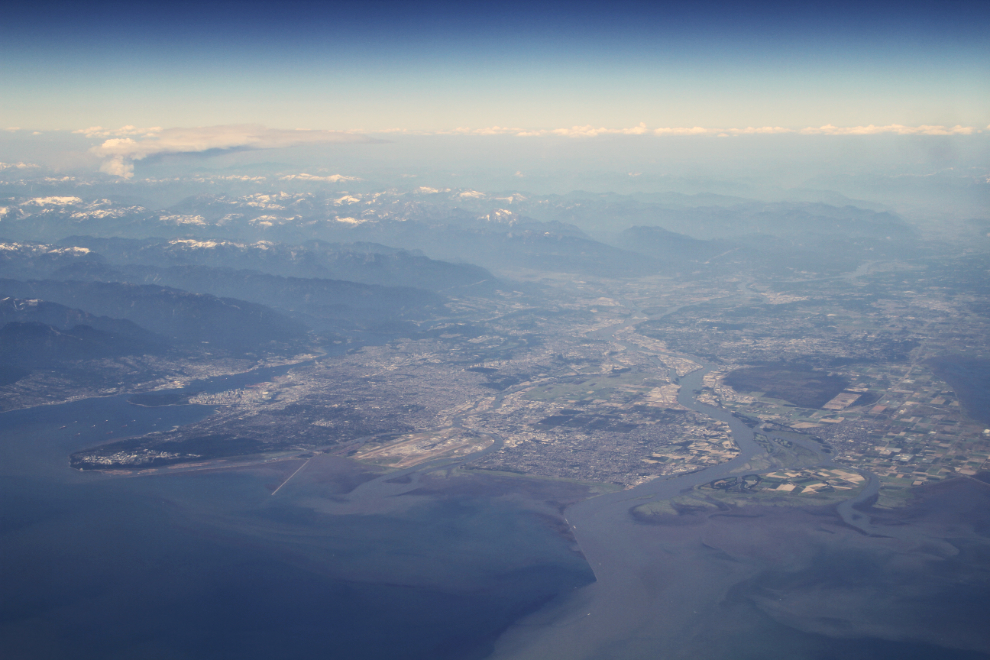
When your flight is destined for Seattle, a high view of Vancouver and the Fraser Valley is afforded. In the final photo, downtown Vancouver is centre left, the green peninsula below it is home to the University of British Columbia, and the muddy water is from the Fraser River
I finished writing this post on an evening flight from Whitehorse to Vancouver and Kelowna. While it was too dark to take any photos, seeing the snowy peaks below dimly lit by a full moon was simply magical, and in a couple of days I get to re-trace that route. If Mother Nature cooperates, perhaps the aurora borealis will light up that flight as it has a few others. BC is spectacular from any vantage point, but the views offered from 35,000 never cease to thrill me.