An e-bike wander around southern Whitehorse
On May 15th, with the weather forecast calling for a gorgeous day, I had an urge to do a major e-bike wander. The back trails mostly still have lengthy sections of snow and/or mud, so I decided to see if I could find an interesting route around town. It turned out to be very interesting. Interesting enough that there are 37 photos – I just couldn’t edit any more out without losing something of interest 🙂
You can see the 33.5-km route on my Strava page.
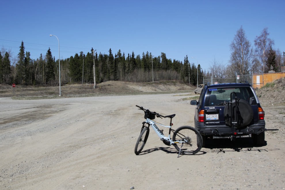
I thought for some reason I would be maxing out my battery with what I had in mind, so loaded the bike onto the Tracker to take it a few k towards town.
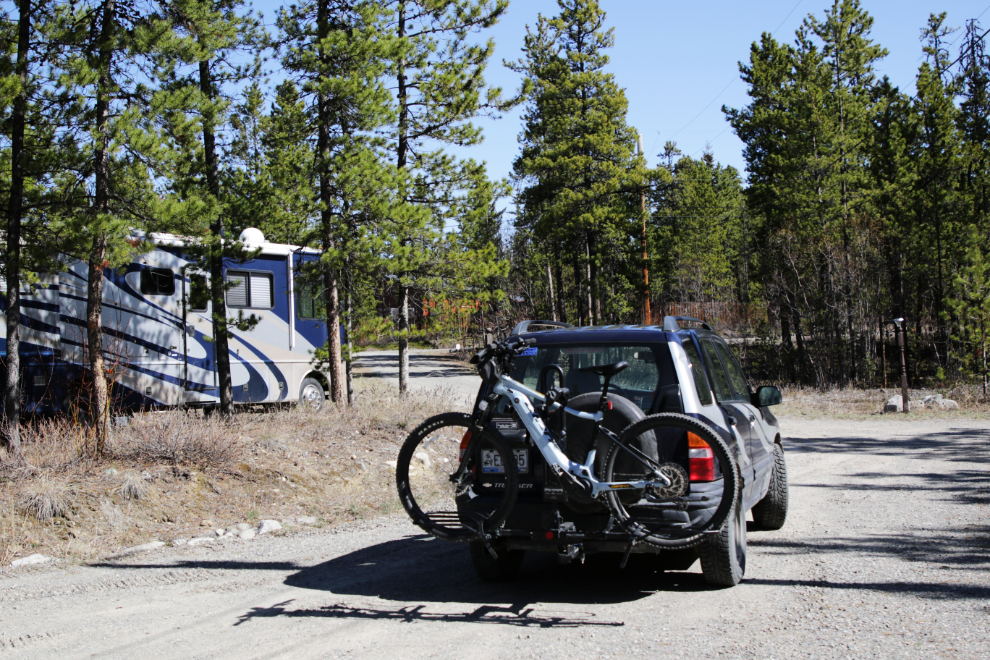
I looked at a few spots to park the car, and finally decided that the Petro-Canada gas station at McCrae would work well – it’s only 7.5 km from home but that would be enough to allow me to wander without battery life being a consideration. This is Km 1413 of the Alaska Highway.
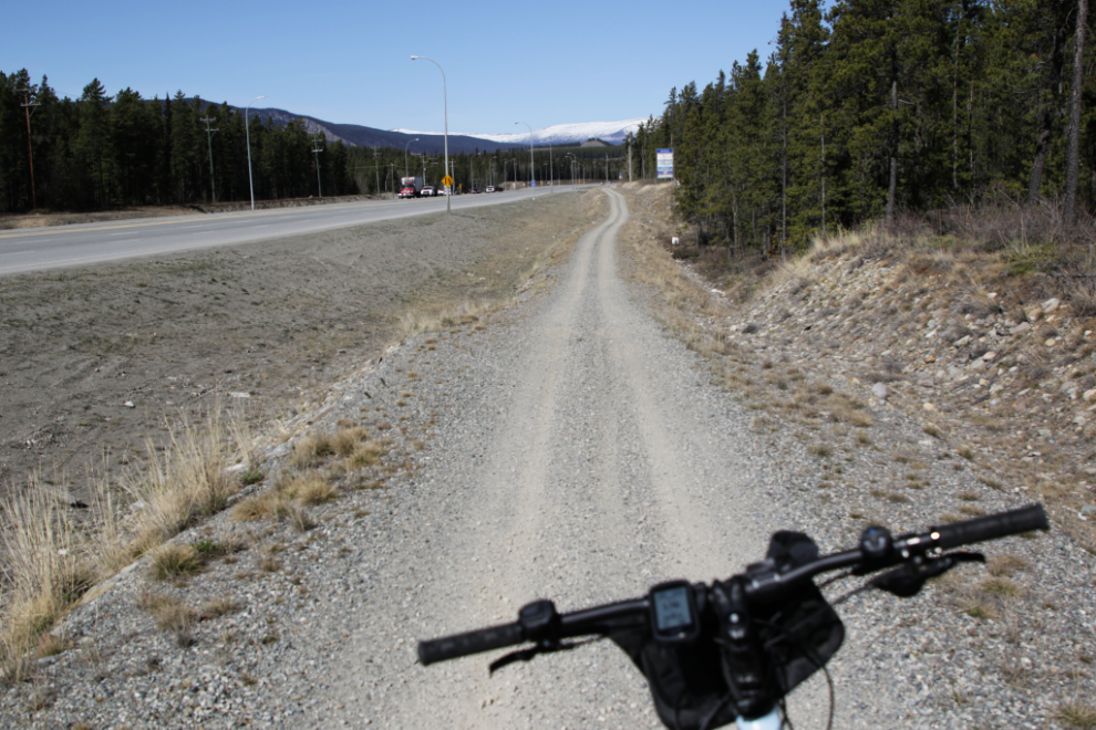
I really don’t like riding on the shoulder of the Alaska Highway, but road construction made it necessary for the first few minutes.
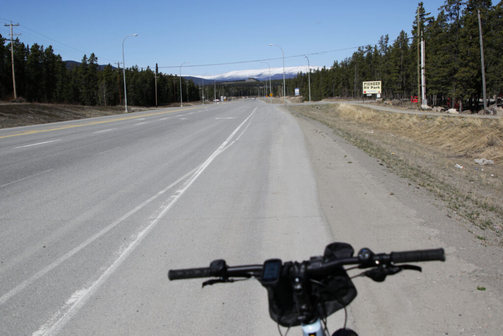
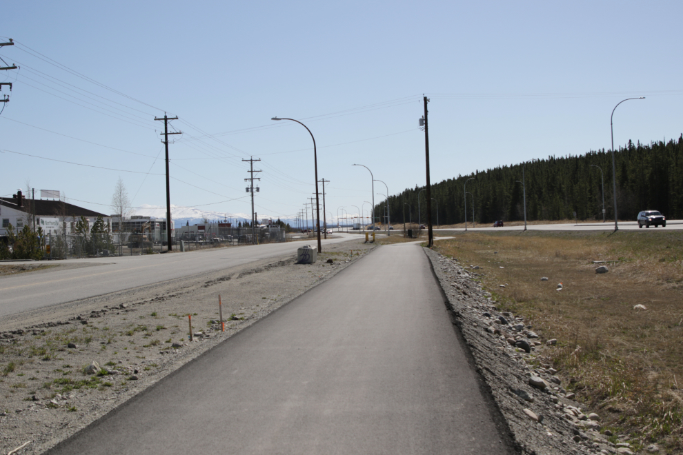
The quality of the “ATV trails” beside the highway vary a lot, but where the highway has been rebuilt in recent years, the quality of what are now classed as multi-use trails gets better and better.
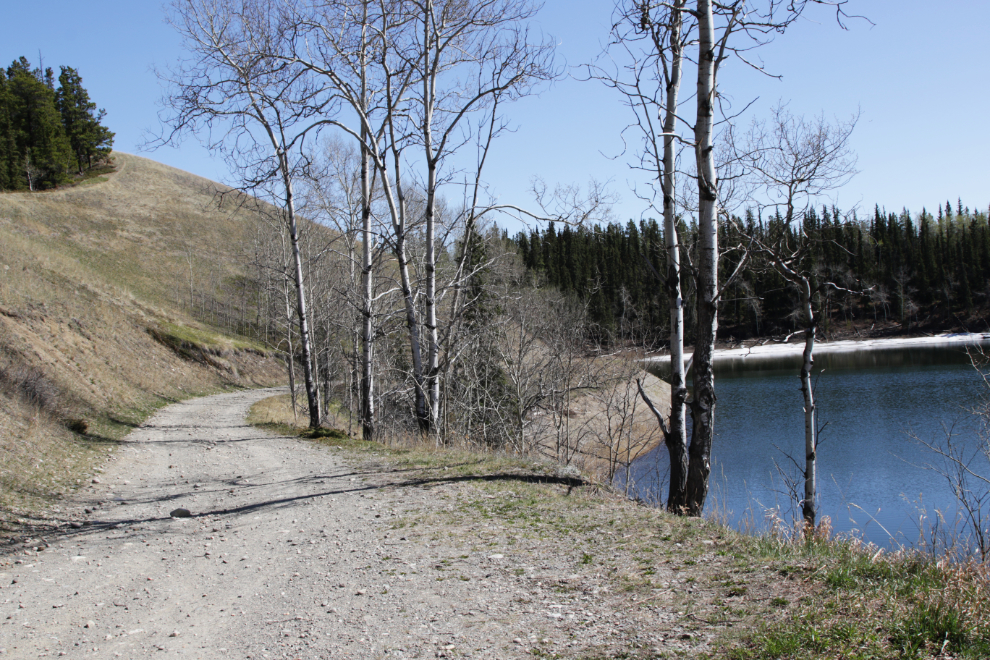
A little over 3 km from the car I turned onto the Miles Canyon Road, the narrow, hilly and winding scenic route to town. The next photo shows the view as I dropped down to Schwatka Lake, a widening of the Yukon River created by construction of a power dam in 1958.
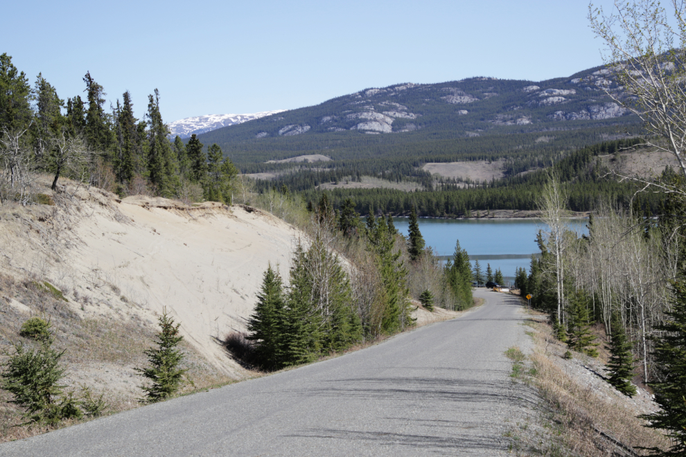
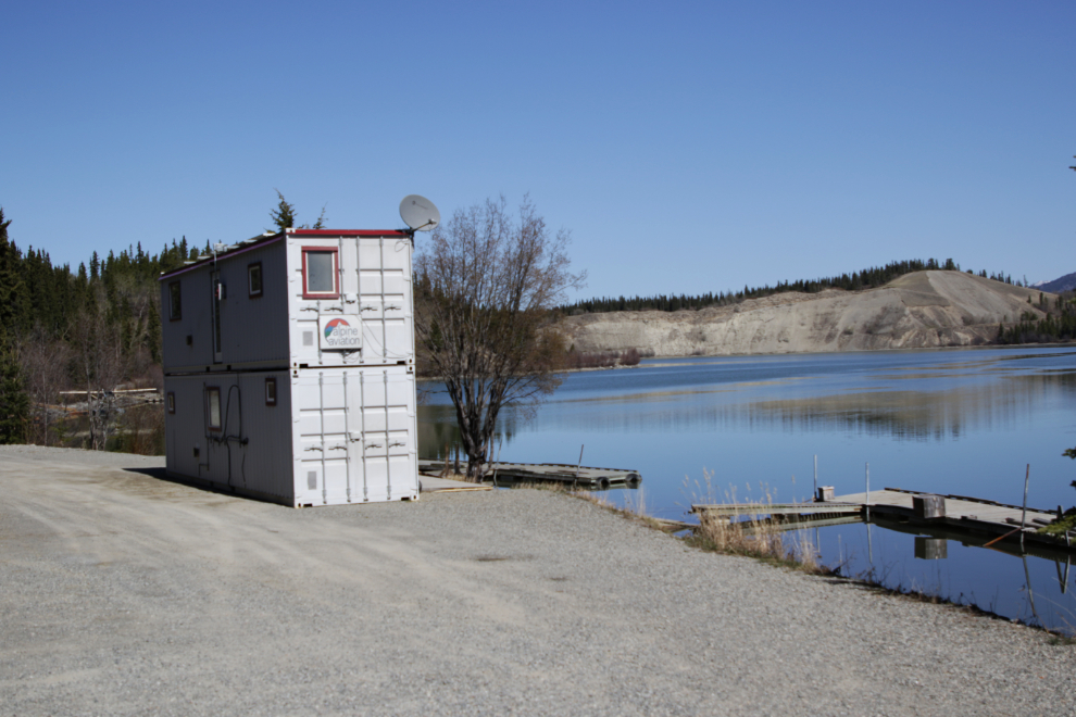
Float plane season has begun – the last of the ice cleared a couple of days ago, the first couple of planes have been moved down from the airport, and the main commercial operator on Schwatka Lake, Alpine Aviation, has moved their summer office to their lot.
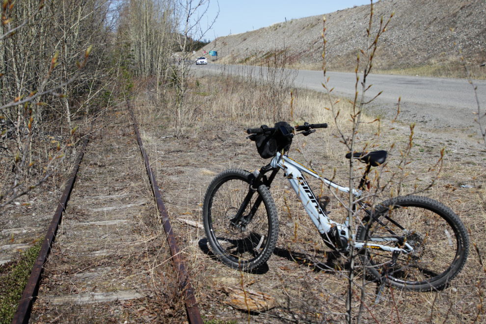
As Miles Canyon Road gets close to Robert Service Way, the White Pass & Yukon Route railway runs alongside the road. Some day perhaps this will join the “rails to trails” movement, but there’s no hint of it happening yet.
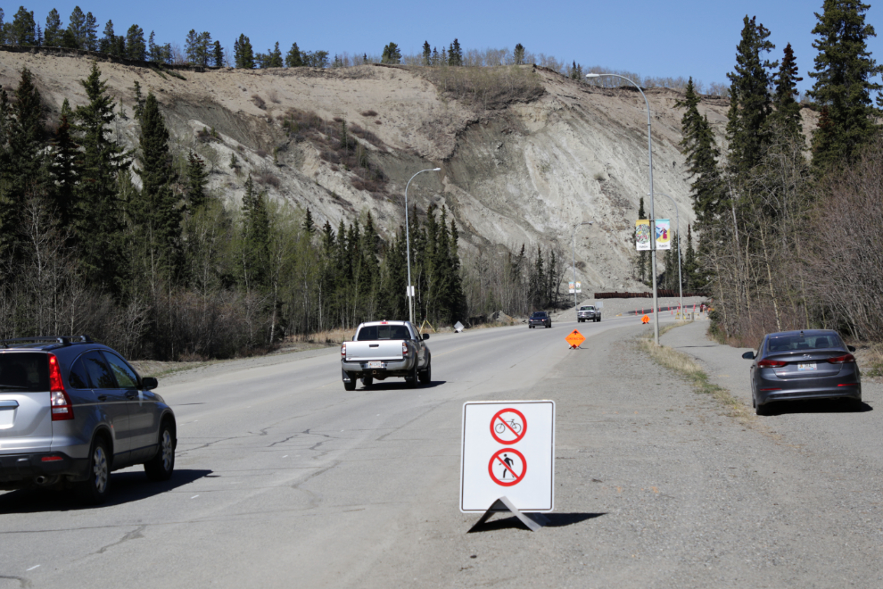
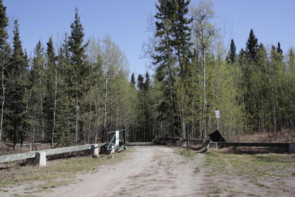
Robert Service Way just re-opened 5 hours before I started my ride, after being closed for 5 weeks because of landslides off the escarpment. I didn’t know whether bikes were allowed yet – the answer was “no.” I hadn’t seen an access trail to the Millenium Bridge that is to be used by pedestrians and cyclists so I asked the security guard in the car to the right and got a vague reply about it being back there somewhere.
By riding through the Robert Service Campground in the general direction of the bridge, I found the trail and then could see that a narrow path had been cut through to the road.
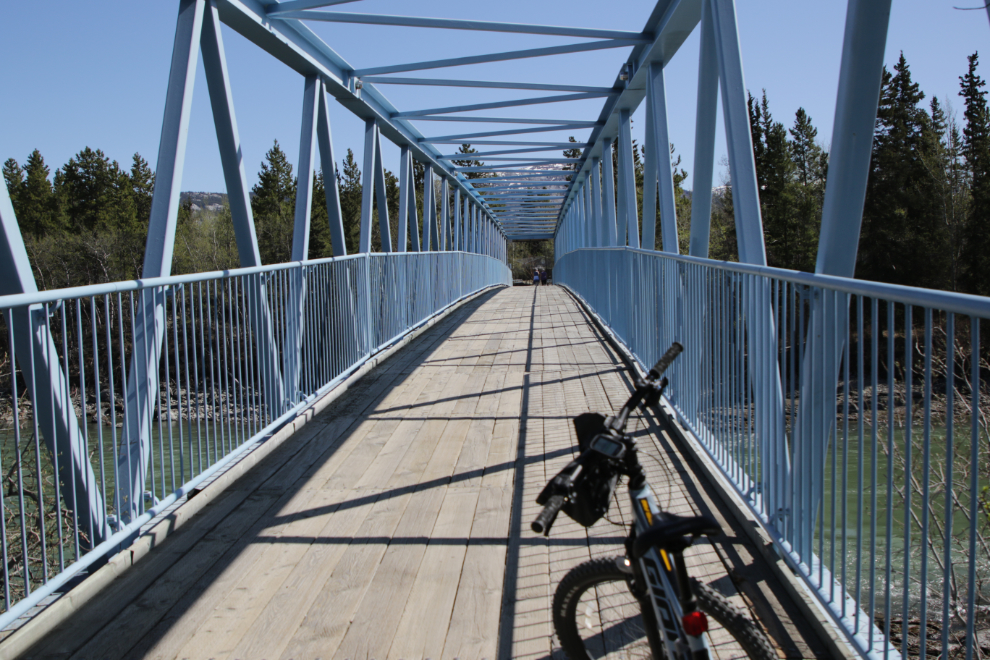
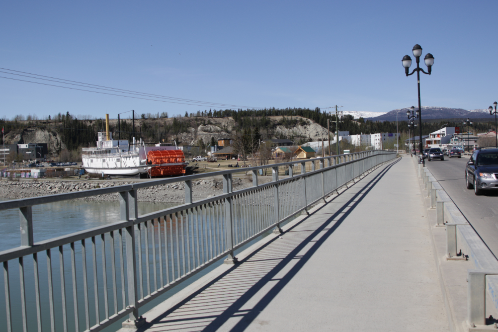
The Rotary Centennial Bridge was built in February 2005 – it crosses the Yukon River to make the Millennium Trail a circular path.
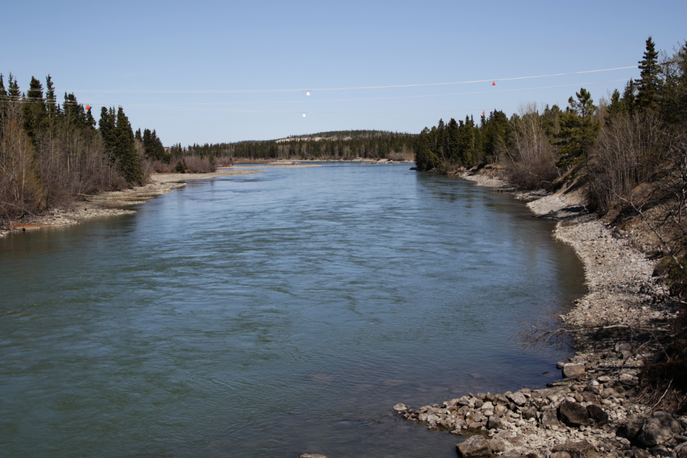
Looking down the Yukon River from the bridge.
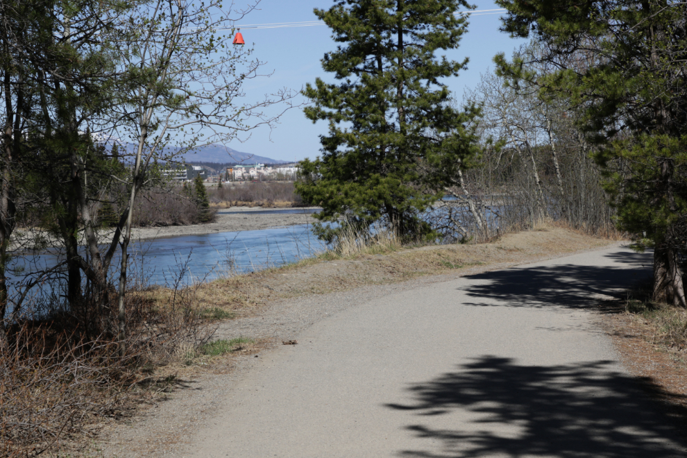
The Millennium Trail is all paved and is very popular, though there were few people when I was there just before 1:00 pm on Monday.
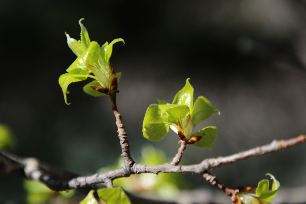
Ah, Spring! We’ve missed you, little buds 🙂
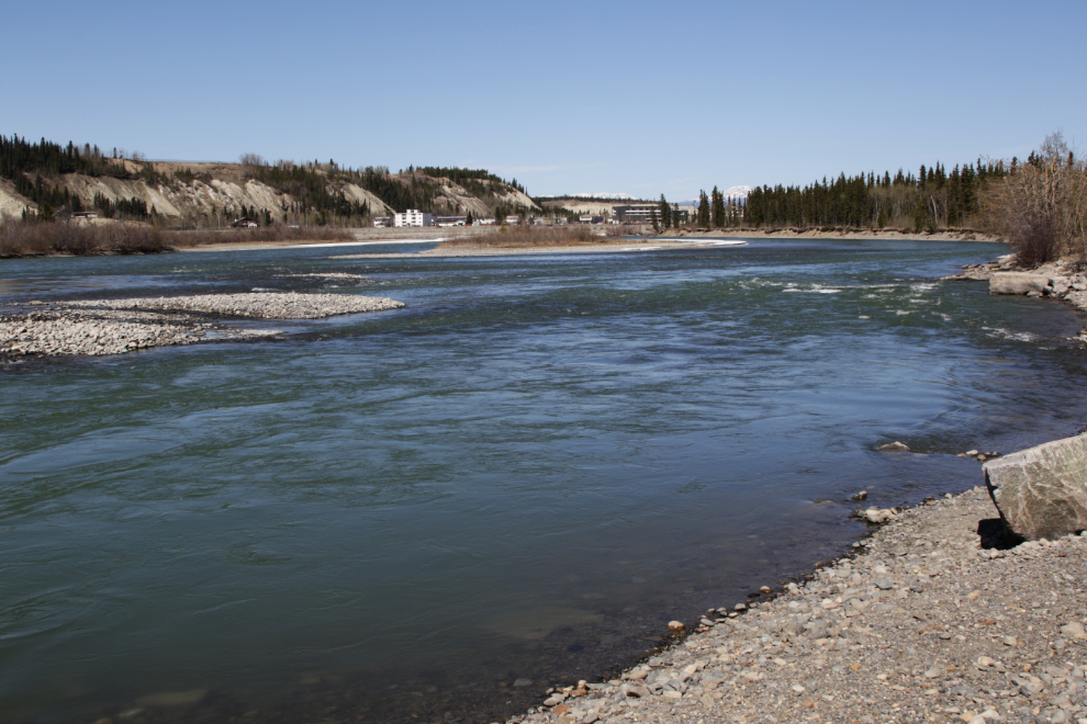
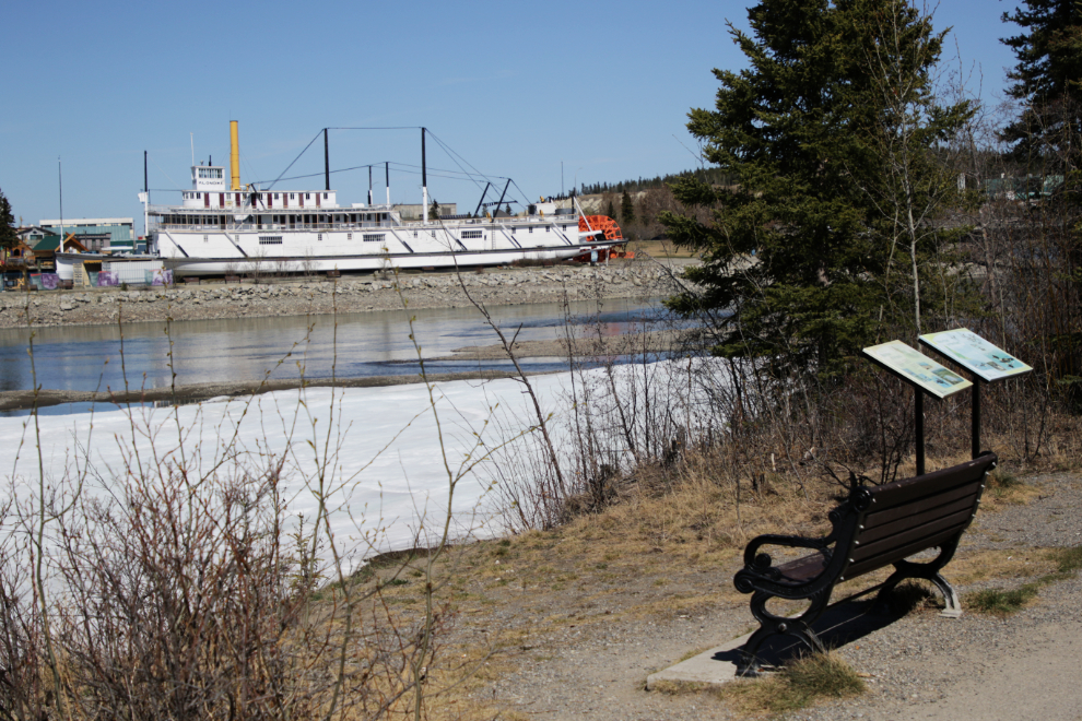
This is extreme low water for the Yukon River. The water was clear two days before but now it’s cloudy, so Spring runoff has begun and that will change rapidly.
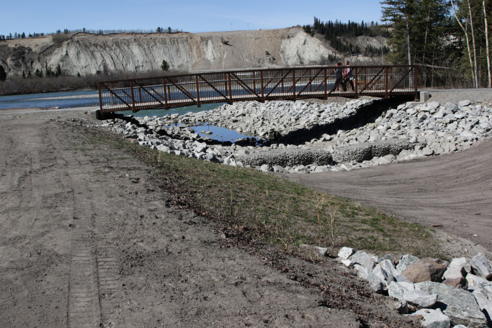
This drainage channel was just built recently (last year?). It was very controversial because of the size, but I’m quite intrigued by the design, which has large rocks, smaller rocks in wire cages, and grassed sections alternating down its length.
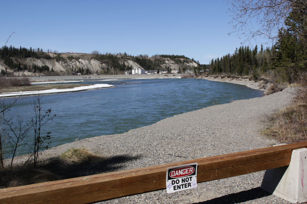
Very high river levels the past two runoff seasons cut away at the bank on this curve, closing the side trail that ran along it.
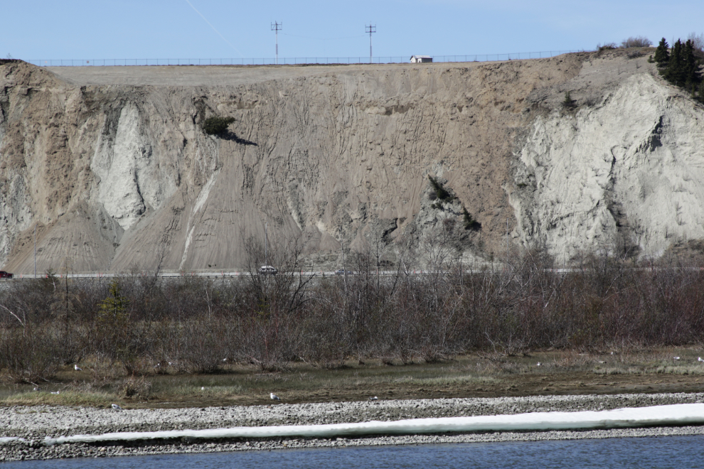
Here’s a look at the problematic section of the escarpment. Last week, a loader dug away the top layer of earth and shoved it over the bank in an attempt to reduce landslide activity in the future. This is a temporary measure until a permanent solution can be found.
Here’s a wonderful spot along the trail to set a spell and enjoy this world.
All too soon, I was off the trail, and on the Robert Campbell Bridge to start riding across downtown. I mentioned at the start that I really don’t like riding on the shoulder of the Alaska Highway – I hate riding downtown, but it’s only about 3 miles.
Halfway across town, I stopped in at Cadence Cycle to see if I could get a luggage rack for the bike. They carry a wide variety of options, which of course was beyond my ability to figure out, but the sales guy was great and I soon had one that looks like it will fit my needs – which are really basic – perfectly.
With that accomplished I was soon on my way again, and when I shot the next photo had crossed downtown and was starting up Two Mile Hill towards the Alaska Highway.
Up top there’s a nice new paved trail between Range Road and the Alaska Highway.
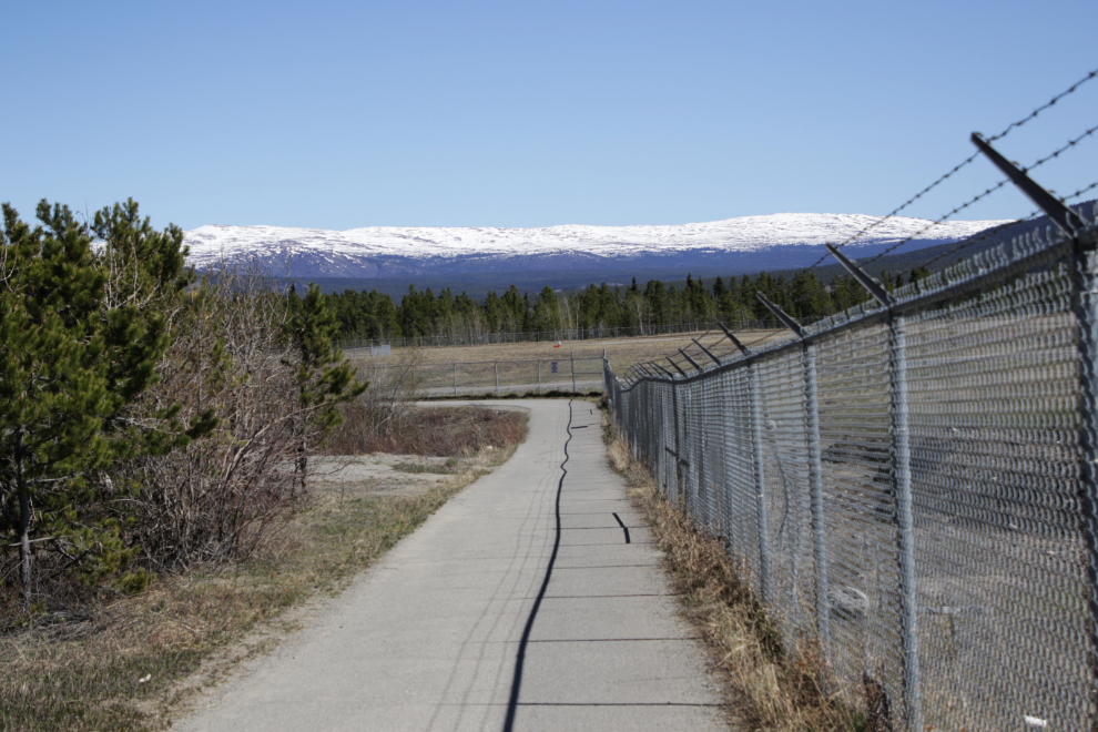
As I neared the airport property my bike computer said I had ridden 18.8 km and had 70% battery left. I felt good, so decided to detour on the airport trails for a bit.
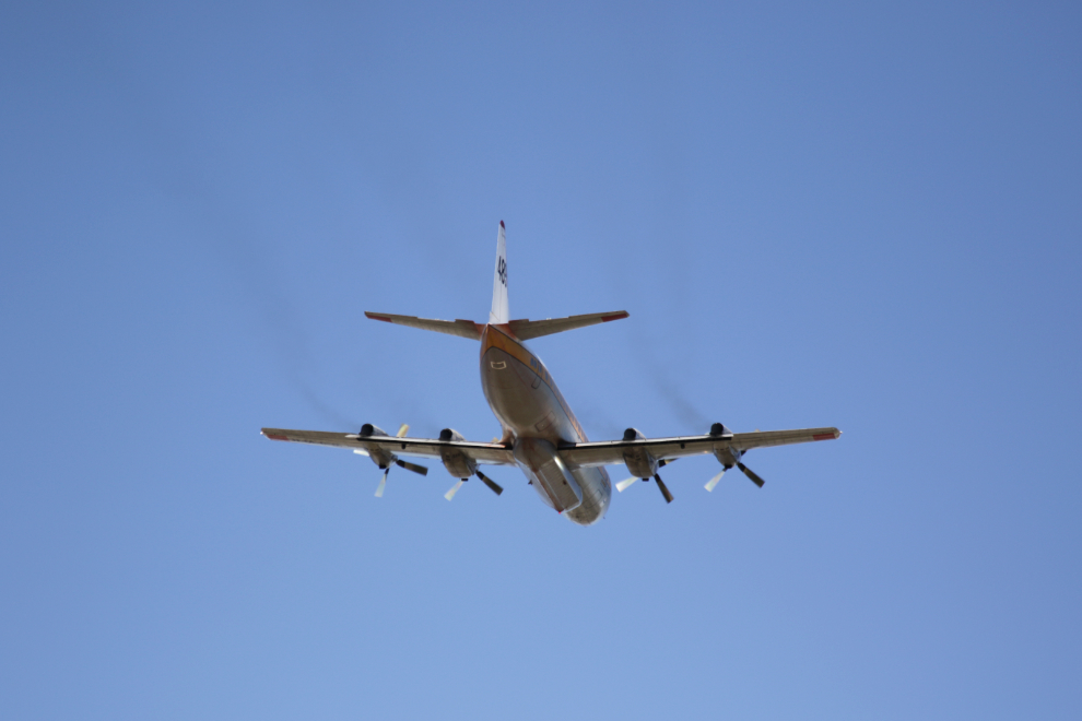
As I reached the runway, Air Spray’s Lockheed 188A Electra water bomber C-FVFH, roared overhead.
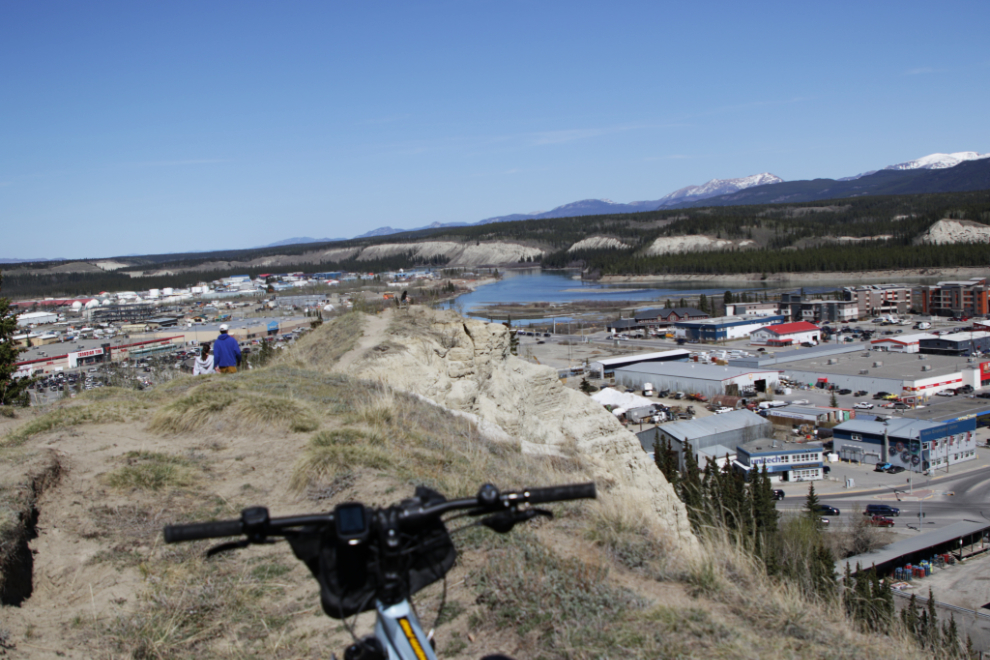
The airport trails offer lots of variety, from pavement to narrow dirt tracks through the forest. As is often the case when I walk these trails, this was where I ended up, looking to the north down the Yukon River.
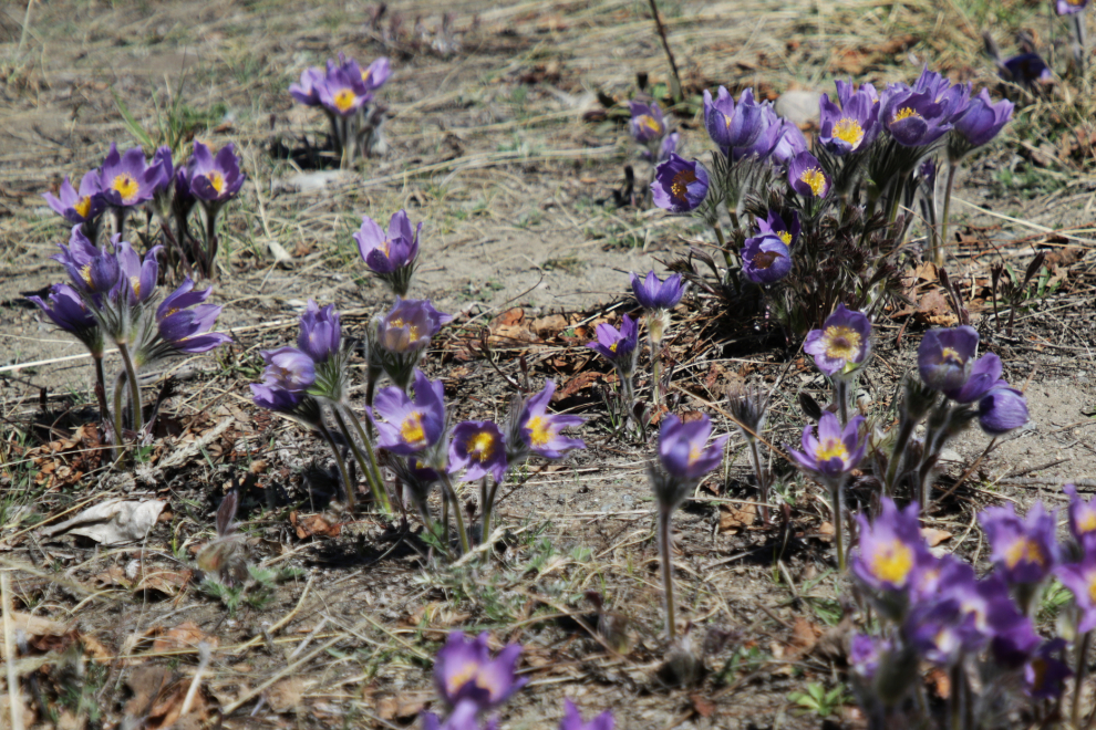
The Prairie crocus were at their peak, and there were thousands of them along the open trails.
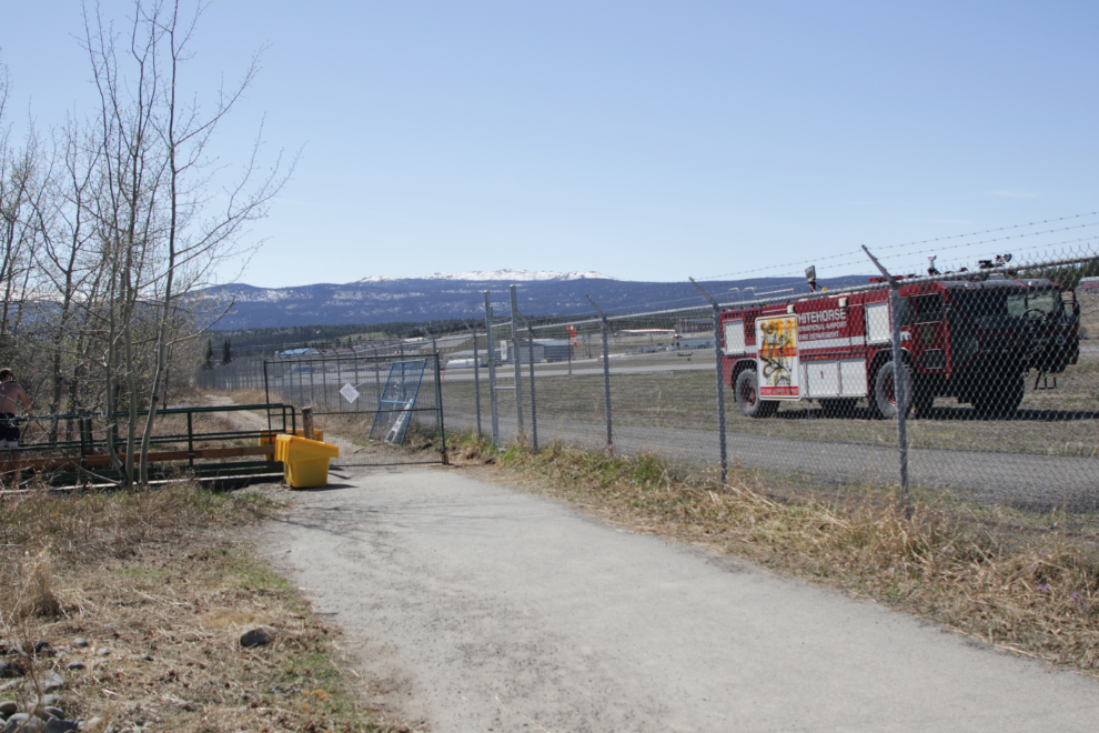
I turned back here, at the top of the Black Street Stairs from town. It wasn’t apparent why the crash truck was there – it was nothing serious, though.
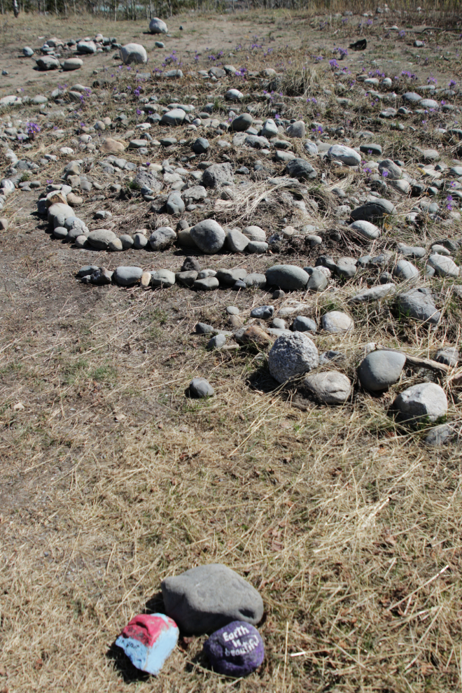
I enjoy finding painted rocks like these when I’m out wandering 🙂
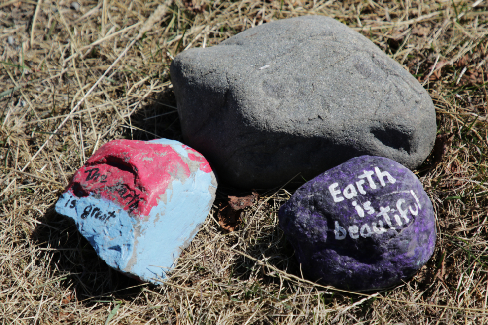
Those painted rocks were close to a labyrinth that was built near the Black Street Stairs a few years ago.
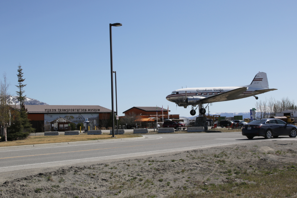
Back on the highway, I was soon passing the Yukon Transportation Museum.
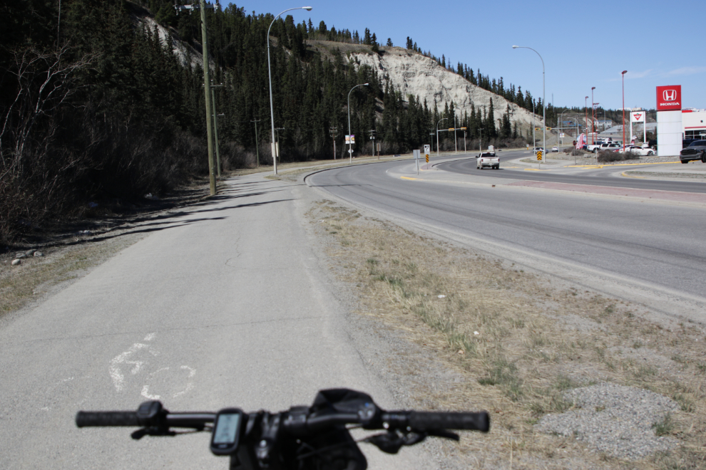
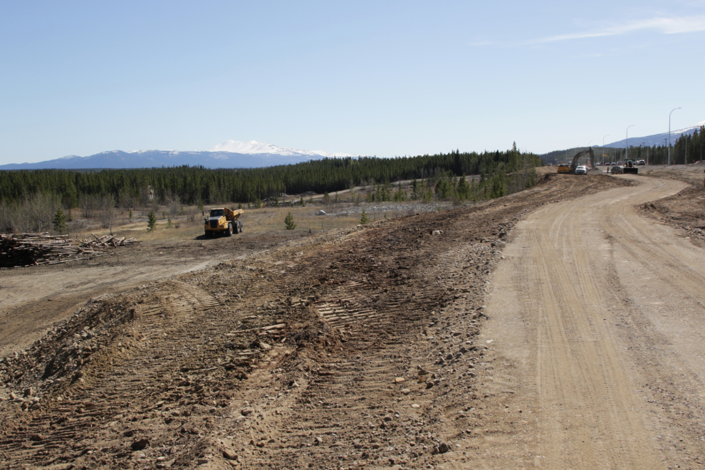
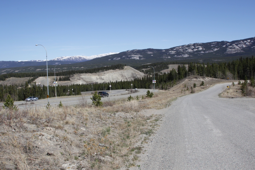
I had not been looking forward to riding through the mile or so of heavy re-construction going on just east of the airport, but I got lucky. The new multi-use trail beside the highway had just been roughed in, with the packing possibly done just that morning 🙂
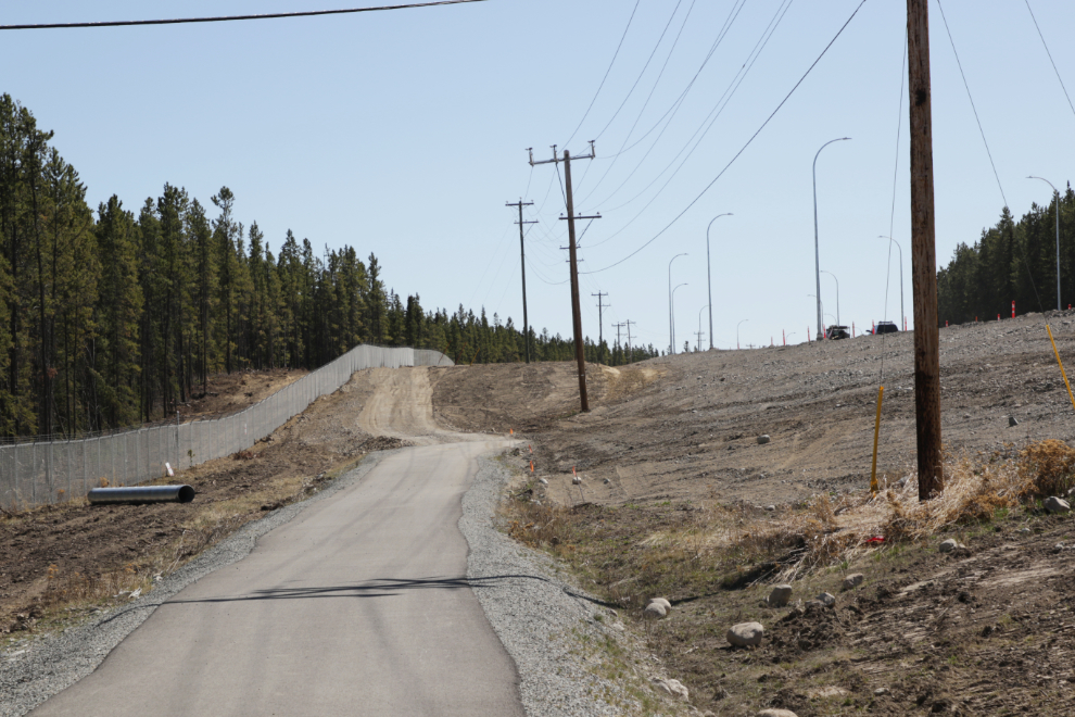
The new section of trail is excellent, with expansive views across the valley. I had to make a short detour off it to get around a crew that was installing a drainage culvert under it.
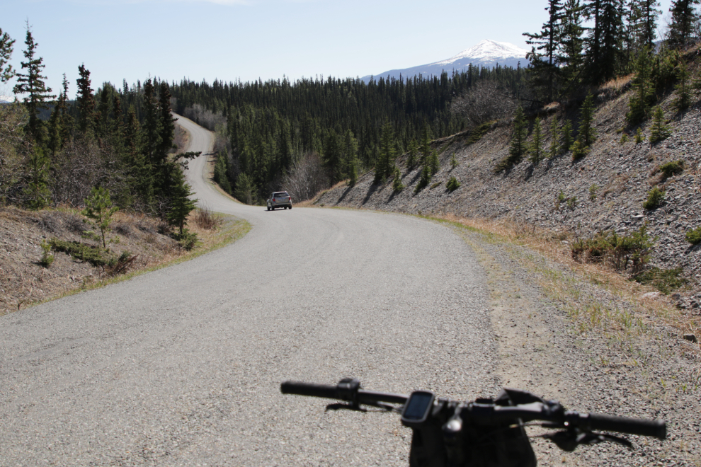
I had planned to ride down Robert Service Way and then repeat the Miles Canyon Road, but decided to make a detour via Ear Lake instead.
What a disappointment to find that a car (stolen, probably) had been burned on the road to the lake. I walked the bike through a lot of debris including broken glass 🙁
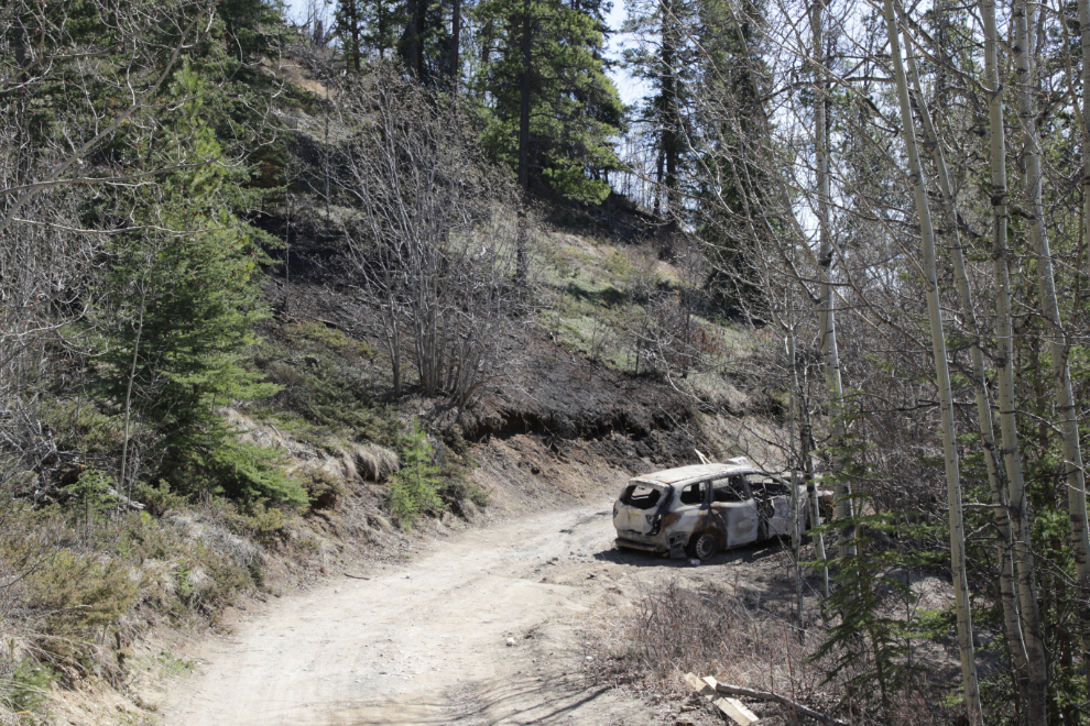
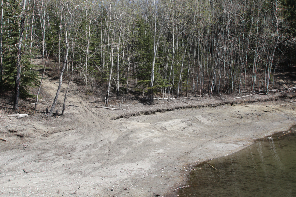
Ear Lake should have been made a park a century ago, but the City has never had a Council interested in making it happen. It was always a popular spot, going back before World War I, but in recent years it’s been badly trashed and few people go there anymore. It was the official unofficial nude beach for many years – not official but everybody knew it was. It’s such a lovely spot but just has bad energy now 🙁
The rough route from Ear Lake to the Miles Canyon Road starts at this steep old road, then goes off into a narrow trail.
Although it felt much longer, only 9 minutes had elapsed between the last photo and this one shot on the Miles Canyon Road.
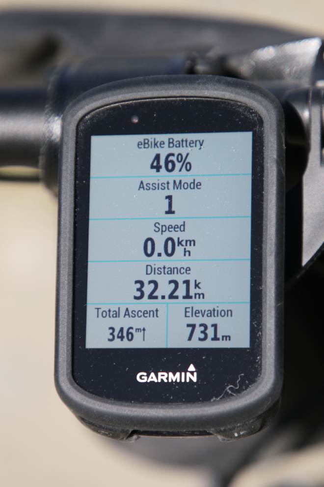
And that’s the end. I was soon back at the car, loaded up, and home. I was very pleased with the final stats (the computer and Strava don’t quite agree – I don’t know which is more accurate).
is fun to see what you can see in town on two wheels … the e-bike certainly adds a lot of potential miles when needed. Nice day to get out too.
Yes, the bike does add a new dimension to exploring. I need to do a bit of research before doing the same sort of wander on the north side of town – I don’t know very many of the trails in the area, but a friend posted photos from a great one high about the river a couple of days ago.
Jealous! I’ll be glad when Warren gets the “all clear” to ride again.
I hope that’s soon – it’s been a long haul for him (and you).
Thanks for the tour Murray to parts of your area we would never see. We’re real happy to see you out and about enjoying life.
I’m glad you enjoyed it, Barb. I think even most people who live here would be surprised at how much variety we can get in a very small area. It feels SO good to be getting out.
What a glorious day! Thanks for taking us along for the ride!
My pleasure, Ellen. It’s always nice to have you join me 🙂