Searching for Spring
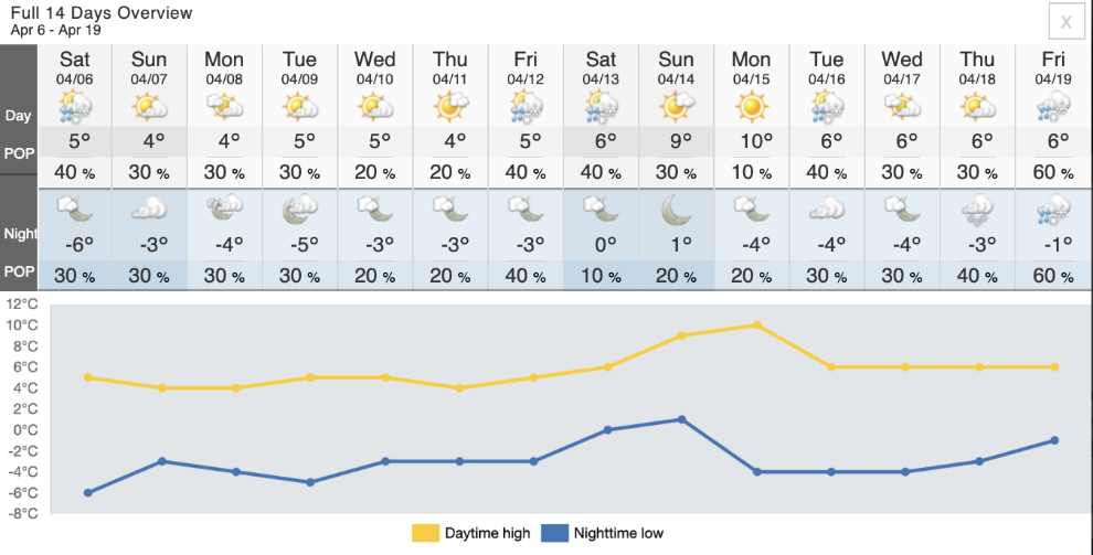
That was a very easy Winter we just had, and I’m craving Spring now. But Mother Nature has gotten lazy, and the advance towards Spring has stalled out. For the past 2-3 weeks, and the 2 weeks ahead, highs are just above freezing and the lows just below freezing.
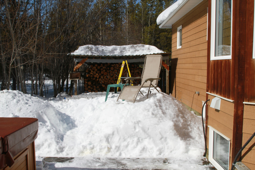
Despite the stall, most of what snow we did get is gone. On April 3, 2021, I posted the photo below on Facebook with the comment “It was the first day of sun-tanning for the year, but I had to create a perch 32 inches above my chair’s normal location on the grass. Crazy year.” As of yesterday, there is no snow at that spot.
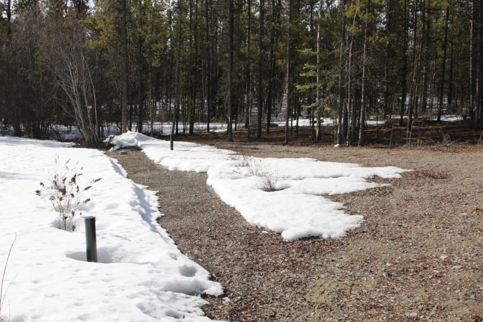
Back on March 21st, I cleared snow from a path across my new “bee garden” to speed up the thaw, and it’s coming along nicely where the sun hits it.
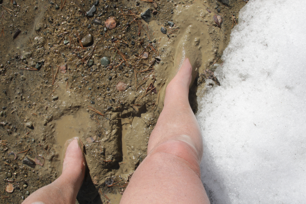
Although the path looked solid a couple of days ago, I had a pretty good idea of what would happen when I stepped on it, so was barefoot. I love Spring mud! 🙂
FB Memories sometimes provide very valuable perspective for me. One from 2022 two days ago sent me to my journal – reading it, I saw that I was very sick then and got a whole lot worse. My incredible osteopath is still working with me, and about 10 days ago I had another sudden improvement right after a session with her. For years, I didn’t think I’d be alive now, but here I am, with a long way to go still but yesterday I decided to head down to the White Pass with my snowshoes again, but with the pups this time.
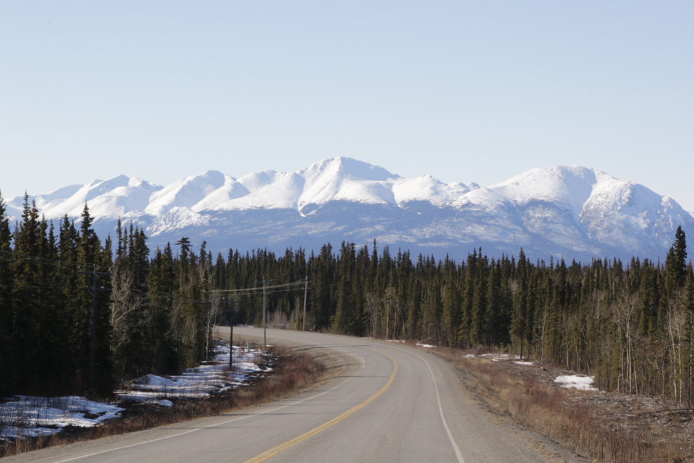
The weather forecast for Whitehorse called for mostly sun with a high of +6C/43F, which was a great start. Skagway was calling for the same temperature but with wind and snow showers, so I didn’t really expect to get into the White Pass.
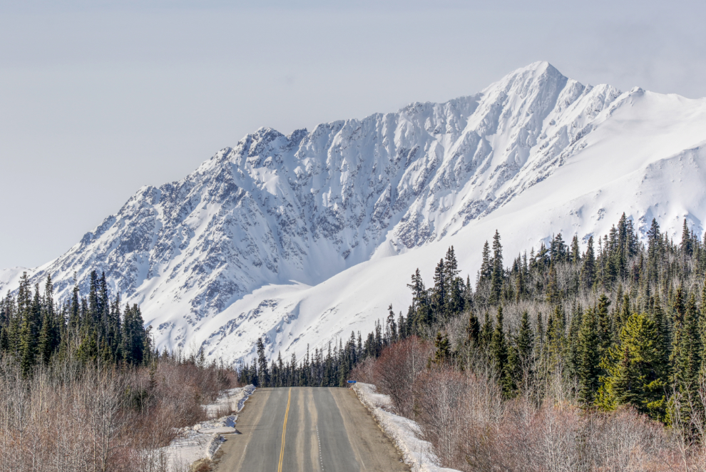
At 11:00 I was a few miles down the South Klondike Highway. It was great having Bella and Tucker with me this time. However, they complicate the day to the point that I’ve seldom been able to bring them, and even yesterday I was terrified that I would assess a situation incorrectly and get them into a situation where they would get hurt. When I say I still have a long way to go health-wise, that’s the way it plays out in day-to-day life.
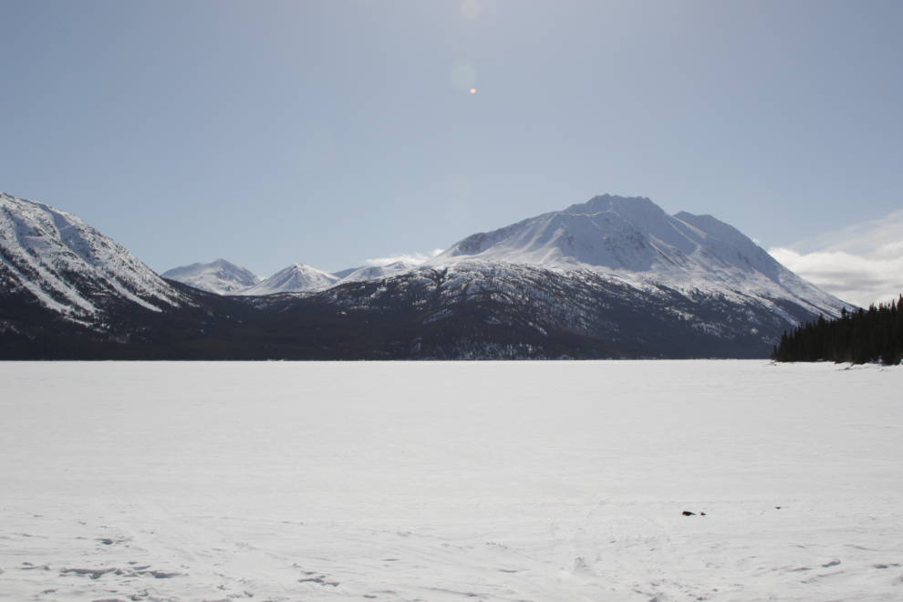
Twenty minutes later I made a brief stop at Emerald Lake to check on its progress. The ice was looking quite thin so it could be an early breakup.
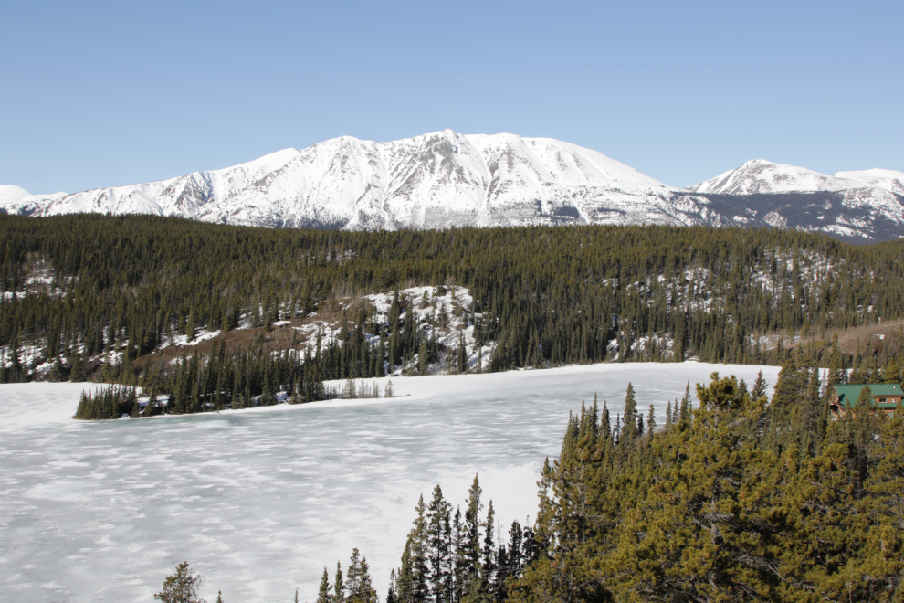
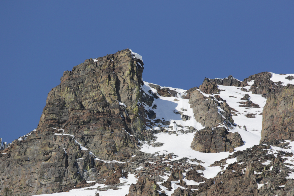
Looking south from Emerald Lake to the Montana Mountain massif, with Brute Peak to the right.
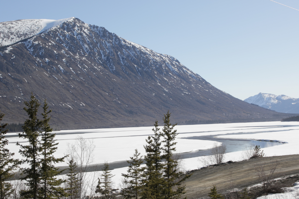
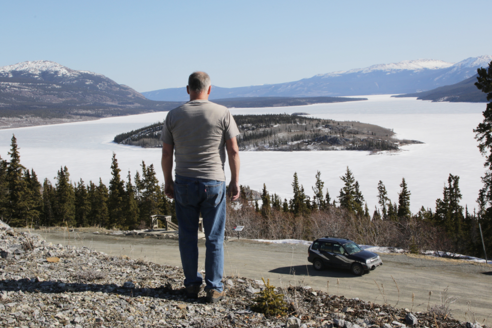
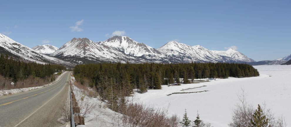
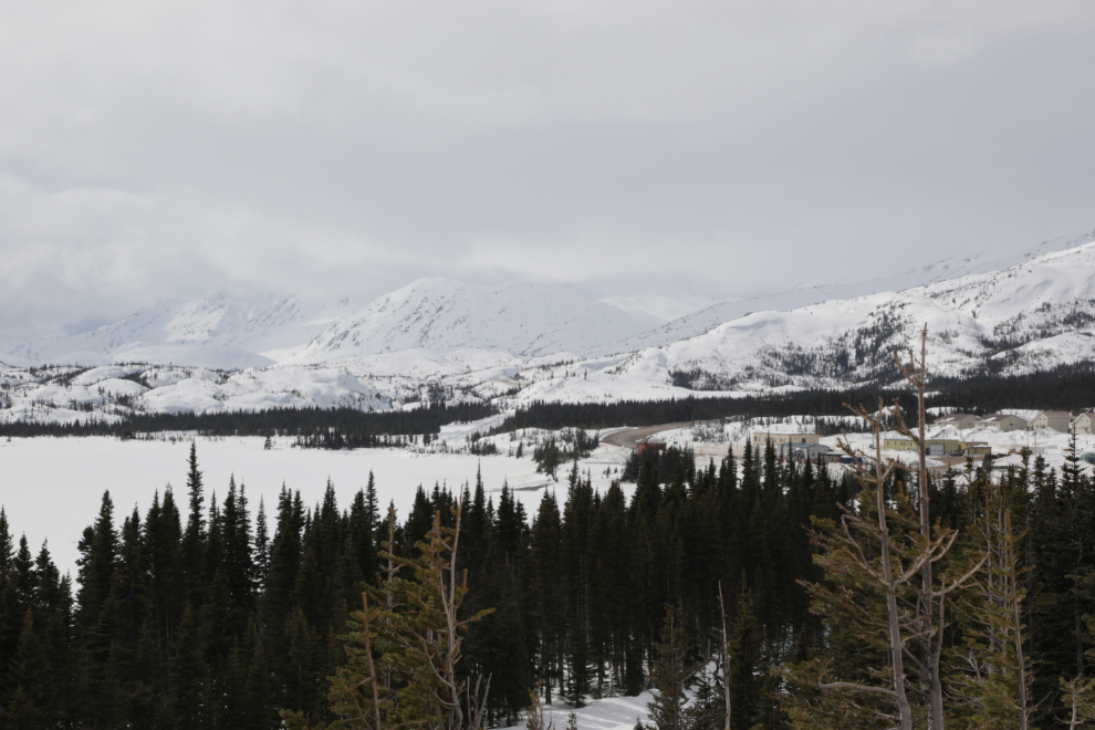
In 2-3 months that vast expanse will be Nares Lake. Right now that’s not frozen water, it’s snow on dry ground. When the water does come up, most of the lake is very shallow, and there’s a marked channel for the few boats that use it.
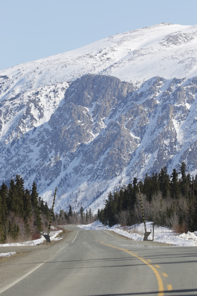
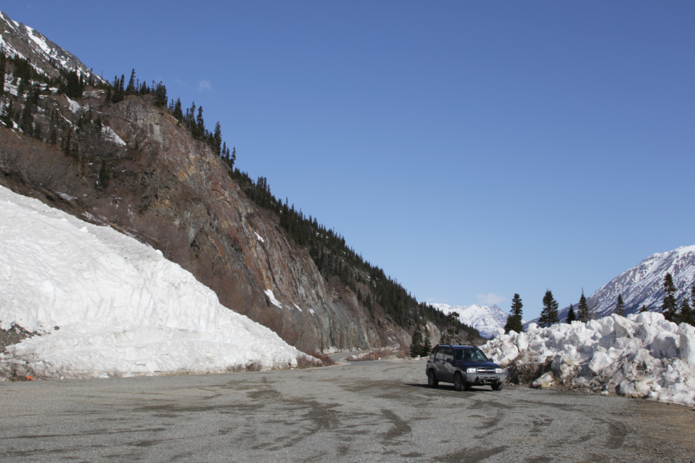
The avalanche gates south of Carcross at Km 98.3 seemed to be closed a lot this past winter, but all was good this day.
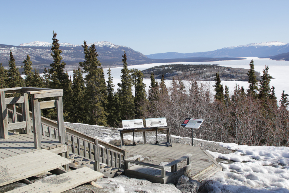
At 11:45 I reached the Bove Island viewpoint and stopped for a few minutes.
I really like the view from the cliff above the viewpoint, so climbed up there. I posted a similar but different photo on the naturist group I belong to at Facebook. It’s more, you know, natural 🙂
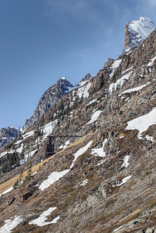
Conditions were perfect to stop at Pooley Creek and get another couple of photos of the 1906 Venus silver mine.
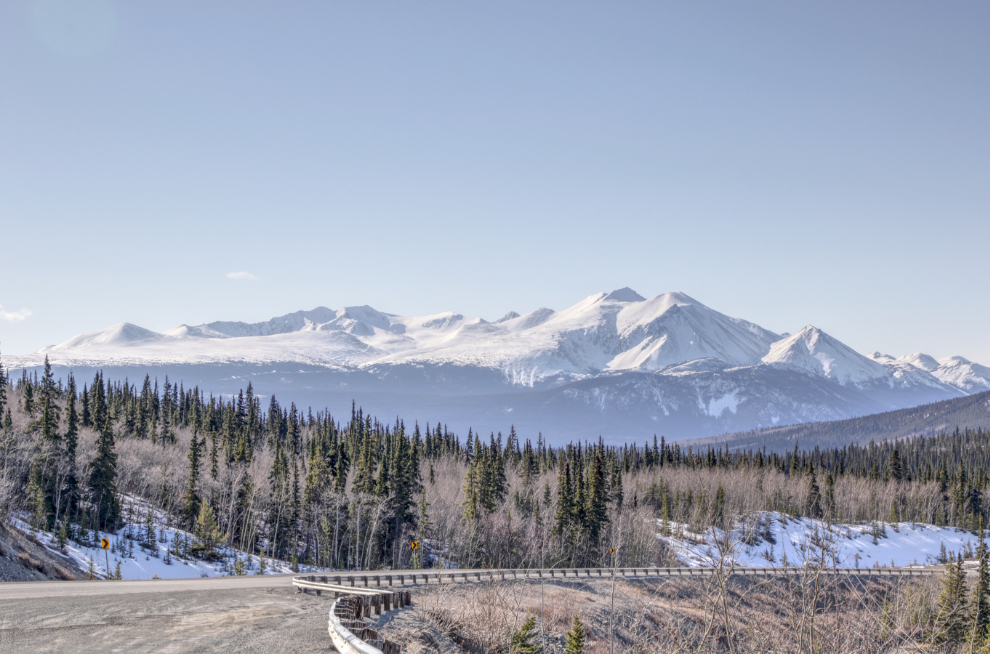
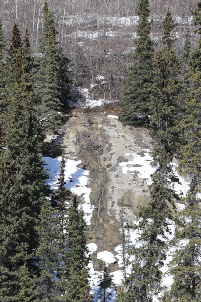
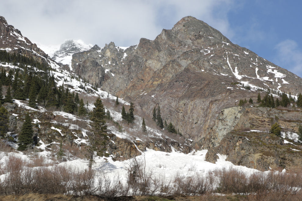
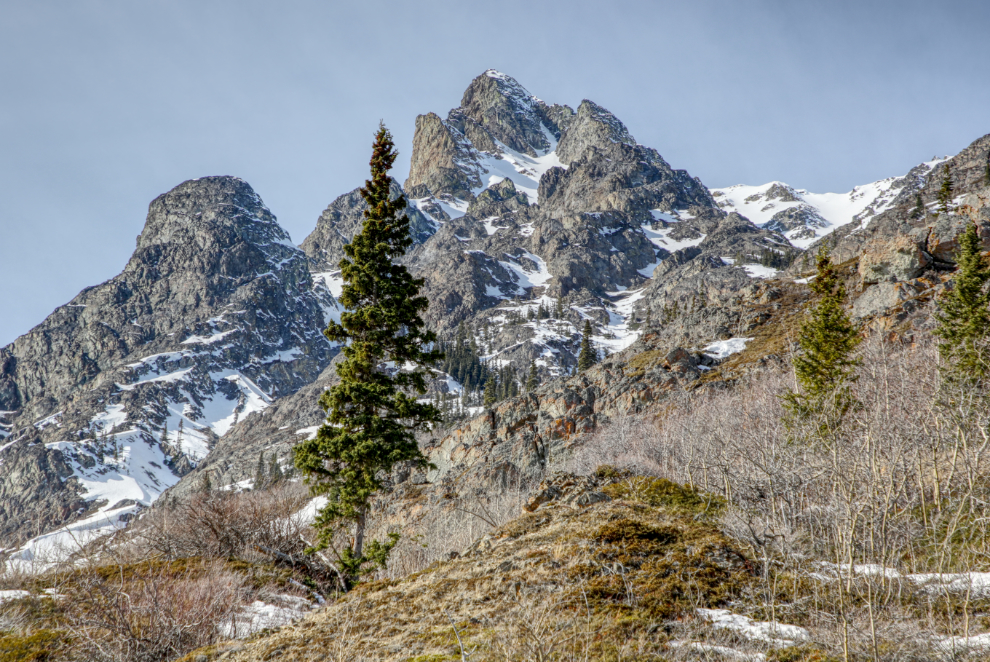
Dail Peak doesn’t attract many hikers/climbers but I’ll bet the view from up there is pretty amazing.
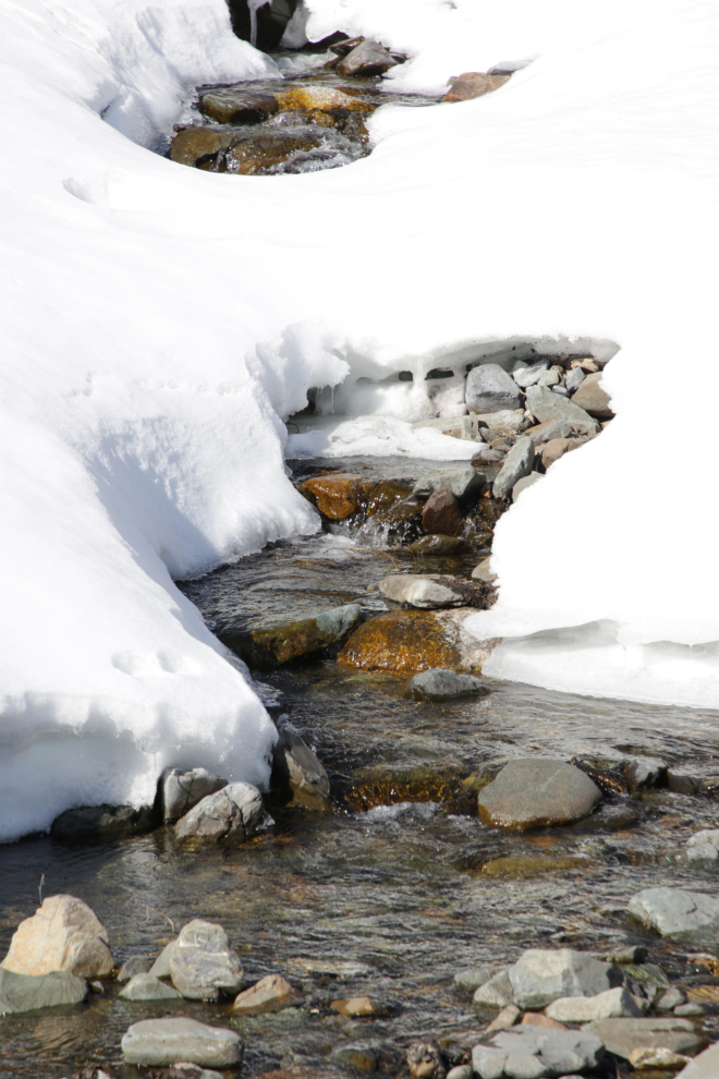
Seeing water flowing in Dail Creek prompted a stop and a walk down to the water. I shot a video, too, but it’s too shaky so not useable. I need to remember to always use the tripod for video.
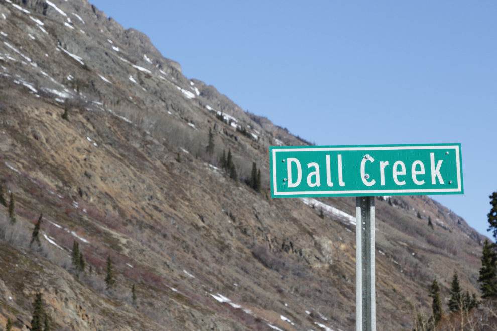
Some day I’ll bring a bit of green paint down and fix that sign – no it’s not Dall Creek, it’s Dail Creek, named after the guy who staked the first mining claim along it.
The flow of very cold water from this mineral spring high above the highway just south of the south end of Windy Arm never changes through the year. Many years ago I climbed up to it for a look.
This view climbing the ridge that separates Windy Arm from Tutshi Lake, with a dramatic but unnamed peak in the background, always catches my attention. I’ve been fairly high up the back side of that mountain, but would really like to go up the face to check out that glacial cirque. I’ve never seen a report of anyone doing it.
I stopped at the parking area and boat launch on Tutshi Lake where my dogs have been playing for 25 years or so, but the wind was strong and bitterly cold – even Bella and Tucker weren’t interested in staying. We’d find a sheltered place…
A panoramic look back at that spot where we stop.
This appears to have been the largest avalanche Highways had to deal with – and perhaps the most active avalanche chute, with more than one coming down. It’s along Tutshi Lake at Km 57.9.
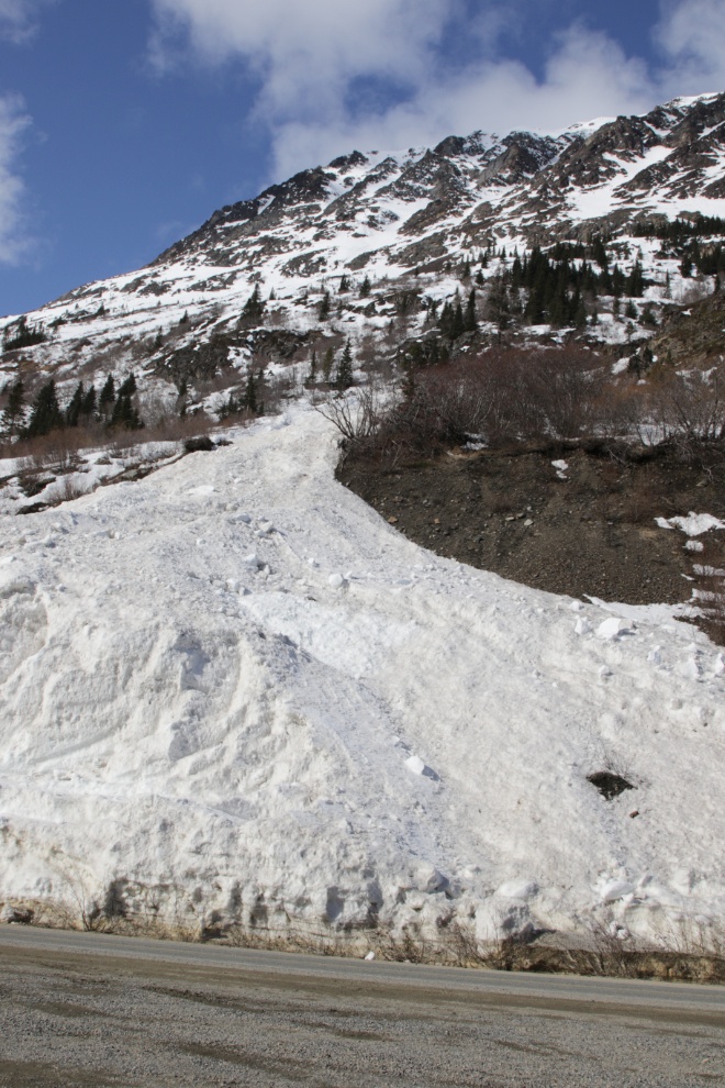
Yes, that would be quite a job to clear.
That would be quite a sight/sound to experience an avalanche coming down that spectacular chute! From a safe distance out on the lake!
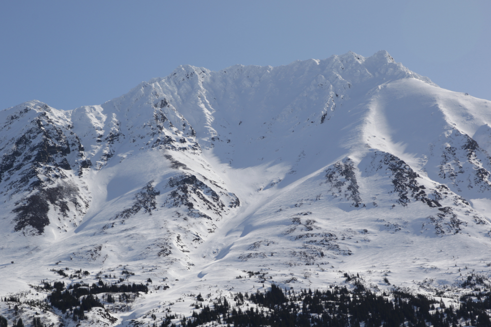
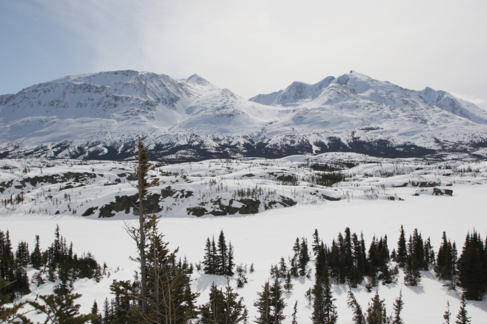
This is the view on the opposite side of Tutshi Lake at that spot – the high point is Jack Peak, at 7,050 feet/2,149 meters.
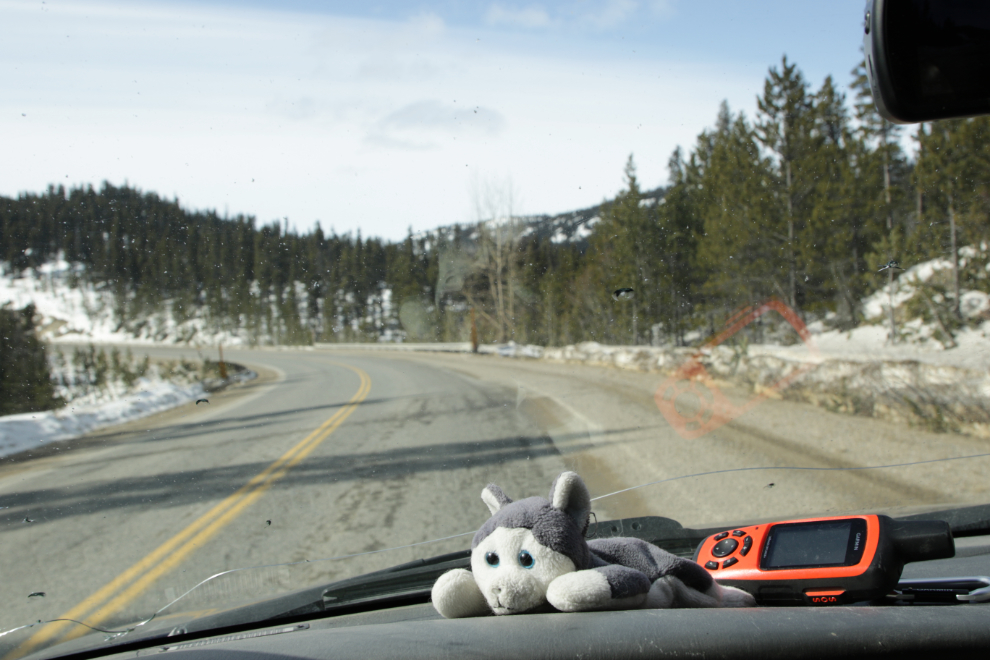
Having Nanook and the inReach on the dash and the pups behind me made this feel like the old days – very nice 🙂
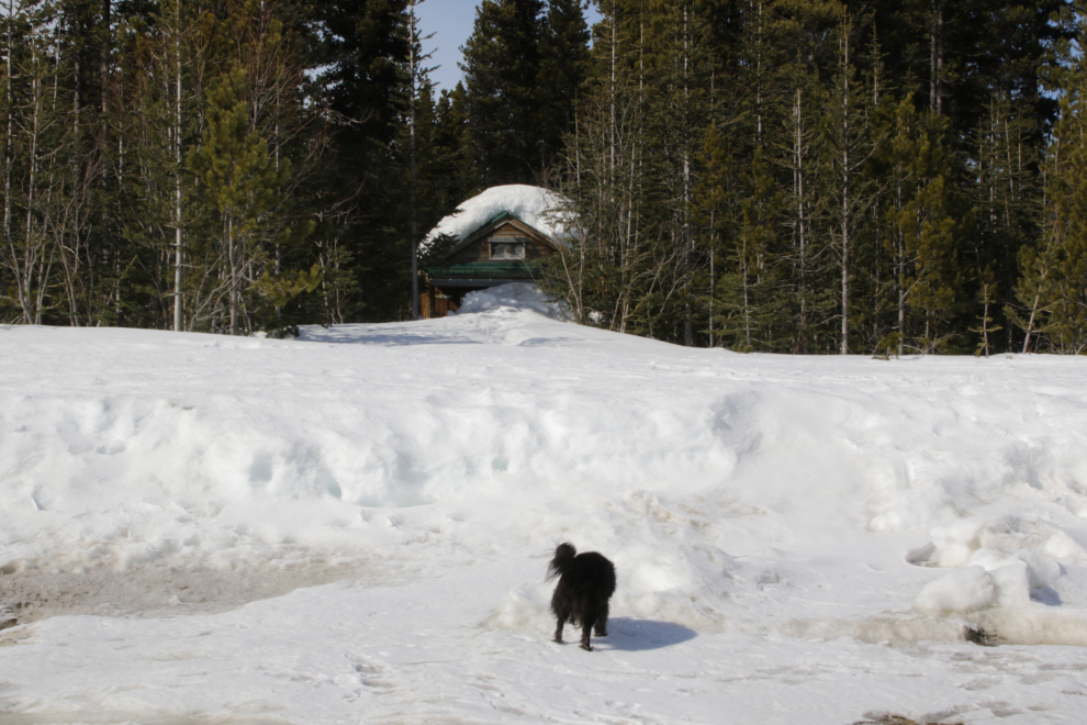
Log Cabin would be our major stop of the day, and we were there for quite a while. Warm sun, out of the wind, and lots of exploring for Bella and Tucker to do.
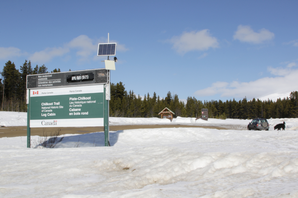
The winter outhouses were built a few years ago because the main bathrooms were too hard to maintain once snow arrived.
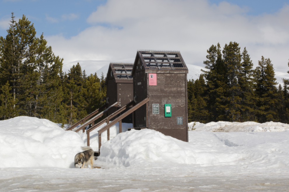
You can see what I mean about the main bathrooms being too hard to maintain 🙂
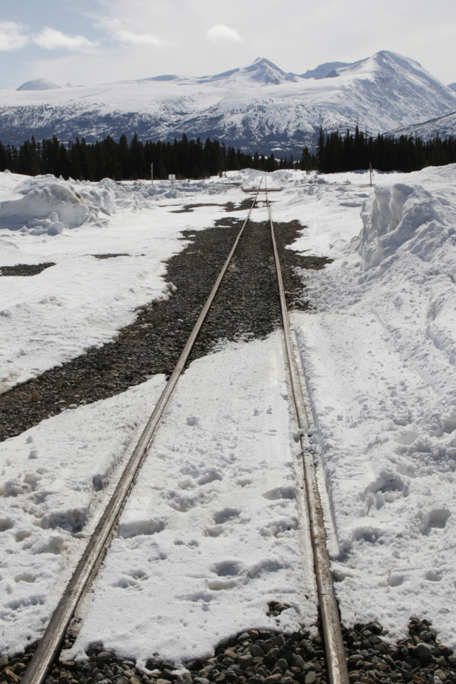
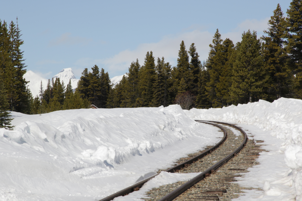
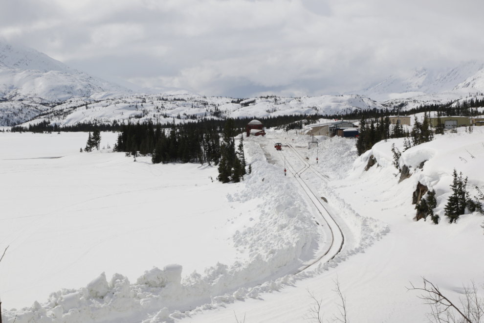
Looking south along the White Pass & Yukon Route railway line from Log Cabin. They’ve just recently been cleared for the coming season.
And the view to the north, towards Lake Bennett and Carcross.
As expected, Skagway’s weather reached into the White Pass, so Fraser would be where I turned around.
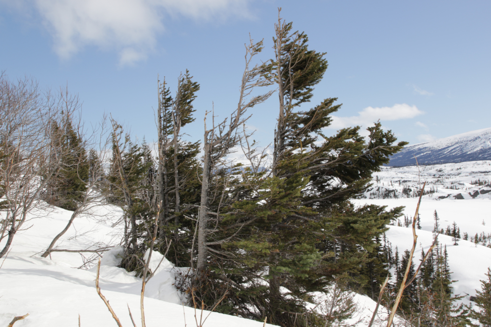
There’s no question where the prevailing winter winds come from. The north winds are often full of ice crystals that strip the upwind side of the trees.
The view across Shallow Lake just north of Fraser.
The tracks are all cleared at Fraser, now they have to get the parking lot ready for all the tour buses that pick up or drop off passengers here. Skagway to Fraser or vice versa is commonly done as train one way, bus the other.
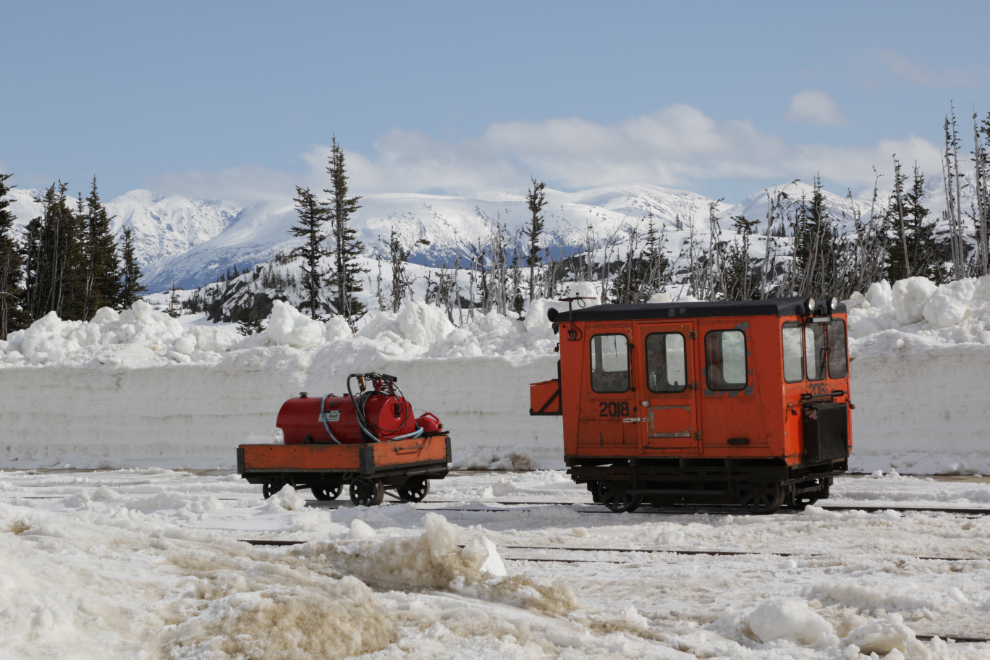
A Casey or speeder with its fuel trailer at Fraser.
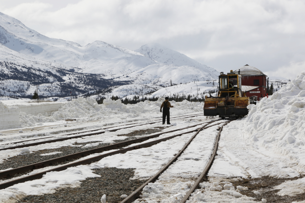
That’s a Kershaw Ballast Regulator coming towards me – one of the machines that keeps the ride smooth for train passengers.
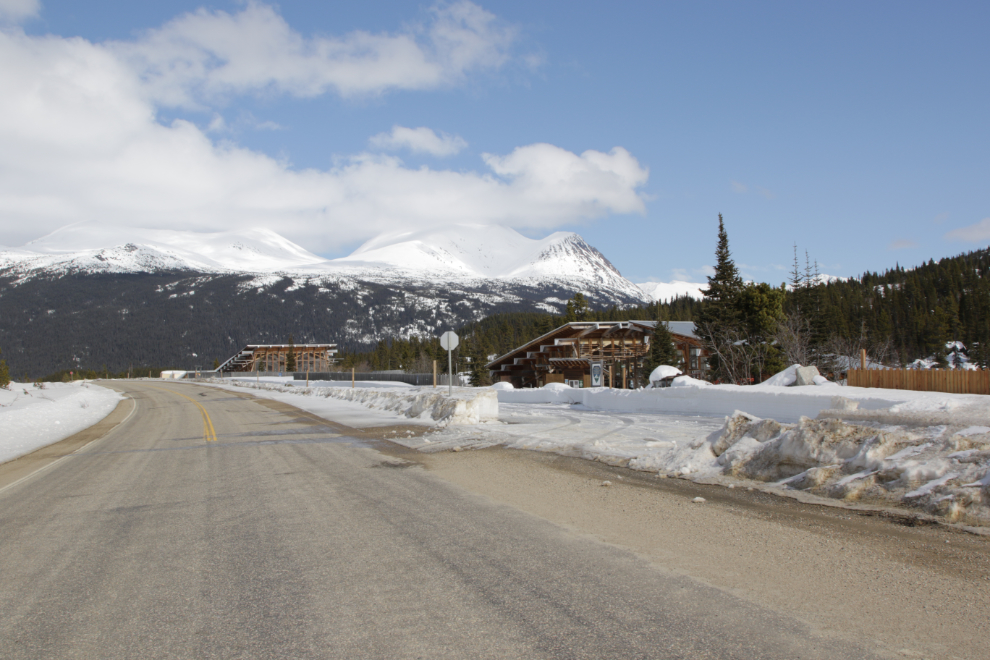
Heading home, I stopped to get a shot of the start of clearing the Yukon Suspension Bridge property for another busy season.
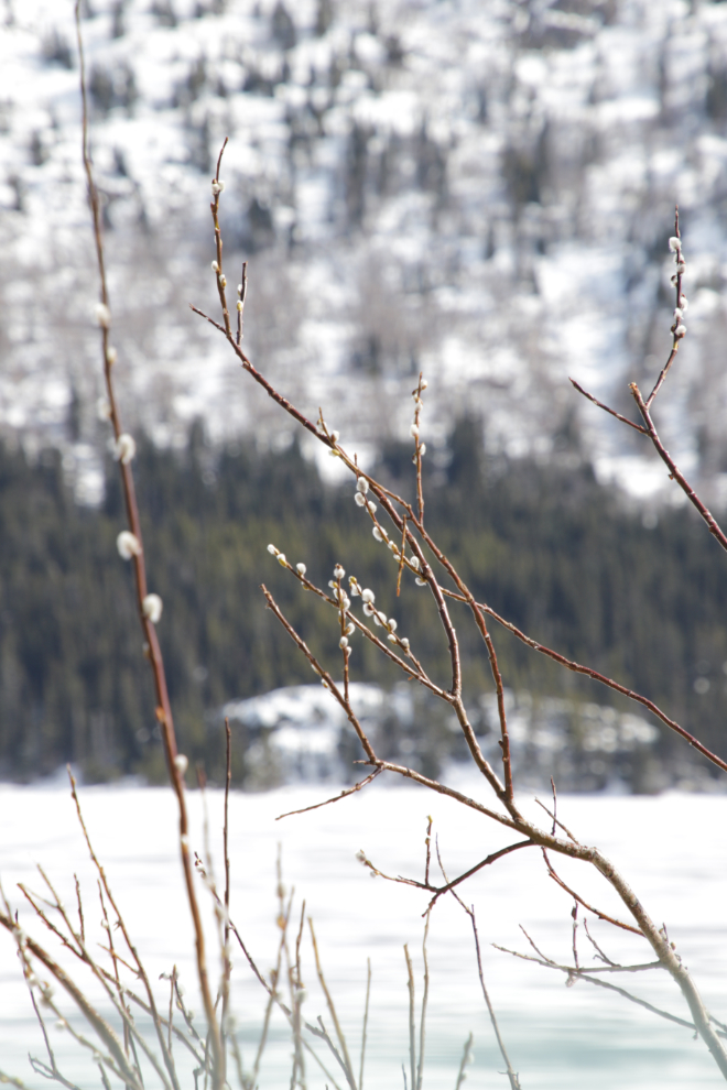
Seeing my first pussywillows of the year, along Tutshi Lake, prompted a U-turn! 🙂
Another view of Dail Peak.
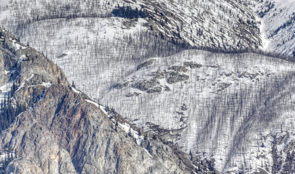
Nearing Bove Island, noticing the patterns and textures created by the rocks of Lime Mountain and the burnt trees from a 2018 wildfire got me to stop for a few photos.
We got home just after 3 pm – it had been an excellent day and felt like a pretty big step in the right direction. I went straight to bed for an extra-long nap with Tucker, then that evening got a message from a friend in Inuvik asking if I’d like to fly up, do some exploring with him to Tuktoyaktuk and Aklavik, then drive the Dempster Highway and North Klondike Highways home. When? In 2 days! So far I’ve expressed a lot of interest, but as soon as I post this I need to lay the plan out on paper and show Cathy before calling Air North for a seat. Hopefully my next few posts will be from that trip. Although I’ve been to Inuvik probably 15 times, and Tuktoyaktuk half a dozen times, this would be the first time to Aklavik, and it’s an ice road to get there. And my Arctic visits were all long before the blog, most in the 1990s. Fingers crossed I can make this work.
Edit: April 5, 09:40 – we got that trip put together and I’m off to Inuvik on Sunday. I’m looking forward to showing you country that few people ever see. 🙂
It is rare that I fall behind in posts, but I certainly enjoyed this one, the photos and what almost seemed like an uptick in mood and energy as the day progressed and your excitement about the proposed trip…yes! I will be looking forward to catching up on your travels and know I have dozens and dozens of photos of the north country to enjoy! As always, thanks for sharing your adventures big and small.
Wow….. that was an enoyable blog.
Thank you, Neal 🙂
So happy to read your posts. Have a good trip! Stay safe.
Thanks, Patsy. I’m sure looking forward to getting back to sharing some unique Adventures like in the before days 🙂
Beautiful photos as per normal Murrster, I left the Yukon in 1998 and through your adventures my former Yukon life returns, off to the NWT, wondering if the zoo is still open in Inuvik, Eskimo inn, igloo church, Tuk U t shirts, all weather road to Tuk yippee, Demspter highway winter cruising sounds amazing, Stan still working at eagle plains I wonder , look forward to the photos, take care bon voyage eh.
Thank you, Paul. It’s going to be an amazing experience – a new Adventure combined with a significant flashback. Incredibly, Stan is still at Eagle Plains. Strange things done in the Midnight Sun – my busload of people actually got mooned by some 5%er as we neared Eagle Plains, if you can imagine that! 🙂