From Winter to a snow-free hike at Skagway
I’ve been watching the weather forecasts to make another try to get to Skagway, and yesterday, though not great, was the best day in Skagway for 10 days or so, and was forecast to get as the day progressed. in both Skagway and Whitehorse.
The day turned out to have a great deal of variety, and this post needed 49 photos to show you! 🙂
At 09:50, I was about to turn onto the Alaska Highway, with the day looking pretty decent, at -10°C/+14°F.
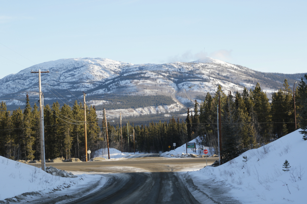
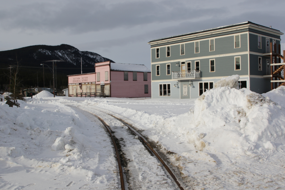
I decided to make a loop through Carcross to see what’s been happening. Pretty quiet, as expected.
I was surprised to see the railway lines plowed out. I should have parked and walked to the bridge to see how far the plowing went, but that just felt like too much work.
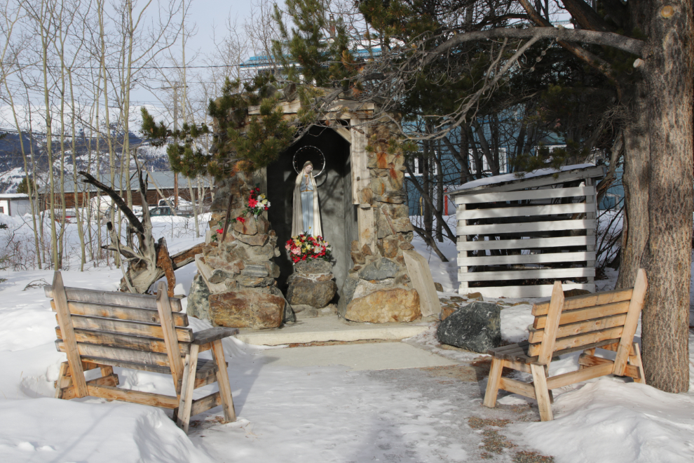
The grotto that was built beside the Catholic church in the form of a mine tunnel a few years ago is quite wonderful.
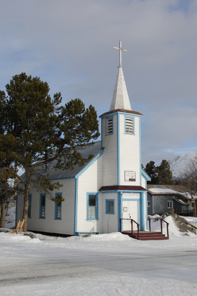
St. John the Baptist Church was brought from the long-abandoned community of Conrad to this site in the early 1940s.
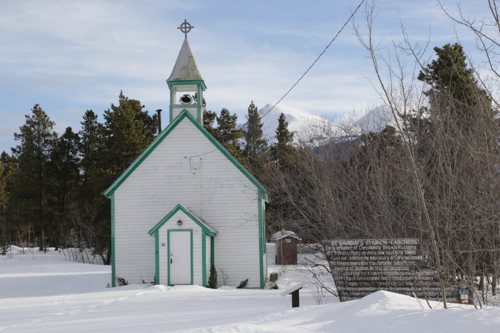
While the Catholic church is being used, St. Saviour’s Anglican church isn’t. That’s the opposite of the situation in the community historically – the Anglican church was always the strongest. It’s possible that the fact that the Anglicans ran the Choutla Indian residential school in Carcross explains that change.
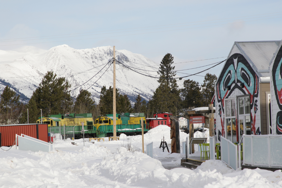
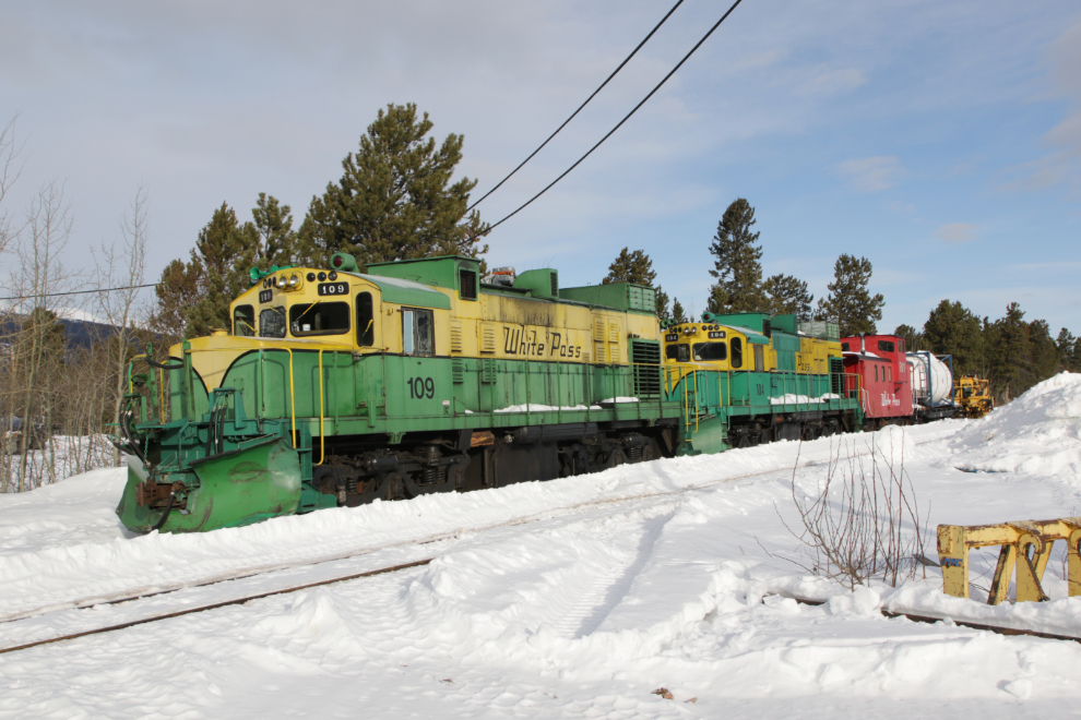
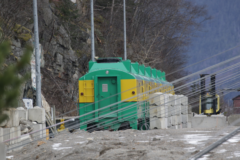
The work train, powered by ALCO locomotives #109 and #104, is still snowed in. The locomotives were built by the American Locomotive Company – #104 in May 1969, and although Wikipedia says that ALCO ceased production in 1969, #109 was built in December 1971.
Looking back to the north at 10:58.
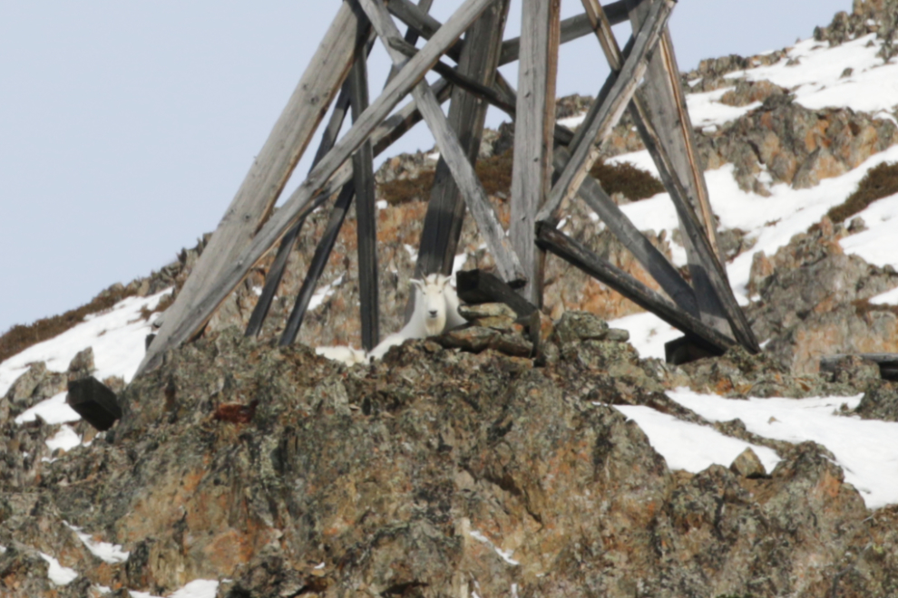
I shot the next photo of one of the 118-year-old aerial tramway towers at Pooley Canyon, and it wasn’t until I saw it on the big computer screen that I noticed the mountain goat laying under it watching me.
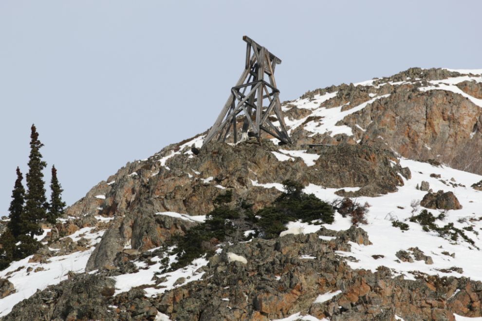
The goat 🙂
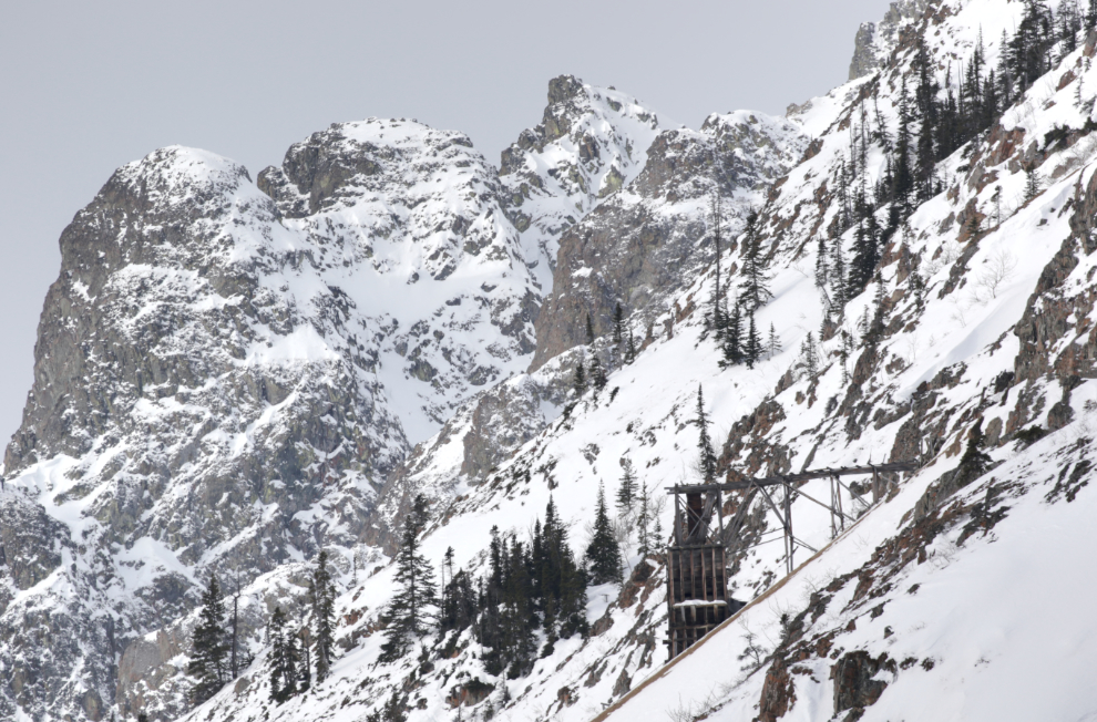
Stopped at at Pooley Canyon, I decided that the Venus Mine high above needed attention…
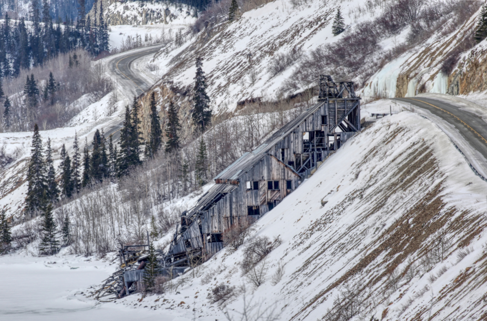
…as did the Venus mill a little bit below (processed as an HRDI to bring out the detail).
Starting to drop down to Tutshi Lake, the skies got quite dreary, and my hopes to go snowshoeing at the summit disappeared.
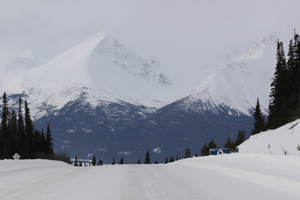
The roof of the restaurant at the Yukon Suspension Bridge can be seen on the left in the next photo. There was pretty much no traffic on the road other than some fuel tanker trucks bringing their liquid gold up from Skagway.
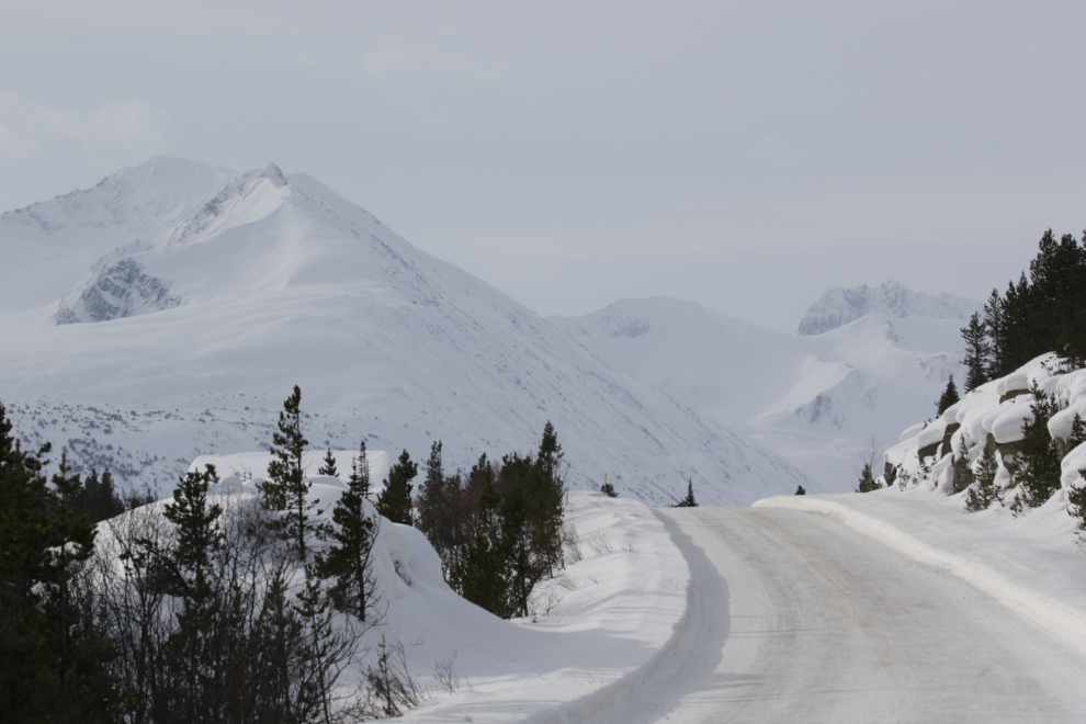
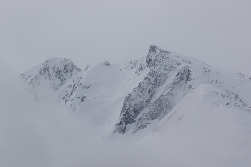
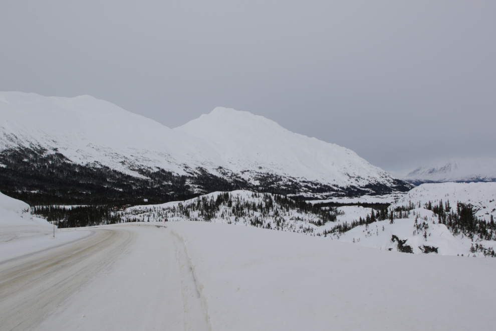
Nearing the White Pass summit, only occasional peaks could be seen in breaks in the lower cloud layers. There were quite a few people camped in the pass right from Log Cabin to the summit, with vans, trailers, and motorhomes.
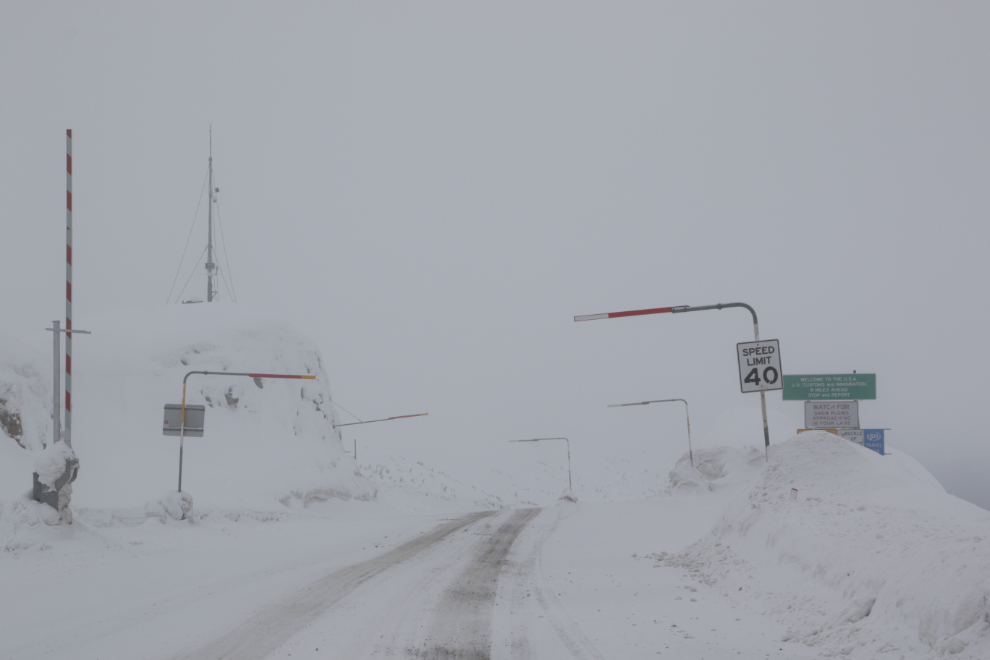
At the Canada-USA border, it was socked right in. I still had fairly high hopes of getting out of the white stuff at Skagway, though.
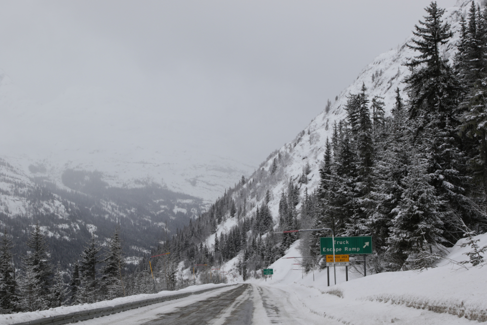
One of the truck escape ramps along the steep drop to sea level. It’s high testament to the quality of the people driving the semis here that the only time I’ve ever seen them used was many years ago when a trucker’s strike brought in some scabs (oh, sorry, “replacement drivers”) from down south.
Crossing the border took a bit longer than usual, as I got pulled aside for secondary examination. That secondary took about 10 seconds 🙂
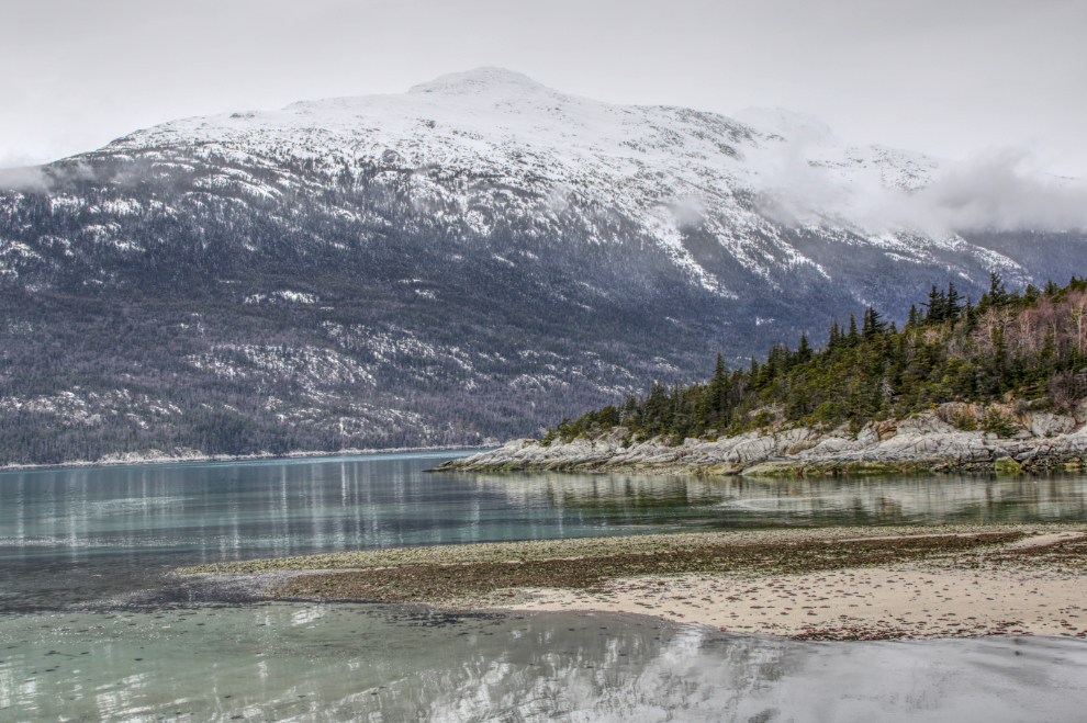
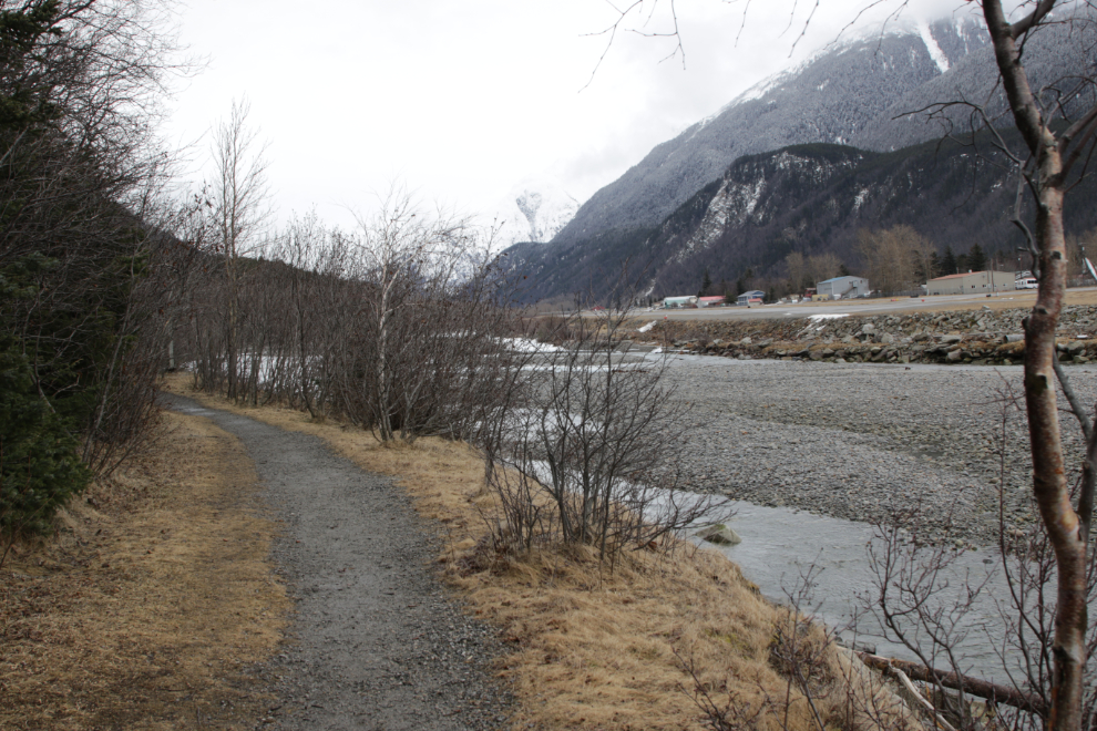
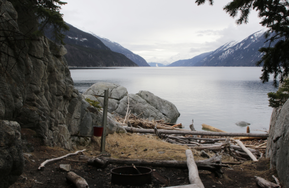
At 12:30 I had reached the sea, and yes, was out of the snow. The next photo shows the mouth of the Skagway River, with Yakutania Point, one of my planned hiking destinations, on the other side.
The steel footbridge across the Skagway River.
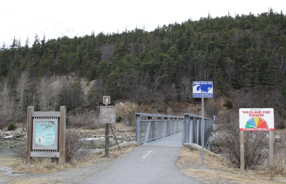
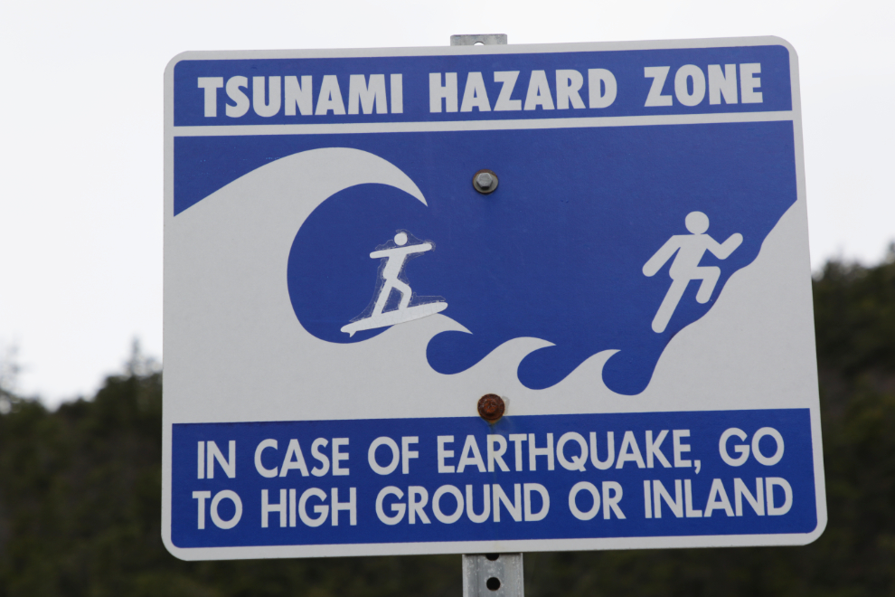
This irreverent, very “Skagway,” modification of the Tsunami Hazard Zone warning sign at the bridge always makes me smile 🙂
Across the bridge, I decided to turn to the right instead of left, as I don’t think I’ve ever been to the Pet Cemetery. The trail starts as a level path along the river.
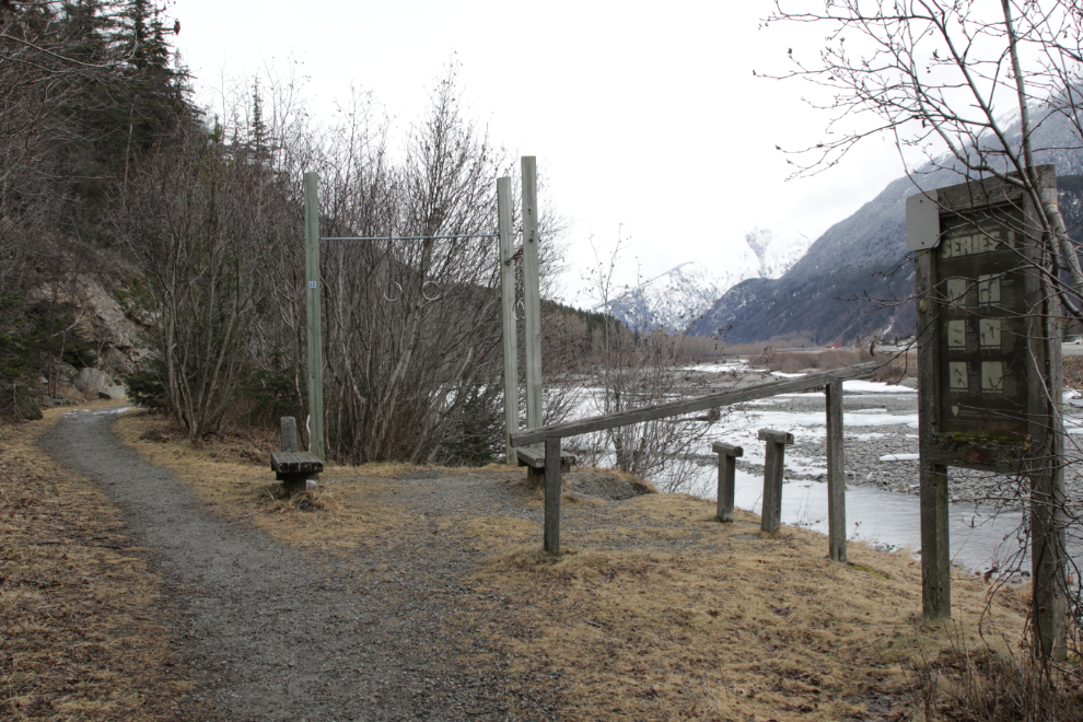
There is a variety of exercise equipment along the trails, with large panels about this parcourse (to save you Googling as I just did, that’s “an outdoor exercise track or course, especially for joggers, equipped with a series of stations along the way where one is to stop and perform a specific exercise”).
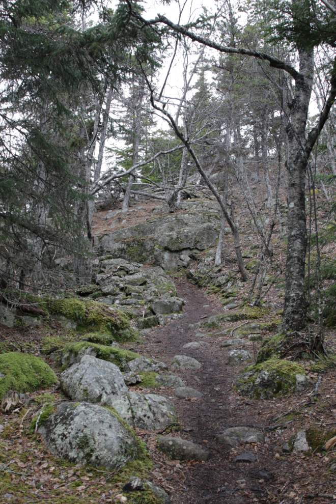
The trail started climbing but is a lovely route. I really love coastal forests.
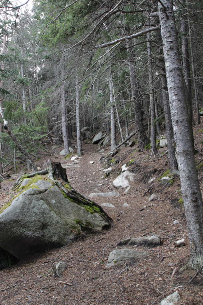
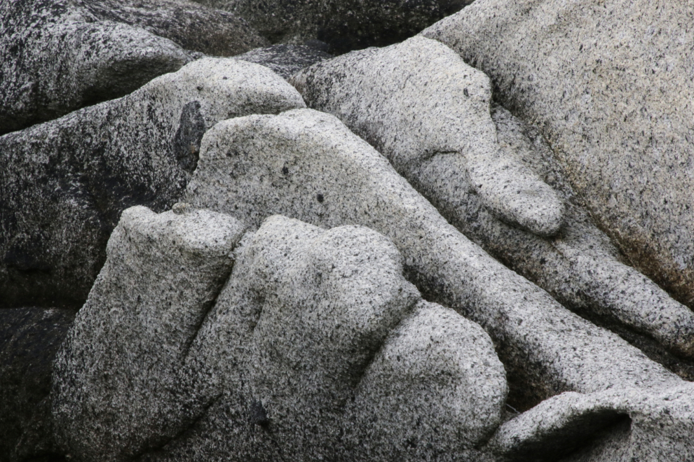
As the trail climbed into the granite, it got even more interesting.
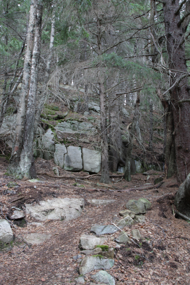
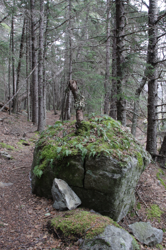
This was interesting – a tree started growing on top of a granite boulder, but then after a while (a couple of decades, I would guess by the size of the trunk), couldn’t survive there.
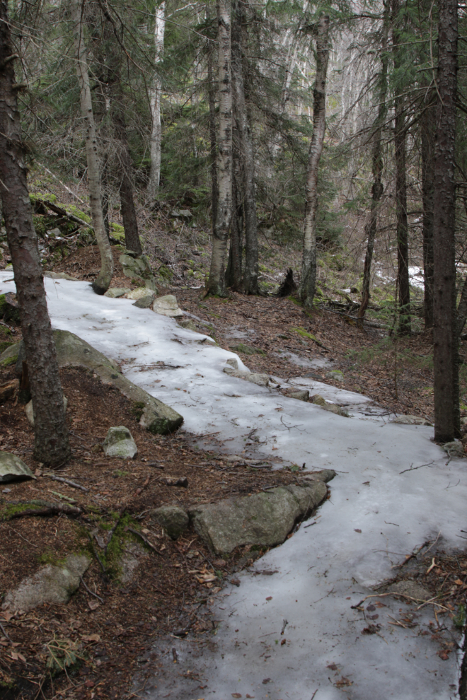
At 12:55 the trail suddenly became a sheet of ice, and I turned back. I’ll see the Pet Cemetery another time.
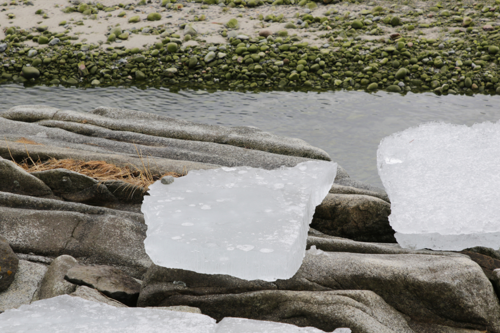
Back along the river, a wide variety of shapes and textures – those ice chunks are about six inches thick.
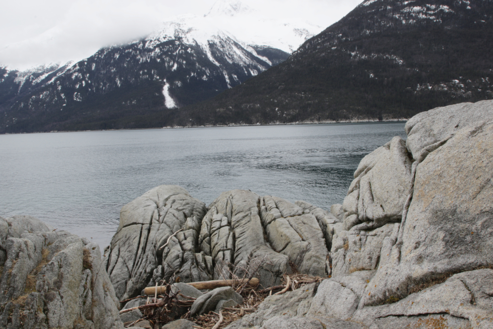
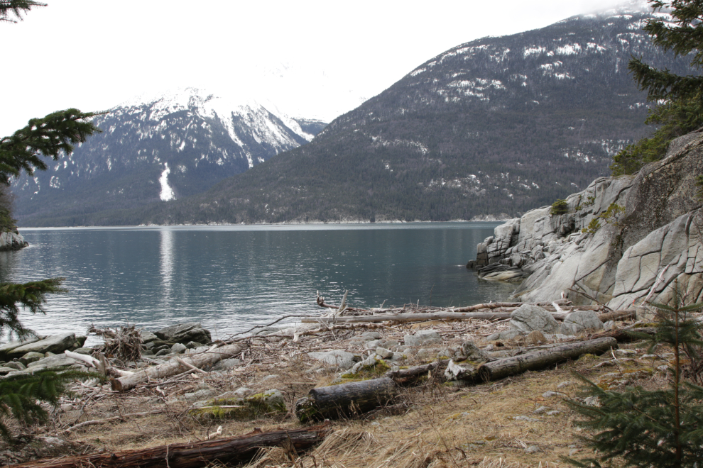
I have shot a lot of photos at Yakutania Point over the years – I love both the broad views and the details.
At the north base of the point is a little cove, and I stopped there for a few minutes. Despite its popularity, the cove doesn’t seem to have a name.
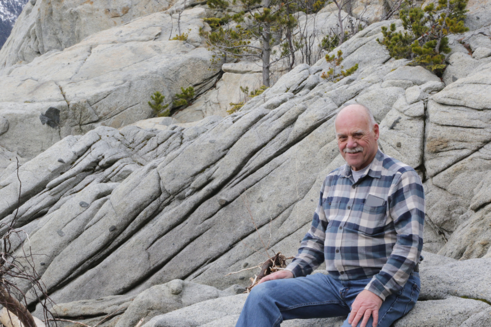
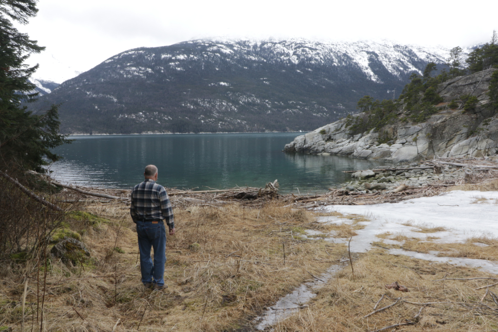
I was in a really good space, and decided to shoot a selfie there.
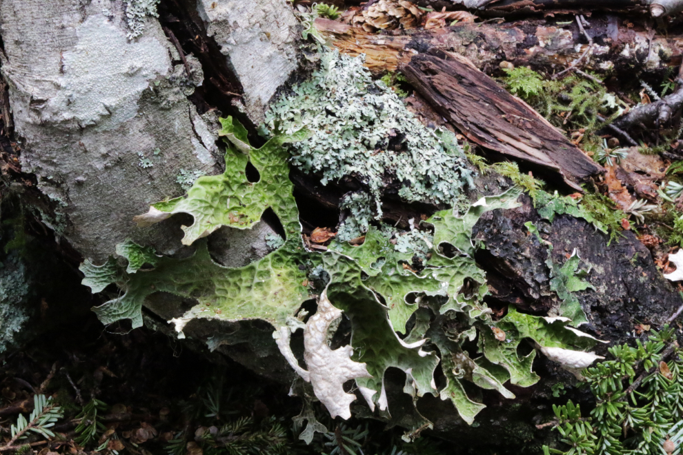
An endless fascination with the textures and patterns 🙂
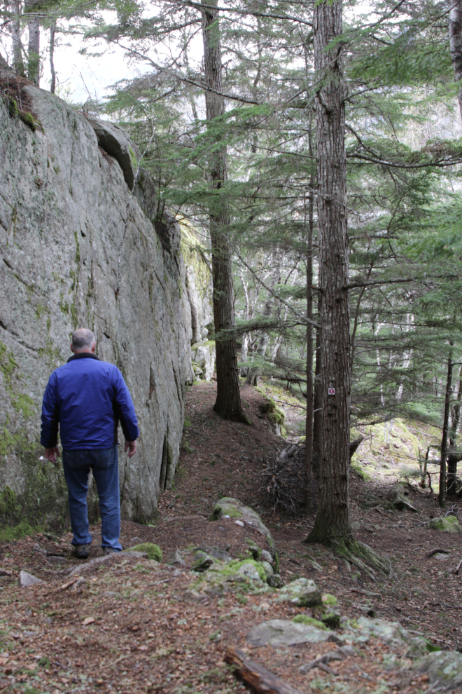
Heading back towards town, I came to a junction in the trail, and decided I wasn’t ready to leave, and I don’t think I’d ever seen to Smuggler’s Cove. The trail to Smuggler’s has great variety, with some steep climbs….
…and some impressive cliffs.
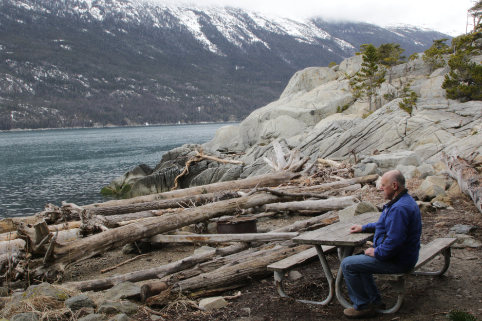
Reaching Smuggler’s Cove at 1:45 (Yukon time because I can’t deal with the actual 2-hour time difference!), I saw an interpretive panel, so started there. I had forgotten that there’s also a road to this place.
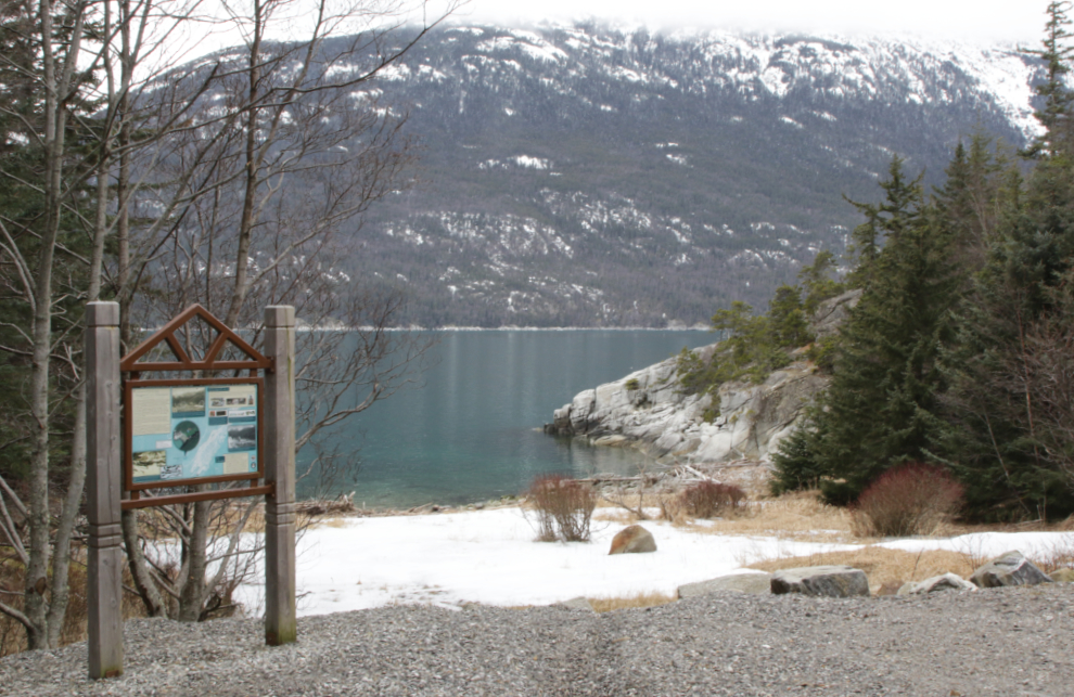
All signs of the buildings that used to be here are gone, and the cove, at least in March, is as beautiful and peaceful now as it’s ever been.
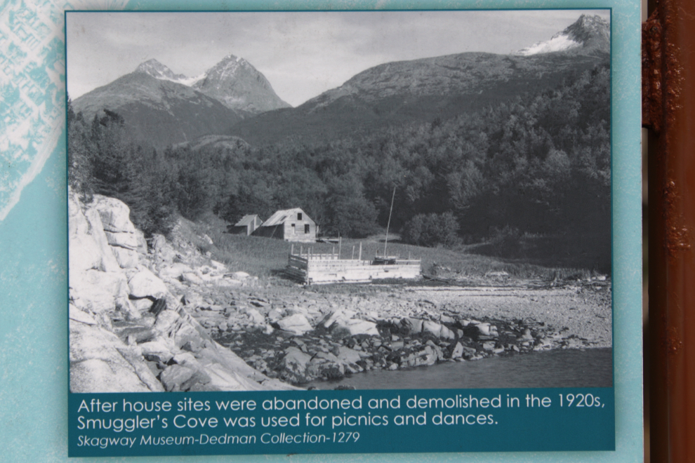
The interpretive panel describes the origin of the intriguing name: “It was during a mapping survey in 1883 that Lieutenant Commander H.E. Nichols of the U.S. Navy gave Smuggler’s Cove its current name. It is possible that the features which made the area ideal for making landfall in canoes (convenient, sheltered, and relatively flat) led Nichols to imagine it would be an ideal location for smugglers as well, but we may never know for certain.” Not nearly as interesting as what I had come up with 🙂
I spent a while poking around, soaking up the power of the place. This may now become a regular destination. Not by road, though – the rainforest trail seems to have provided a spiritual connection that made a big difference for me. This was the place I really needed to be on this day.
A final look. I would really like to be back there right now…
Back on the trail.
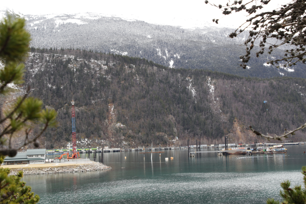
Nearing town again, I noticed that the Ore Dock is almost gone, the first step in a new development.
I was getting pretty tired, but wasn’t ready to leave, so I took a couple of side trails that led to the water. One long and steep one half-way back from Smuggler’s hugely intrigued me but I decided it was just too difficult to navigate. The first one I did take, though, led to this postcard-beautiful spot. This will be the Featured photo for this post.
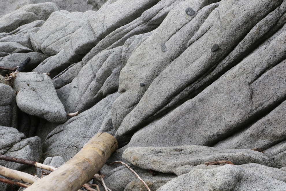
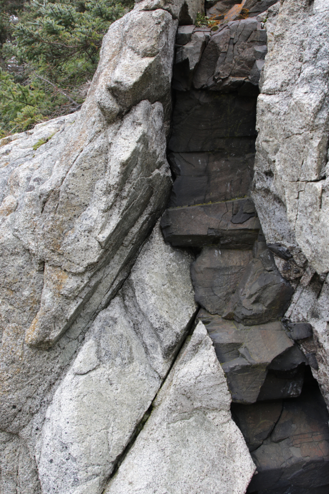
The next side trail took me to a tiny cove with some amazing vertical granite slabs!
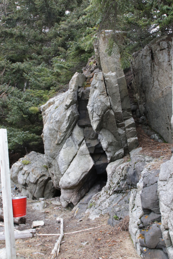
Volcanic intrusions into fractures in the granite aren’t all that common here, and this one was particularly impressive.
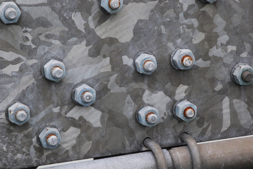
Now I was ready to leave – with a stop for lunch and some sausage Cathy wanted me to pick up. This detail on the footbridge caught me eye, though 🙂
Town didn’t work out well at all. I fueled up, but then both cafes I usually eat at were closed. I went back to gas station and was told that there actually is no place to eat until 4 pm. I was completely unable to figure out what time it was. I was very confused, nut convinced myself I could make the stop for sausage – they didn’t have any. Okay, time to head for home.
Well, not quite – from the trail I had noticed a line of locomotives on the Railroad Dock, so drove over there. The area is closed because of slide danger, but I got a couple of photos – the tracks have been covered over with gravel (on purpose), so the locomotives are actually stuck out there for the foreseeable future.
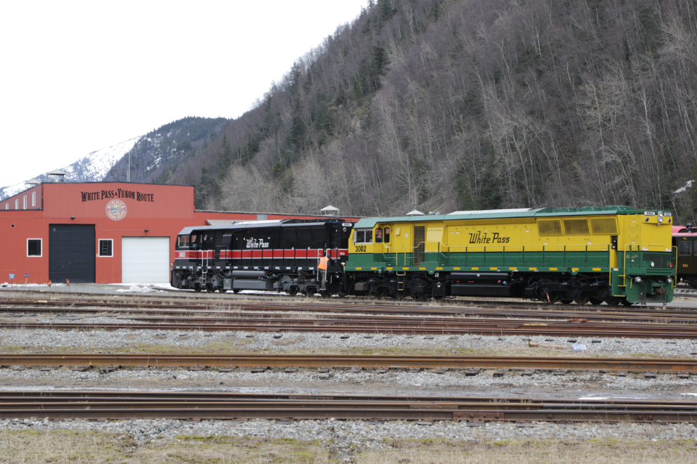
Heading north, two of the new locomotives, one in each paint scheme, were now in front of Shops, so I got a photo of them.
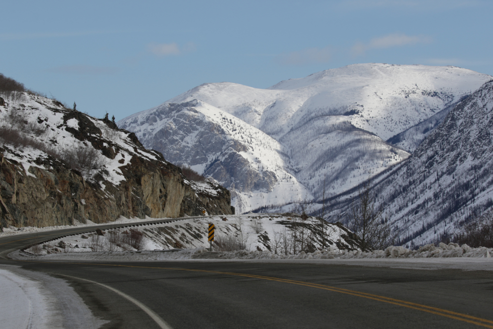
I only shot one photo on the drive home, just south of Fraser, though it was sunny for the last hour of the drive.
It wasn’t an easy day, but it was a very good day. This was my first successful solo drive to Skagway in 11 months. I unfortunately don’t think I can deal with having Bella and Tucker along yet, but I’ll keep working towards that.
Cathy and I are still thinking about future plans, and have modified a trip already booked for June, but there are some good Adventures coming 🙂
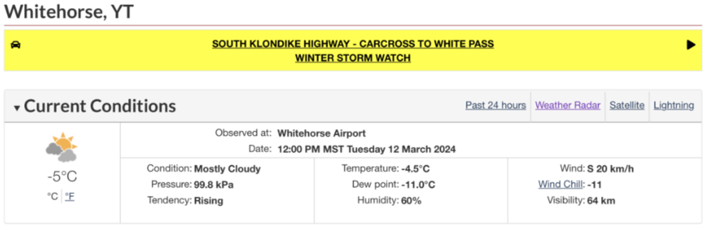
Addition: At noon, just after I posted this, the weather report was changed, with this warning added!
What an adventure! It is absolutely gorgeous in Skagway!
I recently came across your blog when searching for information on “The Ibex Trail” and now I am hooked on your blog! I subscribed to it so I don’t miss future posts. I have lots of reading to catch up on.
We moved to The Yukon in May of 2023 but haven’t had the chance to explore much due to work. Luckily now I can read about your adventures and add to our bucket list.
Looking forward to reading about your travels.
Thanks Holly, and a belated welcome to the Yukon! I hope you find lots of places to explore, and time to do it 🙂
Your eye for details never fails… from the locomotives to the goat at the mine (my wife and I actually first saw the lower goat and your own eye caught the other higher one!), the rock details, bolts on the bridge, and always some wonderful landscapes. Amazing how that road pass at the border collects the weather and for all purposes looked full on winter (as did your other photos that showed the roads)… Great to see you out and about, shame about the sausages.
What an interesting blog entry. Also some gorgeous scenery.