An excellent day – new flowers and old mines
I have some very good reasons to say “no” to most activities. But yesterday was an excellent day because I said “yes” to two. The first one was quite easy. Spring hasn’t really arrived at Whitehorse until I’ve been out photographing the first Prairie crocuses (Anemone patens) – that happened yesterday.
There’s one exposed, dry slope above Schwatka Lake on the Miles Canyon Road that I’ve been shooting crocuses at for many years. I took Tucker with me, but Bella was asleep in the sunshine on her deck so I left her. She’s almost fully recovered from her knee surgery, but we’re still being very careful, as recommended by our vet.
The first photo shows the access to the trail – it’s not used a lot, and is easy to miss. There’s no parking, and parked on the shoulder you can’t get completely off the road, either.
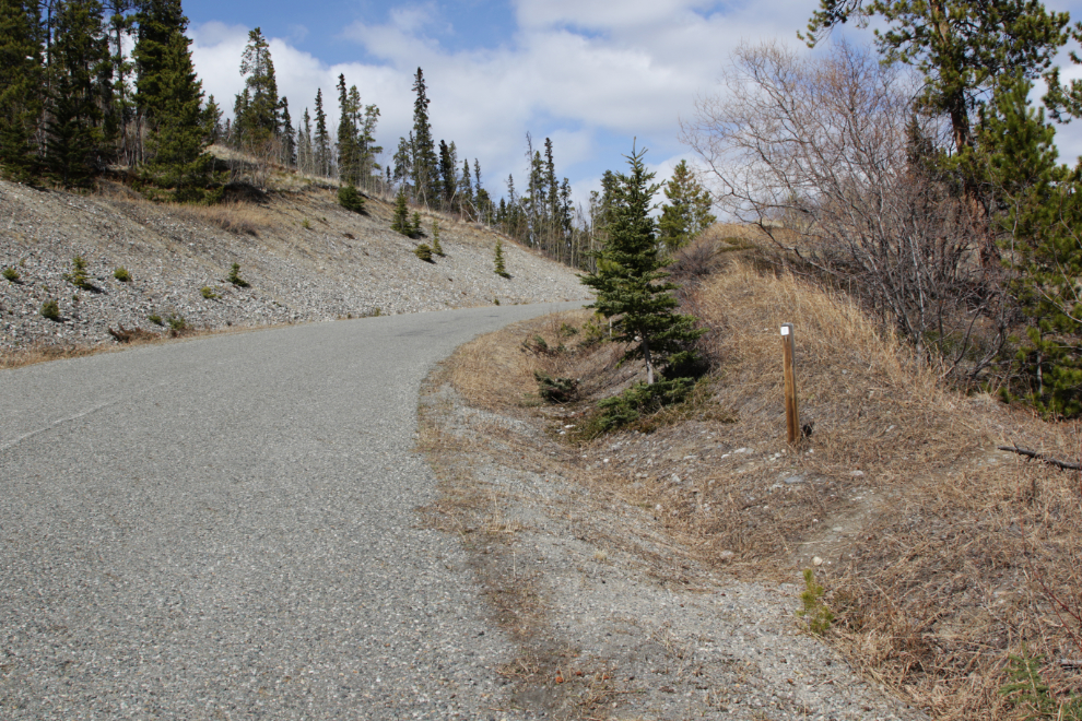
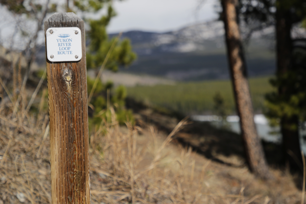
The trail is signed as part of the Yukon River Loop Route.
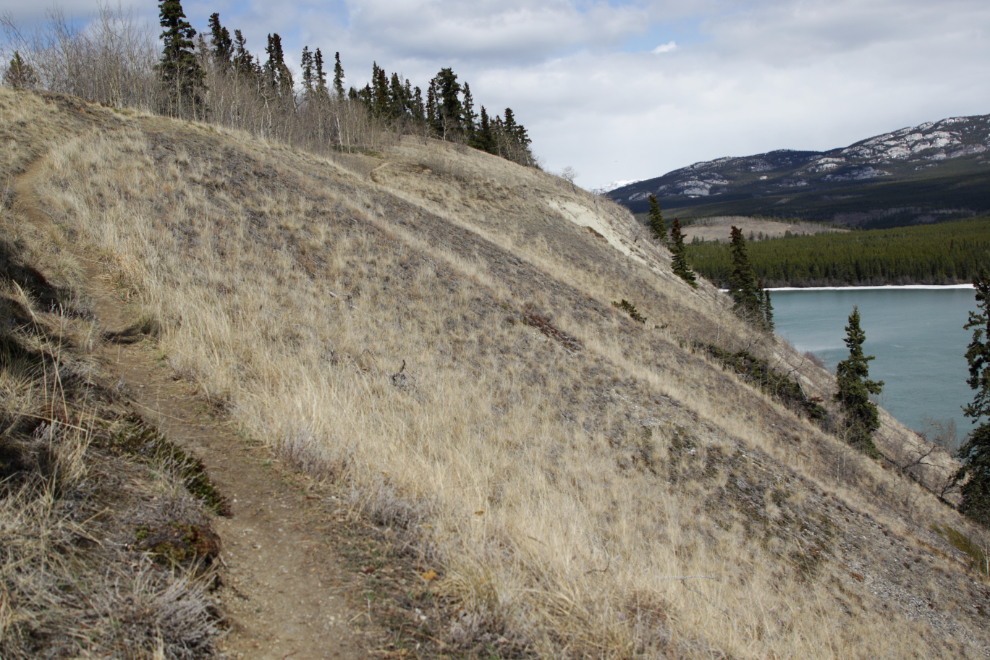
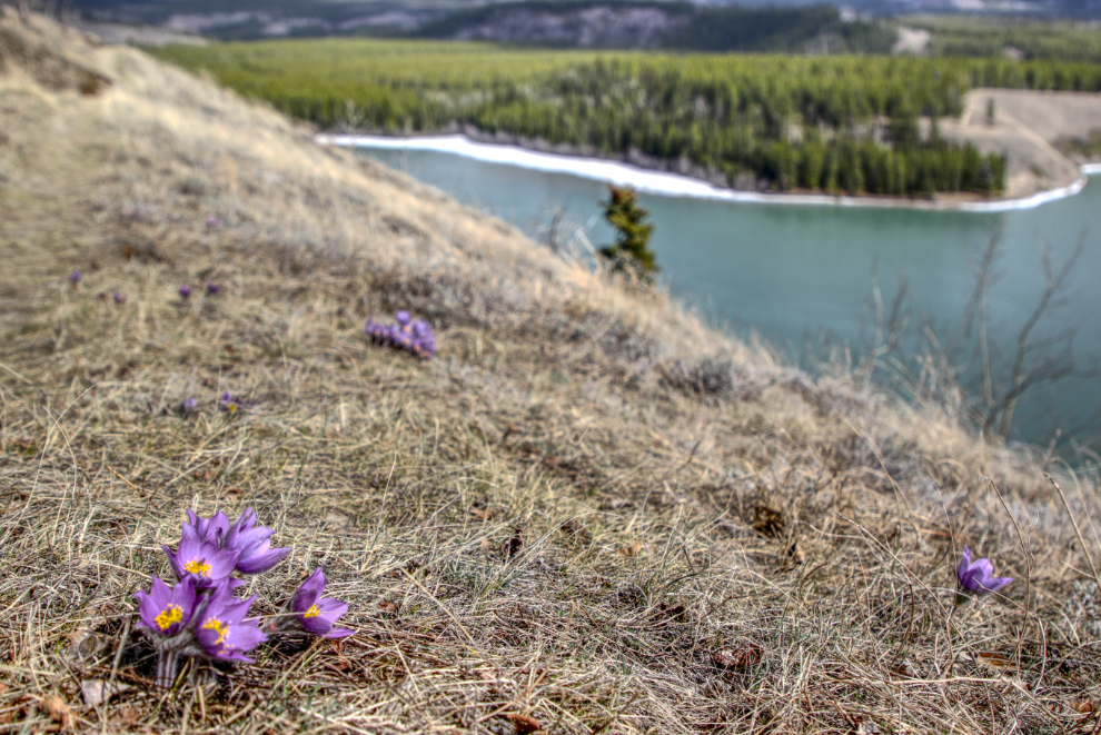
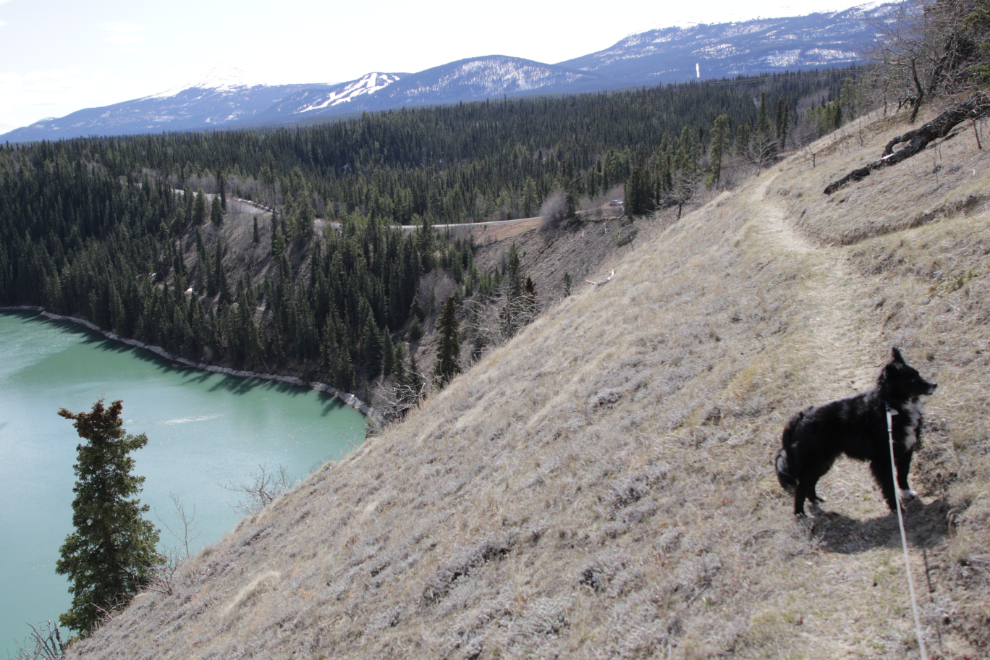
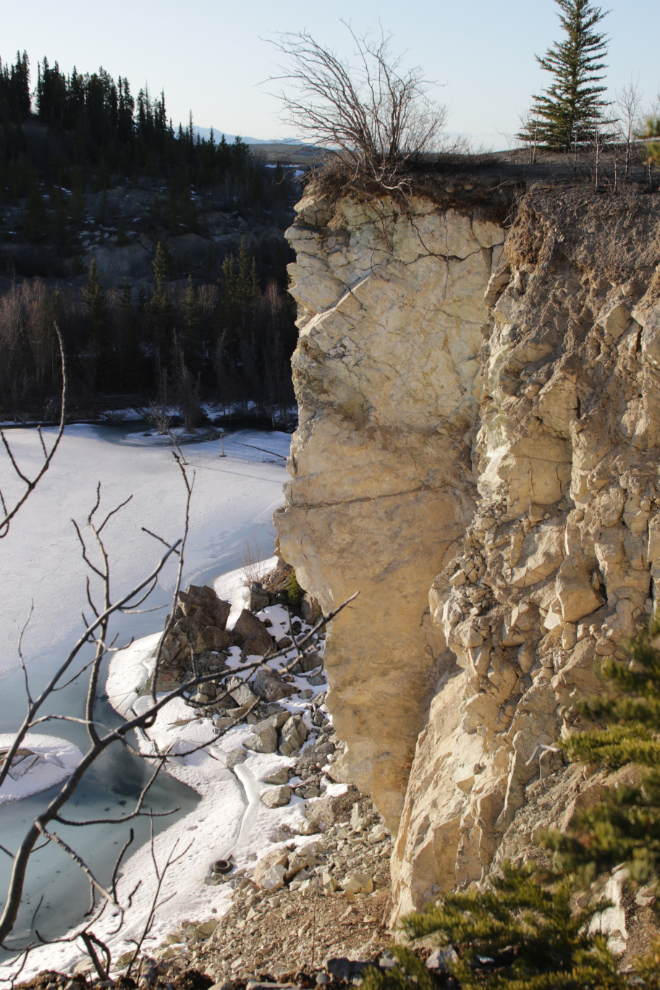
Some people apparently really dislike the exposure. Yes, it’s a very long way down to that icy water.
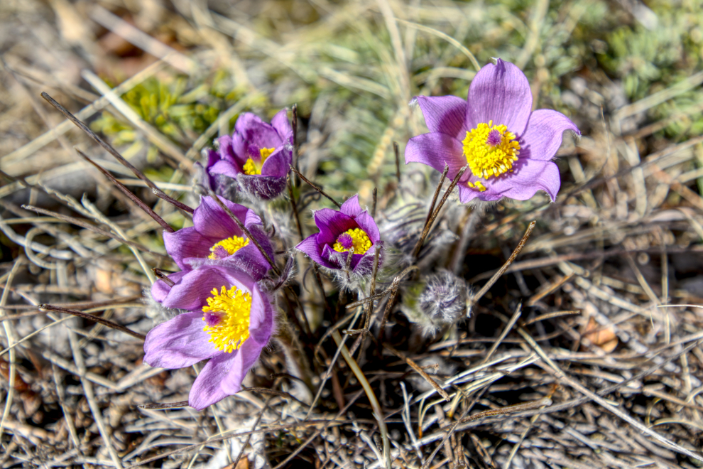
In just a couple of minutes, I spotted the first crocuses – there were quite a few of them on the ridge above the trail. The day was perfect, with some blooms at their peak and others just starting to bud.
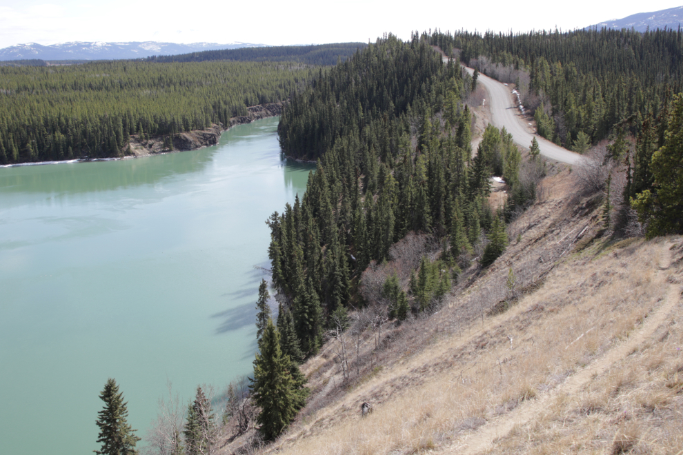
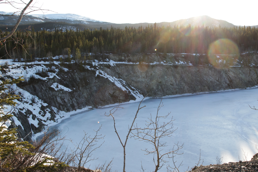
The next photo shows the view looking upstream to the bottom of Miles Canyon from that spot.
The Prairie crocus grows in small groups scattered across the landscape, and I was soon into another of four areas on this trail where they’re plentiful.
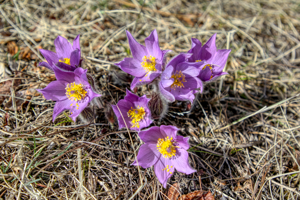
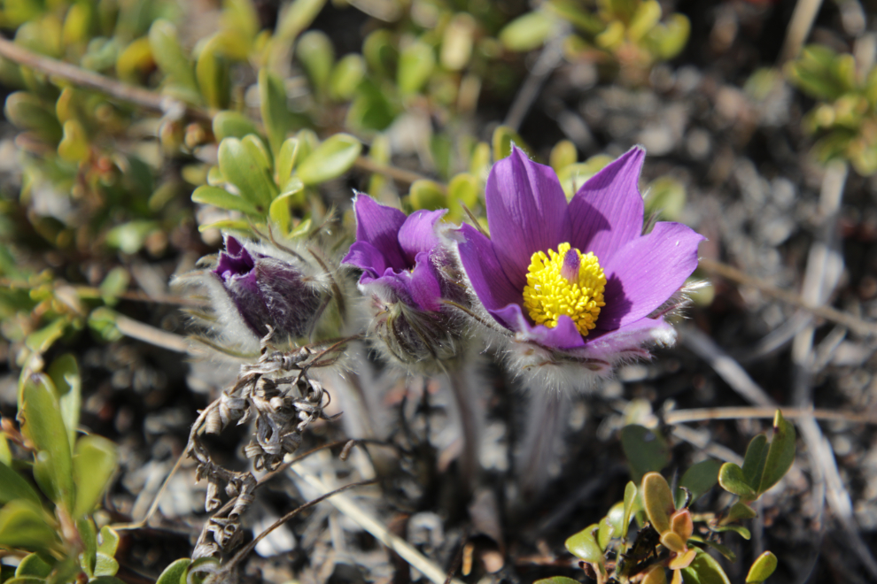
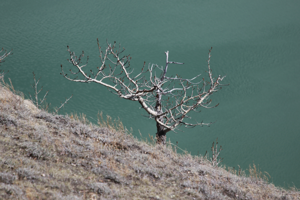
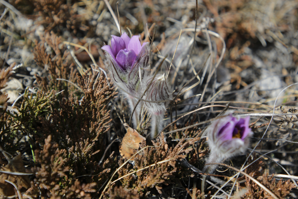
While the crocuses loudly proclaim Spring, this tree below the trail clearly thinks it’s too early to make that declaration yet 🙂 NatureNorth says “by blooming so early, the crocus assures itself of the complete attention of available pollinators – small bees and other insects.”
The next photo shows another distinctive survival technique of the Prairie crocus – fuzz that keeps the warmth in.
Just 15 minutes after leaving the car, Tucker and I were on our way back to it.
Well, with a couple more photo stops 🙂
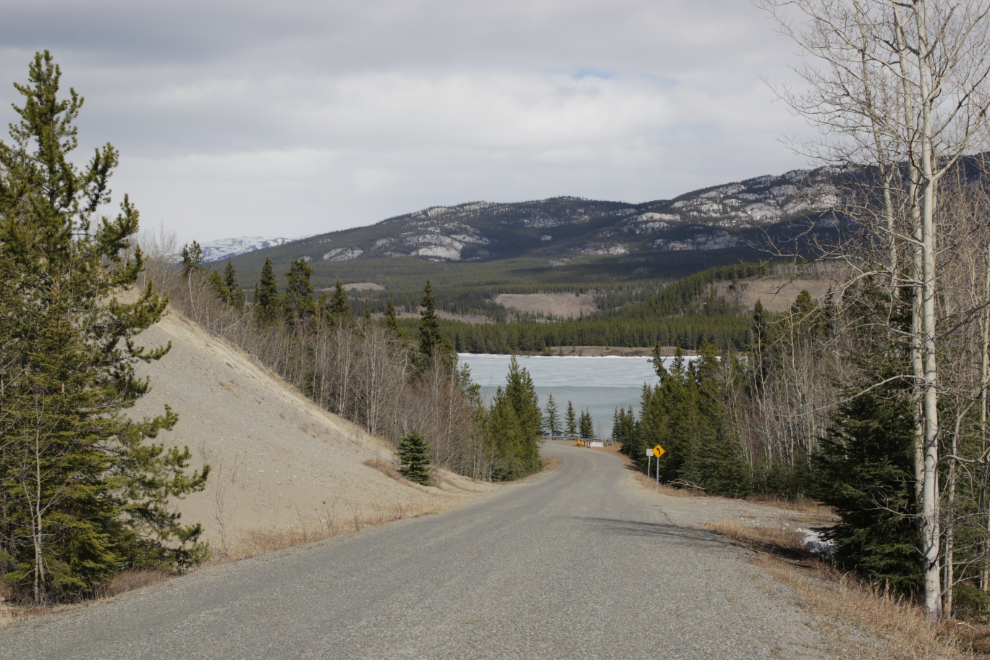
The final photo from this walk shows the view as the Miles Canyon Road drops down to Schwatka Lake, which still has lots of ice on it.
The other activity I had said “yes” to yesterday was a geology tour of the Whitehorse Copper Belt. I had seen the poster for it a few times but had waited until the last minute to register because I knew it would be at or perhaps beyond my abilities. I know the facilitator from a series of geology outings at Tombstone Park that they called “Tombstone Rocks,” and I had no doubt that this would also be excellent. I was very surprised to discover as I was writing this post that that weekend was 7 years ago.
It was disappointing to find that of the 9 people who signed up for the tour, only 3 of us showed up. So Helen, Copper Belt history expert Tim Green, and I, got pretty much a custom tour by Leyla Weston, Outreach Geologist at the Yukon Geological Survey (YGS), and Jeff Bond, head Surficial Geologist for YGS.
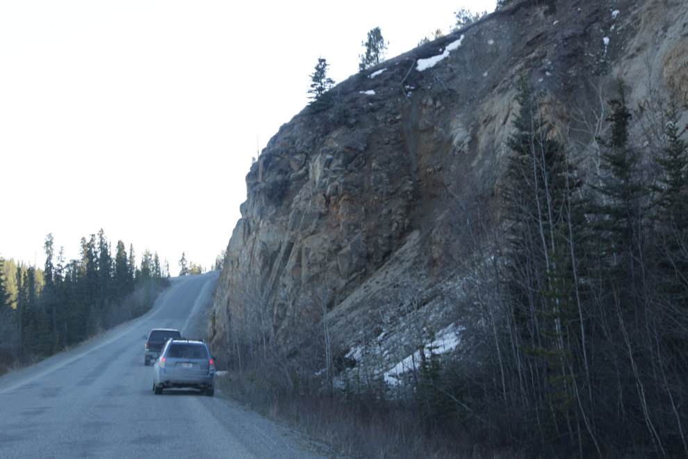
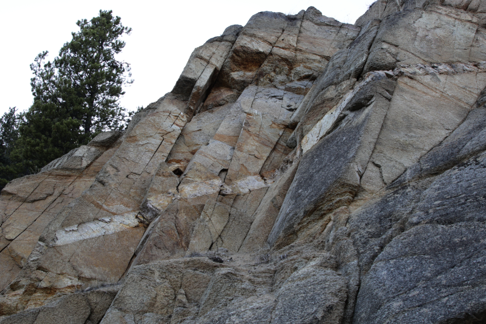
We began on the Fish Lake Road. I had forgotten to bring a notepad but trying to keep up with the amount of information being shared probably would have made my head explode, so perhaps it’s a good thing I did forget it. After driving past the oldest rocks in the area, a cliff of limestone, we stopped at this adjoining outcropping of granite for a detailed look. Leyla handed out rock hammers and hand lenses to each of us to use during our examinations. The sun had been warm, but just before 6:00 p.m., it was surprisingly cold here in the shade!
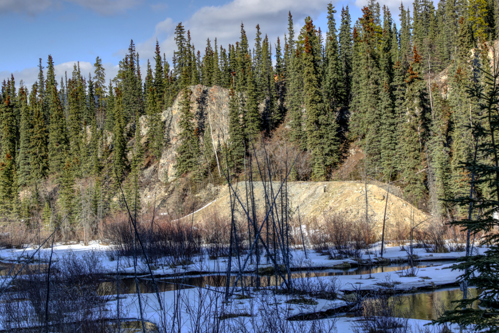
Right across McIntyre Creek from that spot is the first mine in the Whitehorse Copper Belt, the Copper King (the link goes to Tim Green’s main page on the mine). The ore deposit was staked in 1898 and development of the mine began the next year. The next photo shows the waste rock from the mine. The plan had been to explore that mine, but there was still too much snow on the access trail so that was cancelled.
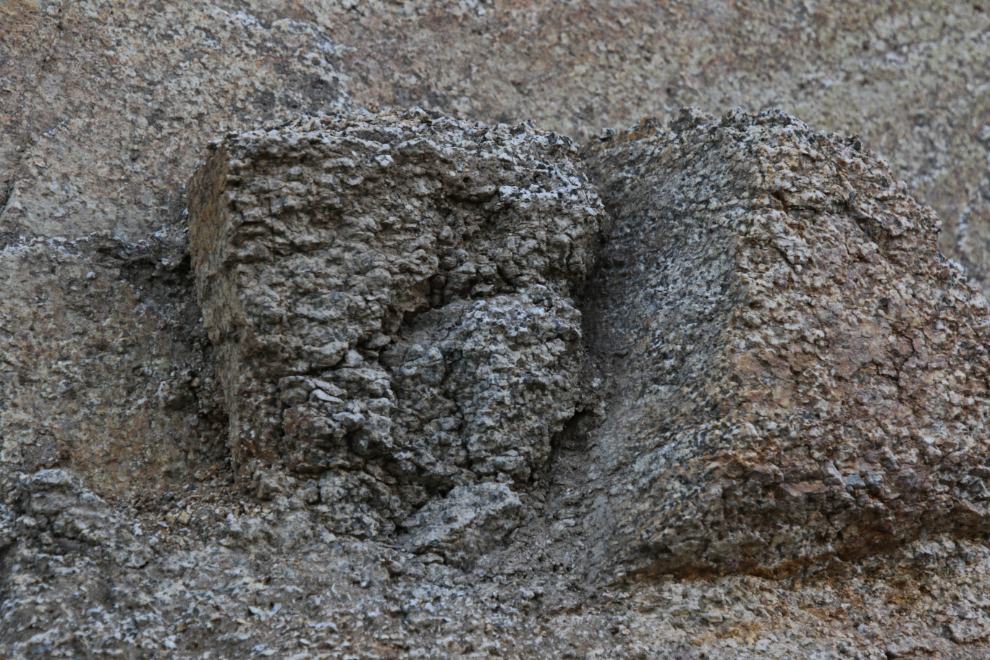
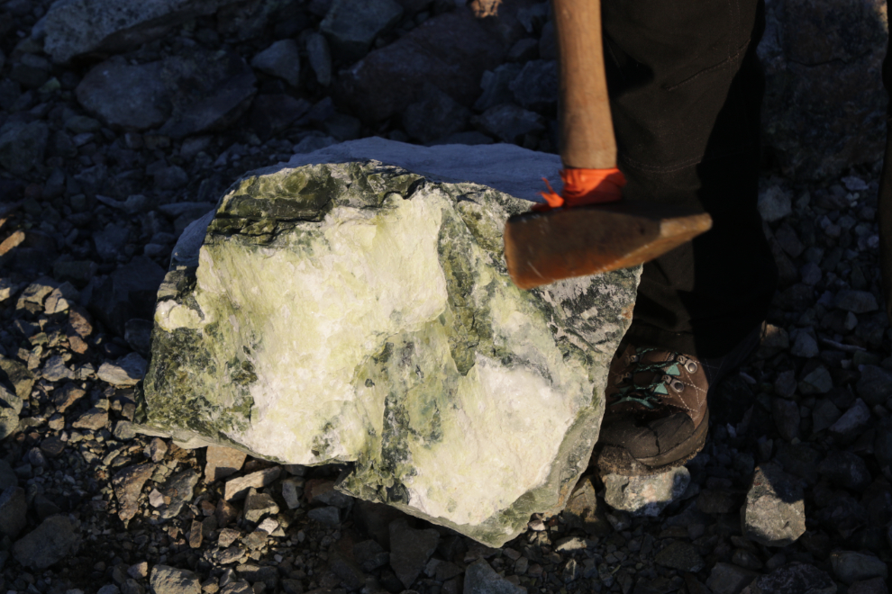
Back to that granite. Although I use that simple term, it’s actually granodiorite, a coarse-grained igneous rock similar to granite, but containing more plagioclase feldspar than orthoclase feldspar. The next photo shows how coarse and eroded it is – what you see there is about the size of two basketballs side-by-side, above my head.
I’m always intrigued by intrusions (dykes) of different rock into cliffs like this.
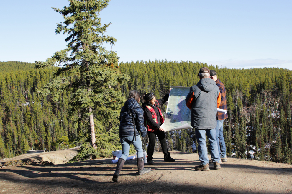
Our next stop was just a few hundred meters up the rocks on top of a sunny ( 🙂 !) cliff high above McIntyre Creek. Leyla and Jeff were well stocked with maps, photos, and a couple of buckets with a wide variety of rock samples.
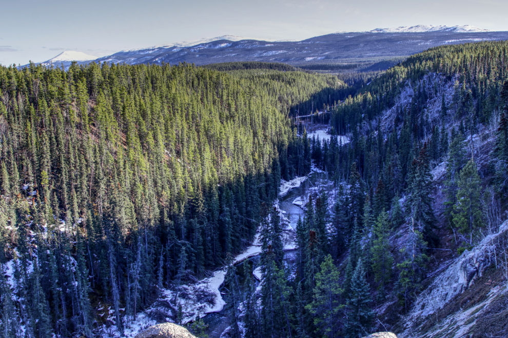
The next photo shows the view up McIntyre Creek from that spot. The canyon was created by drainage from the glacier that covered this area until about 12,000 years ago. Small McIntyre Creek is no longer any indication of the massive amount of water that created this meltwater channel – geologically, the creek is known as an underfit stream.
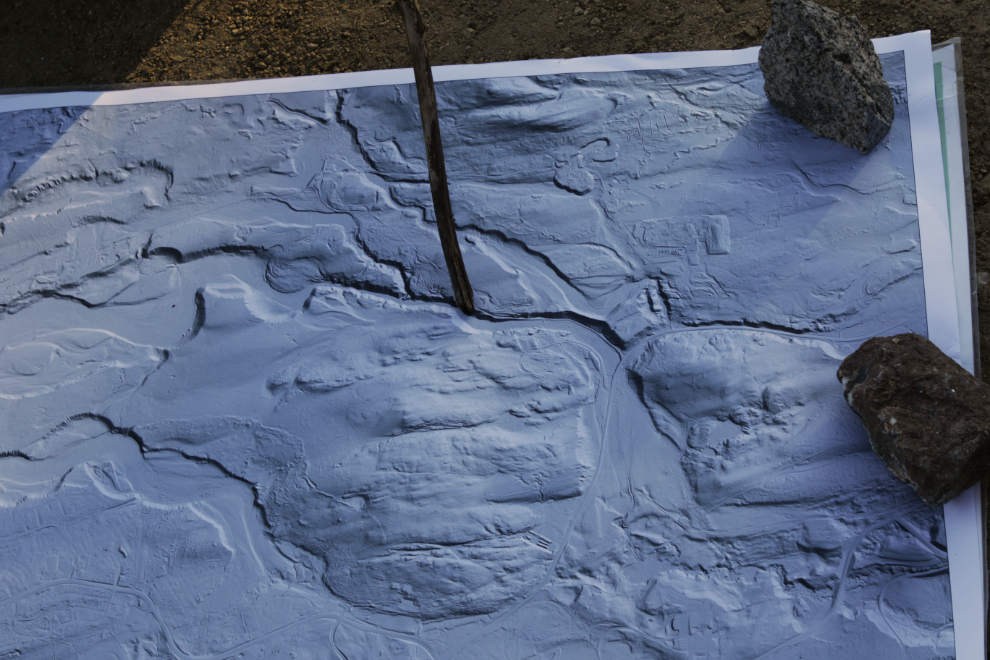
A couple of LIDAR images of the area were laid out. LIDAR (LIght Detection And Ranging) is a remote sensing technology used to acquire very detailed elevation data about the Earth’s surface. I don’t think I’ve ever had a good look at LIDAR, and find it fascinating – the things that show up are quite remarkable.
We spent quite a while at that location, as it was a superb vantage point to learn about both the geologic formation of the Copper Belt as well as the glacial re-contouring of the terrain.
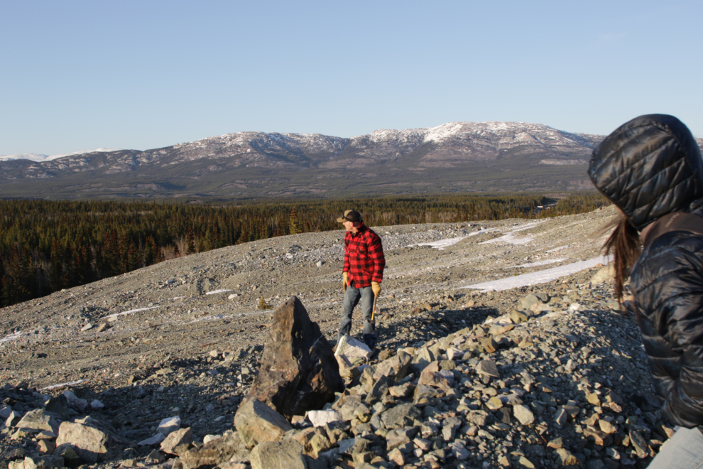
Next we drove a few kilometers east and then up the road leading to the Mount Sima ski area. It also leads to several old copper mines, and we parked and hiked (at times through a few inches of snow) to the Little Chief Mine. Development of the open pit and later underground mine began in 1966 – the pit is quite impressive. There are large fractures around the pit, and footing is quite unstable if you’re not careful.
Our time at the Little Chief was mostly spent looking closely at rocks of about a zillion kinds. This is a popular site for rockhounds from around the world, and it’s quickly clear why.
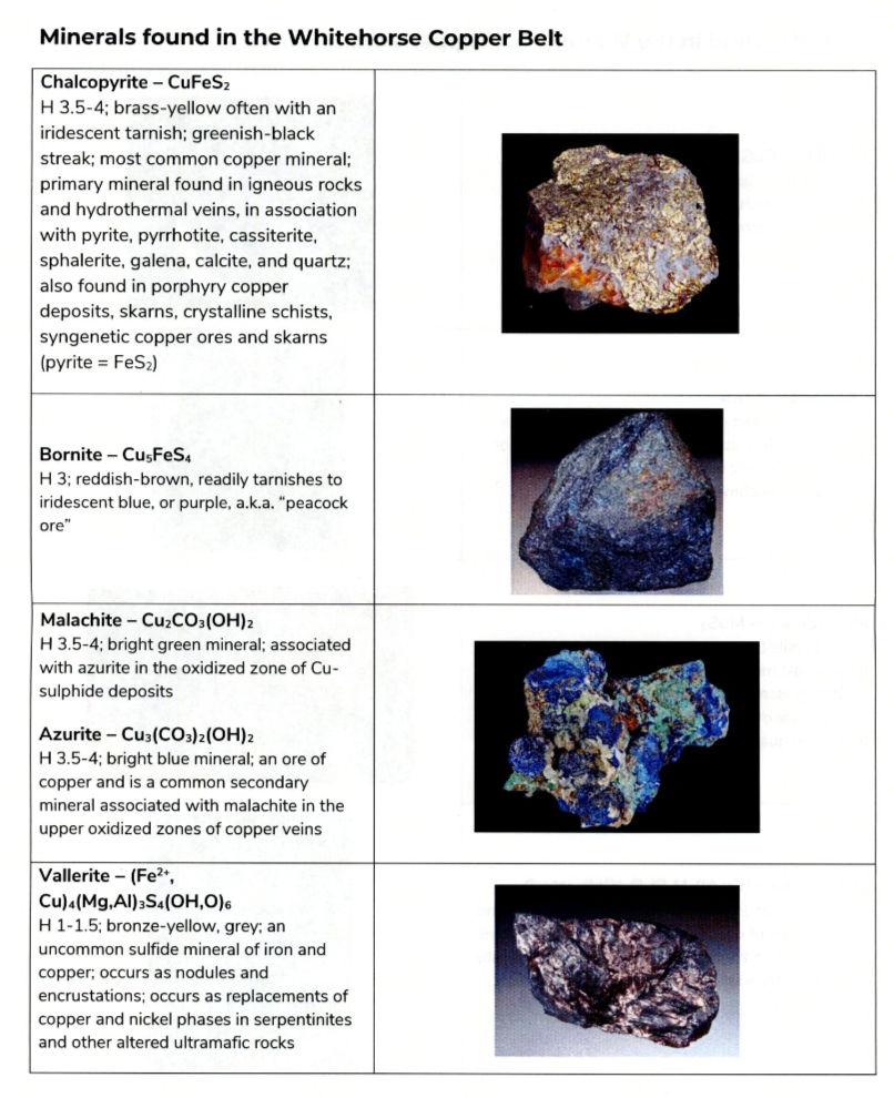
I took photos of a few, and brought four particularly pretty ones home, but (like most rock collectors, it seems to me) I have no idea now what they are 🙂 However, we were each given a 9-page handout with a brief history of the Copper Belt, descriptions of our planned stops, and excellent photos and descriptions of 17 of the rocks we might see. You can see that handout here. So I might yet figure out what my rocks are 🙂
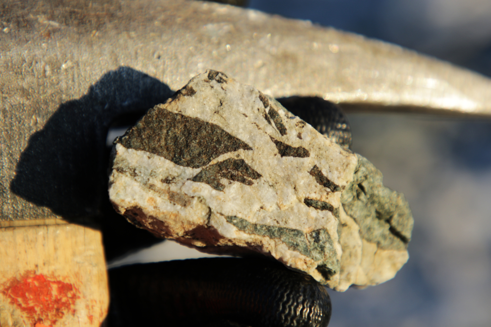
As the sun hit the top of the mountains, it was clear that the temperature was going to drop in a hurry, so at about 9:15 p.m. we started walking back to our cars. The evening light added a nice orangey glow to this little sample.
Although I was pretty much worn out by the time I got back to my car, I’m going to call that two successful “yes” activities in one day – whoohoo! It’s now just after noon and the temperature is at 8C, so I think I’ll use that word again and take the e-bike out for a long ride in the sunshine. After a nap…
Nice little outing. Good that you tackled that slope (which does look a bunch…) with no problems or thoughts about doing it or not. Here in the east coast is almost real dark at 8:15pm yet… are you getting better images with the newer camera body?
It no longer gets dark at night now – sunset tonight is at 11:05 pm and there’s still over 3 weeks until the longest day. Love that Midnight Sun! The new camera body has worked out very well, though I have a couple of settings to figure out yet.
Thanks Murrster, so that’s how the Kopper King Trailer Park/ Bar got it’s name, Rock on eh 🤔
Hi Murray, so glad you’re still out and about and shared your journey and photos of spring in your neck of the woods! Thank you