Hiking the Canada/USA Border in the White Pass
For the third day showing hikers from Haines and Anchorage the wonders of the White Pass, following the Canada/USA border along the granite ridge from the South Klondike Highway to the WP&YR railway was my hope if the weather cooperated.
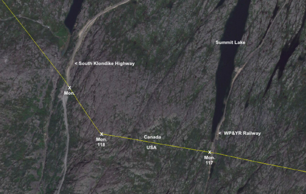
This Google Earth image shows the area and the 3 border monuments we’d visit (two of the monuments are numbered, one isn’t). Click here to open an interactive map in a new window.
Looking towards the summit from our campsite at 07:50, things didn’t look too good.
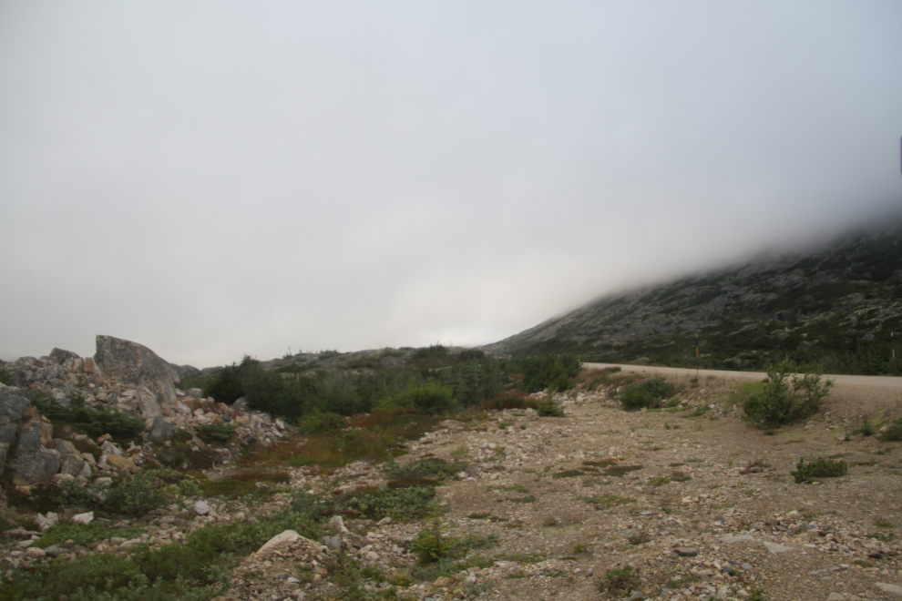
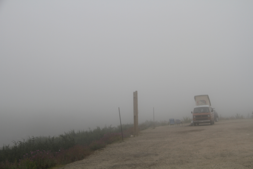
At 08:40, the fog/cloud near the summit was still very thick, so we went back to the motorhome for another pot of coffee.
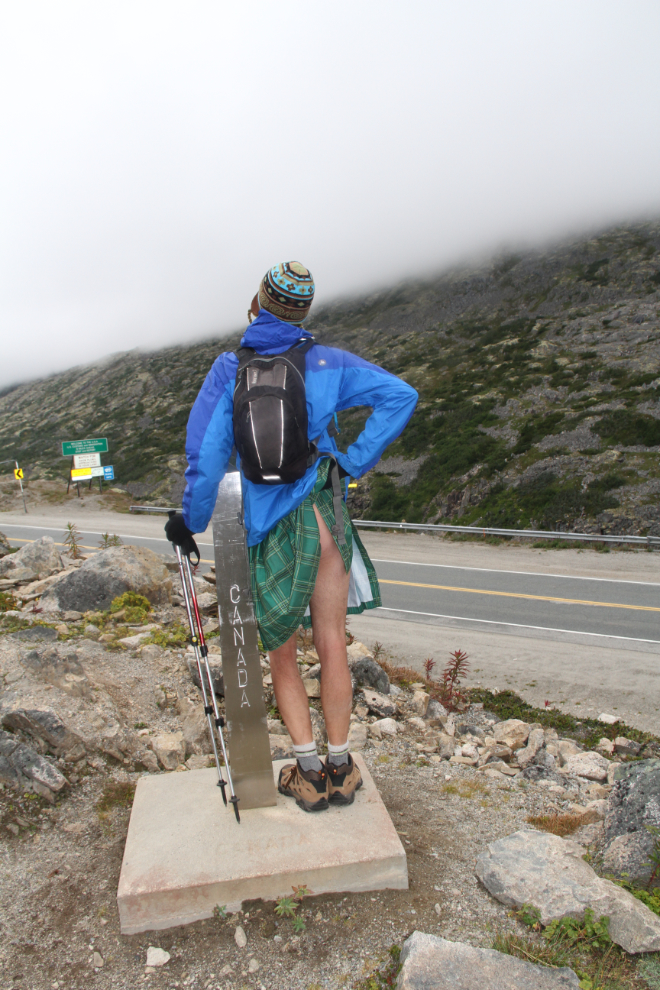
At about 11:00, the clouds had lifted enough to at least see where we’d be going, so we headed out. At the first border monument, a newer and thus unnumbered one beside the highway, one of the fellows showed us why kilts are so comfortable to wear for hiking 🙂
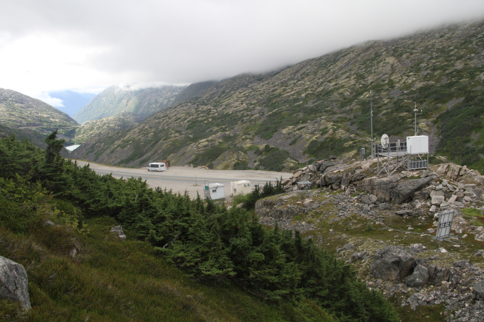
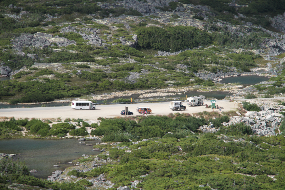
At 11:30, we started the very steep climb from the highway – the small tour bus is at the “Welcome to Alaska” sign. On the other side of the highway from our route, several people were hiking the popular waterfall trail despite very thick fog/clouds.
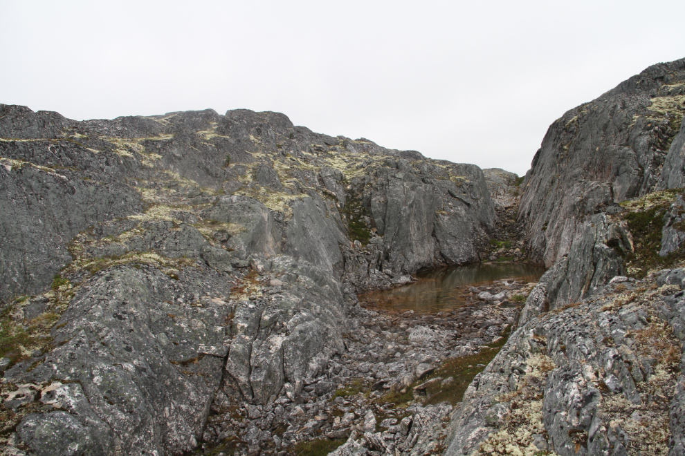
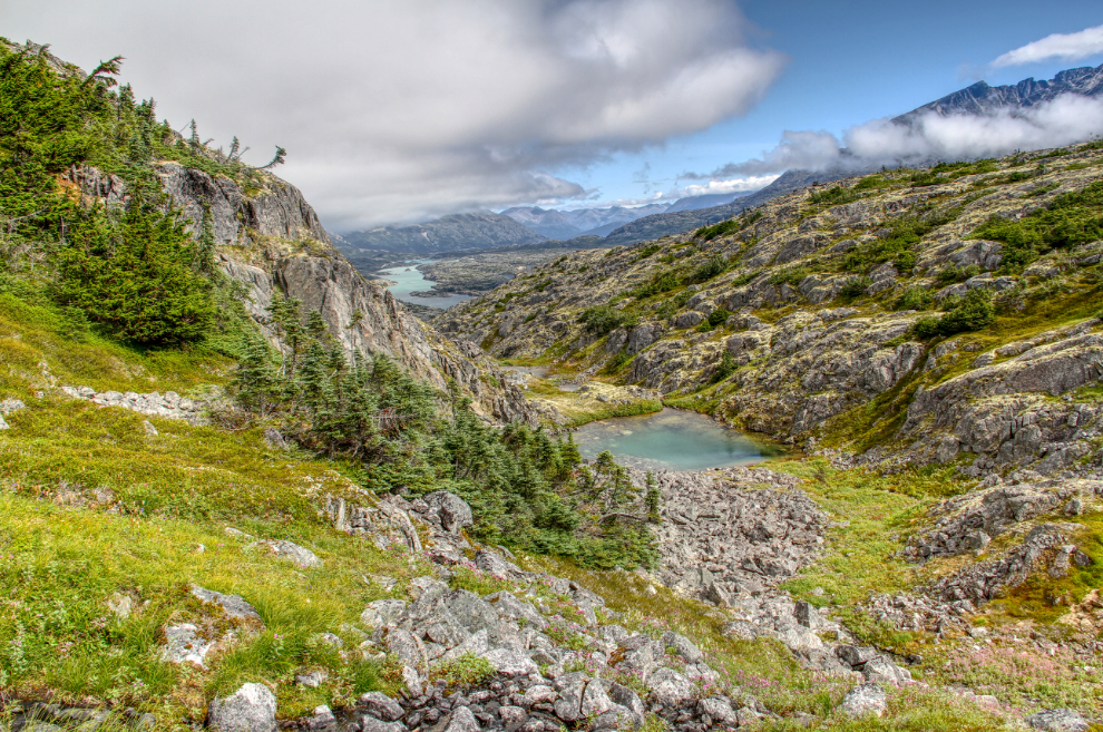
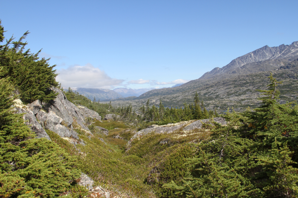
There is no trail along the border, but I enjoy the challenge of finding good routes across the bare granite, which has lots of cliffs and lots of ponds.
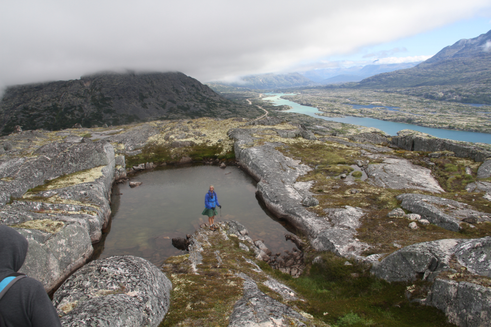
This is one of the most wonderful natural pools I’ve ever seen. Although it was certainly enticing, a very strong and cool wind deterred any of the group from going for a dip.
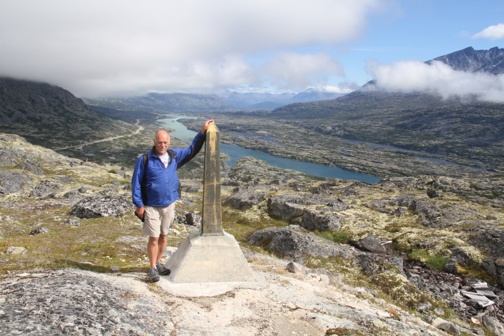
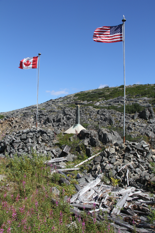
Me at Monument 118. This monument was replaced in 2008, and at the lower right of the photo you can see some of the garbage left by the people who did it (the wooden forms for the concrete base). Before leaving, we gathered up the wood and buried it under rocks, but next time up there, I’ll take matches and burn it all.
There are plenty of ravines to cross, of all sizes. Some are easy to get across, some take some thought about the best route.
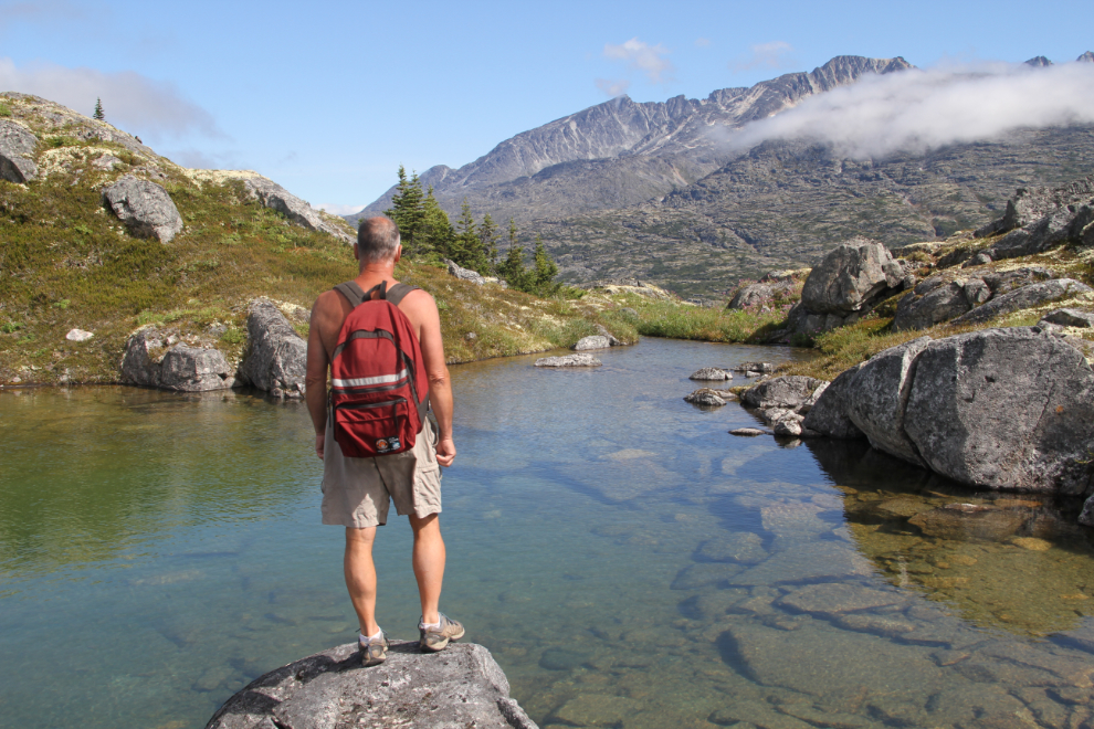
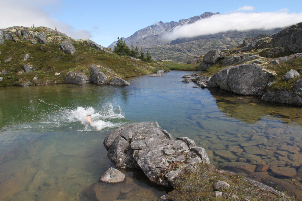
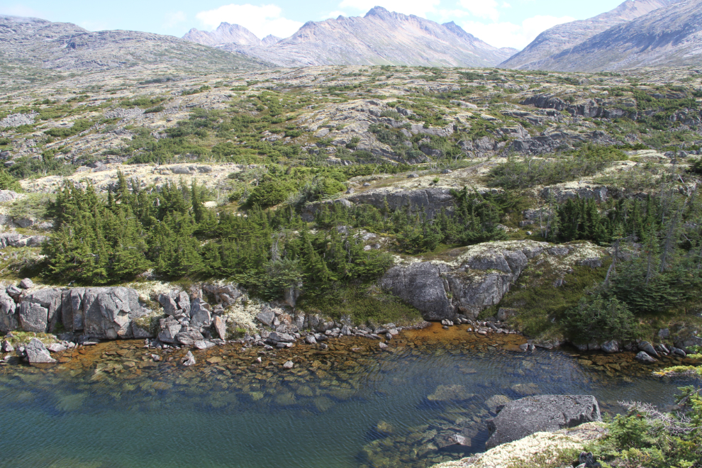
The cool wind had continued, and when I spotted a small lake sheltered in a dip, we headed there for a lengthy lunch stop.
Ahh – refreshing!! 🙂
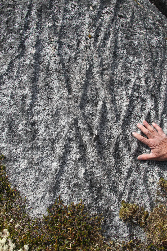
Some very unusual erosion on the ridge above that small lake.
I try to avoid the vegetation in the White Pass as much as possible, as it’s very hard to get through, but for quite a distance dropping down to the railway, it can’t be avoided.
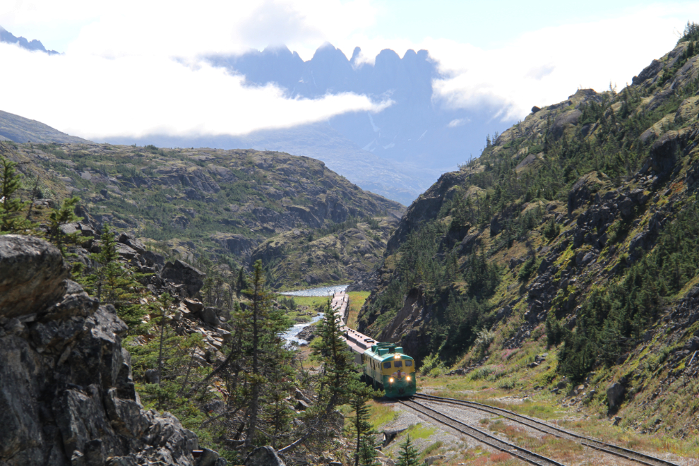
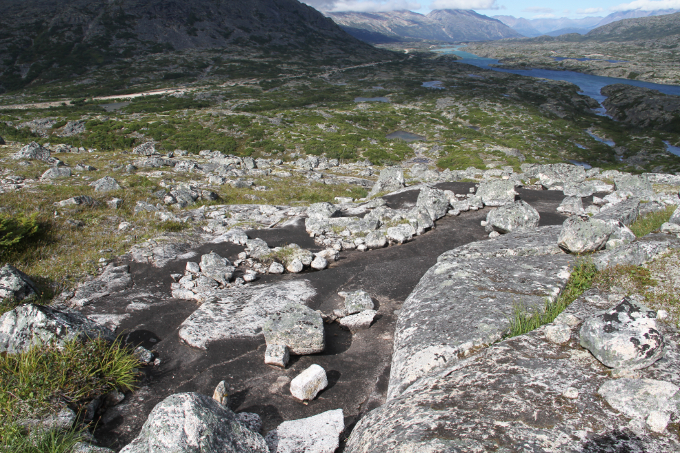
A look at the White Pass & Yukon Route railway as it goes north along Summit Lake.
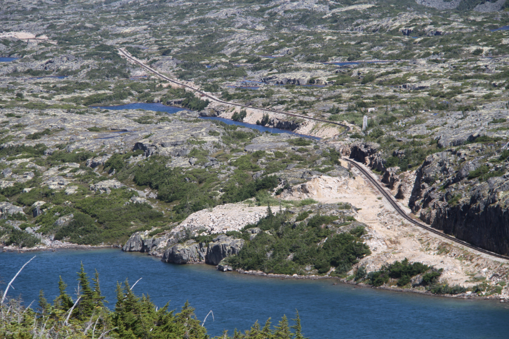
The railway runs though the gap running just above the centre of the photo.
We made a short detour so I should show the group the old wooden dam and water system from the days when there was a hotel at the summit, as well as a tank for watering steam locomotives. This was originally built in about 1905.

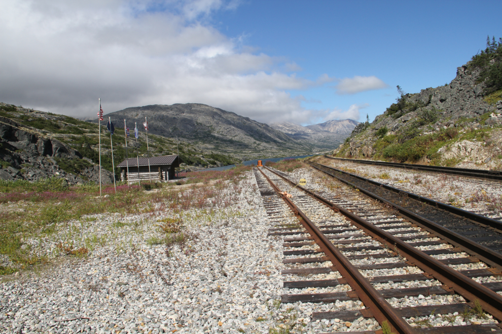
Border Monument 117, which stands right above the railway.
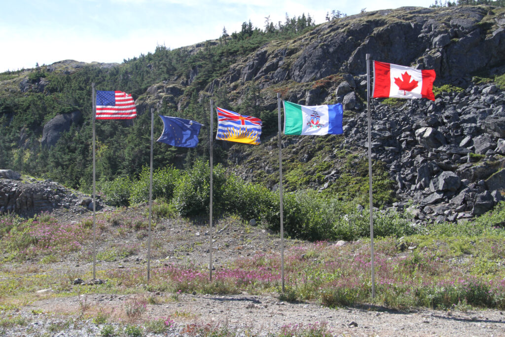
The White Pass & Yukon Route railway at Summit Lake. There’s a replica North West Mounted Police cabin, and a line of flags.
The flags are, from left to right, the United States of America, Alaska, British Columbia, the Yukon, and Canada.
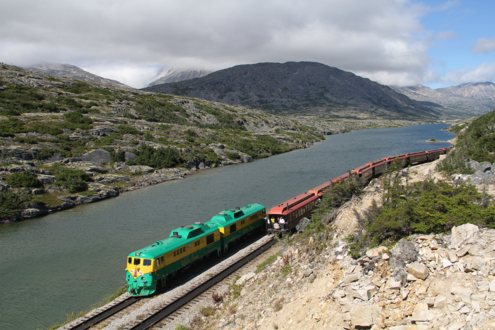
We had just climbed the ridge to the east of the railway when a train arrived from Skagway (at 3:10 pm).
The White Pass Summit Excursion is the railway’s shortest trip, and the most popular one with cruise ship passengers. When the train gets to the summit, the locomotives are disconnected and moved to what had been the end of the train. There, they are re-connected to the cars and can pull them back down to Skagway. This photo shows the locomotives being moved to their new position.
We attempted to hike further to the east, but couldn’t find a good route, and were about out of time anyway, so at 3:45, we started back to the highway, on a different route, lower on the ridge.
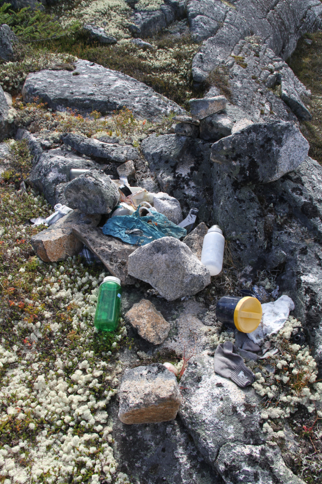
About halfway back to the highway, we found this pile of hikers’ equipment that’s obviously been there for many years. We saw other scattered items for quite a distance from this pile. In the pile was an expensive water filter. Very odd.
These dried-up creeks intrigue me. I’d like to see them at full flow, but this would be a tough spot to get to with a lot of wet snow on the ground.
We spent a long time laying out in the sun on the way back, but just after 5:00 pm, “Outhouse Hill” was close. We stayed well above my usual route, though, and reached the highway just below the spot where we’d left the cars.
That evening, there was a lot of discussion about possibilities for Monday. On Monday morning, though, the weather was dismal and it was clearly not going to get better, so we packed up and headed for home, some up the South Klondike towards Whitehorse, others down the highway towards the ferry to Haines.