Exploring WWII history and a new firebreak in my back yard
Having gotten comfortable with my new e-bike on paved roads, I’ve been anxious to get it out on some of the backroads and trails I bought it for. Although there is still a lot of snow in my yard, I decided on Thursday to give a historic road right behind me in Mary Lake a try. This road was built for the construction of the Canol pipeline in World War II and can be ridden for many miles – exactly how many is high on my list of things to discover this summer.
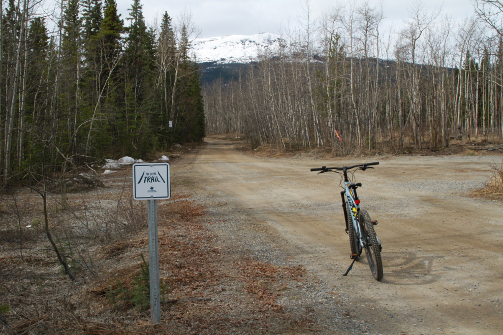
At 11:49, with the temperature at 6°C (43°F) I turned off the paved road that circles the Mary Lake subdivision, onto the dirt access road to the backcountry. It is now part of The Great Trail (in 2024, once again called the Trans Canada Trail). This is 1.4 km from my home.
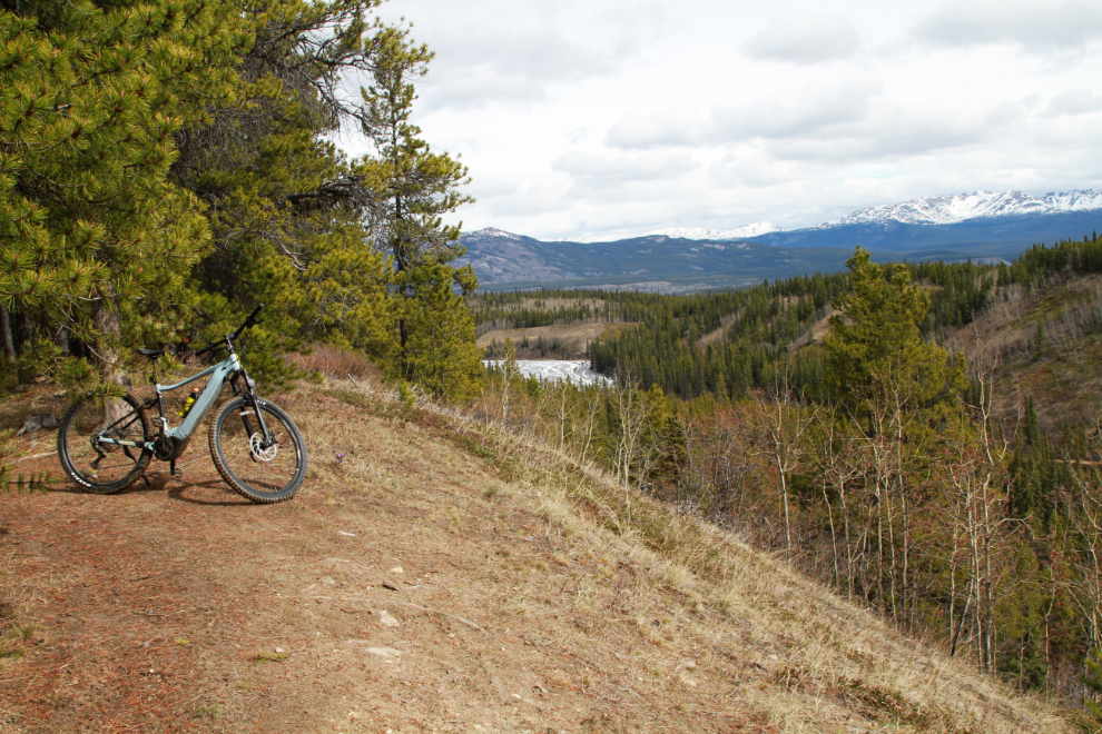
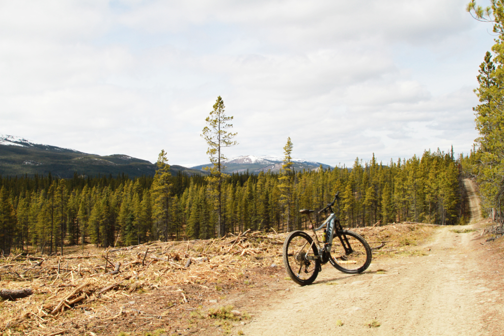
Crossing over the long-abandoned White Pass & Yukon Route rail line at the foot of Mary Lake, I turned onto the little-used pipeline road a few hundred meters further on. The road climbs about 50 vertical meters (164 feet) onto a ridge overlooking the little valley where Mary Lake and Murray Lake are located. At 12:11, this was the view to the North, with Mary Lake visible.
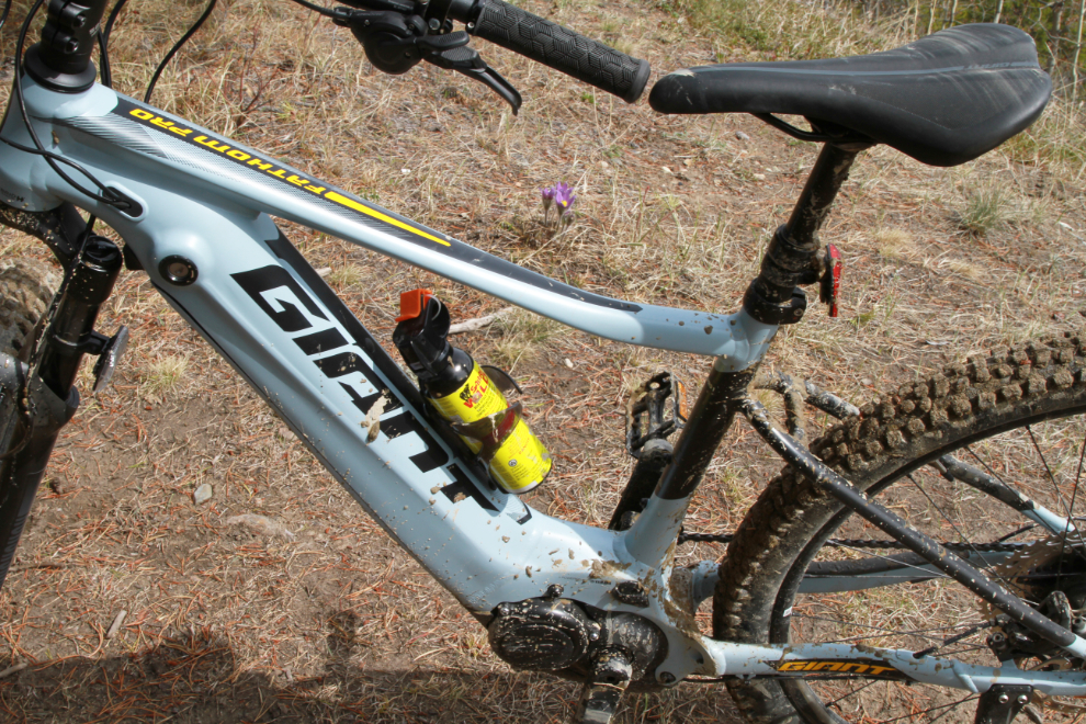
In civilization that’s a water-bottle holder on the bike. Here, it carries bear spray. Behind the bike you can see a Prairie crocus, the first flower that gets Yukoners excited about Spring.
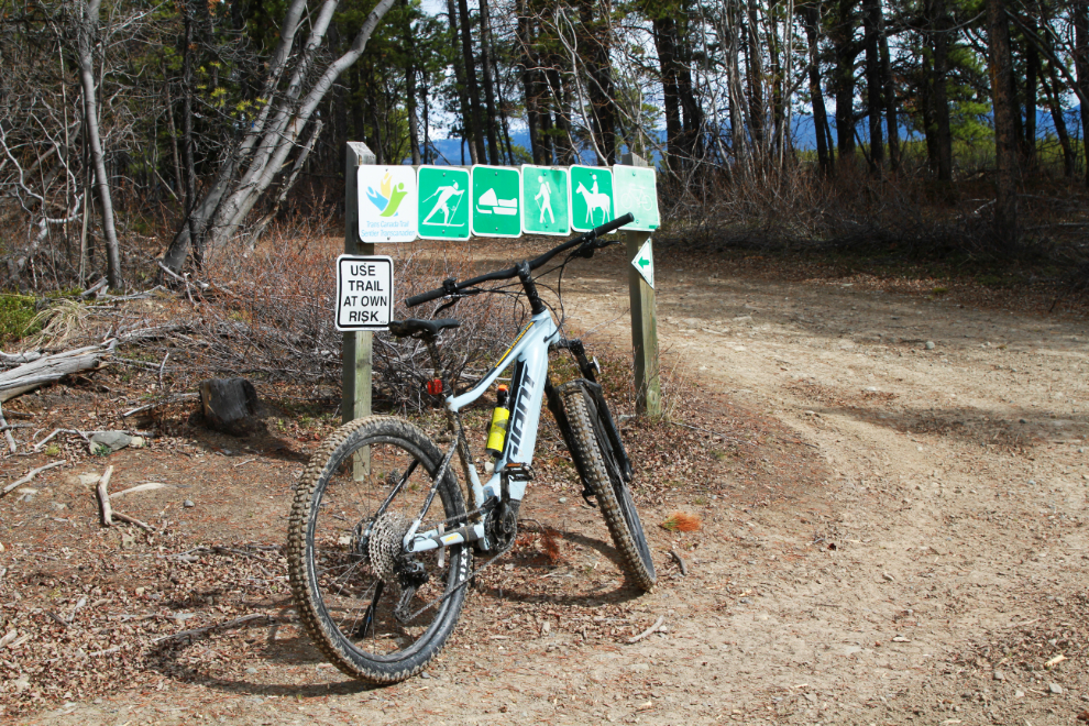
At 12:15 the pipeline road re-connected with The Great Trail.
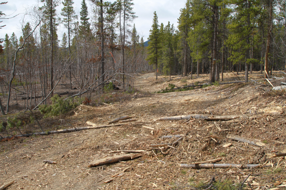
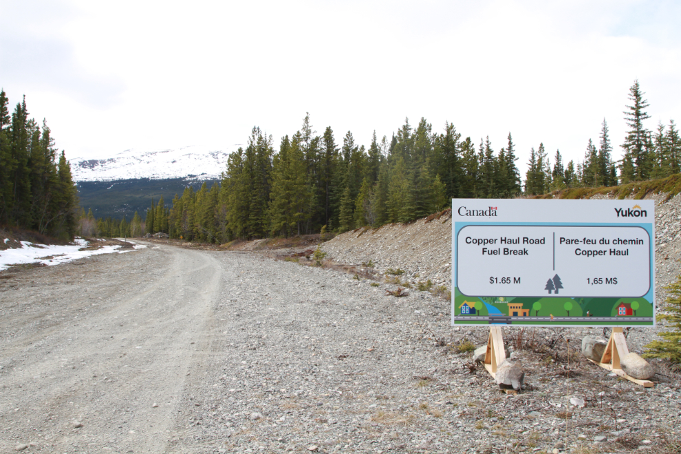
That Great Trail junction is where I first came to the firebreak, which is much larger than it was when I saw it last year. The next photo looks at the road (and Great Trail route) that goes into the copper belt, site of several copper mines dating from 1899 into the 1960s.
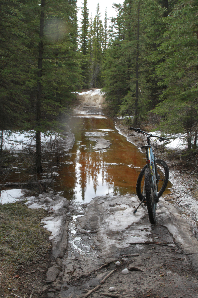
Past that junction, even with a slight drop in elevation, road conditions deteriorated a lot. The learning curve on the bike got quite steep here. The condition of the road surface under that water varied from gravel to mud, with some hidden rocks and blocks of ice to make it even more interesting. One vehicle had been along here in recent days. I was quite surprised that they kept going – I thought about turning back here. The next photo was shot at 12:29.
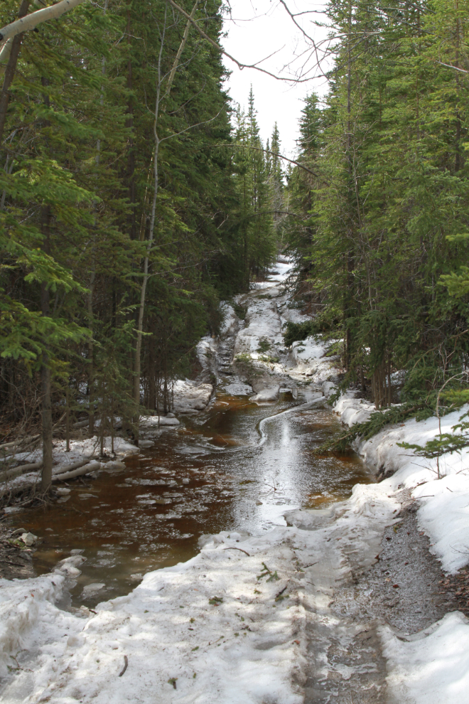
After several more water/mud/ice crossings, I turned off The Great Trail again and soon came to a spot where all I could see ahead was several inches of mushy, untracked snow. This is where I turned back. This was 9.5 km from home, at 12:55.
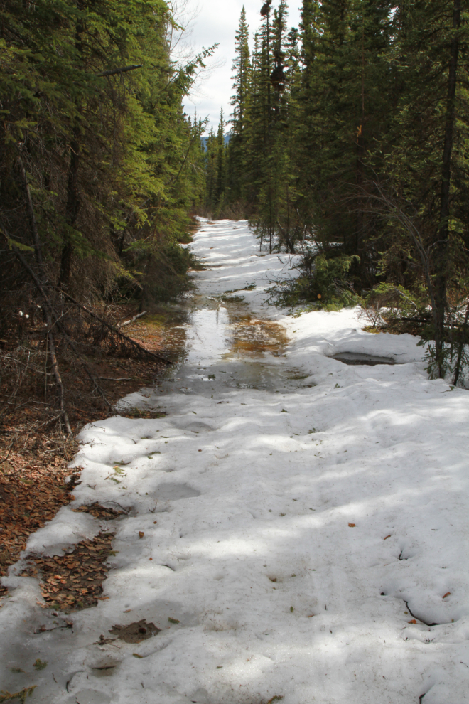
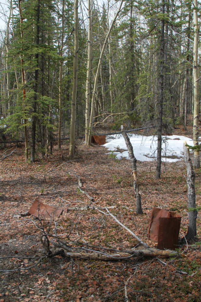
The road wasn’t all snow and muck, there were long stretches of nice riding as well. The next photo was shot just a few hundred feet back towards home from the one above. I stopped here to check out a camp site that appears to be from the Canol pipeline construction period.
There are some tin cans (for gas, I think) at the camp site, but I didn’t see anything of particular interest.
Back through the slop. I was getting more confident with each crossing, though, so perhaps this was a good way to learn what the bike could handle. I’m very impressed by what it can power through.
The view to the east across Murray Lake at 1:21.
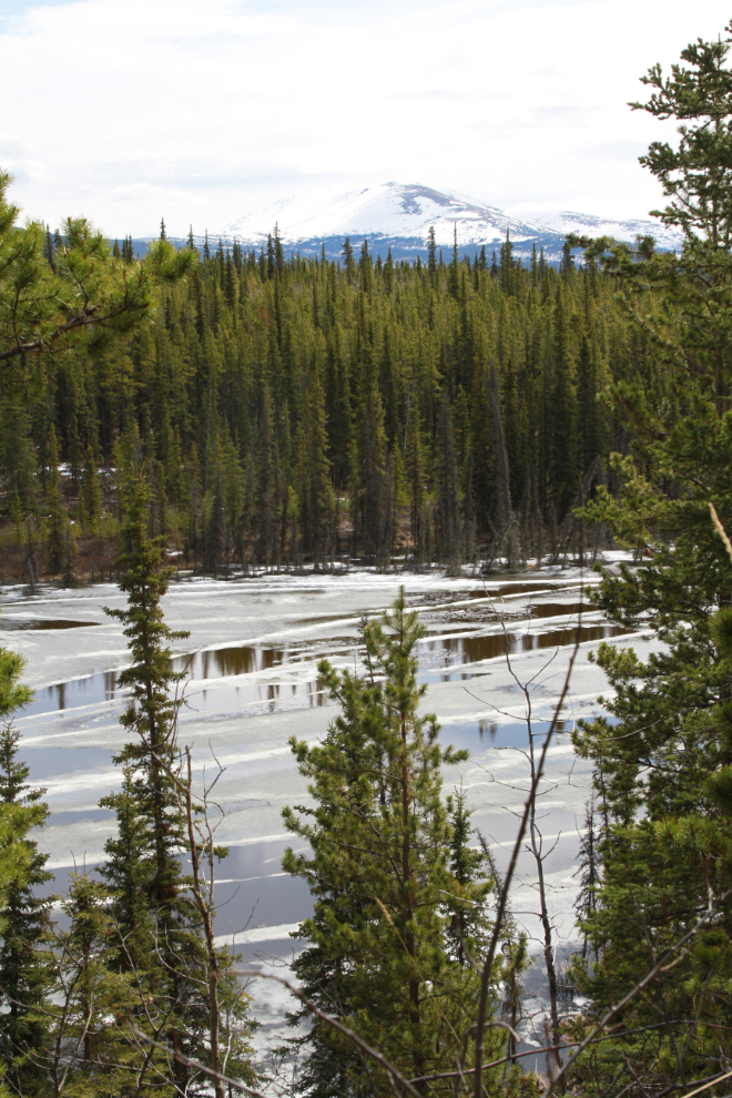
The railway runs through that valley, weaving around between the lakes and marshes. In late October 2013 I walked the rail line as far south as halfway up Murray Lake, and found plenty of interesting sites – see “The History Hounds, sniffing around the White Pass railroad“.
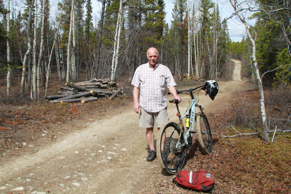
At 1:30 I stopped for a bit of a break and a portrait. I didn’t keep my jacket off for long – when the clouds covered the sun or in open areas where a fairly strong wind from the south hit me, it was chilly.
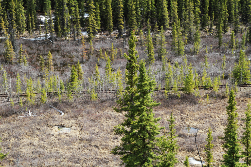
Back at the the junction of the pipeline road and The Great Trail where I had stopped briefly at 12:15, I turned into the copper belt. Much of the road now paralleled the firebreak. The next photo was shot at at 1:44.
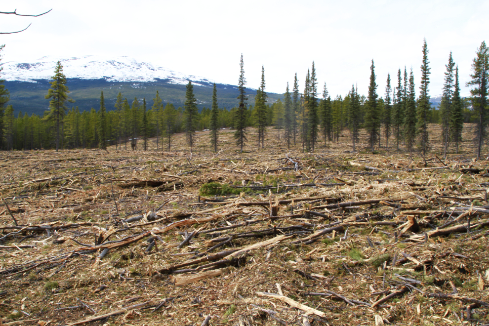
I was quite shocked at the size of the firebreak in some places. I don’t understand the design of it – it’s not a continuous break. I should have gone to a public meeting a week or so ago that included a presentation about it.
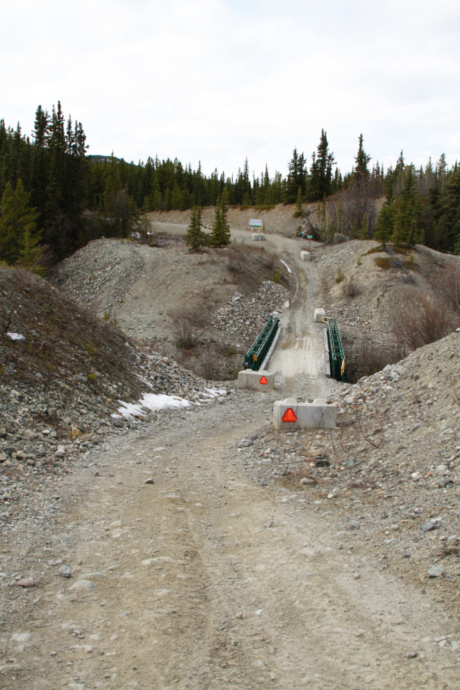
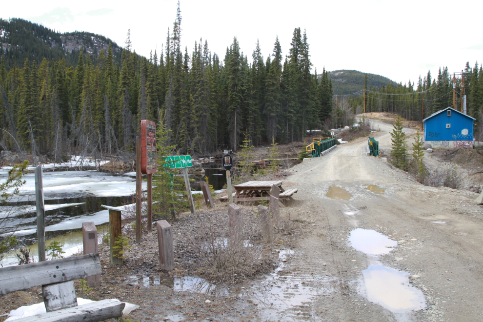
At 1:57 I had a major decision to make. I could turn right and be home in half an hour, or cross this bridge over Wolf Creek and commit to another 20 km of riding on good gravel and pavement. Nowhere near ready for the ride to end, I decided to cross that bridge.
The federal government put up $1.65 million to build the Copper Haul Road Fuel Break. As much as I hate to see millions of trees cut, there’s no question at all that this is needed – we all know that a major wildfire is coming and our “country residential” subdivisions (most are heavily-forested 3-acre lots) are all but impossible to protect.
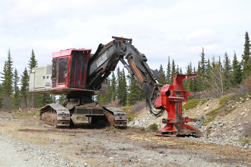
This machine from Dowling C. Monette Logging of 100 Mile House, BC, is doing the munching of small trees after the large trees have been logged. We don’t have a mill capable of doing anything productive with the wood, so I expect that it will all be sold as firewood.
The next photo was the last one I shot, at 2:25. This is where the Copper Haul Road (and The Great Trail) meet the public road at the Mt. Sima ski hill. I had now ridden 23 km and the turn to head back towards home was a few k away yet.
On one of the hills back down to the Alaska Highway, I hit the top speed of the day, 52 km/h. I avoided the highway for much of the way home by riding through a light industrial and then a country residential area. At 3:30 I arrived home, having ridden 38.5 km (23.9 miles). This was a great introduction to e-biking the backcountry, and I’m looking forward to a lot more.
I’m still playing with apps, and on this ride used two. Relive creates a fun video of the ride, while Strava gives more of the data I want.
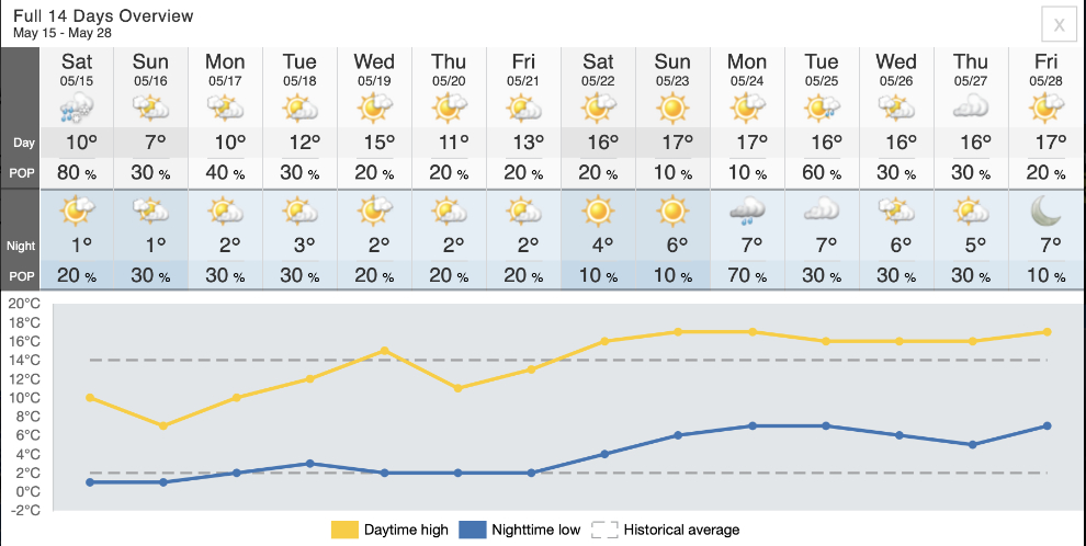
Real Spring (with mornings that don’t require multiple layers of clothing) has now appeared on the 14-day weather forecast, so there’s now an incentive to de-winterize the motorhome and get it ready for some Adventures. I have no big trip in mind yet, but who knows what might come up.
Some other kind of travels to show us some other roads, that’s great.
Love your water bottle !
Watch out for your back on your head on these threatrous roads and remember what you went through to get to this.
Thanks, Maureen. I assure you I will never forget the past 20 months.
Could you add a map link for this ride? Sounds like a lot of fun and I wondered too how much the battery took you and how much was Murray power?! Some serious slop you went through – cold wet and muddy shoes and feet, or as per the portrait photo? Glad to see you got all those miles in and had a great day.
There are 2 map links at the end, Brad, one for each of the apps I used. Yes, it really was a great day.
It is so good to see you out and about exploring again. Way to go and way to bike! I’m looking forward to more of your stories.
Thanks, Barb. I am so excited about being able to get back to what I do, and to have this cool new vehicle to do some of the exploring with.
So glad I found your blog again. Its always fun seeing how you do things because its so different in Florida where I live.
Thanks, Linda – it’s great to see you back 🙂