Hiking the Northside Trail at Twillingate
Thursday, June 18th, Day 21 of our trip and the 14th day in Newfoundland, was so amazing it’s taking me two posts to tell you about it. This first one is about a hike, the next will be about our spectacular iceberg boat tour.
After a good experience with the Rockcut-system trail to Batrix Island, I decided to do the next trail to the east, the Northside Trail. That choice was heavily influenced by the trail description that says it goes to a memorial honouring those lost at sea. It actually doesn’t, but more about that later.
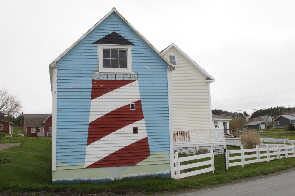
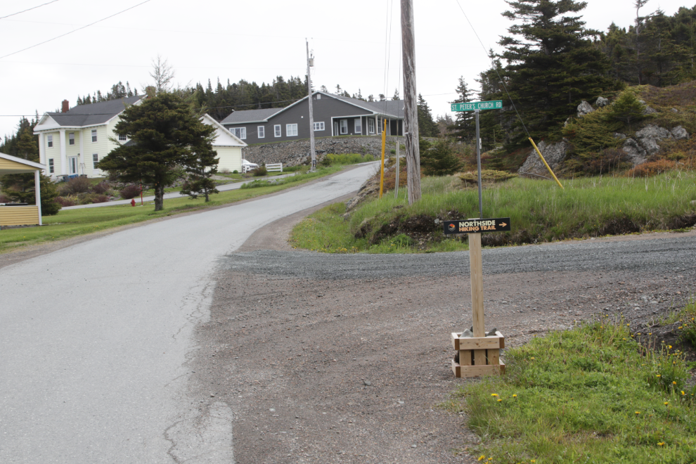
I hadn’t paid nearly enough attention to where it started, so began my wander on Dock Road which had taken me to Batrix Island. I took quite a few photos while looking unsuccessfully for a trail sign. This was the first one – what a cool way to deal with that building, which I think is a garage with a room above.
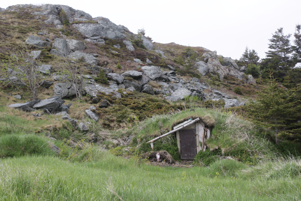
This was the most interesting of the root cellars I’ve seen.
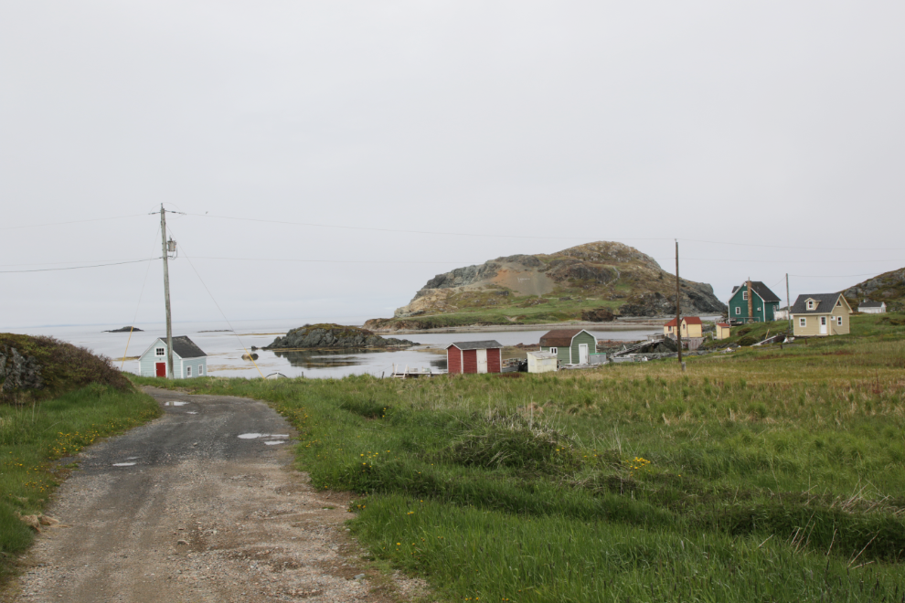
This picturesque bay doesn’t seem to have a name. That’s Batrix Island in the background.

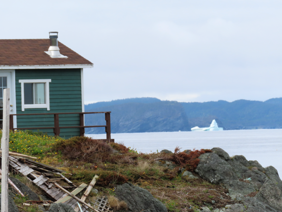
A large iceberg in the distance gave me hope for the afternoon boat tour we had booked.
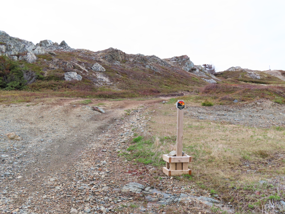
After about 40 minutes, I found a sign! On Dock Road, but a lot further from the water than I had expected. Rockcut has a Google map that would have saved me a lot of time, but I couldn’t get it to come up on my phone. And I got some photos I like during my wander, so all good 🙂
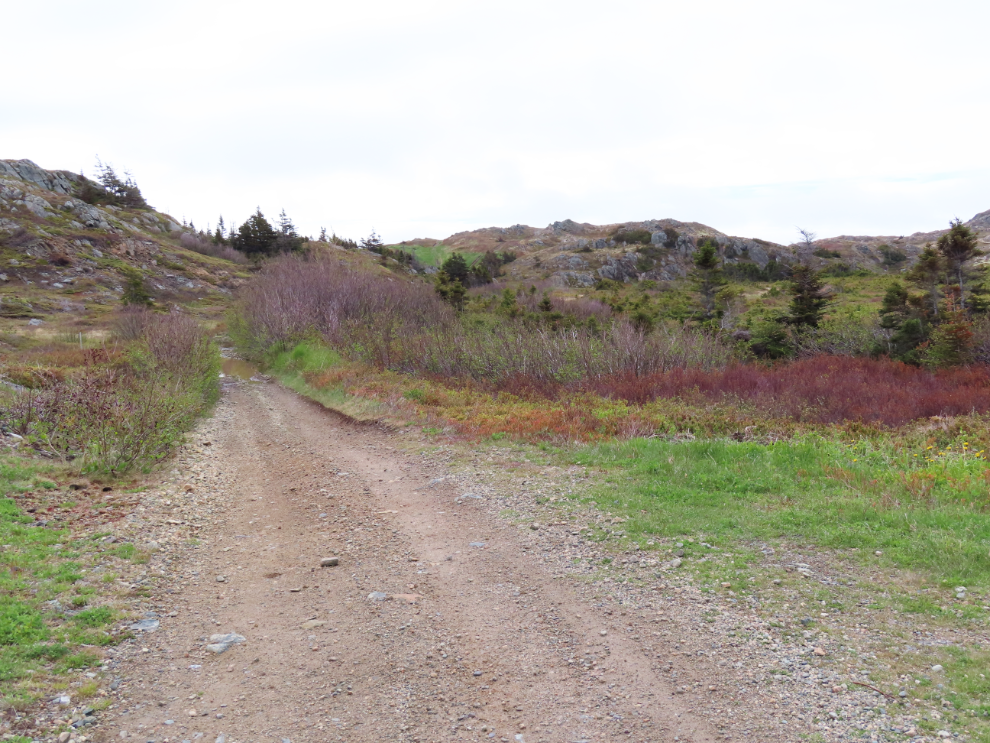
The trail started out nice…
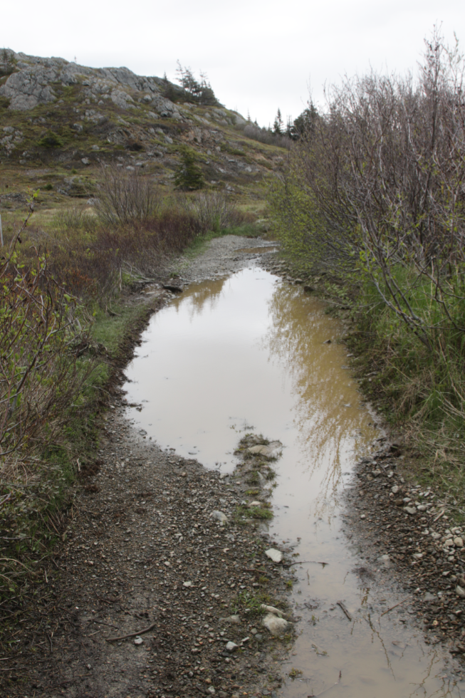
…but then got ugly for a couple of hundred meters, with a lot of water and mud.
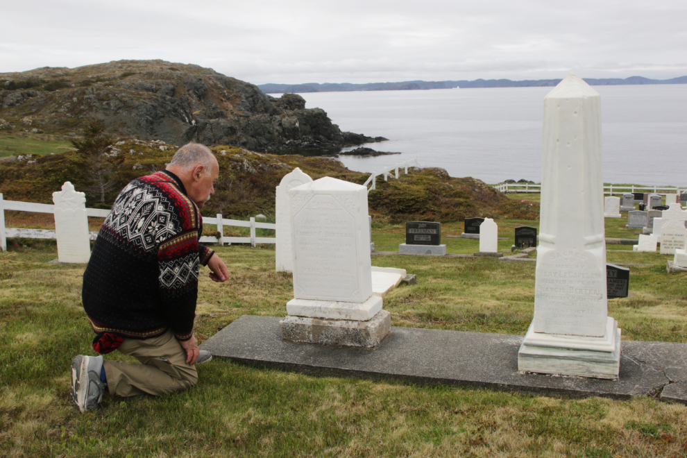
Coming upon the St. Peter’s Anglican Cemetery quickly made me forget about the water.
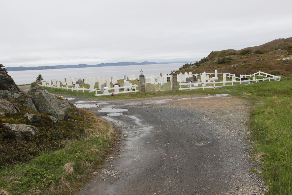
I spent a long time there, reading the fragments of stories told on many of the headstones.
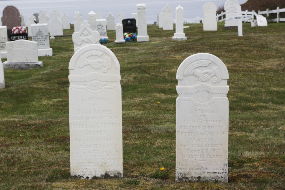
On the left, Dora Agnes Anstey died in 1923 at the age of 16. On the right, Carl Stephen Anstey “fell asleep” in 1916 at the age of 16. How bizarre and heart-breaking 🙁
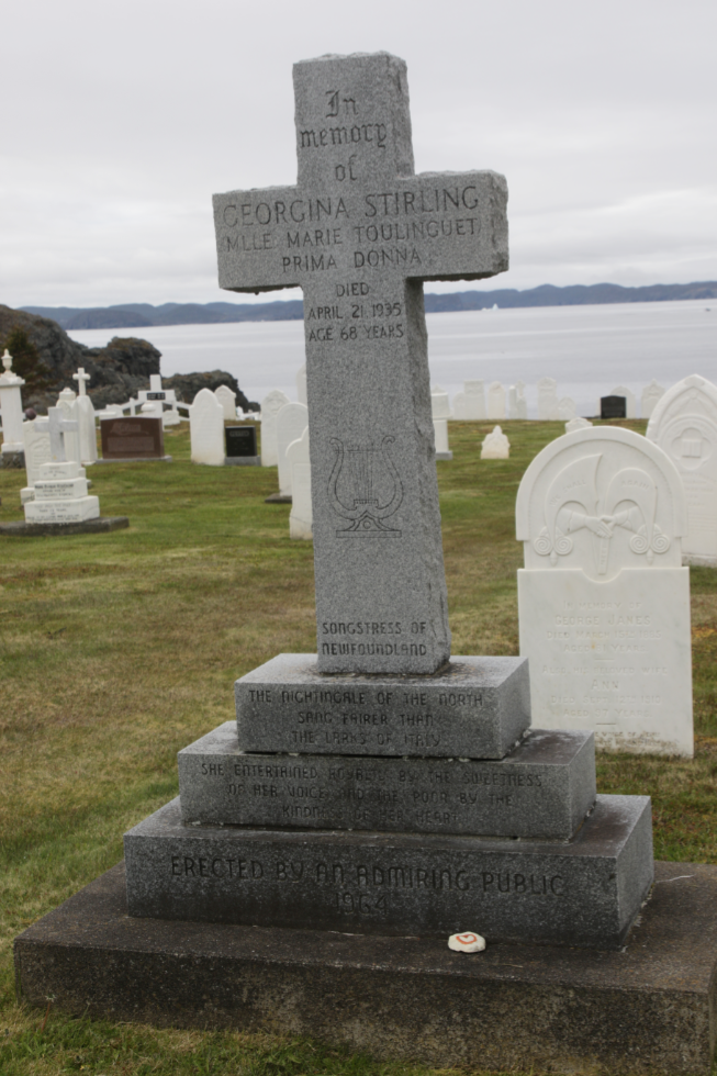
The largest monument in the cemetery is for Georgina Stirling, “Mlle Marie Toulinguet, Prima Donna,” who died in 1935 at the age of 68. The “Songstress of Newfoundland,” this “Nightingale of the North sang fairer than the larks of Italy.” “She entertained royalty by the sweetness of her voice and the poor by the kindness of her heart.” The monument was erected in 1964 “by an admiring public.” Now that’s an impressive legacy. The Dictionary of Canadian Biography has an excellent page about her at https://www.biographi.ca.
I was soon lost again, in a maze of ATV trails, some marked with orange survey tape, which all led god-knows-where. I finally found another Rockcut sign.
With the monument high above on the left, this now felt like the path I wanted.
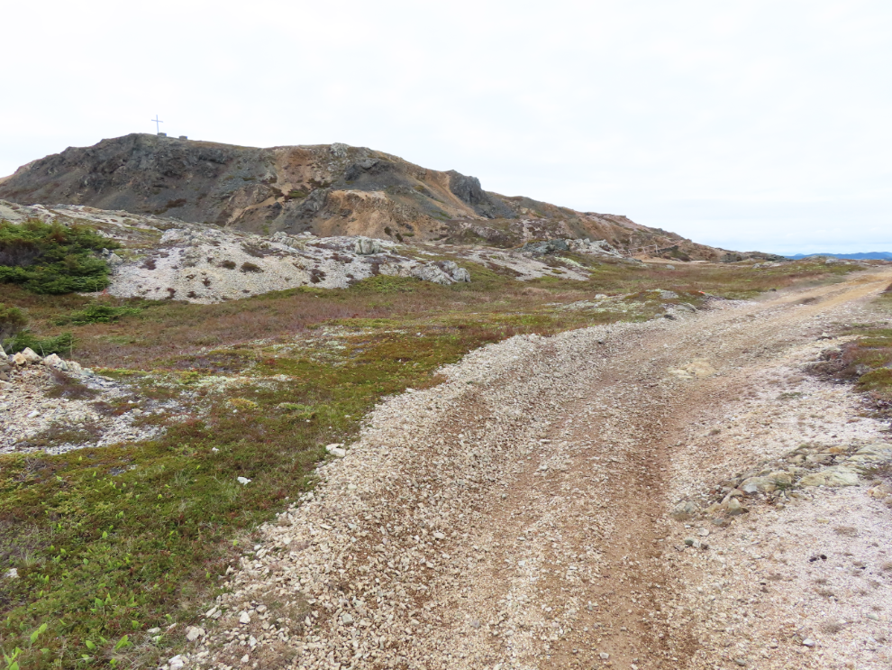
Ahead is the most interesting part of the trail – yes, hanging off a cliff, of course 🙂
There was certainly a lot of work went into that!

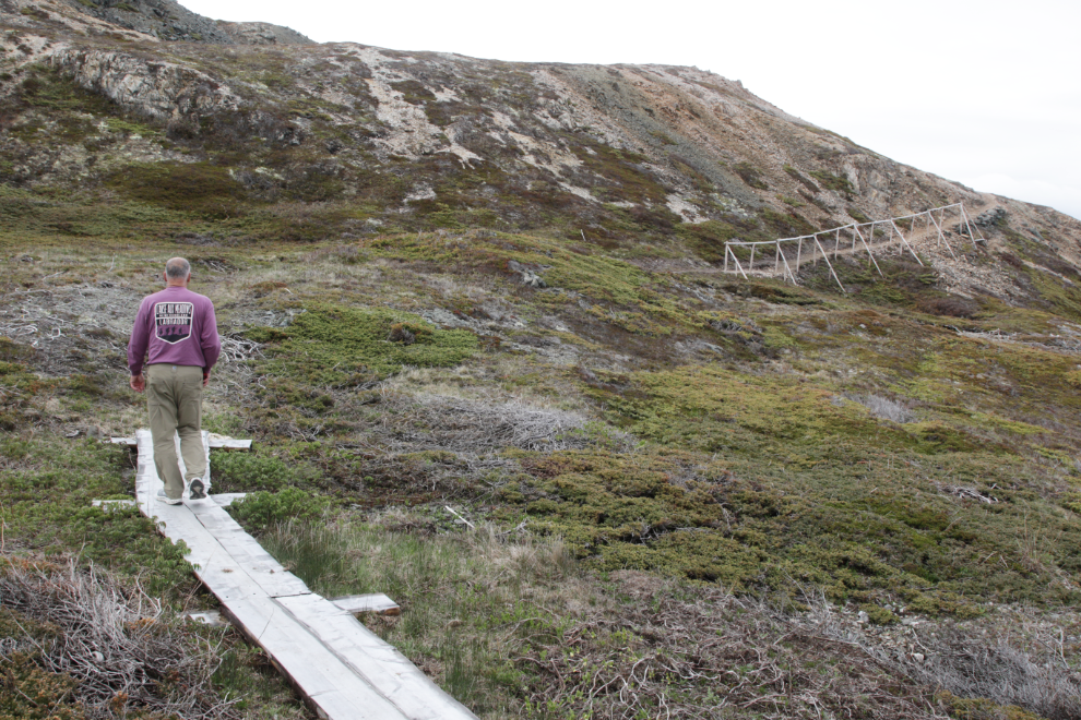
But then the marked trail began to go down. That is not the path I wanted!
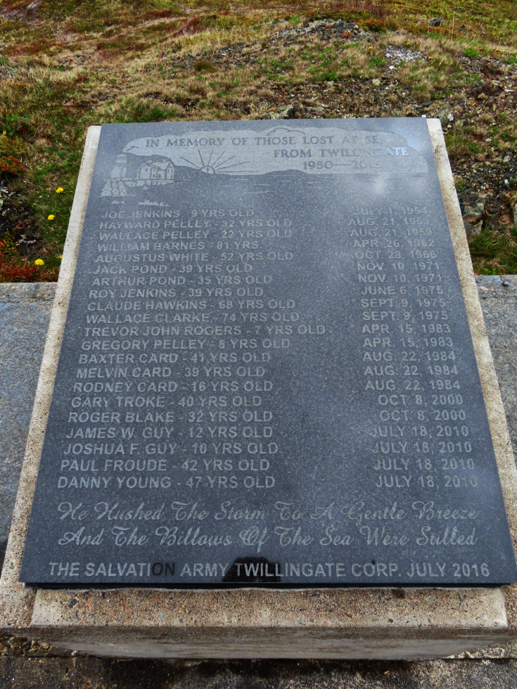
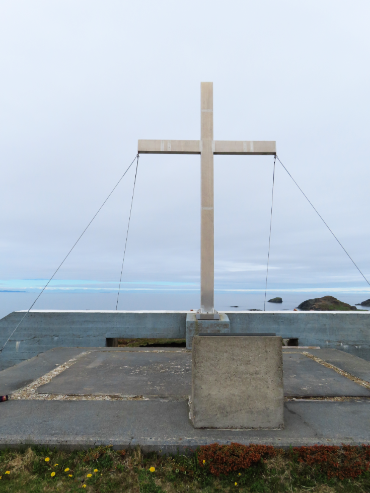
I gave up on the trail and headed cross-country, straight up the slope toward the monument. This is what I wanted to see. The plague lists the name, age, and date of death of 21 people who died at sea between 1954 and 2010. Five were 12 years old or younger, and most were in accidents with multiple deaths. The monument was erected by the Twillingate Salvation Army in July 2016. I’m curious about the dates chosen, and about those lost before 1954.
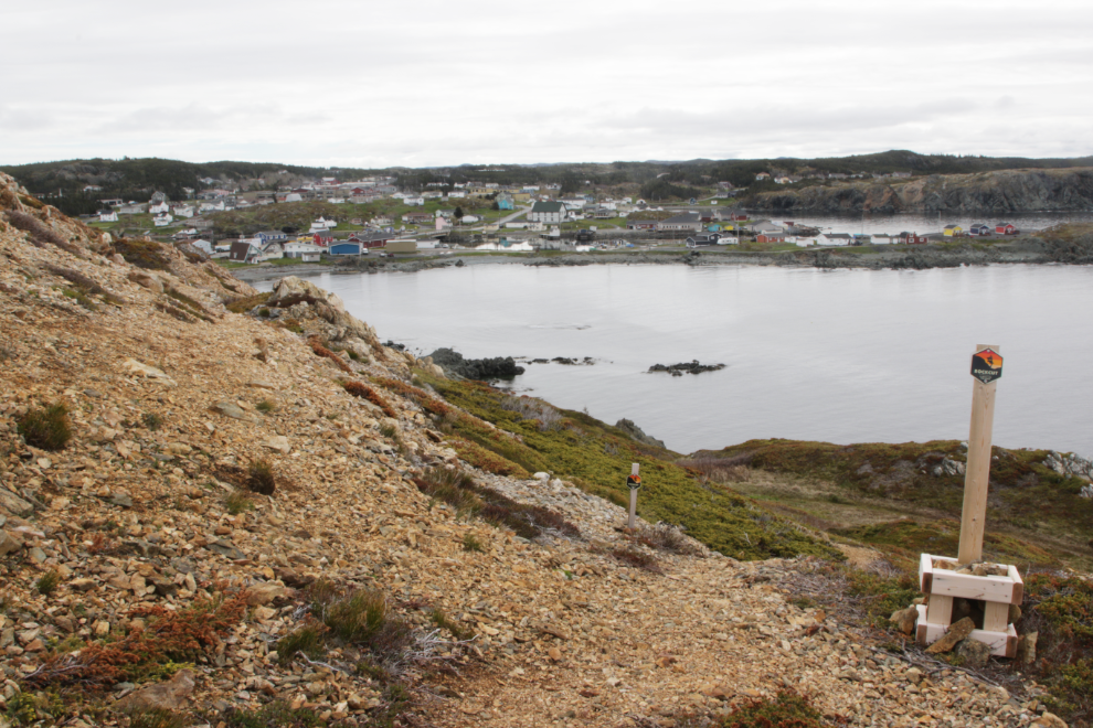
Anyway, as it turned out, the trail to the monument at Smith’s Lookout is a completely different trail than the Northside – even the Google map shows that.
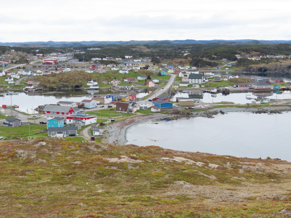
The 360-degree views from Smith’s Lookout are wonderful – here’s a look down on part of Twillingate.
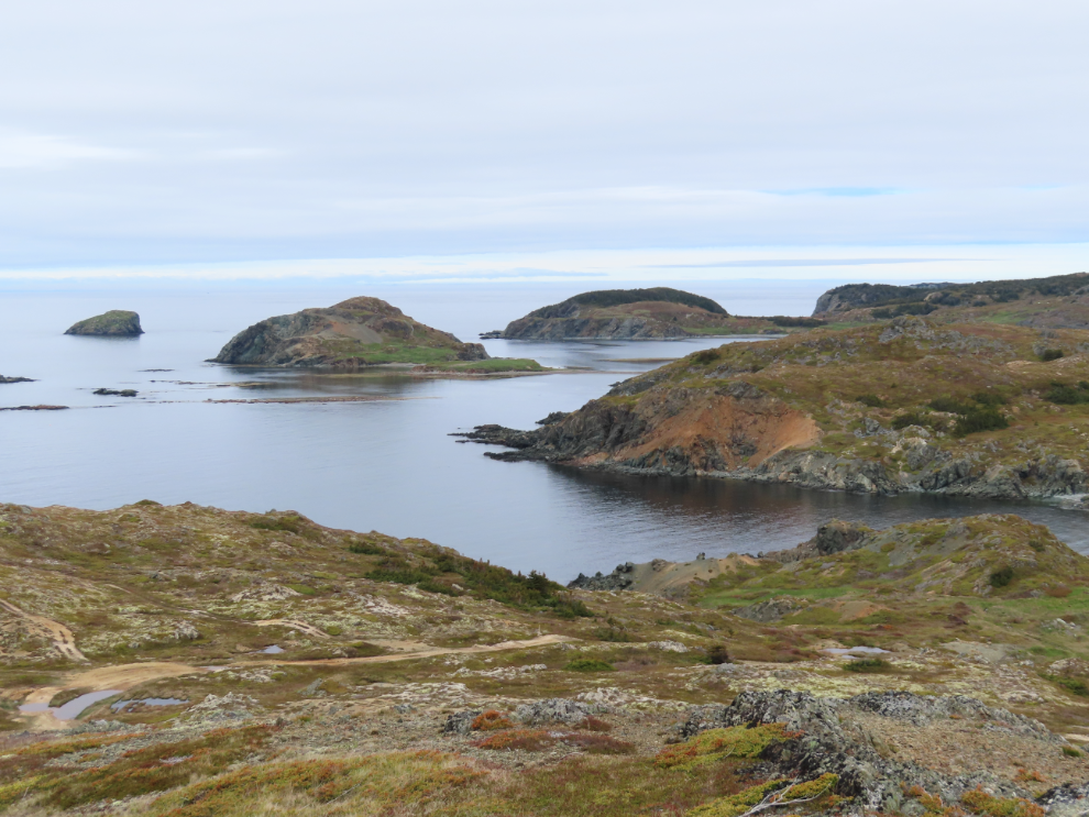
Looking out to sea, with Batrix Island at left-centre.
I decided to return to the RV park through town, partly because I was curious about the route and partly because I didn’t want to deal withe water again. That large building ahead was the meeting hall of the LOL – Loyal Orange Lodge – No. 5. It was built in 1906-1907.

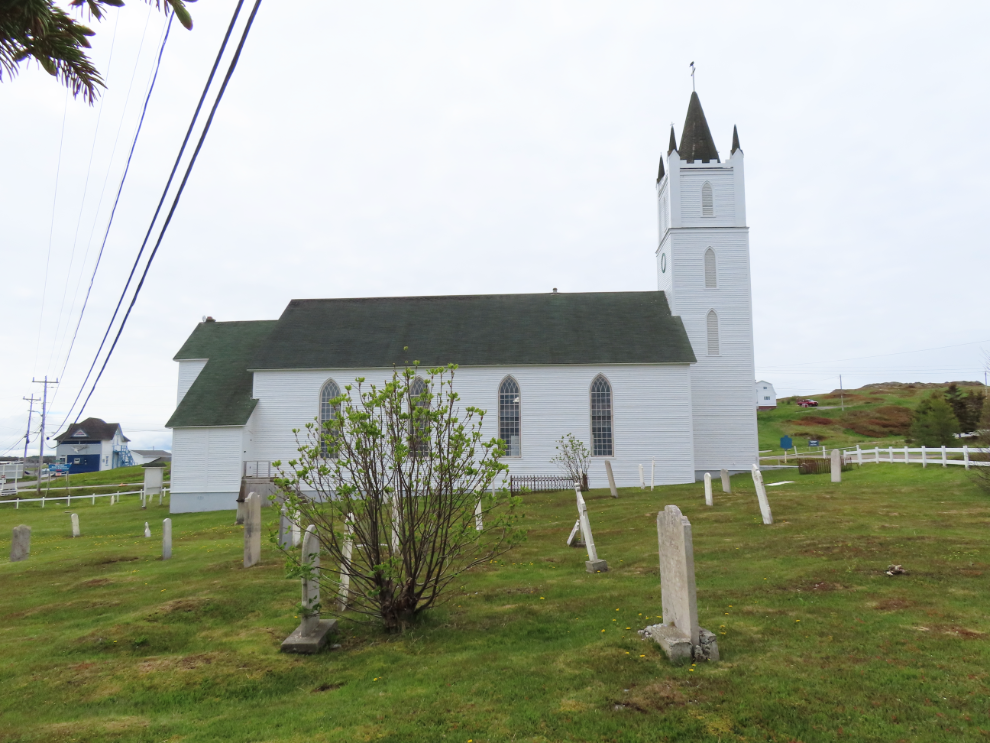
The final photo shows St. Peter’s Anglican Church. Although it was a St. Peter’s cemetery I had visited, there are many more graves here, and mounds hint that many are unmarked.
When I got back to the RV, Strava showed that I had walked 5.78 km, with an elevation gain of 114 meters. A good start to the day.