Fall colours and Yukon history – by floatplane
Yesterday morning I was cooking up a storm, getting some chili and meatloaf in stock for an RV trip that was to start today. Then I got a call about some historic sites along Lake Bennett. That led to an invitation to go flying to check the sites out, and 5 minutes later I had gotten changed, grabbed some aerial photos of the area, and was on the road, headed for the Whitehorse Water Aerodrome (CEZ5, a.k.a. Schwatka Lake).
There are 42 photos in this post – sorry! 🙂
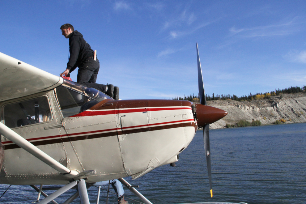
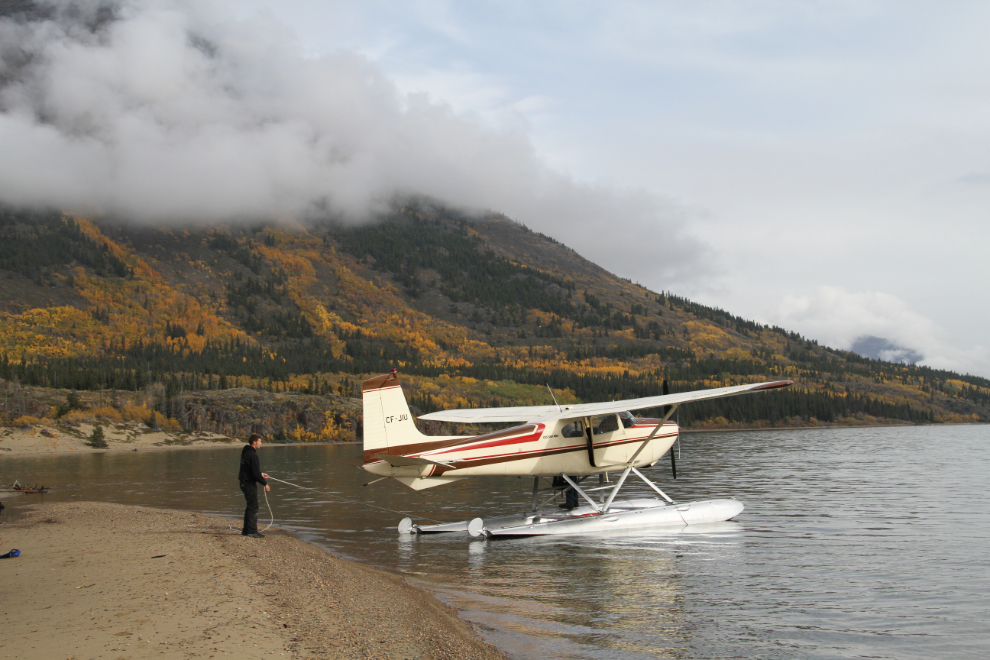
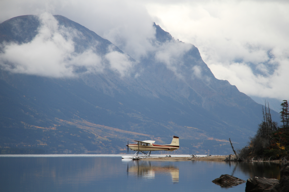
At 11:20, Kyle Cameron was doing the final get-ready stuff on his beautiful bird, a 1957 Cessna 180A on floats. Kyle’s Dad, aviation historian Bob Cameron, and Tracey, a friend and history fan from New Zealand, were also coming.
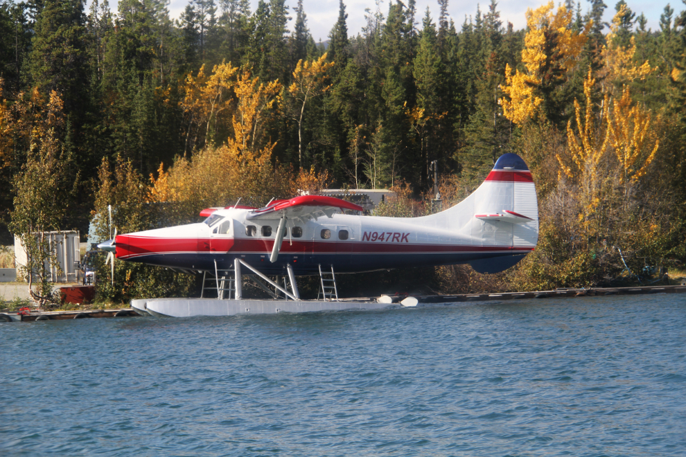
This gorgeous Turbo Otter turned out to be particularly interesting once I checked it out online. Formerly C-GCQA with North Star Air in Pickle Lake, Ontario, she’s a 1955 DHC-3 model (serial number 77) and has just been rebuilt by Recon AirCorp for Rainbow King Lodge. Newly registered as N947RK, she was passing through Whitehorse on a ferry flight to Alaska with pilot Virgil Peachey.
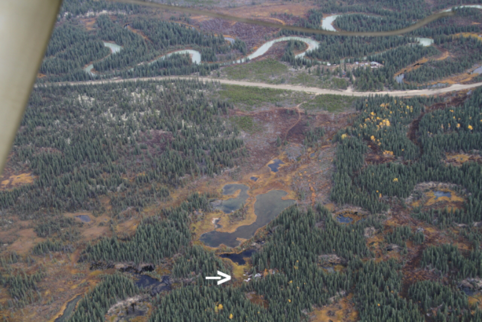
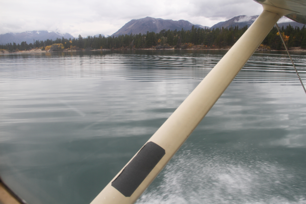
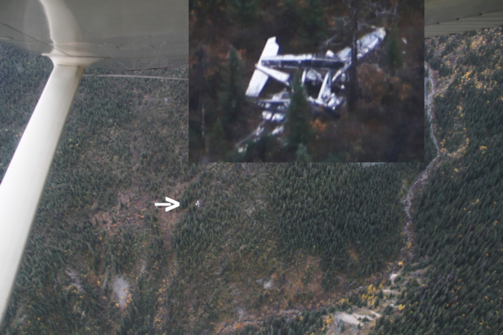
We lost our sunshine within minutes of leaving Whitehorse, but the ceiling was high with a bit of ragged low cloud. With at least 3 of us in the plane very interested in aircraft wrecks, which the Yukon has a lot of, we first had a look at a C-119 Flying Boxcar, which crashed just off the Annie Lake Road in 1961 (the wreckage is marked by the arrow). See more information about that crash here.
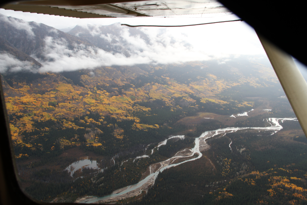
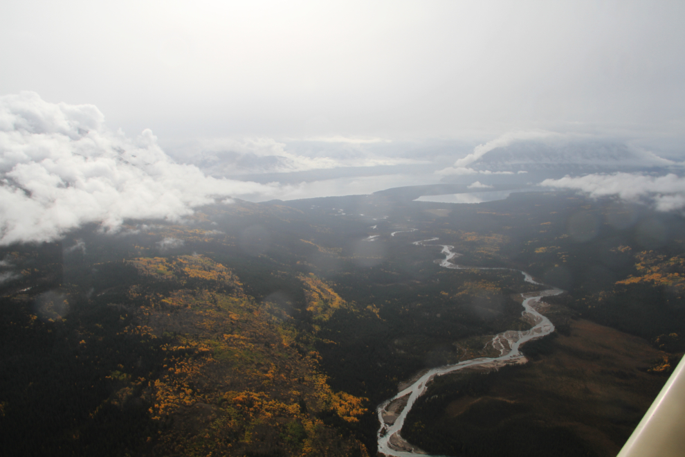
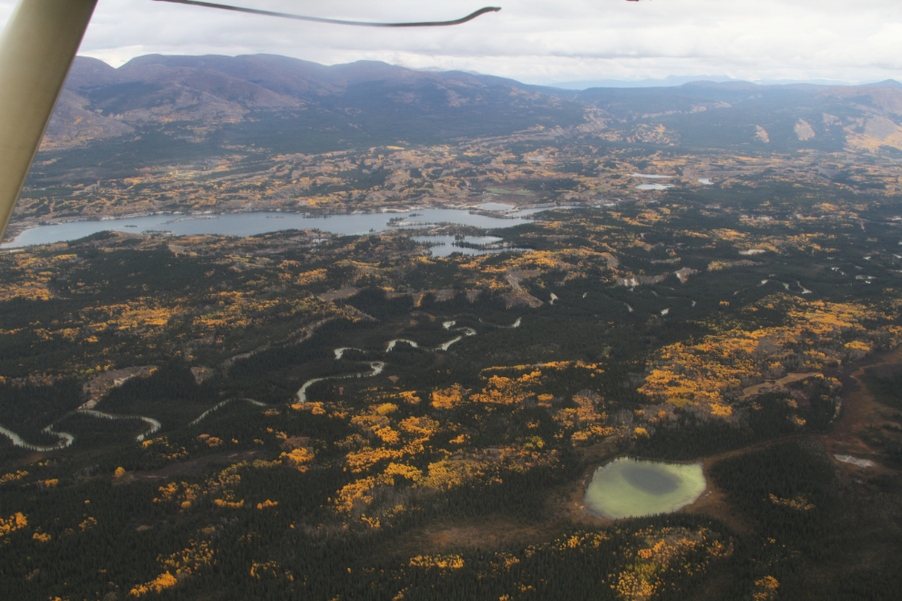
Looking up the Watson River, with a light rain starting. A rough mining road runs up the right (north) side for about 5 miles, crosses the river then goes another 5 miles or so. It’s spectacular country with a fascinating history.

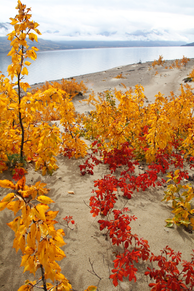
Heading down the Wheaton River. Even opening the window, the mist made it tough to show how brilliant the Fall colours are – we’re pretty much at peak colours now.
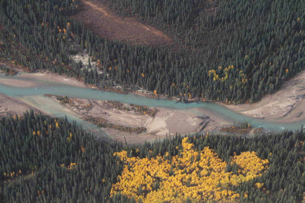
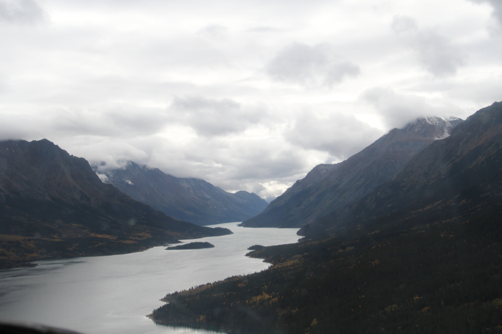
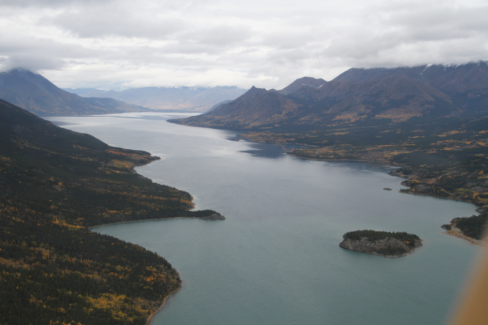
Looking down the Wheaton River to Lake Bennett, with Millhaven Bay on the right.
I’d sure love to canoe the Wheaton!
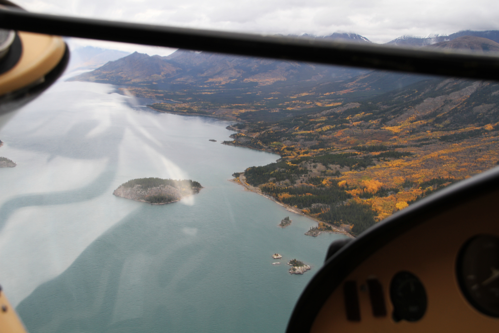
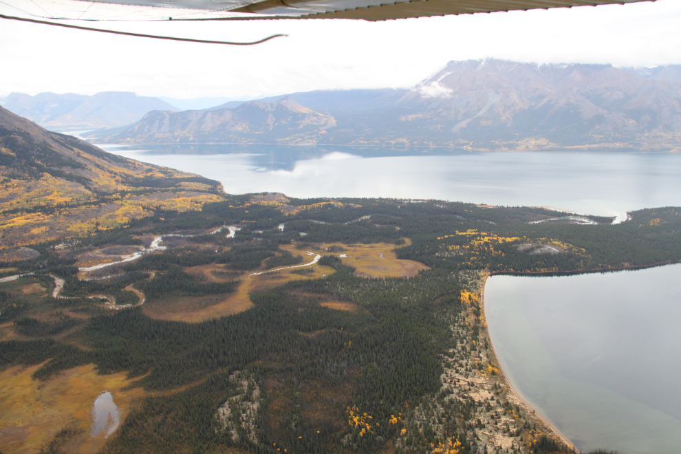
The sandy head of Millhaven Bay. The initial call from Kyle had been about the location of Otto Partridge’s lumber mill on Millhaven. I think that there have been 3 mills here, and that one was near the head of the lake, but from the air we could see no signs.
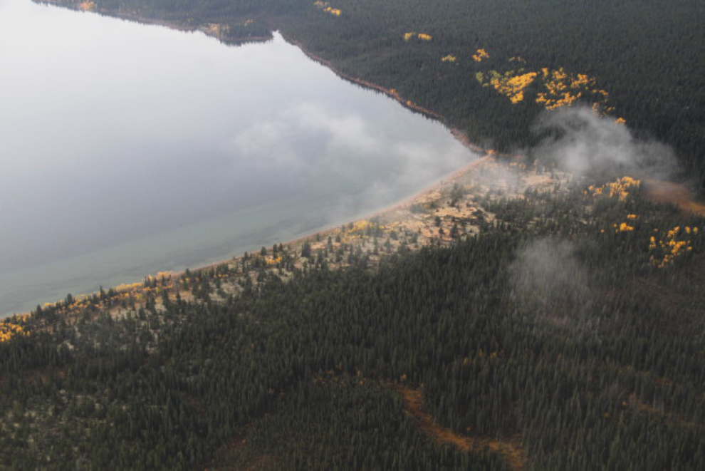
Brilliant Fall colours on the west side of Millhaven Bay.
With no luck at Millhaven, we landed on the main arm of Lake Bennett, close to the location of a Gold Rush boat-building yard, just before 12:30. Here in 1898, the Bennett Lake & Klondyke Navigation Company built 3 small sternwheelers – the Ora, Nora, and Flora.
While Kyle and his Dad got the plane secured, I walked up the lakeshore in search of the boatyard, which I hadn’t been to in 10 years or so. Up close, some of the colours were quite spectacular.
I expected the find the site very quickly, but the further I walked, the more confused I became. Nothing looked familiar, and the heavy erosion that’s occurred made me start to think that it had all been washed away.
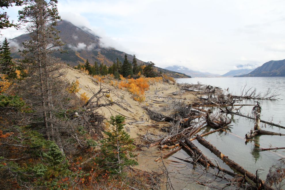
I spent almost an hour walking to the mouth of the Wheaton River and back to the plane. Either everything had been washed away, or I’d walked in the wrong direction.
All 4 of us scattered along the beach and into the forest to the north of the plane, and very quickly found the first signs that this was the right way.
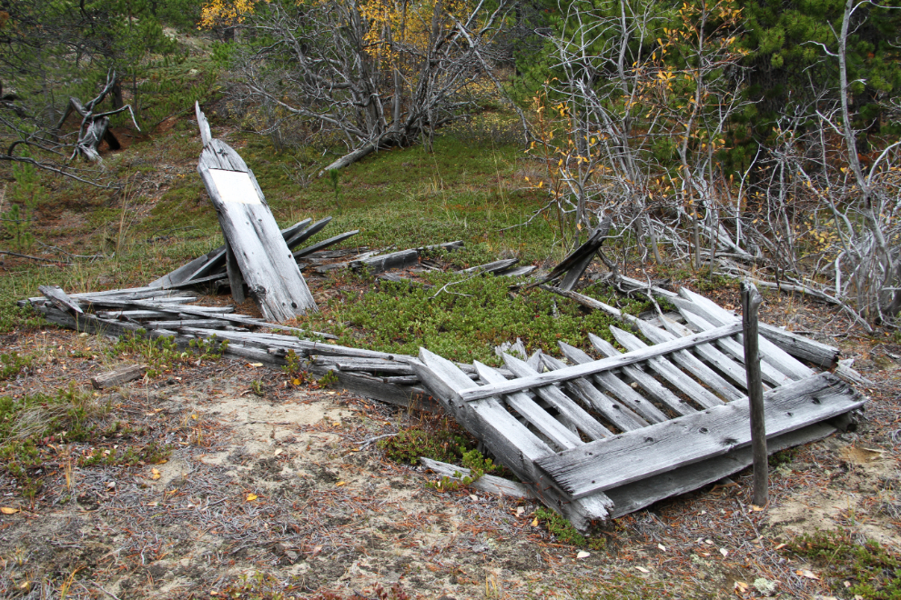
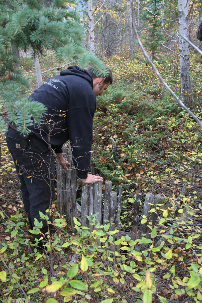
Within 15 minutes, Kyle found the grave that’s at the south end of the boatyard. When I was here 10 years ago, I lightly stabilized the fence and headboard – the headboard was still leaning against the post I sunk then, so it will at least rot slower.
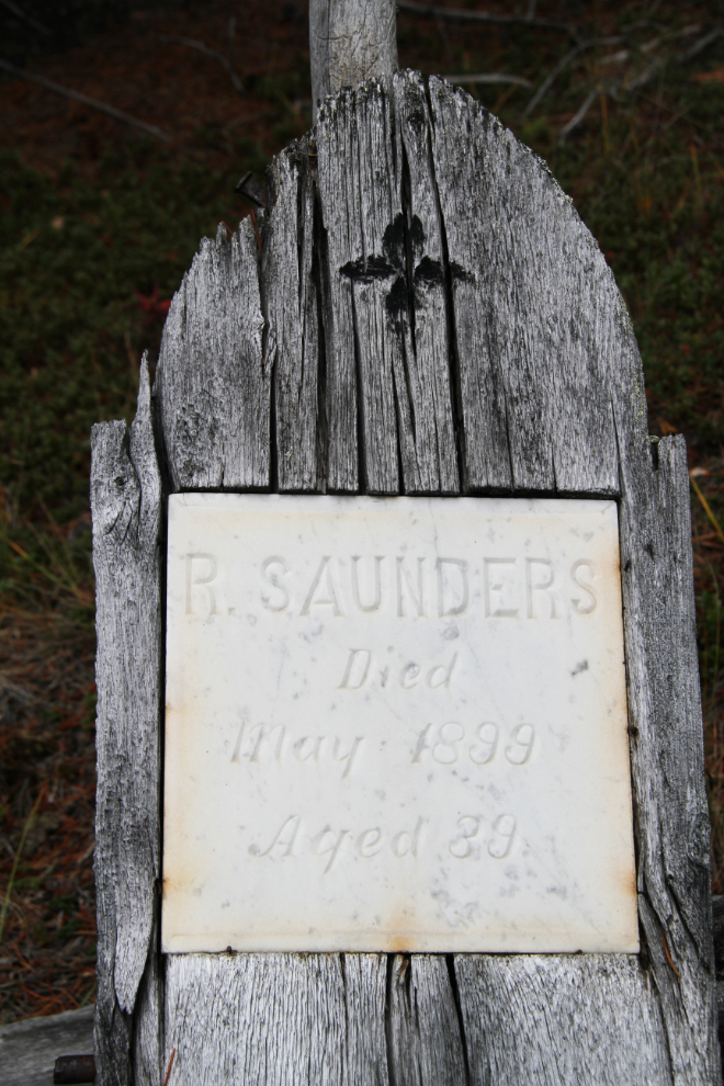
The inscription carved into a piece of marble inset into his headboard states simply that R. Saunders died in May 1899, at the age of 39. Mr. Saunders is, so far, largely a mystery man – all I’ve been able to find out about him is a brief mention in the 1899 North West Mounted Police report, stating that he died of natural causes on June 21, 1899 (contrary to the headboard’s date). Several years ago, I got an email from a man who had met Mr. Saunders’ son some 40+ years ago in Calgary, and he believed that his father died in a boating accident. Saunders clearly had either some very good friends or a family wealthy enough to afford to hire this level of grave construction. At the bottom of the photo, you can see a steel rod that was put through the board to prevent it from warping and popping the marble out.
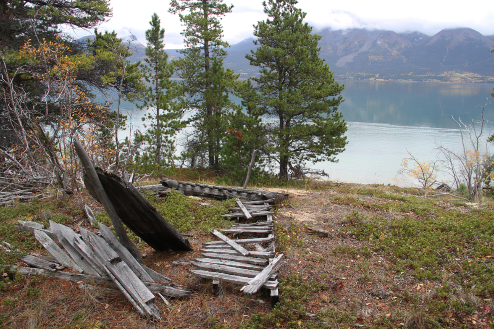
The view from Mr. Saunders’ final resting spot.
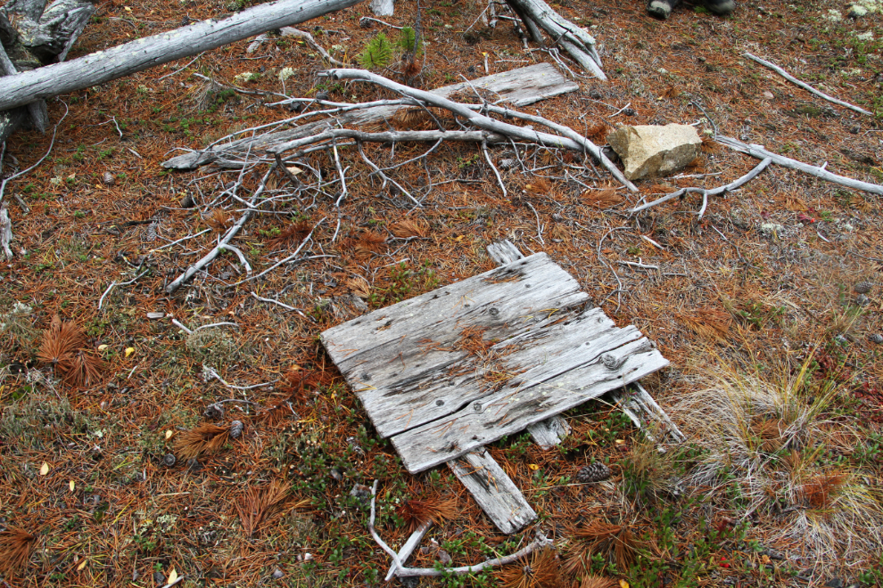
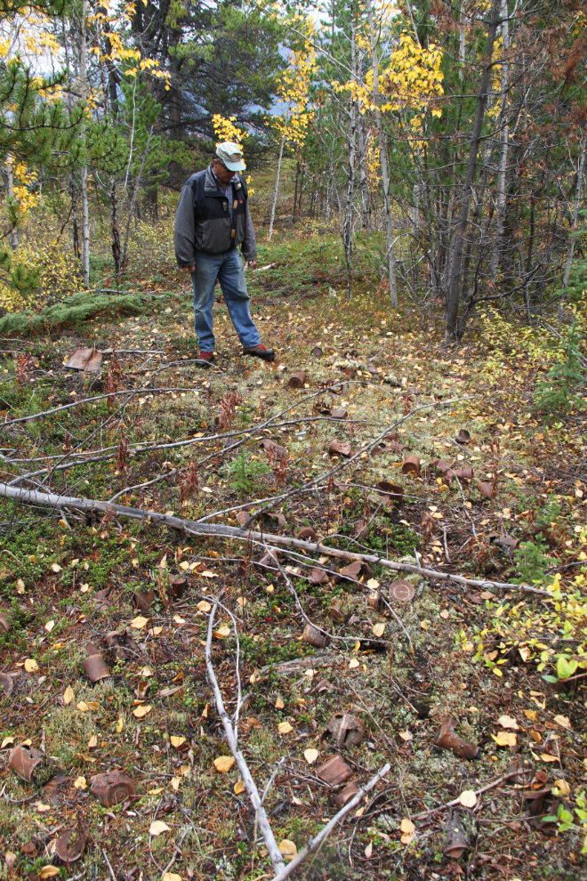
From the grave, the first debris from the boatyard is only 100 meters/yards or so. There’s all manner of metal, from food and gas cans to broken pieces of equipment, most of which we couldn’t identify.
Bob looks over the main food-container dump. It’s hard to say how deep the material is, but it would have taken a substantial workforce to quickly build 3 sternwheelers.
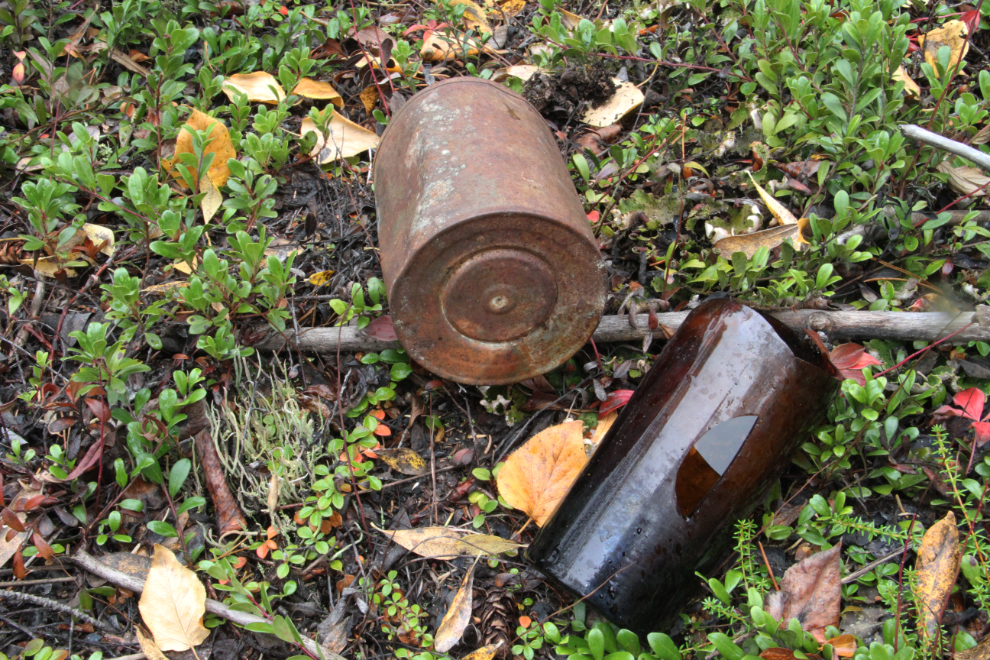
A lead-soldered tin can and a broken bottle. There’s very little glass among the debris, and I expect that “collectors” have removed it over the years.
This was possibly a root cellar, but the small diameter makes me think that it was a well. It would be easier to get good water from a well than from a frozen or storm-lashed lake, regardless of how close it is.
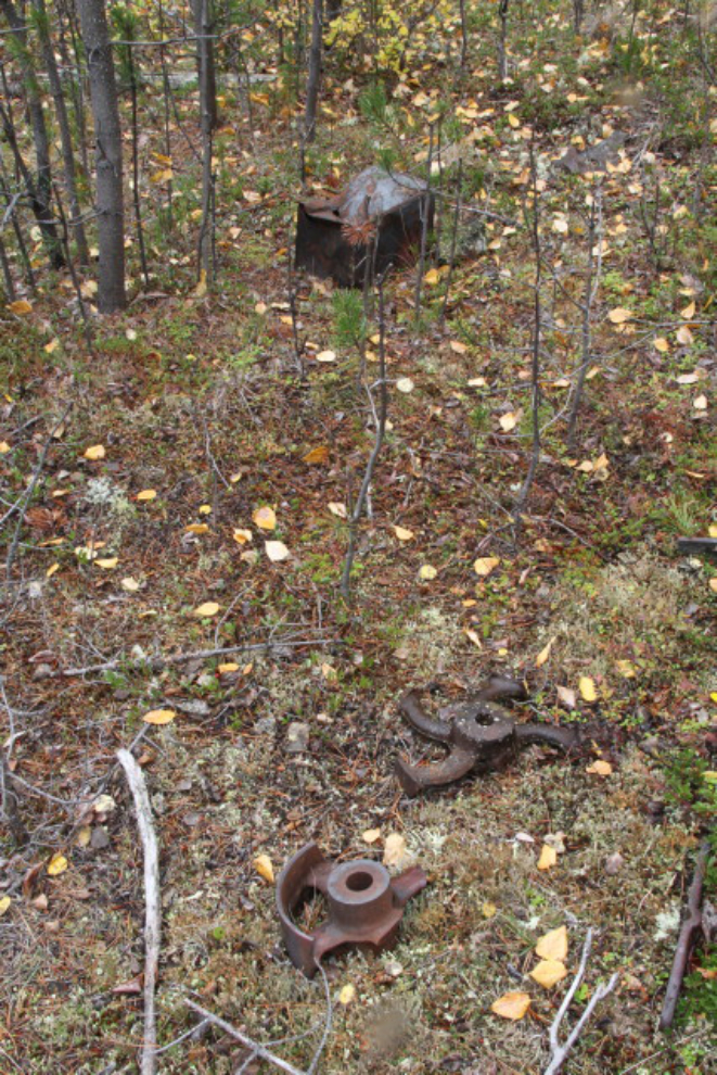
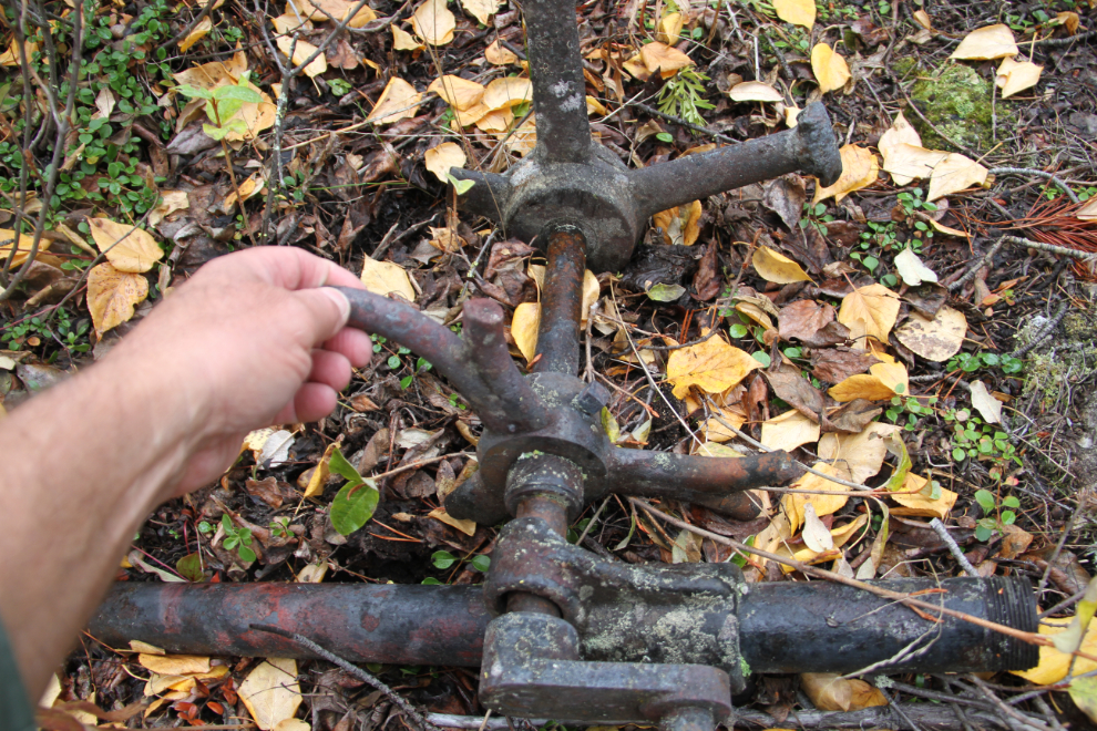
This was one of the 2 most interesting pieces of equipment we found, and we have no idea what either were.
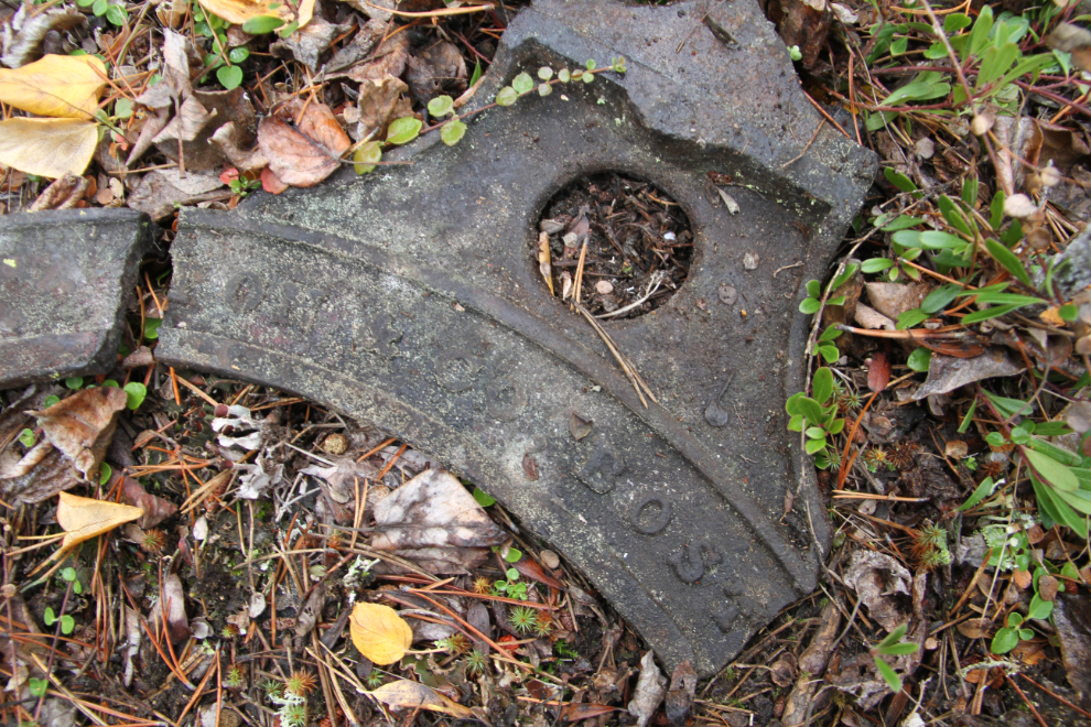
A piece of something from Boston, it appears.
This is the view from the middle of the boatyard. Extremely high water levels are hiding the pilings which allowed me to positively identify the site as being the Bennett Lake & Klondyke Navigation Company’s, many years ago, by comparing the view to a photo of the dock in 1899.
Does that look like pretty much the perfect Yukon day? 🙂
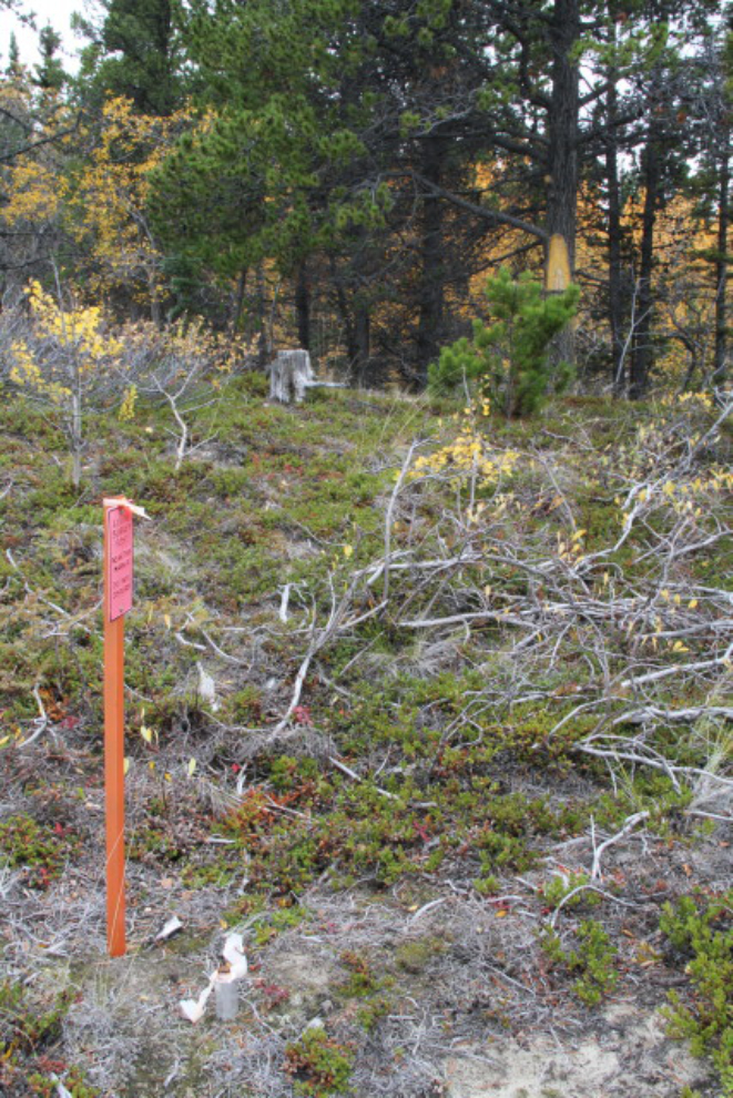
This survey was done a few years ago to delineate the First Nations settlement land here.
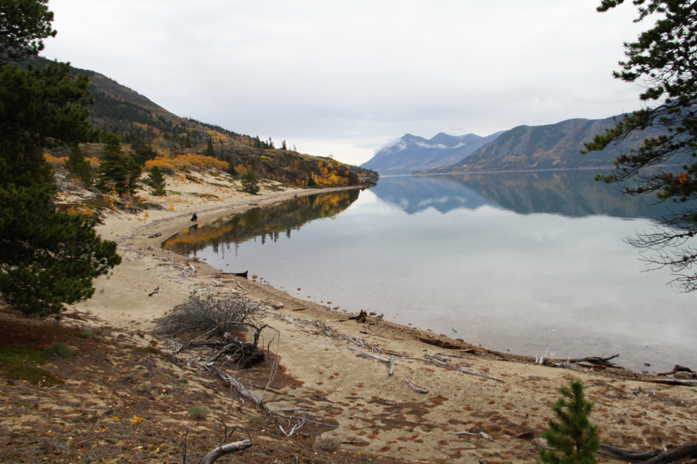
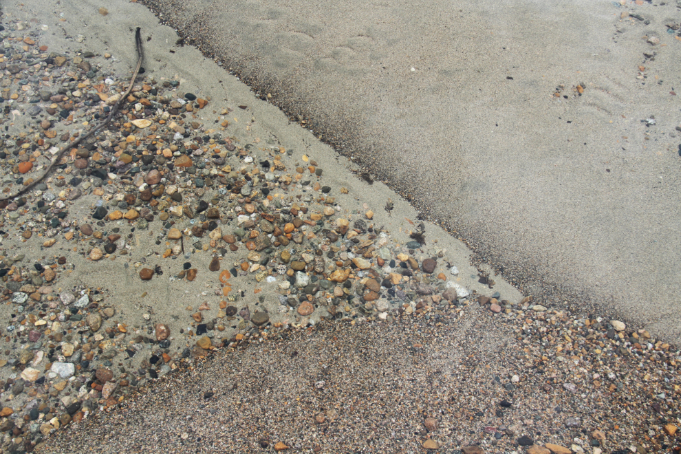
The way water sorts sand and gravel always intrigues me. There’s about a foot of extremely clear water over those materials.
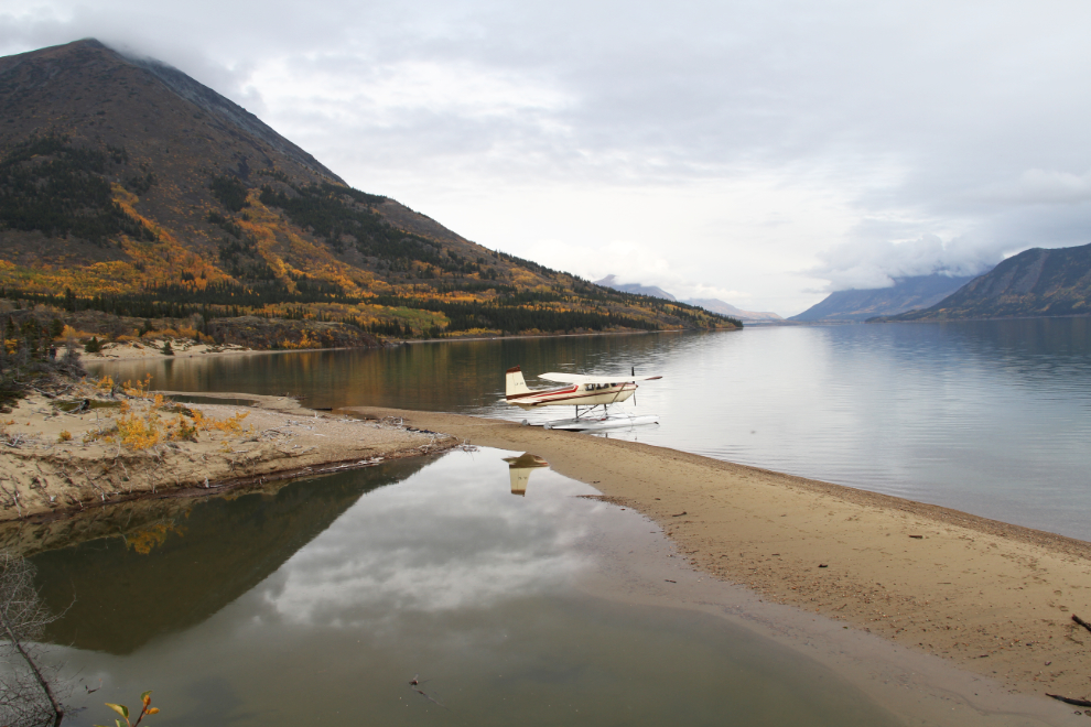
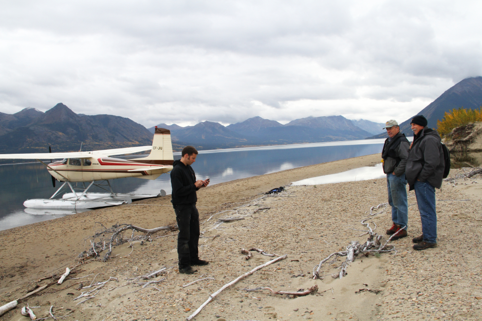
Kyle, Bob, and Tracey discussing departure at 3:30. We decided fly a few miles south to get a high view of another site before heading back to Whitehorse.
If we would have looked at the right spot at the right second as we were landing, we could have walked right to the grave!
Away we go again. It was amazing to see Lake Bennett calm, and then to stay calm – that’s not a common occurence.
The view to the south, down the main arm of Lake Bennett. The Yukon/BC border runs across the lake just to the south of the island.
Looking at the island fLooking at the island from the BC side of the border. On that island are 2 Gold Rush graves, those of Luc Richard and Thomas A. Barnes who were drowned when they fell through rotten ice on Lake Bennett on May 10, 1898. See a brief 1898 report on that accident from The Caribou Sun, a newspaper printed at Caribou Crossing (now Carcross).
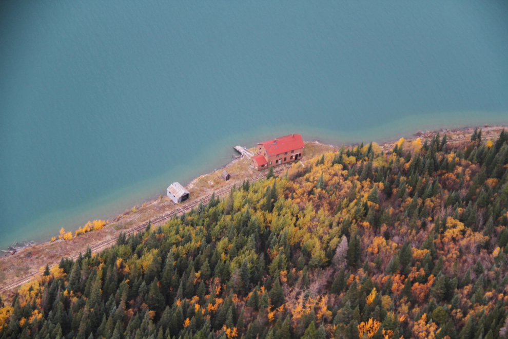
The historic Pennington section house on the White Pass & Yukon Route rail line. Every time I see it, I wish that somebody would turn it into a B&B 🙂
Looking north on the lake towards Carcross.
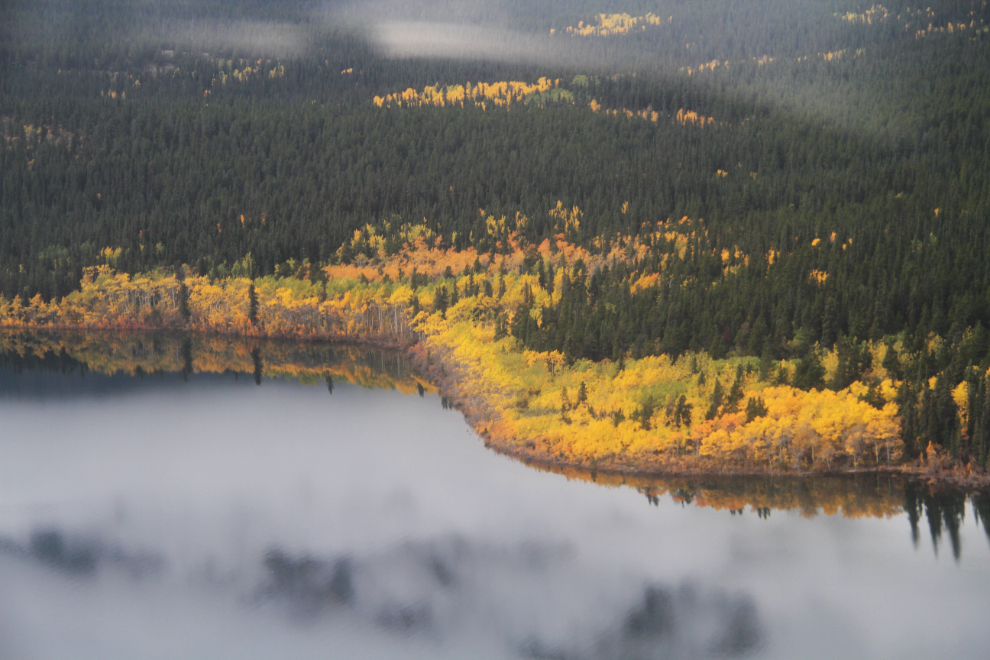
At 3:45, we crossed over Millhaven Bay again, and headed up the Wheaton River.
Another little detour, through a notch in Gray Ridge. Mount Gilliam is on the left (north) side, the peak on the south side is unnamed.
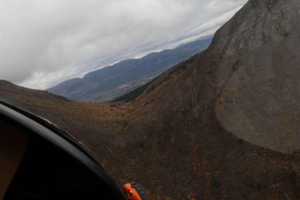
At the bottom of that cliff is a cave that appears to be quite deep. Some of us are quite intrigued by the thought of making the tough hike up to it 🙂
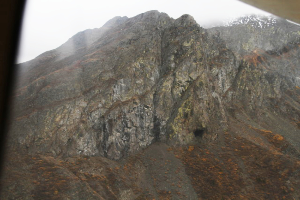
One the east side of that notch in Gray Ridge is another plane crash. The arrow points it out in the main photo, and the inset shows the upside-down Cessa 180 float plane that 4 men were killed in. To non-pilots, looking for this sort of site may seem morbid, but when you’re flying in this country, it’s good to always keep in mind what can happen when you make bad decisions. During the years that I was involved with CASARA (and actively flying), I spent countless hours looking for tiny specks of metal like that, always hoping to see survivors waving at us.
Looking east across the Watson River to Lewes (or Lewis) Lake and the Mount Lorne ridge.
My house is at the lower left in the Mary Lake subdivision, the model aircraft club’s airport is left of centre, and the abandoned stock car track (where I often fly my drone) is right of centre.
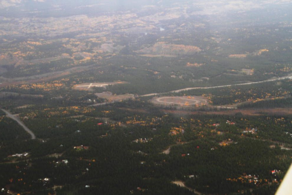
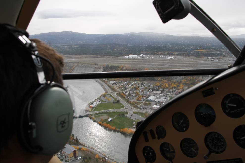
Turning onto the base leg of the approach to Schwatka Lake, with Erik Nielsen Whitehorse International Airport ahead.
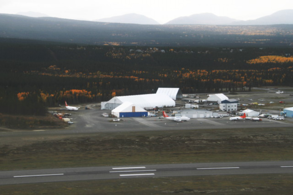
Air North’s base of operations.
When I got home, I got back to my cooking, but my departure in the motorhome has been delayed by a day. The weather is supposed to improve tomorrow anyway, so it’s all good 🙂