Exploring western BC from 35,000 feet
Cathy and I got home yesterday afternoon from a 4-day trip to Vancouver. This is the first of 3 blog posts from it – this one covers the flight down, the next will be the Vancouver experience, and the final one will be about the Indian residential school memorial I found in downtown Vancouver.
Six years ago, I did a similar post to this for Destination BC, entitled “Coastal BC from 35,000 feet.” It had 21 of my best photos from all my flights – today’s post has 20 photos.
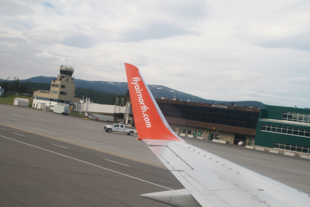
At 09:10 on July 6th, we left Whitehorse on one of Air North’s Boeing 737s. Seat 15A wasn’t prime for photography, but that’s what I get for not booking it myself. We would be stopping briefly at Victoria on this run – I was looking forward to that.
The first photo was shot at 09:29, northwest of Telegraph Creek but despite it being quite distinctive I haven’t found the exact location yet.
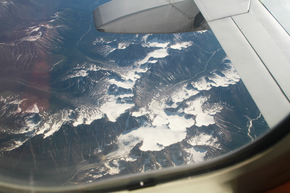
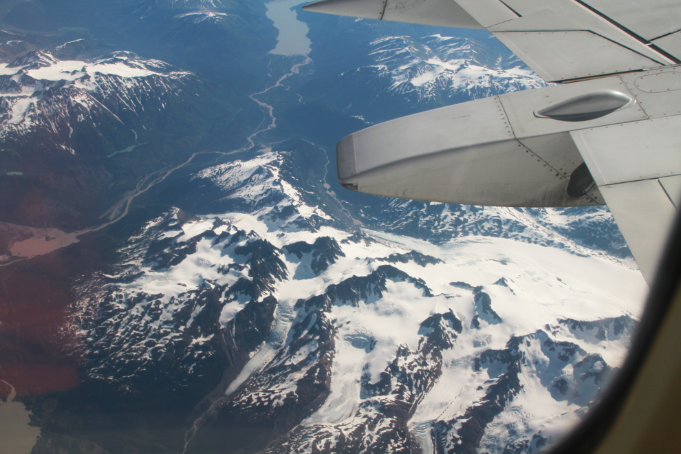
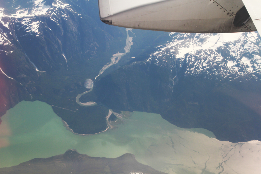
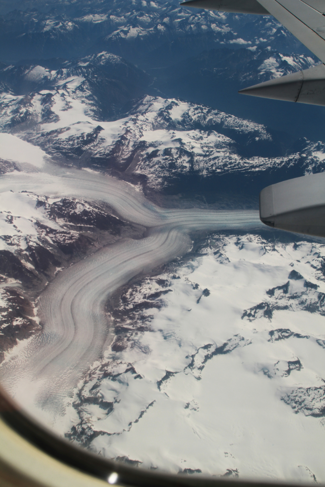
The next 2 photos, shot at 09:58, show Pretivm’s Brucejack Mine, a high-grade gold underground mine located approximately 65 kilometers north of Stewart. The final 15 km or so of the access road from the Stewart-Cassiar Highway to the mine was built down the middle of the Knipple Glacier.
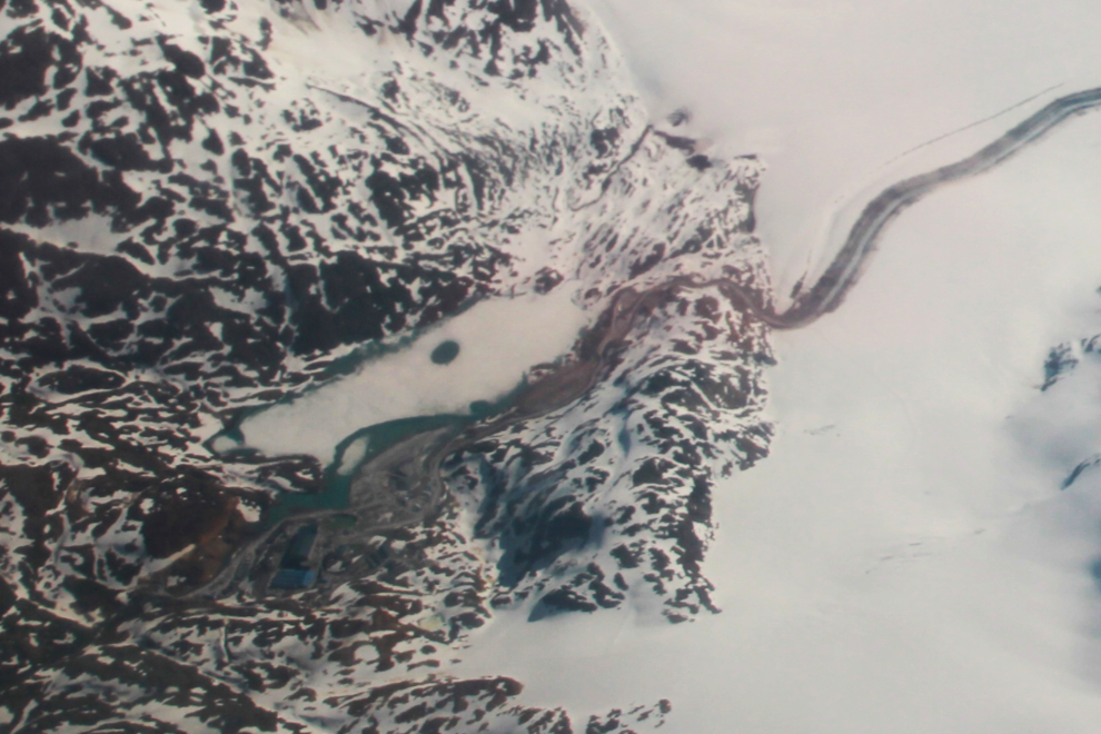
The Knipple Glacier drains into the unnamed lake at the left centre of the next photo. The Bowser River flows from it into Bowser Lake, seen at the upper centre.
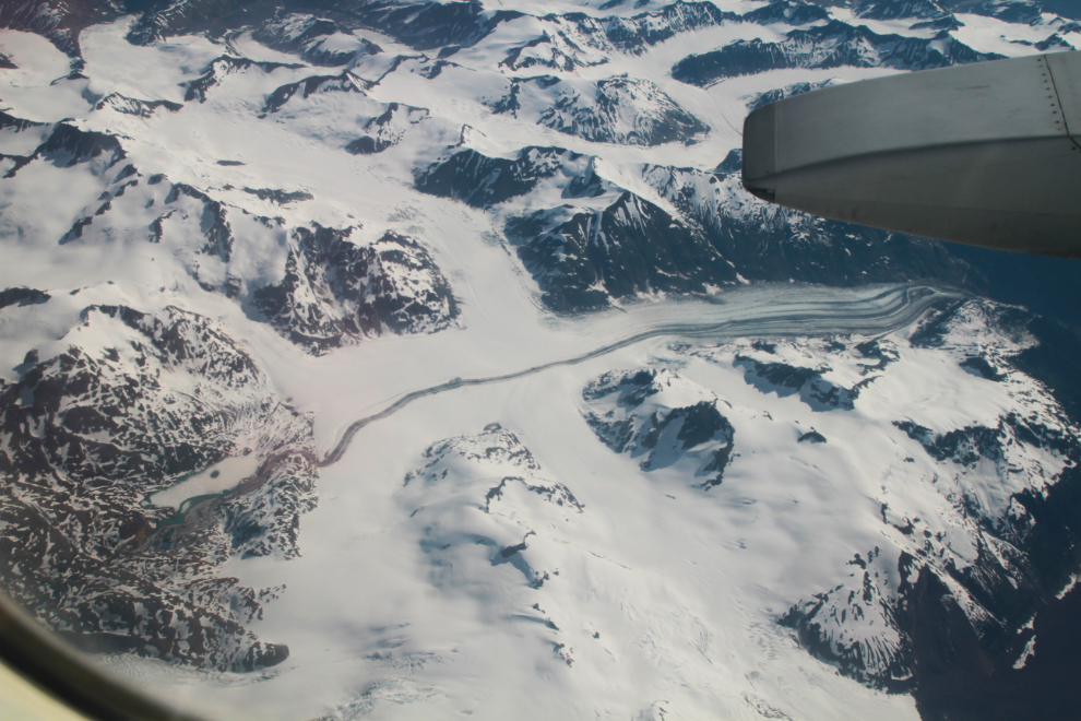
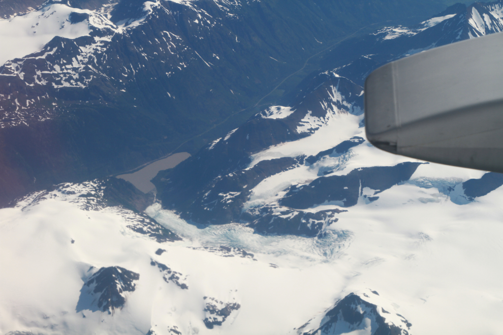
At 10:01 I was looking down at the Bear Glacier, Strohn Lake, and the Stewart-Cassiar Highway just north of Stewart, which is off to the left.
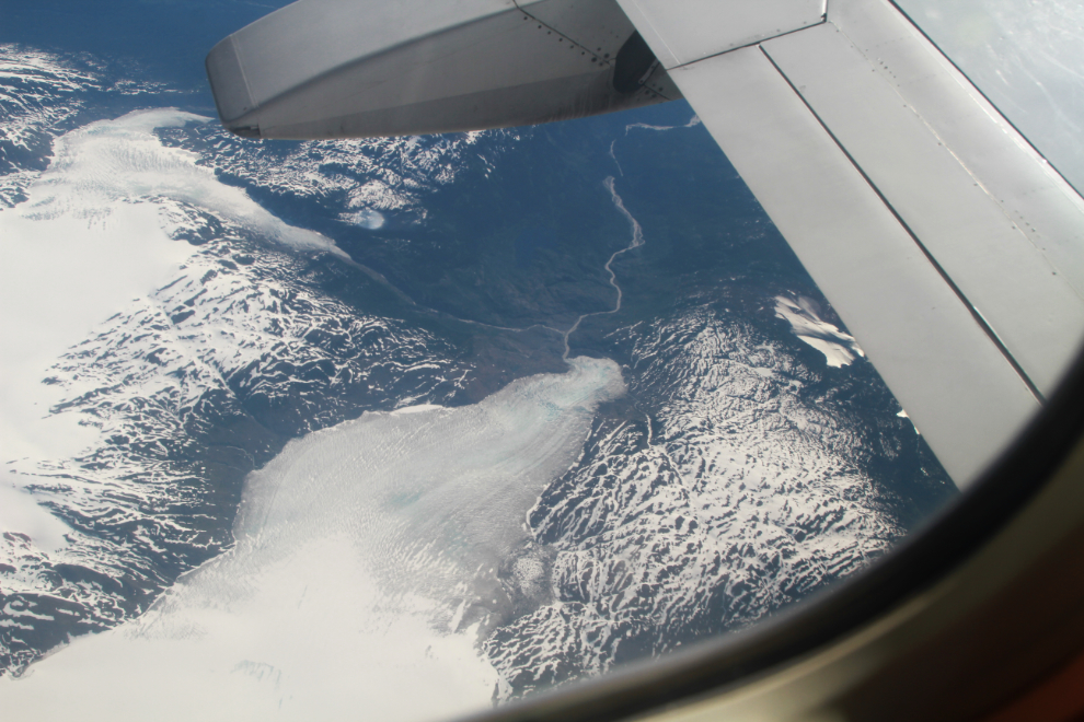
Two minutes later, the large White Glacier and smaller South Flat Glacier, headwaters of the White River, were below.
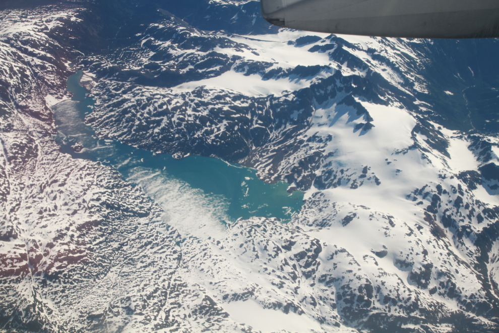
When the ice clears, the turquoise glacial waters of Kinskuch Lake are gorgeous. It’s at 55° 40′ 27″ N, 129° 22′ 35″ W. I was surprised to see so much snow and ice – its elevation is only 1,129 meters (3,704 feet).
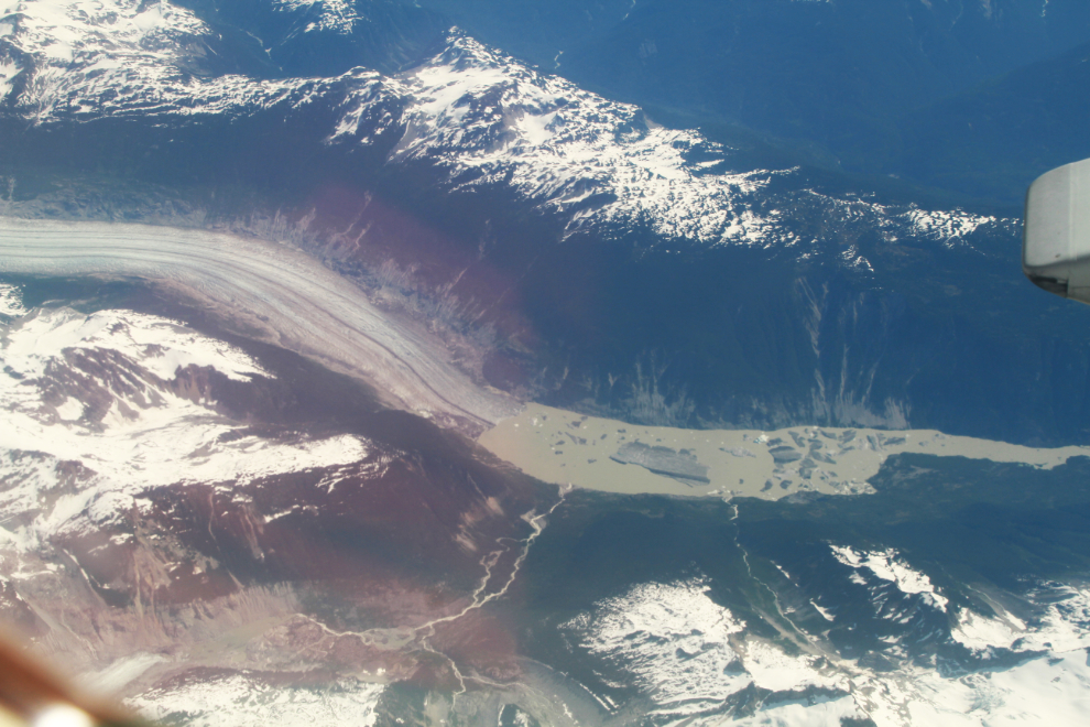
At 10:30, the Dean River could be seen flowing into Dean Channel. This is a very interesting area both historically and geographically – the Nuxalk First Nation village of Kimsquit used to be located there, and from the head of Dean Channel, 10 km to the left, it’s 105 km to the sea at Queen Charlotte Sound.
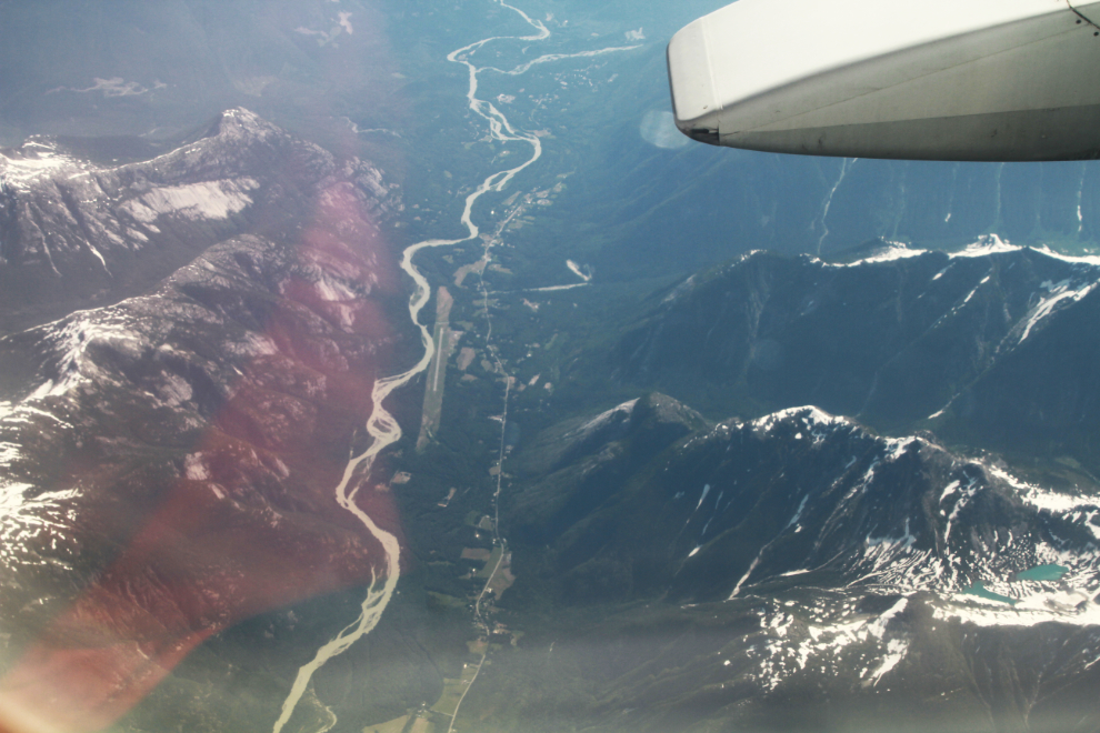
The Bella Coola airport is seen to the left of center in the next photo – the community would be seen from the seats on the other side of the plane. This is an area I haven’t seen nearly enough of on the ground yet.
This is another spectacular glacial valley I haven’t identified yet, seen at 10:38.
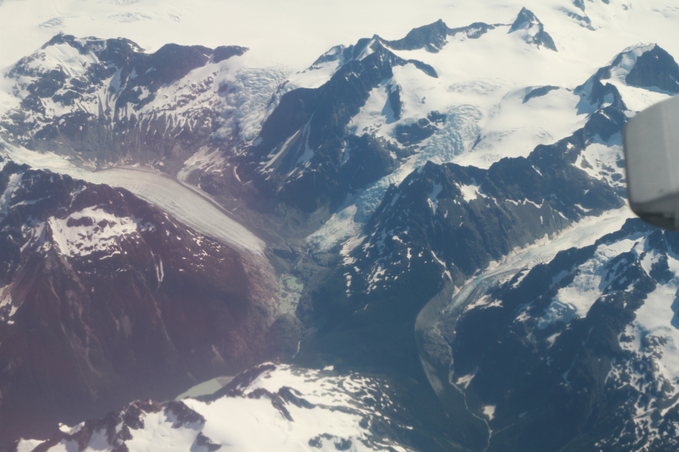
Obstreperous Ridge, in the centre, separates the Sumquolt Glacier on the left from an unnamed glacier, the Princess Glacier, and the Sheemahant River.
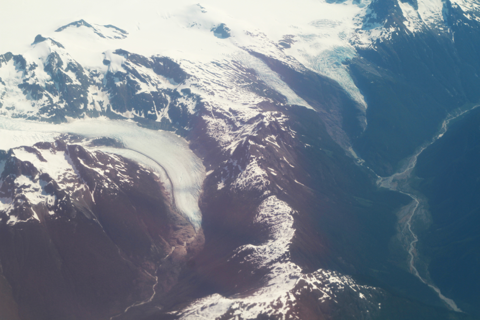
10:42 – the Silverthrone Glacier flows from the lower left to meet the Klinaklini Glacier.
The Klinaklini Glacier and the headwaters of the river of that name.
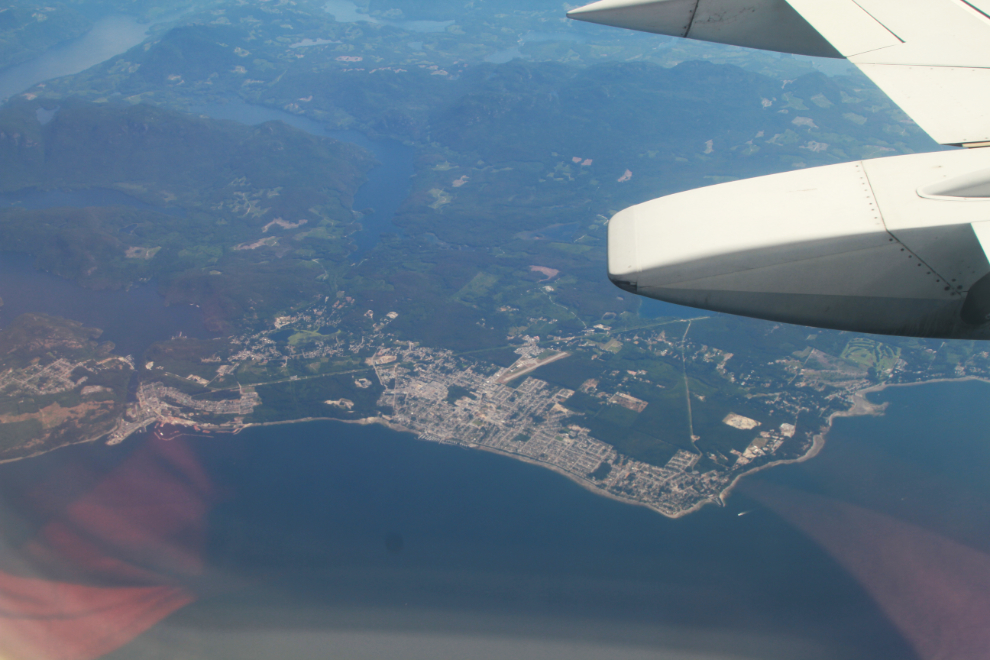
At 10:58 we reached the first large community, and the start of three days of seeing a lot of people – that’s Powell River below.
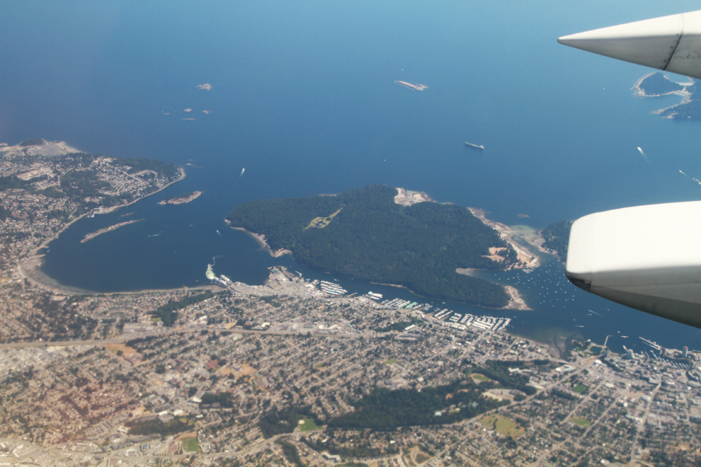
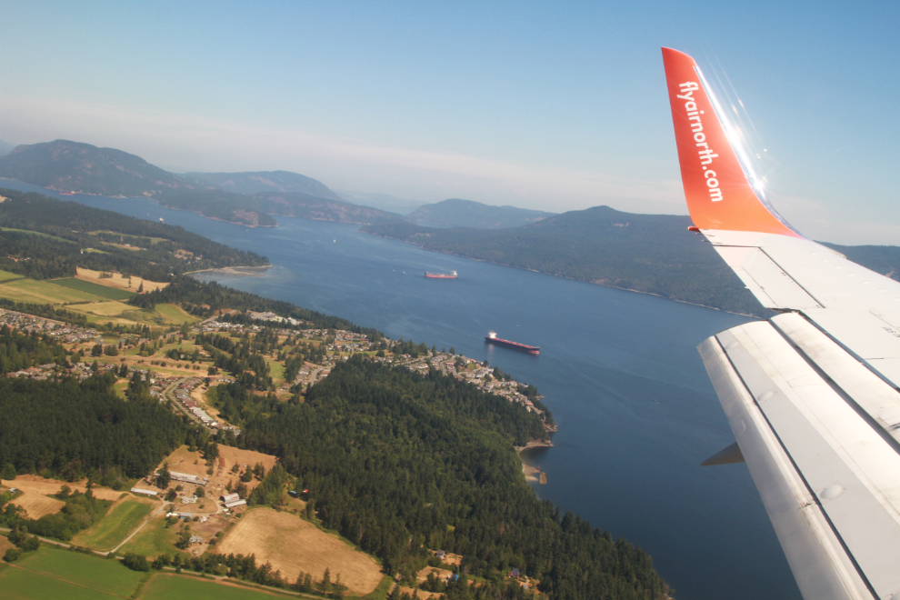
At 11:04 we were over Nanaimo, well into our descent to Victoria.
The approach to Victoria International Airport, which is actually at Sidney, is incredibly beautiful on a day like this. We had passed through an area of wildfire smoke and could see a thick layer of it to the north.
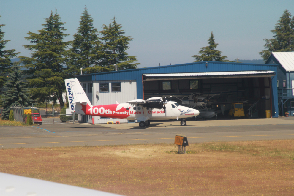
The stop at Victoria was longer than I had expected – about 35 minutes. Taxiing out, I was very pleased to see the 100th Series 400 Twin Otter conversion done by Viking Air.
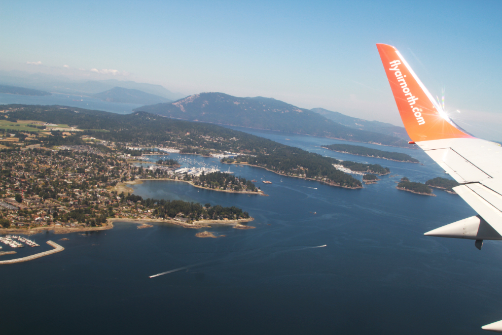
Climbing out over Sidney at 12:11.
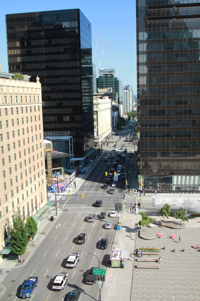
We grabbed a taxi at Vancouver, and were soon settled in a lovely corner room (#723) on the 7th floor of the Fairmont Hotel Vancouver. Yes, this would do nicely for 3 nights 🙂
Unrelated question. Did you ever get back to the high plateau at Spirit Lake, where you had encountered the “dry creek grizzly’ some years back…? I found a sticky note from some old pages reading that I had done on your site.
Yes, on my 3rd try, the Dry Creek Grizzly let me reach the plateau! It’s a steep and superb hike – https://explorenorthblog.com/hiking-to-caribou-ridge-yukon/
I’ve been lucky enough to fly into Anchorage AK, commercially, over 20 times (and back out flying out quite a different direction…) over the years and I am always fascinated to no end by the countless river and glaciers and valleys visible, many of which I can never ID despite trying to find it on a flight tracker application someone pointed me towards. Some great photos as always. I caught up on the e-bike rides, those really reminded me of years in CA’s Sierra national forests.
Thanks, Brad. Finding the locations can be a challenge, that’s for sure. I used to think about getting a GPS add-on for the camera, but scouring Google Earth is very educational 🙂