Exploring Tuktoyaktuk, NWT
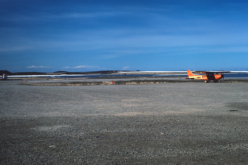
Although Tuktoyaktuk was mostly just part of the package this time, on my first visit 39 years ago, Tuk was the target destination, and the many other places we visited were just bonuses. The first photo today is a flashback to that 1985 visit, with my Cessna 172, C-GWDM, parked near the sea end of the runway. A comment from my article “1985 Flight of Discovery” says “‘Tuk’ wasn’t just the furthest north from my home at Langley, it was the furthest from any experience I’d had before, and I was fascinated by the whole thing.” Within 5 years I had moved to Whitehorse and two years later I was running tours to Tuktoyaktuk. Yes, this is a special place to me, and it’s taken me 49 photos to tell you about part of this day.
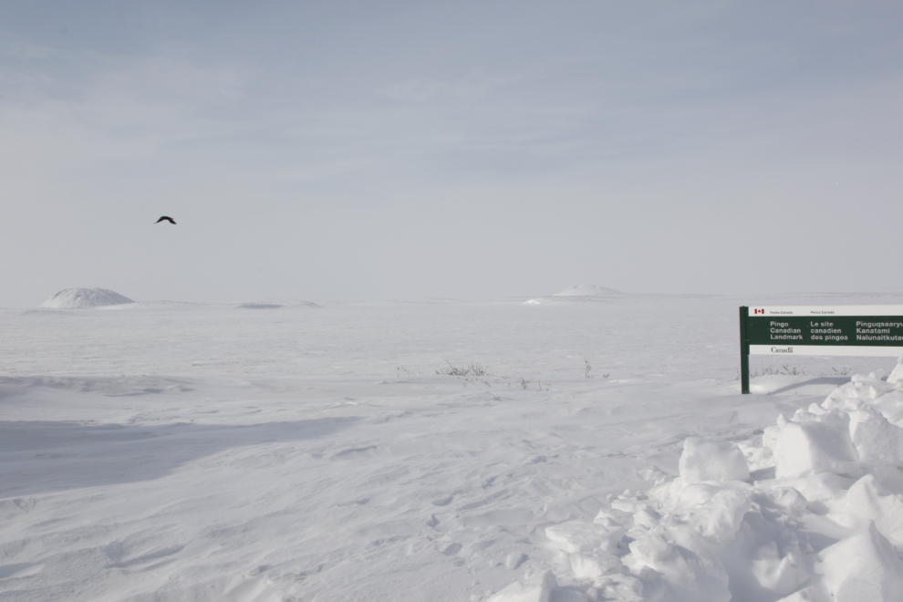
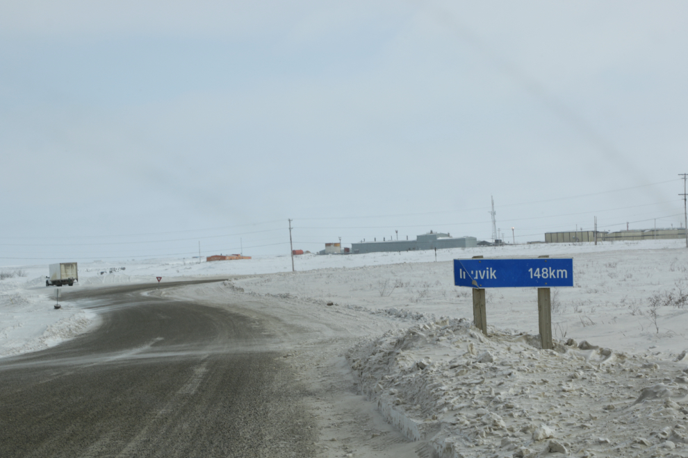
Tyson and I reached Tuktoyaktuk at 1:20 on Monday, April 8th after driving 148 km from Inuvik. We stopped briefly at the welcome sign, then at the visitor area for Parks Canada’s Pingo Canadian Landmark. Pingos are ice-cored hills that form in recently drained lakes – see a full description here. On the left in the next photo is Ibyuk Pingo, and Split Pingo is on the right. Ibyuk is Canada’s tallest and the world’s second-tallest pingo. It reaches 49 metres (about 161 feet) in height and stretches 300 metres (about 984 feet) across its base.
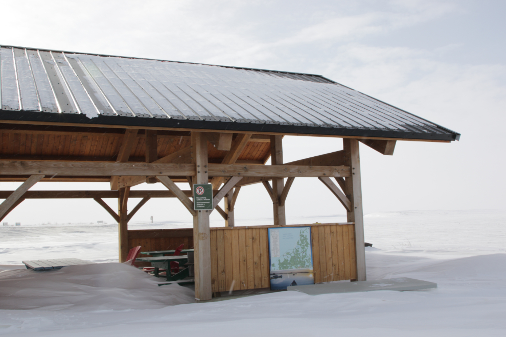
There’s a picnic shelter…
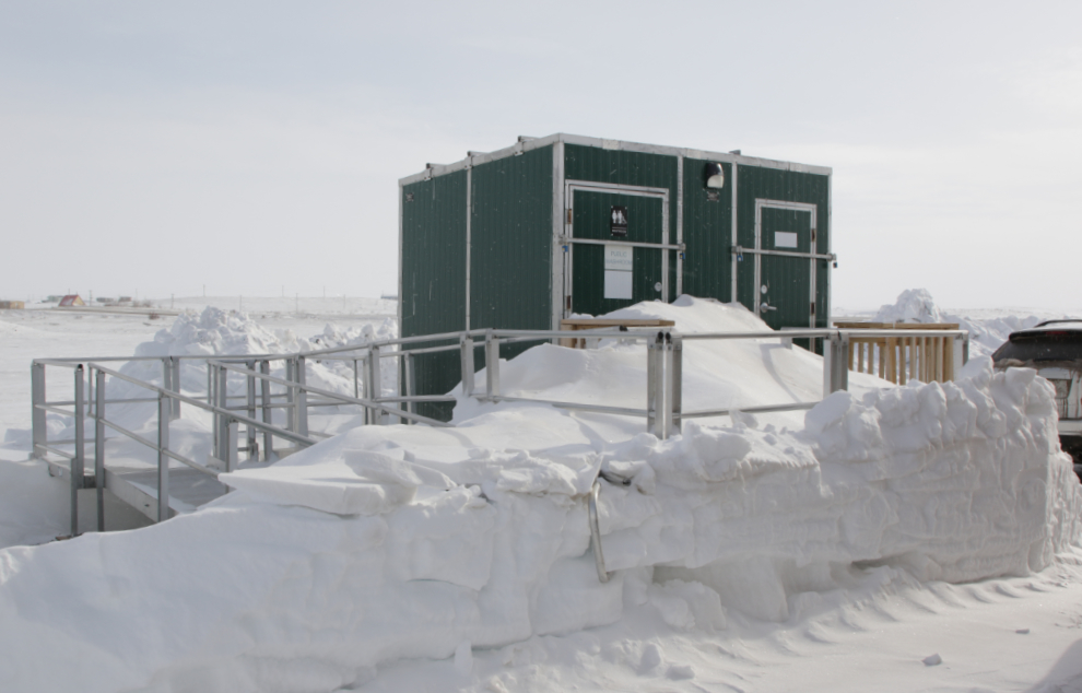
…and flush toilets. There were two RVs from Quebec parked there, but we didn’t see the people. The temperature was -14°C / +7°F but a strong wind off the Beaufort was very cold.
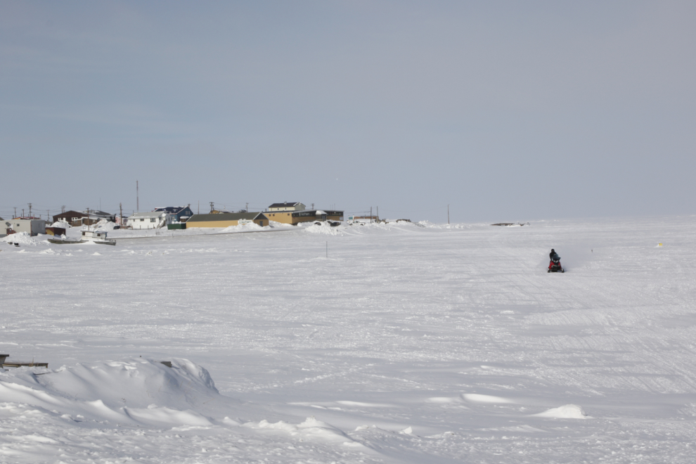
In the winter you perhaps get a hint of what part of the landscape at Tuk is water, but when the snow melts there is a lot of water, both salt and fresh! Click here for an interactive map in a new window, and the Street View feature can show you what the area looks like in the summer.
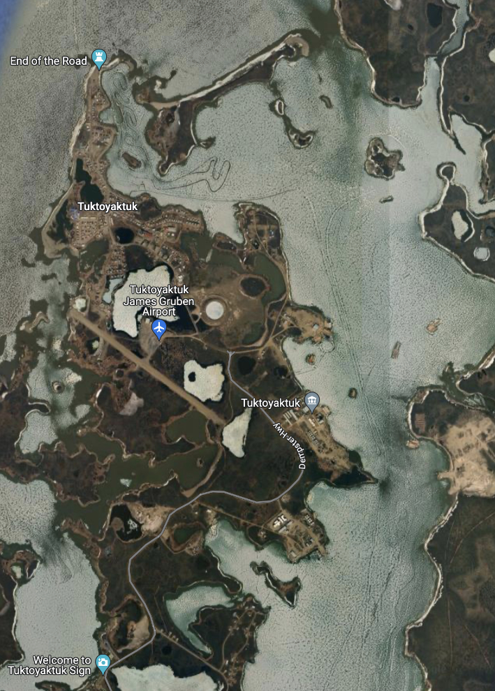
The population of Tuktoyaktuk in the 2021 census was 937, an increase of 39 from the 2016 census. There were 285 homes, an increase of 17.
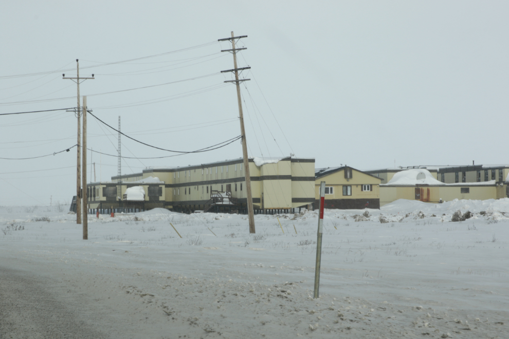
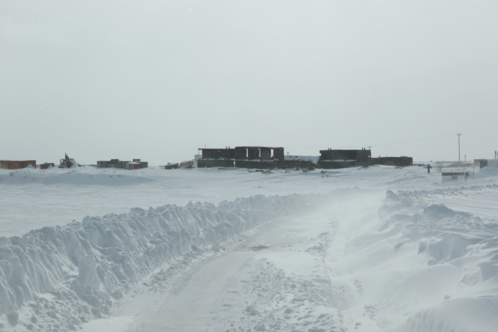
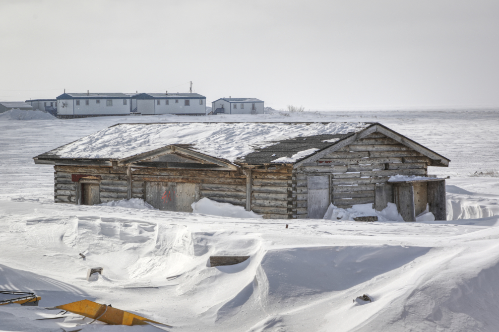
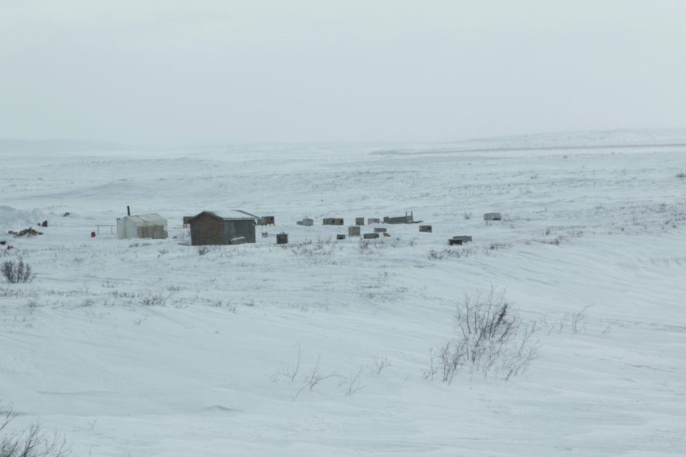
In the 1970s and ’80s there was extensive drilling for oil in the Beaufort Sea near Tuk, and a lot of the infrastructure that was built remains. This is the Dome Petroleum camp – once home to hundreds of people, it’s now empty.
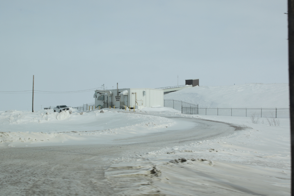
The BAR-3 DEW Line site, built in 1956 on a hill overlooking Kugmallit Bay, is now a Short Range Radar (SRR) facility. It looked like the road to it had just been plowed so of course we went for a look.
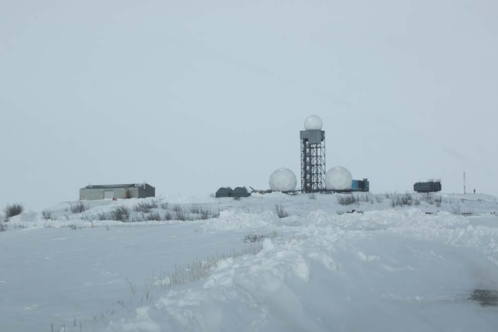
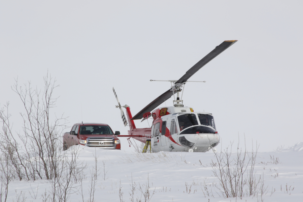
We were surprised to see a helicopter there.
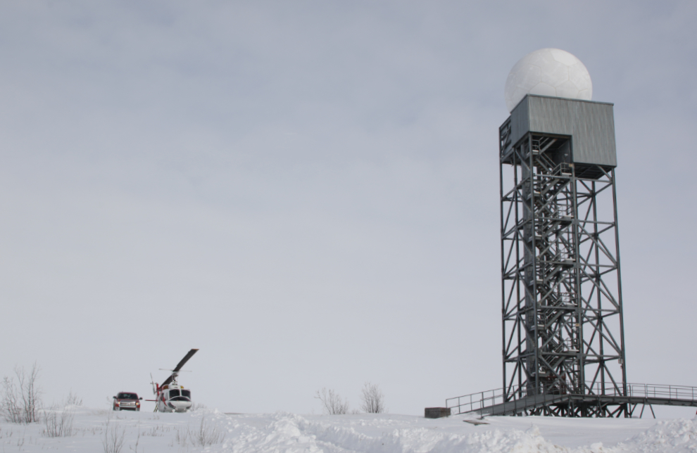
It was Canadian Helicopters’ 1977 Bell 212 C-FOKV.
The radar hill offers a good view of the community and area, and I used to take my tour guests for a walk up there. This day, the wind was picking up, and the snow and ice crystals in the air were reducing visibility more and more.
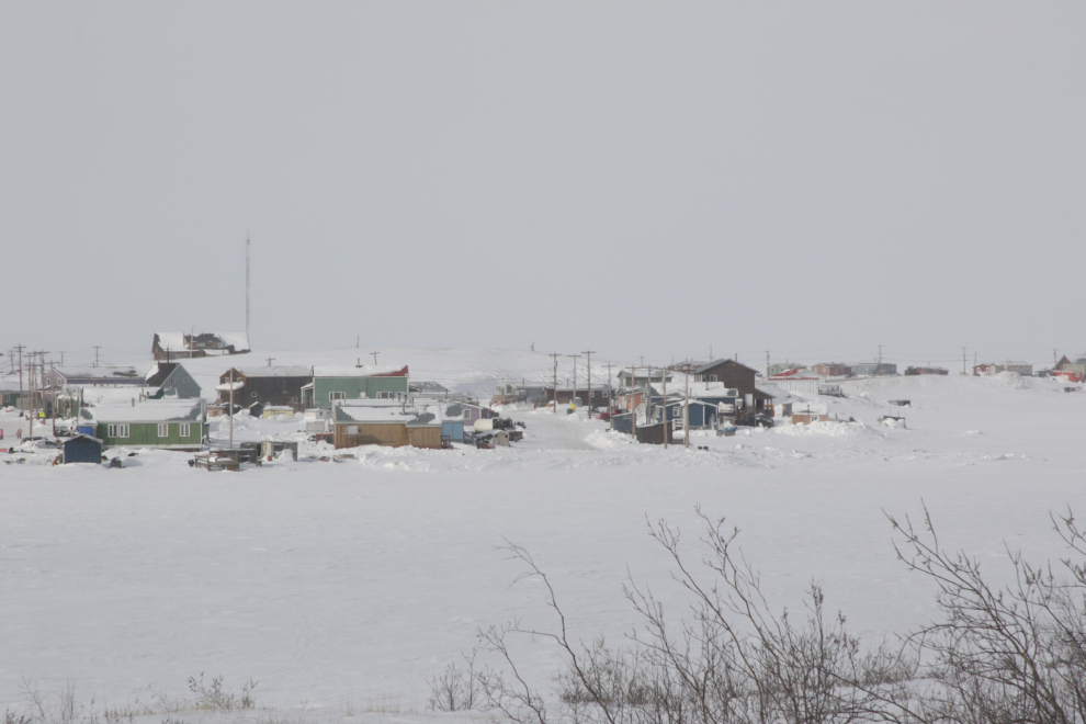
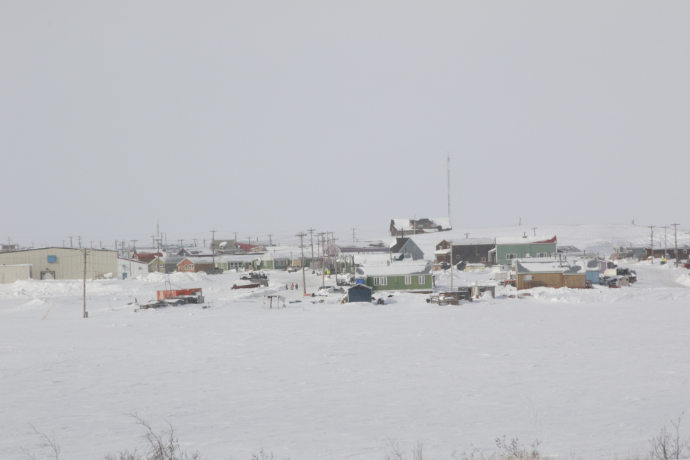
The view to the south as we drove back down.
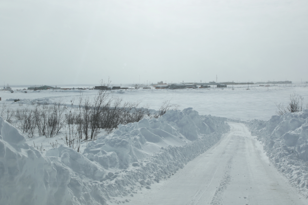
The wind was very quickly drifting snow into the road cut. It wouldn’t be drivable for very long.
Another prominent hill, right in town, is man-made – it’s the water reservoir.
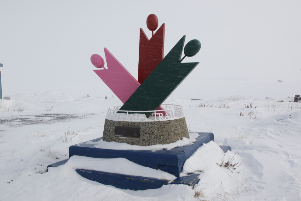
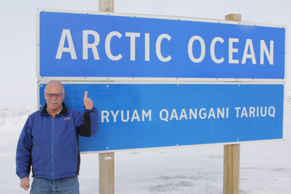
The point at the northern edge of town is the main attraction for most visitors. This monument, erected here in 2000, marks the northern end of the Trans Canada Trail.
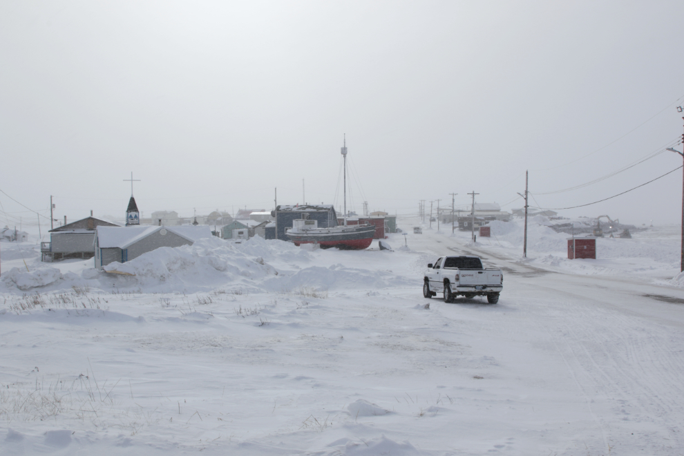
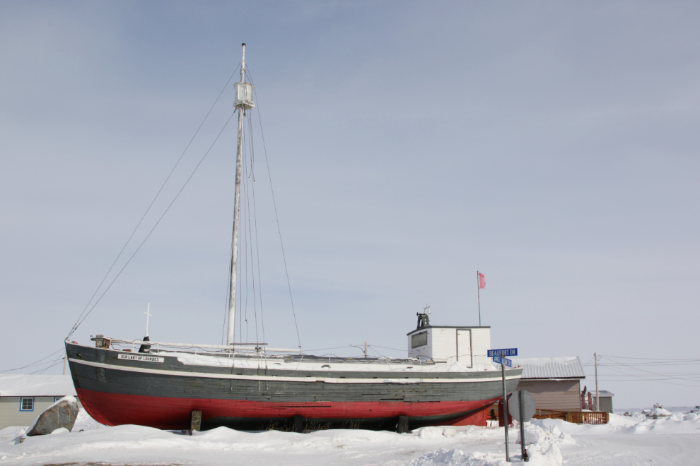
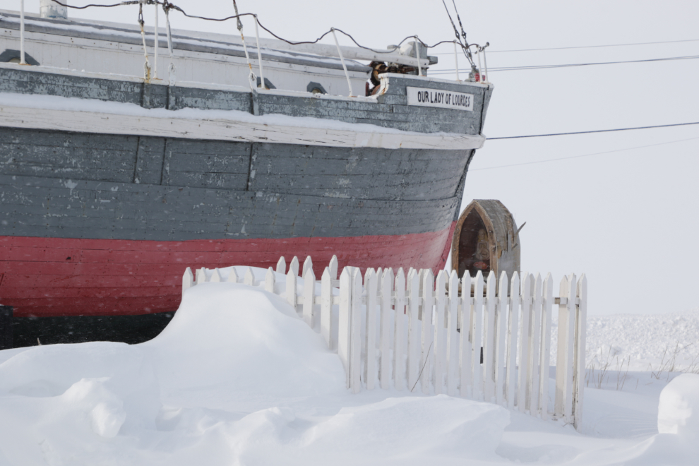
The next photo, looking back towards town from the point, is my favourite from this visit. The Anglican and Catholic churches are to the left, with the mission boat Our Lady of Lourdes in the centre.
The point is being cleared in preparation for the annual Beluga Jamboree which will be held from April 19 to 21. It features a lot of events and contests including snowmobile races, log sawing, harpoon throwing, drum dancing, igloo building, and square dancing.
It’s a “tourist” photo, and doesn’t show the deep satisfaction I felt at being back there. This was a really important trip for me.
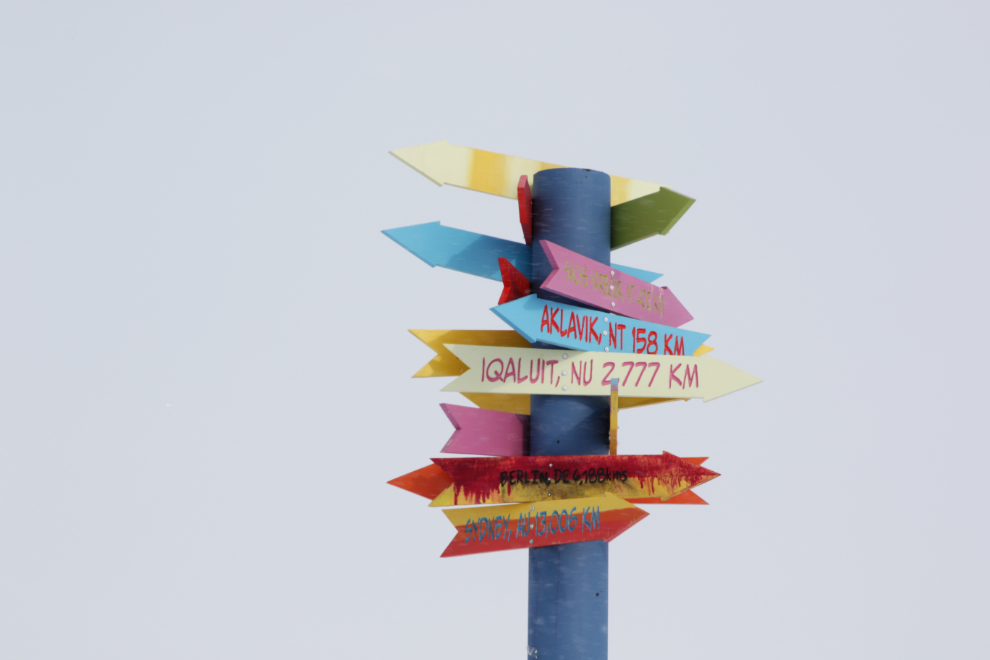
The signpost at the point. The two bottom arrows may have been added by visitors: “Berlin, DE, 6,188 kms” and “Sydney, AU, 13,0006 km.”
Our Lady of Lourdes.
Beside Our Lady of Lourdes is the grave of Father Robert LeMeur. Born in 1920, he came to the Mackenzie Delta in 1946, and served Tuktoyaktuk from 1951 to 1953, then from 1955 until 1985. He was invested as a Member of the Order of Canada in 1982.
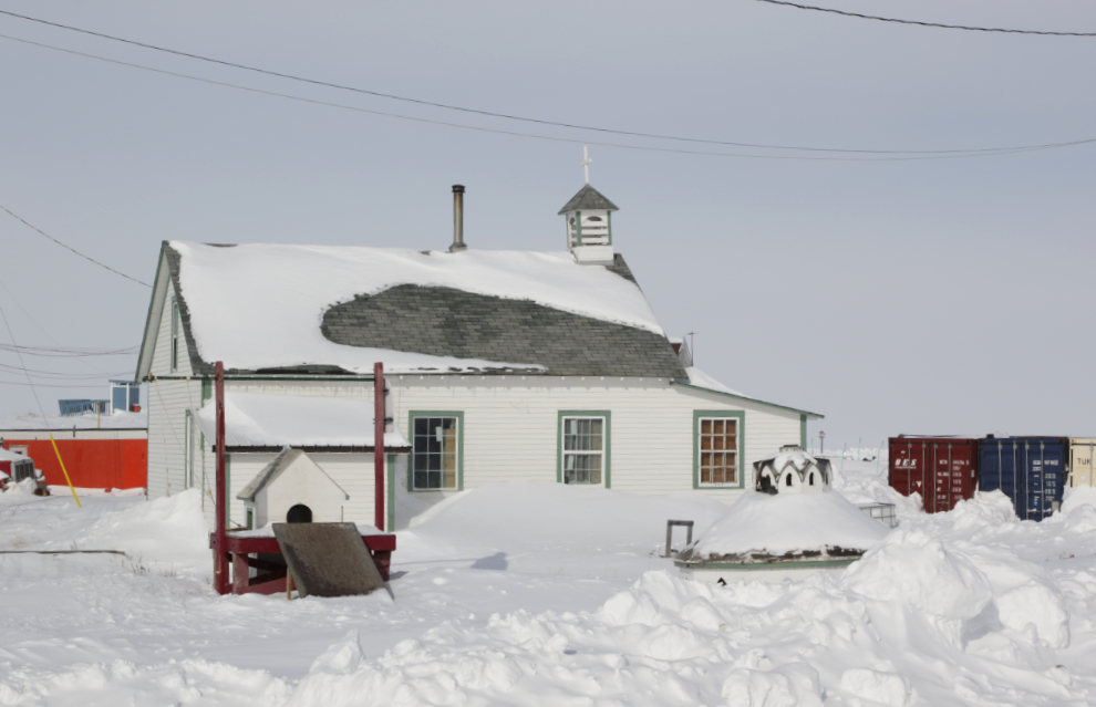
The home for the priests of the Catholic Church of Our Lady of Grace. I somehow didn’t get a photo of the church across the road.
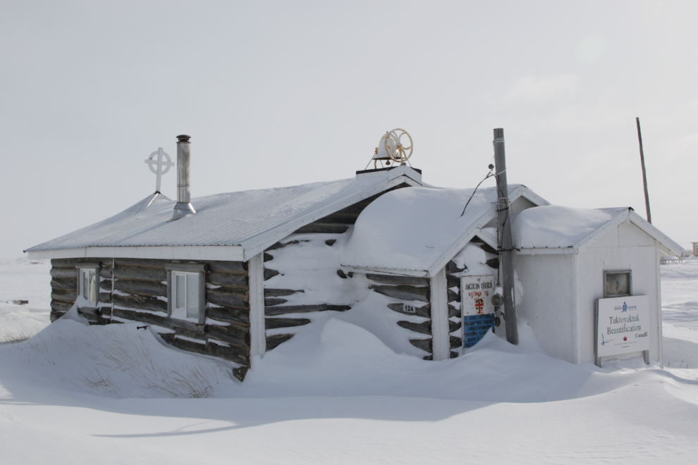
St. John’s Anglican Church.
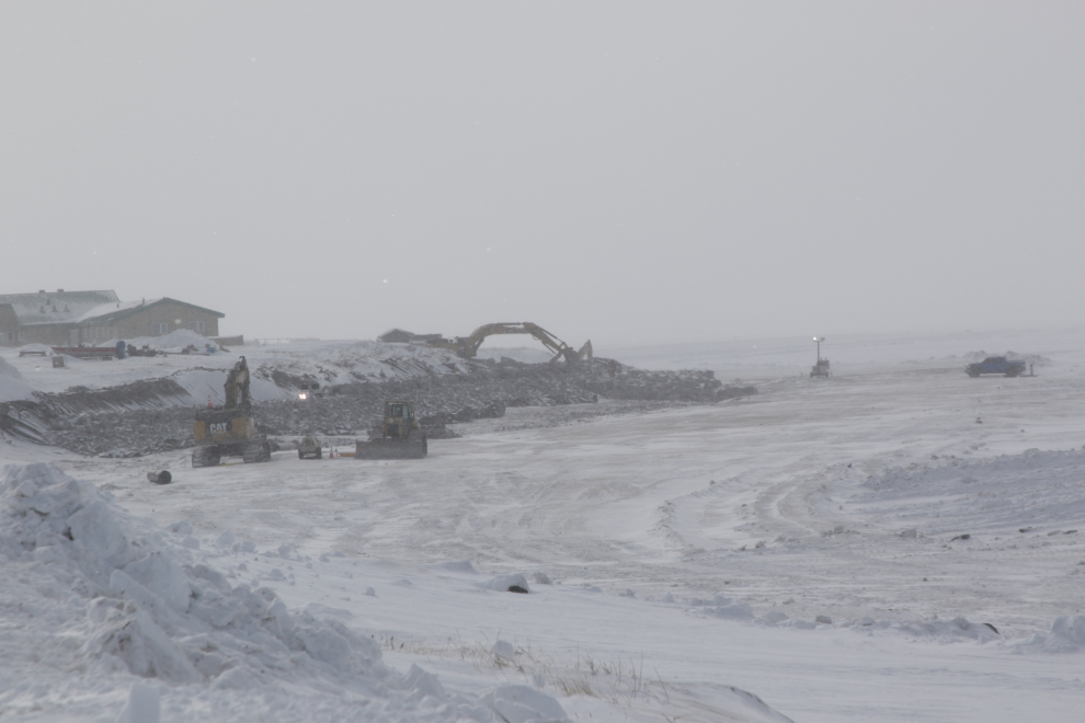
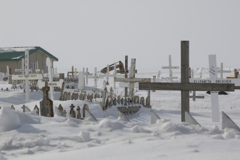
In the last post I mentioned that the trucks we saw were carrying large boulders for critical erosion control work at Tuk. This is what that work looked like from the point. Quite a few homes have been moved away from the coast, but the critical work now being done is focussed on protecting the cemetery.
A corner of the large cemetery. I thought that my cemetery go-to site, FindAGrave.com, would have more information, but they only have 12 graves listed. The erosion control work is obviously deeply personal to the community, and to my friend Tyson, as his mother and many other relatives and friends are buried here.
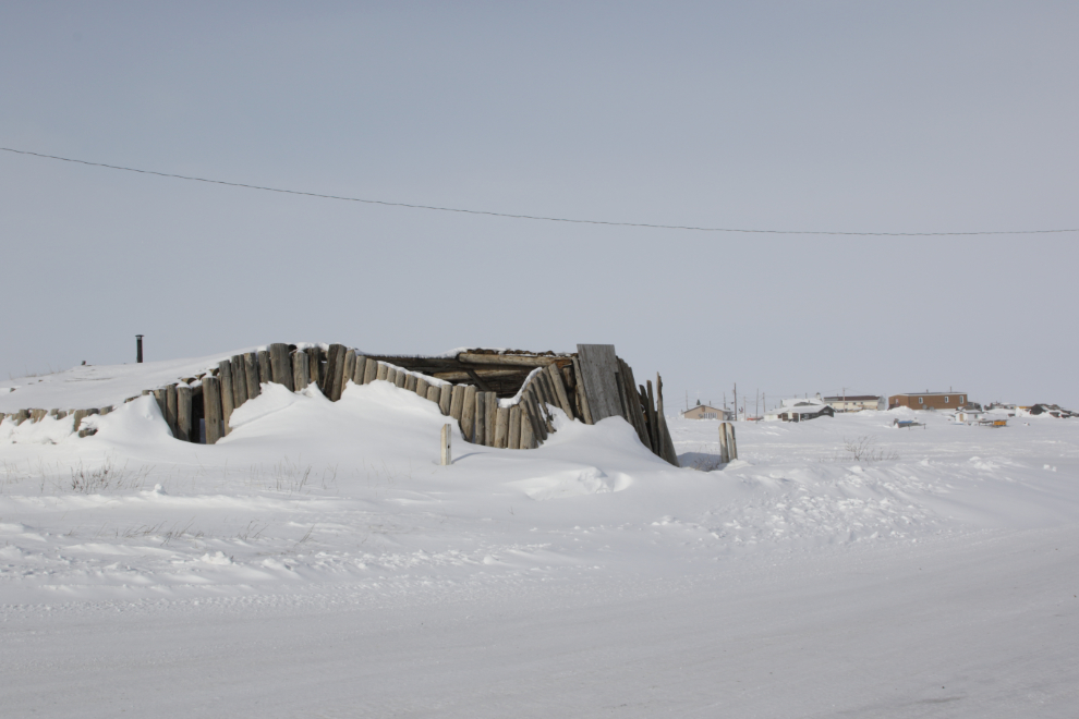
The historic community ice house, dug into the permafrost as a no-cost freezer for community members, was replaced by a new one many years ago.
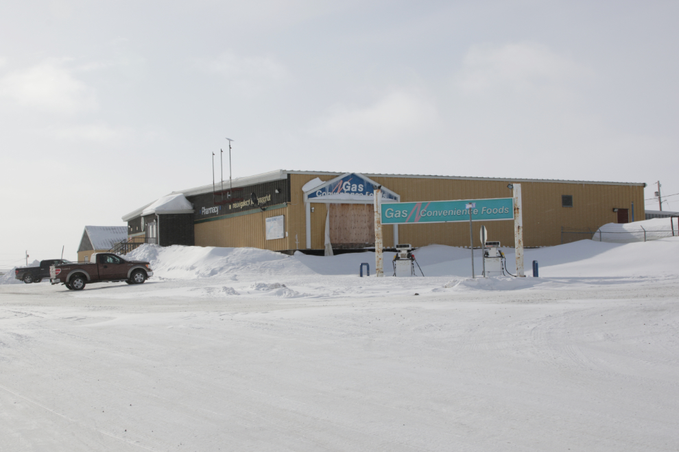
The Northern Store is one of two grocery stores in Tuk (the other being Stanton) and has one of the two gas bars (the other being Bob’s). I didn’t think to check fuel prices.
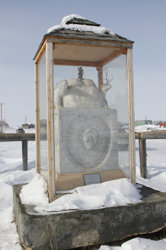
This sculpture by artists Derrald Taylor and Ronald Nuyaviak “is dedicated to the resilience of Inuvialuit and their ability to adapt from their strong traditional lifestyle in order to survive together as a people and while overcoming many challenges. Inuvialuit have always adapted to change by relying on their roots and their close respect for and traditional knowledge of the land and its harsh northern environment.” Among the people honoured on it is Mangilaluk (d. 1945), credited with starting the permanent community of Tuktoyaktuk, and generally regarded as the last traditional Inuvialuit Umialiq.
One of the oldest homes still standing in Tuk. Couldn’t those walls tell stories!
The view across part of Kugmallit Bay.
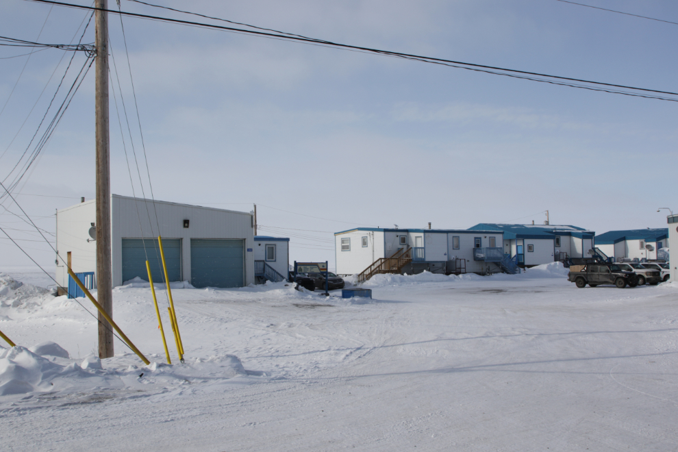
The Royal Canadian Mounted Police (RCMP) garage, detachment, and housing.
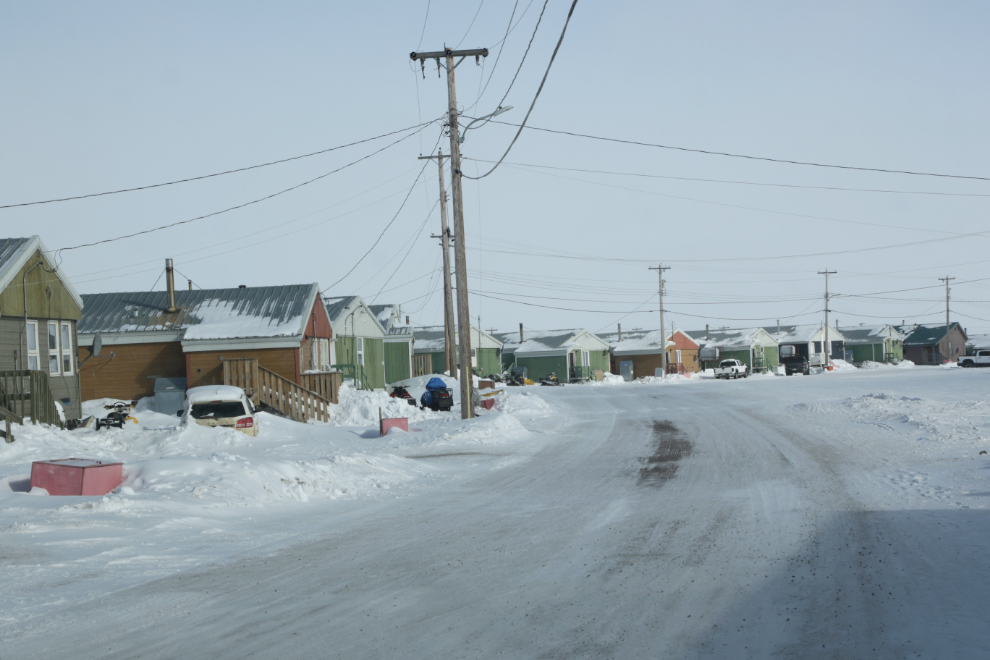
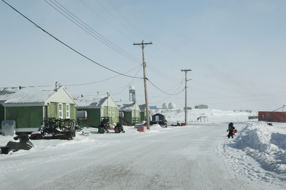
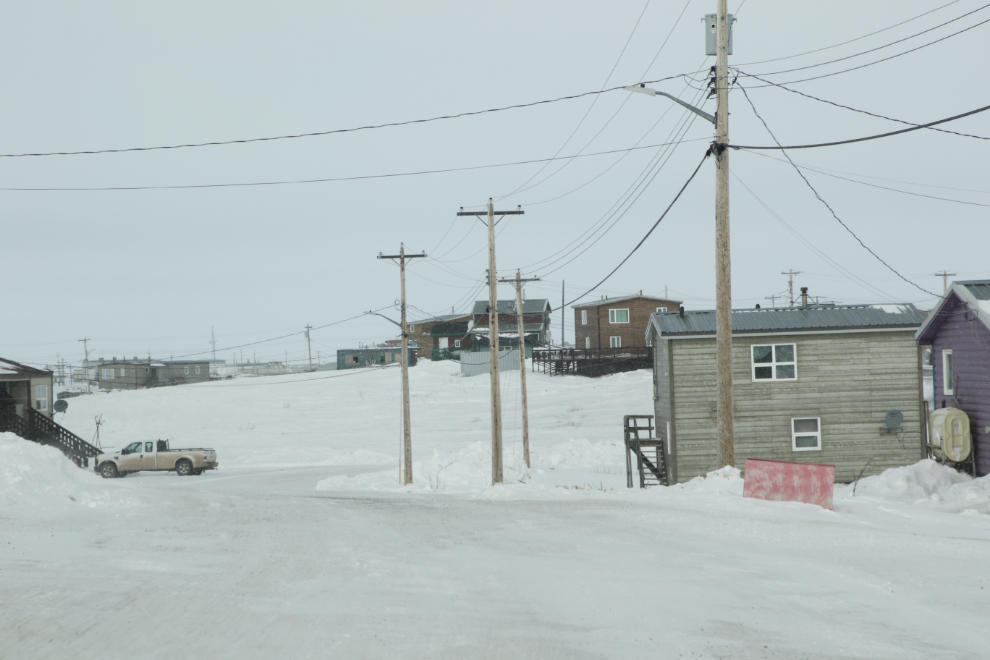
The Mangilaluk Loop residential area.
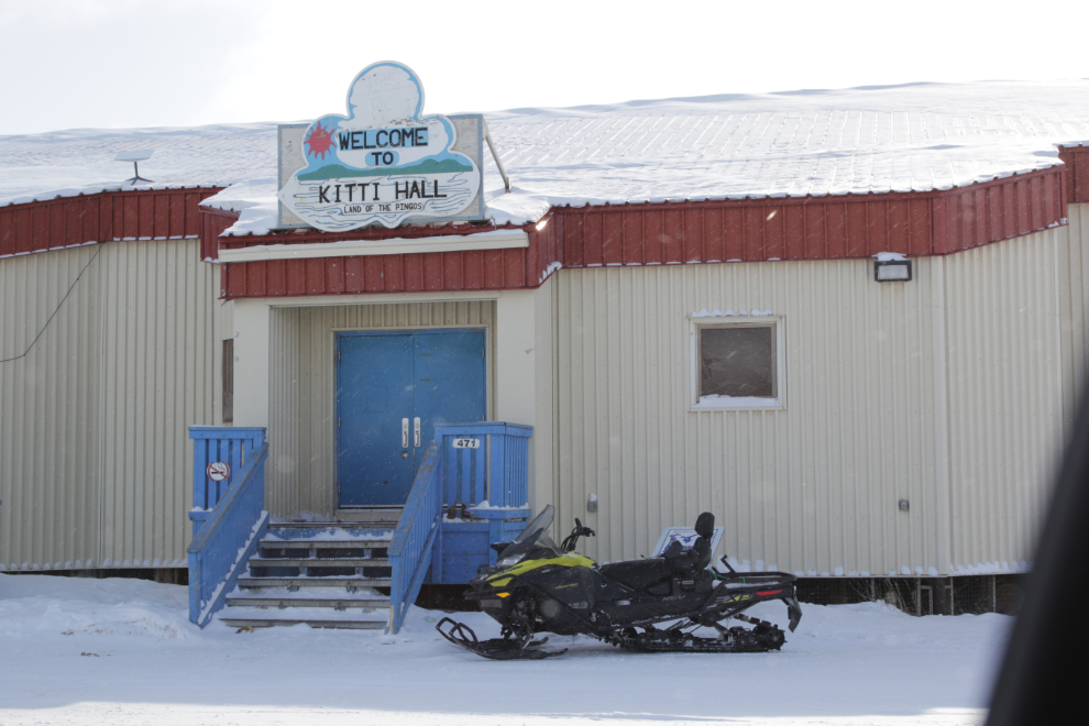
Kitti Hall is the main meeting place in town, licenced for 249 people.
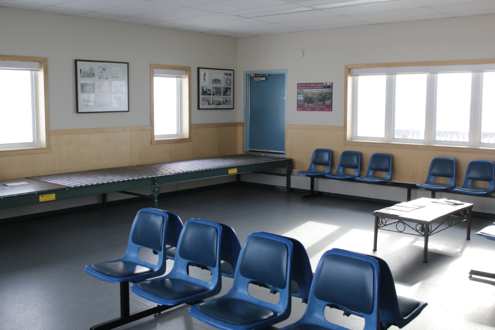
Our next stop was the terminal at James Gruben Airport. It used to be a fairly busy place but doesn’t get much use anymore since the road was built. I did a search to find out if any scheduled flights still operate but all I could find was database-driven nonsense. Even Aklak Air’s sched between Tuk and Inuvik ended with the road;’s opening, so it seems there are none. Back in ’85, this was the first airport I had ever seen a gravel-equipped Boeing 737 take off – direct flights to Edmonton for the oil workers.
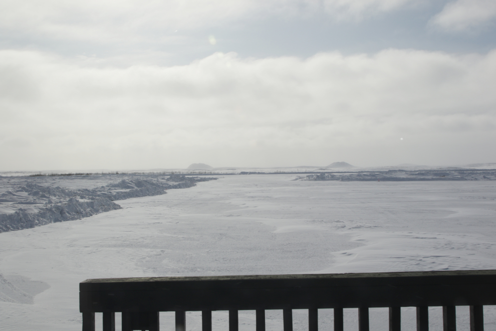
The view west from the terminal to the runway and beyond, with the Ibyuk and Split Pingos in the distance.
A traditional kayak frame hangs above the seating area.
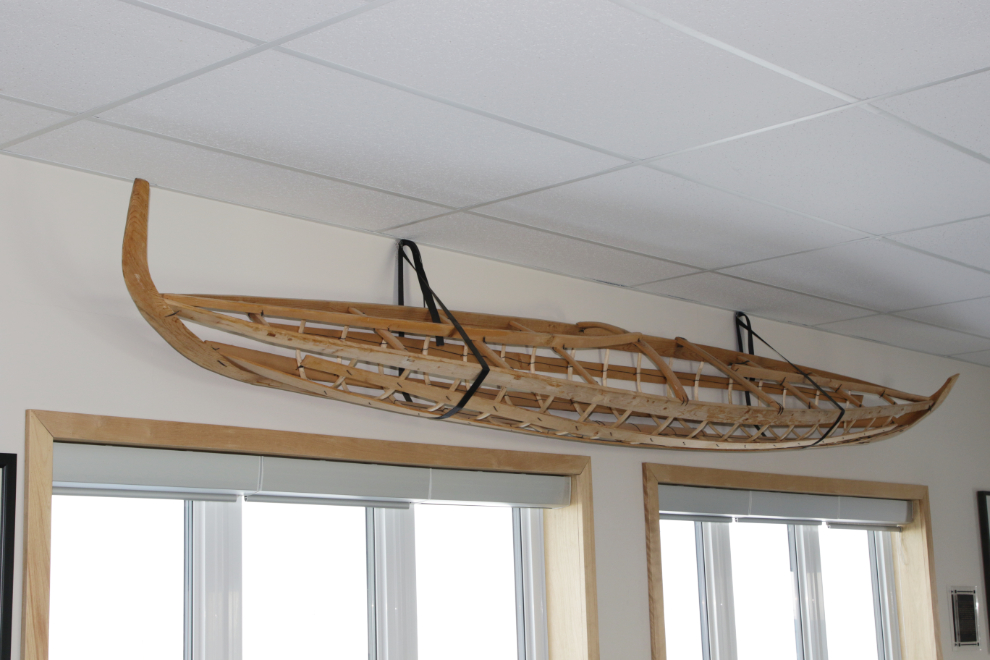
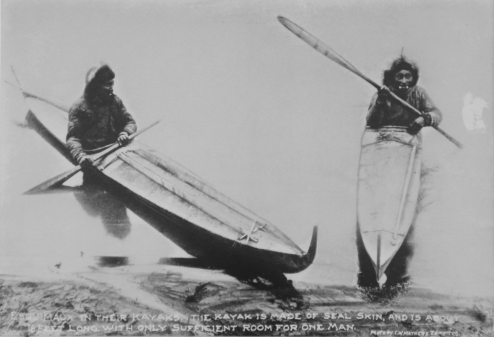
There are quite a few historical photos on the walls of the terminal, including this one showing kayaks of that type in use. Note, too, that the men are wearing labrets.
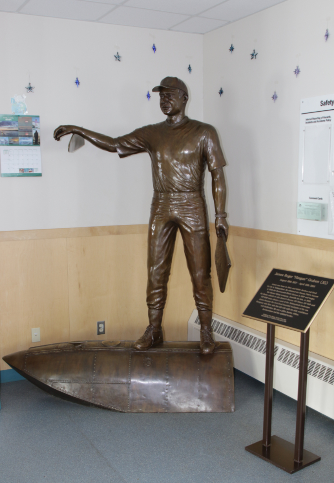
A statue of James Roger “Havgun” Gruben (1957-2001) stands in a corner of the terminal. The best-known Inuvialuit pilot in the area, he is shown standing on a float of one of the Cessna 185s his company, Amaulik Air, operated. Gruben and a friend were killed in 2001, when a new pickup they were bringing up from Edmonton collided with a gravel truck on the ice road from Inuvik.
At 4:30 it looked like we were leaving Tuk, but we actually weren’t 🙂
We took a detour east to a new residential area called Reindeer Point. On a low ridge, it has both new homes and ones moved from the now-threatening seas. On the way, we passed this musher’s sled dog camp.
Reindeer Point is really nice, with large view lots, and there are some lovely homes.
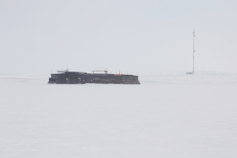
Far out in the bay we could see a CRI (Caisson Retained Island) built by Imperial Oil for offshore drilling back in the boom days.
We had a couple of wonderful visits with elder uncles of Tyson, Frank Pokiak and then his older brother Ernie. The lives those men and their wives have led! There’s never enough time…
A few minutes before 7 pm, we were on the road south. The wind had kept increasing in speed and was now blowing at about 40 km/h, helping the Snow King to rapidly reclaim the land we wanted to drive on.
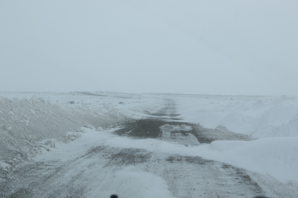
The road was effectively one lane in many places, and visibility at times was very poor.
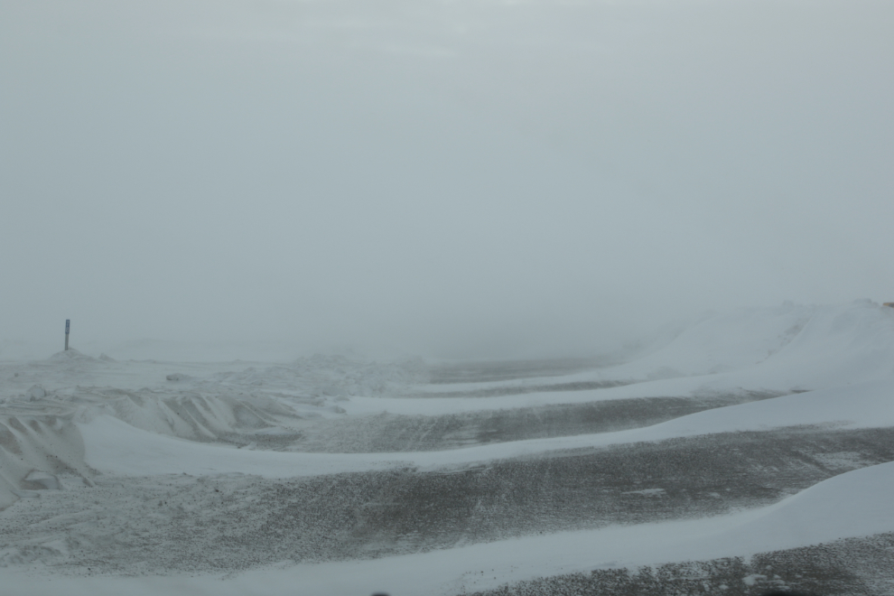
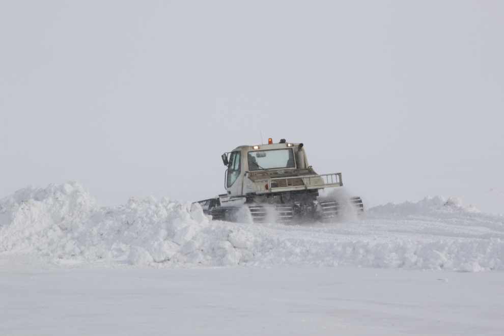
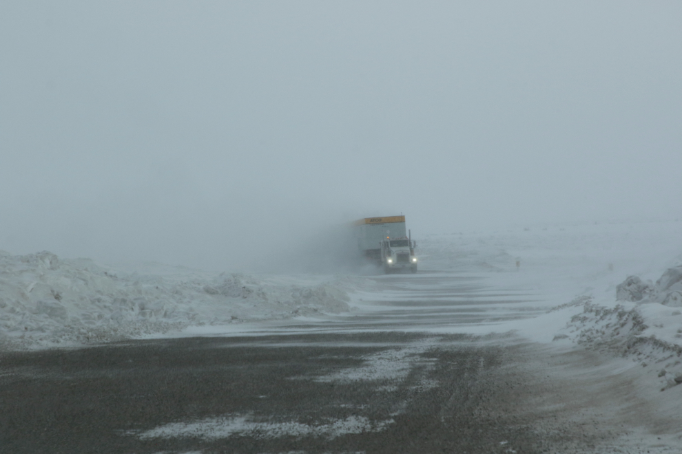
The rock trucks had quit running for the day, but there were still rigs like this to keep us on our toes.
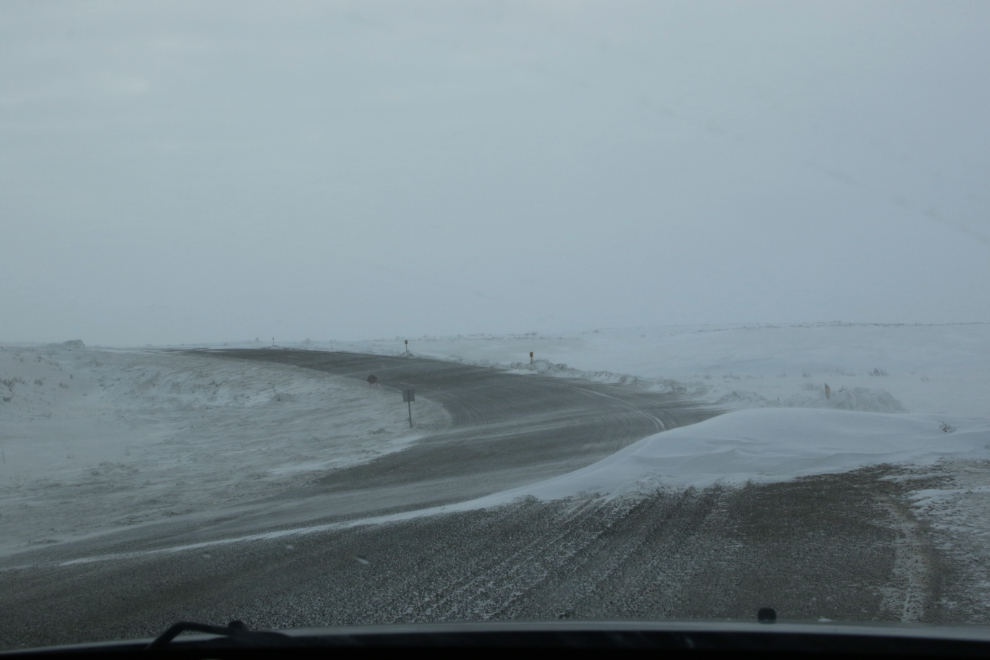
We came to this extra-large drift right at 8 pm.
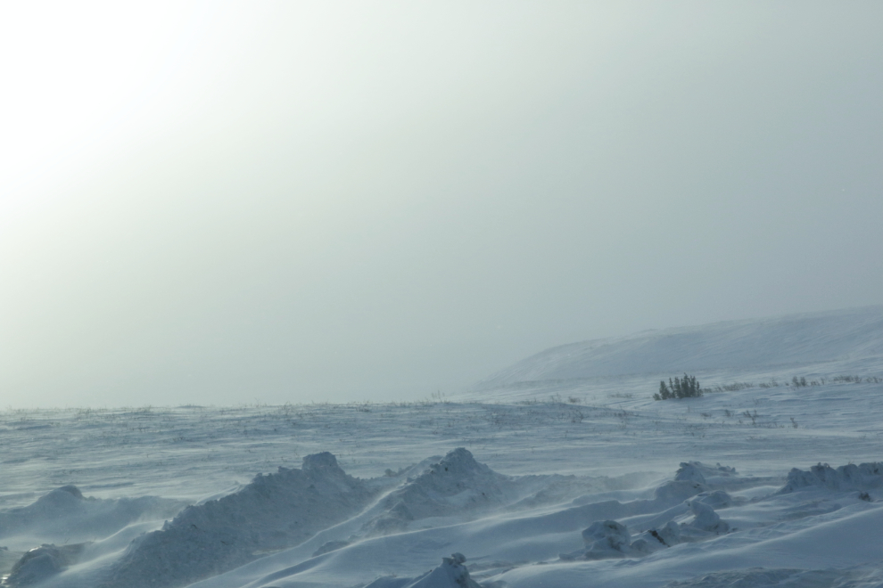
At 8:40, truly in the middle of nowhere, the car died. Hmmmmm…..
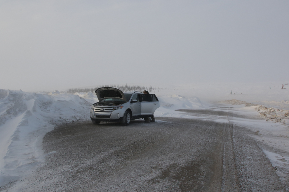
Popping the hood, nothing obvious was amiss. I rationalized that the massive amount of blowing snow had choked off the air filter, and before taking that apart, leaving the hood closed for a few minutes so the warm air could melt the snow should get us going again. It worked 🙂
While we were waiting, I got some photos of what at that moment in time was a particularly inhospitable place.
The next photo I shot was in downtown Inuvik at 9:35 pm. The plan for Tuesday was to drive the ice road to Aklavik – my first lengthy ice-road drive and my first visit to Aklavik!
I really enjoyed all the photos of this interesting town and all the features (like the radar station, seemingly open to visitors) the abandoned and deteriorating oil camp (who is responsible for taking that down when it gets dangerous) … and the weather shots. What a great day, too bad you and Tyson could not have made it two, lots of places you could have slept over with his friends and relatives. A small hotel or B&B up there for visitors?
Tyson and I were just discussing by phone today that we should have made the trip longer but it was spur-of-the-moment and the end plan was to meet his wife in Whitehorse when she arrived from Victoria. It turned out that meeting her wasn’t that important, and we should have added a day or two. Or three 🙂
Lots of interesting stuff in this blog. “Inhospitable place.”….. that’s an under statement when looking at that picture.
Thanks for sharing Tuk with us. You showed me places we didn’t see on our tour in 2009.