Another hike to the upper Venus silver mine
As I get older, the Yukon’s historic Venus silver mine (the primary subject of my first book) has become my fitness test. On Wednesday, I made my third attempt in a month to reach it. I made it. At 71, it was my slowest ever for the steep climb of just over 800 vertical feet (2 hours 40 minutes return), but I’m extremely pleased to have reached it at all.
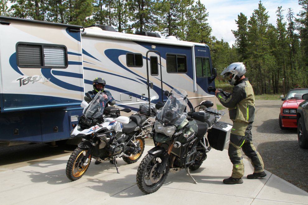
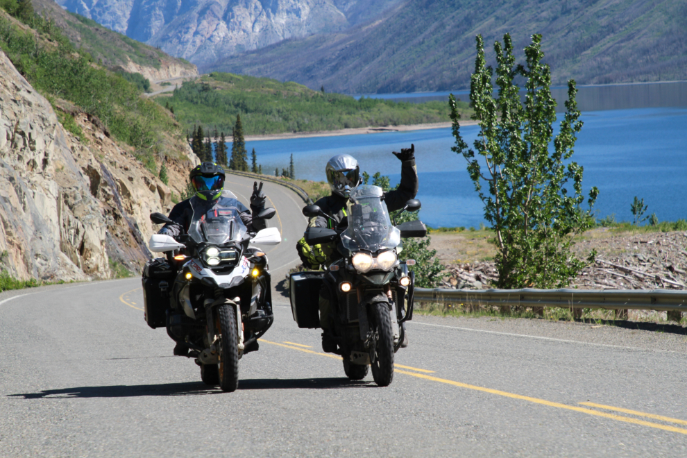
My son and a buddy arrived from Calgary on Tuesday, on a marathon motorcycle wander around the north, with Tuktoyaktuk being the ultimate goal. They explored some of the best of the high points around Whitehorse that day, then on Wednesday were going to ride to Skagway, where they planned to take the ferry to Haines and continue on.
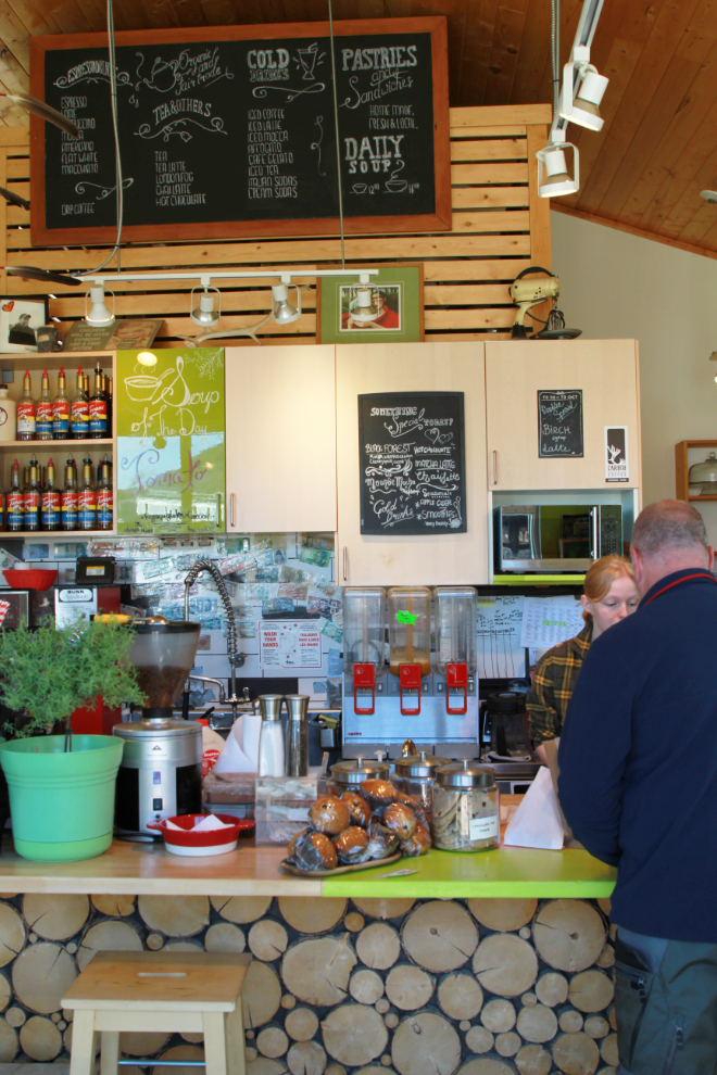
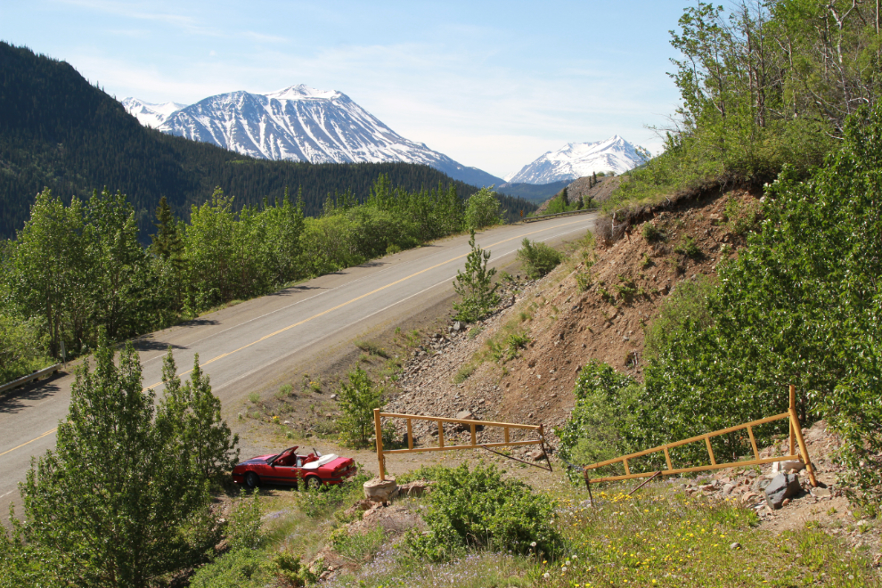
I decided that would be a good opportunity to spend a bit more time with them, so put the top down on the Mustang and went to Carcross to meet them for lunch at the Bistro on Bennett.
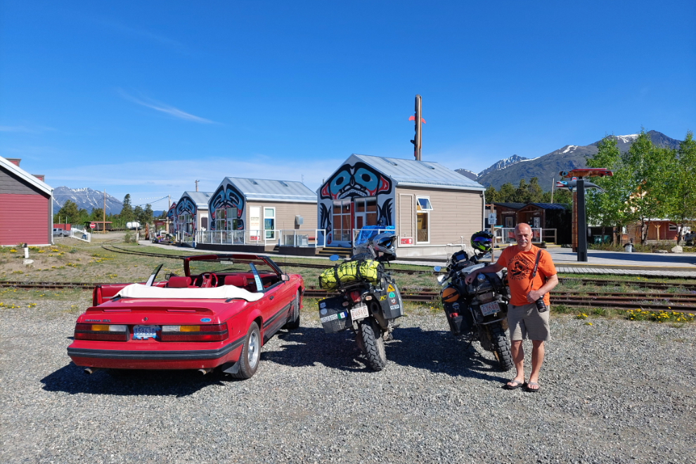
Getting on the road had taken priority over paying attention to when The Bistro would be open, however, and we were an hour early. No problem, the guys could get a snack to get them to a big lunch in Skagway and I could get a light lunch before going for a hike I had decided to attempt again, at Caribou Crossing Coffee, located in the same complex as The Bistro.
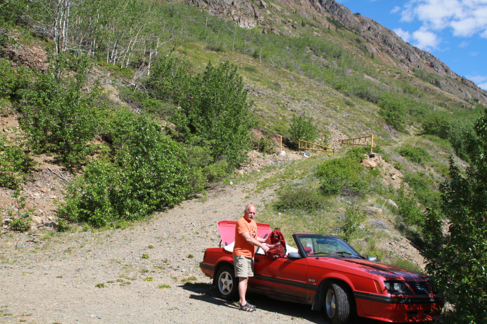
A few minutes before noon, I was ready to start walking up the slope to the mine.
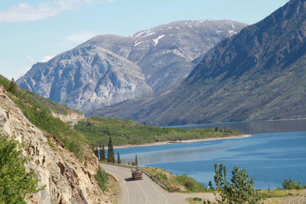
This day was certainly a 10. Days like this make up for some of the terrible winter days the driver of that fuel tanker has to deal with.
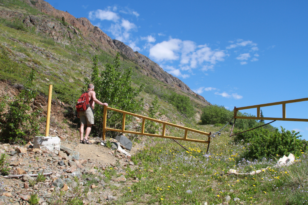
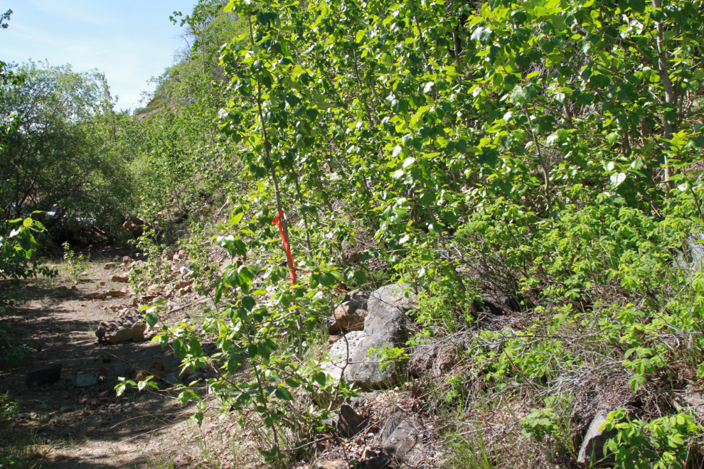
The gate on the road was locked but the road obviously hadn’t been driven on for a year or two at least. A couple of guys had been doing small-scale exploration work in recent years and I talked to one of them about it a bit, but I haven’t seen or heard from them in quite a while.
I saw Steve and Larry go by, but when they saw me still fairly close they made u-turns and came back, so I walked back down. We then set up this and a few other photos for Steve’s album.
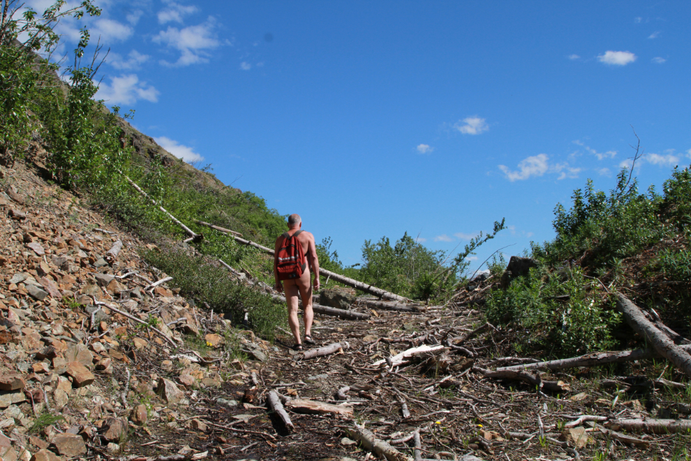
Back on the trail at 12:06. Within a couple of hundred yards I was able to hike in complete comfort – naturally 🙂
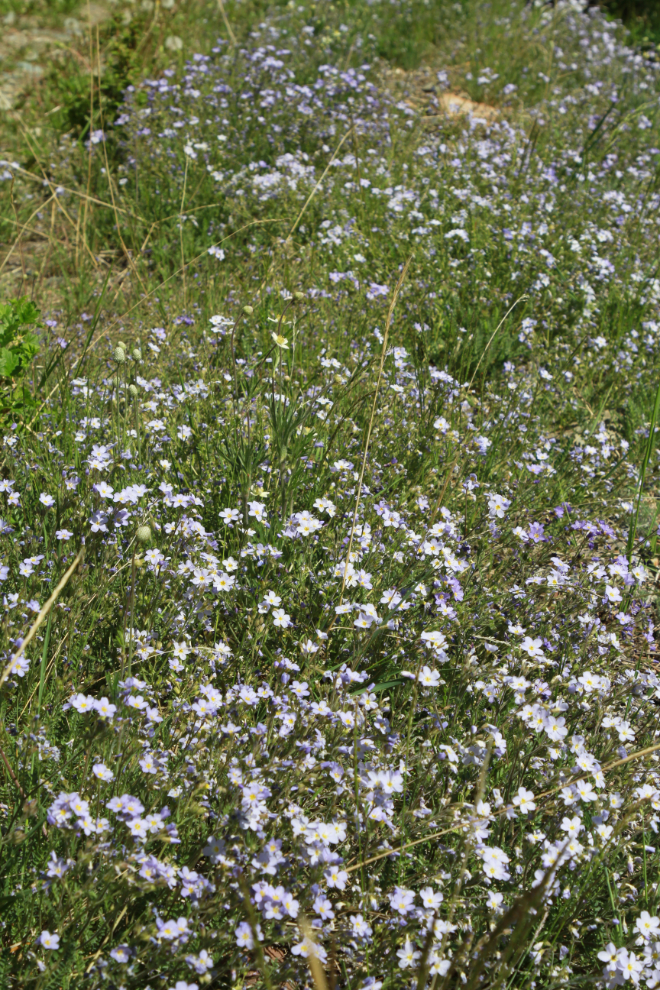
There were wild flowers everywhere, of 8-10 species.
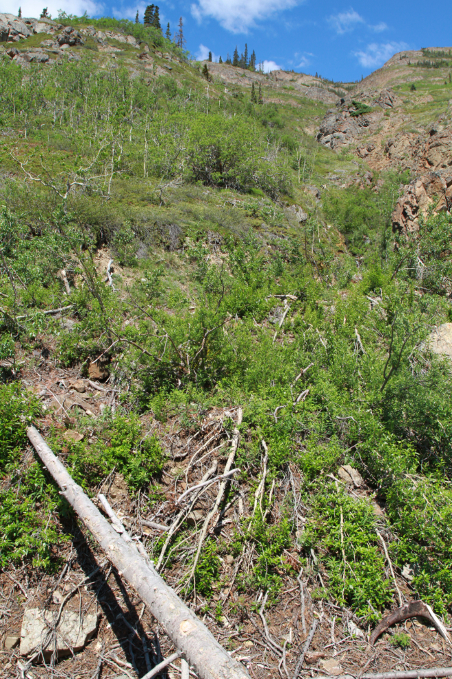
The record-breaking snows of last winter brought down a lot of avalanches. The size of the largest tree in this debris field shows that there hadn’t been a large avalanche there for at least 2 centuries.
Looking up the slope from that avalanche debris field. It’s not an obvious avalanche chute as is often the case.
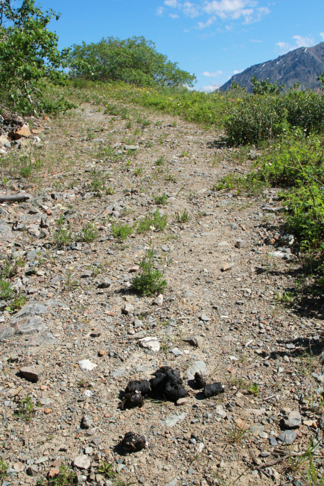
At 12:17 I came to fairly fresh bear scat. Fresh as in possibly this morning. In hundreds of trips along the South Klondike I have never seen a bear anywhere near this location, so bringing bear spray isn’t even a consideration for these hikes. Oh well, it was so warm (about 18°C / 64°F) he/she was certainly gone back down into the trees.
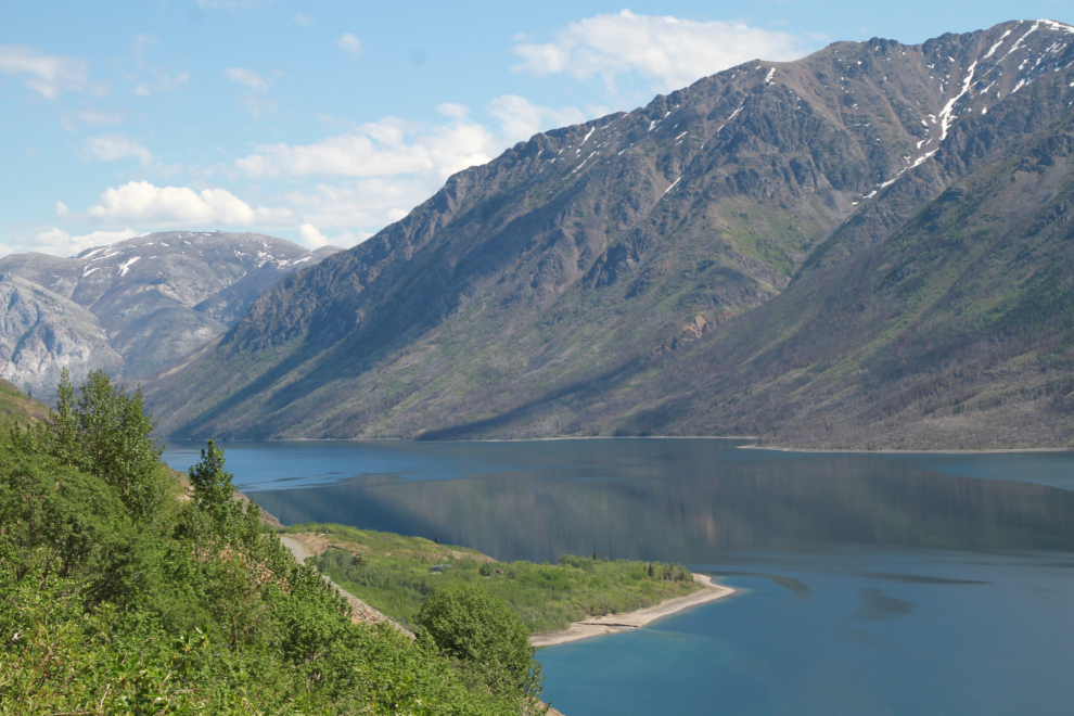
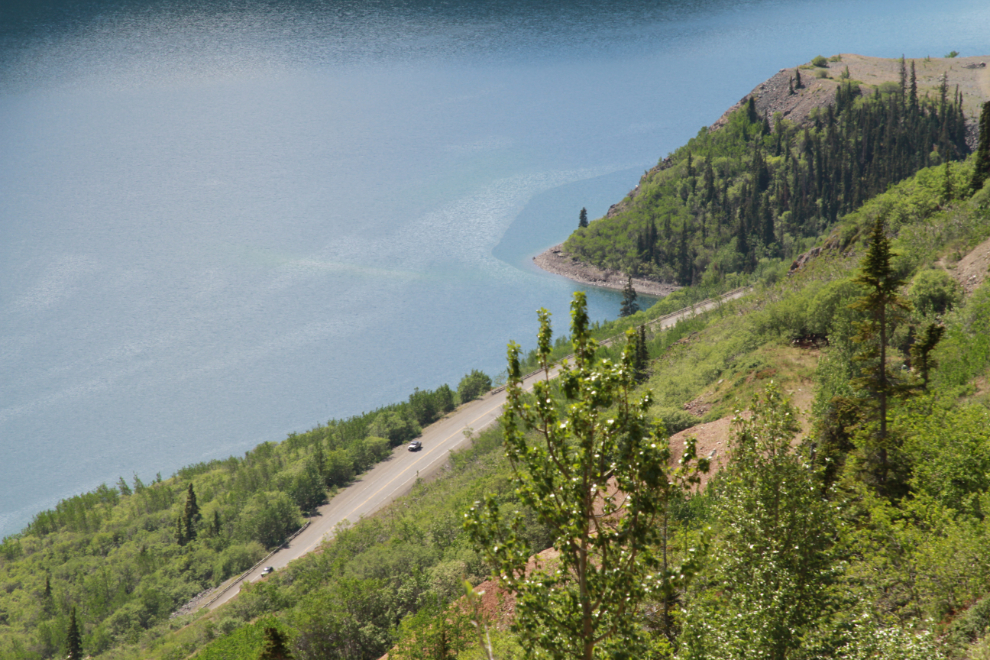
I shot the next photo looking down Windy Arm to show how low the water level is. That’s the alluvial fan created by Pooley Creek.
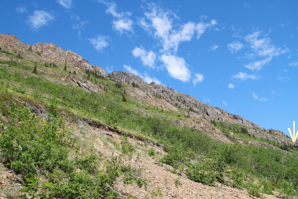
The next photo, shot at 12:44, is a broad view of the mountain ahead and above, with the mine I was headed for marked by the arrow to the right. I had by now passed several more piles of bear scat, so my theory that the bear wouldn’t have gone very high was shown to be wrong.
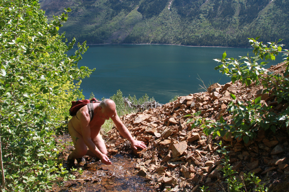
I hadn’t thought to bring water, but one little creek halfway up provided all I needed. I comes from a mine tunnel, from deep inside the mountain somewhere – it doesn’t surface anywhere above that tunnel.
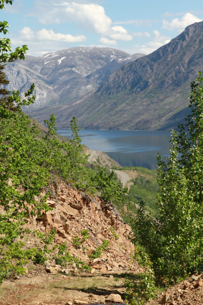
Looking back down the mine road to the highway and Windy Arm.
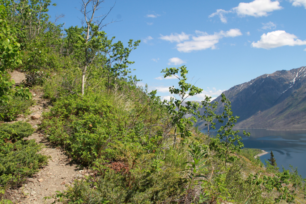
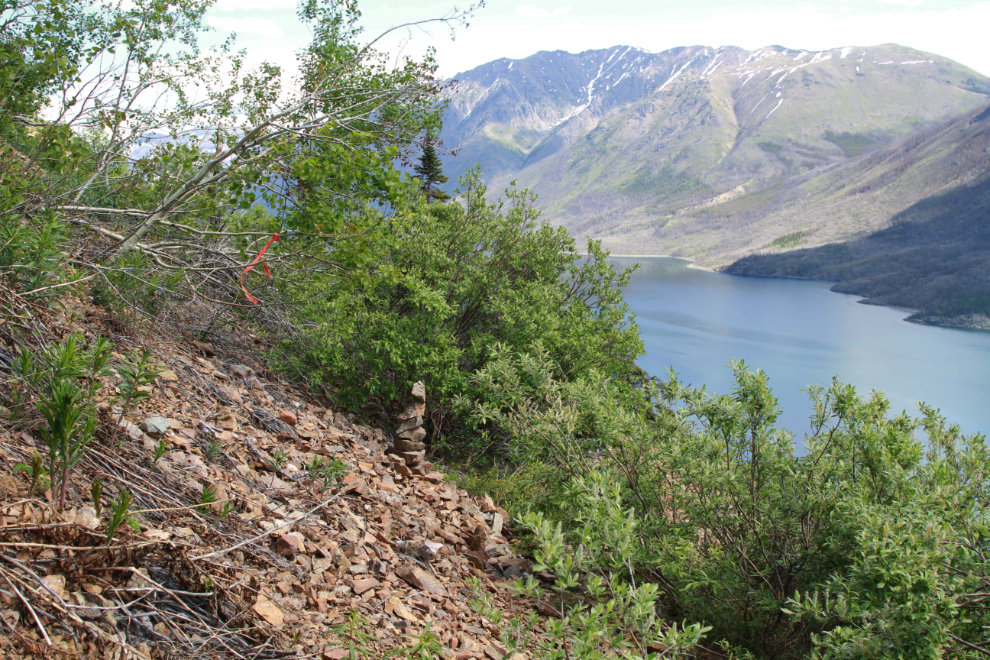
There are two places where it’s easy to lose the best route to the mine (over the years I’ve taken a few routes). This is the first, just past the creek. It’s been marked with tape.
The next photo, shot at 12:52, shows the steepest part of the trail. This dates back to the original 1905 work at the Venus.
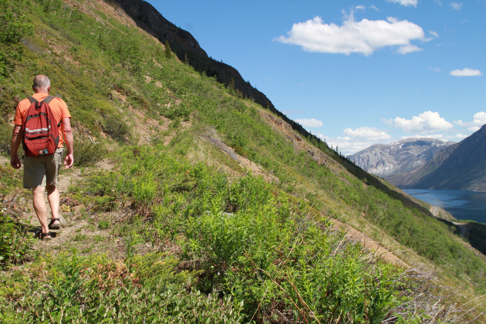
Starting ten minutes later, there was only a slight grade towards the mine, but there are sections with serious exposure for anyone with a fear of heights. Two people I took up on separate hikes years ago were unable to cross this section to reach the mine.
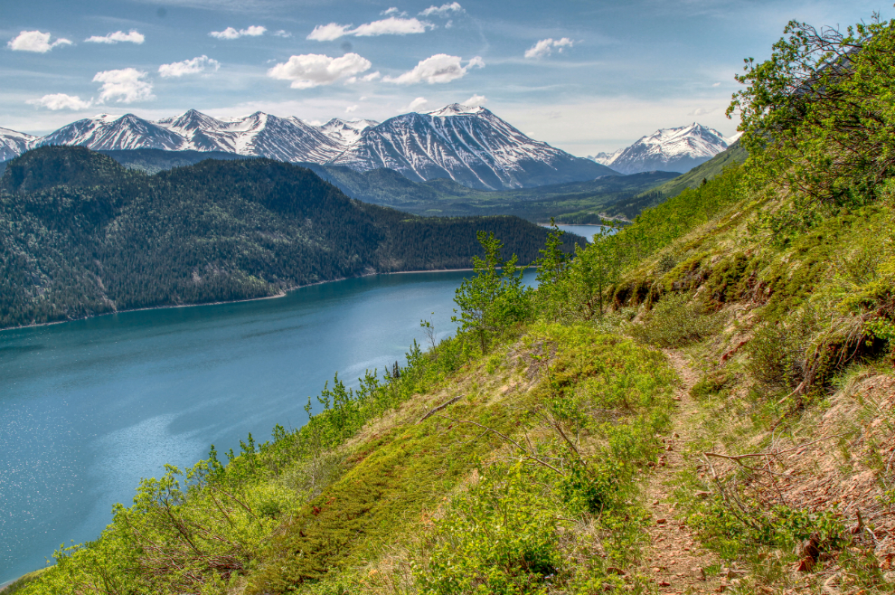
Looking south up Windy Arm. This was processed as an HDR image to bring out the detail.
At 1:14 I reached the second place where this route is easy to lose – it also has been flagged. A few minutes with a pair of garden snips on that willow would make the trail more obvious here. The trail that leads the wrong way, to a dead-end at an old test site, is very well used.
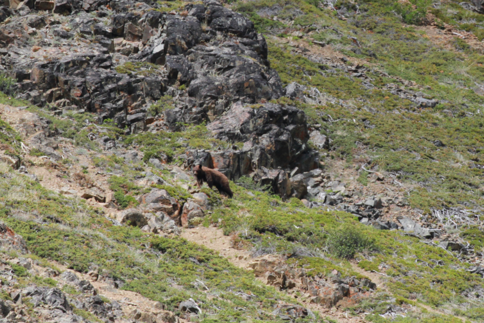
Seeing several vehicles stopped below me watching a bear was a bit discomfiting. An open convertible might be quite intriguing to a bear. All I could do is hope that he/she would at least not do any damage to the old Mustang.
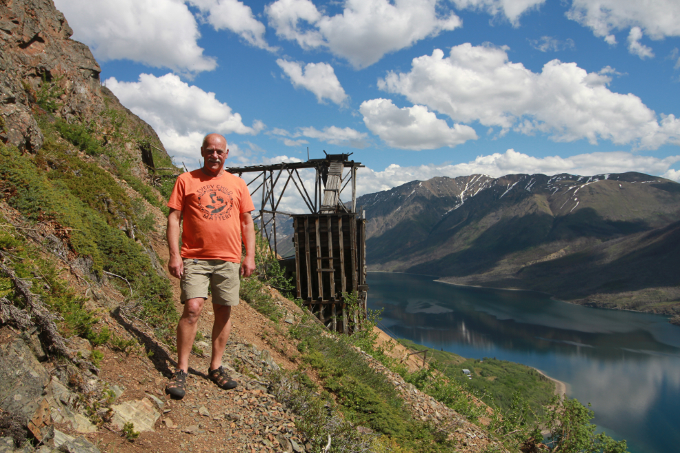
At 1:37 I had almost reached my destination, and was feeling great 🙂
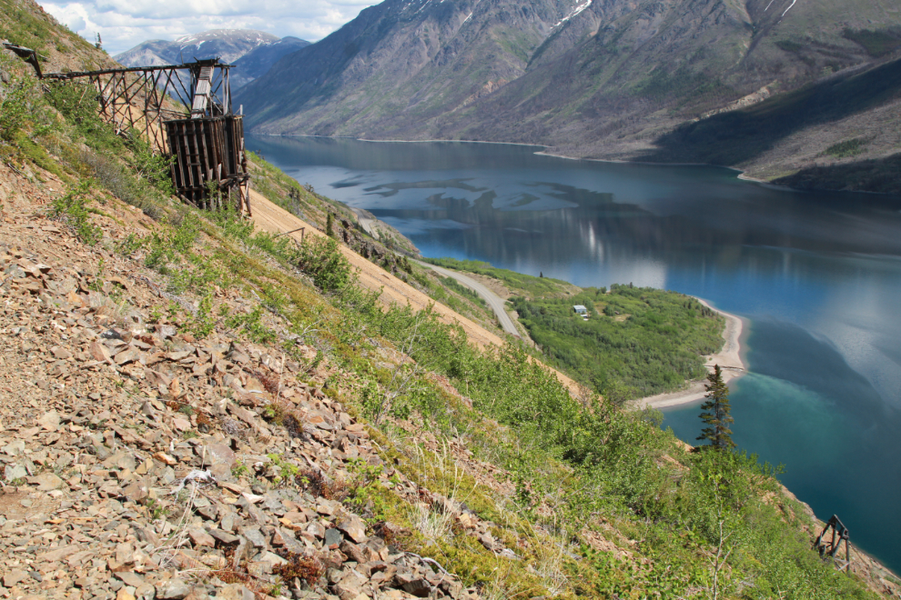
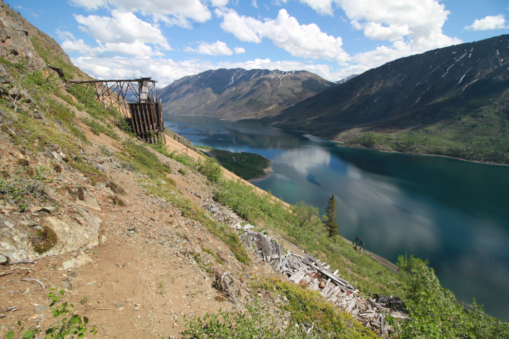
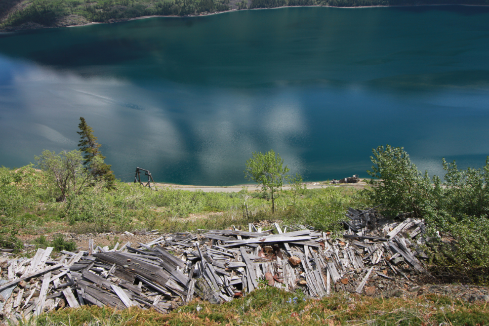
Looking down over the ruins of the cookhouse/bunkhouse to the mill on the shore of Windy Arm. One of the suport towers for the aerial tramway can be seen at the left centre.
This is the trophy photo from the hike. On May 30, 2015, my caption on a similar photo read in part: “My younger readers may have a hard time understanding how incredibly good it feels to be able to get to places like this at 64 years old.” I’ve decided that there simply are no words for the feeling this time, at 71, with multiple challenges.
I discovered at the end of this hike that I’m at the point where I may show up naked at a place where that’s not the norm. That can happen when your brain defaults to who you are, not what society would like you to be (that’s the case with all people with dementia in various ways) – on warm sunny days, who I’ve been or wanted to be for the past 30-40 years is a naturist. I made that discovery when I was back at the car parked on the side of the highway, getting my stuff organized. I eventually realized I was still naked, as I’d been for the entire hike except for a couple of special photos. Oh well… 🙂
Once organized and with shorts on, I drove down to the BC-Yukon border, where my long-time friend Jacqueline sells her jewelry. High on the slope above was a cinnamon bear, and by the time I left about 100 people were watching him/her. At 300mm with a digital crop as well, this photo would be the equivalent of about a 1,000mm lens.
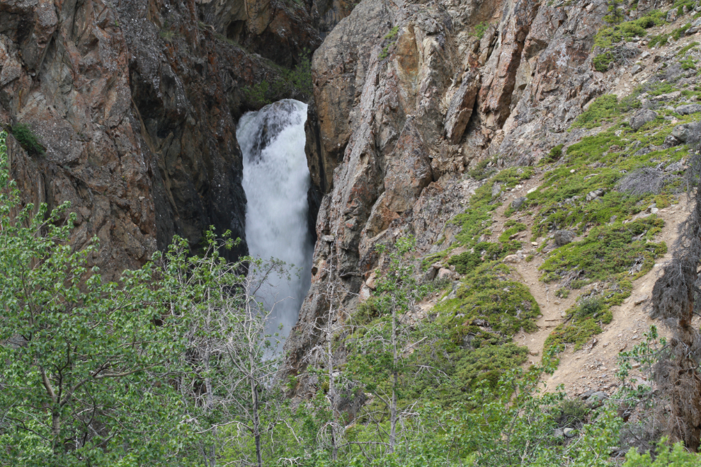
On the way north I stopped and climbed a low ridge to get a photo of the main waterfall in Pooley Canyon at maximum flow.
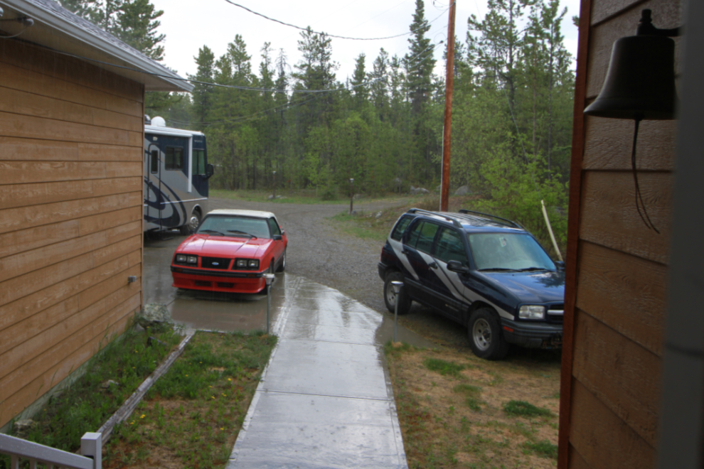
I was exhausted when I got home. I had hit a few brief rain showers, but by the time I got home the skies looked like they would stay dry, so I left the top down on the Mustang. A few minutes later, though, a torrential rain hit. I dashed out and got the top up, but was it ever cold! An exciting end to a great day.
I have a big garage sale happening tomorrow – the first of a few aimed at selling off my collection of books, historic documents, and miscellaneous odds and ends.
Fantastic that you were feeling so good and ambitious to tackle this long afternoon and then added more to it with meeting your son and his friend (I bet you had thoughts of taking your bike out for a ride with them as well) on their ADV bike adventure (that’d be great if you could get him to share a few photos of their travels and a story to boot). Some rugged hiking, though you had done it all before, each trip, especially this one was a challenge and great to see you had the steam to carry on later in the day for a further jaunt to see your friend. I think the rain held off all day long just to accommodate your rambles this day.
Not being able to join the guys on my V-Star was a huge disappointment – the original plan was that I would ride with them to Dawson City or so.
It’s great to have the Venus Mine as both a gauge of my abilities and an incentive to push myself. I think both are important to keep me going.
Murray is back getting stronger and better than ever, Skookum on you, all the way💪🏻👍
Thanks, Paul. It’s been wonderful to chat with you recently – I sure we could get together in person.