Exploring Inuvik, Northwest Territories
I arrived at the Inuvik Mike Zubko Airport on Sunday, April 7th. After not coming over the horizon at all for 30 days, the sun returned in early January, and Inuvik is well on its way to a 56-day period of 24-hour daylight. On the 7th, the sun set at 10:22 pm, and it rose the next morning at 07:29 – at this point, each day is a little over 8 minutes longer than the one before, so we had lots of time to explore.
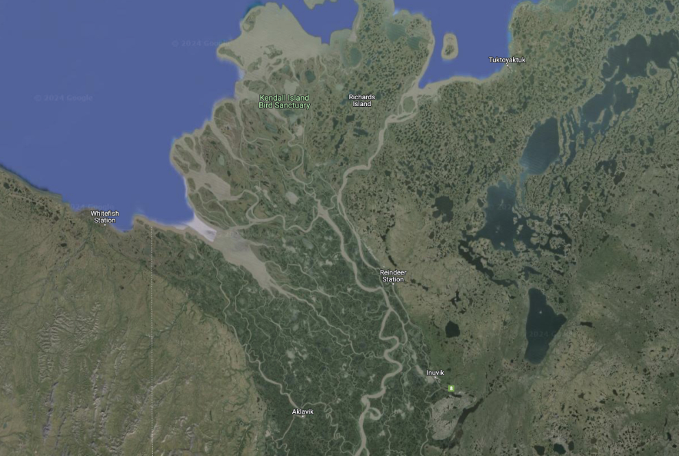
I’l start off with a couple of maps to get you oriented. The first covers the Mackenzie Delta area, with four of the places we would visit marked. Inuvik is towards the lower centre. Aklavik is west-southwest of that, Reindeer Station is north of Inuvik, then Tuktoyaktuk is on the coast of the Beaufort Sea towards the upper right.
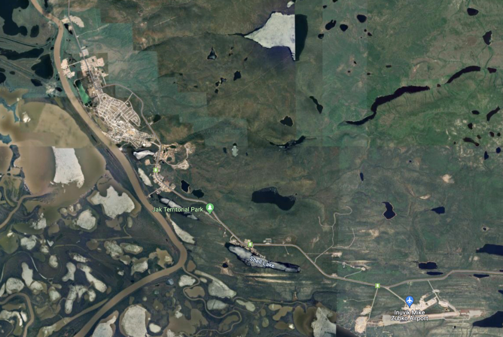
The next map shows Inuvik towards the upper left, and the Inuvik Mike Zubko Airport at the lower right. Click here for an interactive map in a new window.
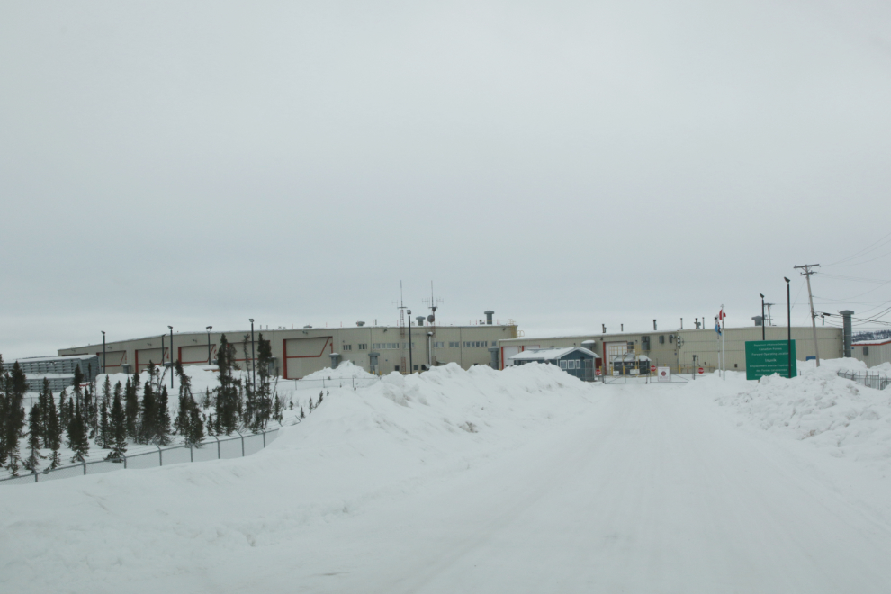
Tyson started our tour at the Royal Canadian Air Force’s FOL (Forward Operating Location), which is at the northeast corner of the airport. The RCAF regularly brings up a squadron of CF-18 fighters for Arctic training (as well as other aircraft), and that 6-door hangar appears to be able to handle at least a dozen of them.
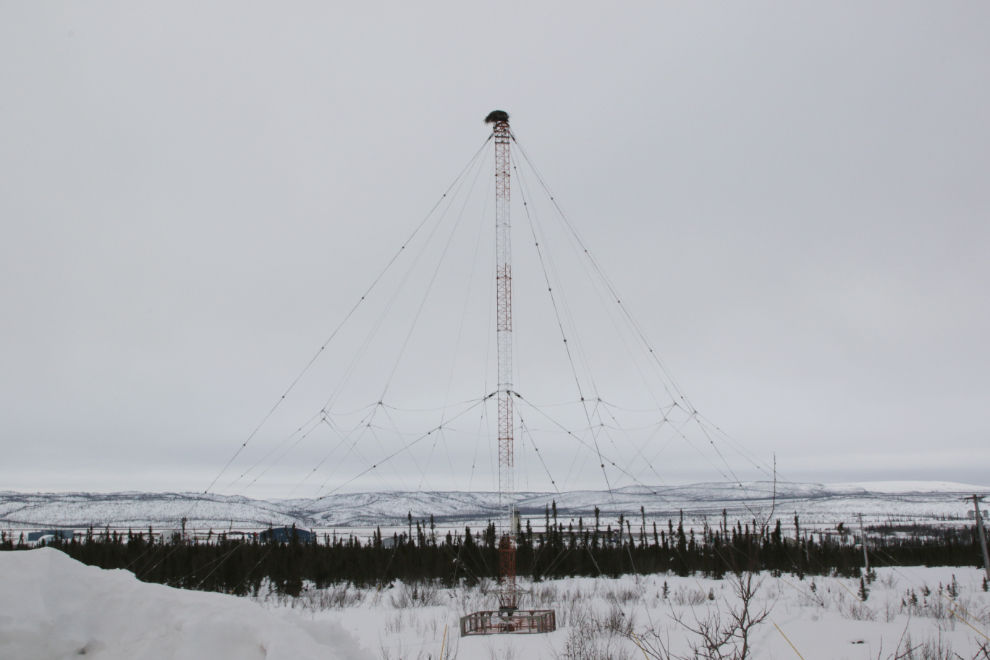
There are a few antennae-type structures around Inuvik whose purpose is a mystery. This extremely well-anchored one provides a great spot for a large bird nest (an osprey perhaps) 🙂
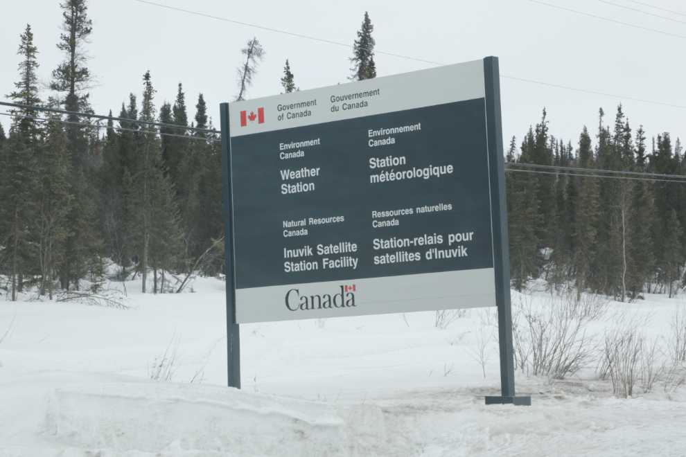
Our next stop was the Inuvik Satellite Station Facility (ISSF). There are four 13-metre remote sensing antennas plus some smaller ones and other equipment. The ISSF is internationally known as a highly favourable position from which to track, send and receive data to and from polar-orbiting satellites.
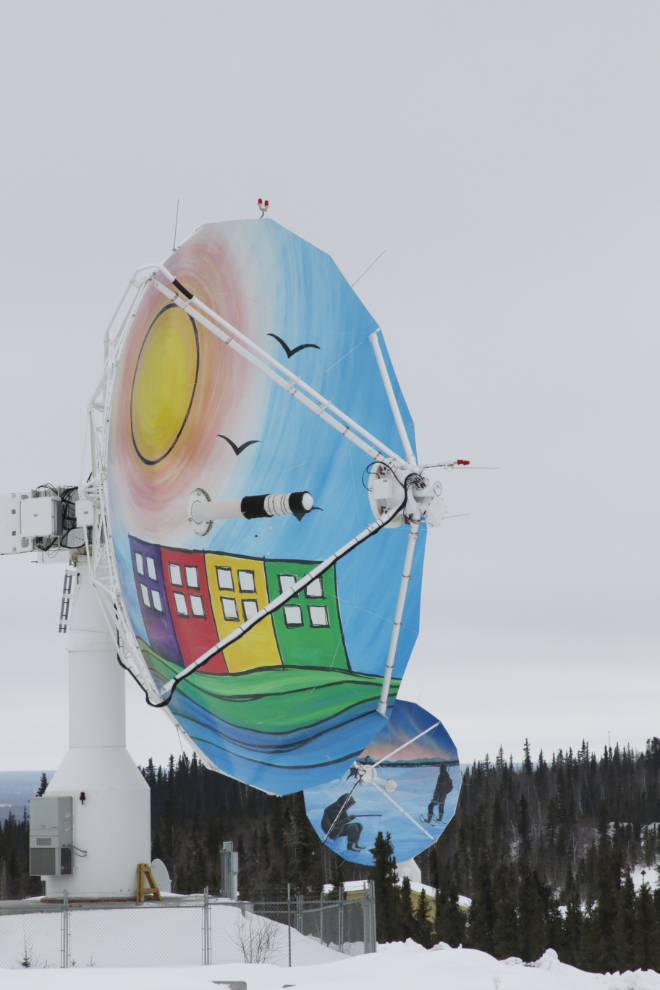
The large dishes all have paintings covering their surface. On National Indigenous Peoples Day (June 21, 2019), Natural Resources Canada held the official unveiling of the Antenna as Canvas project with the goal to honour the cultures and deep history of the Indigenous people in the Inuvik region. Local artists Ronnie Simon, Sheree McLeod, Anick Jenks and students from the East Three Secondary School Art Club created the artwork which represents Inuvialuit, Gwich’in, Métis, and the town of Inuvik respectively.
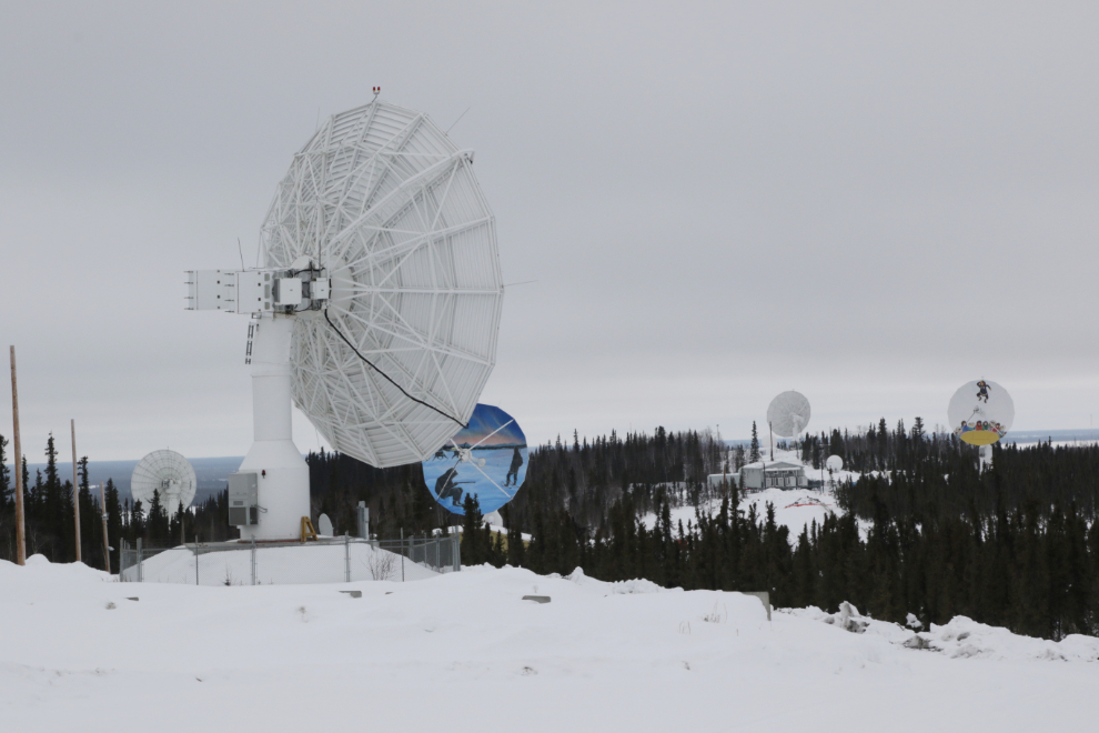
As we stood at the entrance, the closest antenna swivelled to face us – I wasn’t nearly quick enough to catch it on video. This antenna is owned and operated by France’s Centre national d’études spatiales (CNES) in partnership with SSC (Swedish Space Corporation).
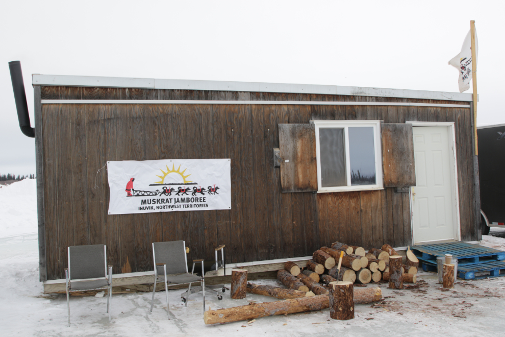
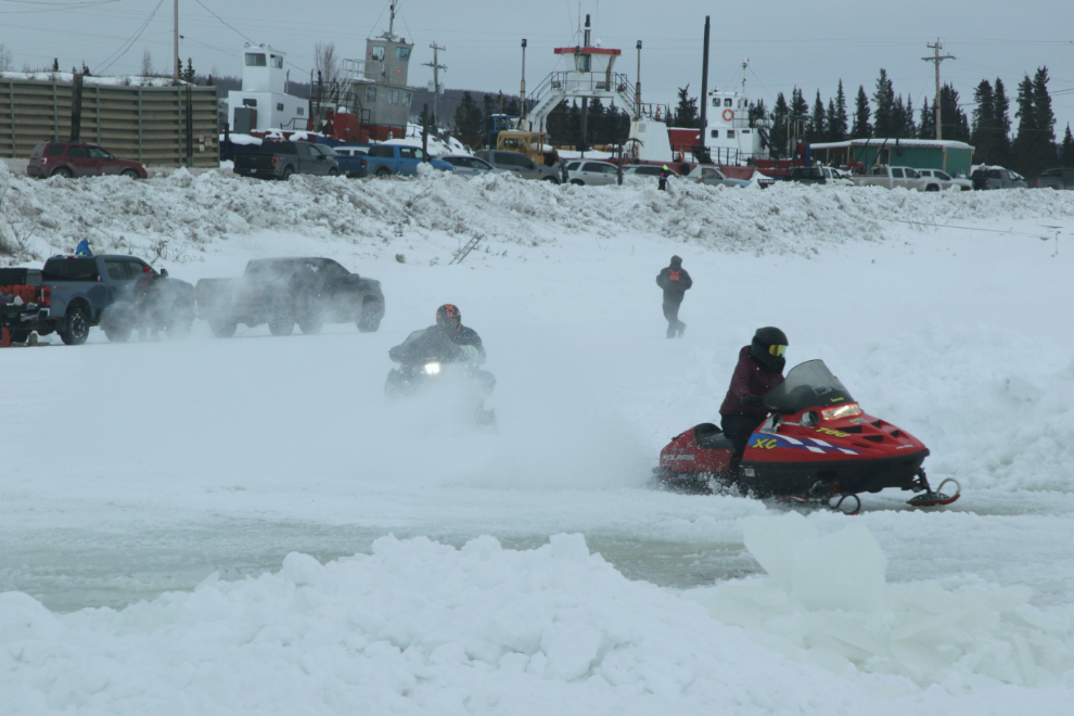
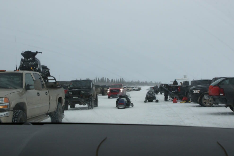
Next we went into Inuvik, and down to the frozen Mackenzie River where the annual Muskrat Jamboree was being held.
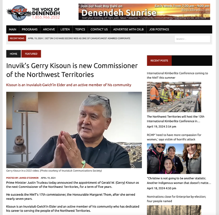
The women’s 75-mile snowmobile race was going on when we arrived. Tyson noticed that Gerry Kisoun was sitting in the truck next to us. As well as being Tyson’s brother-in-law, Gerry is a festival organizer, retired RCMP officer ( he started as a Special Constable then spent over 25 years as a regular member) , and has been in a few other significant positions (he Googles very well). I spent an extremely enjoyable hour sitting in Gerry’s truck talking about policing and festivals and communities and who knows what else as the sleds roared by in front of us.
Edit, April 19: Gerry Kisoun, mentioned above, has been appointed the next Commissioner of the Northwest Territories. From what I learned during the hour or so he and I chatted, this was an excellent choice – congratulations, Gerry!
Part of the reason we had come down was to grab a burger from the food truck, but that never happened 🙂
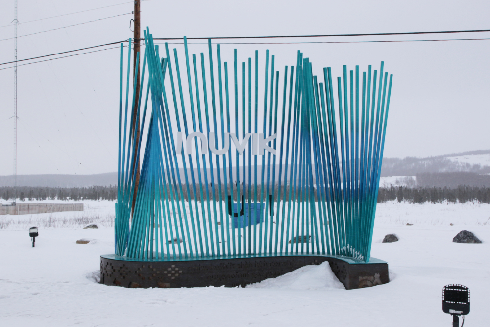
While I rather like the new (2021) “Welcome to Inuvik” sign, they would have been hard-pressed to find a worse location for it.
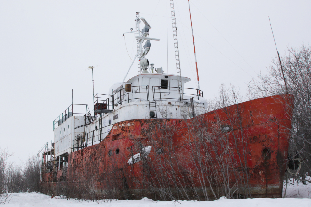
The 120-foot-long GSI Mariner is one of the largest of the many abandoned vessels sitting on the banks of the Mackenzie. She was built in sections in Edmonton in 1970 for Geophysical Service Inc. (GSI) to record seismic data on the Mackenzie River delta and the Beaufort Sea, then the sections were trucked to Great Slave Lake for assembly. In the late 1990s she was bought for $1 by an Inuvik resident who may have had a plan for her, but it never materialized.
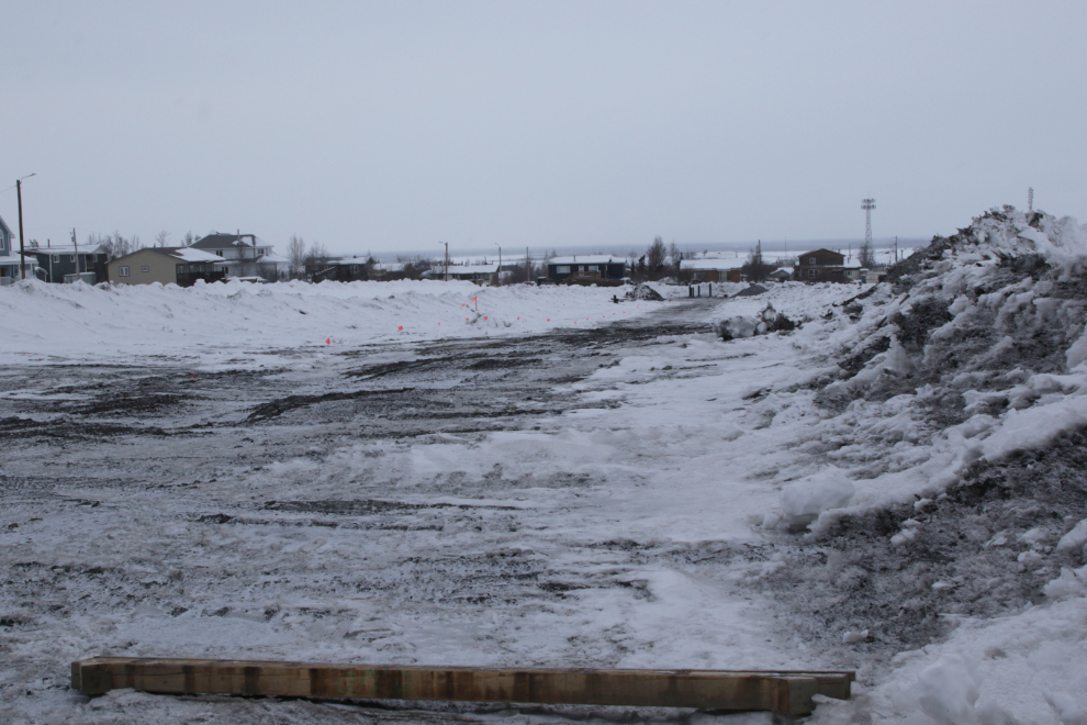
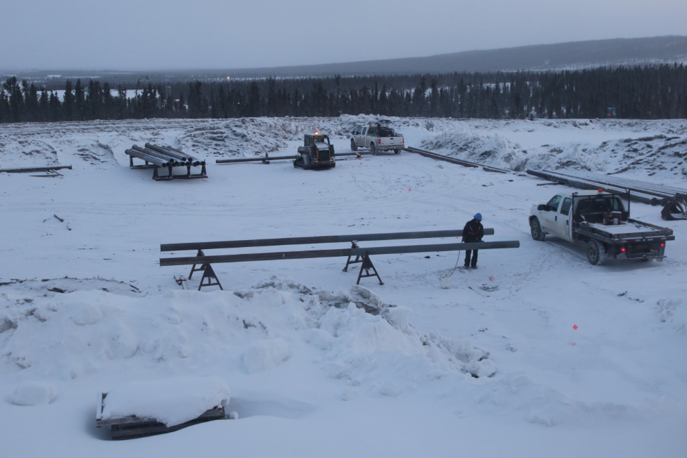
Just before 8 pm, we headed home. There’s a large new subdivision under construction on the land right beside Tyson and Catherine’s lovely home. The first step as is the case everywhere is putting in the services. Unlike the places most of you are used to, the services here are built above the frozen ground (permafrost), in heated enclosures called utilidors. The next photo shows the area cleared for the first line of utilidor pilings, some of which have been drilled in at the far end.
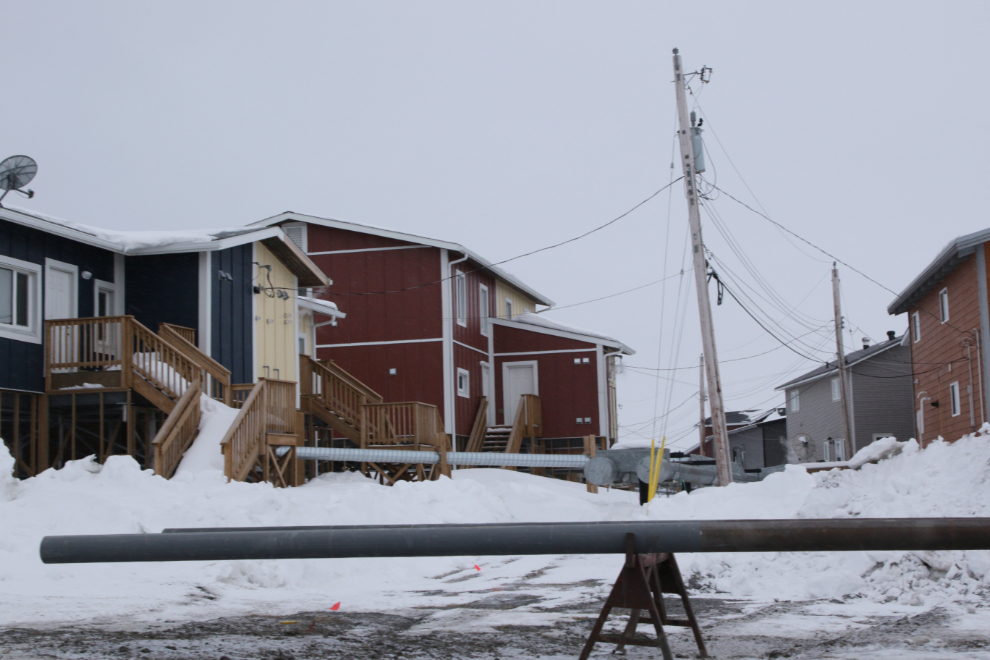
The next photo shows a couple of pilings on the stand where they get coated with something before being installed, with the existing utilidors behind. Although it’s often hidden, the buildings are also usually built on pilings of various types to protect the permafrost, as buildings can be literally torn apart by melting, shifting permafrost. My tours in Fairbanks used to include driving by a couple of homes that had been twisted to the point of being no longer habitable.
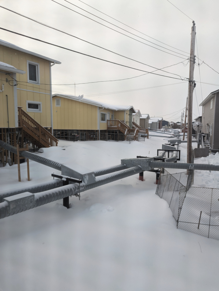
Here’s a better look at the utilidors, from inside the house.
Sunday was a 17-hour day, perhaps made possible by a nap while we were flying above the clouds, and by the adrenalin provided by my pleasure of being back in the Arctic.
Monday started at 06:00, and at 7:30 I photographed the crew already at work getting the pilings ready. The high view from the kitchen provided a good vantage point.
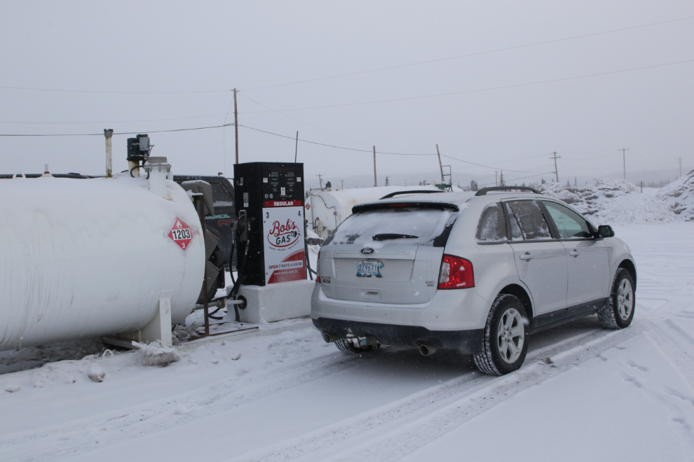
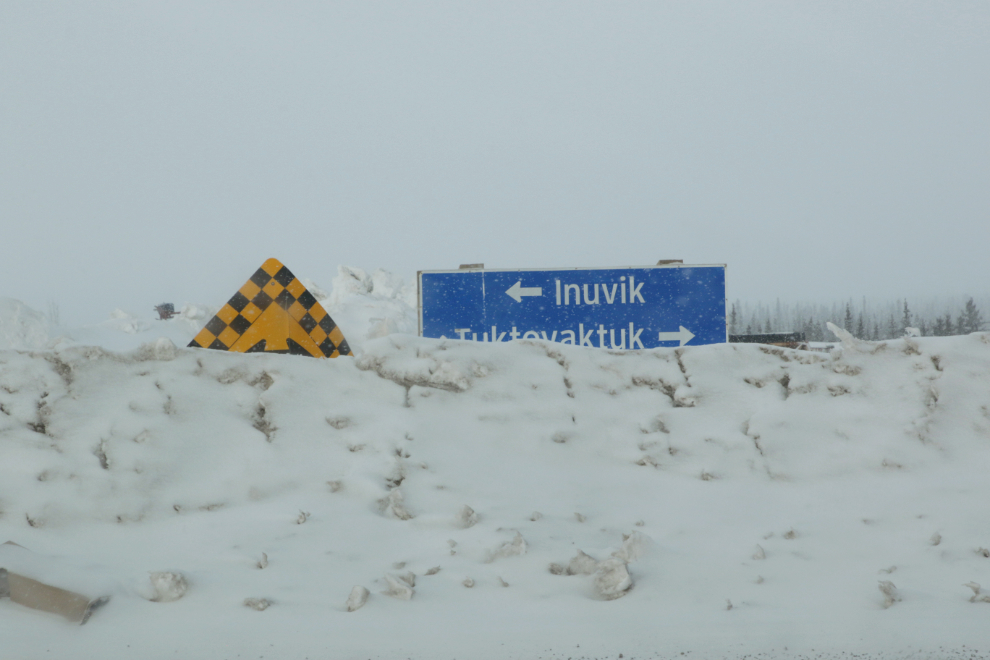
The initial plan was to drive the ice road to Aklavik on Monday but when I checked the weather, Tuktoyaktuk (commonly just “Tuk”) looked a bit better. Our first stop was to fuel up, at $2.33 per liter for regular gas. That’s about $6.44 USD per US gallon. Yes – ouch.
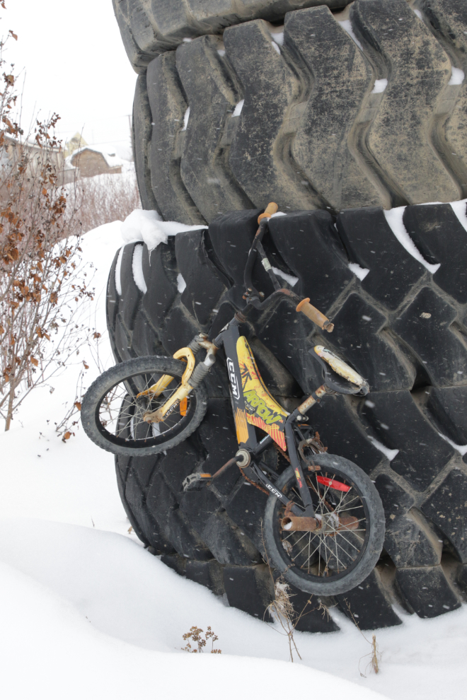
A piece of “folk art” in the industrial area as we headed north out of town. 🙂
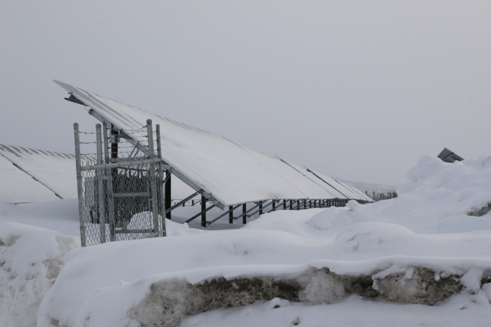
There’s a fairly large solar power array, but I don’t suppose it puts much (if anything) into the grid on a day like this. It would sure crank out the kilowatts through the summer, though.
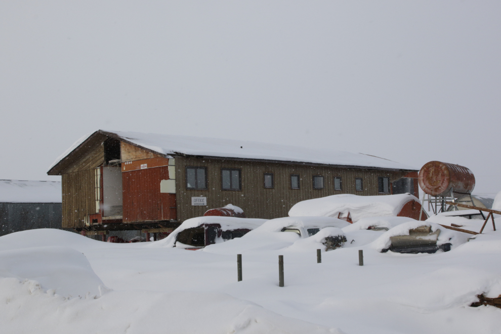
There is abandoned stuff everywhere – I think this modular building was part of the Finto Hotel the last time I was here.
10:25 – off to Tuk. I have lots more of Inuvik to show you, but I’m going to write about the trip as I experienced it.
Looks like an interesting way and place to spend a day, especially with your friend. Must really feel more than a bit different than the familiar hills, valleys, mountains and long views you are accustomed to back home.
Congratulations on making it back to the Arctic and bringing us alongside with you, I too would love to get back too but happy running shotgun with you here from Nova Scotia, thanks again eh🇨🇦👍