Exploring Dawson Creek in the Winter
This article was originally written for the Destination BC Blog, but when that was closed, I moved it here, under the same date.
It’s sometimes hard to get past the visions that we have of communities that are based on postcard images shot in the summer. Visiting when most other people don’t, however, can teach you a lot about a place.
In late February, I spent 2 nights in Dawson Creek with the specific intention of finding out more about a community that I’ve visited or at least passed through many times. I discovered a dynamic little city with a very strong sense of community, with some amenities that surprised me.
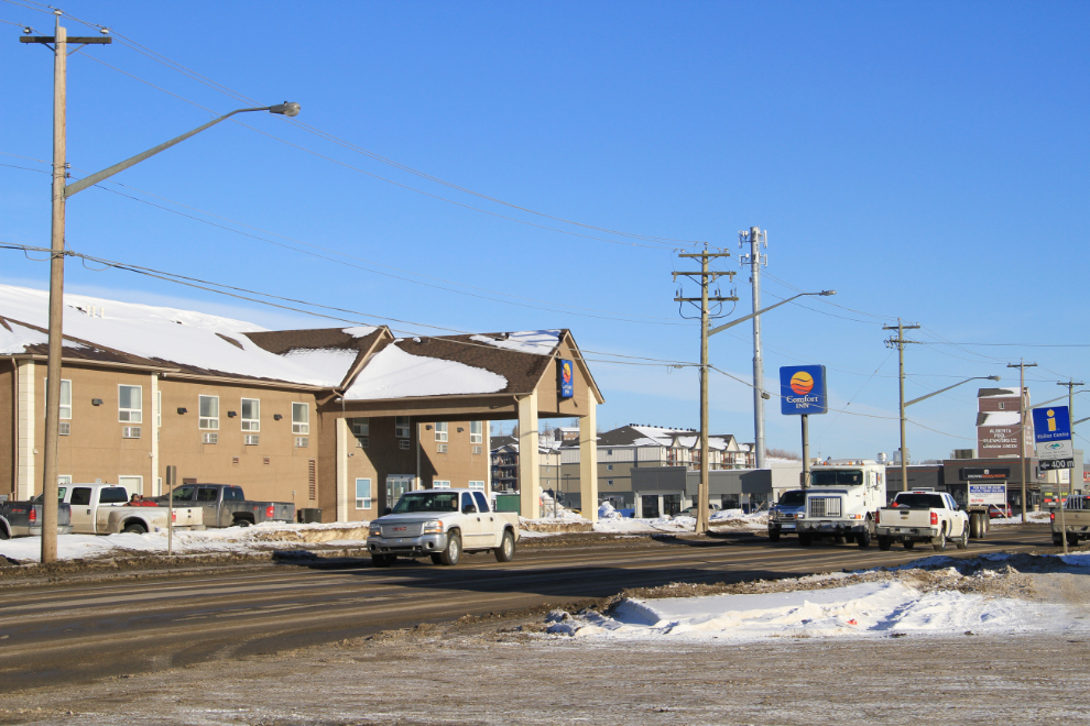
Over the 24 years that I’ve been seeing Dawson Creek since I moved north, I’ve stayed at many of the motels in town. For this visit, I chose to return to the Comfort Inn, located within walking distance of several of the sites I wanted to visit. Friendly staff and having breakfast included always help make my stays here pleasant.
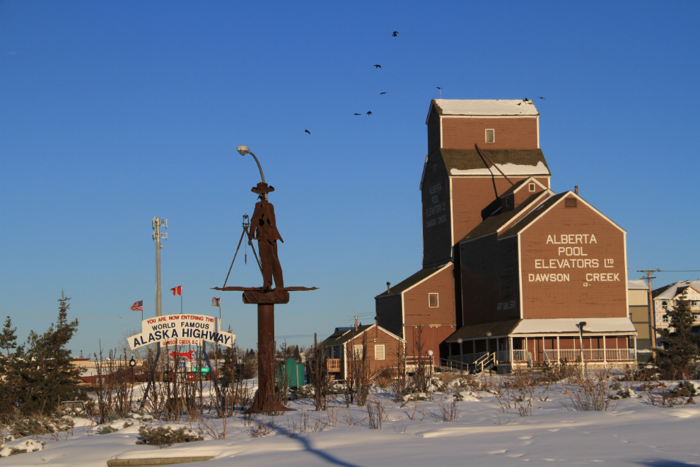
The history of the Alaska Highway is one of my passions (and the subject of my second book), and I often find myself back at Mile 0. Although the Mile 0 monument in the centre of the commercial part of town is the most-recognized marker, the surveyor seen in the foreground of the photo below is at the actual Mile 0 position, now in the centre of a very busy traffic circle. For photographers, the light of a winter morning such as this is wonderful, and comes at much more convenient times of the day than in mid-summer – sunrise this day was at 08:15, exactly 3 hours later than on the summer solstice.
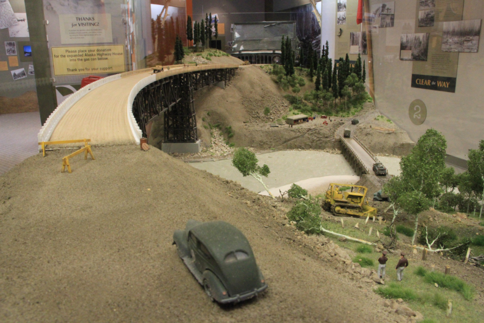
Staying in history mode, I walked over to Alaska Highway House, a fairly new interpretive centre located beside the Mile 0 monument downtown (now closed permanently). There’s lots to see and do here, and I often discover things that I hadn’t seen before. My favourite display is this wonderfully detailed model of the curved Kiskatinaw Bridge as it looked during construction. The wooden bridge, 162 meters (531 feet) long, still stands, accessed by a detour along an old section of the Alaska Highway at Km 27.8.
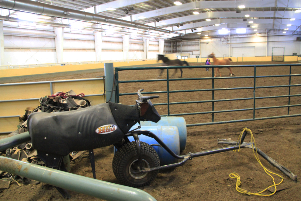
Joyce Lee at Tourism Dawson Creek was very helpful in letting me know about some of the attractions I’d missed in previous trips. For something out of the ordinary for most visitors, she suggested the Lakota Agriplex, a 6-year-old equestrian centre that’s run by a non-profit society. Both the young woman training her horses in the photo below, and a full-time trainer I met there were clearly proud of the facility and happy to talk about it. As well as the 30.5 x 73 meter (100 x 240 foot) riding arena seen here, there are 110 indoor stalls, 76 tack lockers, and a complete wash rack and grooming area. It’s so popular that an expansion of the facility is currently being planned. This was exactly the sort of program I wanted to see to understand the community better.
One of the things that I really wanted to change about my Dawson Creek visits was my dining choices, and I had very good luck with that. A new restaurant, New Tokyo Sushi, has recently opened in the Airport Inn, and served up an excellent chicken bulgogi for my lunch, for $15.99. You can choose between 5 levels of spiciness in the sauce – the #2 was perfect for my mid-day tastes.

After lunch it was time to see some country and get some exercise, and the long row of wind turbines on the ridge south of town was my target. Although it’s hard to miss seeing it in the distance, it’s not easy to find the route to it, but a brochure with map is available at the Visitor Information Centre, and it is well worth the drive.
Construction of the Bear Mountain Wind Park was begun in 2007, and when it went into operation in October 2009 it became BC’s first commercial wind facility. The numbers are impressive: each of the 34 turbines produces enough electricity to power 1,000 homes; the towers are 78 meters (256 feet) tall, and each of the blades are 41 meters (135 feet) long.
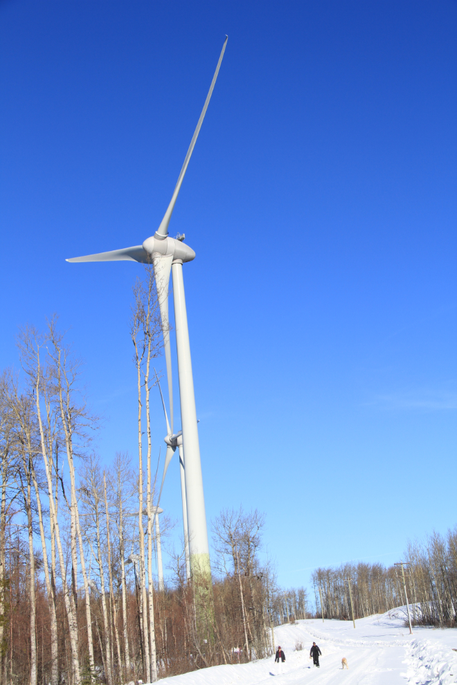
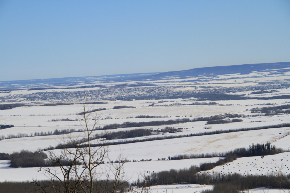
The Bear Mountain Wind Park doesn’t just supply power, though, it offers one of the best hiking trails in the area. The Rim Rocks trail runs about 7 kilometers (4.3 miles) along the ridge, offering views such as the one below, looking to the northeast to Dawson Creek.
When I got back to town I went to meet Don Pettit, a very well-known local photographer who produced a high quality book about the project in 2010. Entitled “Power Shift”, it features about 150 photos of the construction process.
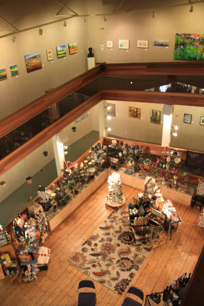
Following a fine energy refresher of coffee and scone at the charming little Baked Cafe, the art gallery was my next stop. I love everything about the Dawson Creek Art Gallery, which is housed in the annex of the community’s last remaining grain elevator. The Peace district has a very active arts community, and this unique renovation gives artists the opportunity to both show and sell their work. The shop is on the ground floor of the building, while the gallery, with 200 lineal feet of display space, spirals up about 60 vertical feet.
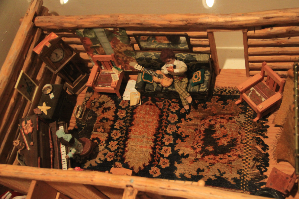
As my touring day neared its end, the museum, in the railway station right next door to the art gallery, was my last site to visit. There’s so much to see and read in the compact space that an hour just allows for a brief overview. From stuffed birds and animals to railway memorabilia, restored rooms and crafts such as the wonderful model of a pioneer log cabin seen below, there’s something for anyone with an interest in history.
My day ended another block towards my motel, at Brown’s Social House, one of the top-rated restaurants in town. It was very busy and my expectations weren’t high, but I was in for a pleasant surprise. I ordered halibut, which is easy for a busy restaurant to ruin, but it was perfect.
Early the next morning, my journey continued. The 36 hours that I spent in Dawson Creek this time, though, was proof that I need to spend much more time there.