Exploring the old Fraser Canyon Highway and Alexandra Bridge
Exploring a bit of the Fraser Canyon in depth was the order of Day 9 – Friday, May 4th. We only put 44 km on the RV, the Tracker got unhooked 4 times for exploring, and some nice surprises were served up in the way of long-abandoned stretches of the old road, and a couple of great waterfalls.
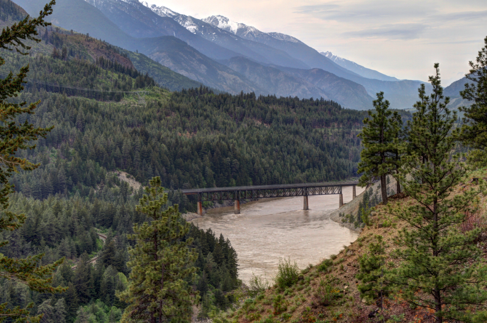
We pulled away from Skihist Provincial Park just after 09:00, ready for pretty much anything that might appear. Like railway bridges. The number of times the Canadian National and Canadian Pacific Railways swap sides of the canyon is almost funny.
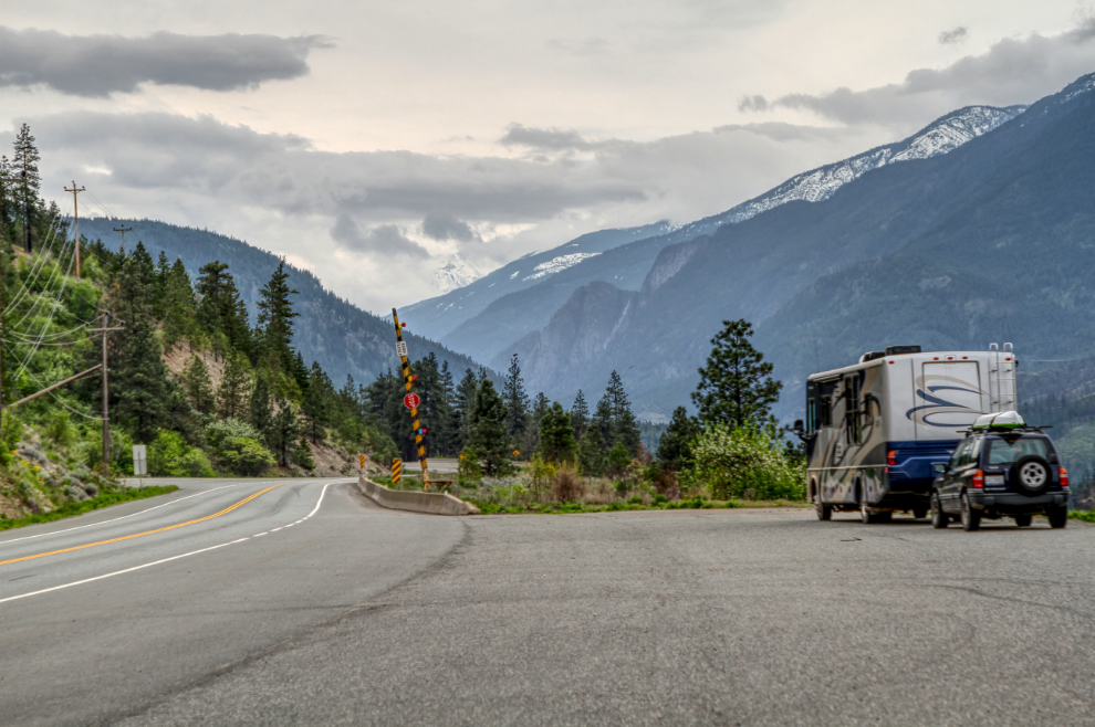
There are lots of pullouts of all sizes through the Fraser Canyon to make exploring easy. Just ahead in the next photos is one of several gates used to close the highway in case of avalanche, rockslide, washout, etc.
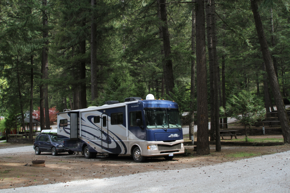
The huge pullout at the old Kanaka Bar Lodge was a good place to unhook the Tracker to backtrack for a look at a couple of things.
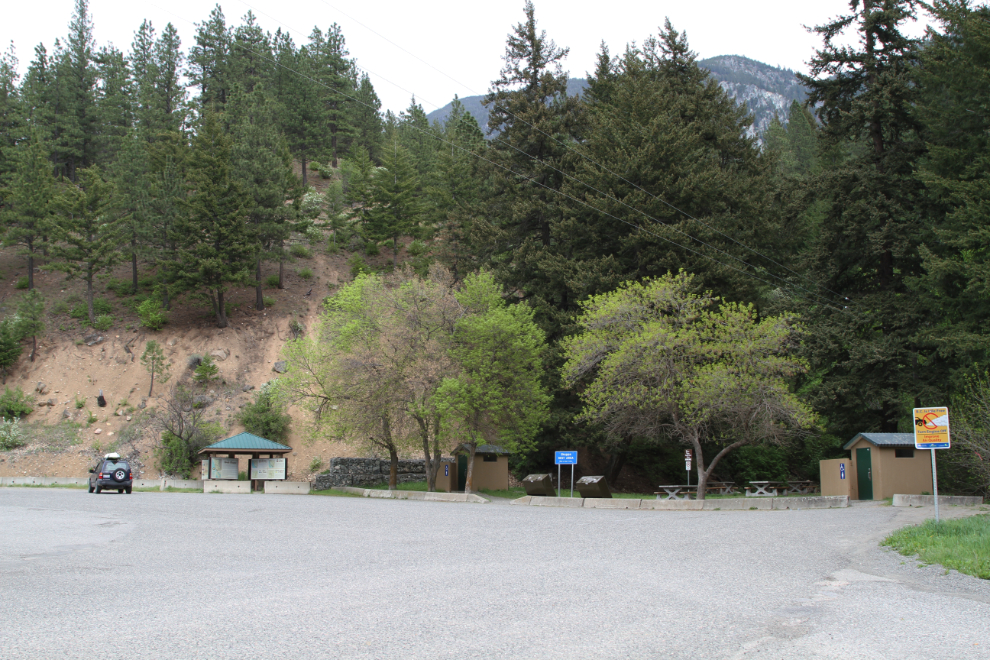
The Skuppa Rest Area was worth a stop. It was named for the Skuppa First Nation of the area.
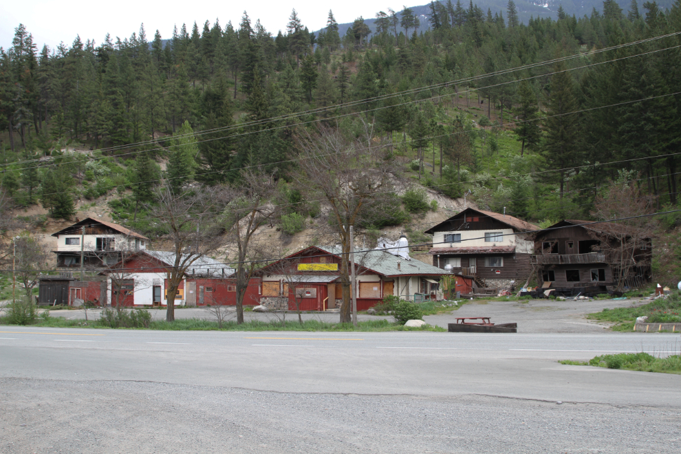
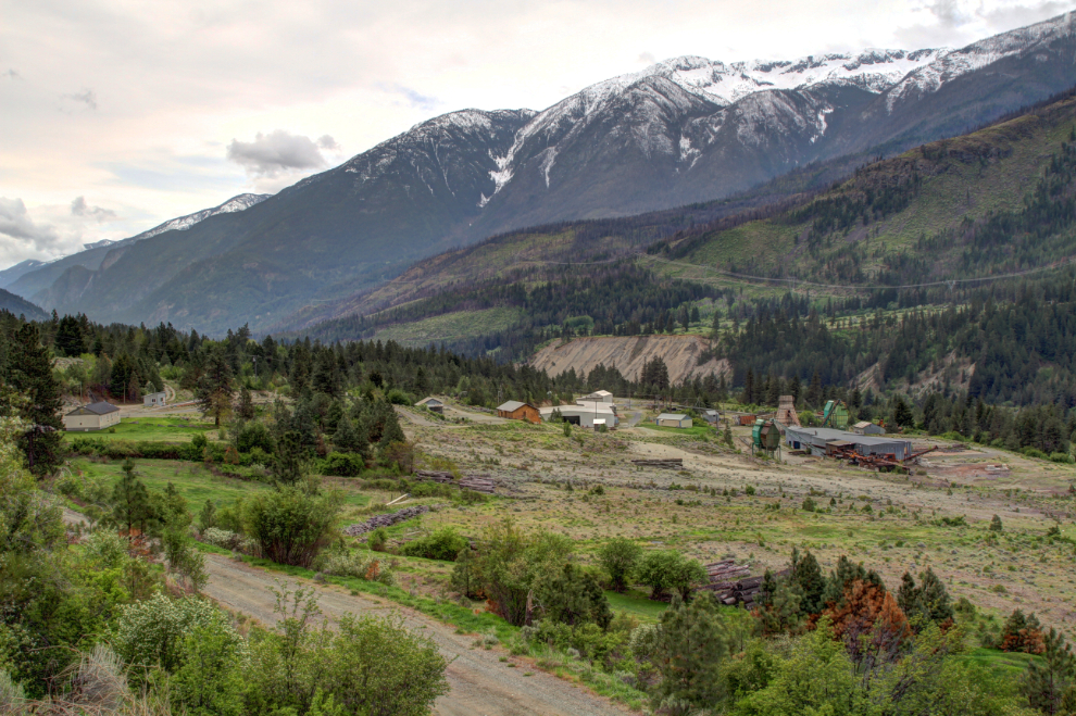
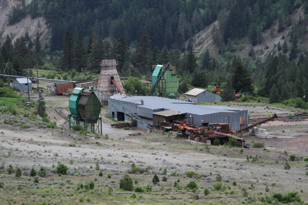
The main reason I went back was for a look at this lumber mill which closed in very recent years. This was the main employer in an area with few jobs. A quick Google hasn’t led me to the story of the closure.
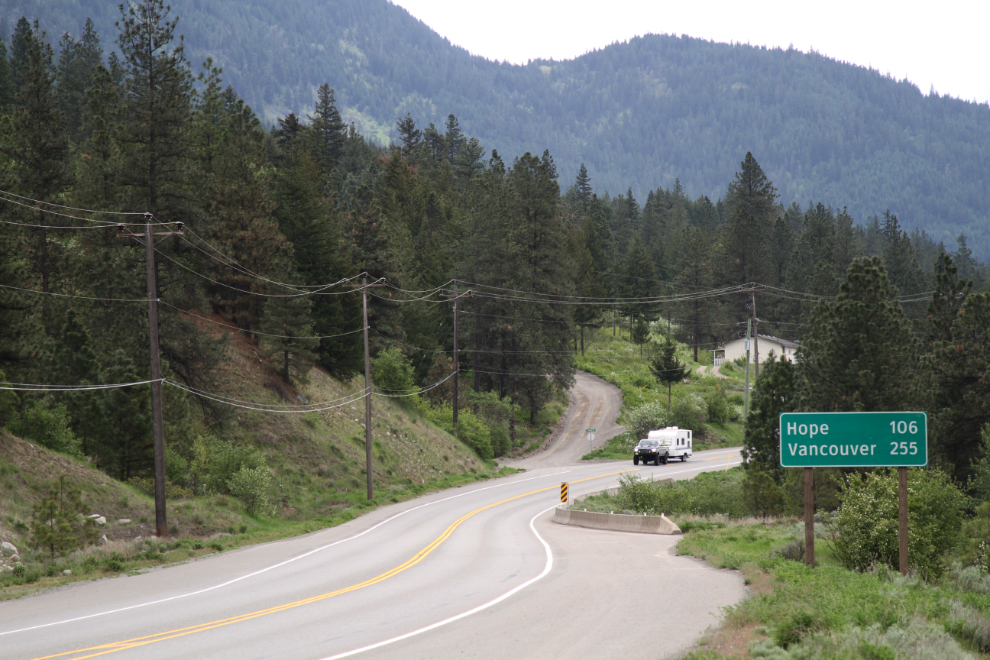
Hope, 106 km south – and I have 2 days to get there 🙂
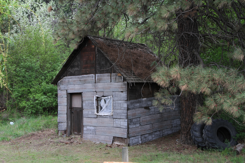
The little cabin was certainly worth a U-turn in the Tracker. I believe that type of siding is from the 1930s but the cabin appears much older than that. It’s on private property so I didn’t go for a closer look.
A well-controlled creek, and manicured slopes above and below the railway on the opposite side of the river.
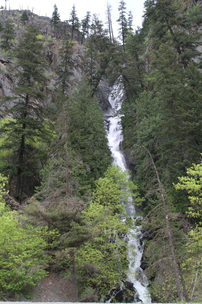
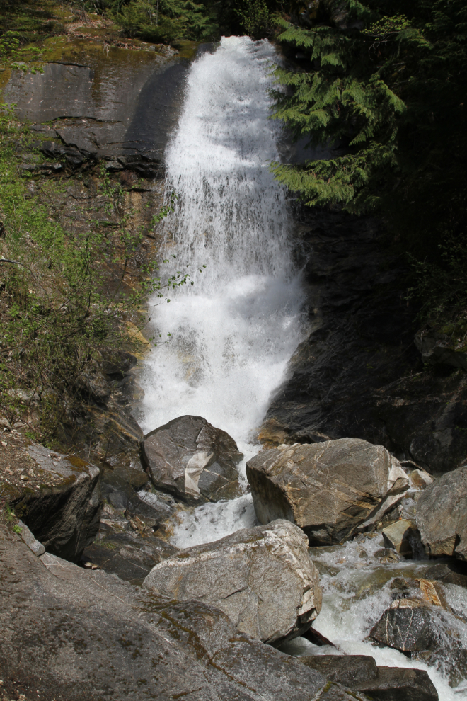
A large waterfall brought me to a stop with the RV, and backtracking to this spot, only a short walk was needed…
…to reach this waterfall.
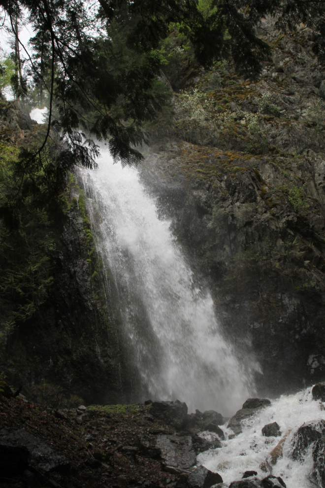
Access wasn’t easy, but I got to the main drop, which is about 20% of the whole waterfall. In the confined canyon, there was a lot of spray in the air, and keeping my camera lens dry was a challenge.
A few minutes before noon, I pulled in to the Canyon Alpine RV Park, which I’d seen comments about having new owners who were doing a lot of work on the property. My initial meeting with one of the owners and the experience of getting set up in a site were both positive, but I was back on the road quickly so I’ll tell you more about the park in the next post.
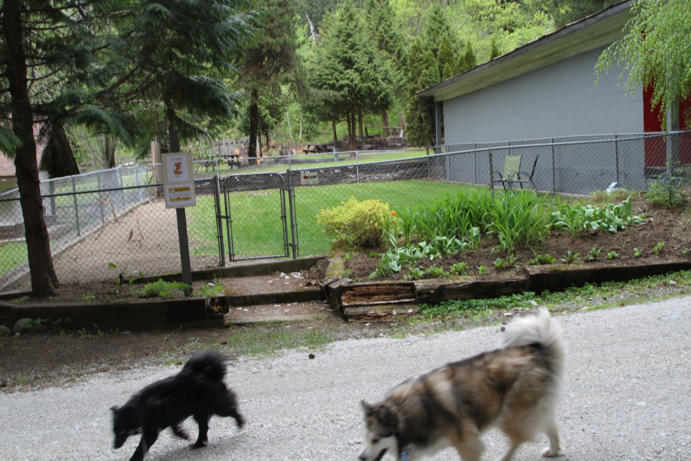
I had a short play with Bella and Tucker in the fenced dog area, but Bella wasn’t into it – too warm for her. I then put them back in the RV because the main place I was going (Alexandra Bridge) isn’t dog-friendly.
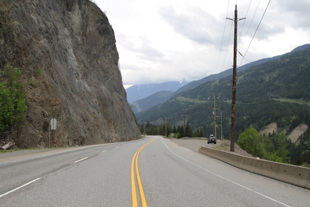
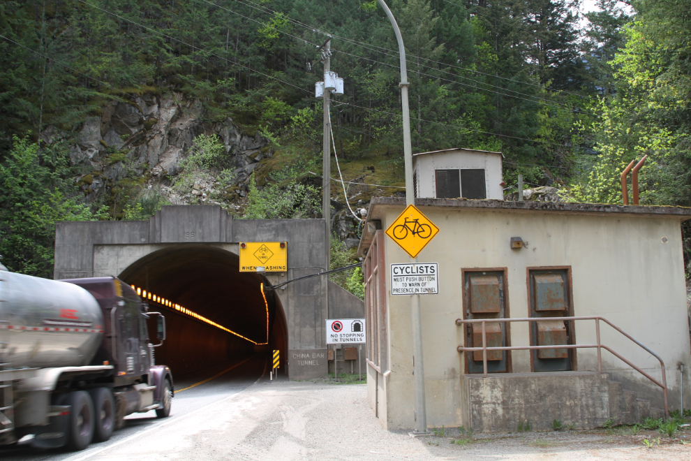
My first stop was at the south end of the China Bar Tunnel, which was built in 1961. That gate to the left was, of course, intriguing. China Bar is the longest of the 7 highway tunnels in the Fraser Canyon, at about 610 metres (2,000 feet).
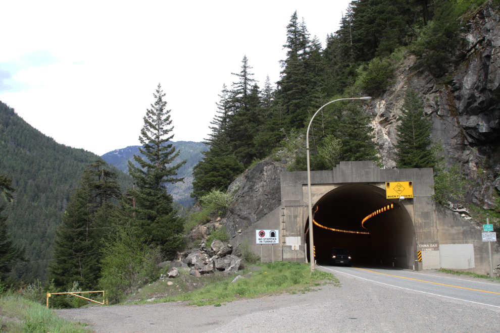
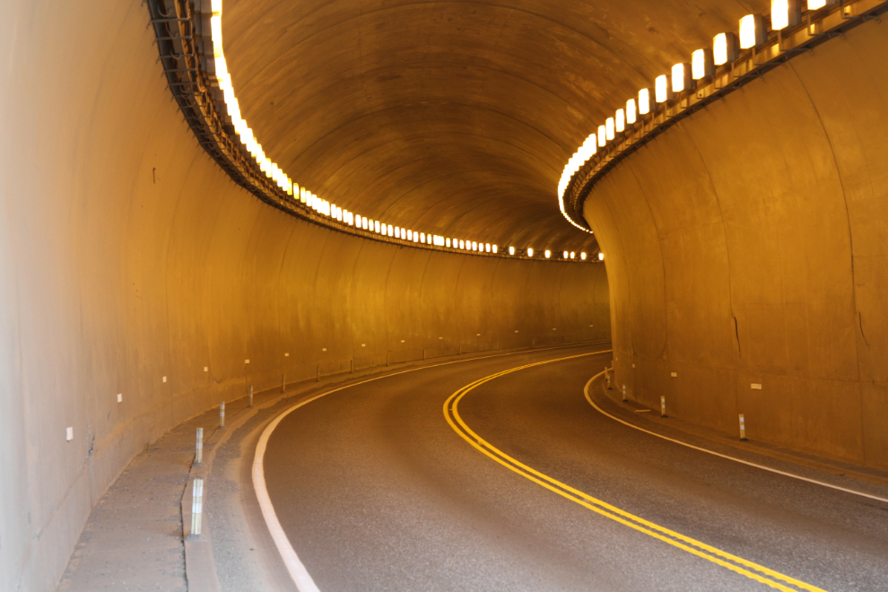
The noise when even small vehicles are in the tunnel is quite shocking. Although cyclists have a very narrow sidewalk, using it would be rather unnerving, I’m sure. I peeked into the tunnel when no vehicles were coming, then went to see what was beyond that gate.
Within a very short distance beyond that gate, I could see that this was the old highway before the tunnel was punched through the mountain.
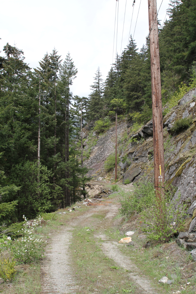
Well this was awesome! In places, the rock and even timber cribbing that held the road in place can still be seen. I rode on the road in my parent’s car at least once (and it may have been several times) as a kid, making finding it infinitely more interesting.
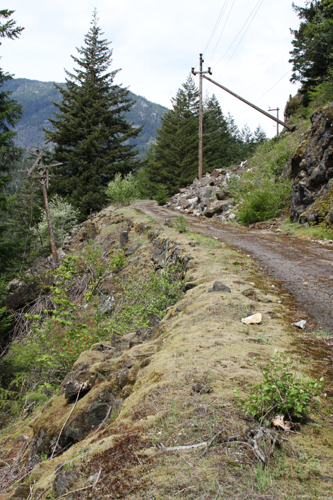
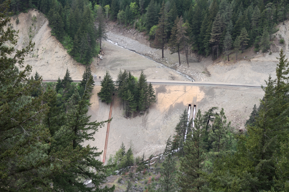
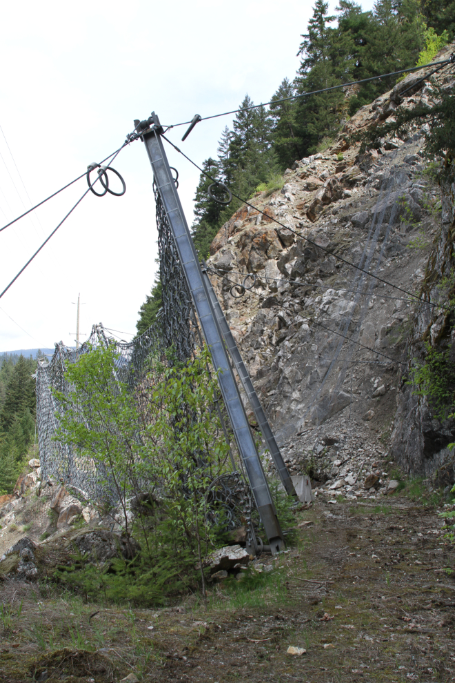
The road is maintained for access to a power line, and the railway below is protected from this large rock slide by a massive steel net.
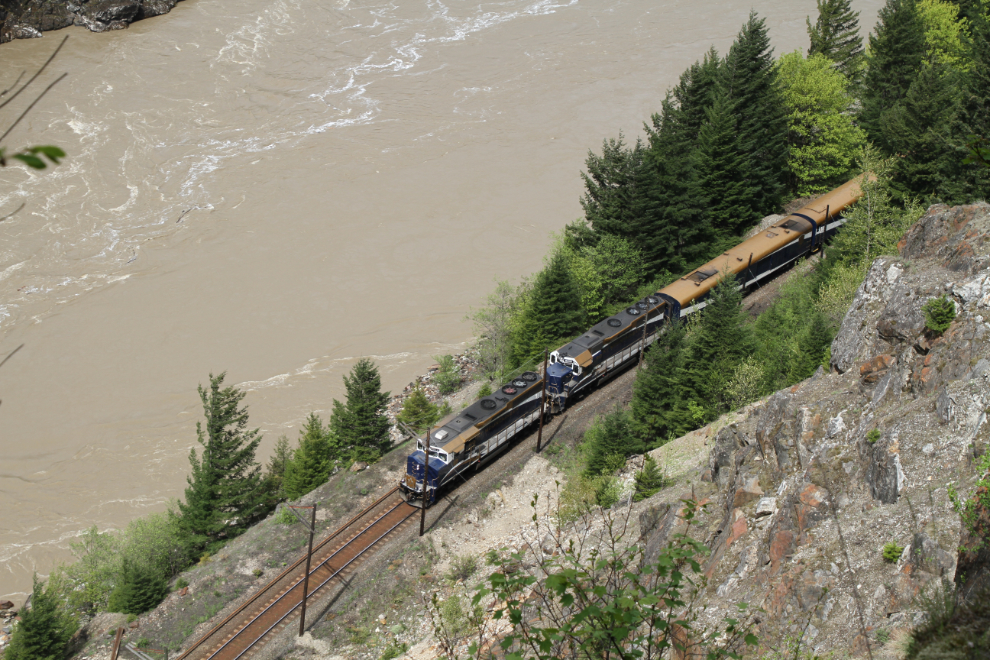
A great waterfall that isn’t seen from the modern highway, a hydro-electric plant, and even a train passing by below. The ROR (run-of-the-river) hydroelectric operation was built on Scuzzy Creek in the late 1990s.
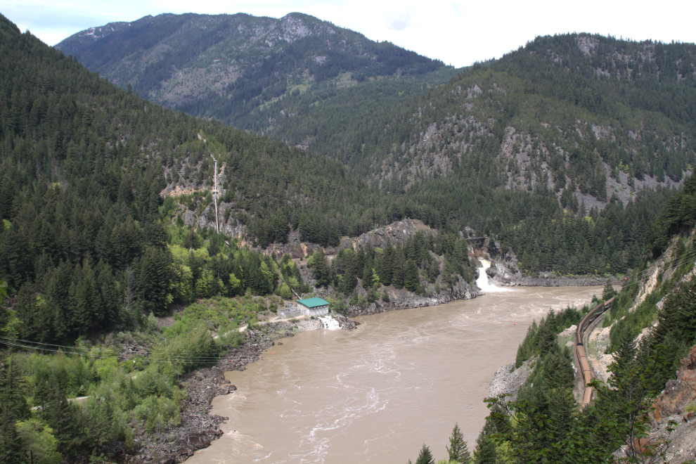
It wasn’t just any train passing below, it was the legendary Rocky Mountaineer! Riding the Rocky Mountaineer is bucket-list stuff. I waved at all the glass-dome cars, but because of the heavy tint on the glass, I couldn’t see whether anyone returned my wave 🙂
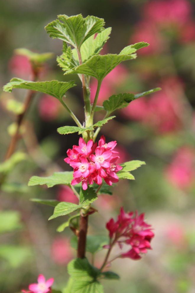
I don’t know what these flowers are (berries, I think), but they sure added a nice splash of colour along the road.
This building at the north end of the tunnel contains equipment for ventilation of the tunnel – China Bar is the only one that is ventilated. The yellow sign above the tunnel entrance has warning lights that are activated by cyclists before they enter the tunnel, which is curved so has reduced sight lines.
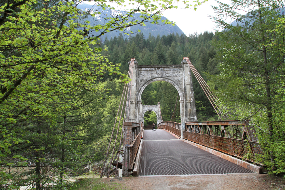
That piece of the old road took me exactly an hour to explore, then I continued on to the primary target, Alexandra Bridge.
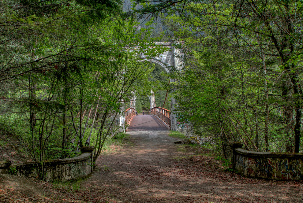
I reached the start of the trail down to the bridge at 2:15 pm, with big plans beyond the bridge.
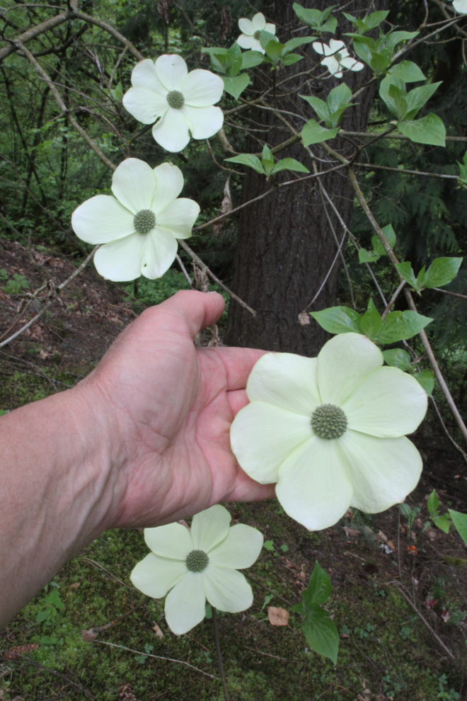
I was immediately rewarded by a Pacific dogwood tree with the largest, most perfect blossoms I’ve ever seen on one of these trees. This is British Columbia’s floral emblem.
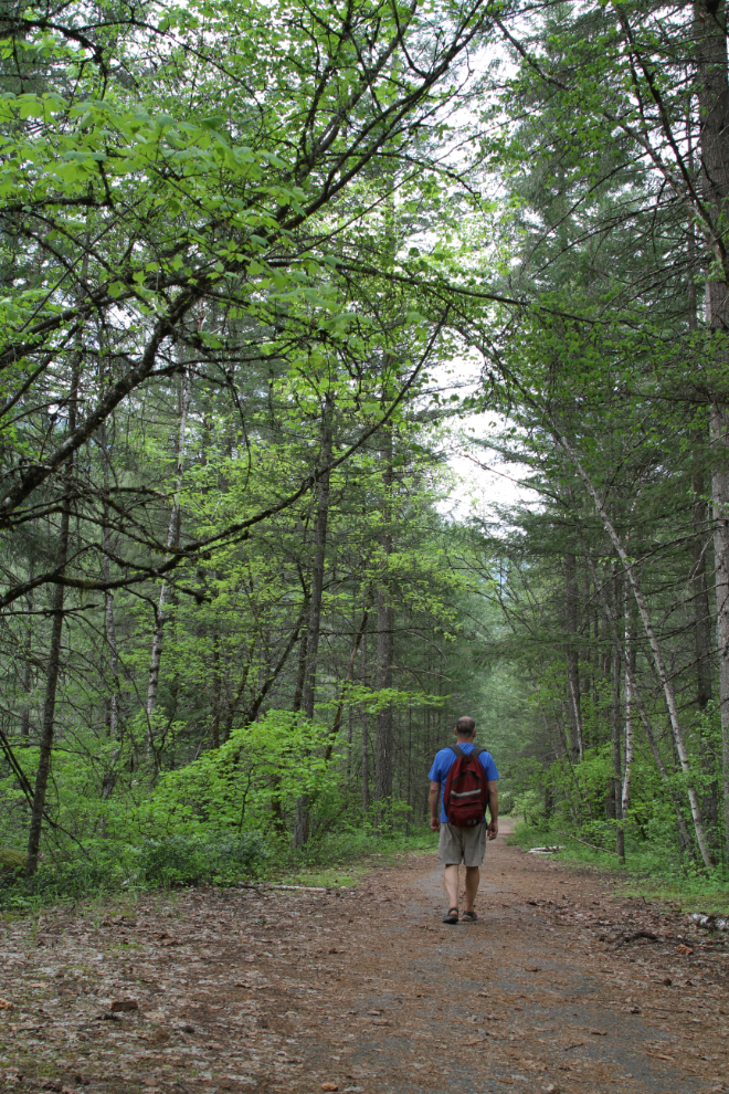
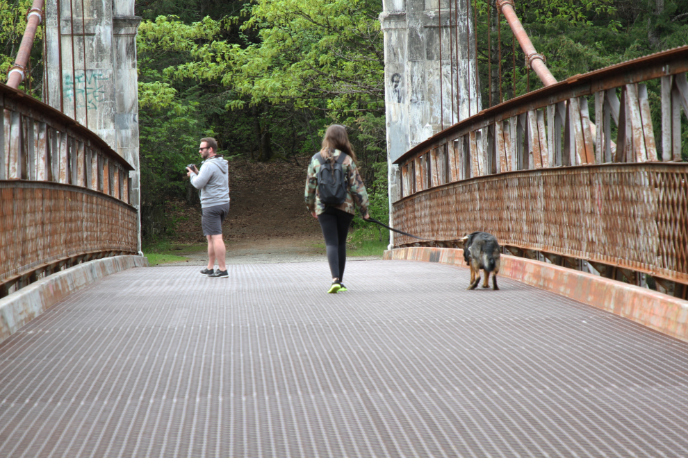
The trail soon connects with the old highway. That’s me walking towards the bridge.
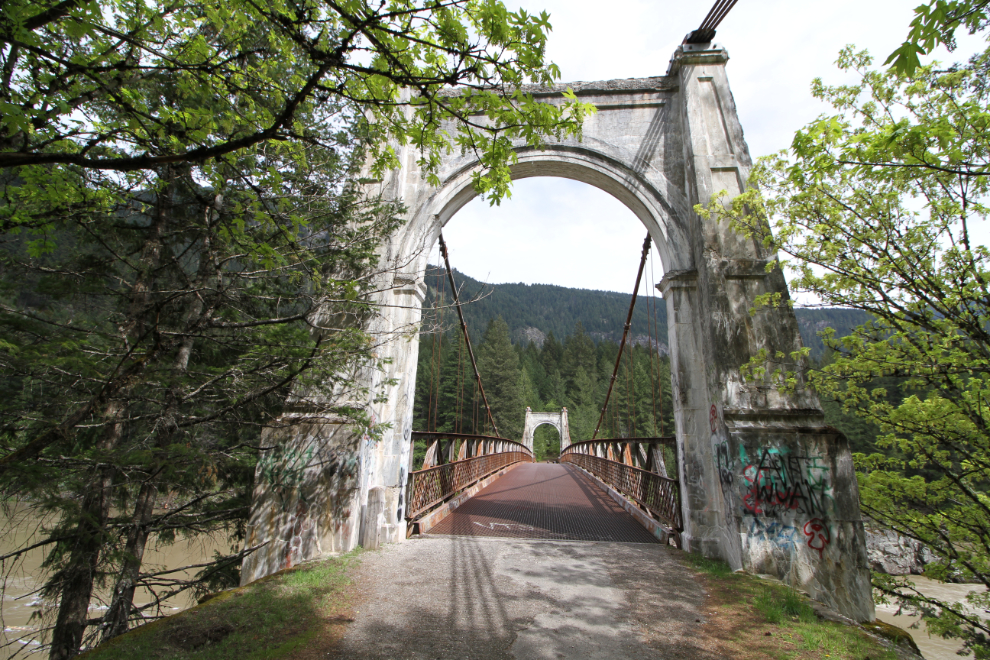
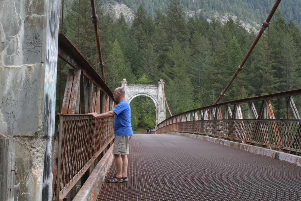
This is one of my favourite historic sites in Canada. I don’t really know why, though perhaps it’s an easily-identifiable one that has been in my life periodically for as long as I can remember.
This is why I said that the Alexandra Bridge isn’t dog-friendly. Especially for smaller dogs, those large openings in the open-grate steel deck are exceptionally difficult to walk on.
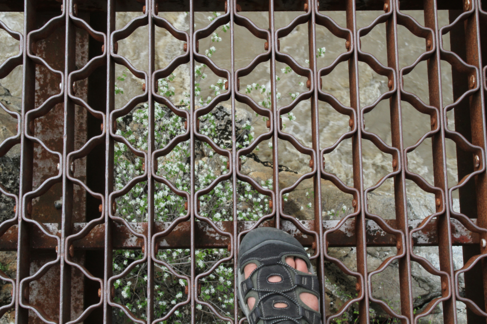
That large 2-year-old German Shepherd (who I met at the start of the trail) was not happy about being on that deck!
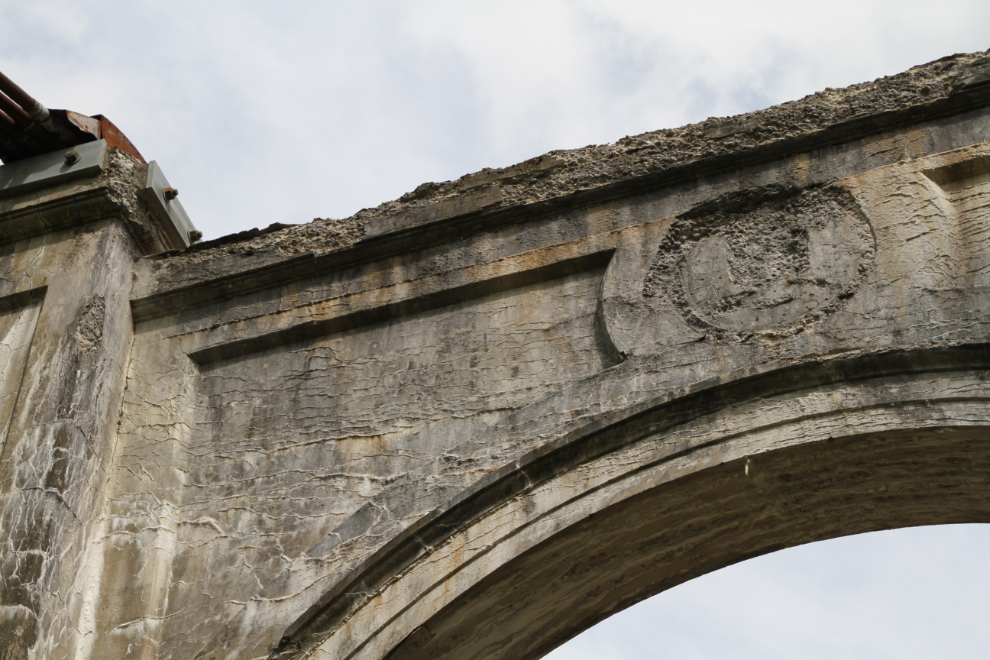
When I see crumbling concrete like that, I always hope that no government lawyer sees it and decides that the province needs to protect themselves from liability issues if a piece falls on someone. There used to be brass plaques with the provincial crest in the round cutout, but they disappeared a few decades ago. [Edit: I found the brass plaques the next day, at the Creighton House Museum in Yale]
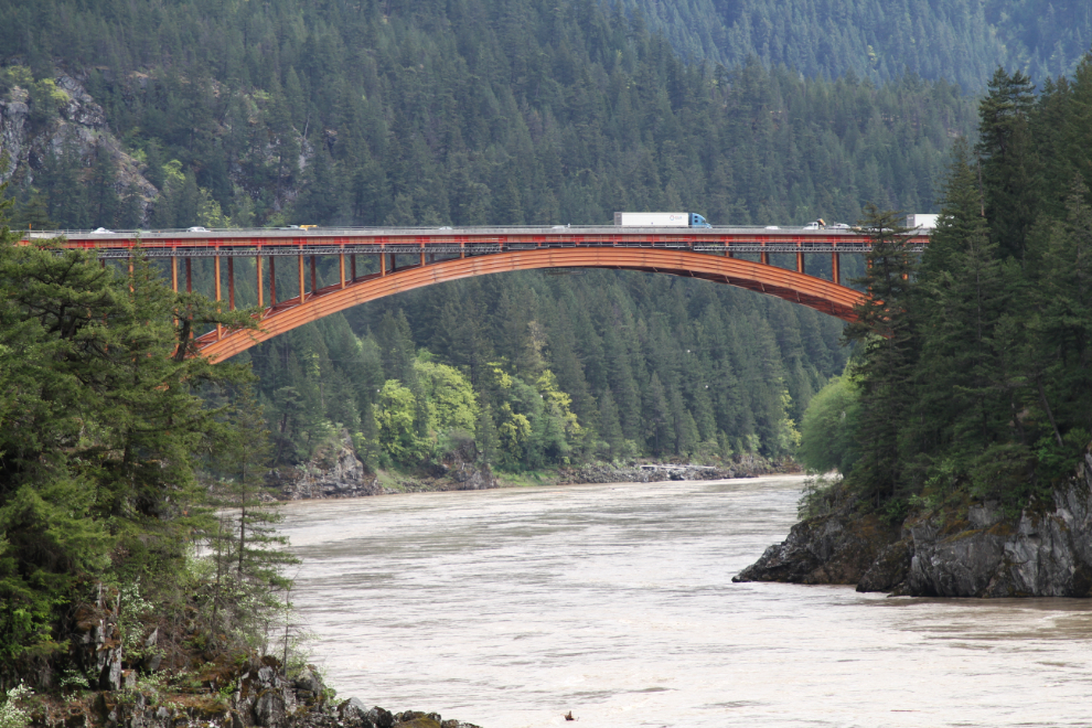
The new Alexandra Bridge a mile downriver opened in 1964. The traffic on it when I was there was backed up due to replacement of the concrete deck being done. My Dad used to have a gold claim just downstream from that bridge, where he panned for several years.
The Alexandra Bridge was built in 1926, and the 55-hectare provincial park that now surrounds it was created in 1984.
It’s hard to imagine 2 vehicles passing on that deck. I haven’t found the width of it stated anywhere.
The curving stone walls at the west side of the bridge are an interesting decorative touch.
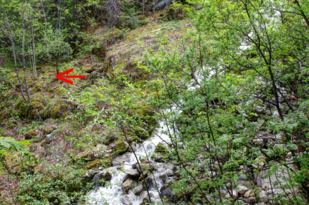
My bigger plan at the bridge was to walk the old highway from the bridge to where Dad’s gold claim was (it was accessed by the old road). That idea got quickly modified by this large washout. The location of the road on the far side is indicated by the red arrow.
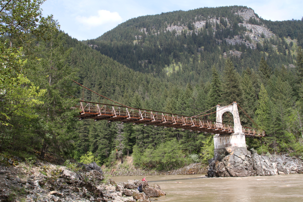
I decided that if I followed a rough path down to the river, the creek that caused the washout might be easier to cross. In any case, I got good views of the bridge 🙂
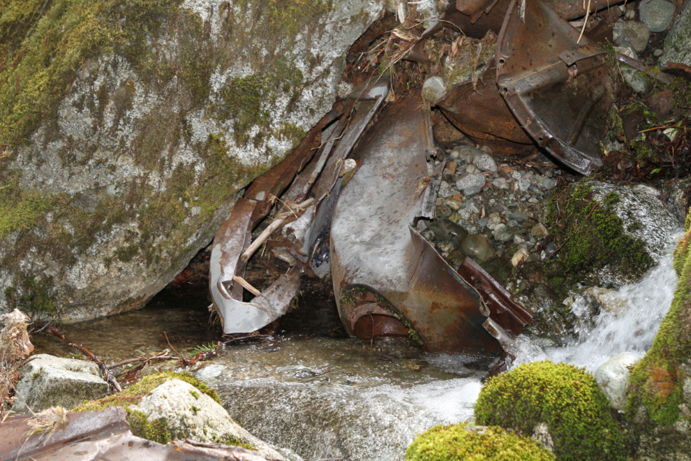
While the creek was easy to cross at river level and the climb back up to the old road was fairly easy, I soon ran into another washout with no easy way across. I might have gotten across with some effort, but decided that this could well be a continuous process of crossing washouts, so returned the way I came.
On the return clamber down the creek, I found the remains of what I think is a 1940 Ford that didn’t survive the road.
At 4:00 pm, I started north to the RV park again, and only got distracted for a few minutes by one more short hike to a waterfall.
The plan for the next day was to have a good look at the historic community of Yale. From there, it’s an easy drive to Kelowna, when I meet Cathy on Sunday evening.