Exploring Drumheller’s Atlas Coal Mine, and a bad road choice
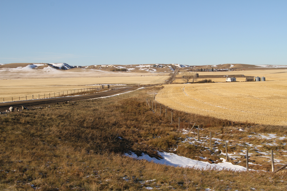
Continuing on our Drumheller-area wander, our next stop after the East Coulee Hoodoo Park was the Atlas Coal Mine National Historic Site. Although I’d been to Drumheller a few times, this was my first time going down the Red River Valley, and I was thoroughly enjoying it. This would be a great place to bring the motohome for a few days.
It was 1:15 when we reached the mine, which is located along the Red Deer River, 20 minutes southeast of Drumheller on Highway 10.
None of the tour times worked for us, so we opted to just do a self-guiding tour. Admission is $10 per person.
The plaque on the left, erected by the Historic Sites and Monuments Board of Canada, reads:
“ATLAS NO. 3 COAL MINE.
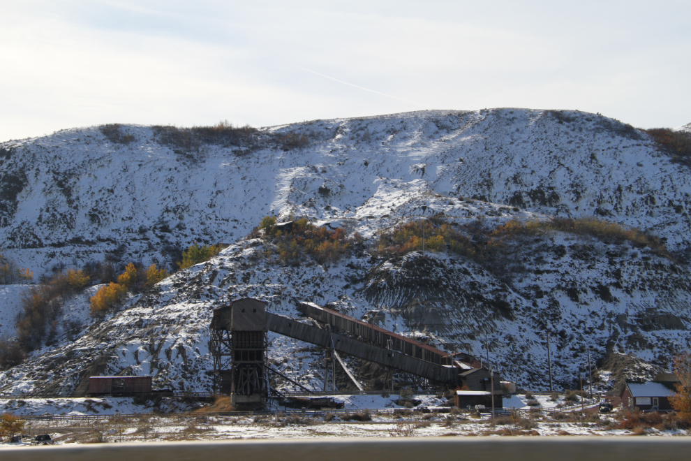
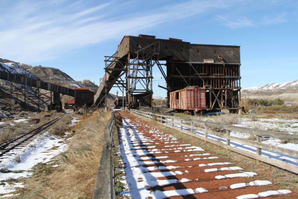
Atlas No. 3 (1936-1956) played a central role in the coal industry of the Drumheller Valley, a leading area in the production of Canadian coal. The mine employed skilled miners and used mechanized equipment to produce large supplies of coal mainly for household use. The surface plant is exceptionally well preserved and the tipple is the best surviving example of the kind of preparation facility common in the Drumheller field. The managers were housed on site and the miners lived across the river, indicative of the social divisions in Canadian coal towns of the period.”
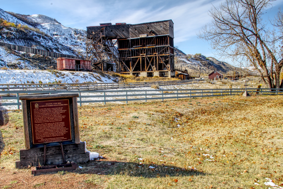
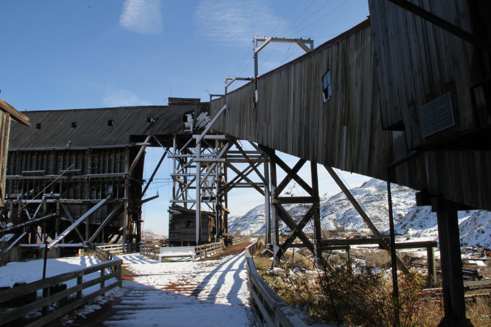
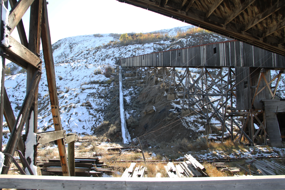
The ramps transported coal into the large building, the tipple, where the coal was sorted into various sizes before being loaded into railway boxcars for distant transport, or trucks for local transport.
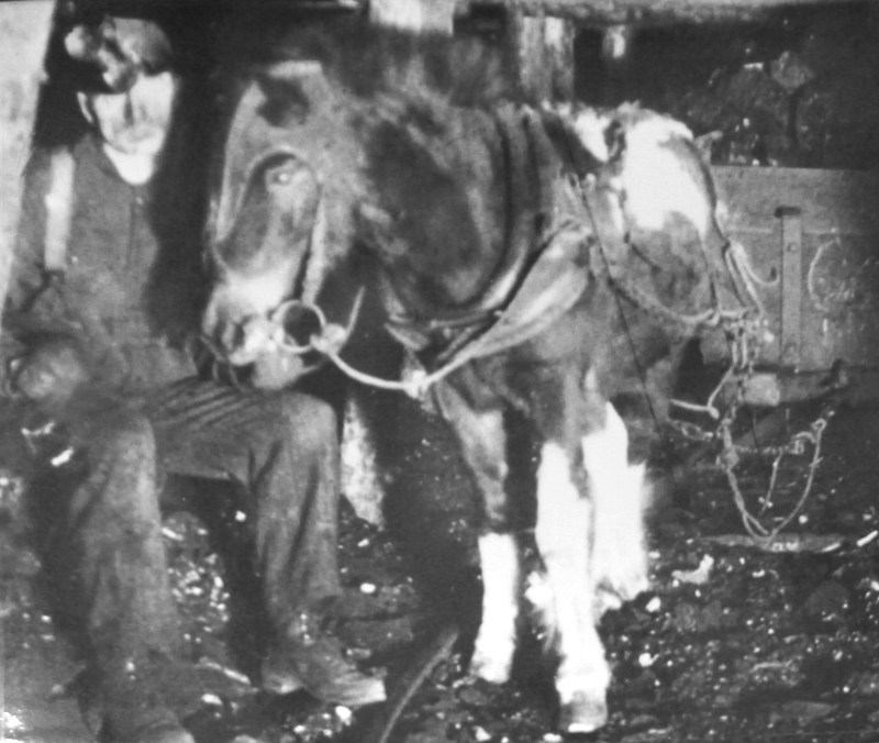
Welsh and Shetland ponies moved the coal from the working face to the main haulage tunnel, where an electric locomotive took over. The ponies lived underground, many for their entire lives.
Conveyor belts inside the ramps moved the coal to the tipple.
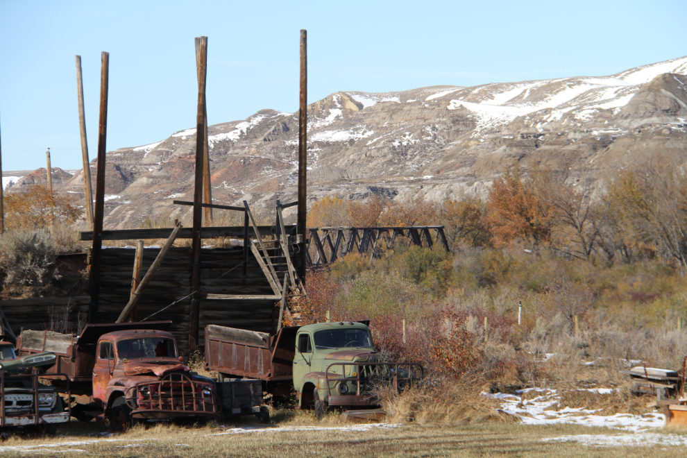
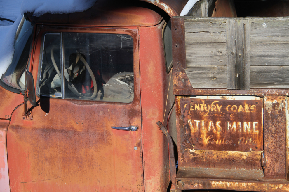
Some of the trucks used for local haulage. Poor families could often find enough coal spilled along the tracks to heat their homes.
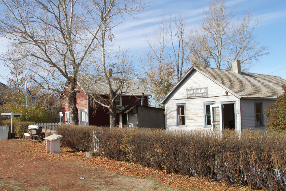
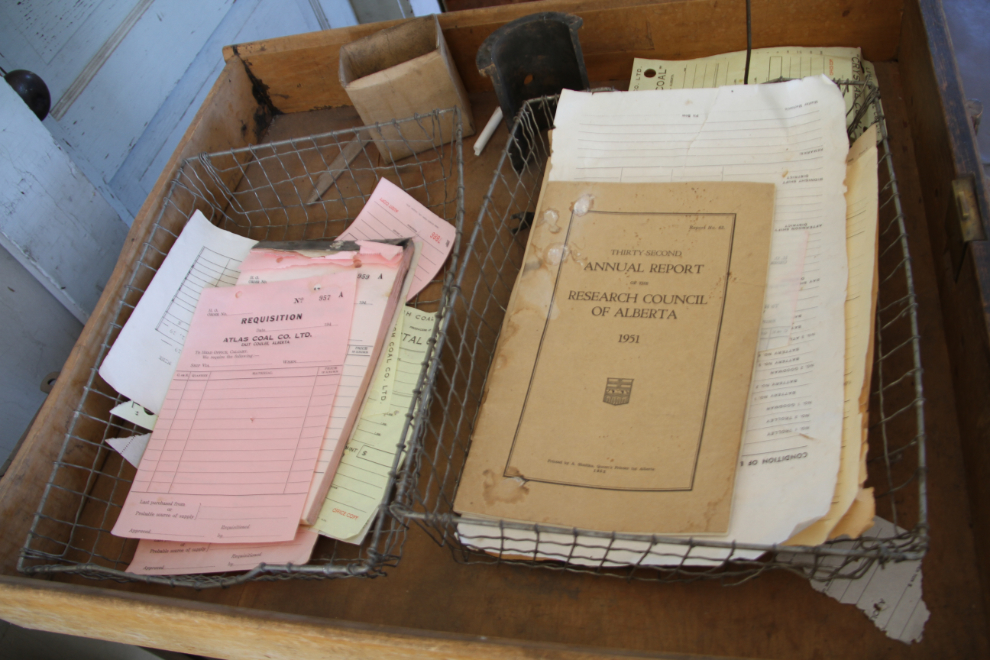
Some places at the mine, like this office, look like the next shift should arrive to start work any time.
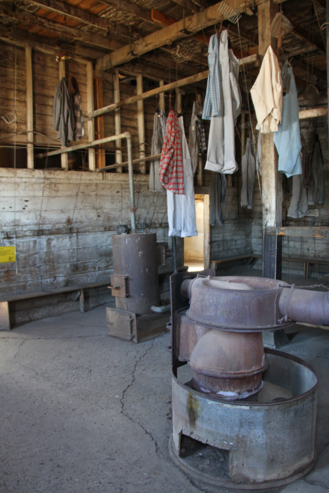
Here at the wash house, mine workers would change before their shift, and shower and change before going home. The tin-lined shower gave me the creeps, looking very much like the “showers” from the 1940s that I saw at the Dachau memorial site.
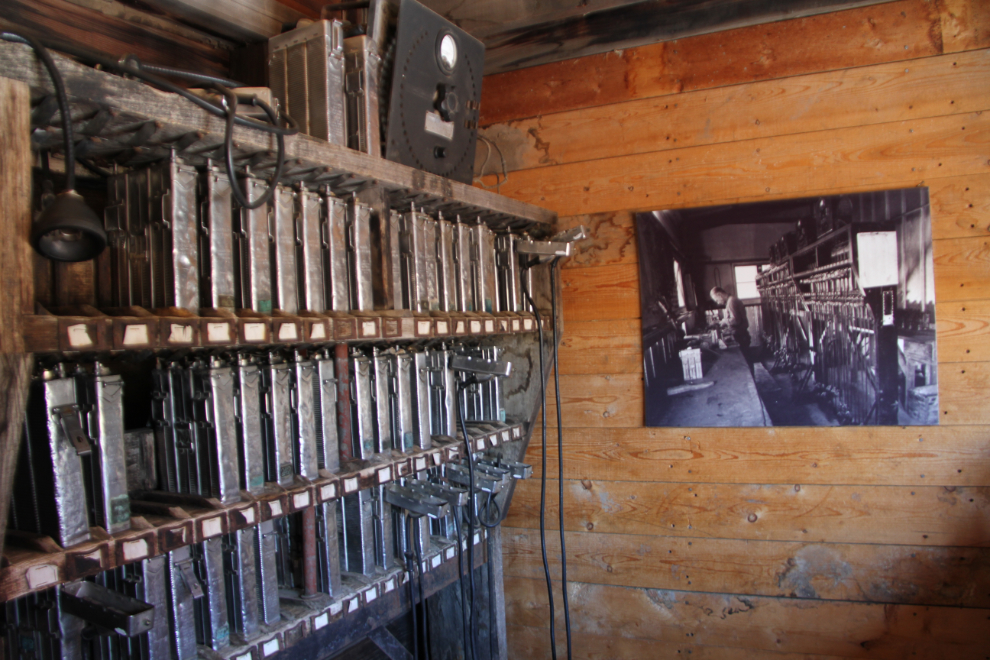
A wall of batteries for the headlamps that came into use after carbide/acetylene lamps were phased out.
I really would like to go underground again. The experience of working underground at the Granduc silver mine 40+ years ago is still vivid, and I recreate a bit of it every chance I get.
A final look at another one of the trucks used to haul the coal.
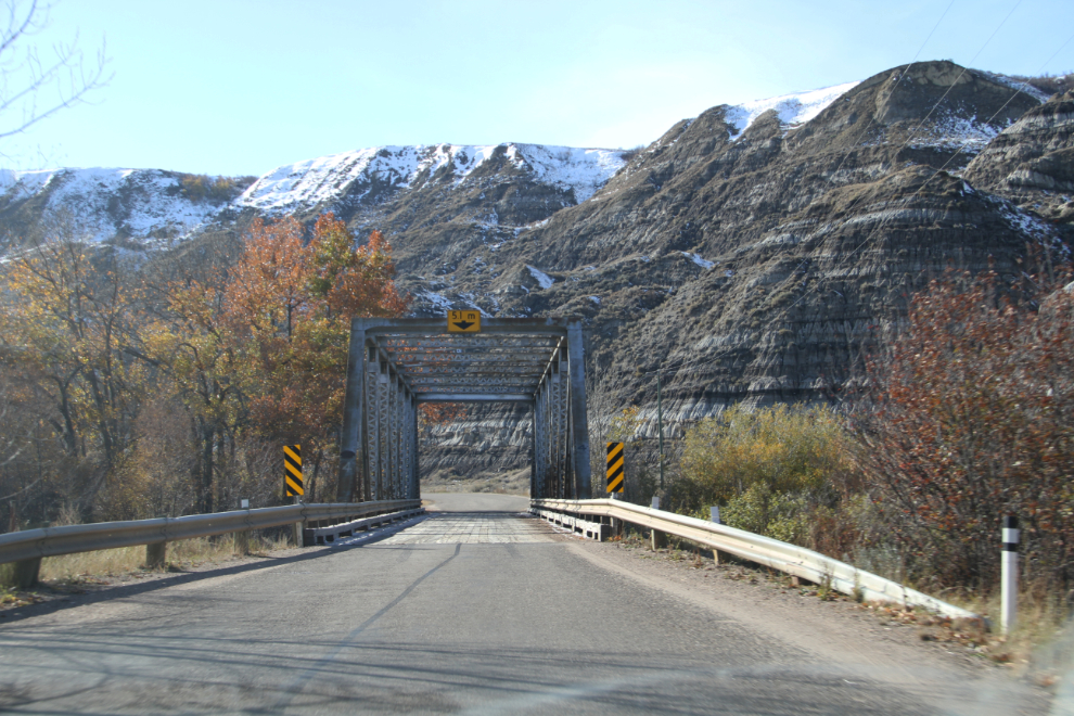
From the Atlas Coal Mine, we retraced our route back to Rosedale, then headed south on Highway 10X to see the famous curvy “11 Bridges” route to the former coal town of Wayne. Each of the bridges is different. This is a very popular route for motorcycle tours.
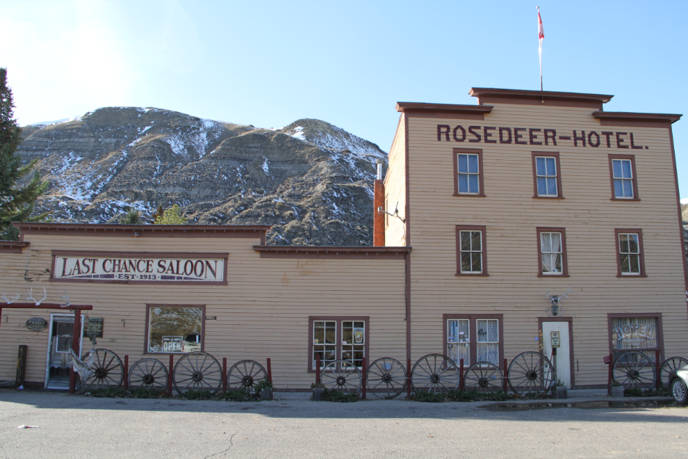
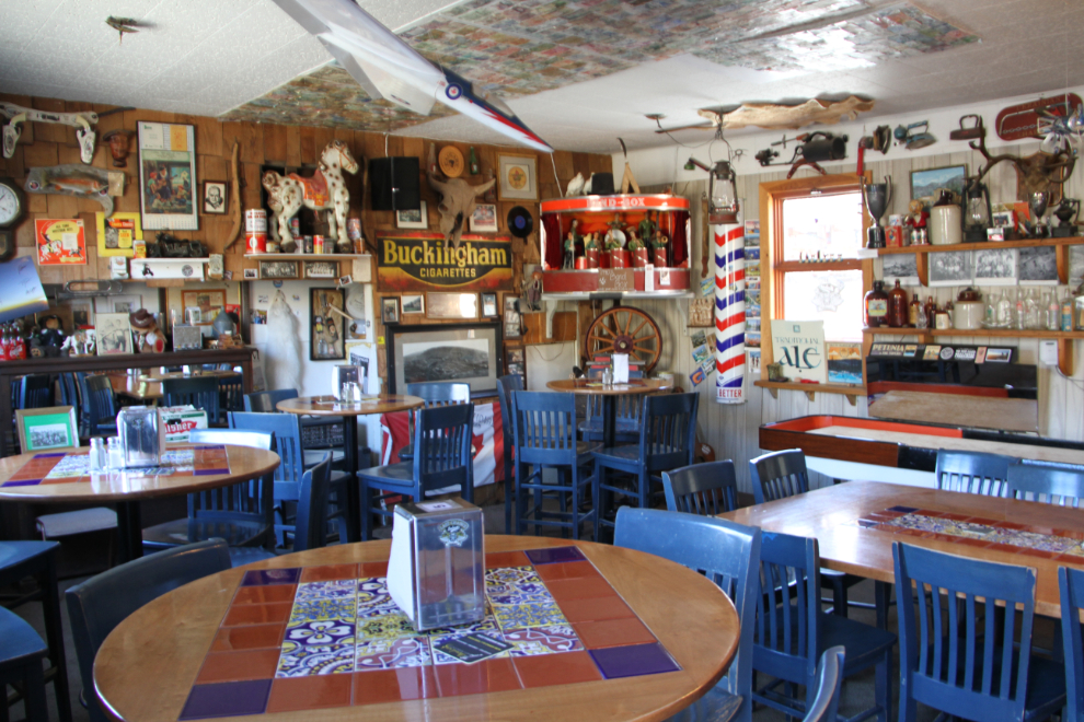
One of the few remaining buildings at Wayne is the Rosedeer Hotel, which houses the Last Chance Saloon. A peek in the door made a stop for a drink an easy choice.
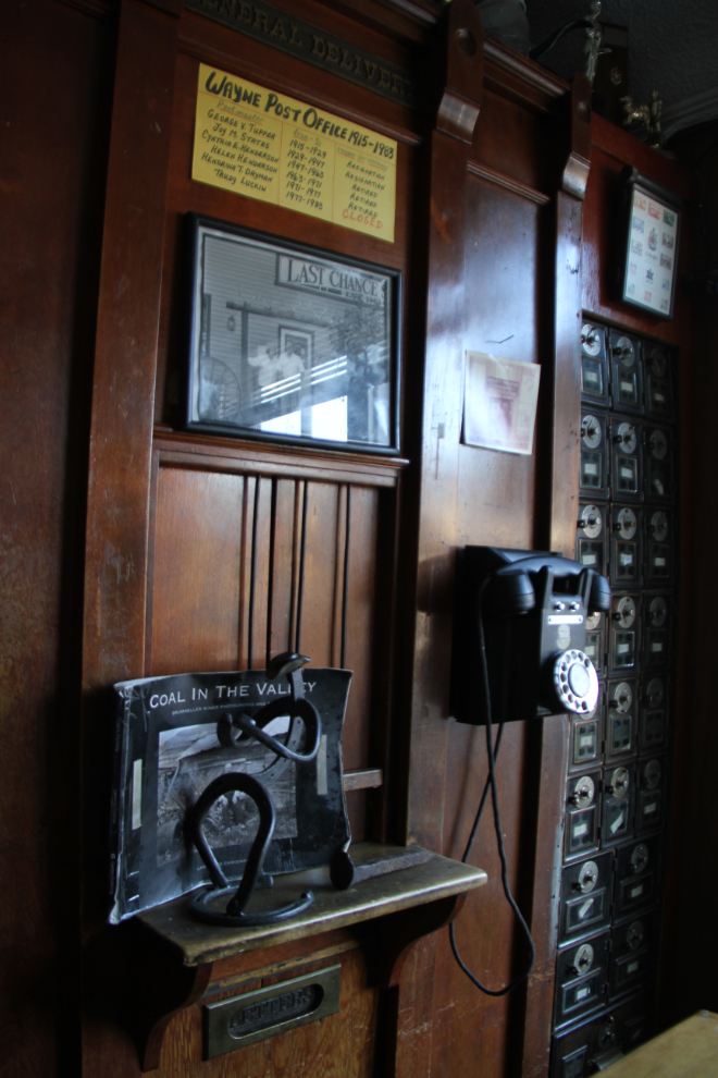
Beside our table at the Last Chance was the wicket and box area of the former Wayne Post Office, which operated from 1915 until 1983. In those 68 years, there were only 6 postmasters, all of them women after the initial man.
There is all manner of memorabilia and “stuff” displayed around the saloon, which is very motorcycle friendly.
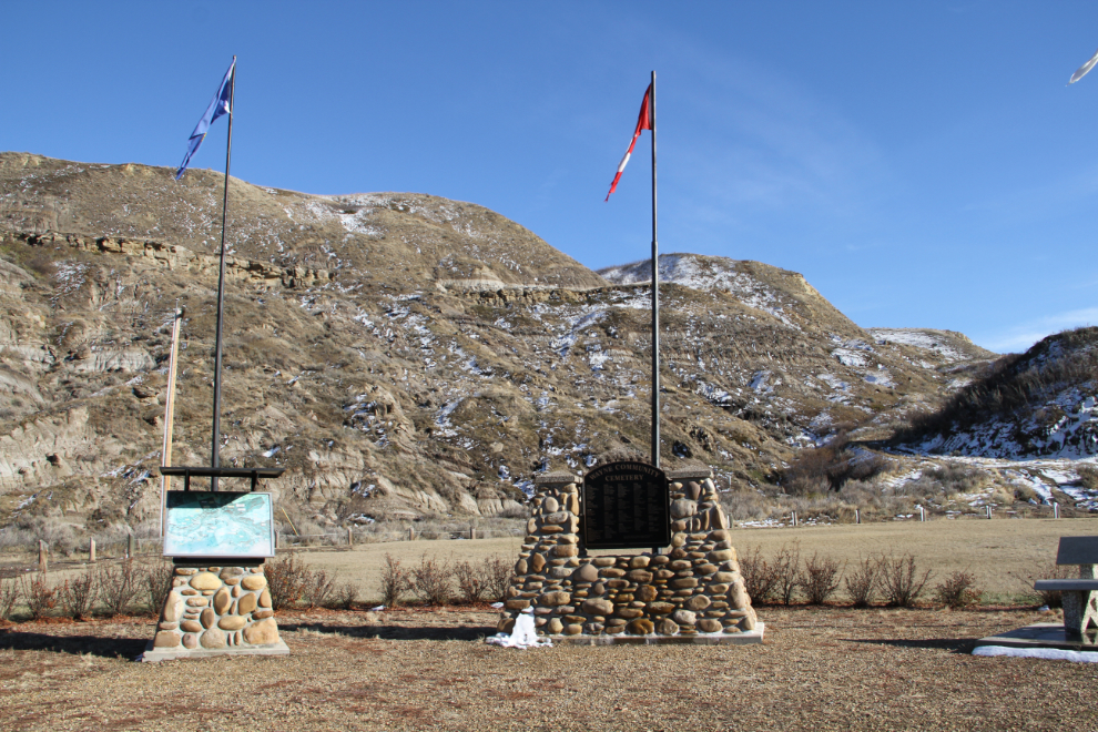
In what used to be downtown Wayne is this memorial for the Wayne Cemetery. I initially thought that the empty field behind it had been the cemetery, but it’s actually high above – access is difficult and visits are discouraged.
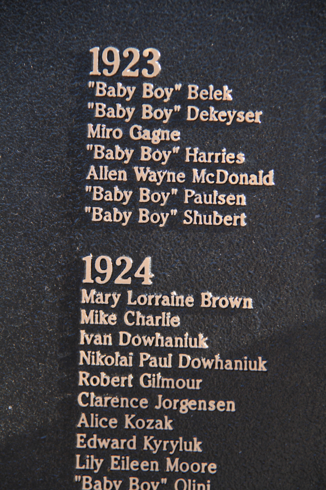
Life was hard in Wayne some years – look at the number of babies in this list of burials in 1923 and 1924.
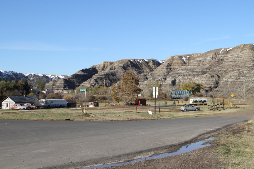
A look at Highway 10X and Wayne from the memorial.
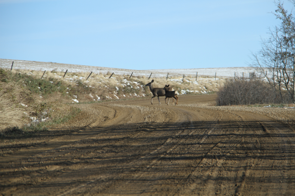
We had heard a woman ask what the best way out of Wayne was, and she was quite dismayed when the bartender told her to go back on that curvy road. Andrea and I had enjoyed the road, but decided to see what the road to the south was like. Within a few hundred meters it turned to gravel Range Road 195A, and we spooked a couple of deer.
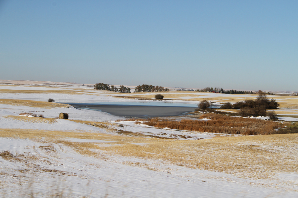
Conditions on what became Range Road 195 weren’t great, but they weren’t bad either, and it was interesting to see what was back there – pretty much nothing 🙂
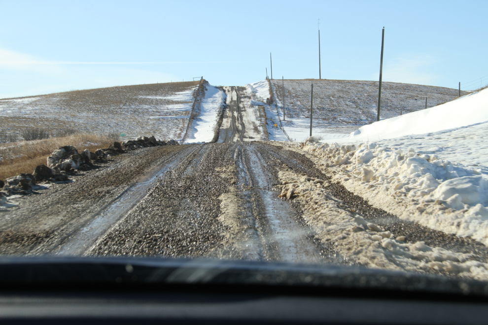
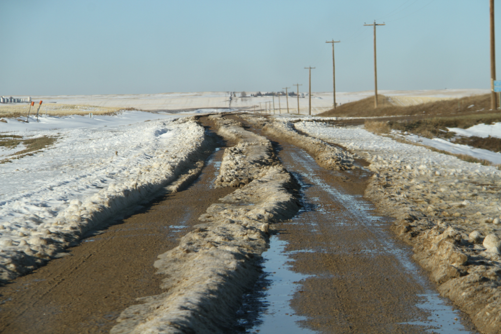
It’s pretty country, though. We were certainly surprised to see this much snow remaining from the blizzard.
The road has obviously been impassable not long before.
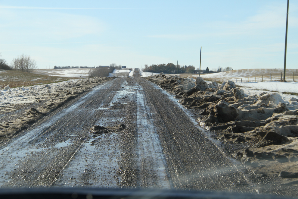
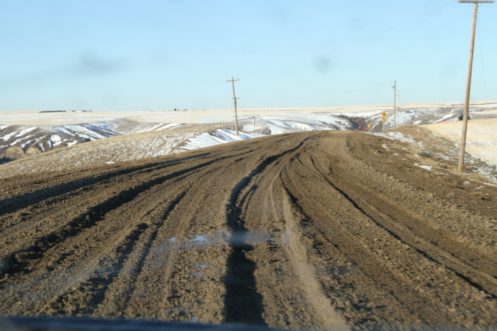
When the road turned west and became Highway 569, conditions got worse instead of better. Alberta apparently uses the term “highway” as loosely as we do in the Yukon and Alaska! Andrea’s new Honda Civic was bottomed out often, and it was a struggle to keep moving in places like the one in the next photo.
Andrea pulled over at a wide spot when she saw a big pickup coming on what was now Highway 841, and when he fishtailed through the mud we weren’t exactly encouraged at the likelihood of getting through successfully, but pavement couldn’t be far away.
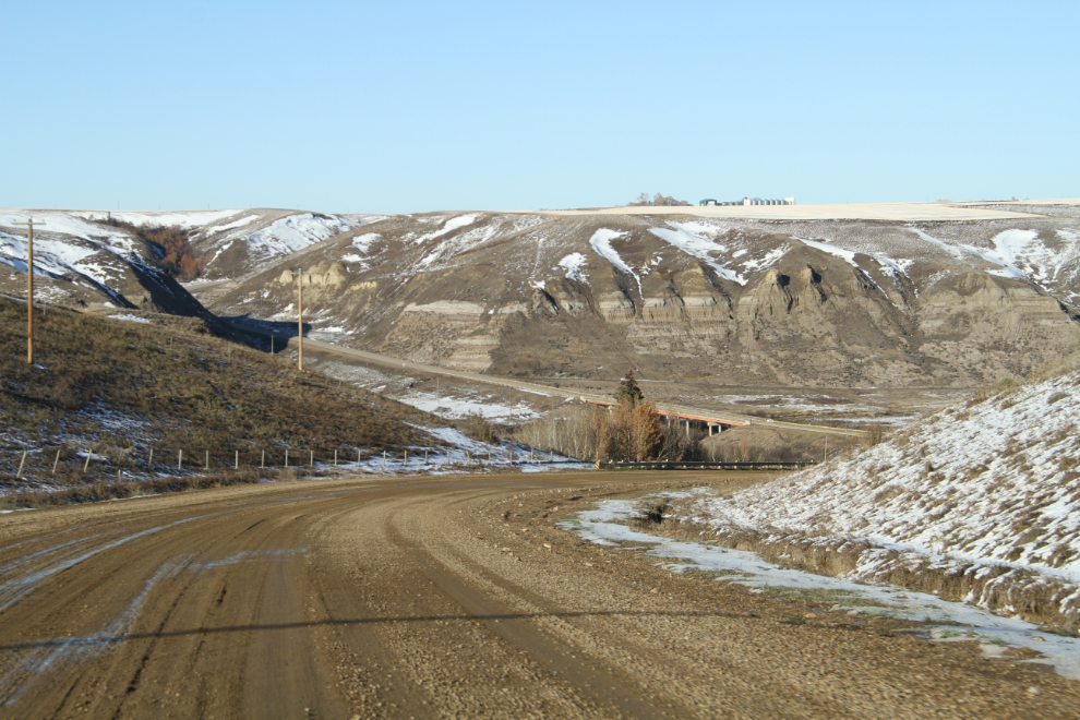
After just a couple of kilometers of deep mud, we could see pavement starting at the bridge ahead.
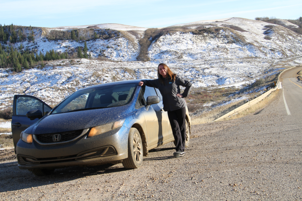
Taking a breather at the pavement, checking for damage, and getting a photo of Andrea’s appropriate “hero” pose! 🙂 We had actually only been on the gravel roads for 30 minutes but it felt like much longer – it would have been great fun in either of the Jeeps that our spouses drive!
When we got back to Highway 9, we were only 3km west of Drumheller. It was a nice calm drive back home from there. It had been an excellent day of exploring!