A drive to Kluane – hoar frost and sheep
Yesterday started off as a drive into Whitehorse to pick up a new phone, but kept evolving and turned into a superb drive to Kluane Lake and back – 8 hours, 511 km. I had taken some extra photo gear and clothing with me with a drive of some sort in my mind as a possibility, which made it a reasonable decision – or series of decisions, actually.
I had bought a Google Pixel 7 on a great deal from Virgin Plus (my total cost for the phone was $24), and Cathy had picked it up from The Source – I was back there just after they opened at 10:00 to get everything switched over from my old Samsung Galaxy S8. I had removed all the photos from it a few weeks ago so the data transfer only took a few minutes – the clerk said it takes 4-5 hours for some people. I thought I could charge the new phone in my car, but it turned out I didn’t have the right cable so it died fairly soon.
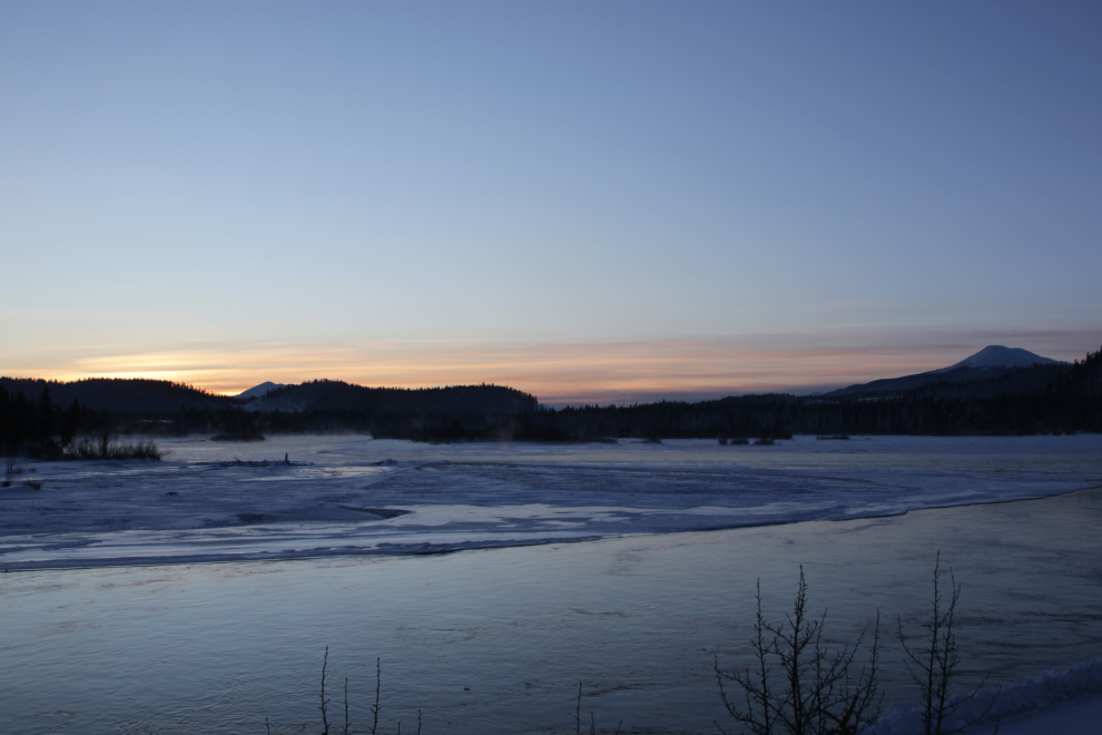
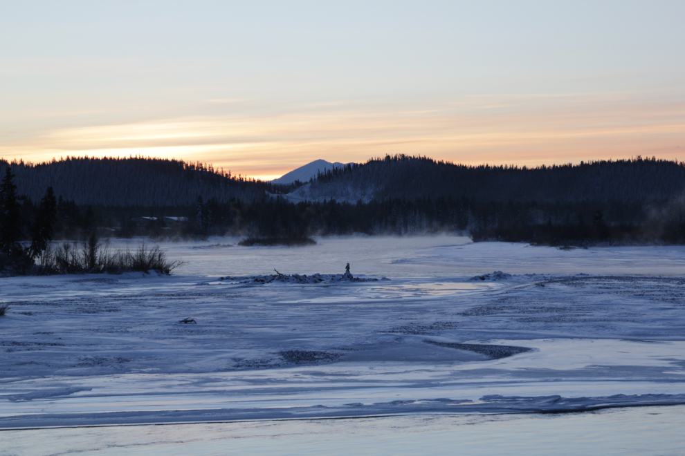
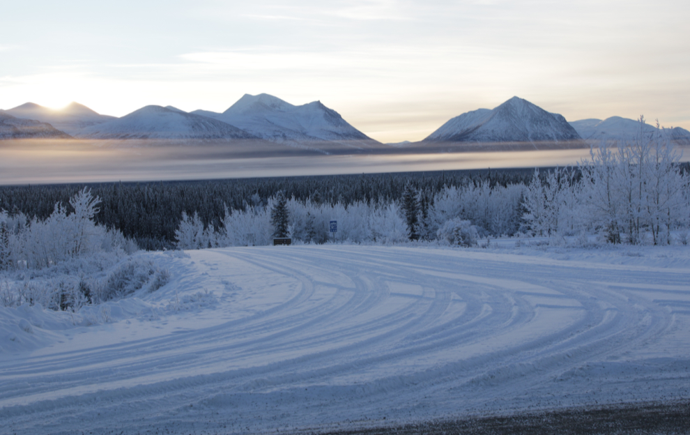
Leaving the store, I started to drive north out of town but then saw a good sunrise possibly happening, so turned around and went back to the Yukon River at the south end of downtown. The next 2 photos were shot at 11:06, 1 minute after official sunrise.
Since I was in the area, I decided to go to my optometrist to order a new pair of eyeglasses I had speced out a couple of weeks ago. That took quite a while, but by 11:45 I was on the Alaska Highway about 20 km west of Whitehorse.
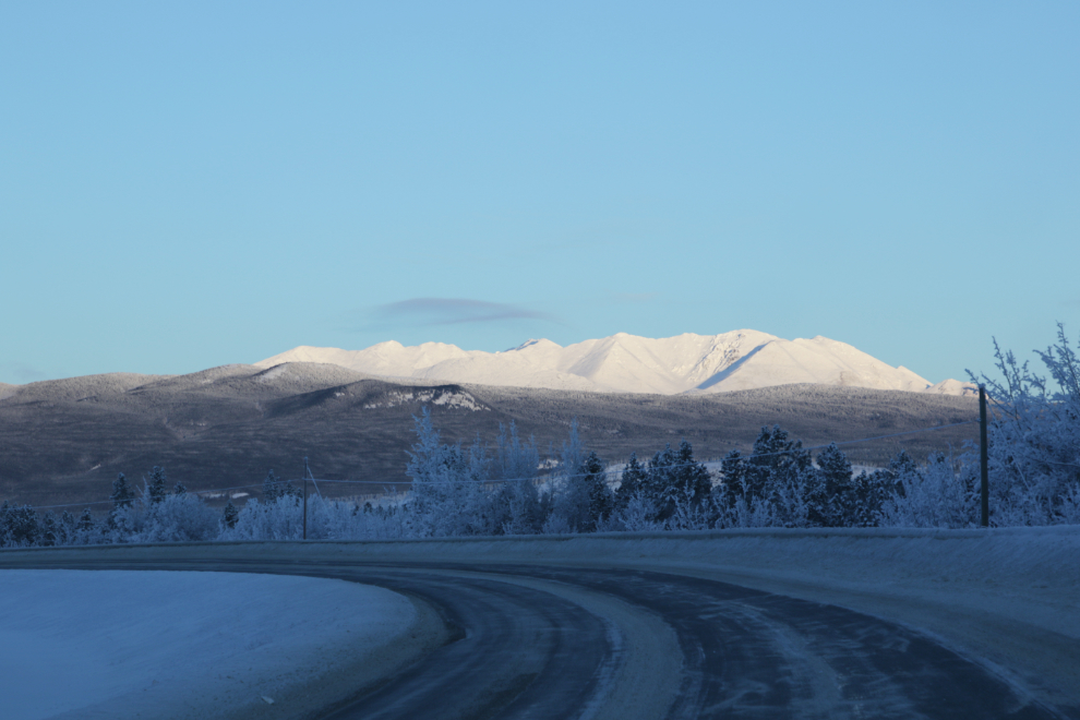
With the sun at a very shallow angle this time of year, it takes a very long time for the sun to reach into the valleys, but at 11:48 the peaks were lighting up beautifully.
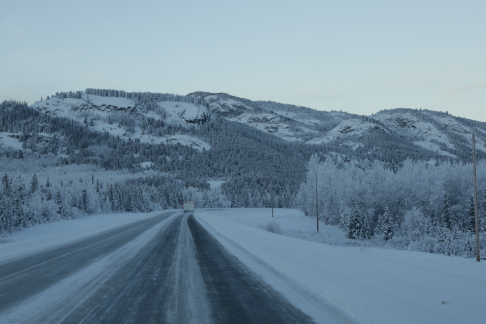
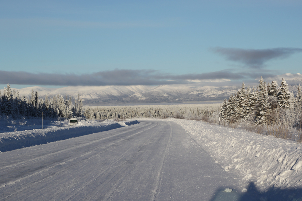
A minute later I was approaching the large pullout (at Km 1454.1) that looks over the Takhini River where the old Dawson Overland Trail used to cross it. That trail was used when the main “highway” to Dawson City, the Yukon River, was frozen. There was a lot of mist in the air ahead, reducing the visibility of the mountains a lot.
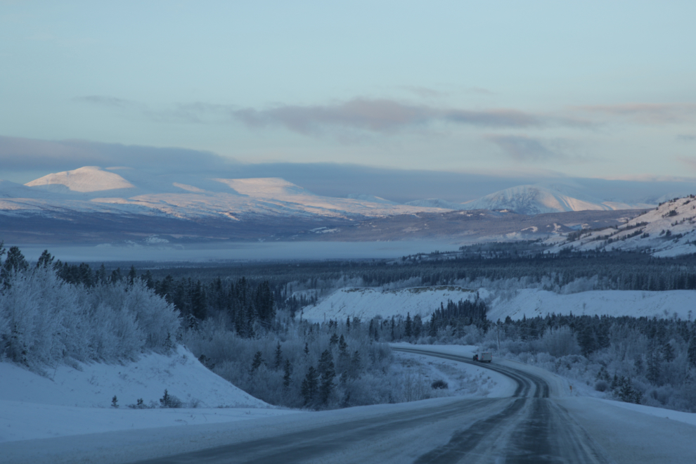
The views ahead and to the right near the Takhini Salt Flats, which are at Km 1467.9. I never have hiked in to them – maybe this year 🙂

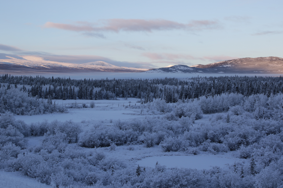
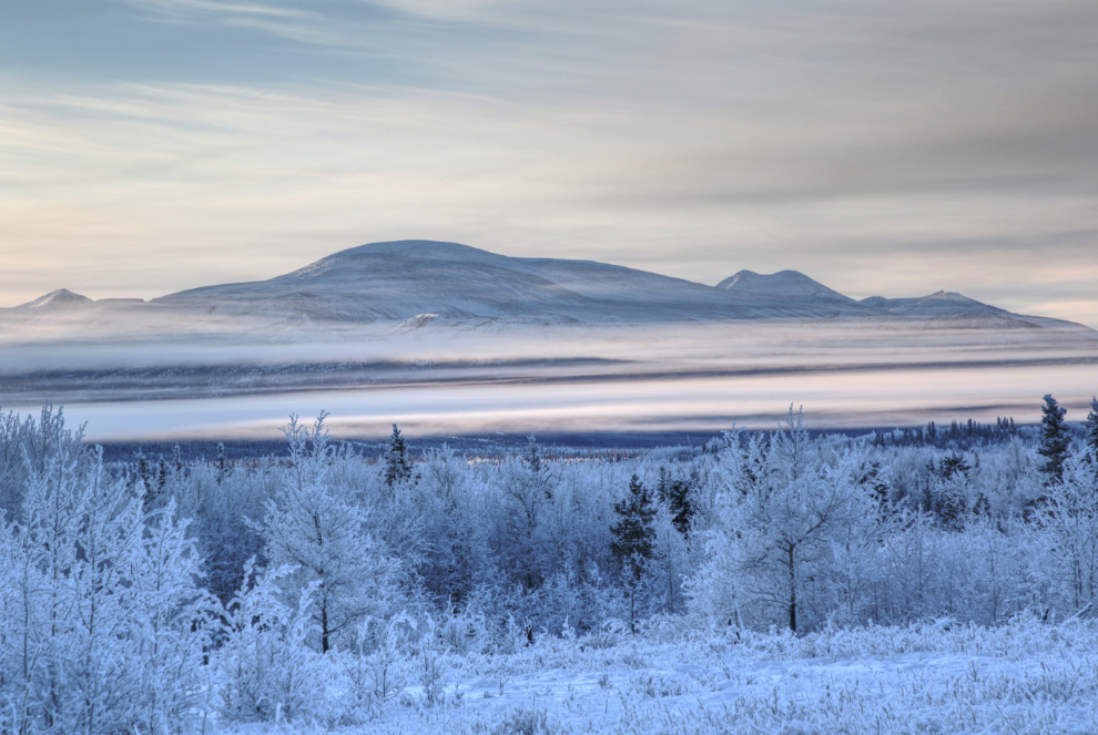
I was soon into the upper Takhini River Valley, where I made a few stops to photograph the interesting layers of mist (occasionally mixed with smoke from woodstoves).
At 12:15 I reached the road to Kusawa Lake and the popular Kusawa Lake Campground.
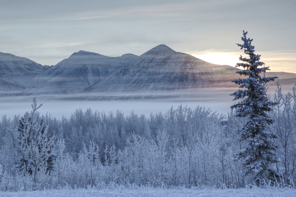
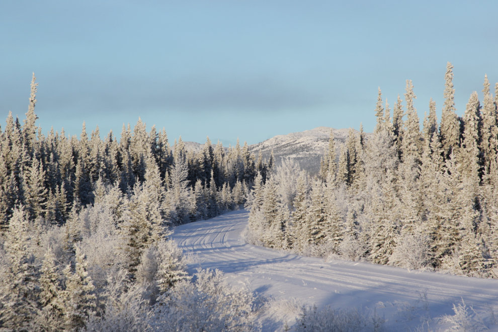
All that mist was making the hoar frost on everything thicker and thicker as I continued west. The next photo shows a section of the old highway that was bypassed decades ago but is still drivable for a couple of kilometers.
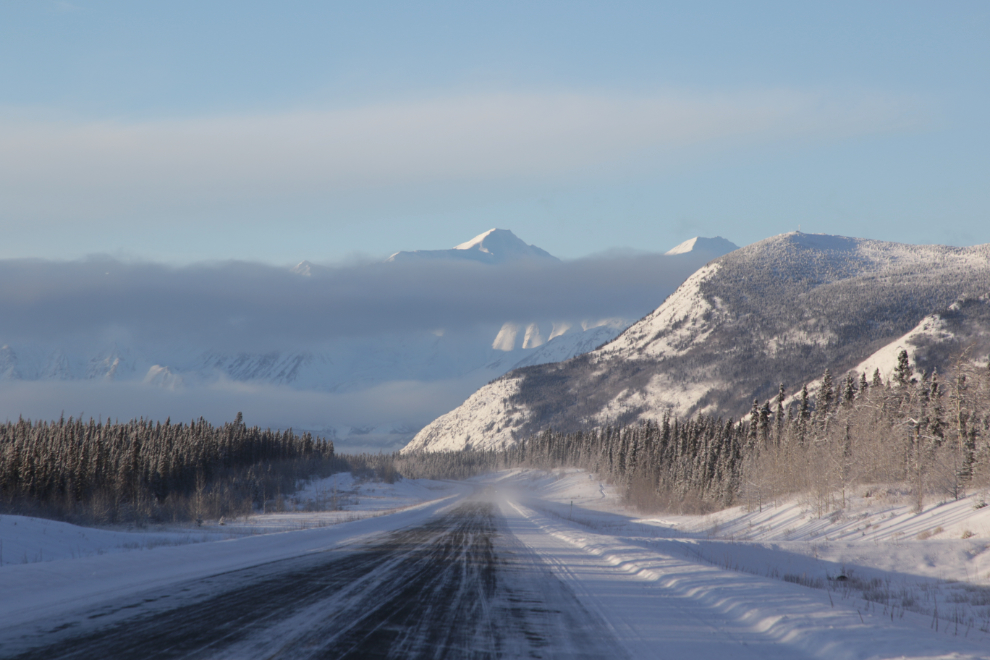
The highway ahead at 1:15…
Just around that next corner is the Pine Lake Campground just east of Haines Junction.
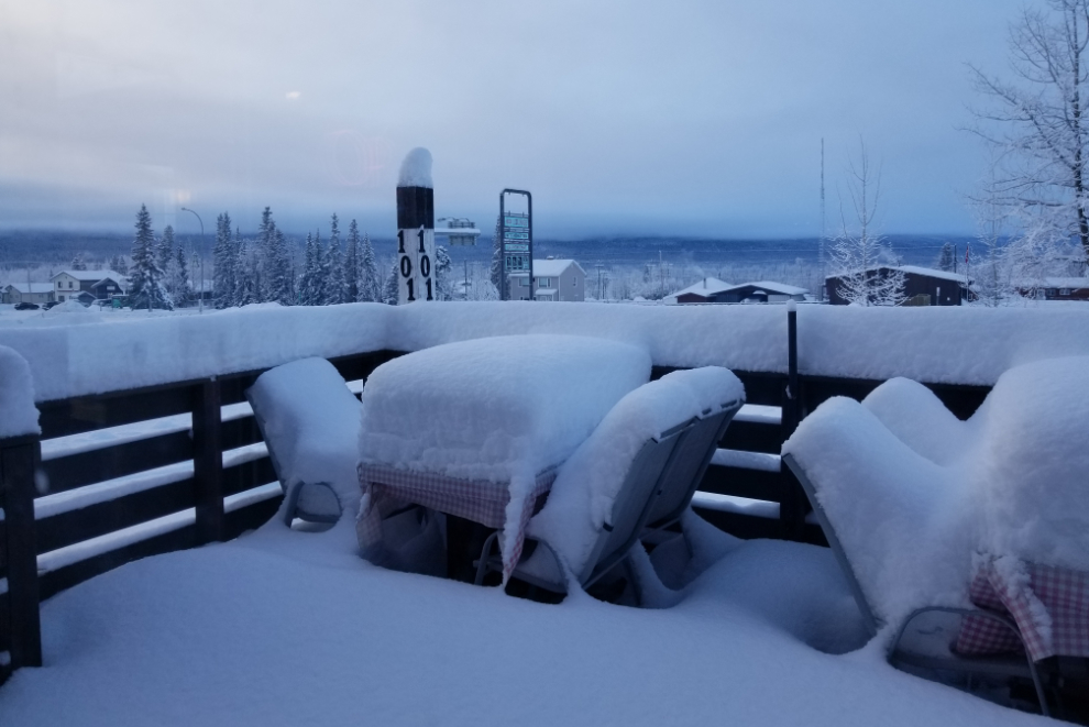
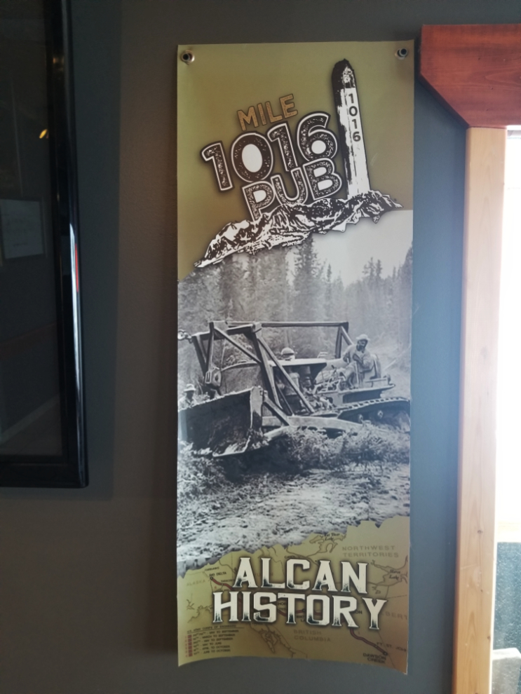
I’m always pleased when a drive is timed so a stop at the Mile 1016 Pub in Haines Junction works out, and this was one of those drives 🙂 The next photo shows the view from my table – with the spectacular peaks of the Kluane Range hidden by cloud.
All set up for a meeting apparently.
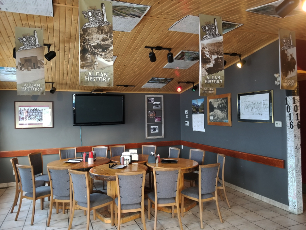
I love the banners, each of which has a different historic photo.
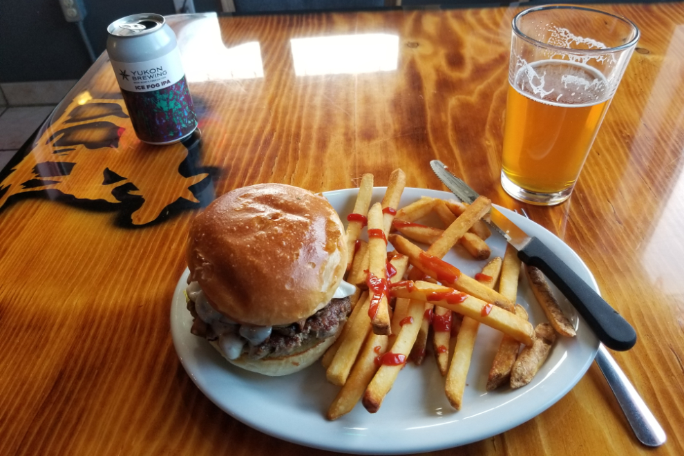
A mushroom Swiss burger arrived very quickly and was excellent, as always. When I had stopped here, I wasn’t sure how far I would go on this drive, but by the time I left I thought that Kluane Lake, another 2 hours or so round trip, was possible.
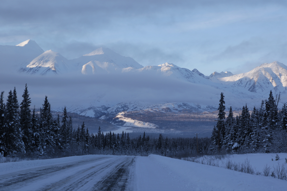
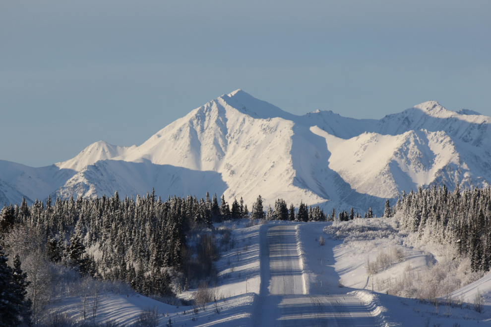
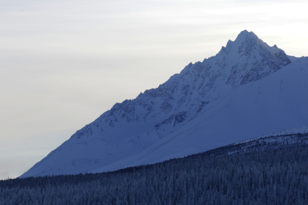
The snow got dramatically deeper climbing to Bear Creek Summit, which at 1,004 meters / 3,294 feet is the highest point on the Alaska Highway west/north of Whitehorse. The next photo was shot just west of the summit.
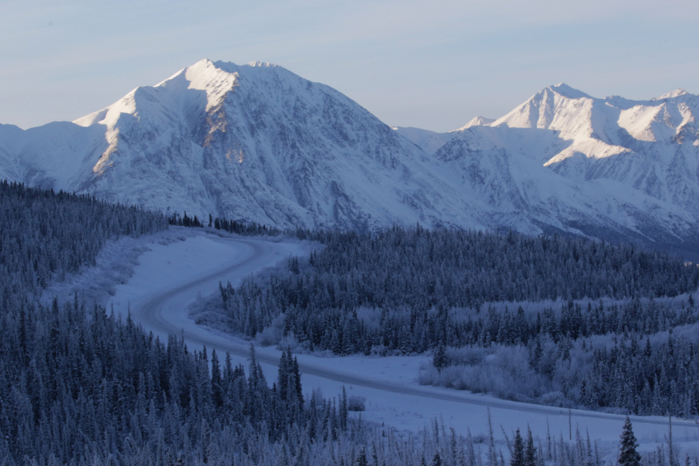
The spot in the next photo often stops me, but requires a lens change to get that effect – this was shot at 330mm on my Canon 100-400 lens.
It had been clear for some time on this drive that I’ve lost my detailed memory of the highway. I now have only the vaguest idea of where I am, with no idea of what’s coming next 🙁
Made it – Kluane Lake! Normally I’d stop at the big pullout where I’ve spent many nights in the motorhome, but didn’t this time. It was now 2:45. That’s Sheep Mountain dominating the view.
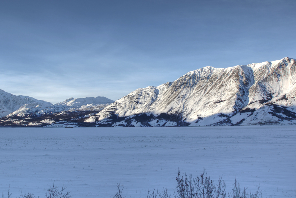
It’s hard to imagine how many photos of Sheep Mountain I have shot from this location just before the Slim’s River Bridge, but it’s a lot 🙂
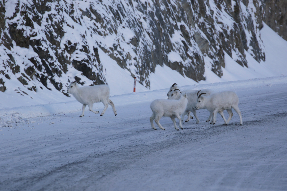
A small herd of Dall sheep on the road surprised me, well camouflaged in the snow. I drove slowly past them, then did a U-turn and came back – it was time to call it a day anyway. The sheep were the highlight of a great day, and 8 photos of them follow.
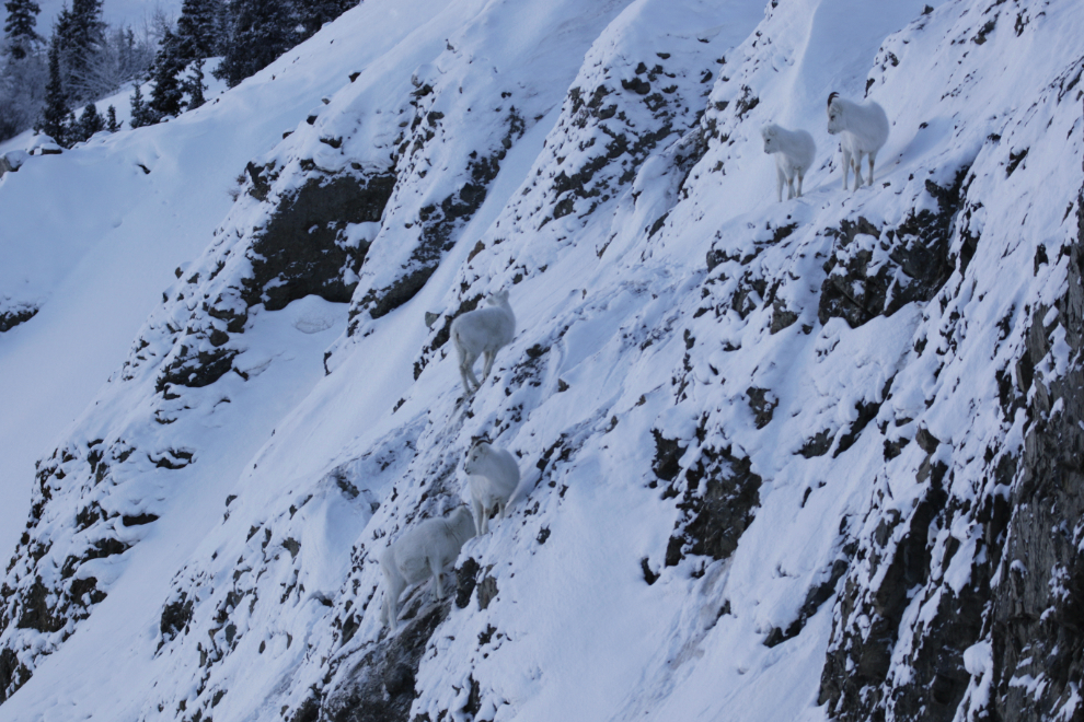
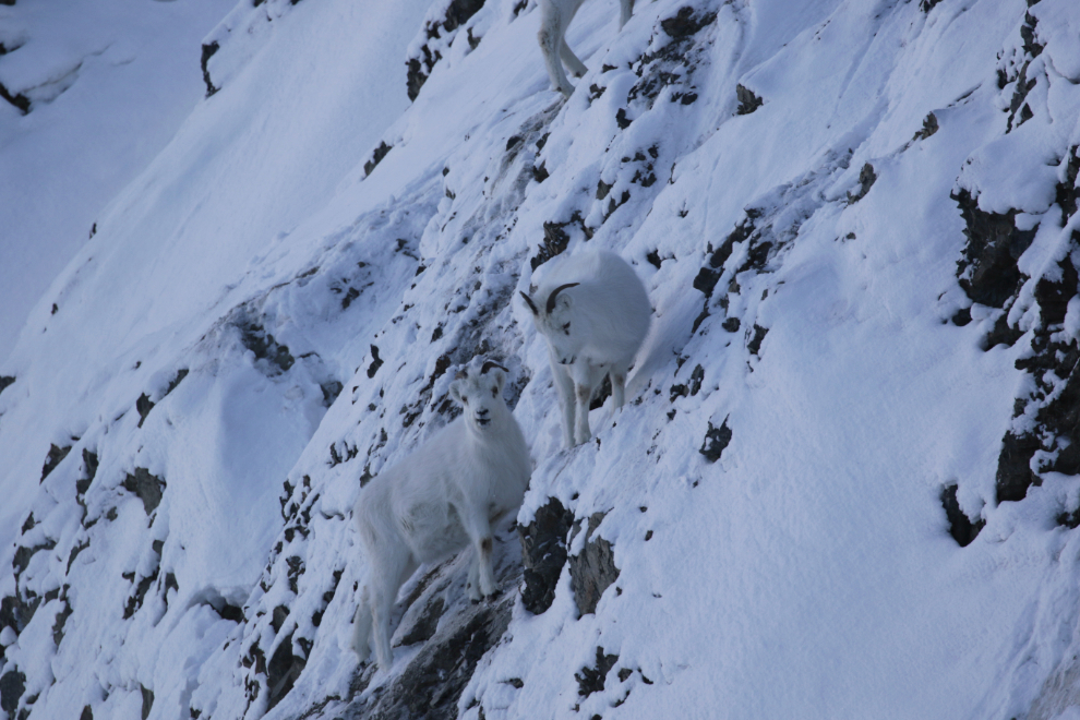
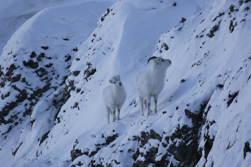
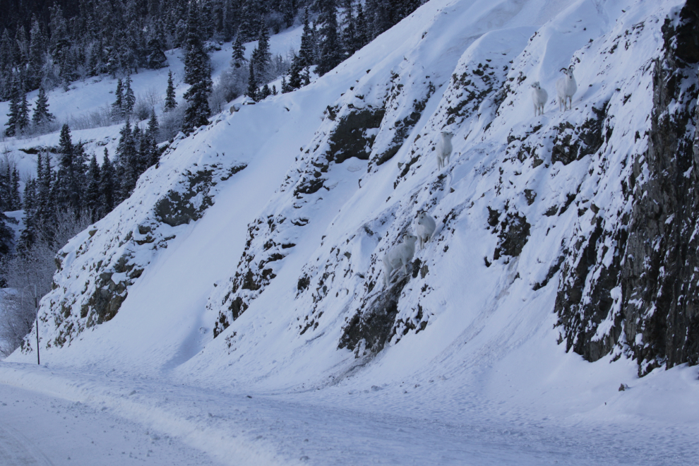
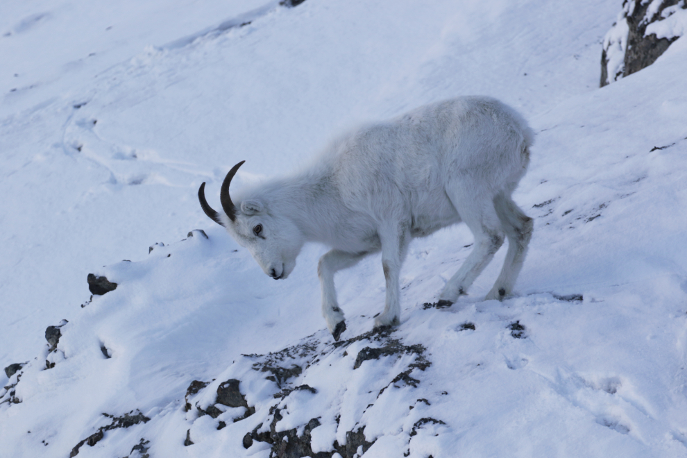
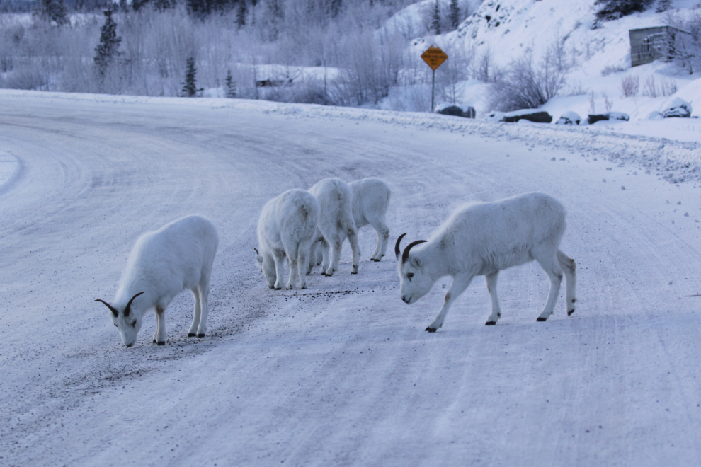
When it was time to leave, I pulled over as far onto the lake side of the road as I could to go by them, as the mountain is their safe place. That worked, and they hardly budged. I should pull the video of that from my dashcam – I’ll see if I can figure out how. I stopped again once I was past them, for some more photos.
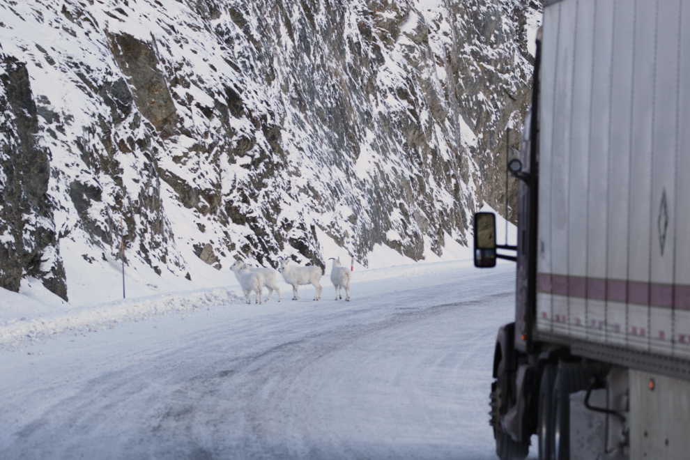
There were very few vehicles on the road past Haines Junction. I saw a semi coming so threw on my 4-ways and then got out with my big lens out so the driver would know what was going on. He crawled by the sheep and they didn’t even move off the side of the road 🙂
The classification and naming of the sheep have recently changed. Once these were Dall sheep, and while that’s not wrong now, they’re called thinhorn sheep in broad terms. This screenshot gives a glimpse at it, and Doug Caldwell goes into a more complete description of the changes, at the Yukon Wildlife Preserve blog.
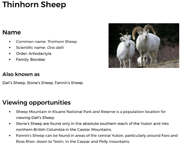
Headed home now, I stopped for a shot of the historic Alex Fisher cabin just past the sheep, at a couple of minutes past 3:00.
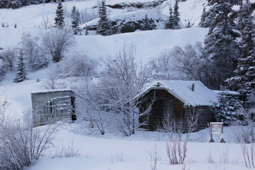
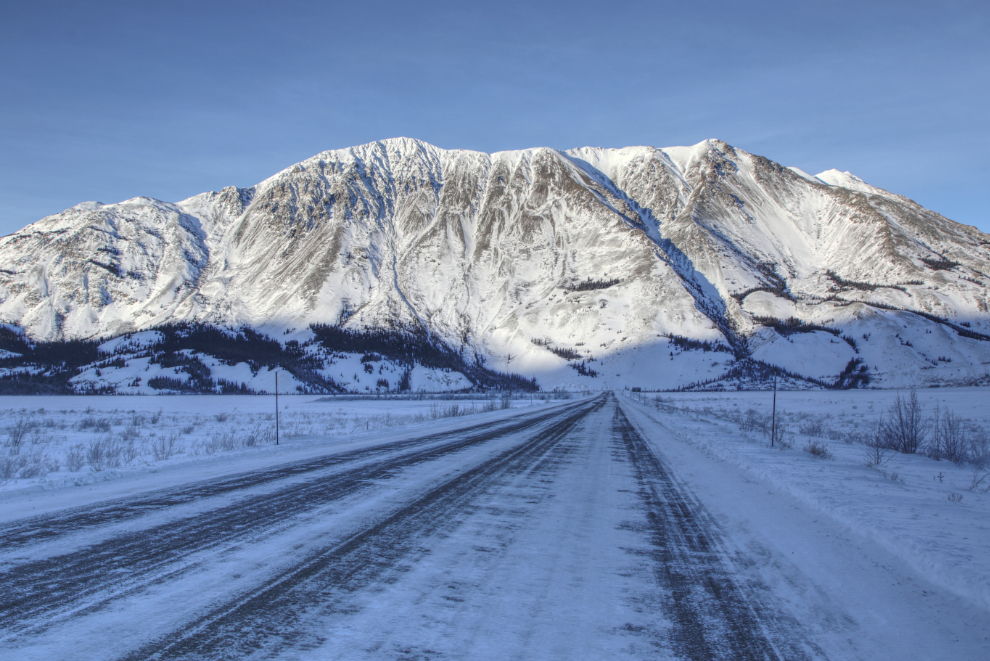
I stopped just past Christmas Creek to get a photo of the dramatic profile of what I think is Mount Archibald. It’s 2,588 meters 8,491 feet high.
And then a shot looking back over Christmas Creek, another location I have many photos of but never tire of.
I was very much watching the clock now. With my phone dead, I had no way of letting Cathy know what I was doing. I had cancelled my inReach subscription quite a while ago when I quit travelling, so even that wasn’t an option. So I really wanted to get home before she did, at about 6:00.
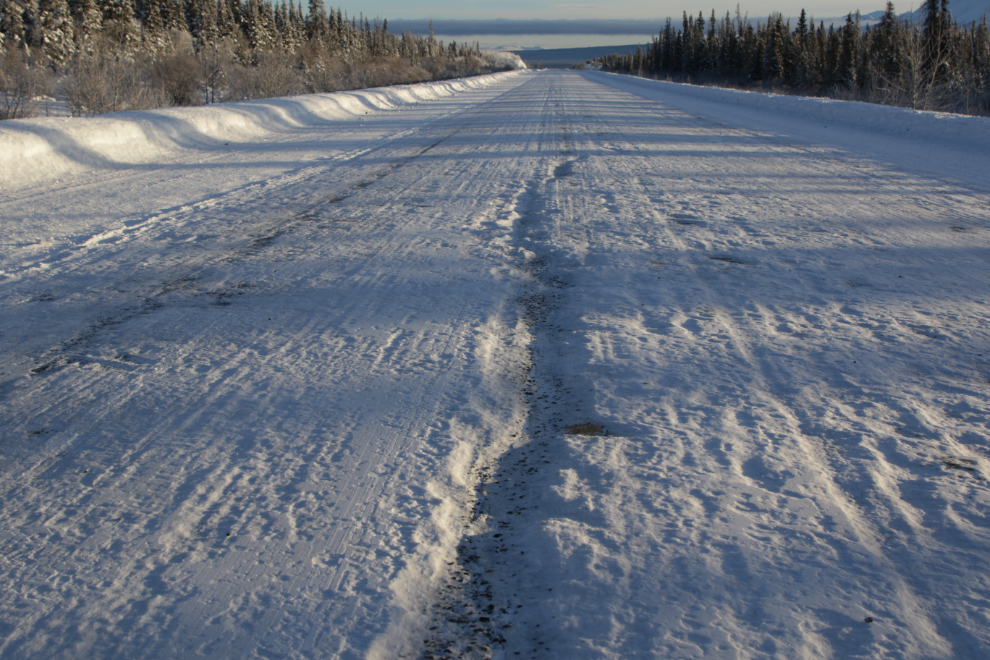
It’s often said that driving is better here in the winter because all the potholes are filled. That’s not always true, though. Sometimes a snowfall will be followed by a bit of a melt, then when the wet snow is all chewed up by traffic, it freezes again, leaving a very rough surface. Graders have taken off a bit of the roughness on this section, but it’s still very rough. Luckily, it was only for 10 miles or so.
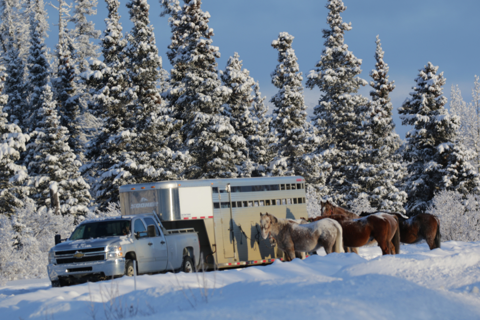
I had been hoping to see some of our wild horses on this drive. I had no luck with them, so stopped for a photo of these domestic ones getting a break from their trailer near the Jarvis River.
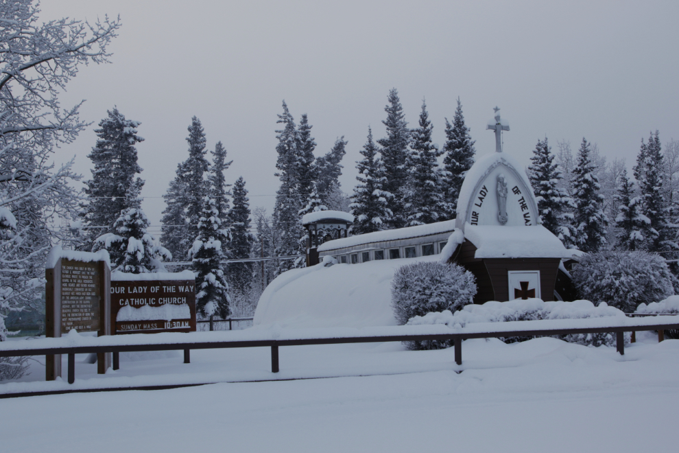
The historic Our Lady of the Way church back at Haines Junction was worth a stop.
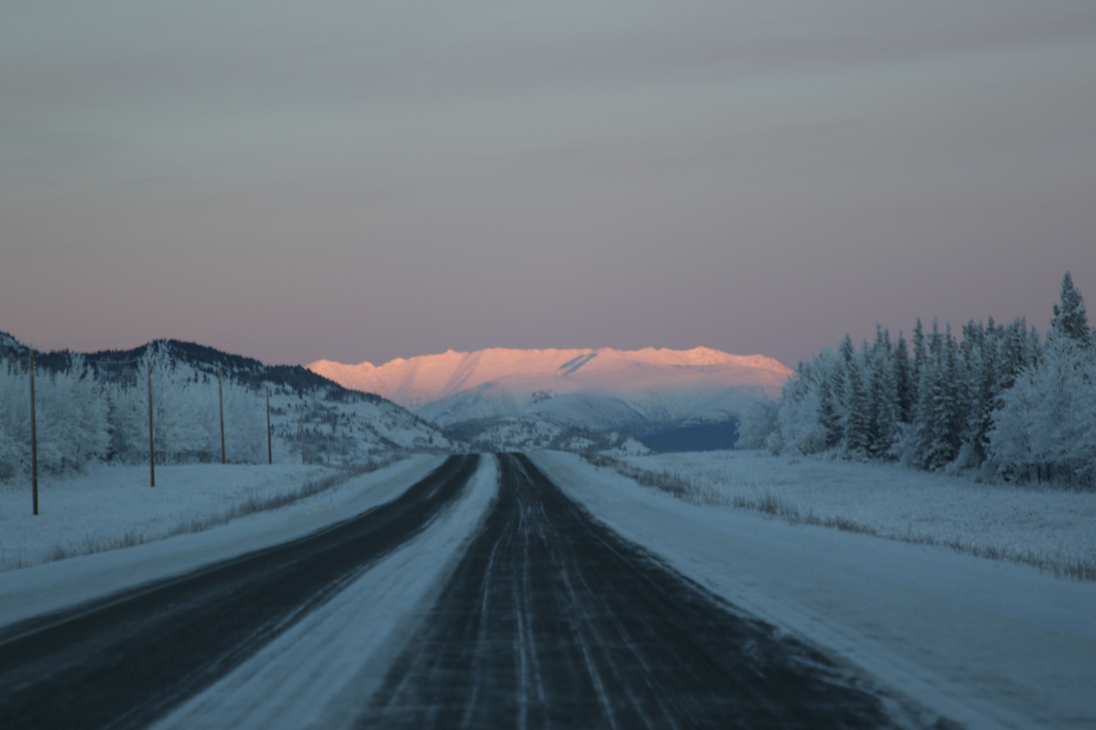
A final photo of the wonderful evening colours, at 5:00, 4 minutes before official sunset. I got home at 5:55 and Cathy was late, arriving at 6:20.
This morning, I’m deeply grateful to be able to do a drive like that again – among many other things, it gives me hope for a good summer ahead.
I really enjoyed your sheep photos…been lucky enough to see them that close dozens of times on the road from Anchorage AK down to Portage, Turnagain Pass, etc. What luck to be able to enjoy them in that close up environment. Did you hand hold the big lense? (Is one of the white body one’s?). Good and steady as you went the entire day! As always, thanks for sharing.
It does my heart good to see you out exploring again and oh what beautiful pictures. I will never see what you’ve seen up there in the winter, thanks for sharing. Love the sheep and the lit up mountain peaks.
Thank you, Barb. I don’t have words for how good this feels. I have a long way to go yet but yesterday was so wonderful 🙂