A bucket-list helicopter tour of Kauai
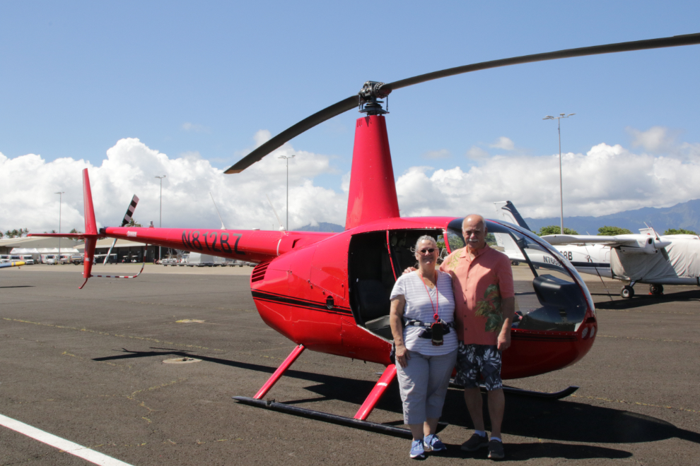
This was the first visit to Kauai for both Cathy and I, and since we booked the cruise I’d been dreaming of doing a bucket-list flight along the Na Pali coast. Cathy booked us with Ali’i Air Tours, in a Robinson R44 with the doors off. She was only thinking about getting me the best possible experience, and was waaaay outside her comfort zone, but it turned out great.
I hadn’t mentioned yet how people keep track of what’s happening on the ship. Each evening we get one or more notices left at our cabin door. The most important piece is The Daily, a 4-page brochure that lists port times, important events on board, recommended attire for the day, and much more. You can see this day’s Daily here.
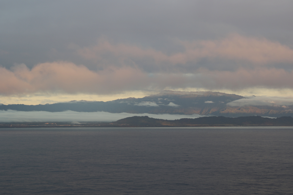
The weather had been foggy as we approached the island, and at 07:40 it suddenly appeared!
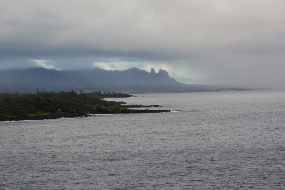
The next photo looks back at the fog back we had emerged from.
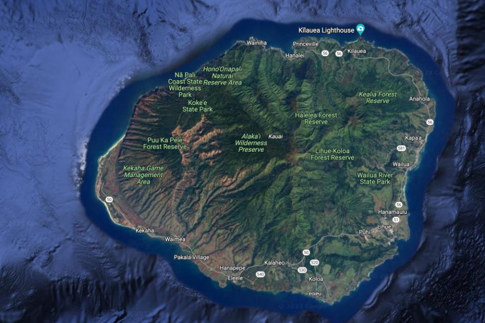
Here’s a map to see where we were going. See the large interactive version here.
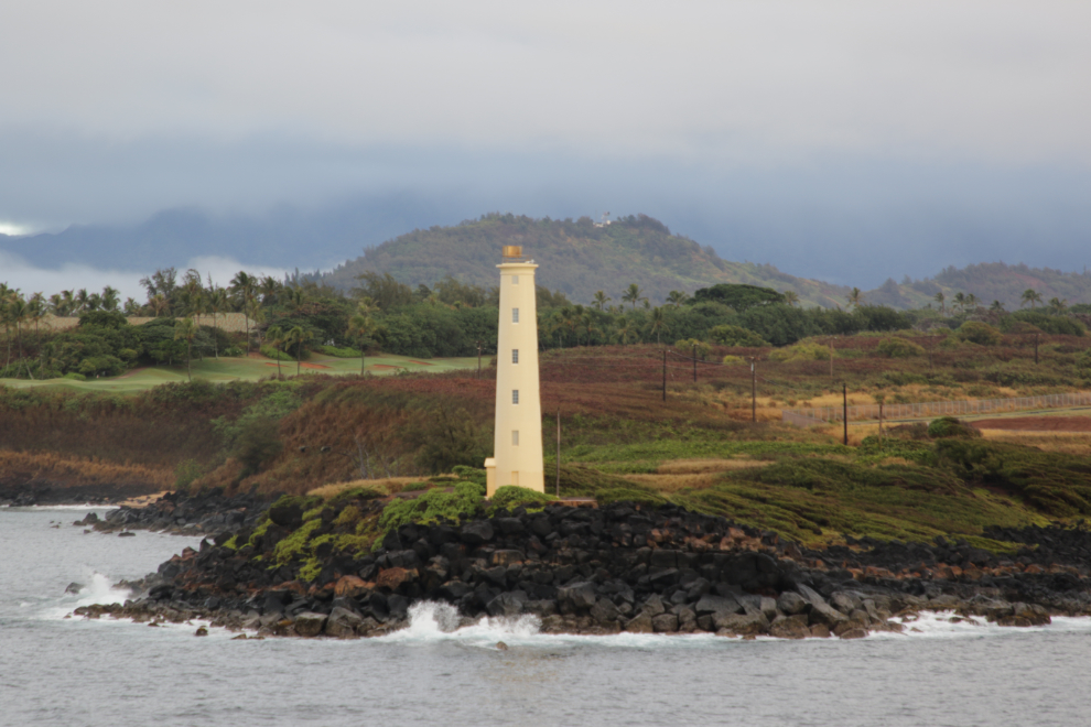
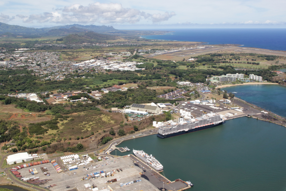
The 86-foot tall wood and concrete Ninini Point Lighthouse, built in 1906, guards the entrance to Nawiliwili Harbor, where we were scheduled to dock at 08:30. The bow of the Koningsdam was opened to passengers at 07:00 for “Scenic Cruising,” but I didn’t see anything that made going down worthwhile, and the bow cam showed few people out there.
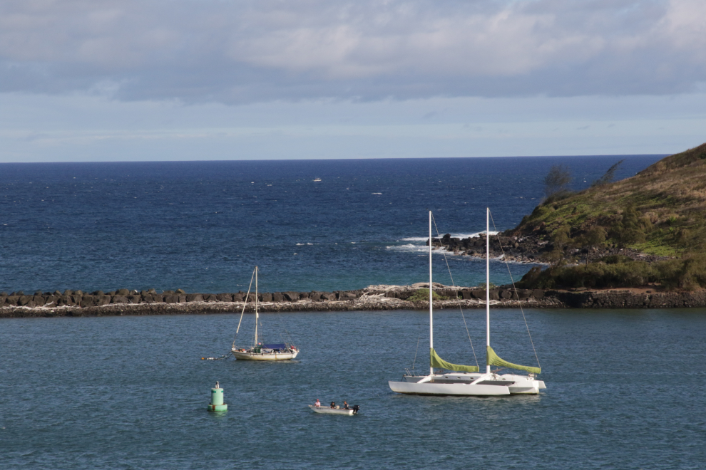
Kuki’i Point beacon is the next guide into what is a very tight harbour for a 975-foot-long ship. Behind it is Kalapaki Beach and the 4-star Royal Sonesta resort.
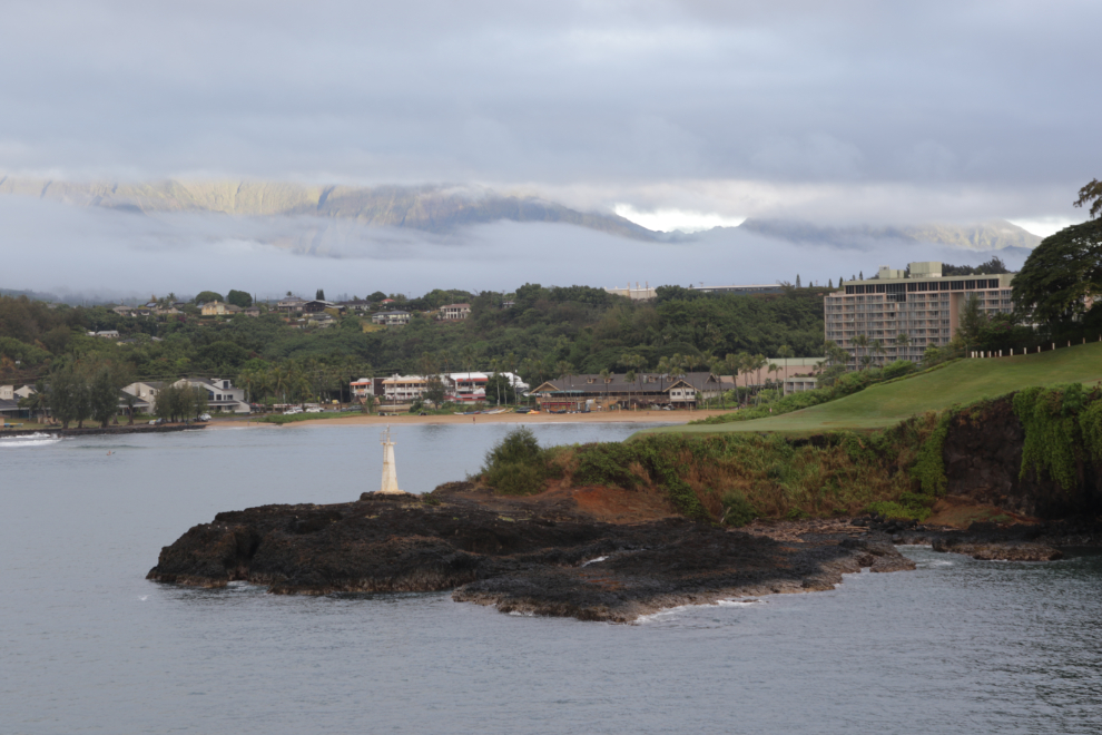
Nawiliwili Harbor, with the cruise ship terminal on the right.
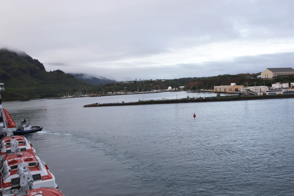
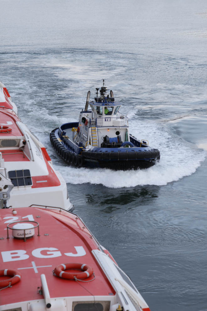
Two tugs were right beside us in case assistance was needed, but Koningsdam managed on her own.
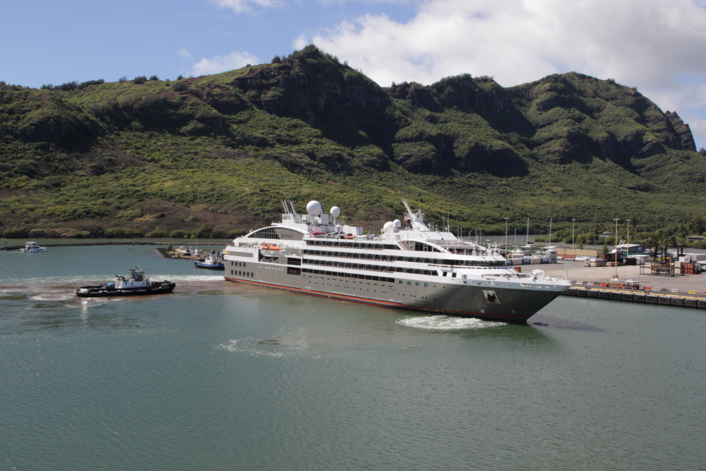
We went for our morning session at the spa, then breakfast, then I laid down for a nap to prepare for our busy afternoon. When I woke up just before noon, the beautiful cruise ship Le Boreal was beside us, coming in to dock. She was sailing from the Arctic to the Antarctic, a 92-day cruise! A friend had been on her as a cultural interpreter on the western half of her last Arctic cruise.
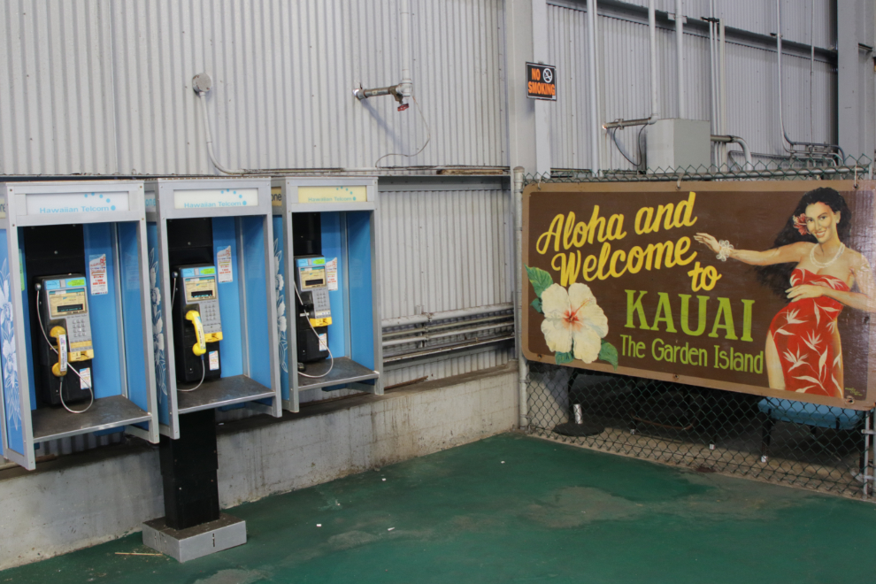
We then disembarked, with the morning rush to get off long over. While waiting for a taxi that Cathy had pre-arranged (as there aren’t very many on Kauai), I spotted this little corner of historic stuff in the terminal.
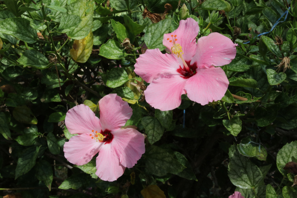
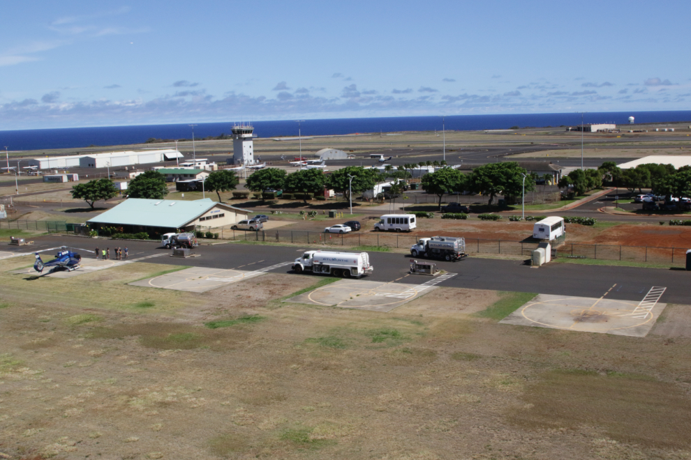
We got to the Lihue Airport way early, checked in at Ali’i, then found a bench to enjoy the sunshine that had now appeared, and the flowers and feral chickens.
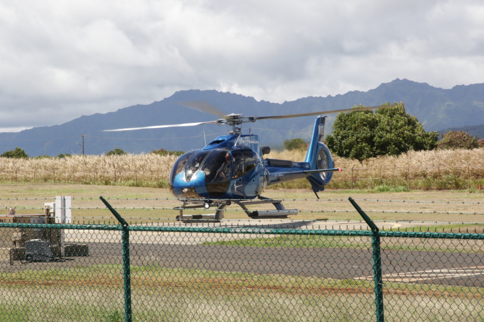
There was lots of helicopter action right in front of us, too, including N11QH, a beautiful Eurocopter EC 130 B4 operated by Blue Hawaiian.
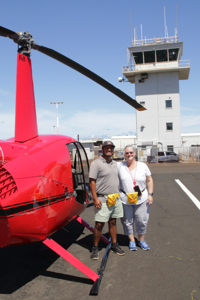
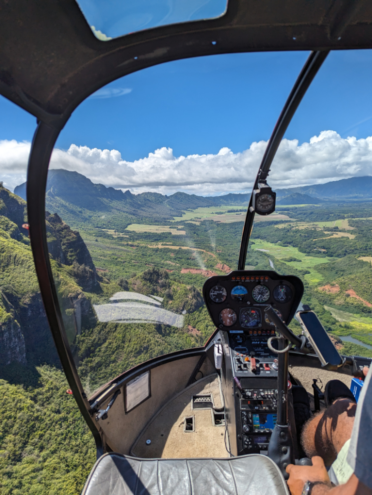
Cathy and me with our magic carpet, N812BZ, a Robinson R44 II.
Cathy with our pilot, Felipe Victoria.
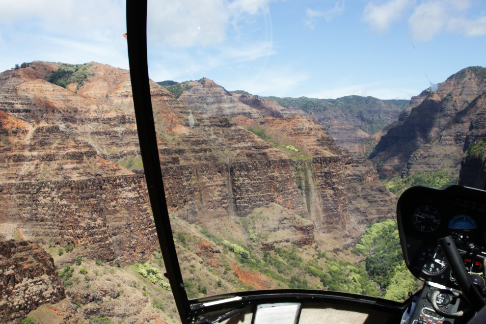
Ready to go!
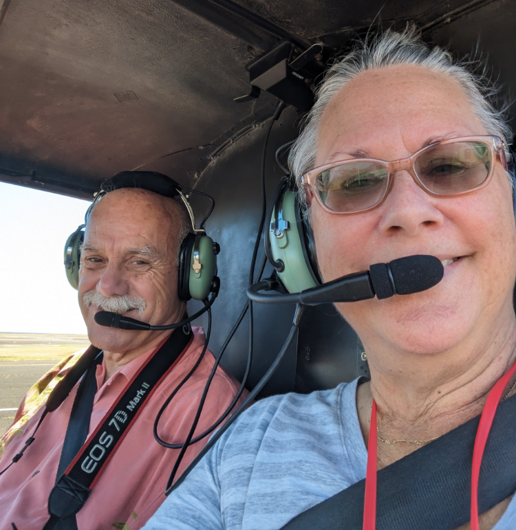
And they’re off 🙂 – it was now 2:06. After editing, I have 185 photos from this flight, and Cathy shot 138.
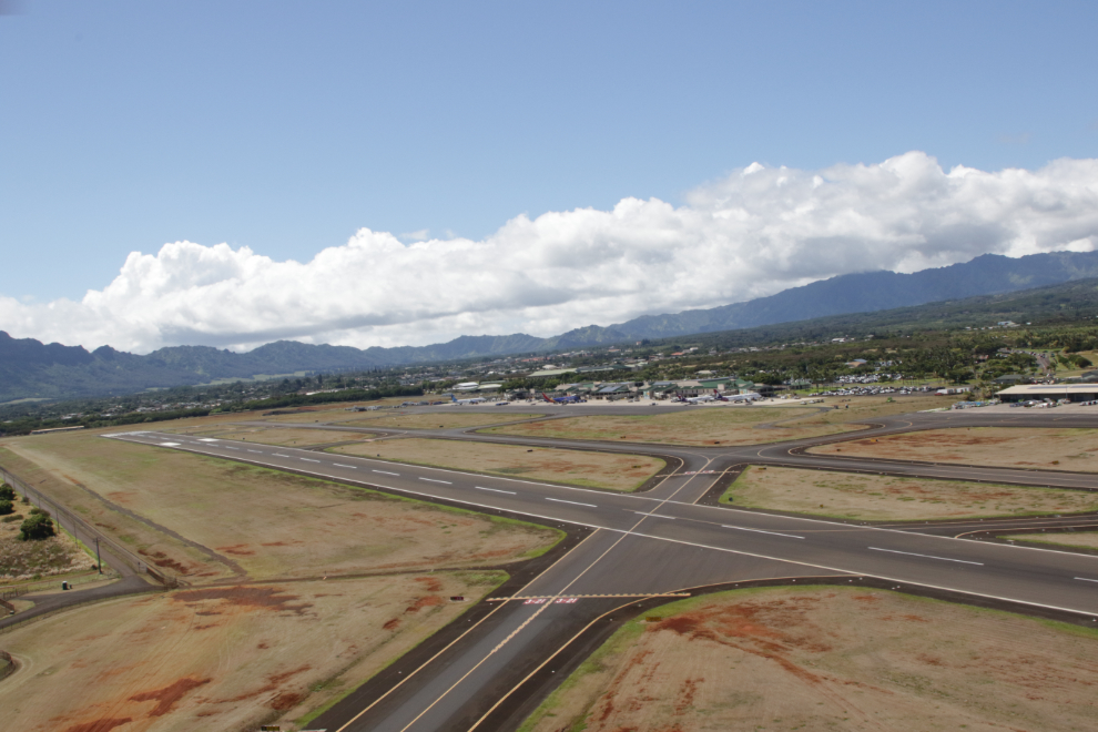
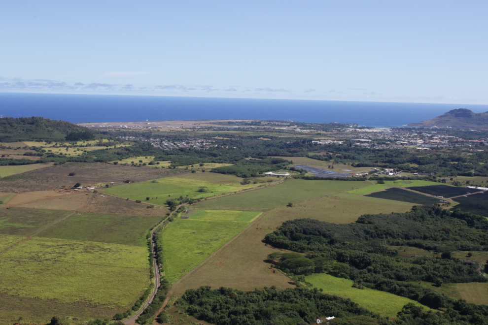
A look back over Nawiliwili Harbor, the community of Lihue, and the Lihue Airport.
We flew due west to start. The large cleared area ahead is the historic Kipu Ranch, which is a 3,000-acre cattle ranch. In 1872, 26-year-old William Hyde Rice formed Kipu Plantation and Lihue Ranch, purchasing the Kipu parcel from Princess Ruth Keʻelikōlani for $3,000 to breed cattle and fine horses. His family became one of the top ten private landowners on the island. Photo by Cathy.
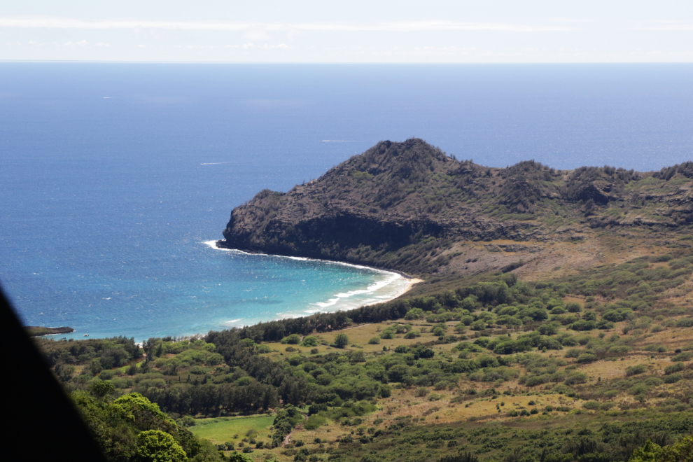
Reaching the start of the ranch, we flew a bit south to see Kipu Kai Beach. It was now 2:09 – yes, just 3 minutes from the airport. I started to learn to fly 56 years ago, before electronic aids, when what you could see, aided by maps and the compass, was how you went places. Hopefully those same skills will let me re-create this flight route for you. Yes, I should have used a GPS tracker to record the route…
We then headed northwest into the wilderness. Much of Kauai is inaccessible except to hikers, and a fair bit can’t be reached even by hiking.
I asked Felipe what these incredible trees were but I don’t remember the answer. He had been doing an extremely good job of narrating the flight.
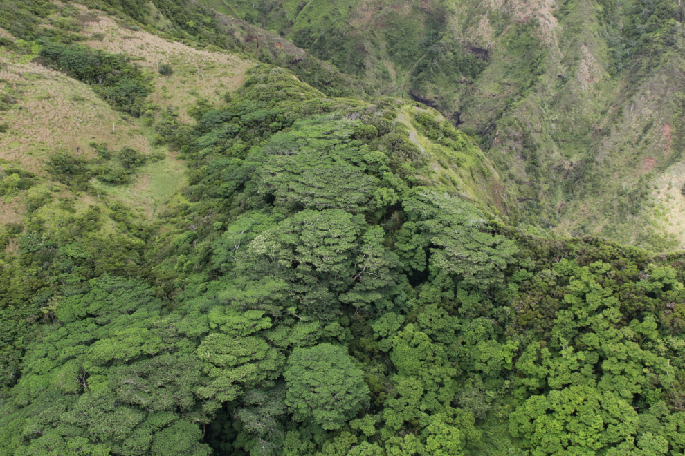
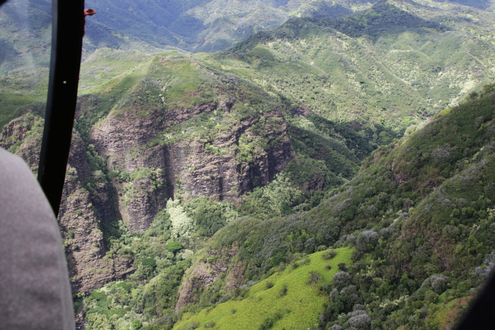
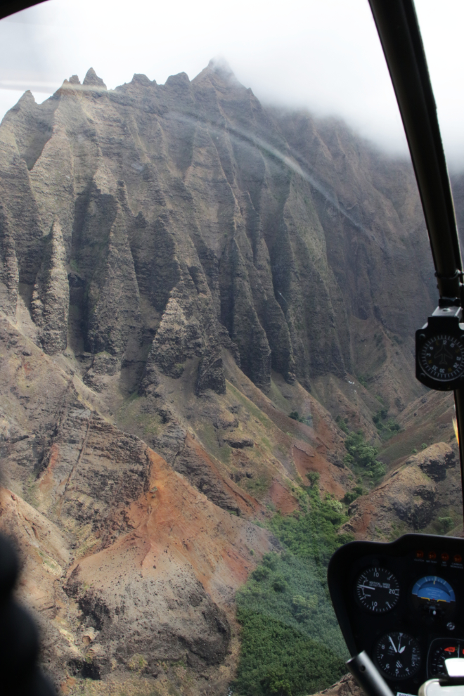
This is extremely rugged country.
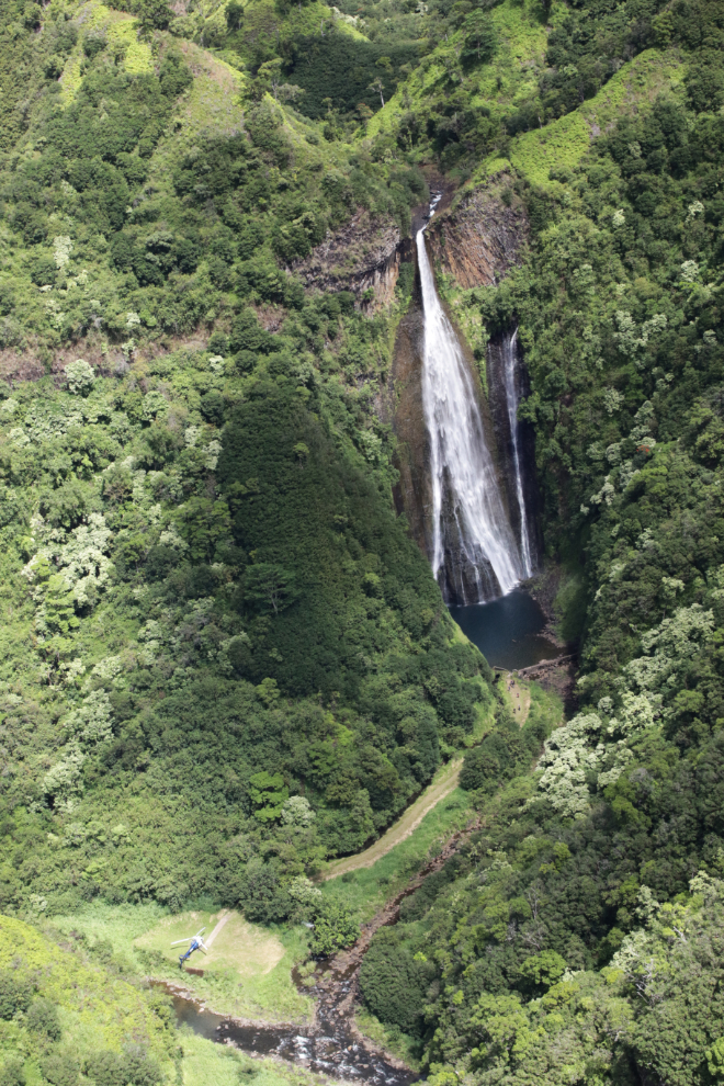
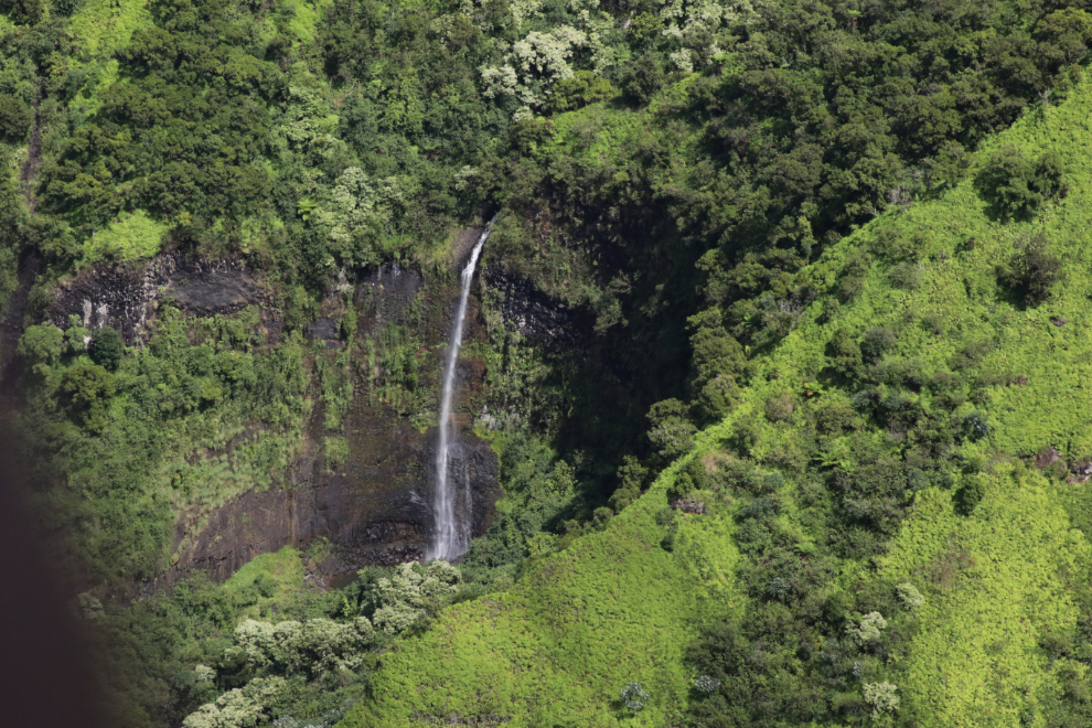
There are a lot of waterfalls due to heavy rainfall in the mountains of northwestern Kauai. This is Manawaiopuna Falls, 122 meters high (400 feet). It is commonly called Jurassic Falls as it featured in the background of several scenes in the 1993 Steven Spielberg film Jurassic Park.
A closer look at Jurassic Falls, at 2:17. Island Helicopters offers a landing and short hike to the falls – you can see one of their helicopters at the bottom left. The waterfall is privately owned, and is only accessible by helicopter.
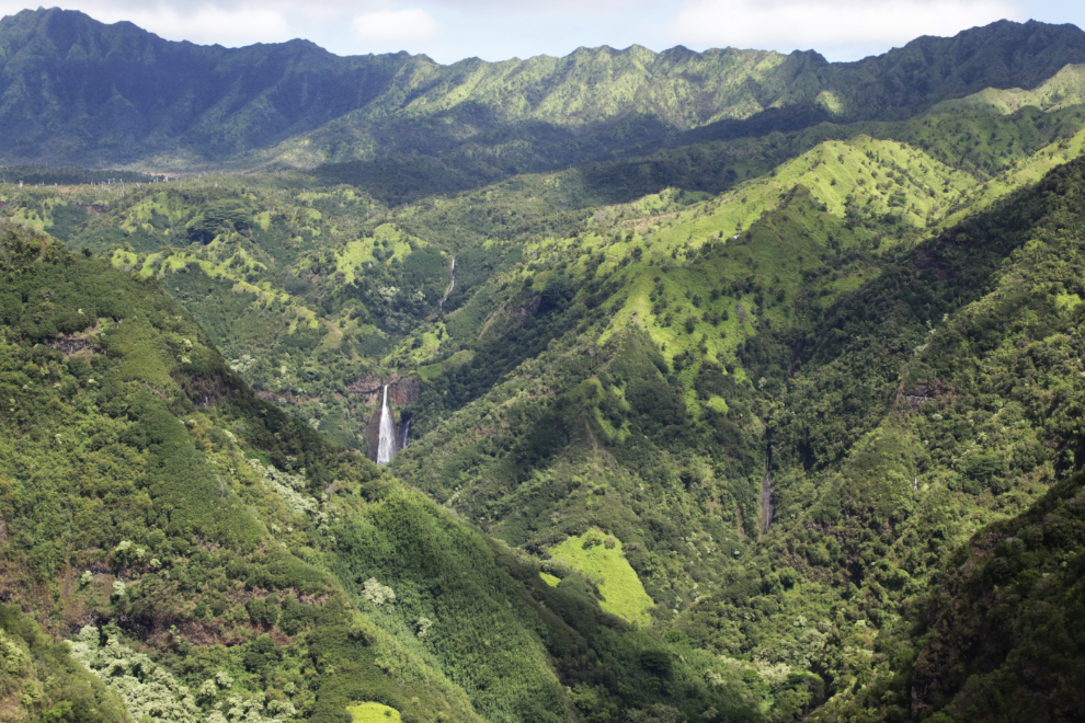
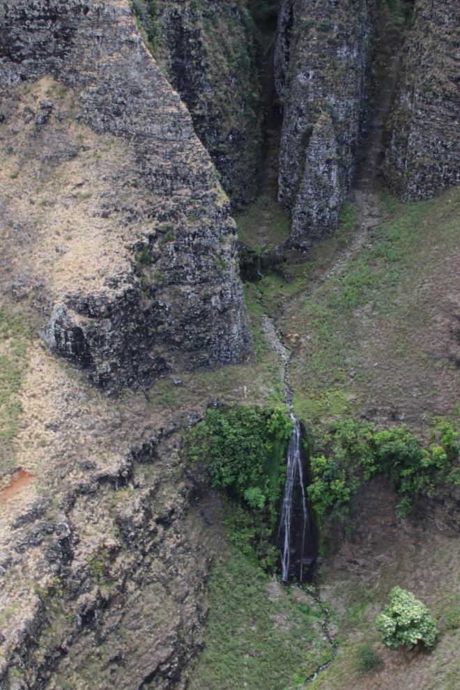
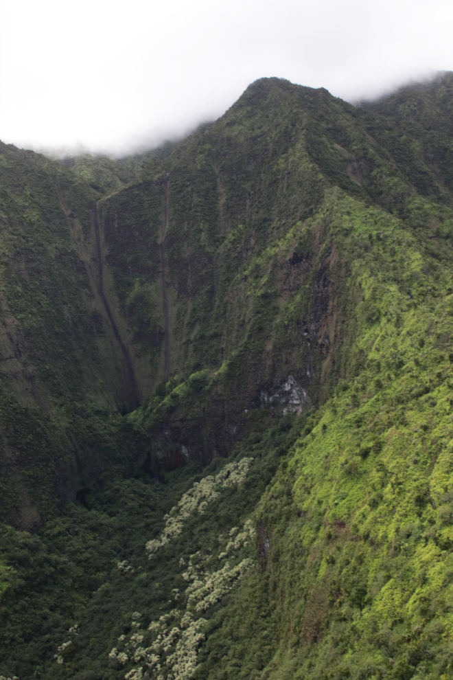
Many – perhaps most – of the waterfalls can only be seen from the air. I think this is Kāhili Falls, a kilometer north of Manawaiopuna.
Continuing northwest, we crossed over the Olokele River at 2:21.
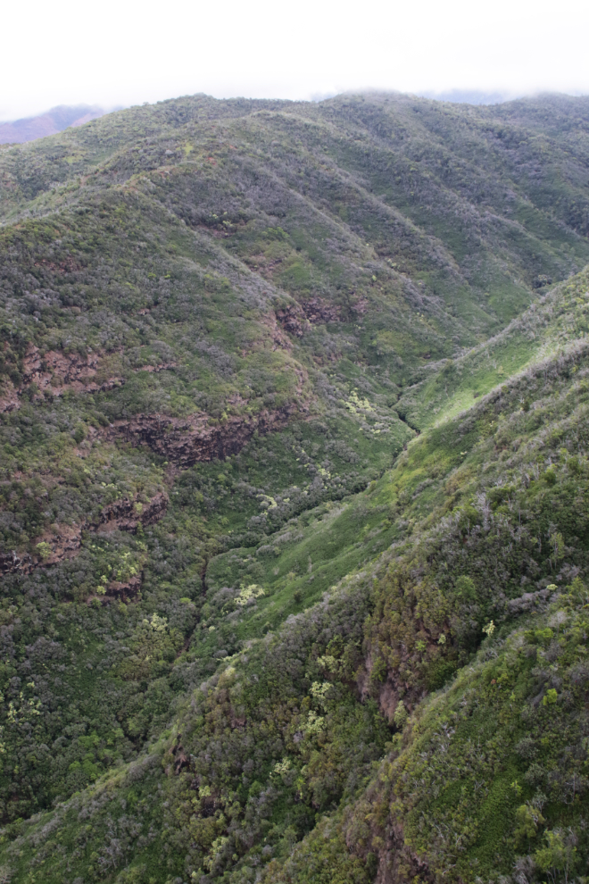
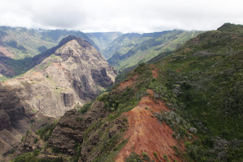
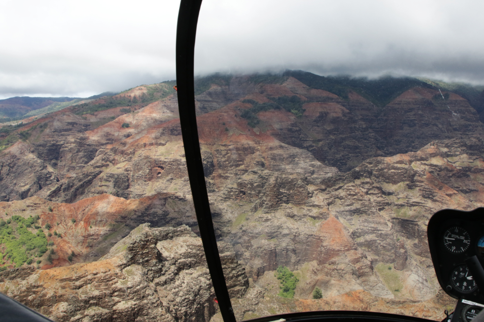
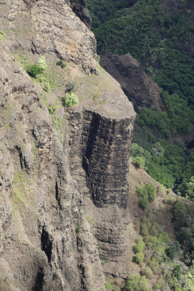
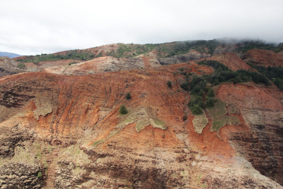
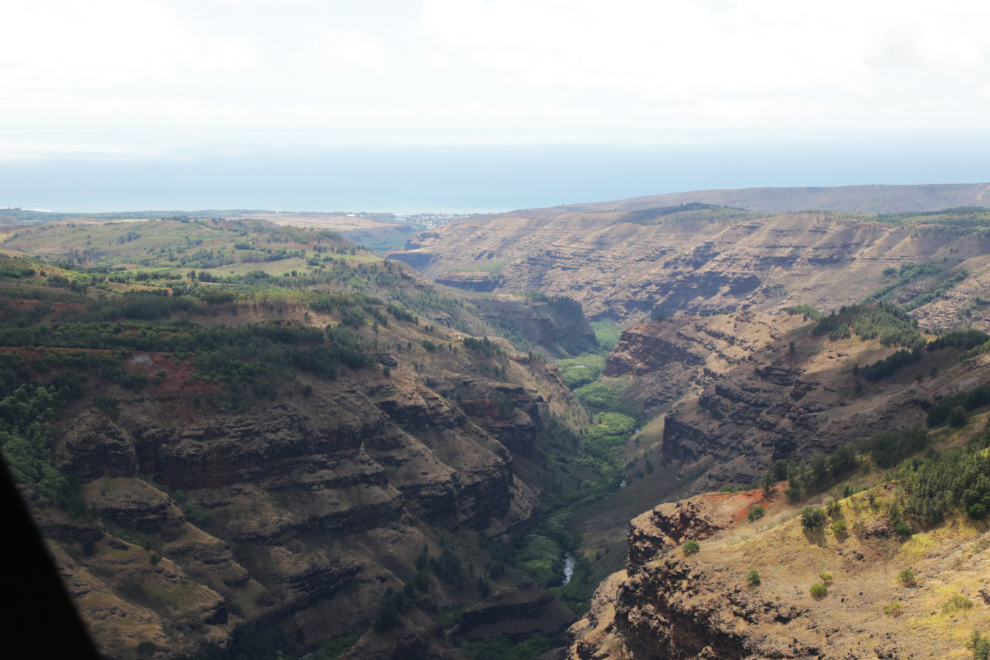
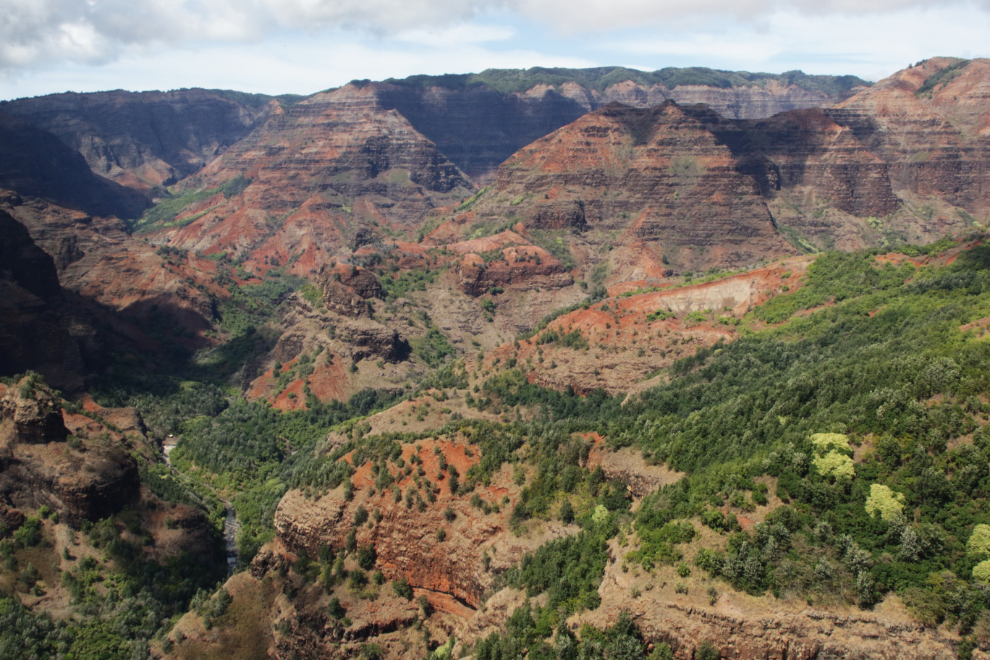
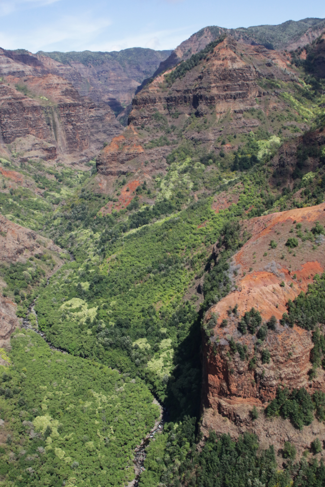
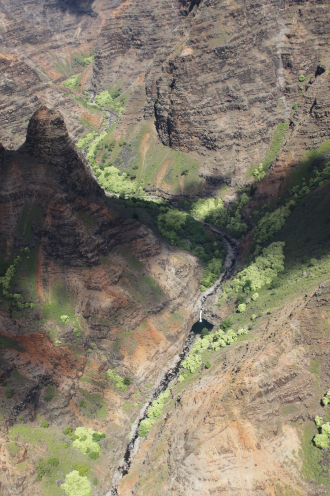
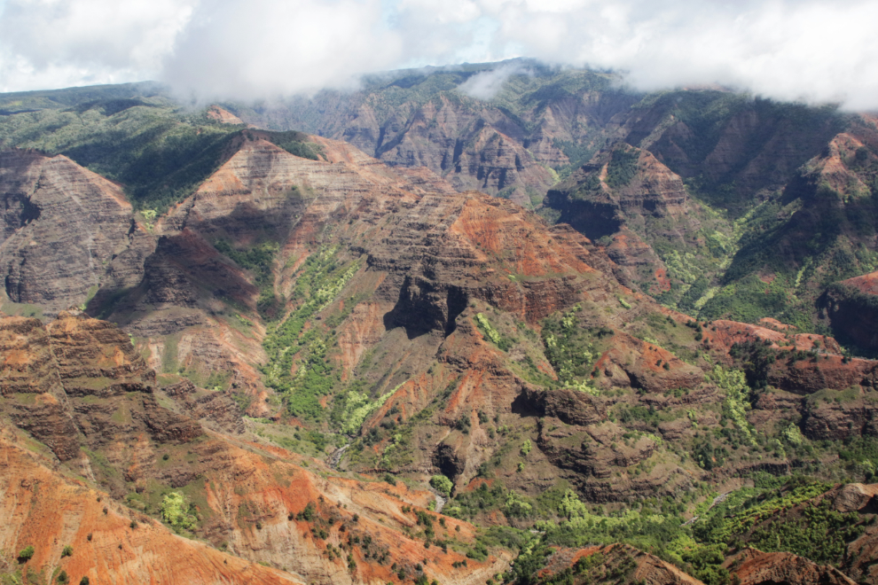
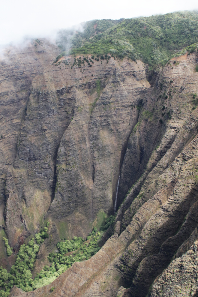
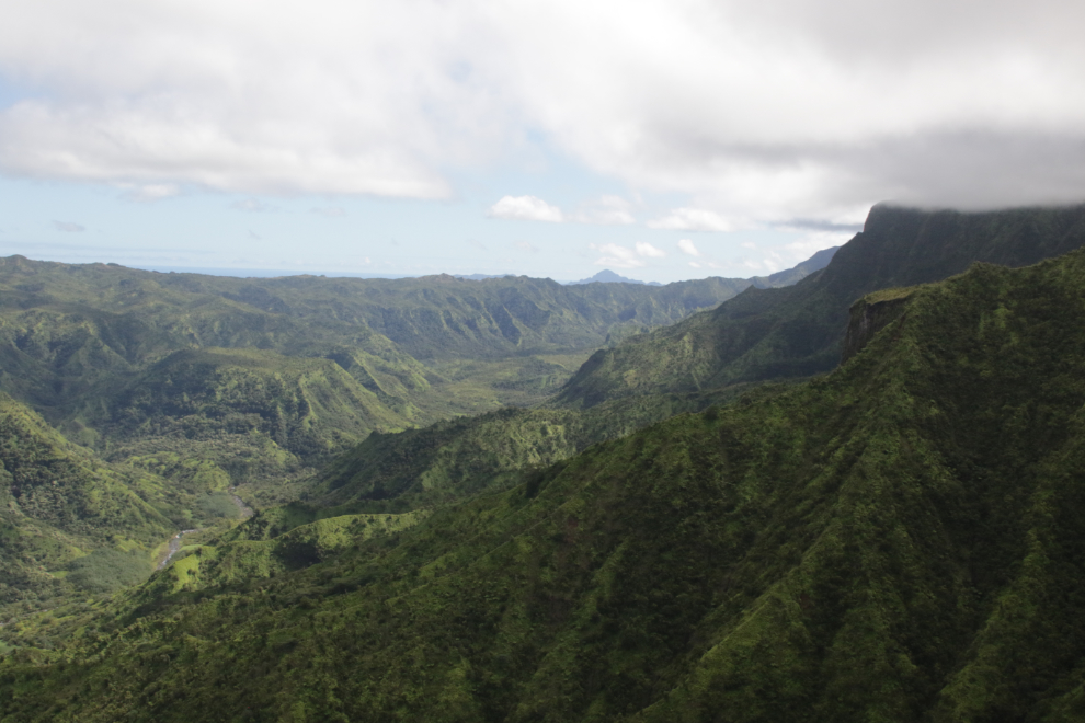
We then explored an area so rugged and complex I won’t even try to pretend I know where we were beyond Waimea Canyon State Park being at the northwestern extent of the area. Along the western and northern edges there are a few roads and many hiking trails. The next 10 photos were shot in that area between 2:22 and 2:29 and are posted in the order they were shot. These are a small fraction of what I shot. It’s a tropical, volcanic Grand Canyon – truly mind-boggling country.
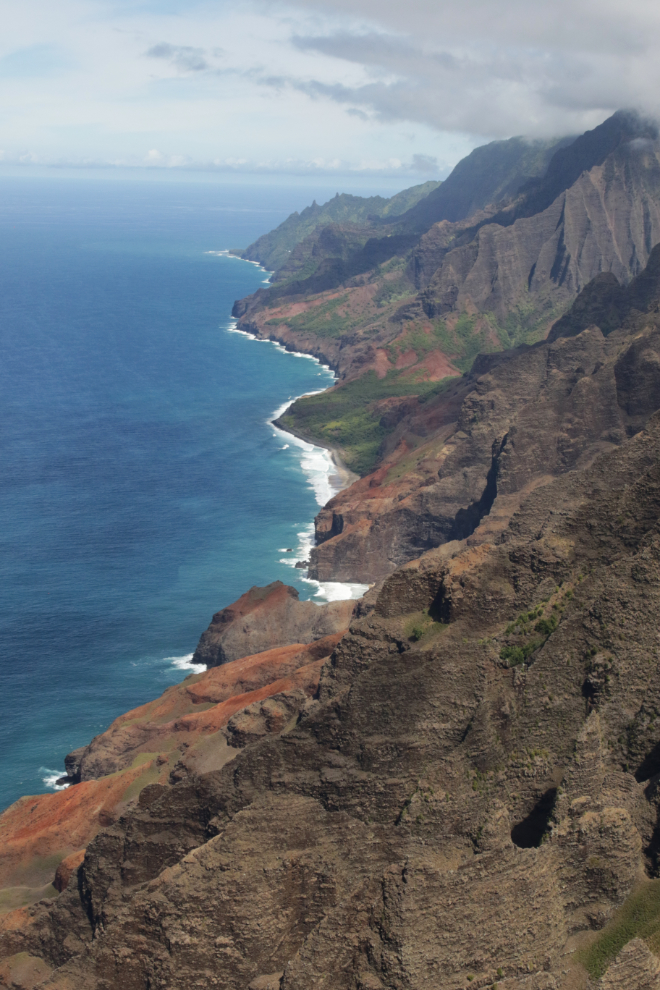
To give you an idea of how close everything is, the fifth photo down looks due south to the coast, with the community of Waimea to the north of the mouth of the Waimea River.
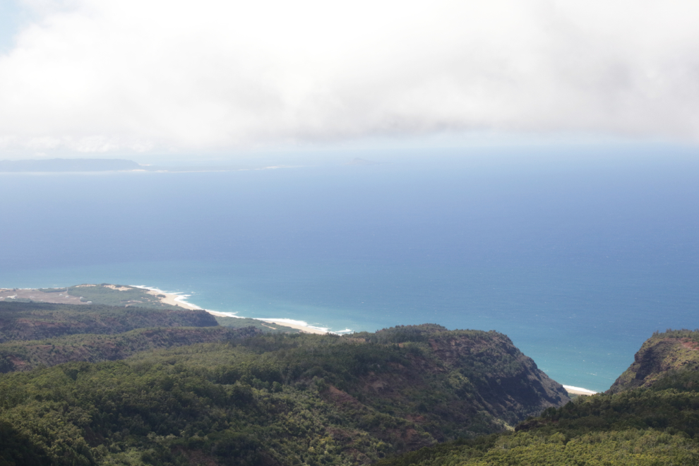
At 2:31 we were getting near what I had expected would be the highlight of the flight – the Nā Pali Coast. The next photo looks in the opposite direction – southwest – to Barking Sands Beach and Polihale State Park. In the distance is the private island Ni’ihau, the “Forbidden Island” because visitors are not welcome.
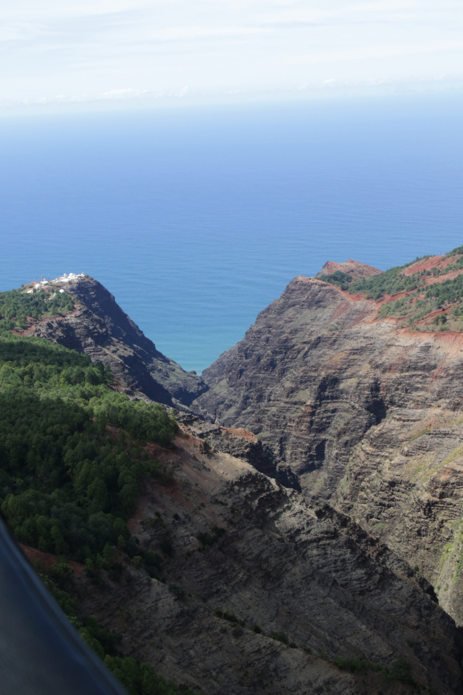
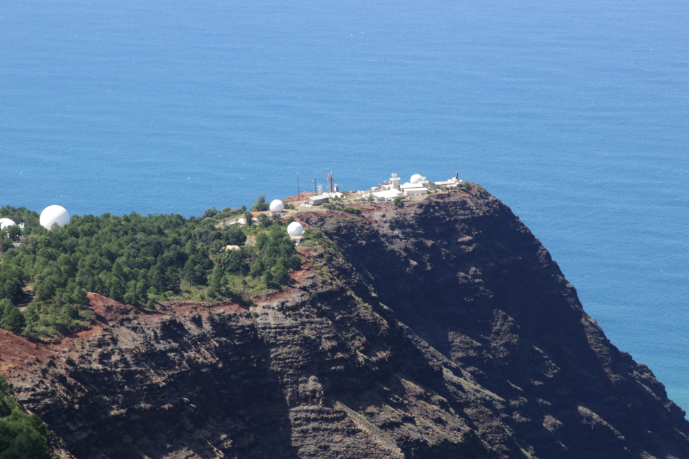
The next 2 photos show the Makaha Ridge Pacific Missile Range Facility. This is one of the support facilities for the large PMRF Barking Sands.
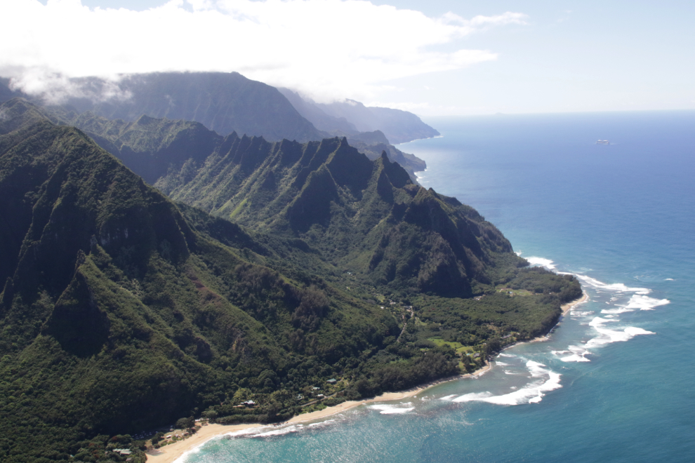
Starting up the Nā Pali at 2:33, we had a look at one of the incredible valleys, as we did at several places. There are a few trails to viewpoints at the top of the cliffs.
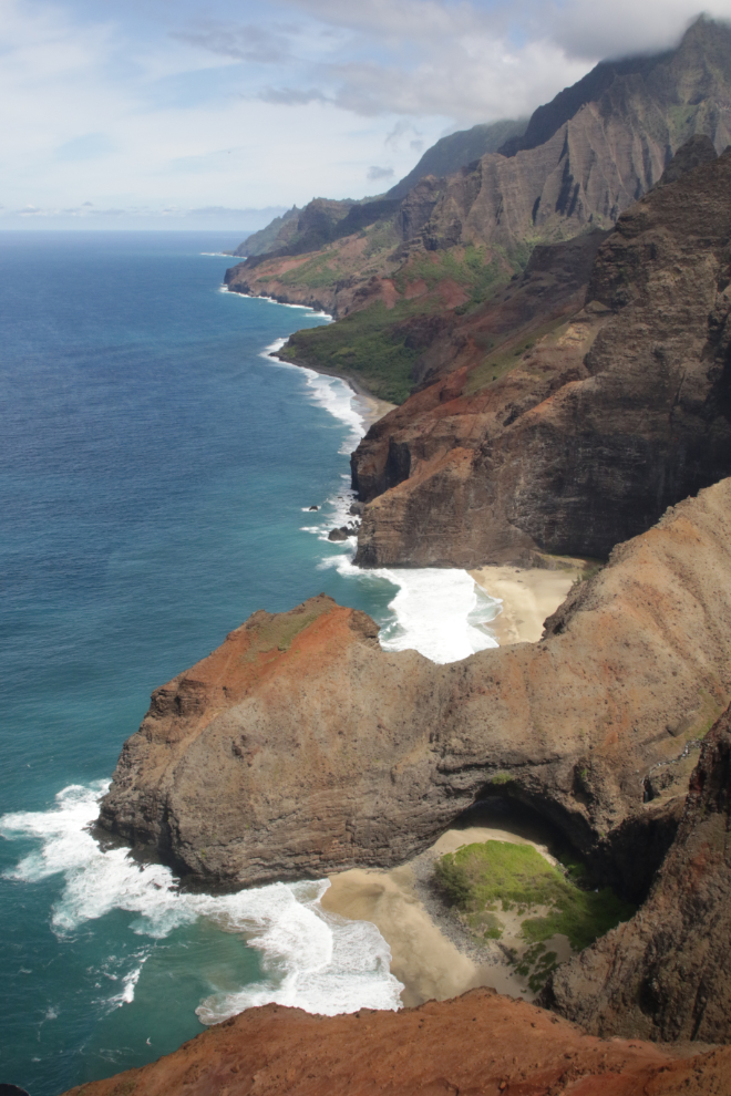
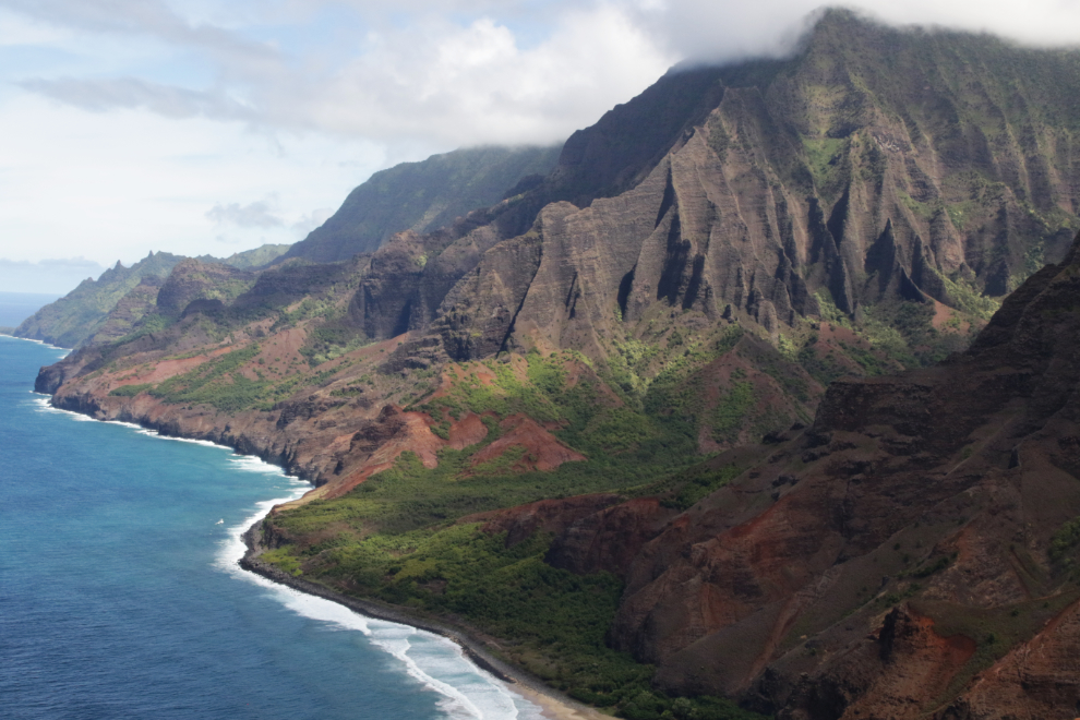
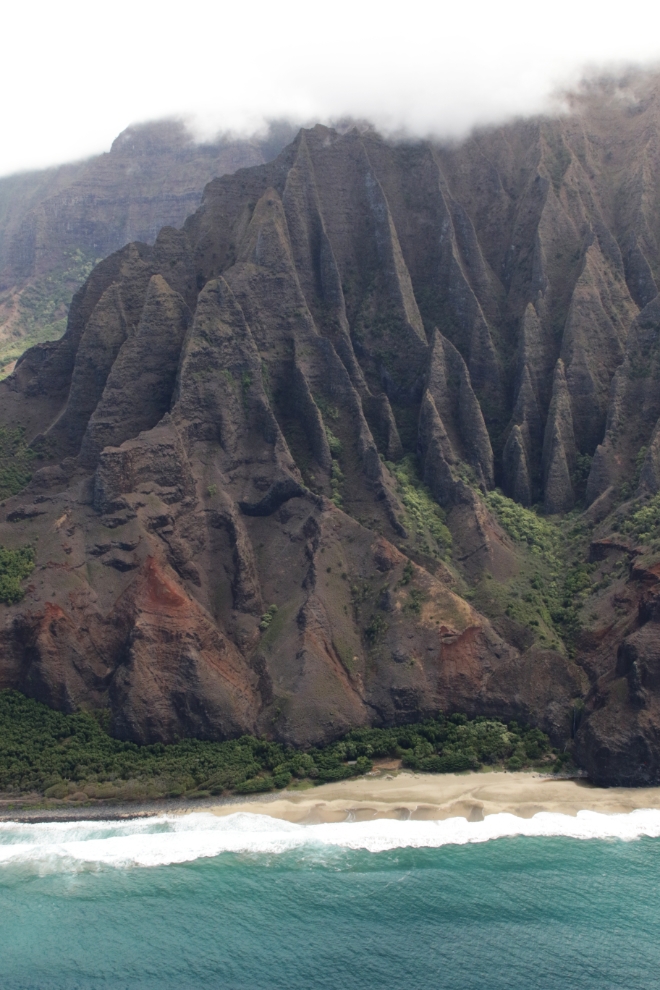
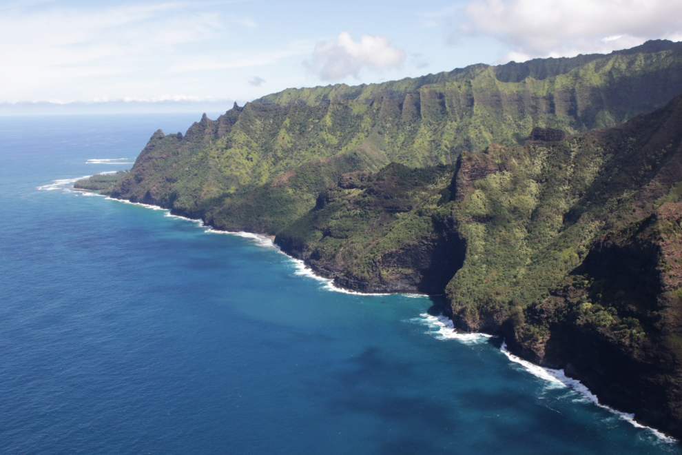
After 40-odd years of anticipation, there it is. The Nā Pali Coast did not disappoint.
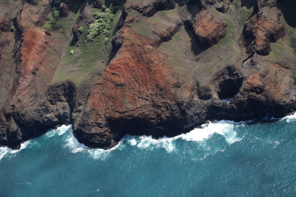
The large Koa Mano sea cave, whose roof has collapsed, was worth circling.
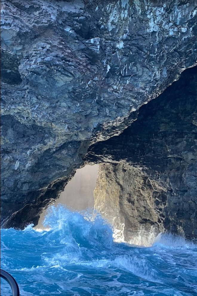
Cathy shot 3 short videos, which I stitched together, show the Koa Mano sea cave at the end.
At low tide, the Koa Mano sea cave is accessible by small boats. Google Maps has had some great photos aded, this one by Keaton Terry.
There are no words that properly describe this place. Even from the air, the power is stunning.
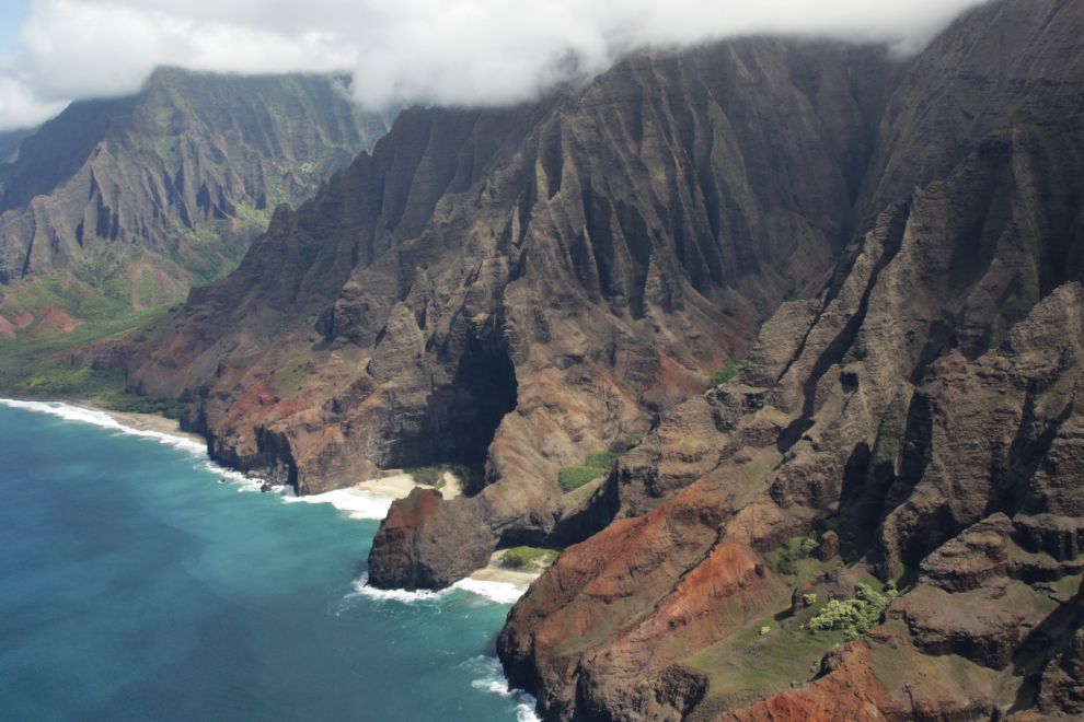
The nearest of the 2 beaches in the next photo is Honopu Beach, a sacred place and said to be the ancient burial grounds of Hawaiian chiefs. It can legally only be accessed by swimming – no boats or helicopters are permitted.
Another little valley to have a closer look at.
It can be hard to take your eyes off the grandeur of the entire scene, but there are countless wonderful little details.
I can feel the power and the magic of this place – I wonder what stories it could tell.
North of Honopu Beach, the Kalaulau hiking trail along the ridges allows access to some beaches, notably Kalalau Beach and Hanakāpī’Ai Beach.
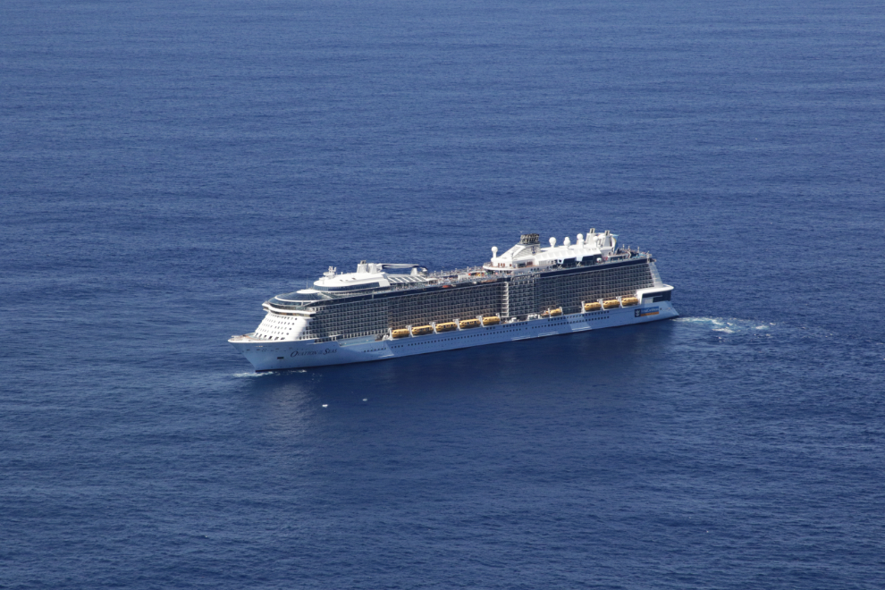
Royal Caribbean’s massive Ovation of the Seas (up to 4,900 passengers plus 1,500 crew) was slowly spinning to give all of her guests a good look at the coast on this perfect day.
There’s at least one building at Kalalau Beach, and a few tents could be seen.
Looking south, a large arch can be seen at the far end of the first beach.
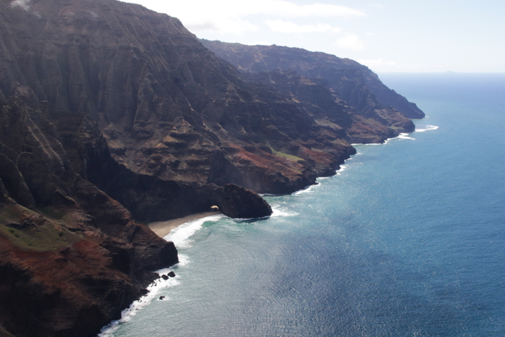
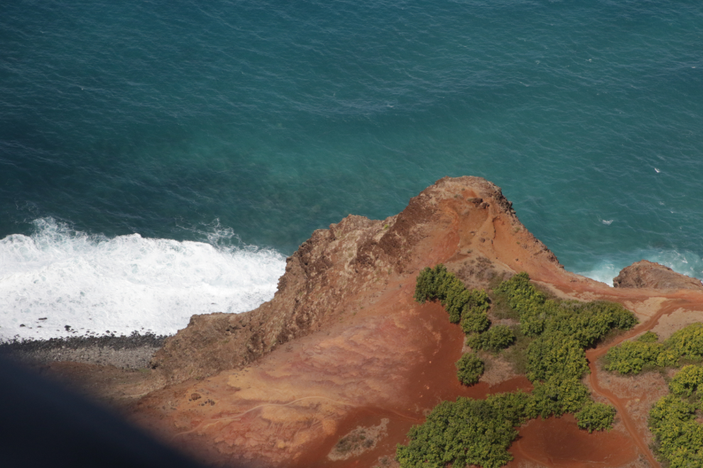
At 2:39 we reached an area where hiking trails could clearly be seen on the barren red slopes.
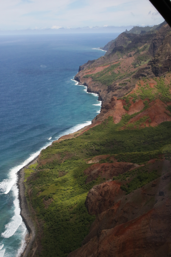
Nearing the end of the spectacular part of the coast, at 2:41. A bit of Hanakāpī’Ai Beach can be seen about 2/3 of the way up.
In the foreground of the next photo are Ka’llio Point and Hauwa Reef. The Kalaulau trailhead to hike down the coast is also is this area. In the centre, Ha’Ena Point and Makua Reef.
Local advice for Tunnels Beach says: “The reef starts at the water’s edge and it stretches 1/8-mile into the ocean. There is an abundant sea life with turtles and tropical fish. Out on the larger reef there are dangerous currents, snorkeling there is recommended only for very strong swimmers and experienced snorkelers.”
Looking back to the south, to Ka’llio Point and beyond. The little valley to the left is the site of the Limahuli Garden & Preserve, National Tropical Botanical Garden.
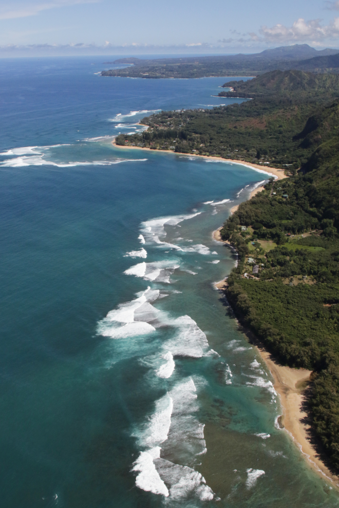
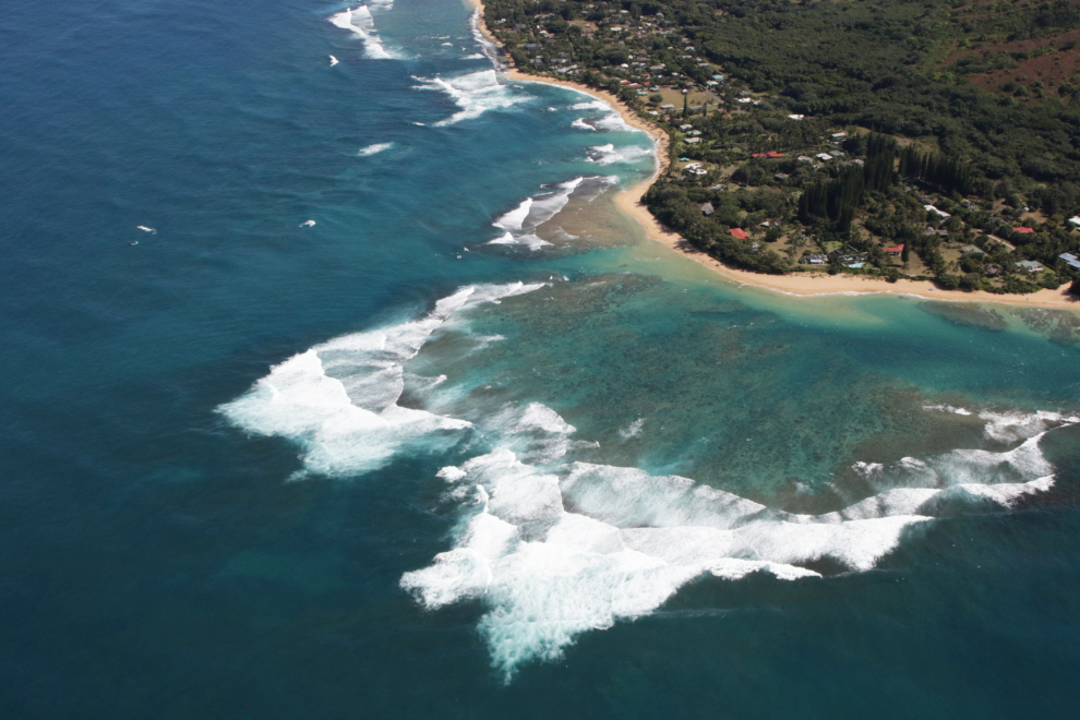
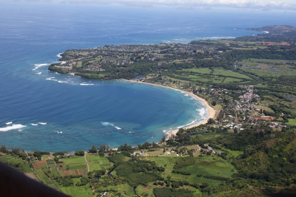
The little community of Hanalei is at the head of beautiful Hanalei Bay, with the new 9,000-acre planned community of Princeville on the point to the north.
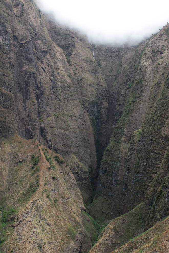
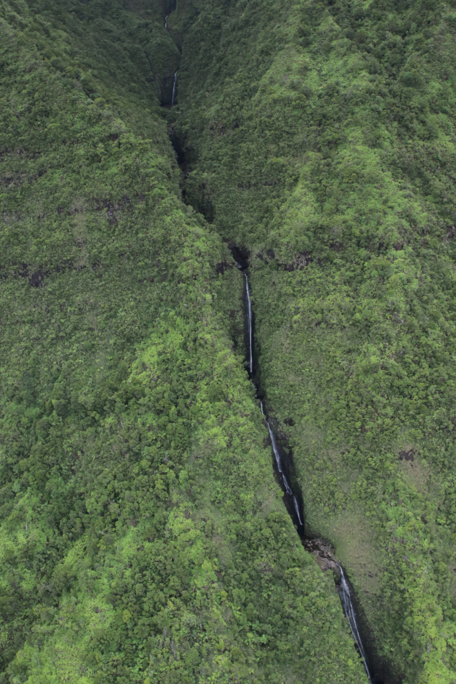
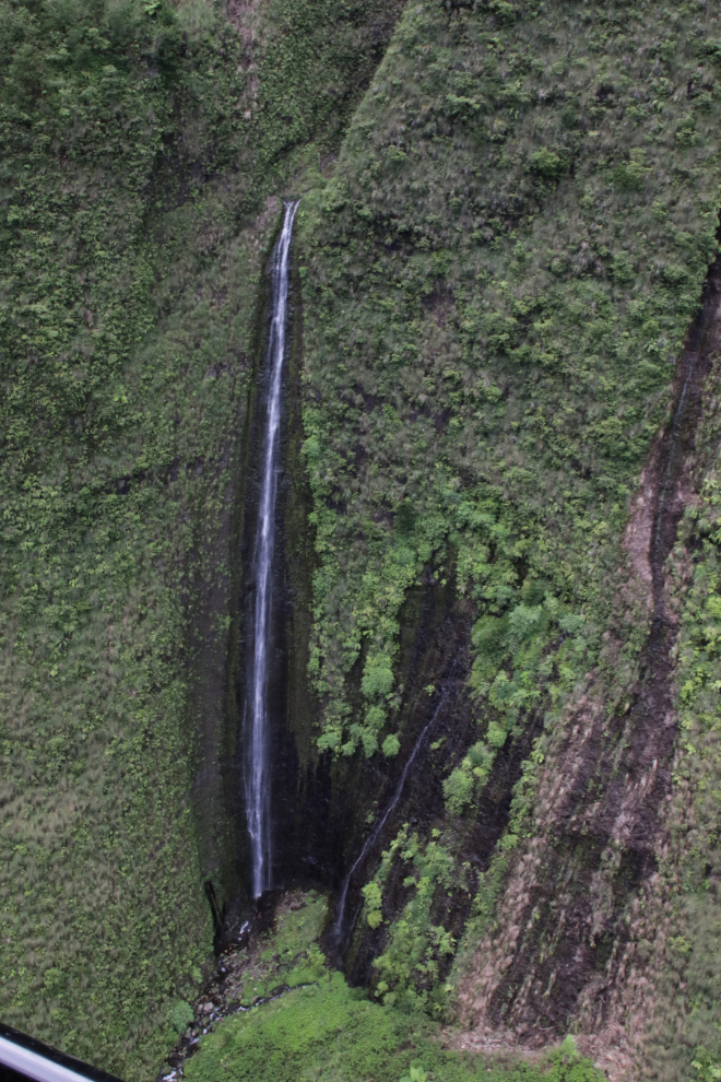
From Hanalei Bay we flew due south, back into the mountains. This is one of the wettest places on earth – the slopes of the highest peak, Mount Waialeale, got 519 inches of rain in 2018, so there are a lot of waterfalls. It was now 2:51.
Looking south up the Halelea Forest Reserve.
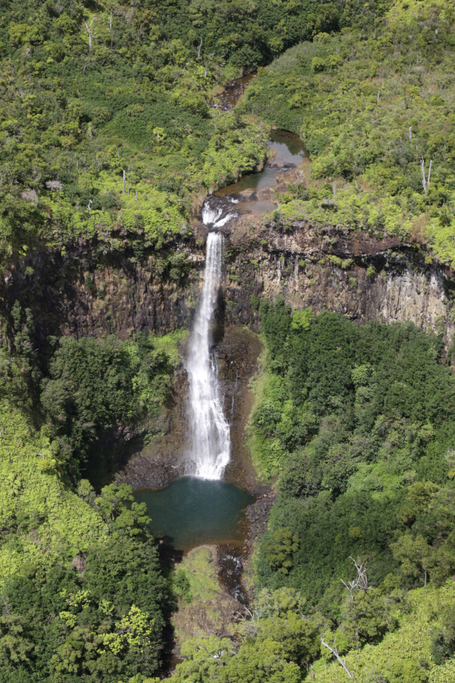
Googling “waterfalls of Kauai” probably brings up some wonderful places – many of them places you can’t get to except by air.
As well as getting the broad view, Felipe took us in very tight to these incredible slopes.
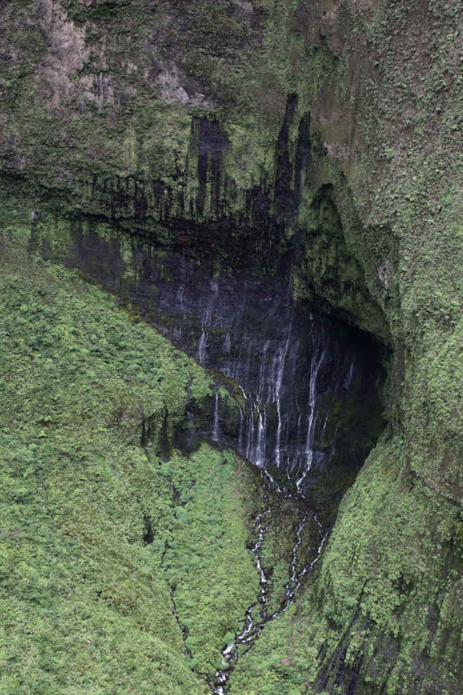
This is another area that is absolutely magical.
When I saw this I said “a weeping wall”. Felipe said “That’s right” – it turns out that actually is the name of this place 🙂
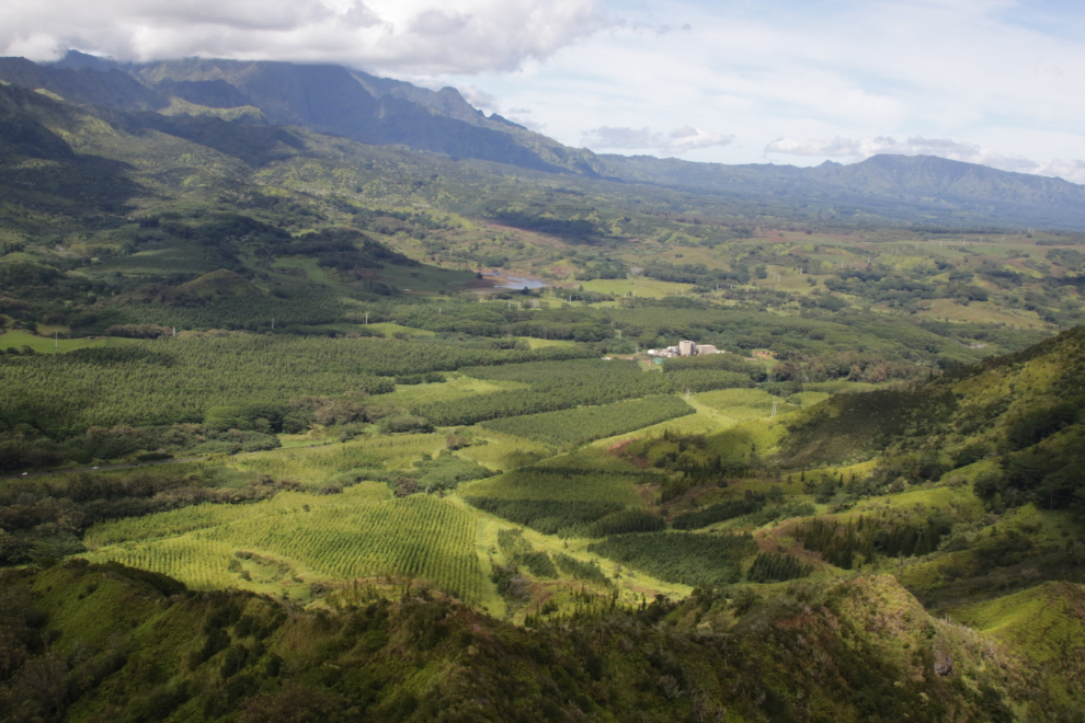
The transition to mountain wilderness back to civilization was very rapid. At 3:03 we were over a large cattle ranch on the upper Wailua River. I believe this is the Kunoa Ranch.

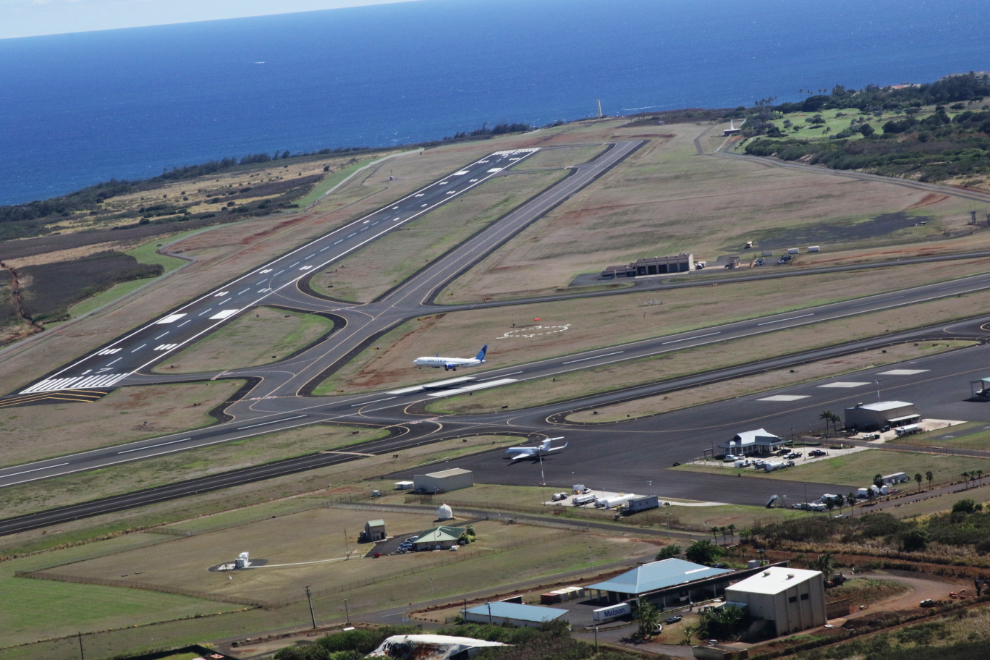
One minute later, the airport is at left-centre, the community of Lihue to the right.
A United Airlines plane was taking off as we approached. I was very surprised by the amount of airline traffic we saw.
At 3:07 we were seconds from being back on the ground. It takes a few minutes to cool the helicopter’s engine down so it can be shut down for us to get out, then we had a few more minutes to wait for the taxi that Cathy had arranged to show up.
Compiling and writing this post has brought the flight back to me in a wonderful way. It was so much better than I had expected, because of the variety of country we saw, and because of our pilot and guide, who gets the highest marks I can give, for both jobs.
Although we had been scheduled to sail away at 4:00 pm, we didn’t leave until a few minutes after 5. The captain probably explained why, but I probably didn’t hear the announcement.
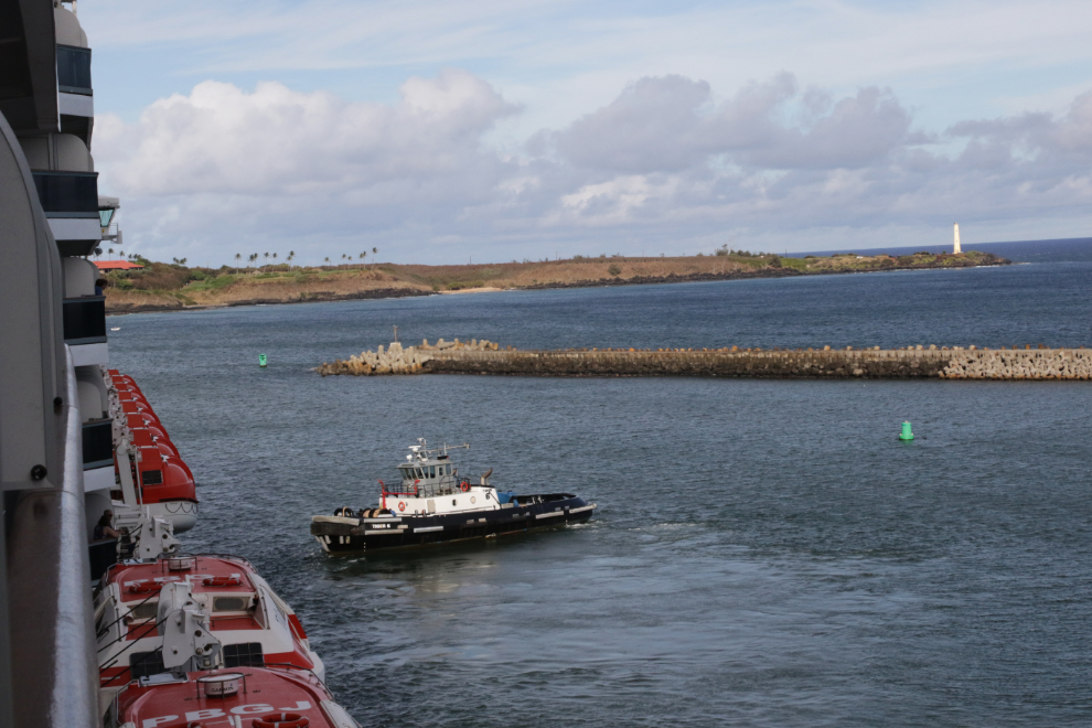
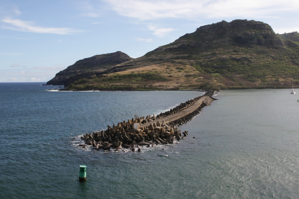
A final look at part of the outer harbour area.
The lengthy seawall that protects the harbour.
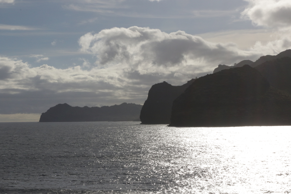
And a final look at the coast we flew along. We didn’t go up top for the sailaway party – I was exhausted, and as soon as the view from our verandah became all sea, a few minutes after I shot this photo, I went to bed.
My final assessment of Kauai is that I love this place. I like Hawaii in general, but don’t love it. Kauai has a very different feel to it. It’s the fourth largest of the Hawaiian islands but is only 25 miles long by 33 miles wide at its furthest points, a total of 533 square miles. I find the fact that much of the island is inaccessible to be fascinating. I expect that if I lived there, the fact that much of the island, included vast wilderness areas, is privately owned and gated off, would make me nuts, but there is still lots to explore.
One final comment – never give up on the things that are on your bucket list. This may have taken 40 years to so, but it was worth waiting for.
as always Murry, THANKS! for sharing.. wonderful. Great comment about fulfilling that bucket list dream…
Thanks – it’s always nice to have you along, even if only in a virtual way 🙂
CommentWhat a fascinating evening I’ve had.Watching this video almost took me on the trip with you. Enjoyed it immensely.Not only the extraordinary photography but the information you investigated which we benefited. Thank you both. Look forward to your next journeys
Wish I could tag along. Do you turn in at 7:30 P.M.?
Thanks, Blanche – I’m glad you enjoyed it. I do often go to bed early – it depends on how I’m feeling. Not usually 7:30, but 8:30 is common.
Absolutely stunning!
Thank you, Patsy – I’m really glad you enjoyed it 🙂
Fantastic!
Thank you, Shelly. Back when I taught night-school photography, I told students that the #1 key to getting spectacular photos is to go to spectacular places. This might be a good example of that idea 🙂
Thanks for taking us on your spectacular adventure. Stunning views. Loved the video.
Thanks, Barb. I rarely think about shooting video, so I was really pleased to see that Cathy had shot a bit.
Excellent! Thanks for showing us.
Thanks, Tracy – my pleasure!