Hiking Tina Creek Ridge, Haines Highway
Cathy has been wanting to get back to Haines for a long time, so a couple of weeks ago made a reservation at the Oceanside RV Park. I arranged for a Haines friend to meet me at the Haines Summit for a hike the day before that reservation started, and so we could get a full day of mountain wandering in, Cathy and I needed to leave from Whitehorse Saturday afternoon (August 17th).
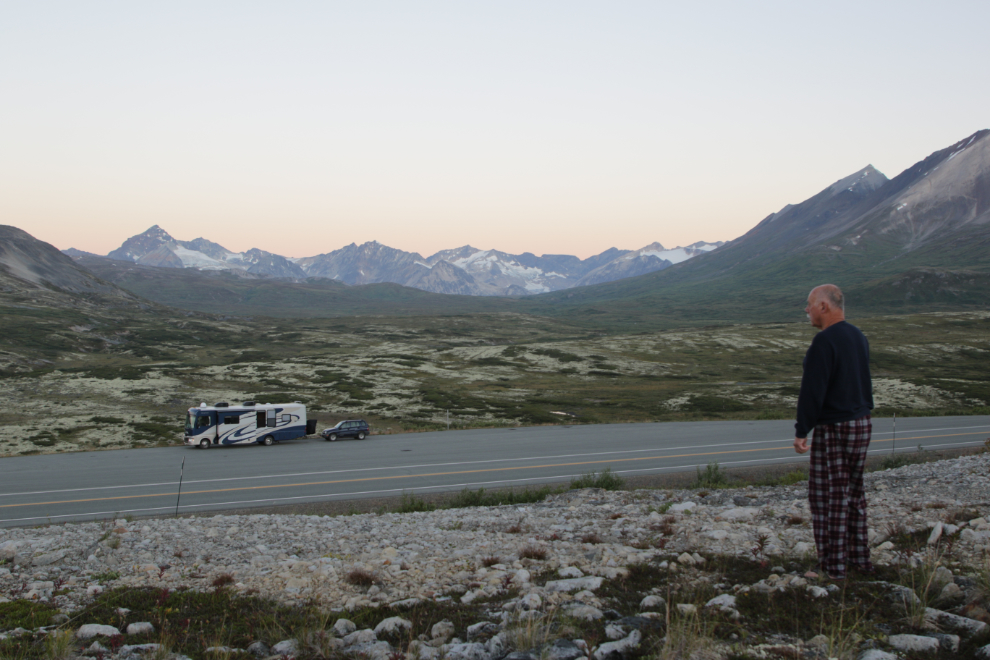
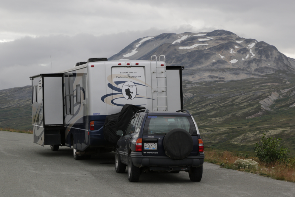
Things got complicated and we didn’t get away until about 7 pm. Cathy wanted to stop part-way, at a reasonable hour before dark, but I was set on being on the summit for sunrise. We made it – the first photo was shot at 10:54 pm, and a few minutes later it was very dark.

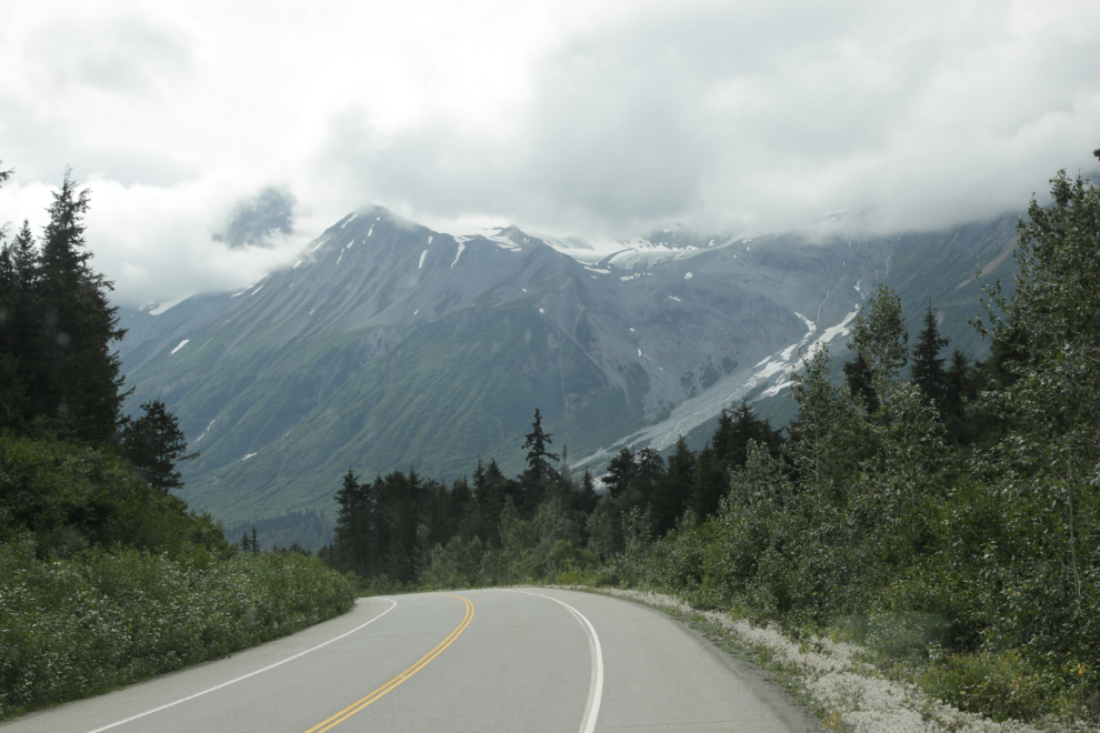
Just before 06:30 on Sunday, I headed out for a long walk in my pyjamas. This is why I was focussed on being here – the beauty and the power of this place is amazing. Although it’s not far from the White Pass as the raven flies, it’s a very different place. Not better or worse, just very different in pretty much every way.
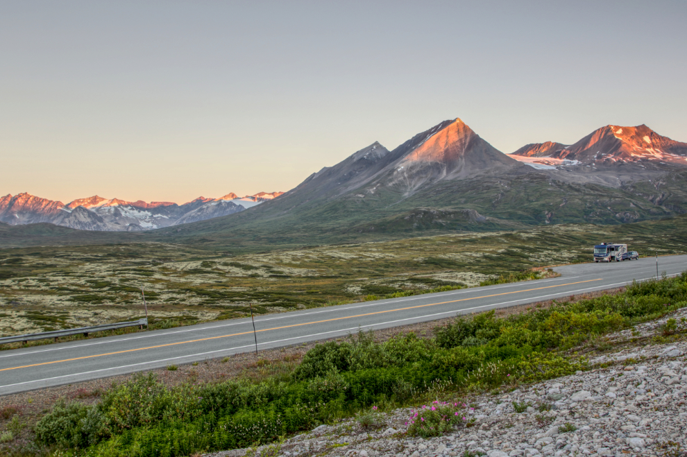
The sun coming up at 06:37.
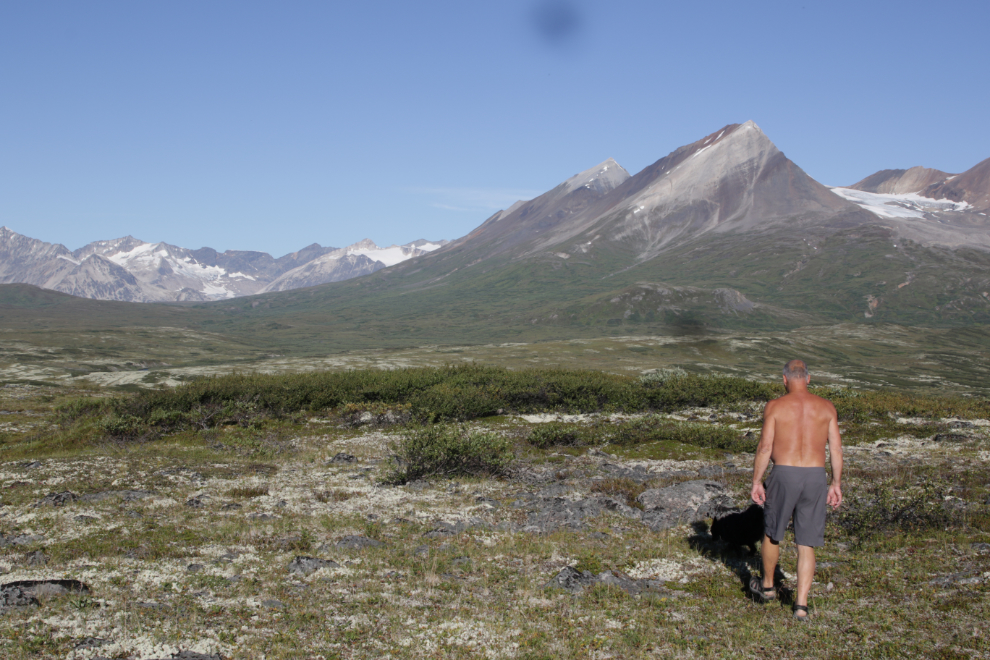
I went back to the motorhome, put a pot of coffee on, took Bella and Tucker out for a short walk, etc. Then just after 9 am, decided to take the pups on a big walk. They loved the hill above the RV, and ran and played and sniffed everything! 🙂
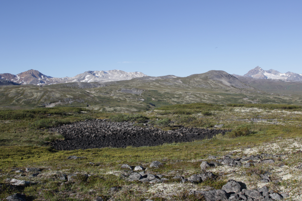
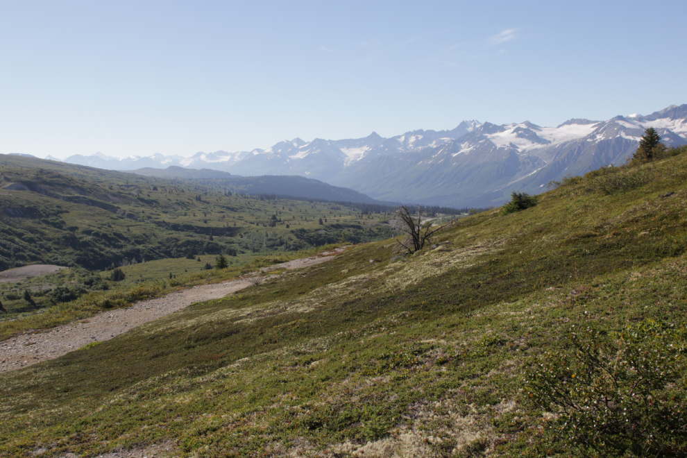
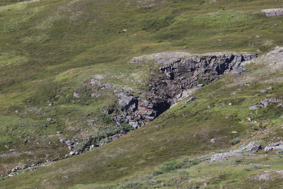
We were quickly out of sight of the highway. The seasonal pond in the centre was dried up but the rocks seem to indicate that it’s there for much of the summer.
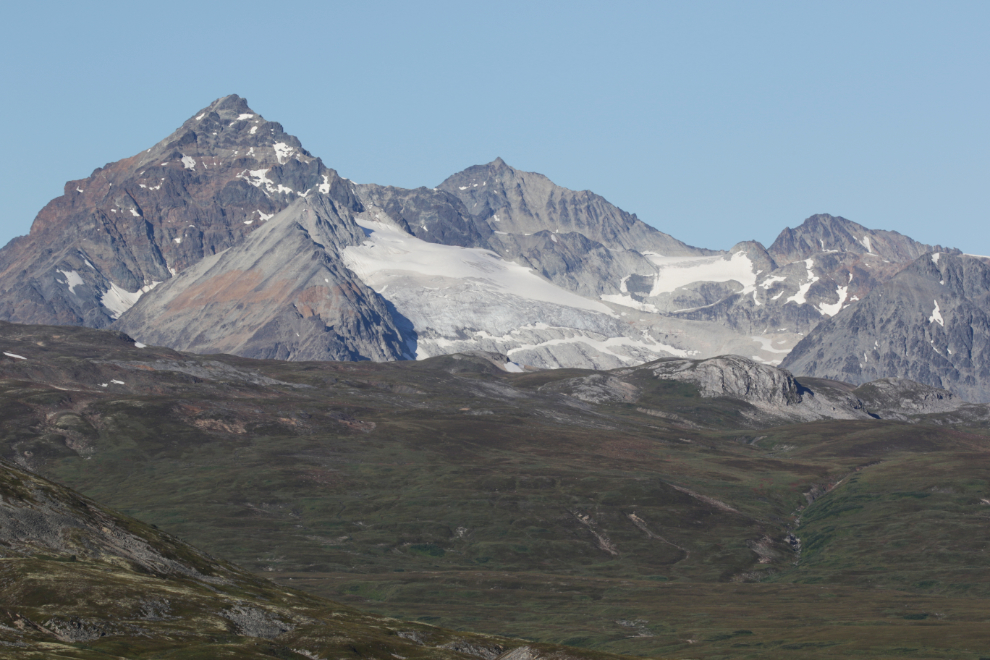
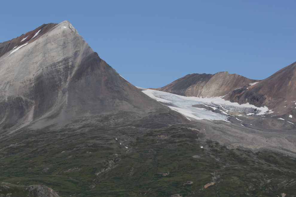
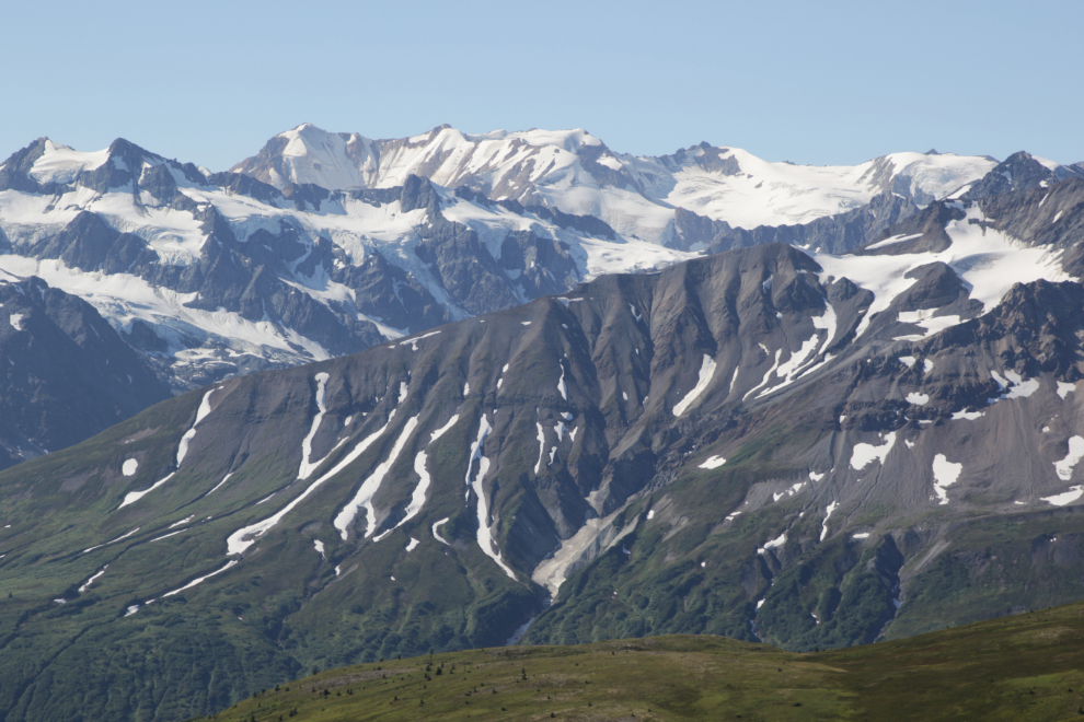
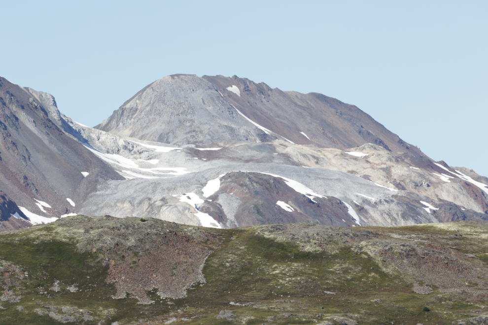
I photographed a few specific mountains and glaciers in the hope that at some point I’ll be able to put names to them.
It got really warm, and Greg and I were clearly going to have a spectacular day for our hike.
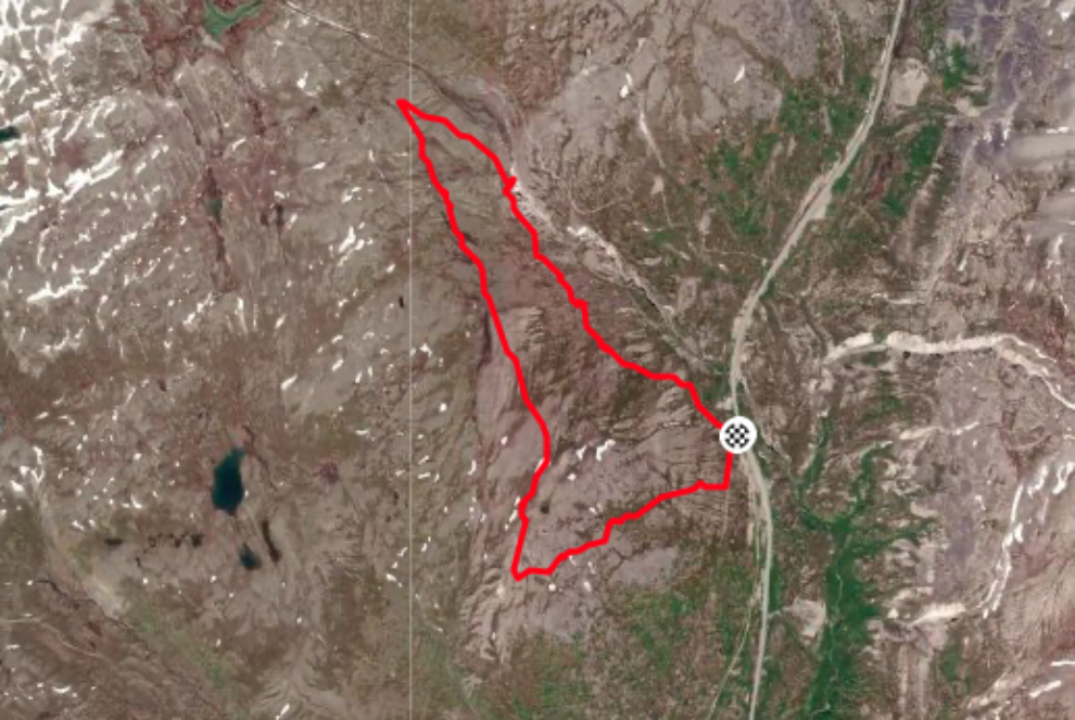
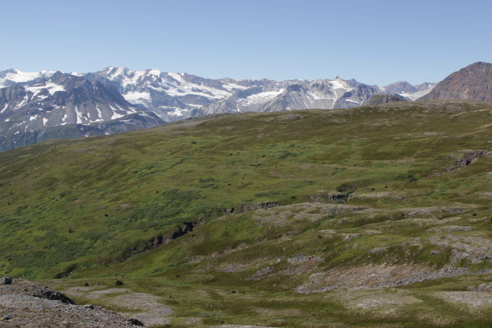
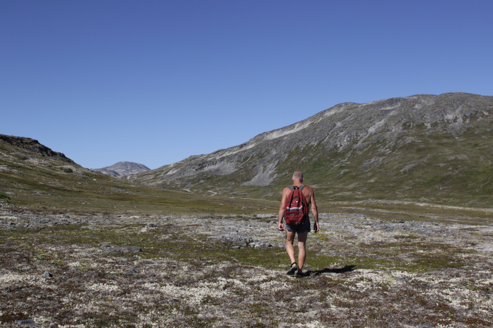
Greg and I didn’t have a hiking route planned yet. We drove south to look at a few possibilities. There were a lot of people out hiking! The Samuel Glacier trail parking lot was pretty much full when we went by the previous night. We decided on one that I call the Tina Creek Ridge. While there was one vehicle there, it’s an off-trail area where the odds of us meeting them were near zero. At 11:05 we started up, on the route of the old Fairbanks-Haines pipeline.
Here’s a look at the route we took – we hiked clockwise from the checkered flag. The line across the northeast follows Tina Creek down. This map is from my Strava page.
Within a couple of hundred meters/yards we left the pipeline route and head up the hill. In this fragile country we’re both very careful to step on gravel or rock whenever possible.
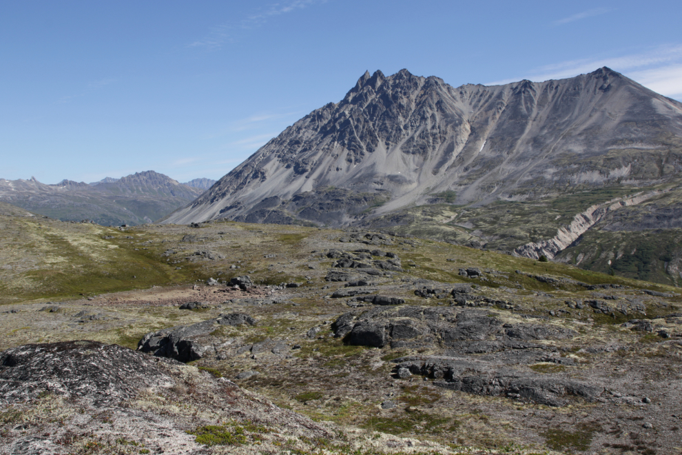
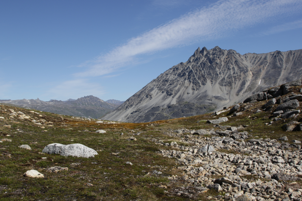
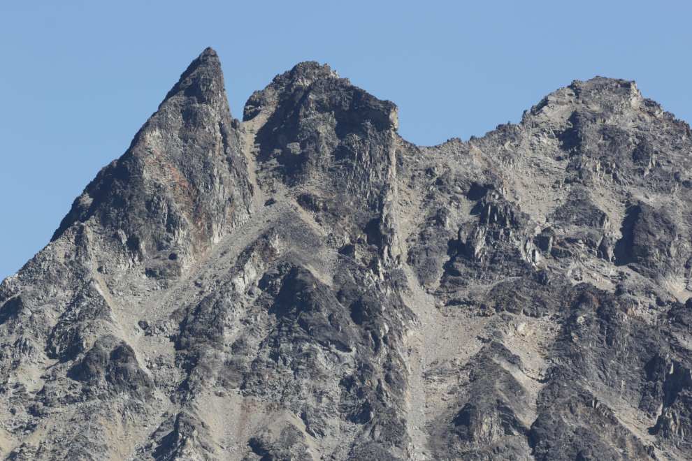
By 11:37 we had gained a good amount of elevation. The Three Guardsmen was the backdrop to much of our day.
The view south towards Haines at 12:53.
This was almost as far to the southwest as we went, at 12:17. This is a wide-angle view, at 24mm.
A closer look from that spot at some of the peaks (but still only at 78mm).
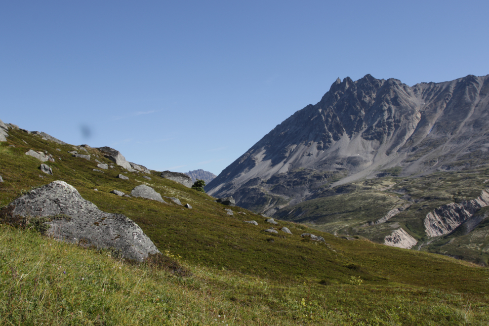
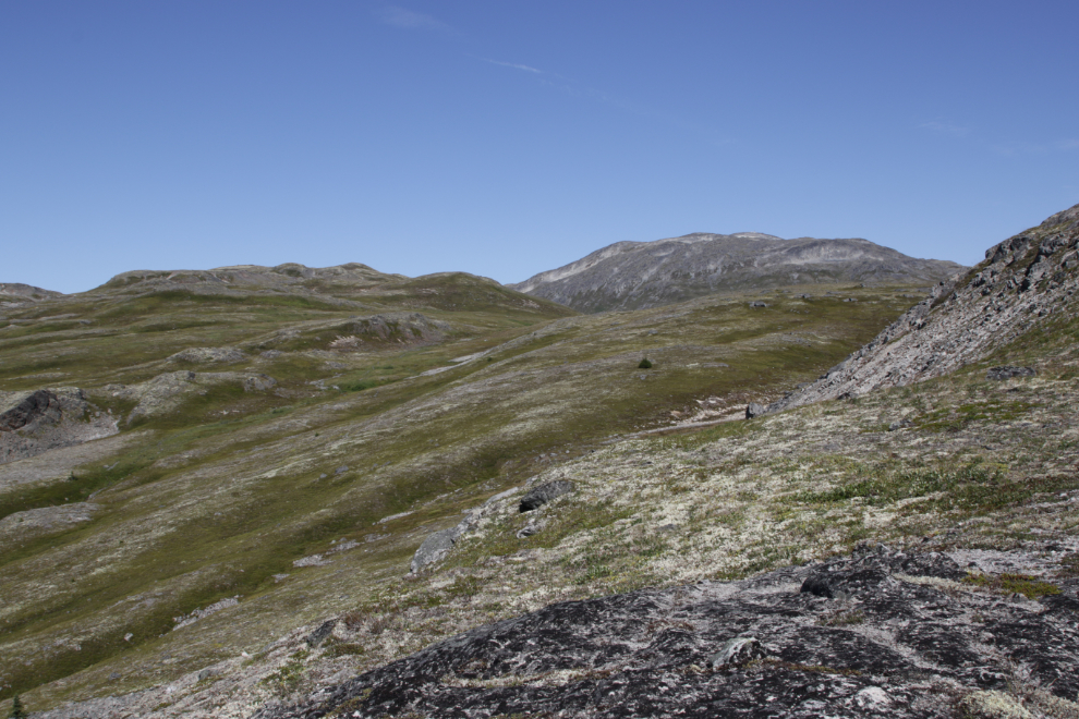
At 12:40 we reached the end of a peninsula ridge at the southwest limit, and we pondered awhile about which direction to go. The options were limitless. In this country you really are alone – there’s no sign of people ever having been here.
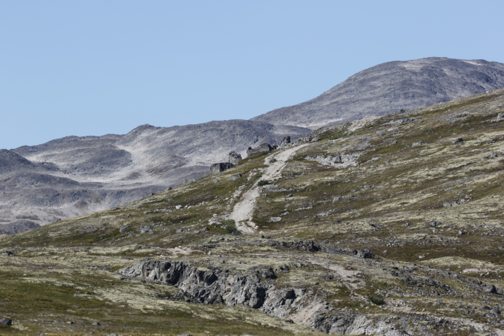
Down below this isolated spot I could see an old mining road that has intrigued me for many years, but I haven’t yet found the access to it from the highway. From here we could hike down to it, west a few miles to the mine, then backtrack to the highway, solving that mystery. Edit: thanks to a reader, the mystery has been solved – see the comments.
In the end we decided to hike through the pass we could see to the northwest, partly because I knew of some nice lakes in that direction.
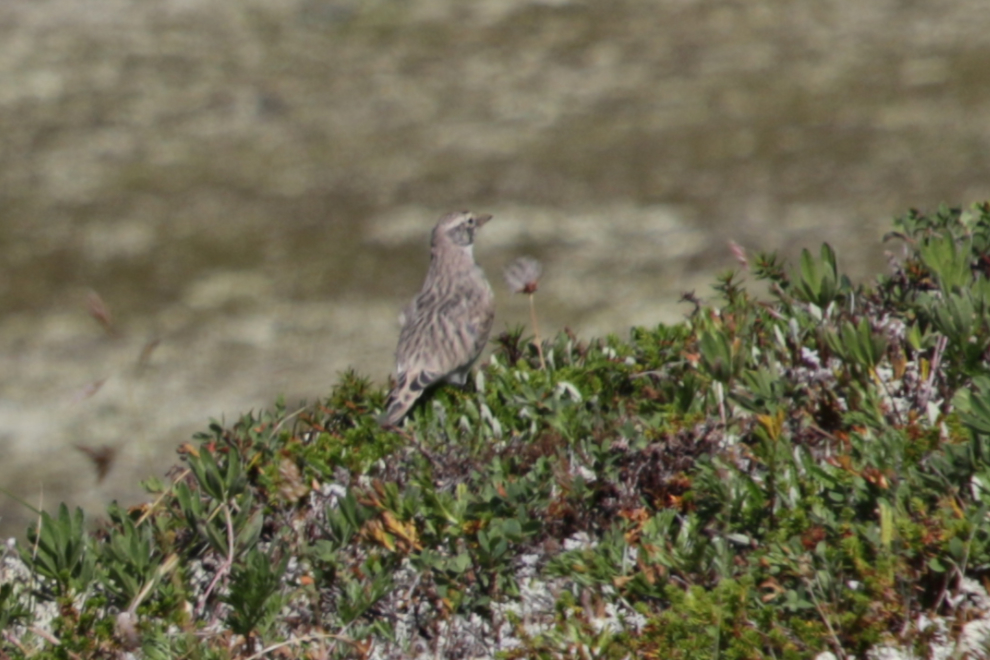
I need to identify this unusual bird we met – neither of us could recall seeing one before.
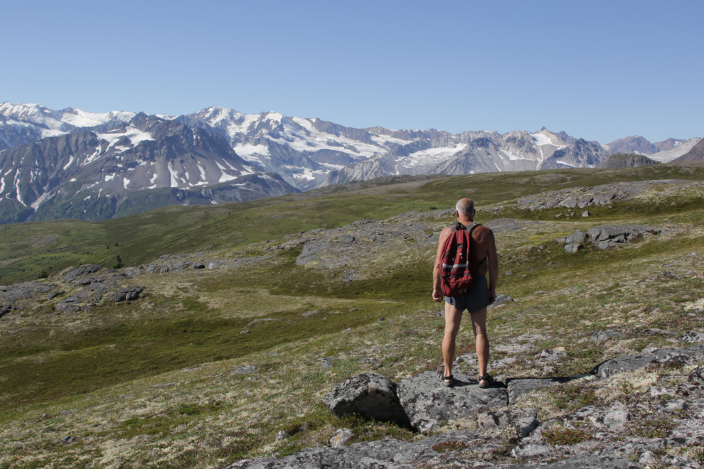
For both Greg and I, hiking doesn’t get much better than this.
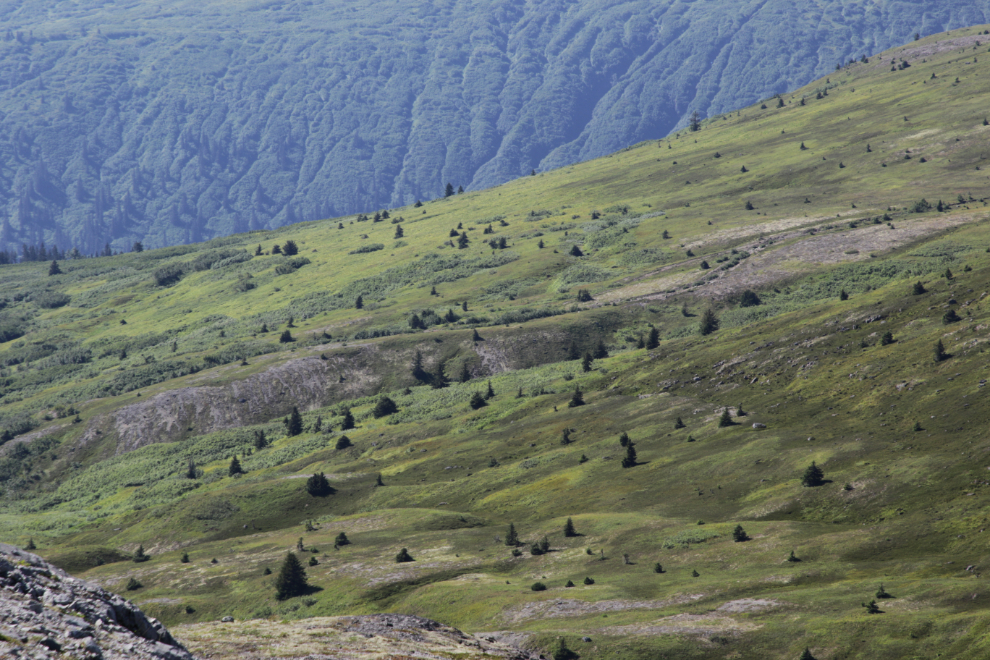
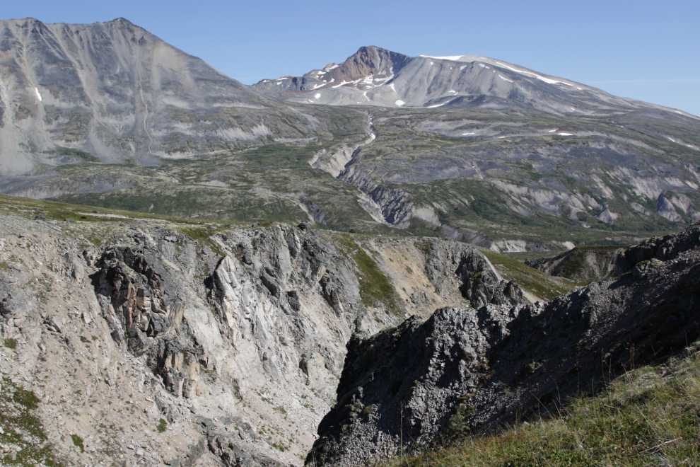
The geology and terrain here are both complex and fascinating.
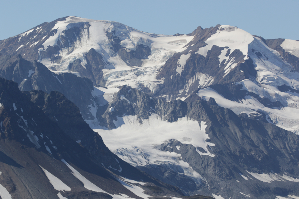
A telephoto look (164mm) at some of the peaks and glaciers. There are some particularly fine hanging glaciers in this shot.
We saw a lower pass to the east of the one we had been headed for. The next photo looks back at a little canyon probably caused by a geological fault in the valley we were leaving.
As we started up to the pass, we came to an area of patterned vegetation, with plants growing in distinct arcs and even some small circles. I have no idea what could cause this, in only this one small location.
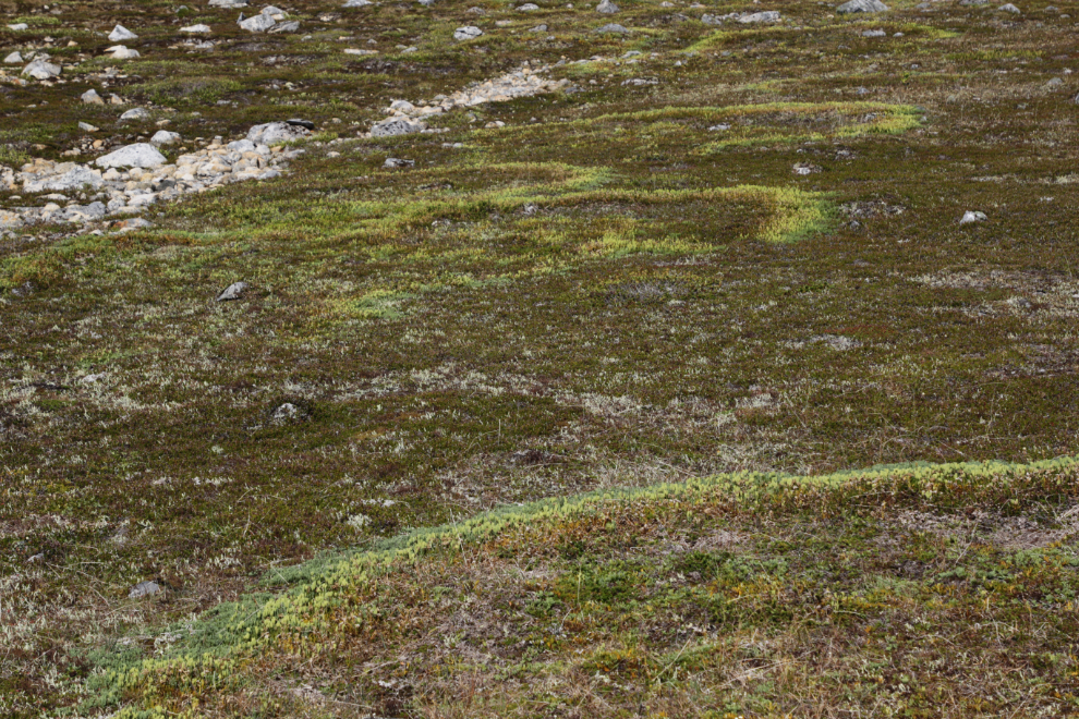
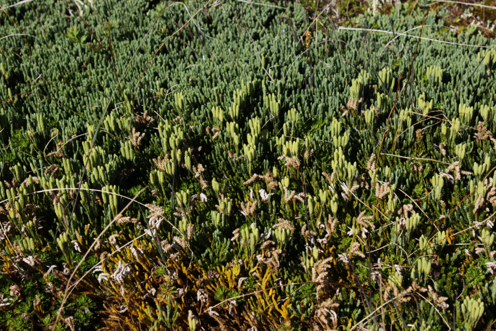
These are the plants that make up the patterns.
It’s very unusual for me to hike in an area where bugs are a problem, but they were all through the summit area this day. They weren’t bad, but they were annoying.
The view north from the top of the pass, at 1:35.
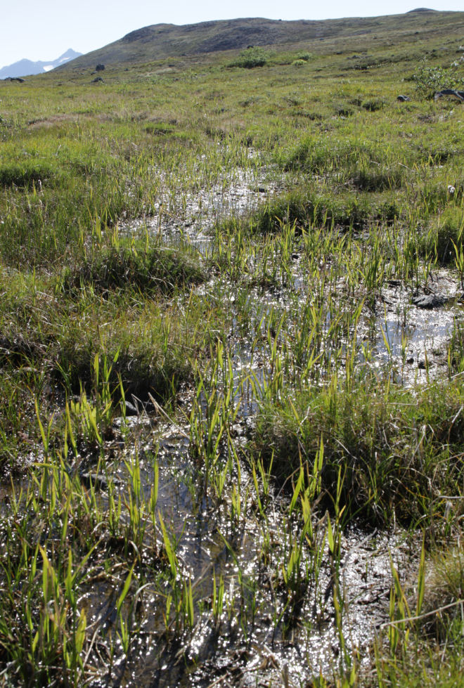
Dropping down, we were soon in a vast area (several hundred meters square) of wet ground created bye a series of springs along the ridge above us. There is enough water flowing in total to supply a small community.
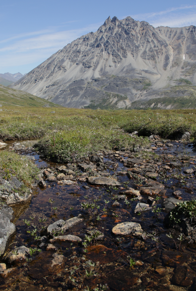
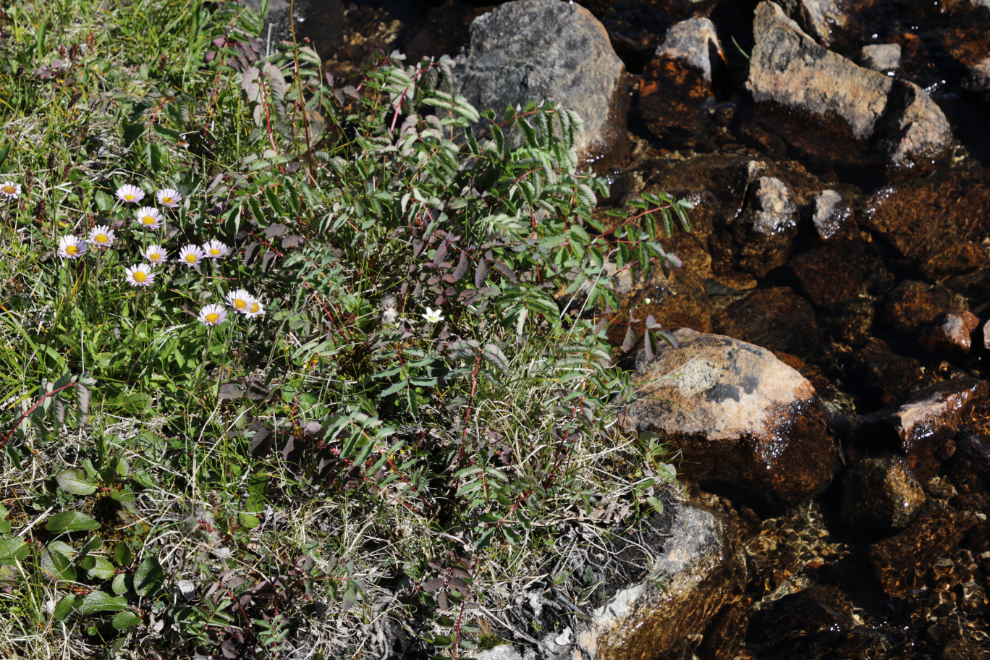
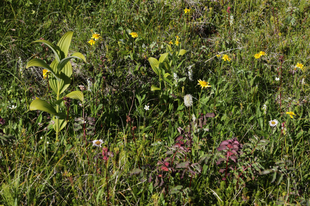
Where there’s water, there are flowers, and there was a large variety of species spread across the area.
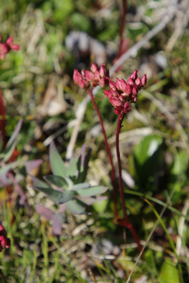
My app says this unusual one is Fireleaf leptarrhena (Leptarrhena pyrofolia).
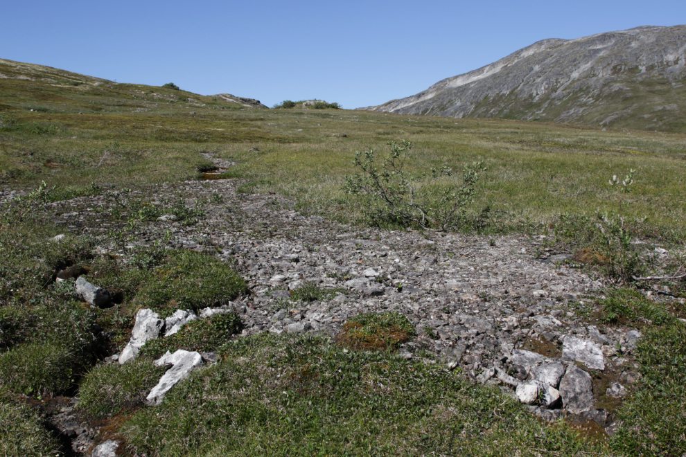
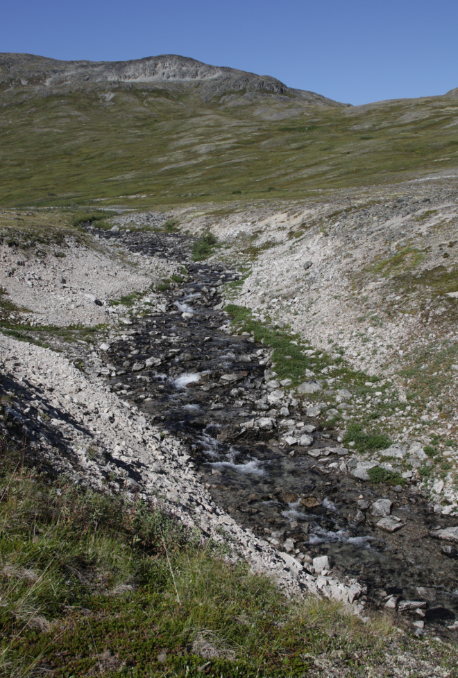
Earlier in the season there were several creeks flowing down it, that are now dried up.
At 2:50 were we nearing the spot where we started back towards the truck. I just wanted to check out the view from one more ridge – only a few hundred meters ahead 🙂
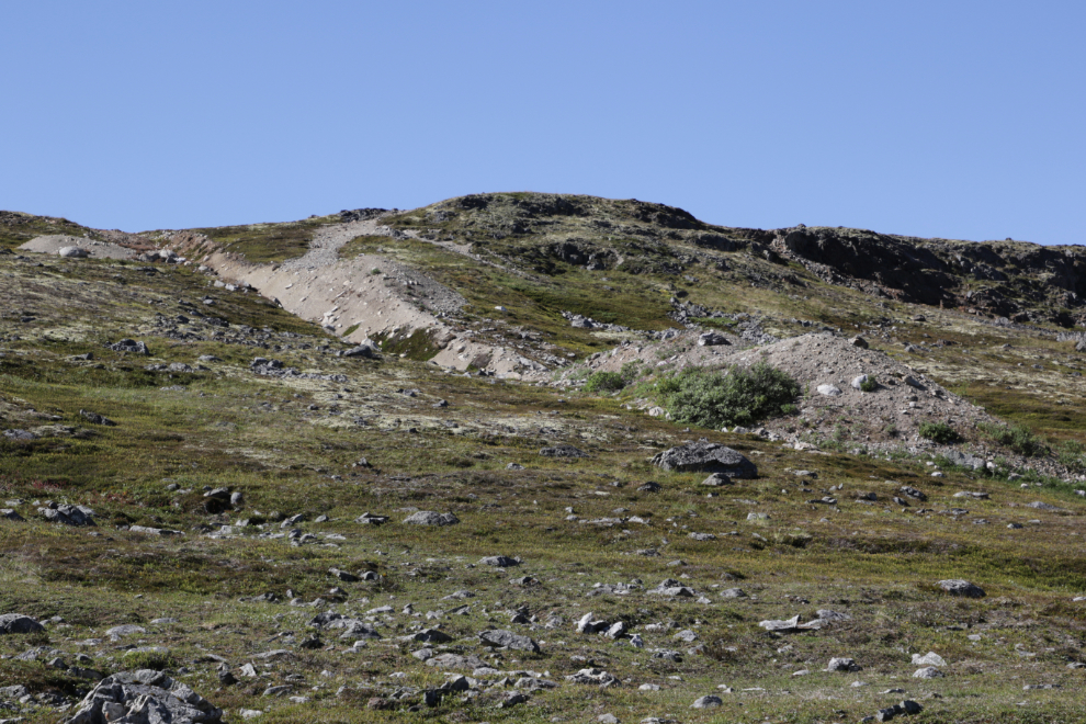
This mining exploration cut was a surprise. I expected that a Cat trail must lead to it from the other side of that ridge, where there is quite a network of mining roads. We were both too tired to climb up to see if that was the case, but a look at aerial photos when I got home showed that to not be the case. The equipment was apparently brought in and taken out when enough snow covered the ground to protect it.
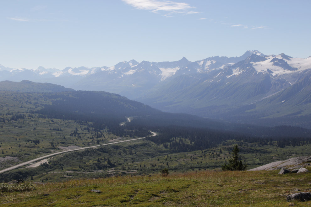
From the ridge where we turned back at 3:15, I got a telephoto (188mm) shot of a road we hiked up in July 2017, to a communications tower. We could see many hikers on the Tina Creek trail – there were 7 vehicles at the trailhead, far more than I’ve ever seen before.
The Three Guardsmen – the spike on the left is Mount Glave
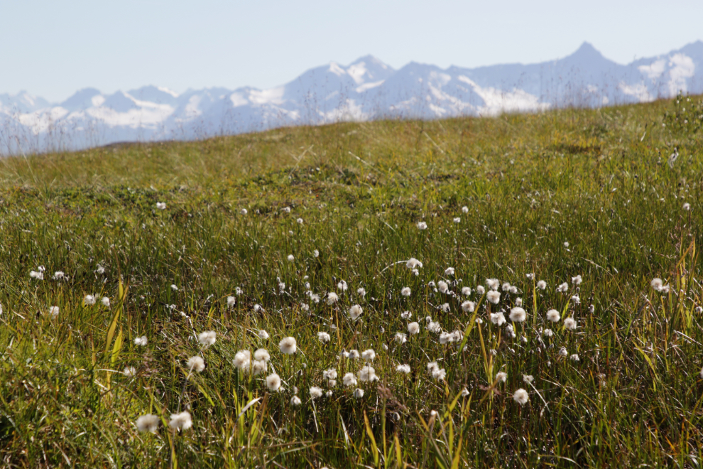
Back into the wet area, we came to the only patch of Arctic cotton grass we saw on this hike.
In some places it was just plain swampy. In many places the water and associated features made walking more difficult.
At 3:45 we reached the start of the very impressive lower canyon of Tina Creek. The next photo shows the creek just above the drop into it.
Looking down at the upper part of the drop.
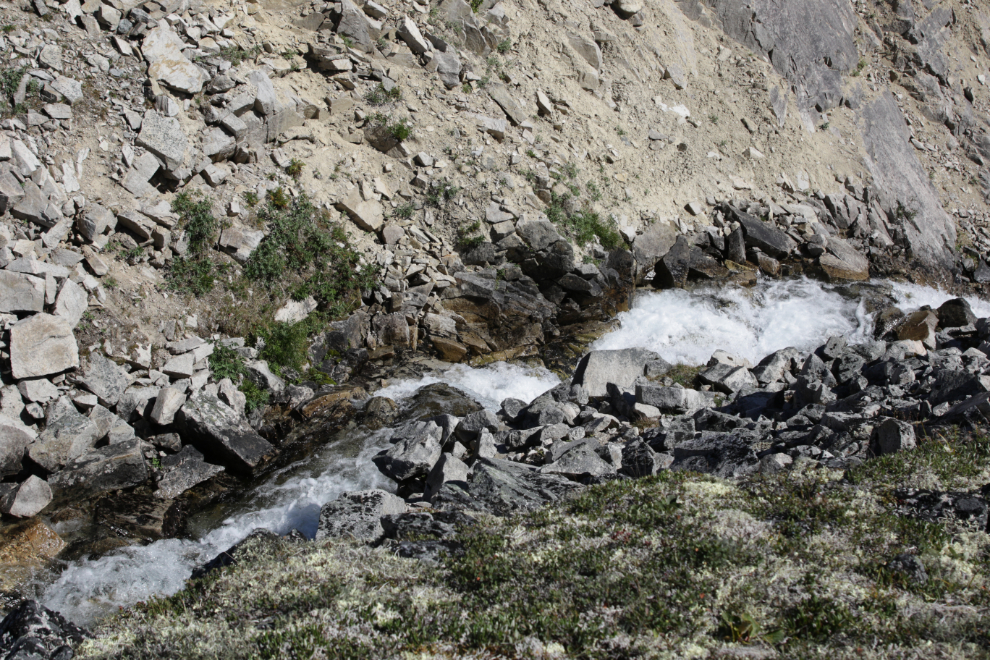
More of the drop. From the usual Tina Creek trail you would never know this canyon exists, although there are hints if you have a curious nature.
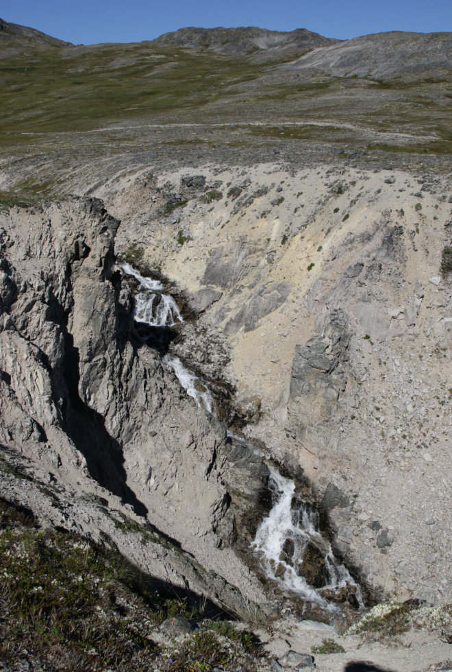
Looking down the canyon, it can be seen that it matches another canyon coming down from the Three Guardsmen, confirming its geological fault origin.
Away from the canyon edge, there was still a lot of water, and lots of flowers.
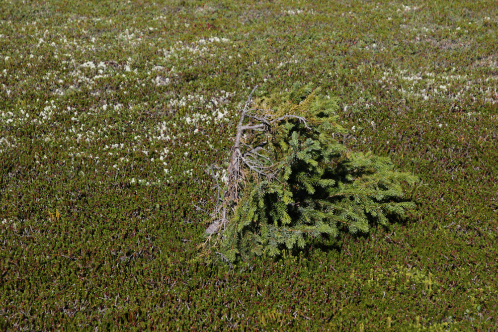
When I get tired, I shoot less photos – the final photo of the hike shows a little spruce probably many decades old, right at the edge of survival.
When we got back to the truck, my navigator showed that we had hiked 6.99 km – not bad at all for 2 guys in their 70s 🙂
Back at the motorhome, we savoured a cold Yukon beer, then I went to bed and Greg headed home to Haines, probably to do the same.
It was a quiet evening, just enjoying our surroundings and taking Bella and Tucker for short walks.
By 12:30 on Monday Cathy and I were pretty much packed up and ready to leave the summit. Although I would have been happy to park there for a few days 🙂
I shot the final photo at 1:15 as we were headed down the hill for a 5-night stay in Haines.
As I post this, we are on our 4th day in Haines. So far, there will be 2 posts about Haines – one about the very cool Hammer Museum which I finally found open, and one about everything else.
Hey Murray! Check out the Copper Butte Trail in Tat-Alsek park BC Parks trails page for how to get to that old mining road you mentioned. It’s a bi*** of an alder Bushwhack but well worth the final result! I did it last fall and it was incredible. Cheers!
That’s great – thank you!
Copper Butte route
The Copper Butte hiking route is an abandoned access road roughly 160 km south of Haines Junction on the Haines Highway. It is approximately 3 km past the end of Three Guardsmen Lake on the east side of the highway.
Park your vehicle in the pull-off at 59ﹾ 584022N and -136ﹾ467244W. Begin by walking down the old Haines Road. This abandoned access road is unmaintained and there is no signage at the start of the route or anywhere along it.
Walk roughly 2.5 km down the old Haines Road until you come to Schulz Creek. This will be the second creek you encounter. From here, head north (right) and begin a moderately strenuous hike through the Alder.
This goes on for about 100 m until it opens to the old Copper Butte mining road. Follow this to the old mines. It is a very scenic abandoned road with many visible remains from past mining activities.
Once you reach the first plateau, the terrain opens. You are greeted by mountainous vistas and get a bird’s-eye view of Inspector Creek. From the Copper Butte Plateau, you can continue north-northwest to Mineral Lakes.
There are beautiful camping opportunities on the shores of these alpine lakes. From Mineral Lakes, you can head towards the Chuck Creek Trail, which makes for an easy walk back to the highway.
It was such a great day for such a fantastic hike.