To Green Point, with a shipwreck and a UNESCO geologic site
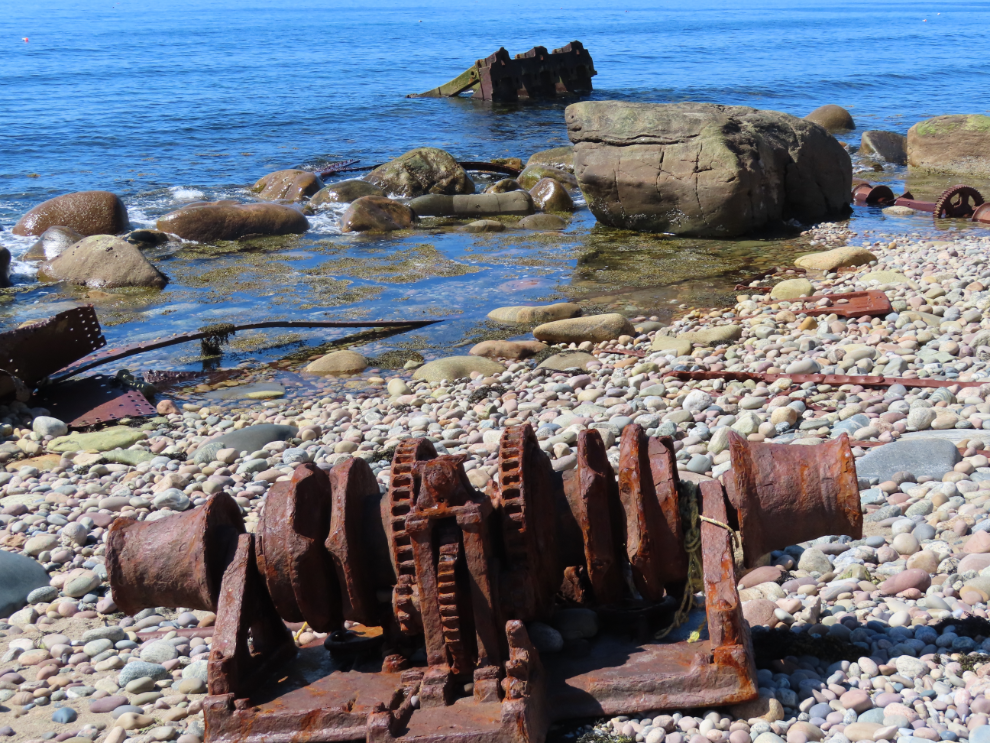
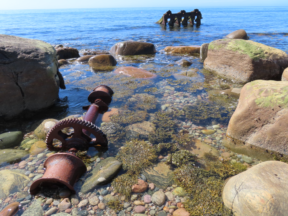
Following our Western Brook Pond boat tour, it was only 23 km to Green Point Campground where we had a reservation. After 10 minutes on the road, though, a sign reminded us of the S.S. Ethie shipwreck at Martin’s Point, and I pulled in there. It’s a very scenic stop.
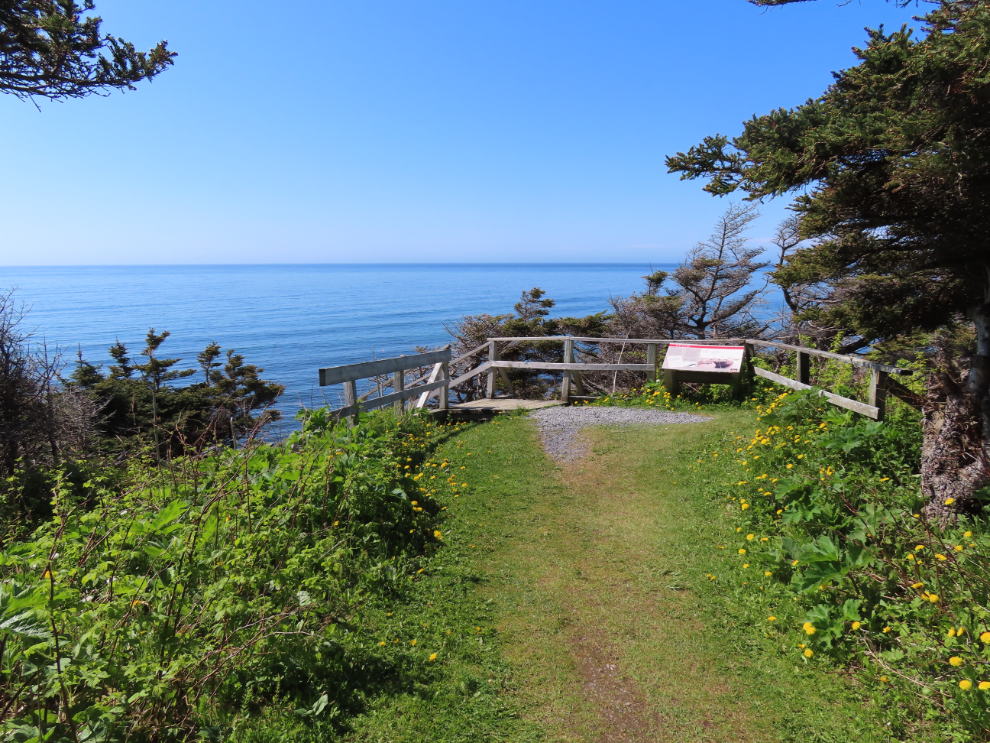
Ethie was an auxiliary steamer – a sailing vessel that also had a steam-driven engine – working the coastal trade. She was wrecked here in a storm on December 11, 1919. While the ship was lost, it was rather a miracle that everyone on board was saved.
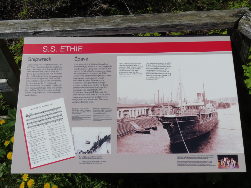
It was nearly high tide, but there was still enough wreckage to made it very interesting.
nfld5-7586.png
We were soon at the Green Point Campground, where Cathy had one of the nicest sites booked (as usual).
The best couple of sites were booked immediately when reservations opened, but this view looking north up the coast was less than 100 meters away.
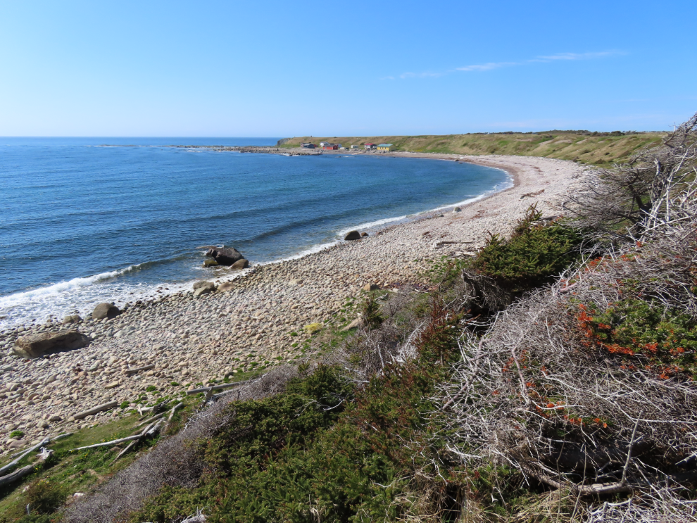
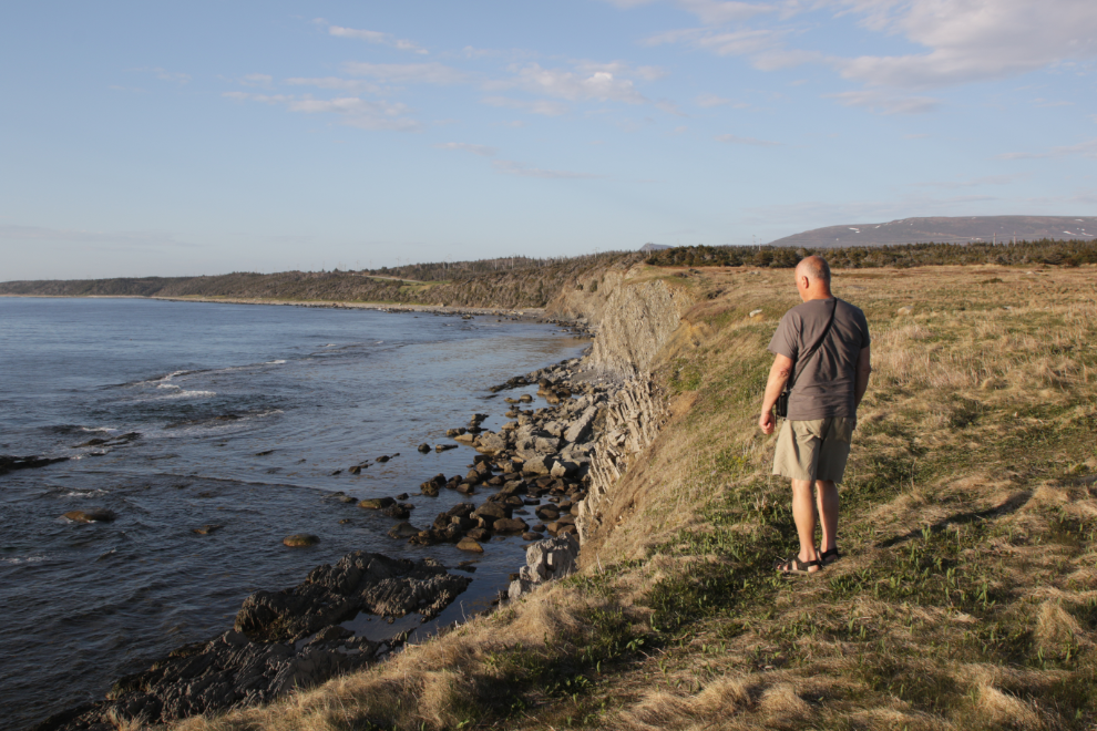
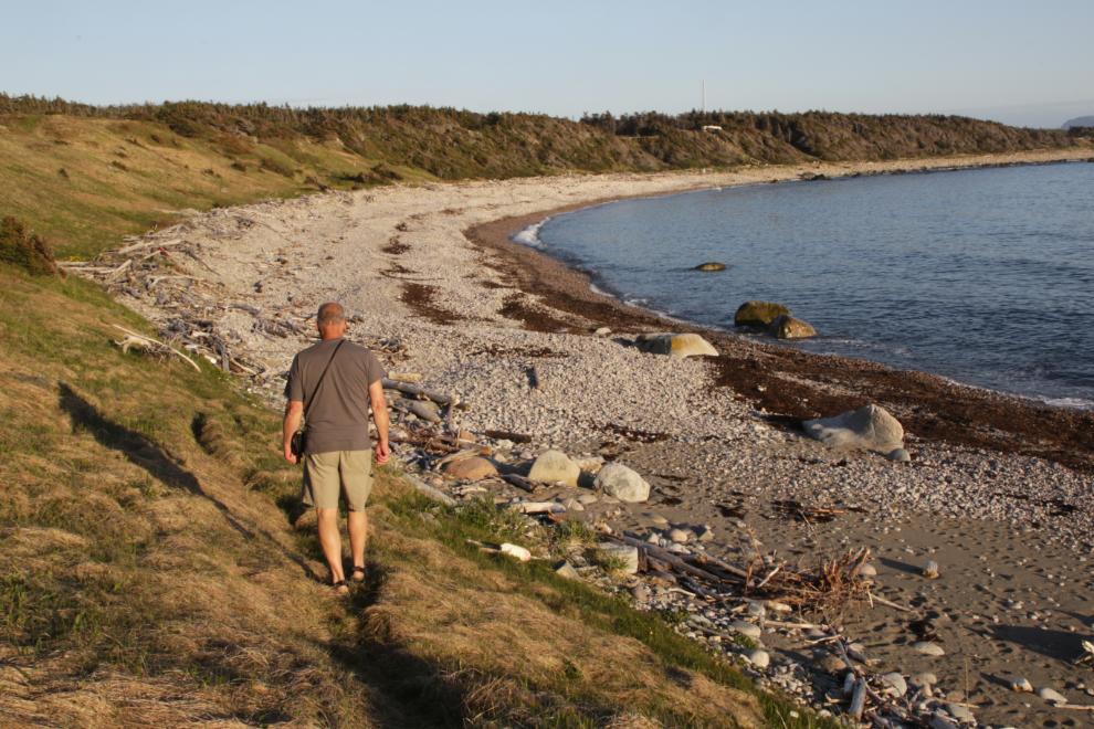
At 7 pm I decided to see if I could find the famous geologic site, having failed to find a map. I hoped it was north along the beach (this photo is looking south).
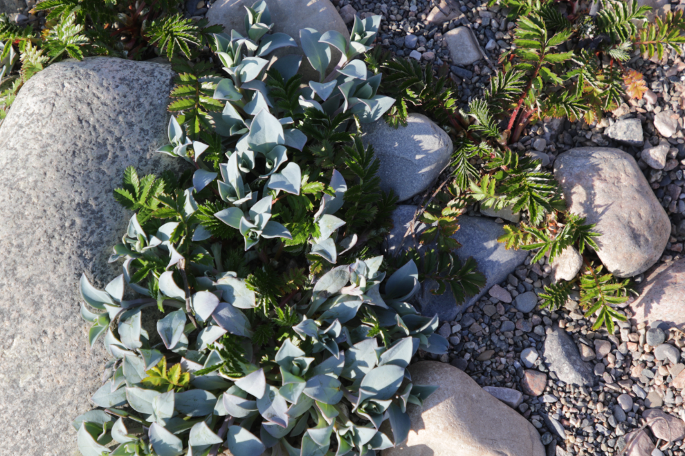
There was a trail along the beach above the rocks for a few hundred meters. I am of course constantly encountering plants I don’t know. THe silvery-blue leaves are oyster plants (Mertensia maritima), so called because those leaves have an oyster-like flavour.
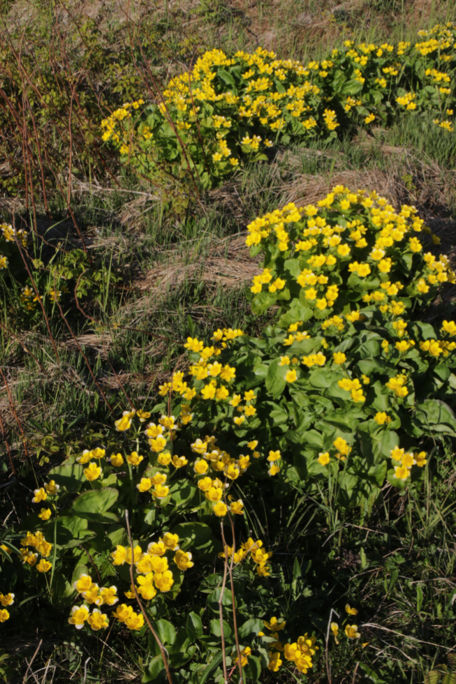
In the wet ground along a small stream Marsh marigolds (Caltha palustris) were doing very well.
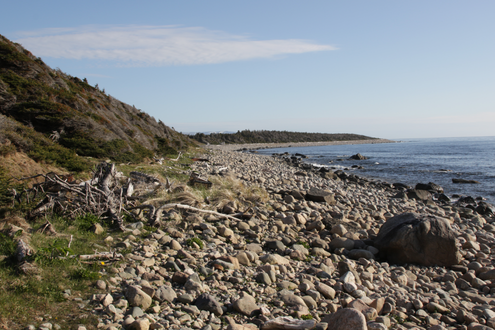
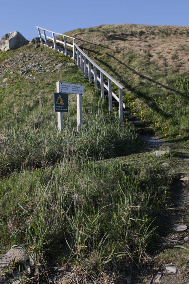
Large, loose rocks made walking on the beach rather challenging when the path ended, and the cabins along the beach took some thought to get around, but even so, I reached the geologic site in only 20 minutes. There are stairs down from a parking lot accessed from the highway.
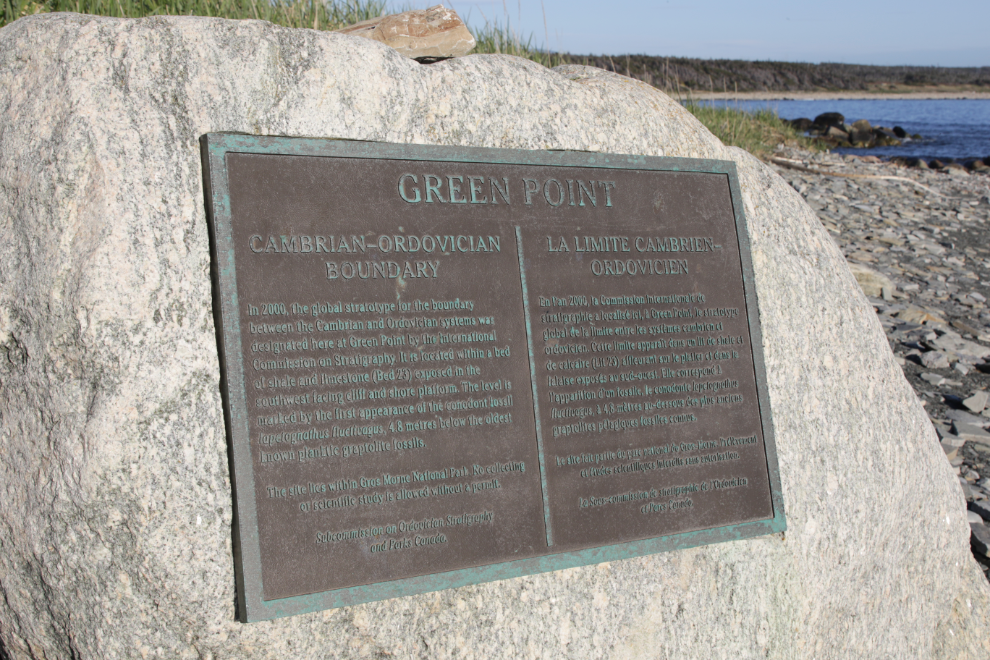
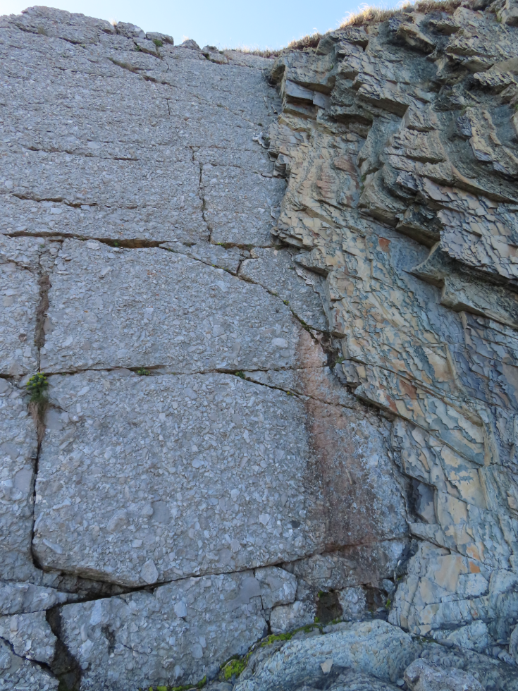
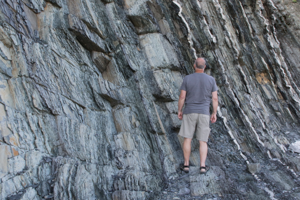
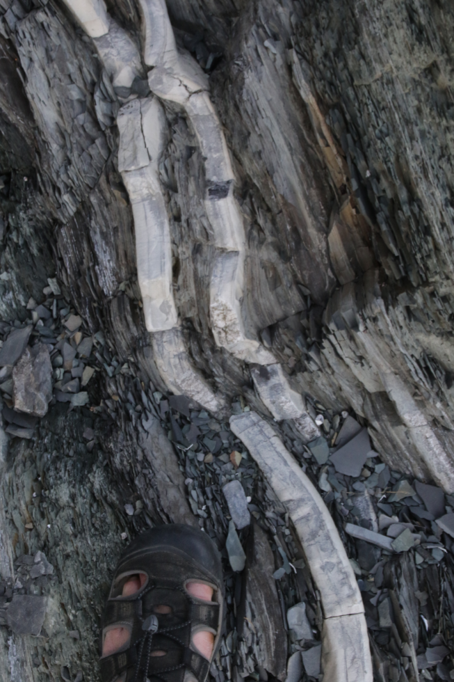
“Green Point Cambrian-Ordovician Boundary. In 2000, the global stratotype for the boundary between the Cambrian and Ordovician systems was designated here at Green Point by the International Commission on Stratigraphy. It is located within a bed of shale and limestone (Bed 23) exposed in the southwest facing cliff and shore platform. The level is marked by the first appearance of the conodont fossil iapetognathus fluctivagus, 4.8 meters below the oldest known planktic graptolite fossils.”
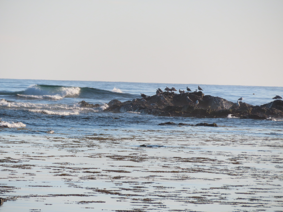
The surf and birds were a wonderful addition to the rocks 🙂
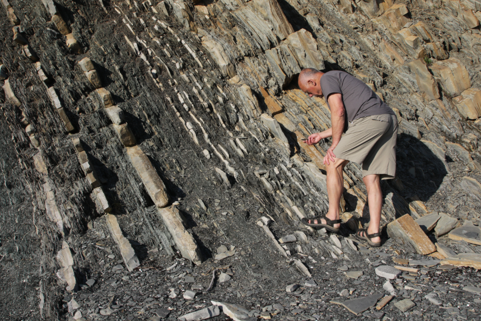
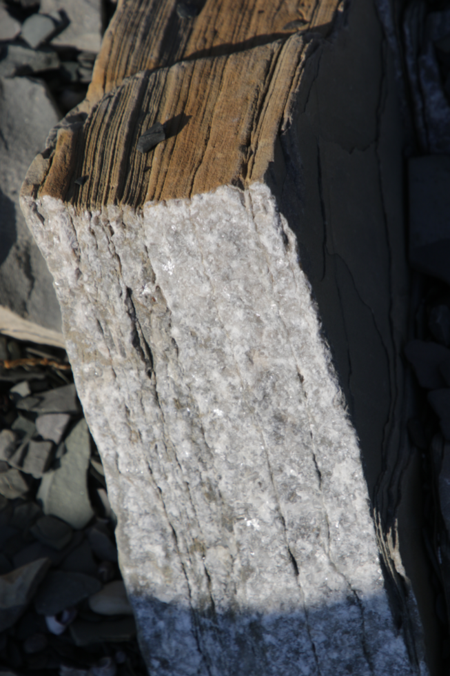
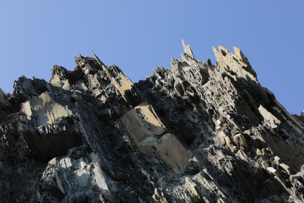
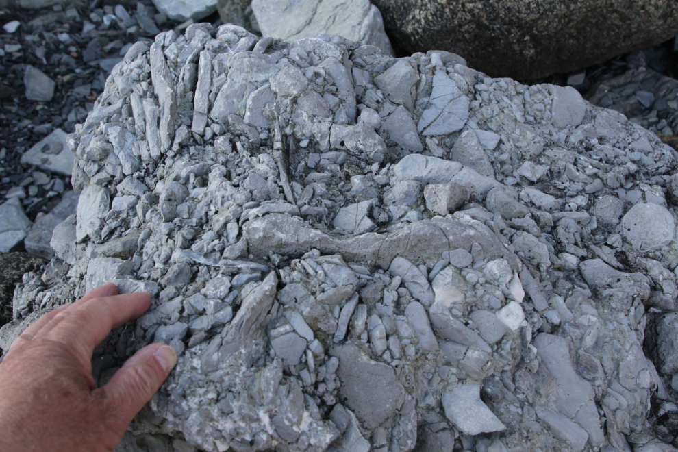
I have no explanation of what the next 7 photos are showing exactly, but I’ve never seen a formation like this before. Perhaps you’ll find them as intriguing as I do. There was a Parks Canada tour to the site being held the next day, but it wasn’t early enough in the day to allow me to attend.
I finished by going up top – so much exploring to do! 🙂
I found a path along the top of the cliffs leading back towards the campground, but it didn’t go very far and I was soon forced back onto the rocks.
Walking along the water’s edge this time, the sound of the rocks being rolled by the surf was amazing, and I shot a video of it.
Most of our driving days are short but at 348 km, the drive to an RV park near L’anse aux Meadows the next day would be one of the two longest ones.