Three days boondocking along Abraham Lake, Alberta Highway 11
Just after 3:00 pm on Day 44 of the trip – Friday, June 8th – we left Rocky Mountain House National Historic Site and headed west on Highway 11. The destination was vague – somewhere around Nordegg, where I wanted to take a tour of the historic coal mine the next day. I arrived at Nordegg, 89 km from the Rocky Mountain House site, at about 4:30, and made the short detour into town for a look around. I’ll show you a bit of Nordegg in my next post, which will be about the mine tour.
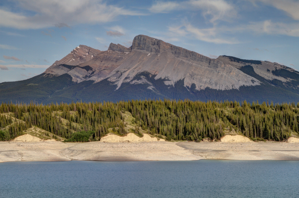
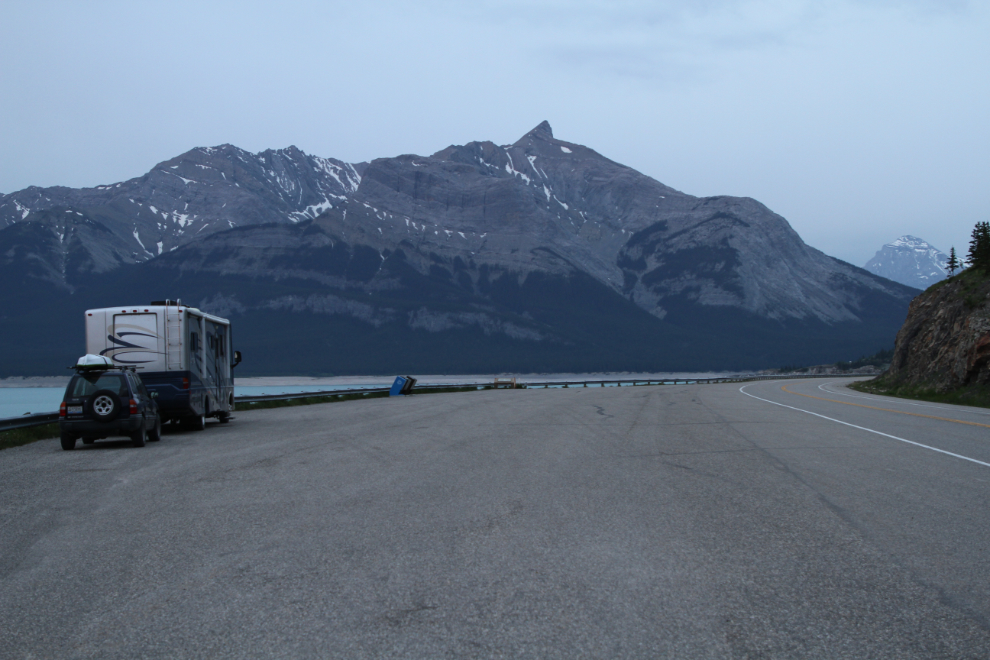
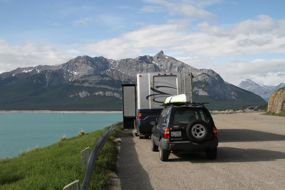
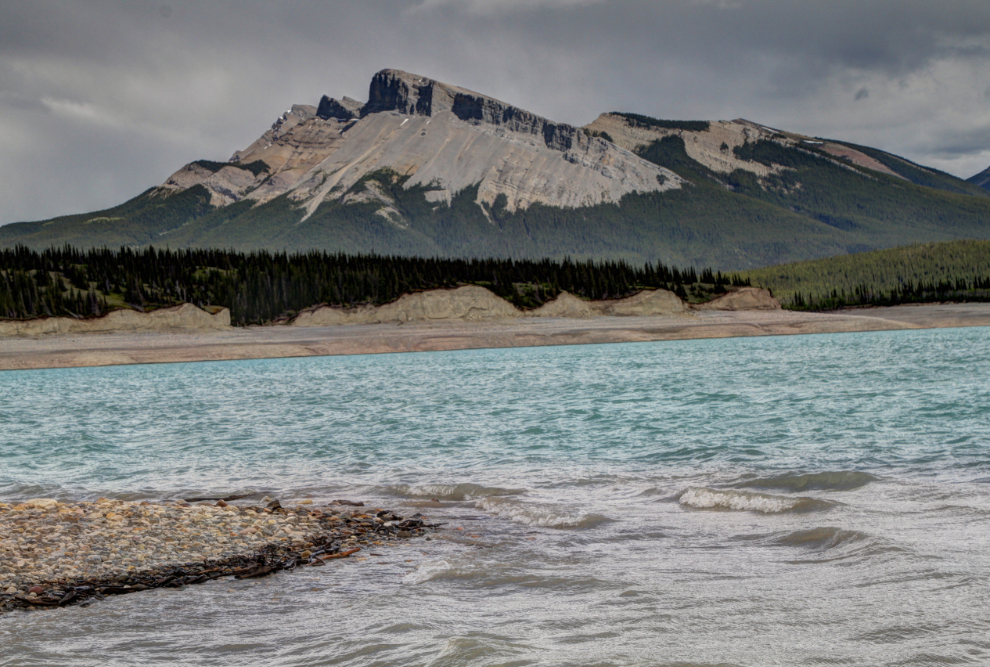
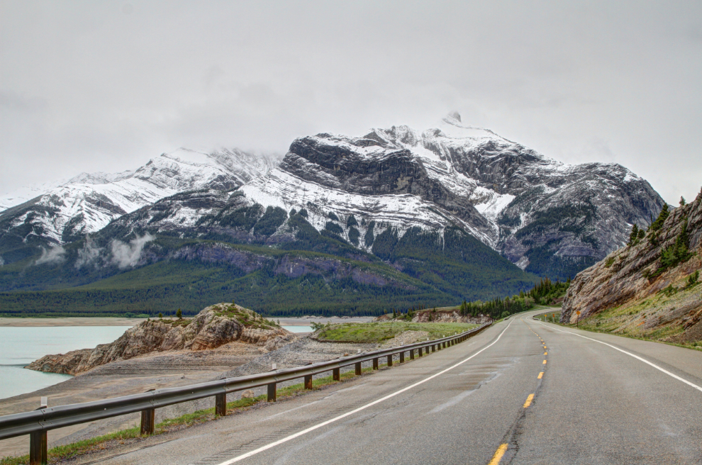
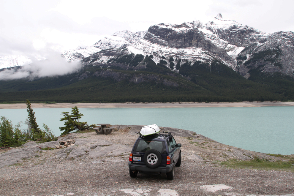
I had been watching for a spot to overnight as I got near Nordegg, but nothing appealed to me. There were some Alberta Provincial Recreation Site campgrounds, but knowing nothing about them, I wasn’t willing to pull off the highway into any with a rig the size of mine. I remembered a huge pullout on Abraham Lake from last December, when I discovered this spectacular highway. This pullout turned out to be an excellent choice. The first photo shows the view ahead (to the west), of Mount Michener, named in honour of Daniel Roland Michener, who served as Governor General of Canada from 1967 until 1974. The peak is 2,499 meters high (8,198 feet).
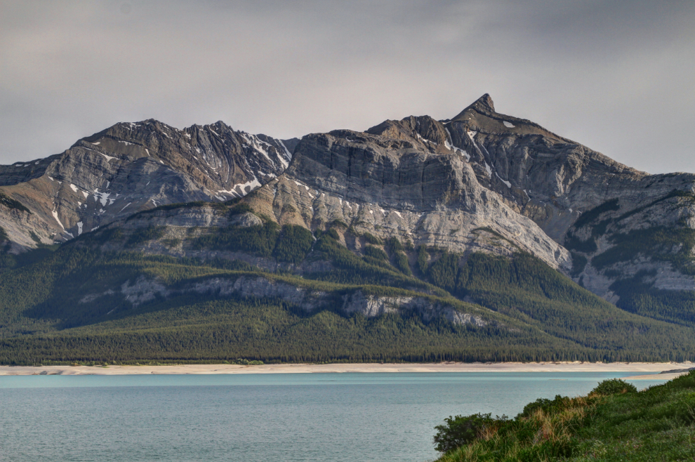
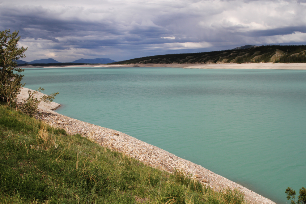
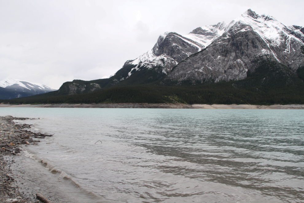
Next is the view across Abraham Lake, which is Alberta’s largest man-made lake. It was formed when the Bighorn Dam was built in 1972.
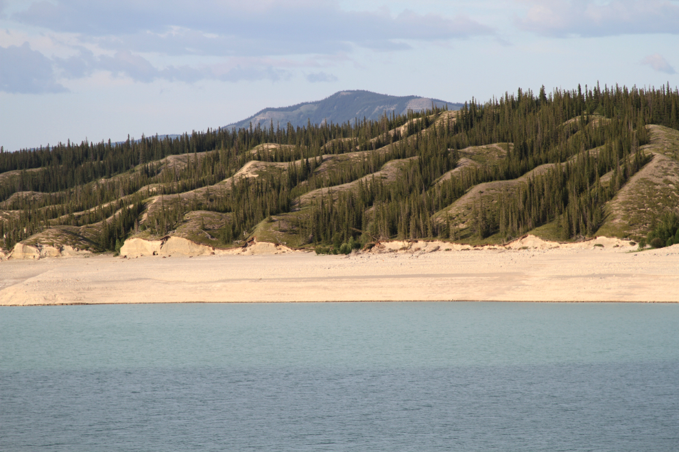
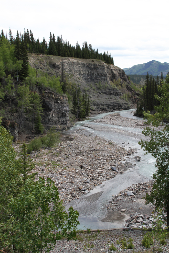
The terrain to the east on the opposite side of the lake is very different than any other in the area.
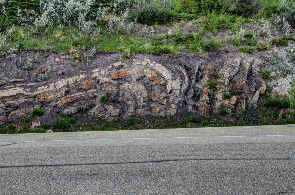
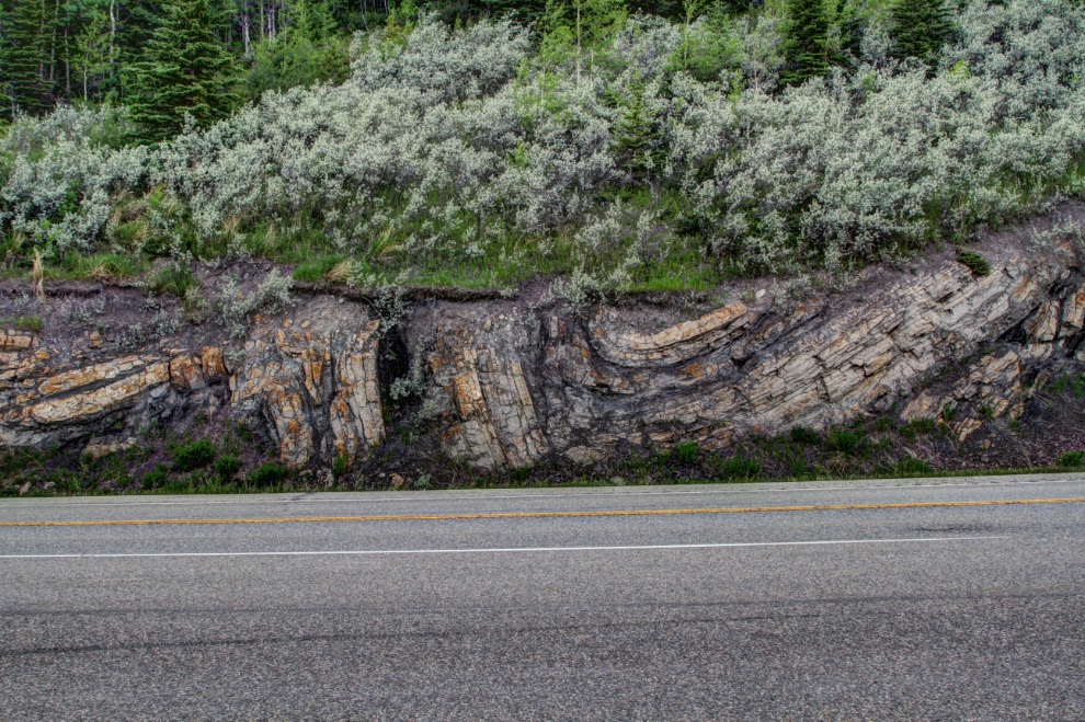
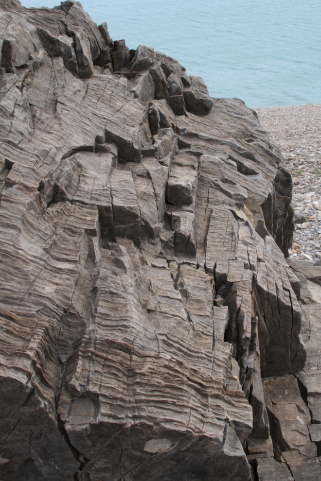
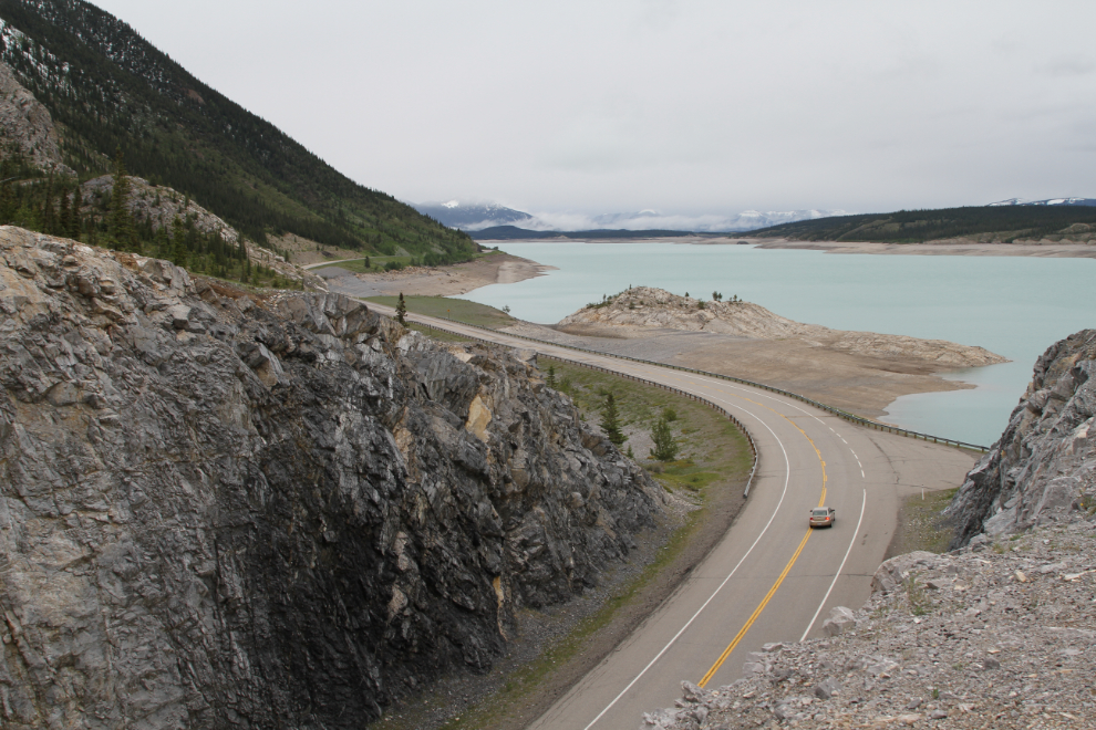
Right across the highway from where I parked, there are some incredible rock formations. It’s hard to imagine the forces that can do that to rock.
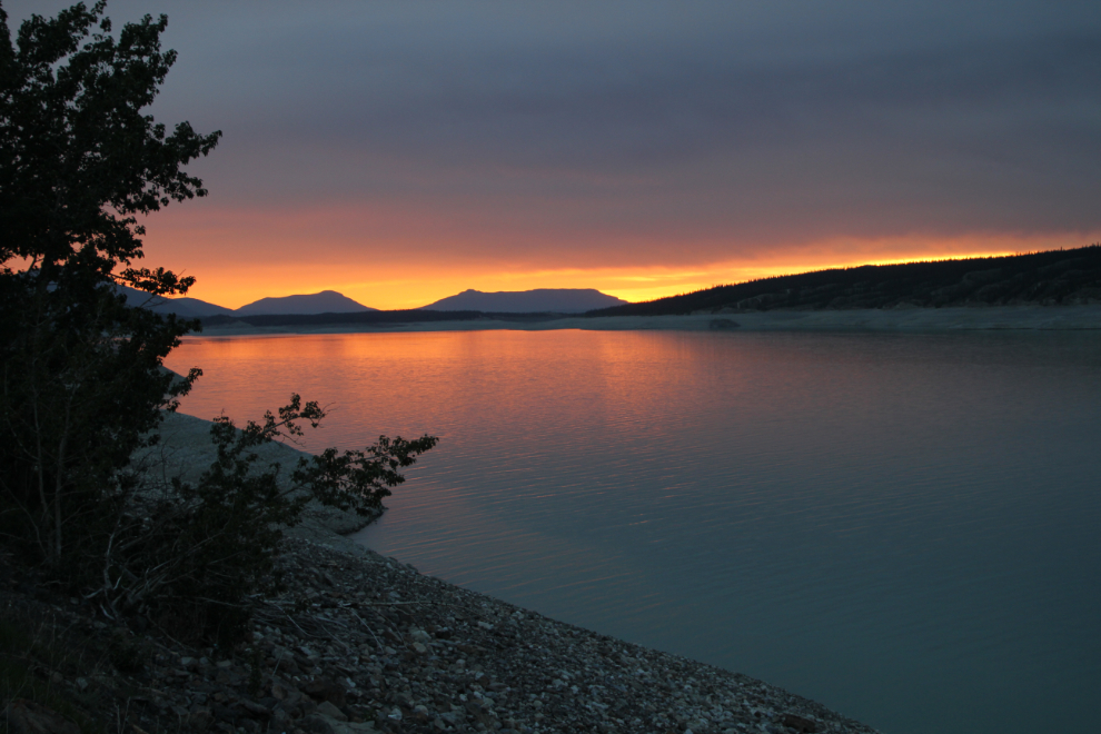
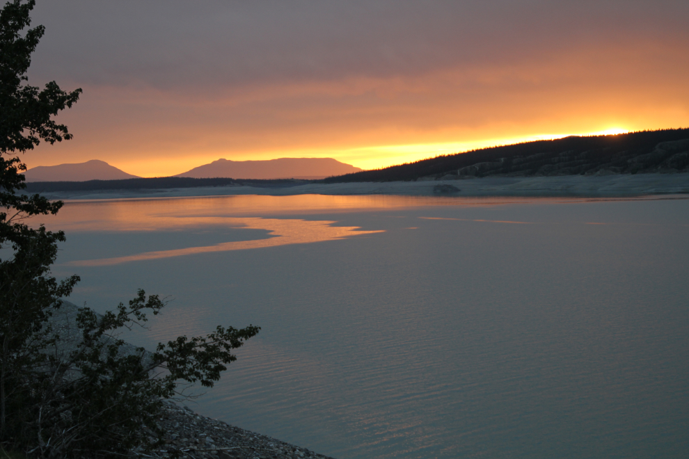
I was awake early the next morning as usual, and was rewarded with a spectacular sunrise which I took the next photo of at 05:29.
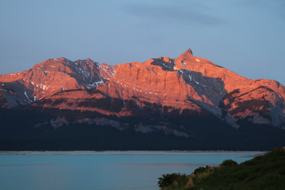
The colours on Mount Michener were amazing as the sun rose.
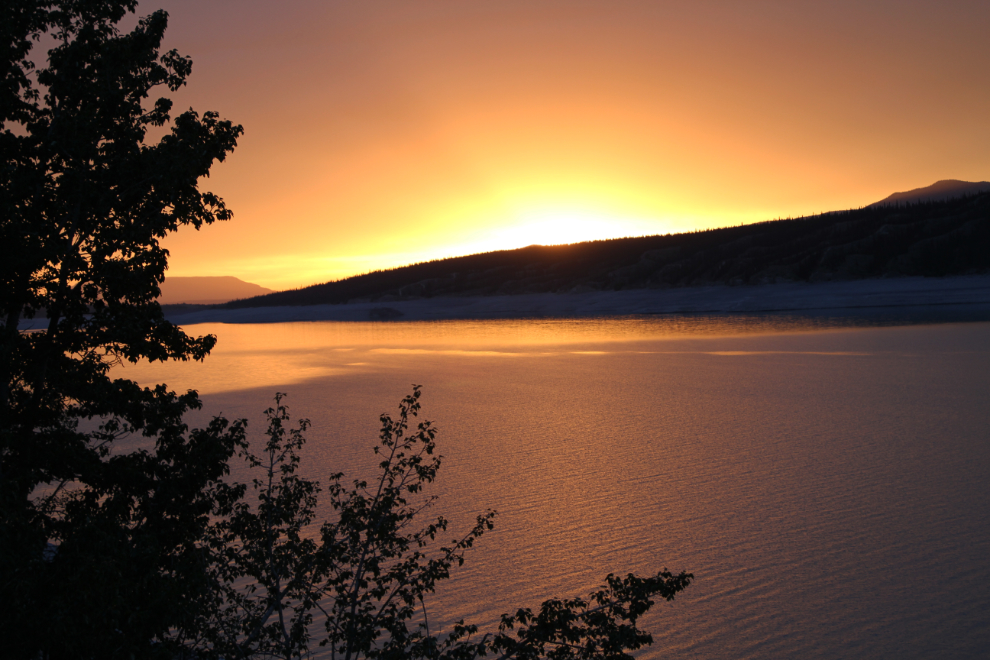
Two more photos shot at 05:36 and 05:41, then the sun lifted into the cloud layer.
Just 2 minutes later, my world was gray. Here’s what the pullout looks like – plenty of room for whatever might come along.
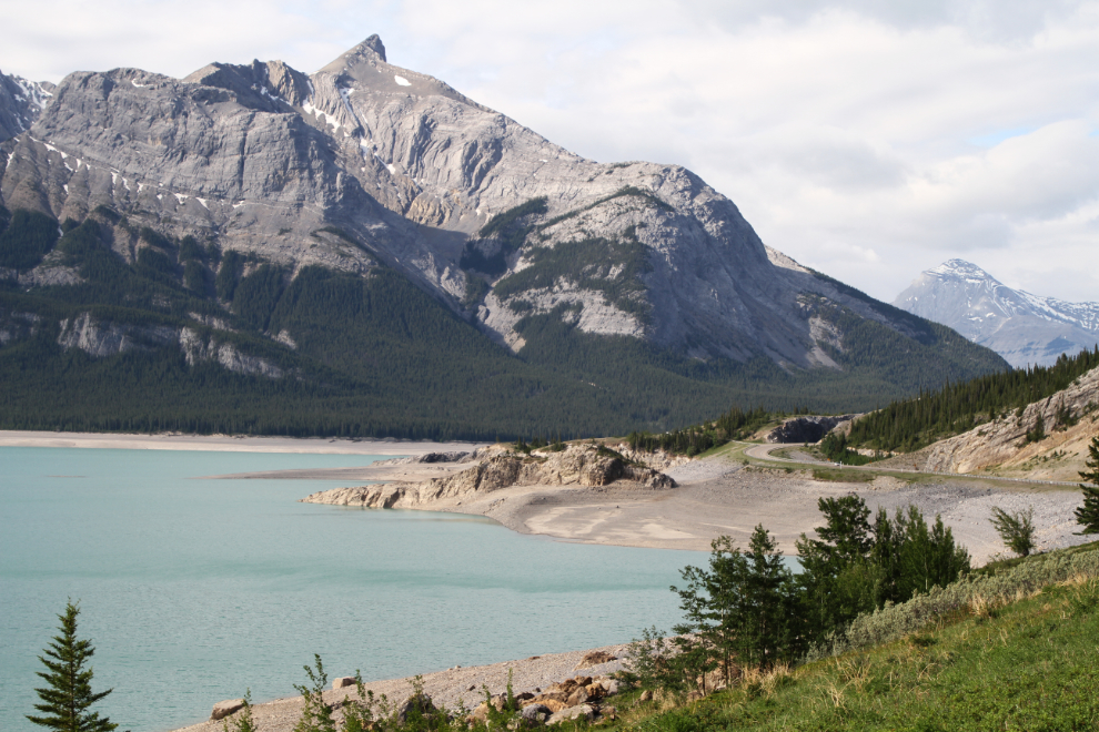
Despite a weather forecast calling for clouds and occasional rain, the sun was out by 09:00.
The lake needs sunshine to bring out the gorgeous milky turquoise colour of the water.
I wanted to take the 10:30 mine tour at Nordegg, so left just after 09:00 to allow for some exploring during the 50-km backtrack. First off, I wanted to know something about Alberta’s Provincial Recreation Sites (PRAs), so stopped in at the Dry Haven PRA.
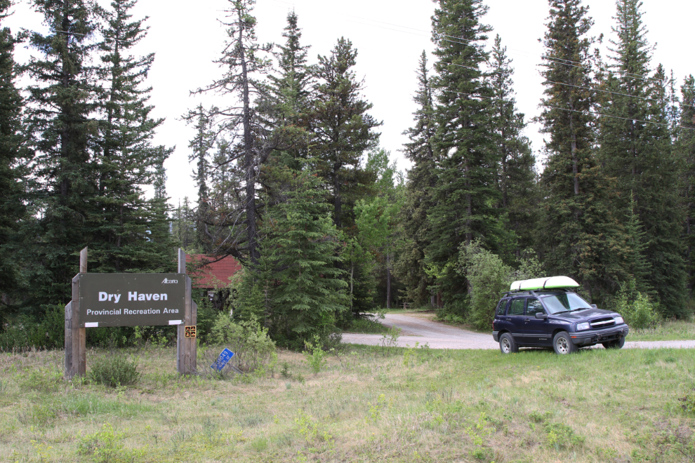
It’s a small campground, with about a dozen sites. The fee per night is $20.
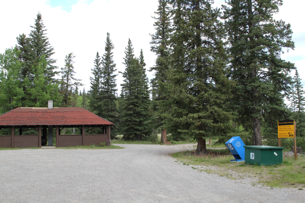
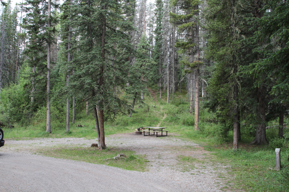
The camp sites are a good size but aren’t meant for larger RVs. Mine is about as large as you’d want to bring in (32 feet for the motorhome, 51 feet including the Tracker).
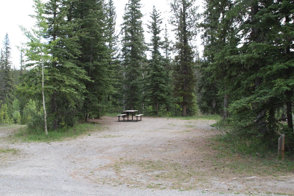
The next photo shows the only pull-through site at Dry Haven. I expect that most of its use is pickups with small trailers.
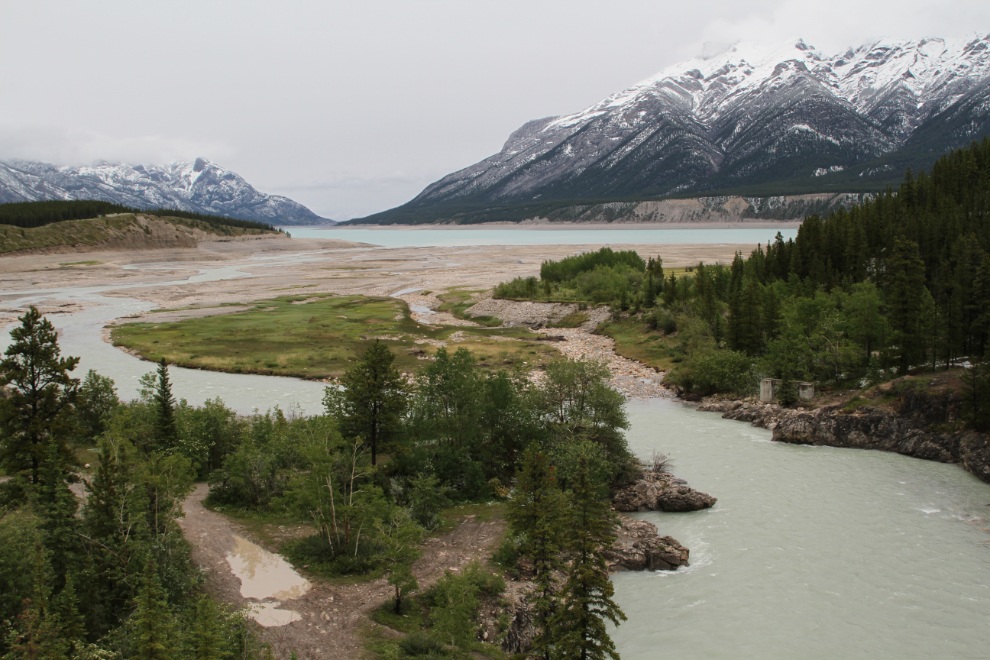
The main place that I had in mind to photograph was the Bighorn River. When I got back to it at 1:00 after the mine tour (which I’ll tell you about in the next post), the light wasn’t as great as it had been the previous evening, but it was still worth checking out.
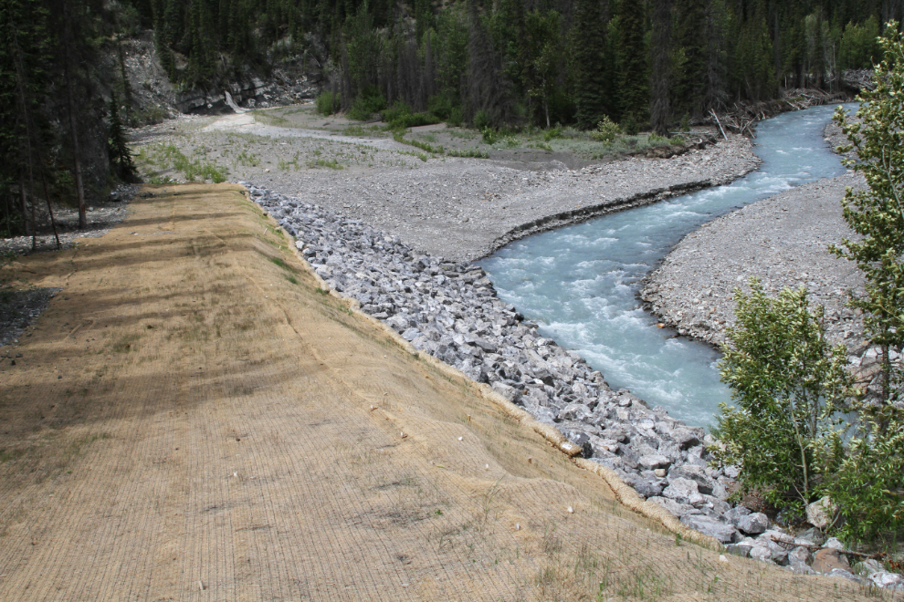
On the upstream side of the highway, a lot of erosion control has been done along the Bighorn River in very recent years, perhaps last year.
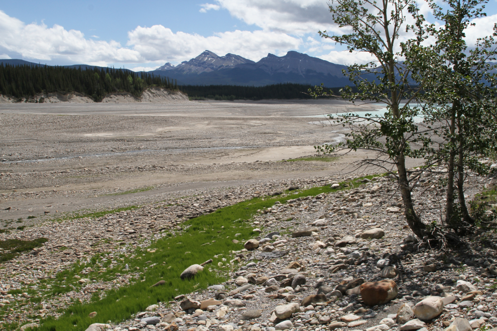
I went down a little gravel road and ended up at this massive dry bay where a few people were camping. The unofficial camping areas I saw were getting much more use than the official ones.
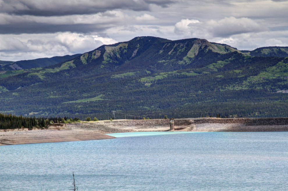
The next photo shows the Bighorn Dam. It’s the largest producer of hydroelectric electricity in Alberta, with an average of 408,000 megawatt hours each year.
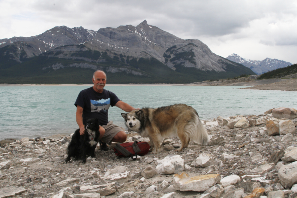
Back at the motorhome, a storm appeared to be closing in on us from the east, so it was time for some exploring with Bella and Tucker.
With the extremely low water, getting down the steep, rocky bank to the shore isn’t easy. It also isn’t easy getting these two to stop for a photo! 🙂
I found a gentler grade and even some sand where the kids could play.
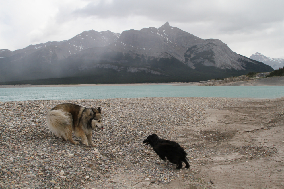
The winds were extremely strong, but the rains were skirting around us so far and the main storm was holding its position to the east.

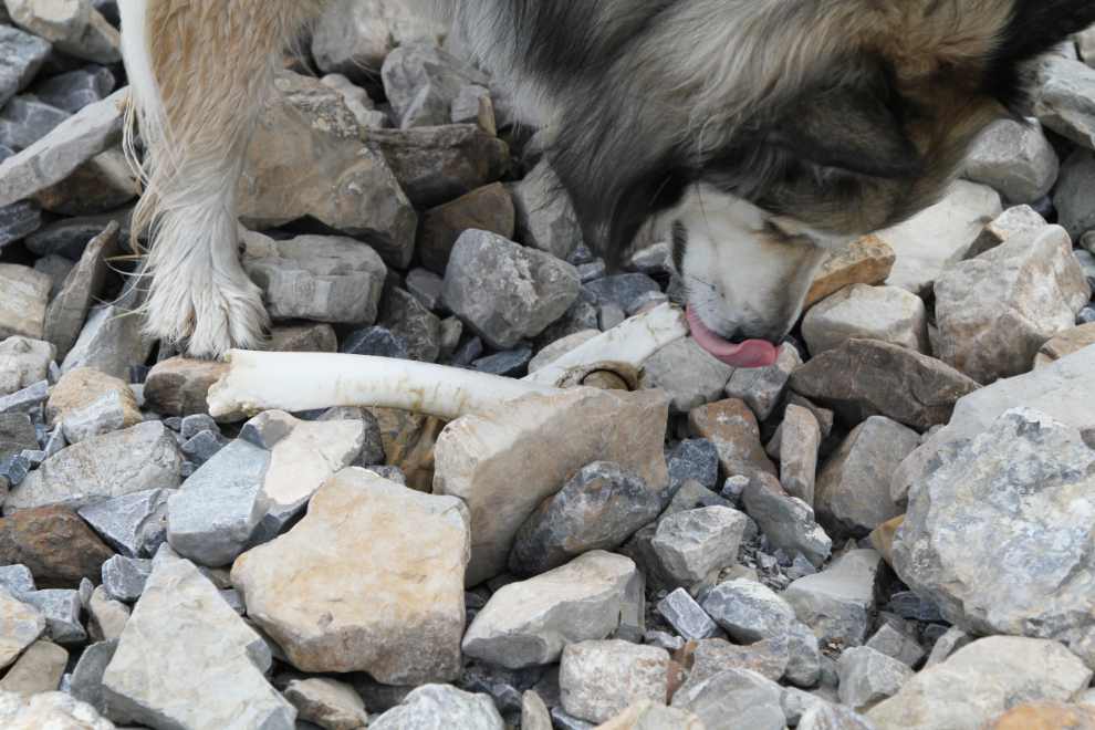
Bella found an elk knee that was fresh enough to be very interesting.
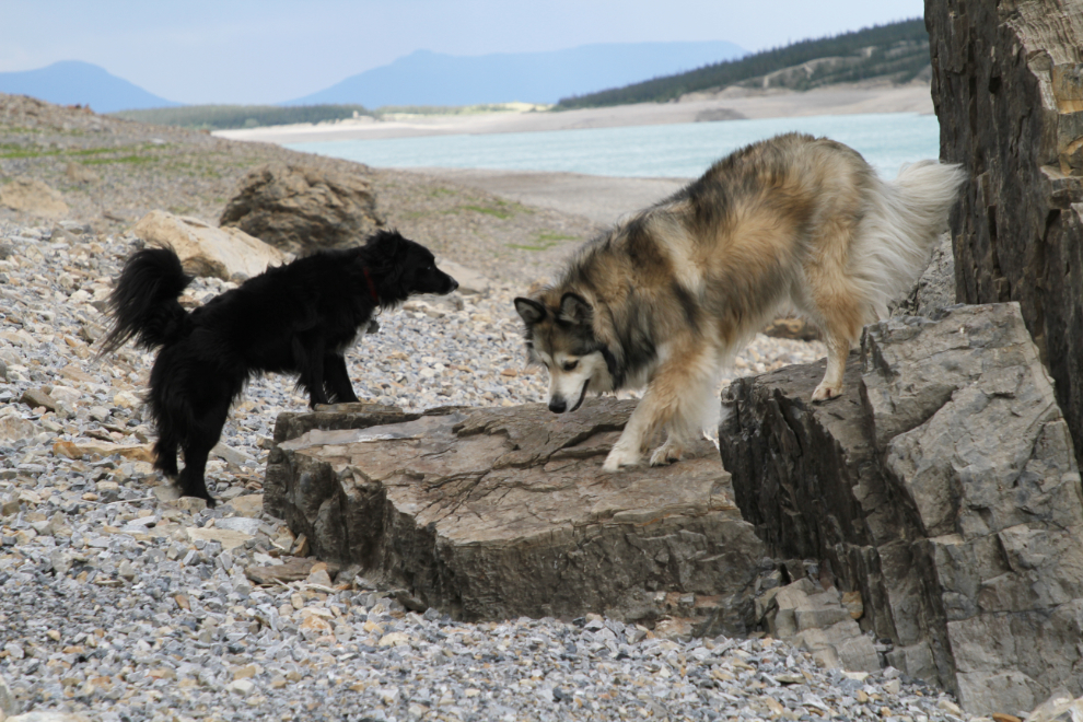
Bella couldn’t resist climbing up onto a high rock after I took her elk knee away.
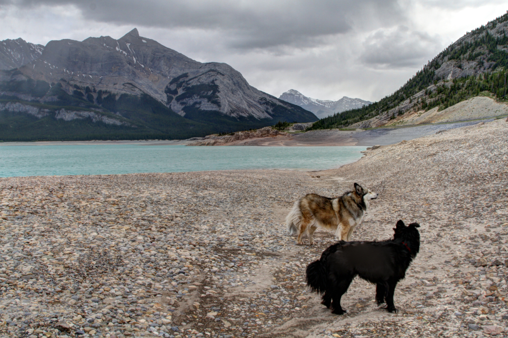
It was a good long walk.
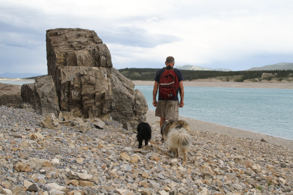
Some of the rocks along the lake are unique, apparently having broken off from the cliffs above and tumbled down.
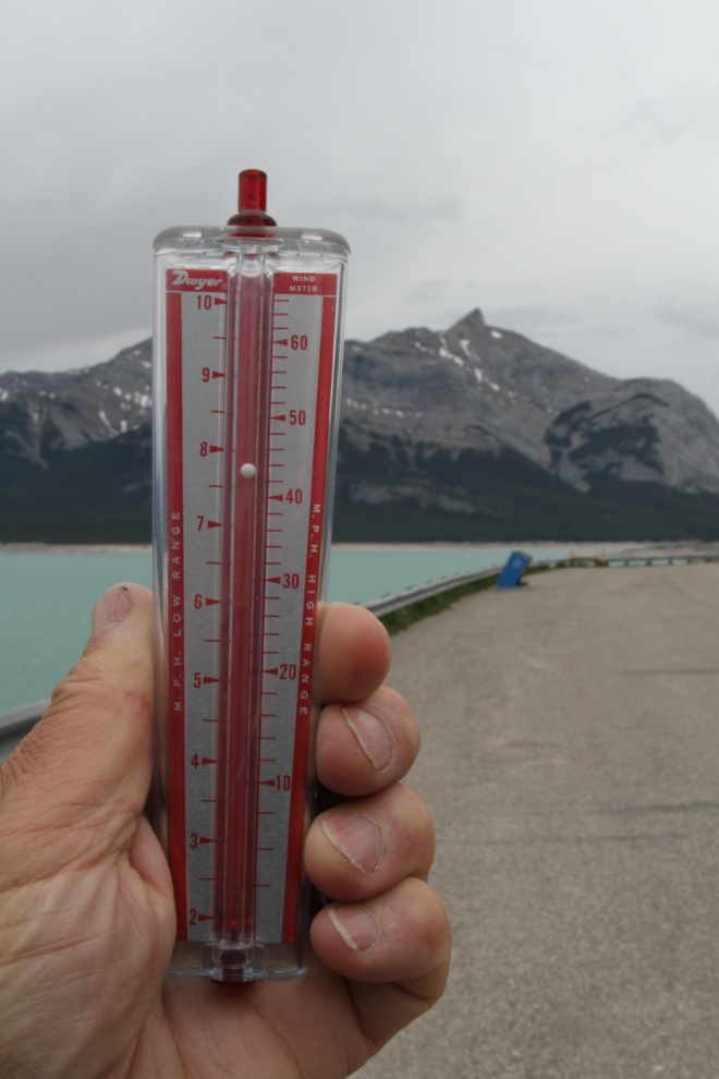
The winds got much stronger, and we retreated back to the motorhome. At 5:30, I found the wind meter that I’d remembered to pack, and went out to see just how strong the winds were. I saw three gusts that went off the scale, which is 65 mph (105km/h)!! The one I caught in the photo was only 44 mph (71 km/h). Something was certainly going to blow in.
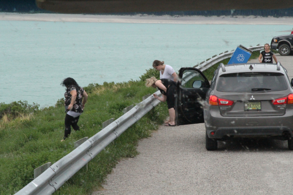
The guardrails along the viewpoint have hundreds of signatures on them. It seems to be understood that it’s okay here – I saw entire families doing it. Bizarre. In contrast, though, grafitti on the rocks in the region is rare.
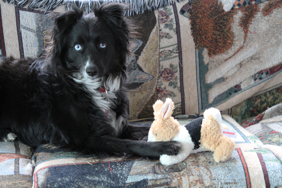
With the wind screaming, we had a quiet night “at home” on Saturday night. I took this photo of Mr. Tucker with his bunny to send to Cathy. She misses all of us, but Tucker has a special place in her heart.
The next photo shows the view out the front window at 05:20. As ugly as that was, it would soon get much worse.
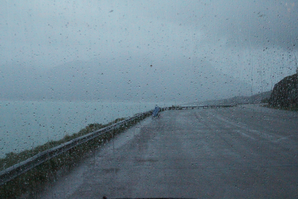
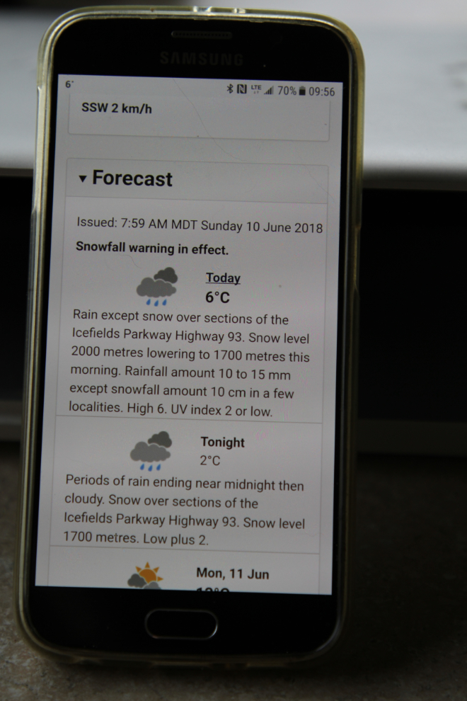
A couple of friends on Facebook alerted me to a snowfall warning that had been issued for the area. Sure enough, there it is! That got me to re-thinking our plans for the day.
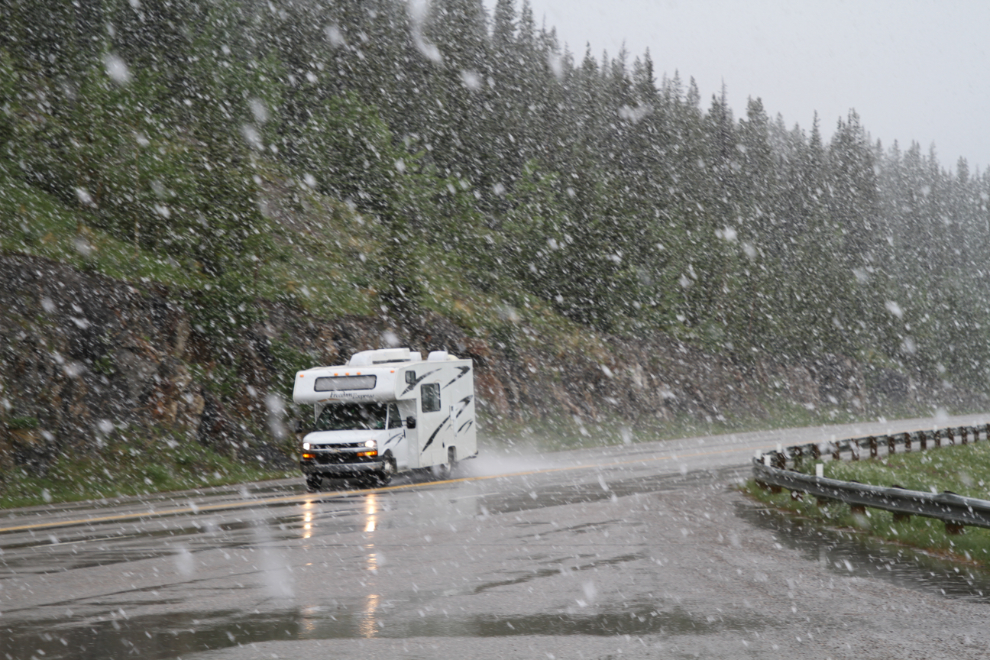
The rain began to turn to snow, and by noon it was snowing heavily, with the temperature at +3°C (37°F). I decided to stay where we were for another night. There were a few rental RVs going by – mostly driven by people with no experience with larger vehicles, and many probably with no snow experience. I’ve put a whole lot of miles on dealing with large vehicles and icy roads, but wanted to be nowhere near them.
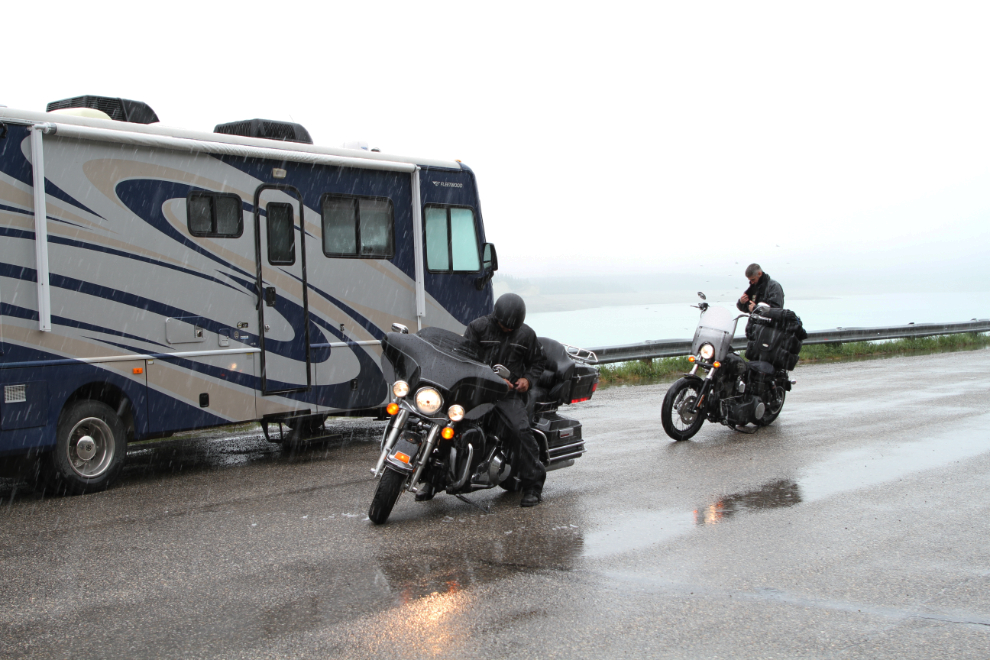
At about 12:30, two guys on Harleys stopped near me. Something didn’t feel right – conditions were atrocious to be out on a bike – so I went out and asked the front rider if I could put a pot of hot coffee on for them. He accepted, and when they came in, I could see just how cold he in particular was. After about 15 minutes, he started to shiver – he had been dangerously hypothermic. They spent almost an hour with me, and when they left, they were only going to Nordegg, where they’d get a motel. I wonder what would have happened if I hadn’t been there when they needed help.
By about 5:00 the storm had quit and the clouds were soon lifting. It looked like a good evening to take Bella and Tucker for a drive in the Tracker.
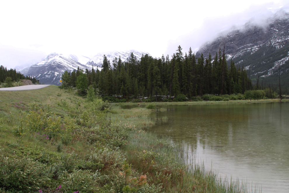
We spent a few minutes at this little lake a few k to the west, just watching the ducks and geese on it.
I crossed over the Cline River, then did a U-turn and went back to walk across the bridge. Even with poor weather, this area is becoming one of my favourite parts of the Rockies.
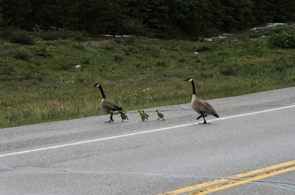
Back at the small lake we’d stopped at, a pair of Canada geese was taking the family for an evening stroll. After being perfectly quiet before, Tucker just couldn’t take this and went crazy. He doesn’t bark at times like this, he screams. It sure got the geese off the highway in a hurry! I need to video him 🙂
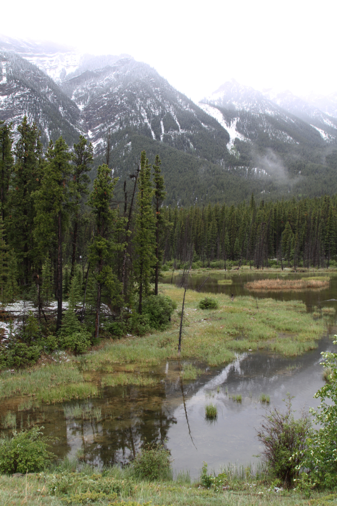
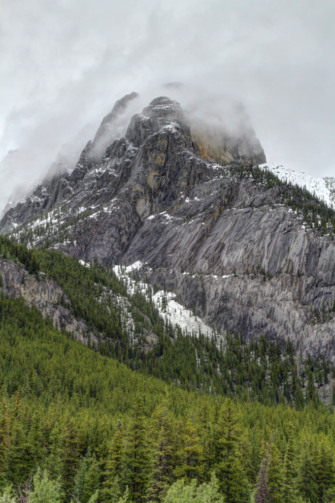
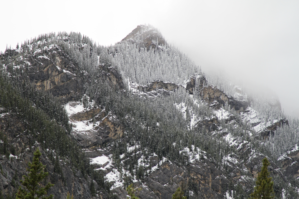
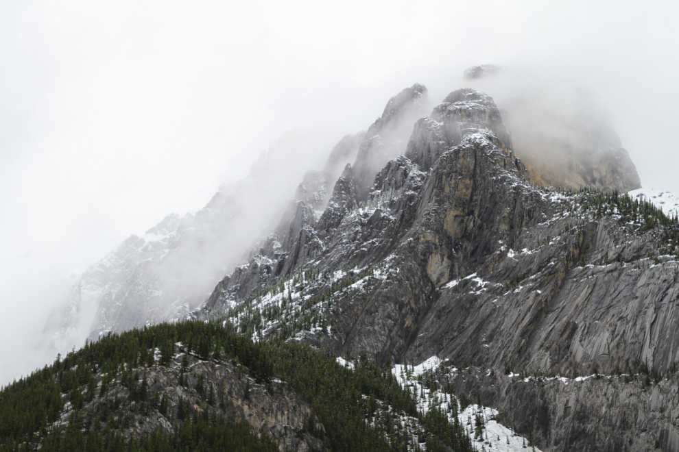
The next 3 photos just show some of the peaks along the highway.
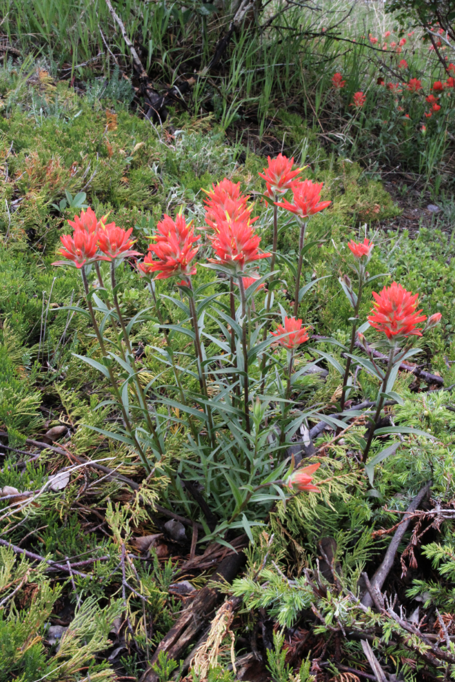
Beside the road were some Indian paintbrush, seemingly unaffected by the snow that had hit them. They’re one of my favourite wildflowers.
At Hoodoo Creek, a road went down onto the beach, so I drove down and we had another good walk and play.
Back on the highway, I noticed a small gravel road at a large rock cut as we got near the viewpoint where the motorhome was parked. I was extremely surprised to find the road lined with guard rails, and leading to this spectacular picnic spot, with a single fire pit and concrete picnic table. Very odd. I could easily get my motorhome to it, and will keep it in mind for next year 🙂
The next photo shows the view from above the rock cut where the picnic site is located. What a superb spot to end the day.
The plan for Monday was to drive to somewhere in the Jasper/Hinton area, but if the weather cooperated, the scenery along the Icefields Parkway might be too amazing to leave.