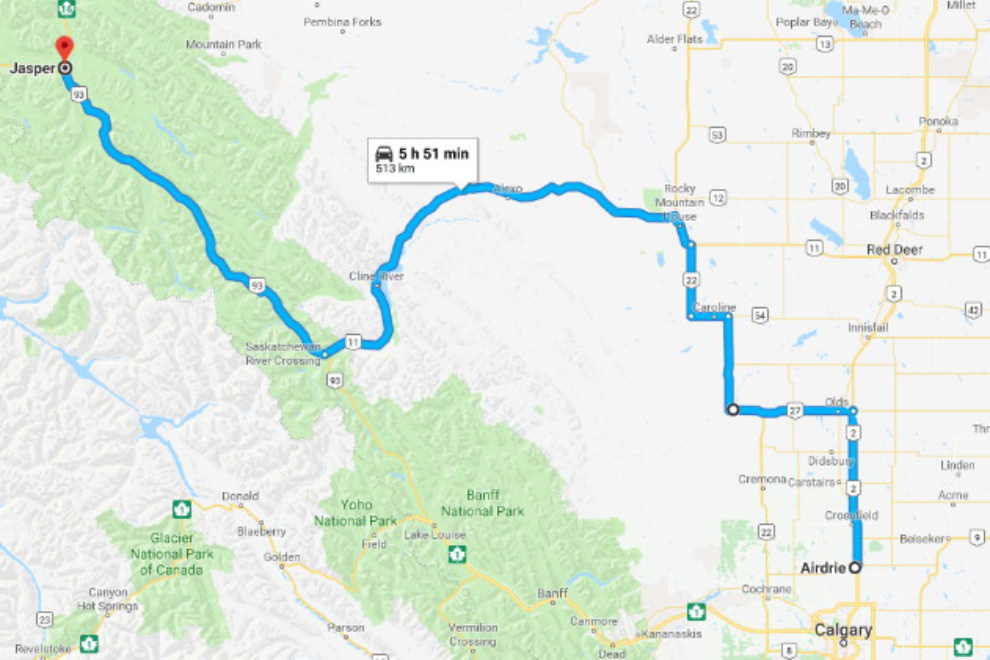
Calgary to Jasper via Alberta Hwy 11, the David Thompson Highway
On Wednesday, December 13th, I began the 60-hour drive home. I had planned to start by heading west on Highway 1, but my son suggested that I take Alberta Hwy 11, the David Thompson Highway. He said that it was spectacular, particularly the section that runs along Abraham Lake. Was he ever right!
For this new and rather complicated route, I’ve added a map. Click here to open an interactive version of the map in a new window.
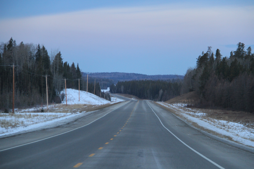
I left my son’s home at about 05:30, long before anyone was up. Heading north on the freeway, Highway 2, I was surprised by the amount of traffic. I wonder what gets that many people on the road 3 hours before sunrise.
As I drove through the small town of Sundre on Highway 27 in the dark, the old Sundre Hotel looked interesting and the restaurant’s “Open” sign was lit, so I made a U-turn for breakfast. Small-town hotel restaurants are as predictable as any franchise chain, and much more interesting. The food was good and cheap, the service very good. And in the centre of the restaurant was one of the largest curved counters I’ve ever seen – probably 60 feet of it forming an almost-complete circle. Although only 4 of the 25 or so seas at it were occupied that time of the morning, the waitress said that it’s usually full.
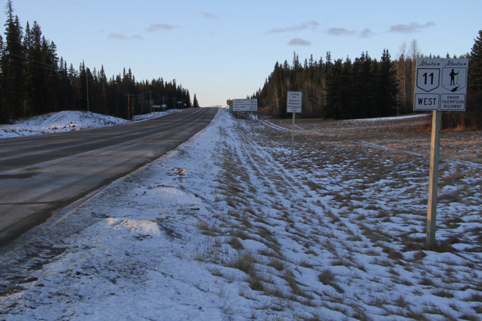
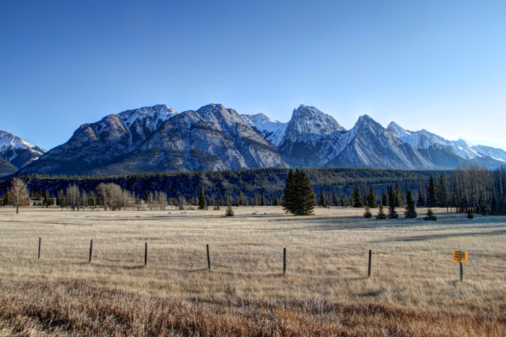
By 07:50 I could see the country I was passing through on Highway 11 west of Rocky Mountain House. Pleasant and very quiet.
Just east of Nordegg at 08:00, Highway 11 passes through a short spine of mountains.
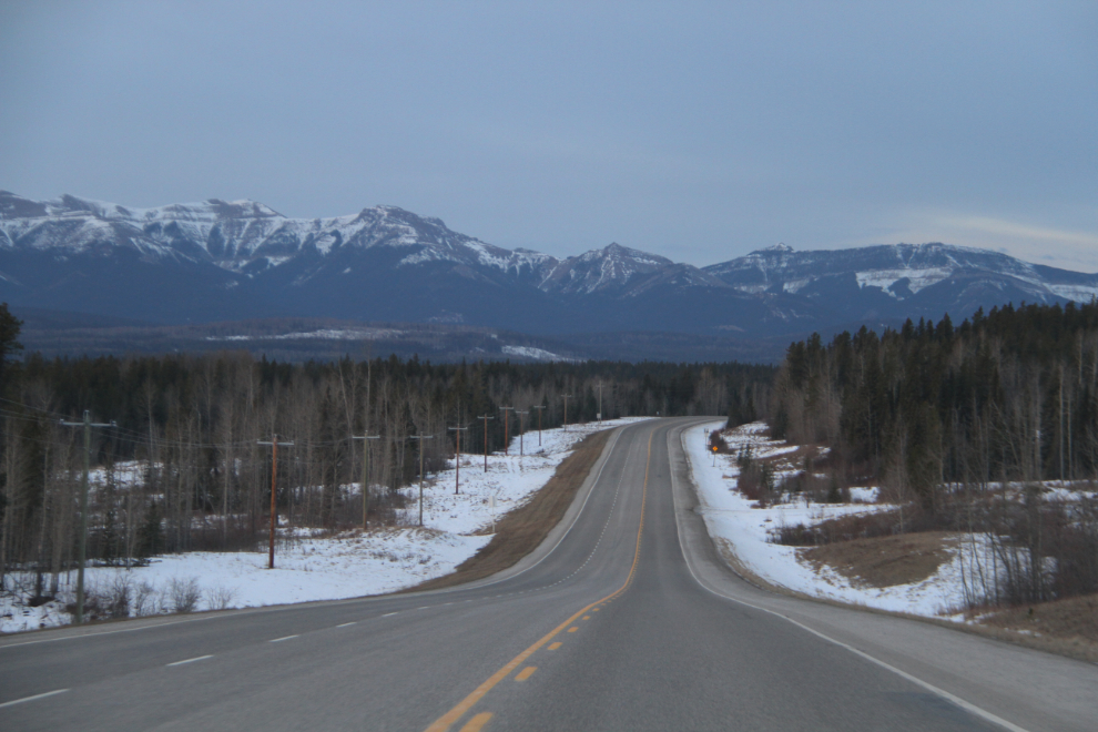
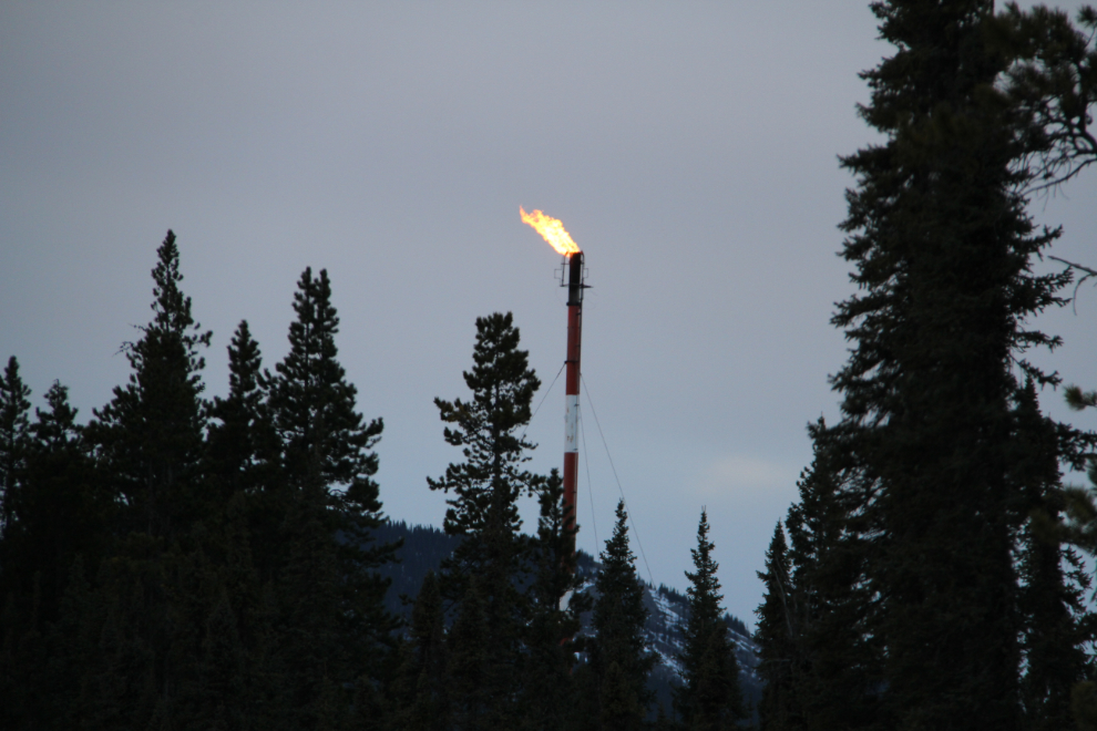
This is oil and gas country in a small way, and I saw a few gas flares along the highway and across distant slopes.
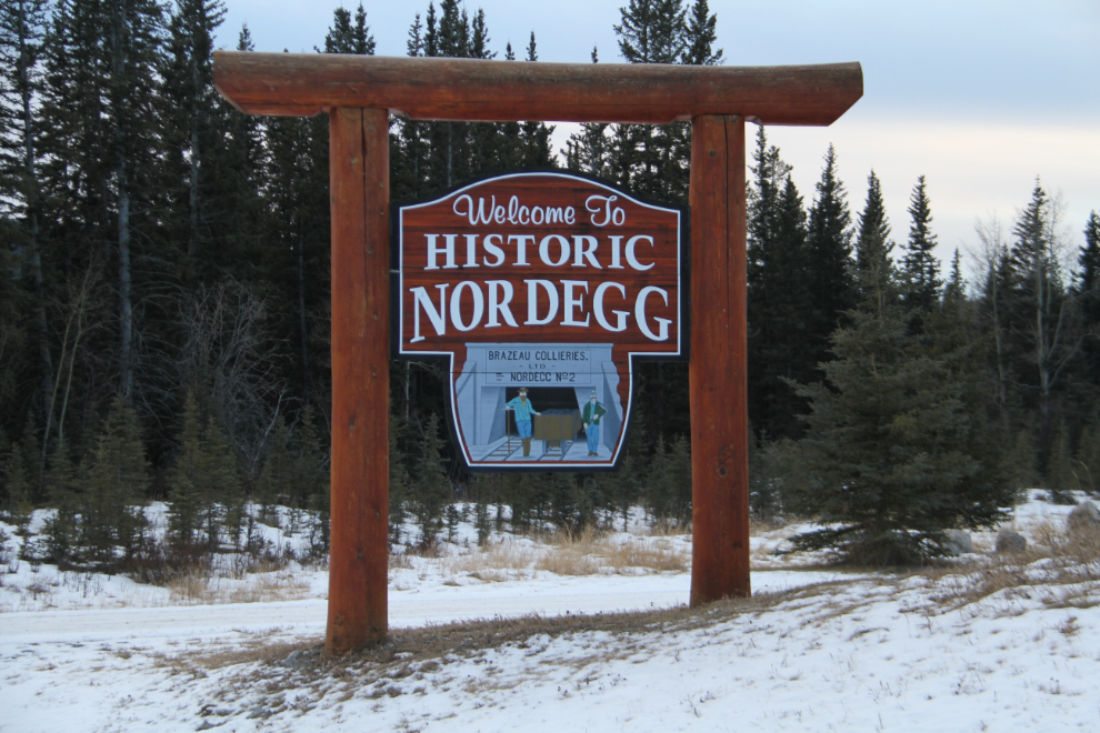
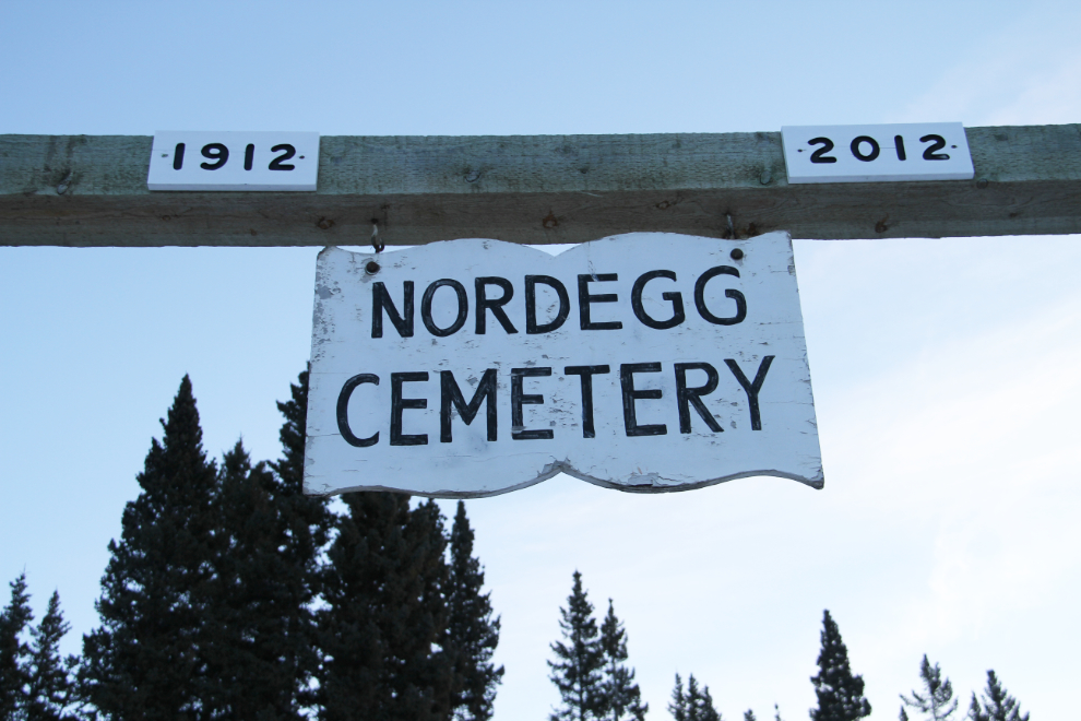
I had done no research on the highway, but the sign for Nordegg intrigued me enough to take the short detour into town. A historic mining town? Heck yes 🙂
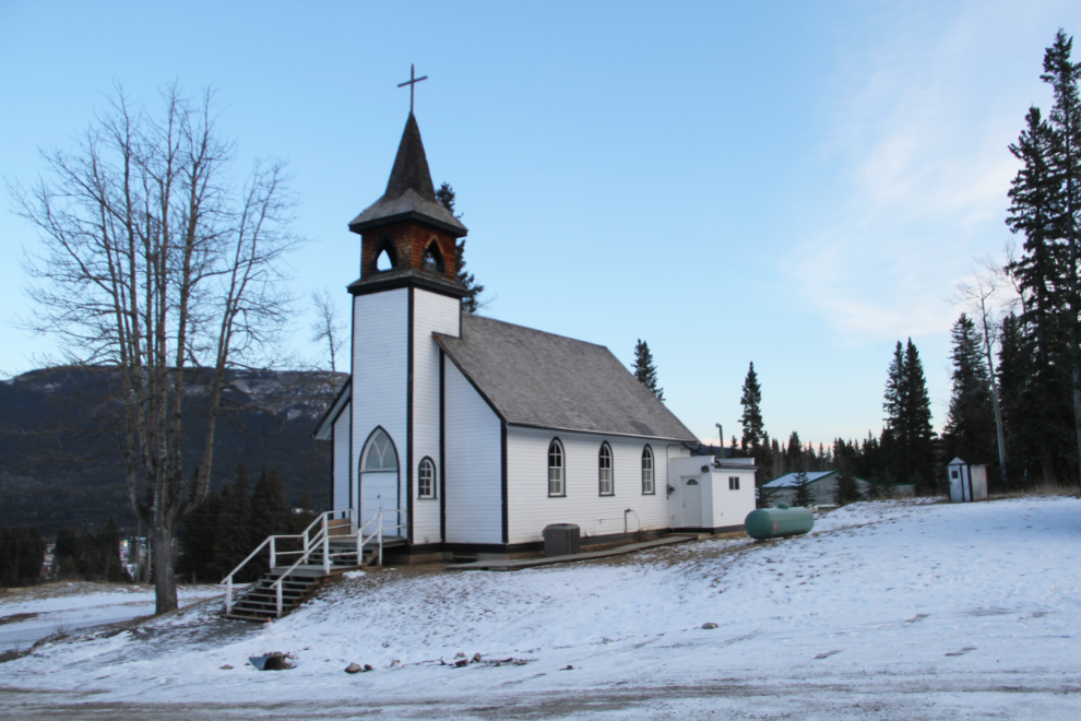
The church is now just called the Nordegg Community Church. Some sources call it a historic building while others hint that it is a reproduction built after the original Protestant church burned down in 1975. Services were re-started in 2003 by CSSM Ministries, now called One Hope Canada.
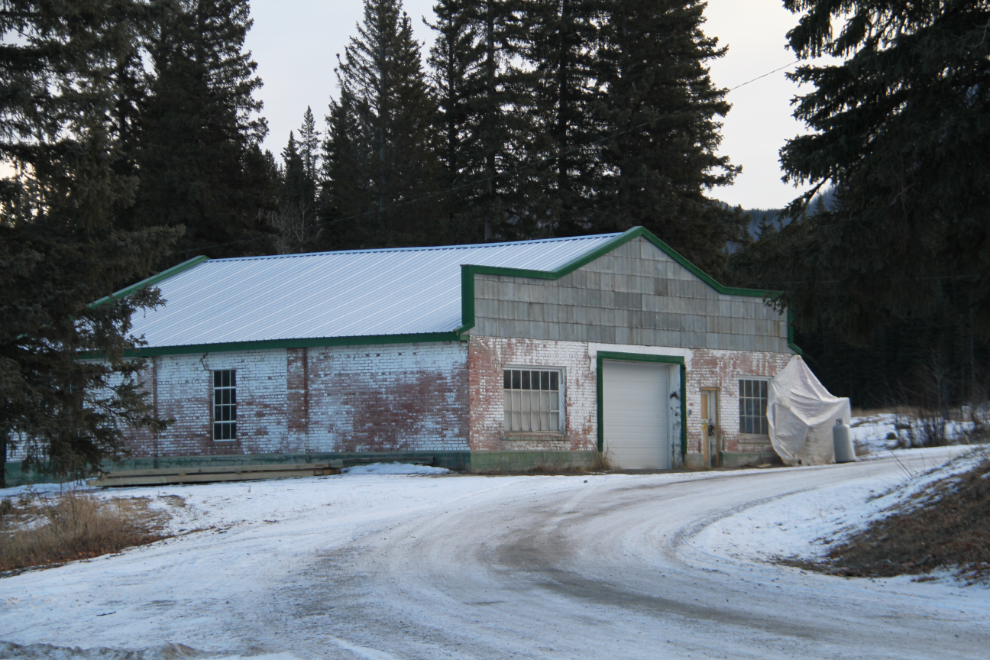
Behind the church is long-abandoned Shanks Garage, which I would guess dates to the 1940s.
I stopped for a brief look at the Nordegg Cemetery. The 250 graves at the cemetery have been thoroughly documented at Find A Grave. There is another neat little cemetery behind the museum, for 29 miners who were killed on October 31, 1941, in an underground explosion at Brazeau Collieries Mine #3.
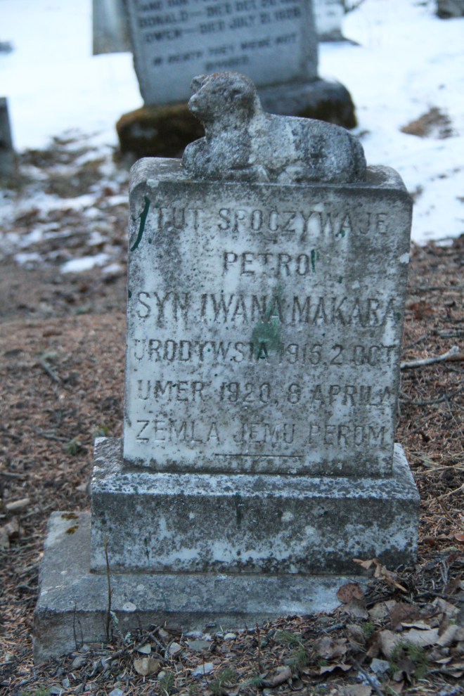
This headstone, written in Czech, is for 5-year-old Petro Makara, who died in 1920.
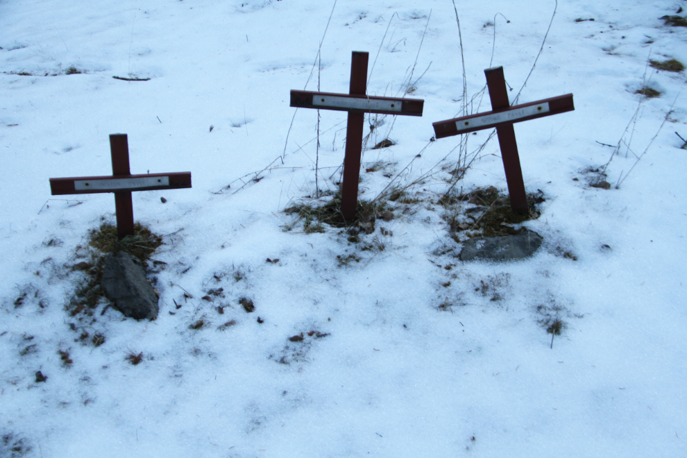
These 3 tiny crosses near the entrance to the cemetery mark the graves of members of the Fabbi family – Malvina, Serana, and Giuseppe. Strangely, no death dates are recorded for them. Due to poor light and very limited time, I didn’t go much further into the cemetery.
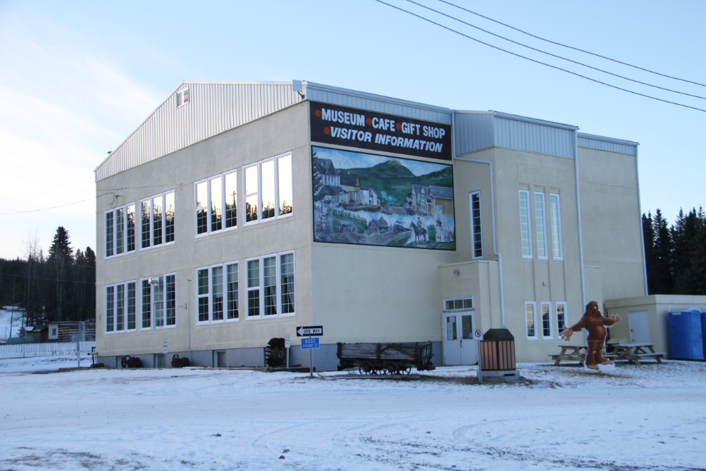
I had expected to be able to find the historic Brazeau Collieries mine site, but I discovered while researching for this post that due to vandalism, it can only be accessed on tours run by the Nordegg Heritage Centre, which of course wasn’t open. The Heritage Centre building was built in 1945 as the Nordegg School after the original schoolhouse burned down.
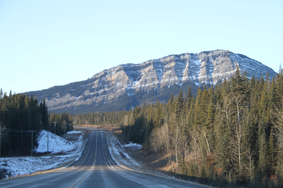
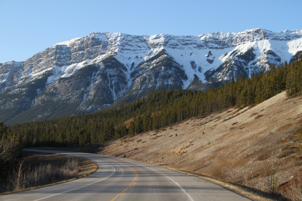
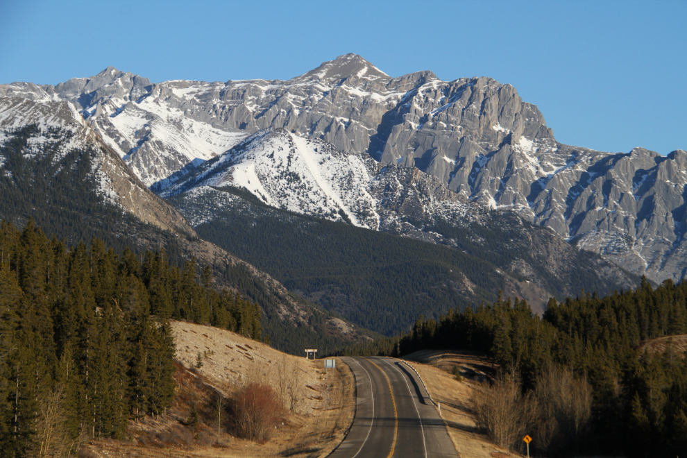
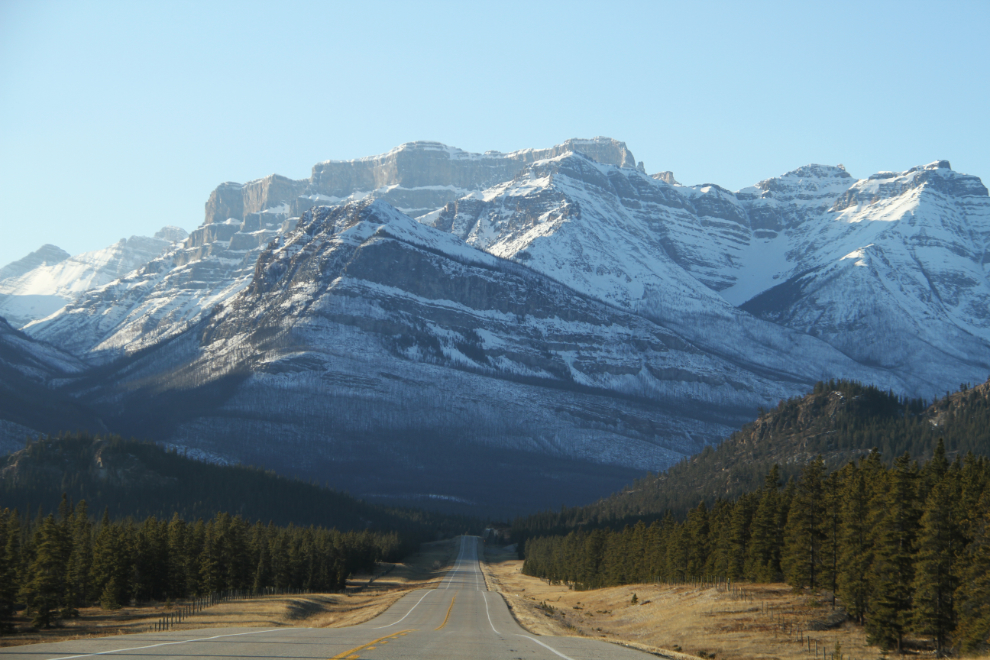
At TripAdvisor, the short page about Highway 11 from Nordegg west begins: “The most underated route into the Canadian Rockies and the grandeur of the famous Icefields Parkway is Alberta’s Highway 11, the David Thompson Highway. A glorious paved route, with barely another car in sight, will take you from the growing resort town of Nordegg to Saskatchewan River Crossing in Banff National Park through some of Alberta’s finest scenery.” I began the 100 km drive from Nordegg to the Icefields Parkway at 08:45.
Some solitary peaks along the highway just pop out of nowhere.
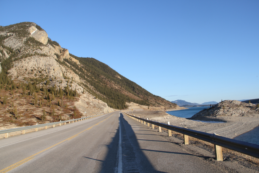
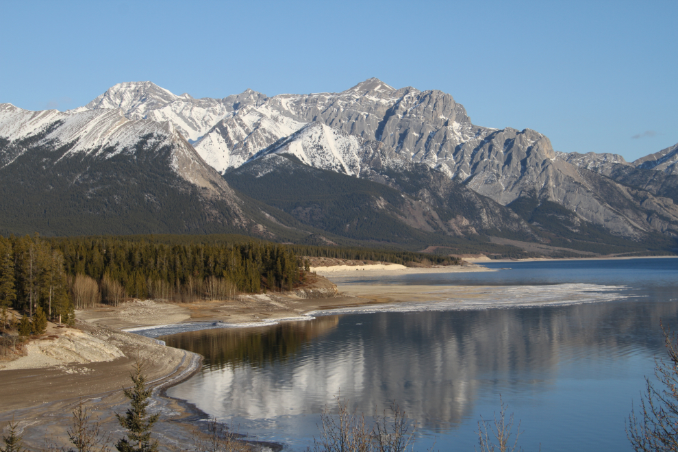
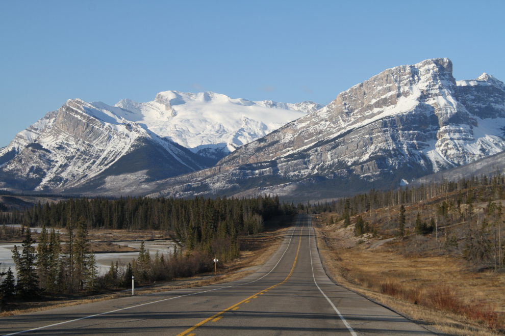
By 09:00 I was driving along Abraham Lake. Created by a dam on the North Saskatchewan River, it’s about 32 kilometers long (20 miles), and in good light is a gorgeous turquoise blue. It has become known as “The Bubble Lake” in recent years due to the many photos that have been published showing frozen methane gas bubbles in the lake’s ice. The sharp peak is Mount Michener, named in honour of Daniel Roland Michener, who served as Governor General of Canada from 1967 until 1974. He was born at Lacombe, North-West Territories (it became the Province of Alberta in 1905), on April 19, 1900. Mount Michener is 2,499 meters high (8,198 feet).
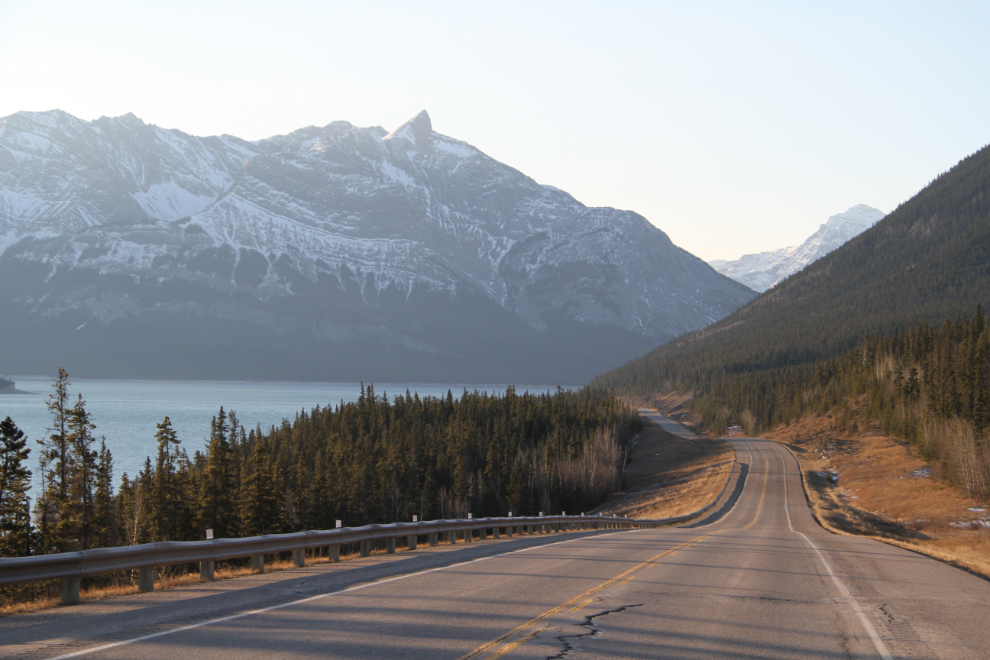
The drive along Abraham Lake was very slow – I was stopping often to take photos.
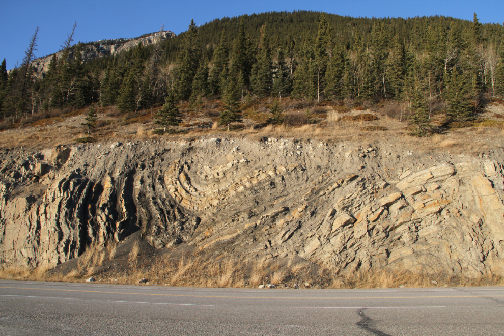
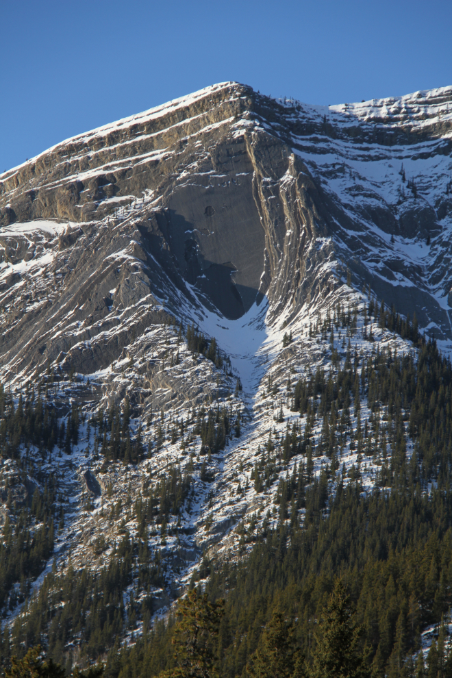
There is some fascinating geology along the highway.
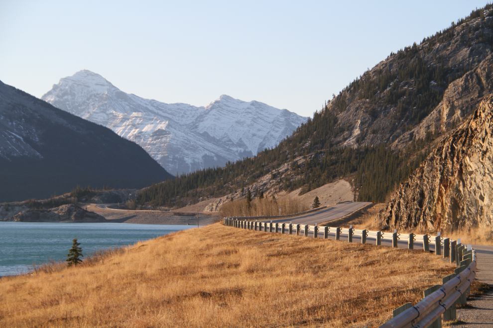
Looking back to the east along Abraham Lake.
I think this is part of the Abraham Mountain massif, 2,940 meters high (9,645 feet). The incredible weather included temperatures of -2 to -4°C (25-28°F) along most of the mountainous part of Highway 11.
That’s an impressive slab of slate!
The next photo was shot near Cline River, which is still along Abraham Lake.
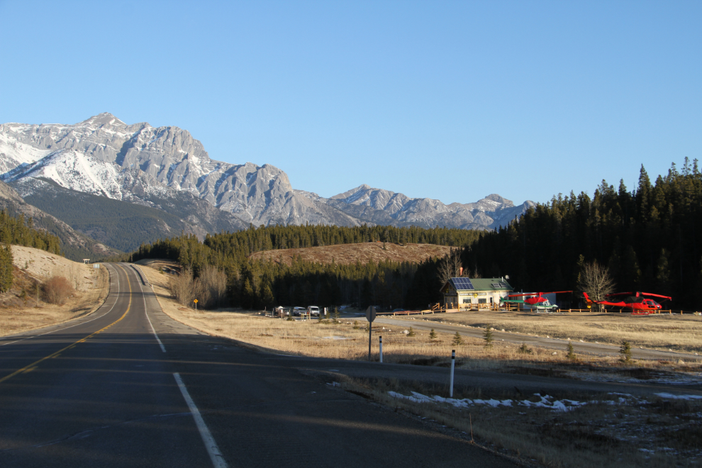
I doubled back to get the next two photos. To the right (which is east at this point) of the highway in the lower photo, Rockies Heli Canada operates at the Cline River Heliport.
A final shot of Abraham Lake, taken near its head at 09:30.
I found the variety of mountains to be quite remarkable, from limestone to slate and granite.
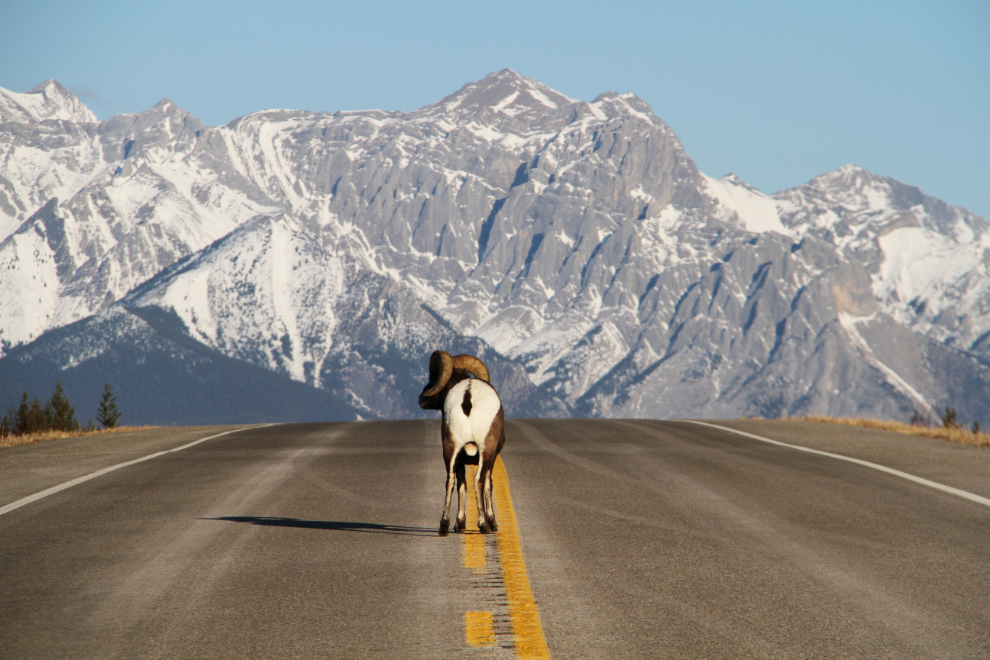
This Rocky Mountain Bighorn sheep ram (Ovis canadensis) was quite unconcerned about my presence even as I crawled by him as far off on the shoulder of the road as I could get.
I almost missed this significant monument when I pulled off at the Siffleur Falls trailhead rest area. It got overpowered by the mountain that it points out. Ex Coelis Mountain has 4 main peaks – Normandy, Ardennes, Rhine, and Elbe – named for some of the battles that the 1st Canadian Parachute Battalion fought in during World War II. A separate monument was erected here to honour Corporal Frederick George Topham, a 1st Canadian Parachute Battalion member who was awarded a Victoria Cross as a result of his actions during a battle near the Rhine River in March 1945.
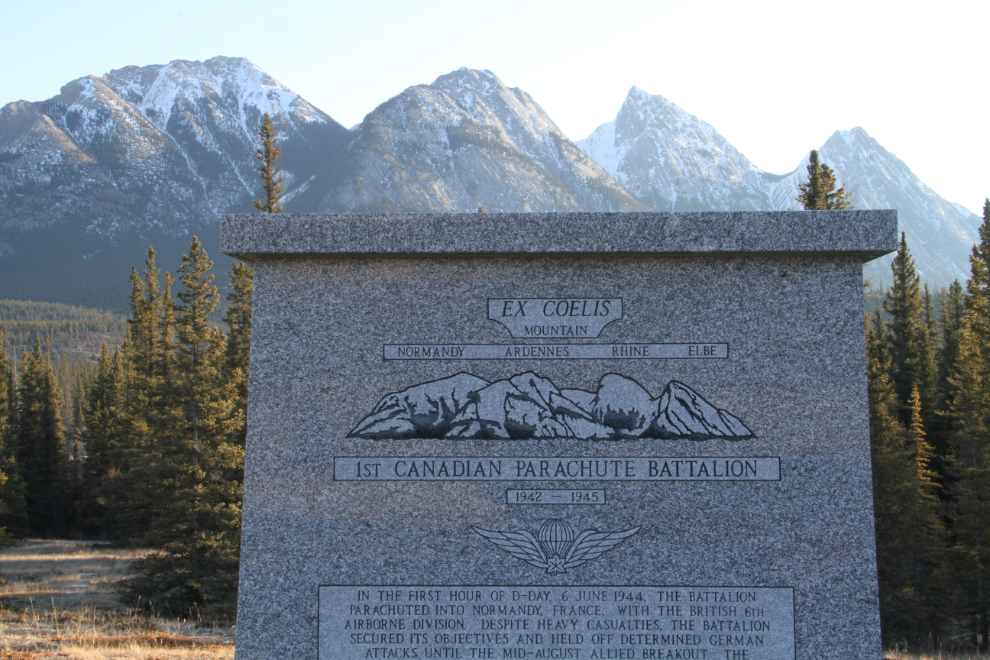
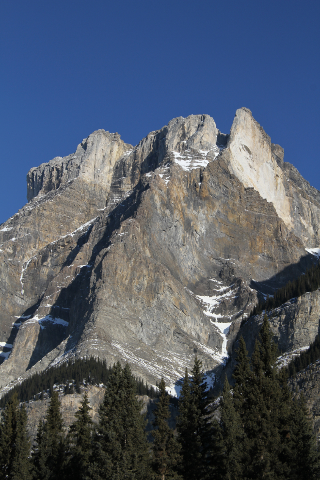
Here’s a better look at Ex Coelis Mountain from west of the rest area.
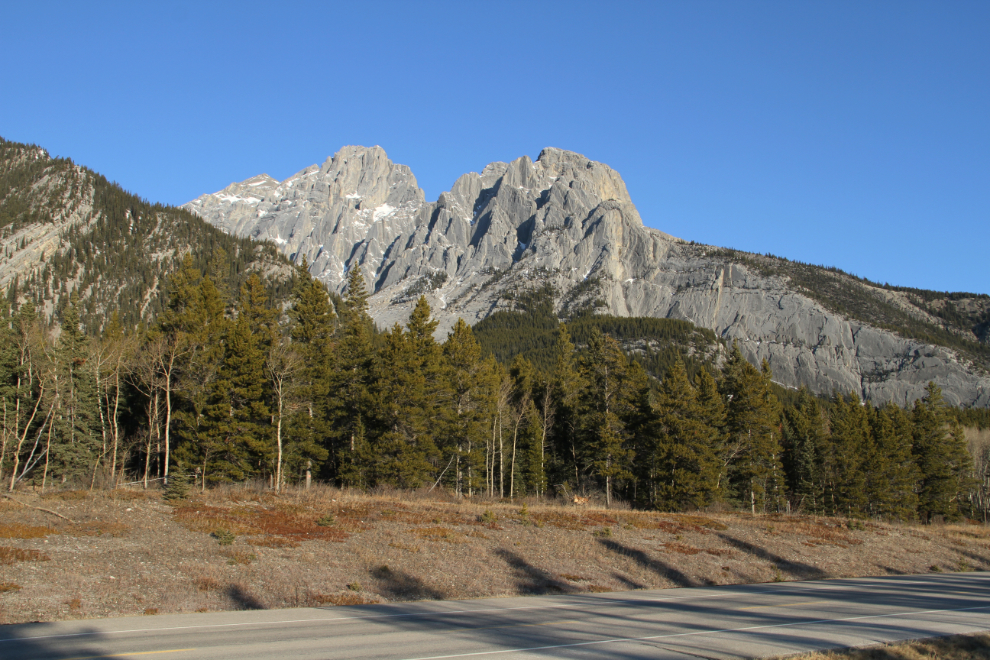
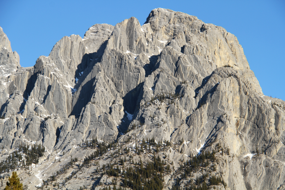
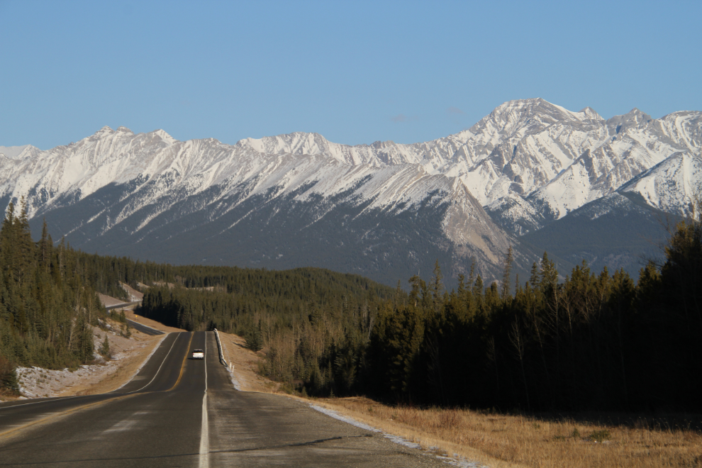
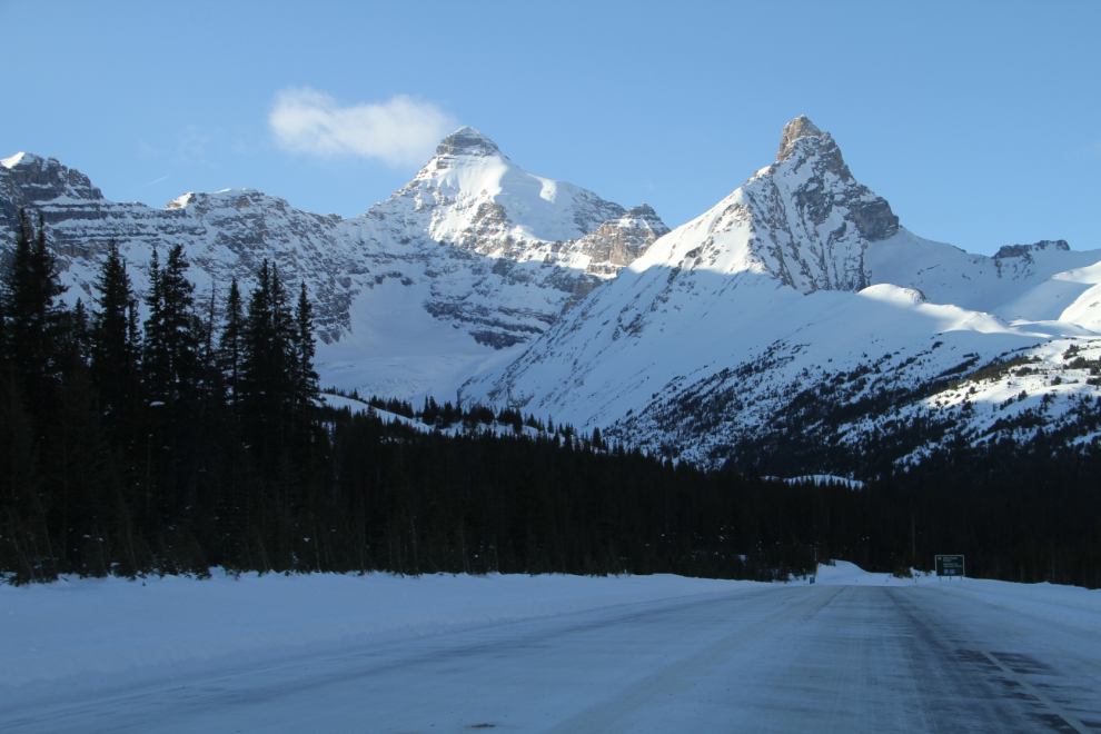
By 10:00, the mountains were starting to look familiar in type – the quite distinctive forms of the main body of Canadian Rockies.
The next photo is from of my favourites from Highway 11 – the North Saskatchewan River is to the left, and the glacier ahead is on Mount Wilson, 3,260 meters high (10,695 feet).
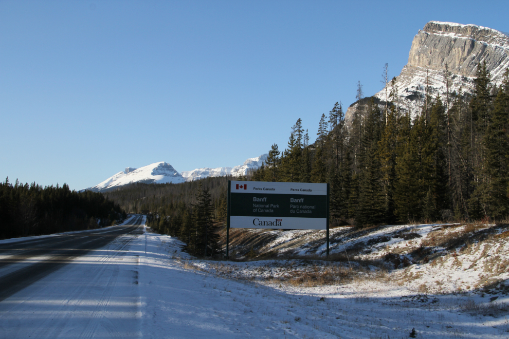
At 10:20, I crossed into Banff National Park – the Icefields Parkway was just a few kilometers ahead. I was already determined to get back to the David Thompson Highway for a much better multi-day look in June.
Turning north on Highway 93, the Icefields Parkway, I made a short stop at Saskatchewan River Crossing to get a few photos of The Crossing Resort, which only operates in the summer.
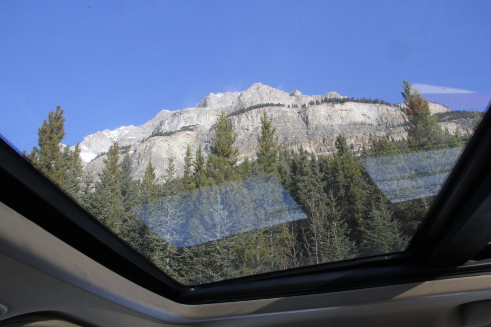
I’ve posted quite a few photos that I shot on the Icefields Parkway during my drive south a few days earlier, so I made few stops this day. Sunroofs were made for roads and days like this, though! 🙂
On a day like this, some peaks are tough to not stop for, regardless of how many times I’ve seen them.
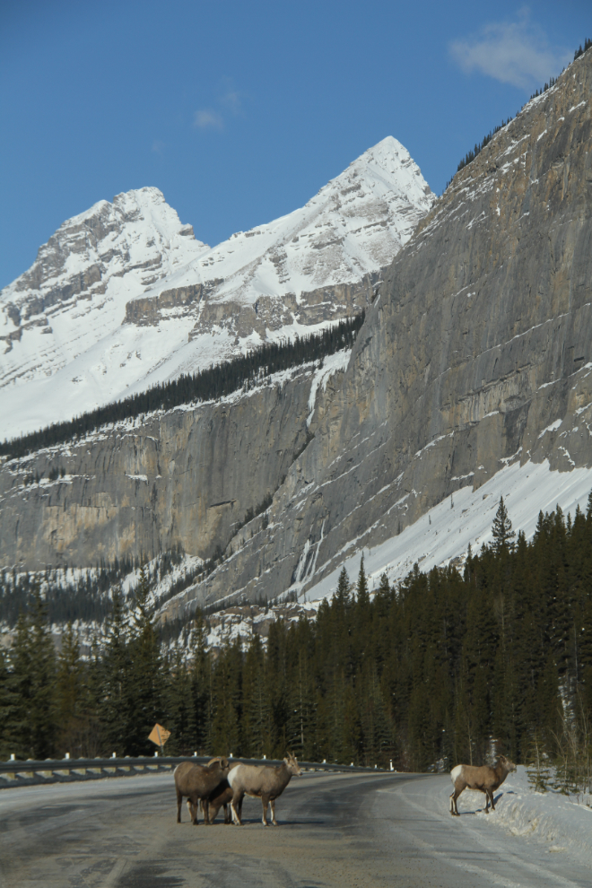
Rocky Mountain sheep stop pretty much everyone. The ram was pretty sure that Spring has arrived 🙂
There were only a couple of small areas along the Icefields Parkway where it really looked like winter.
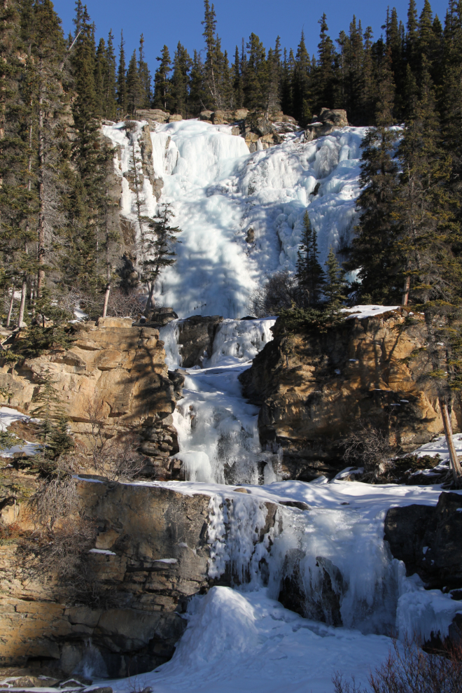
I hadn’t stopped at Tangle Falls on the way south, but took a few shots this day.
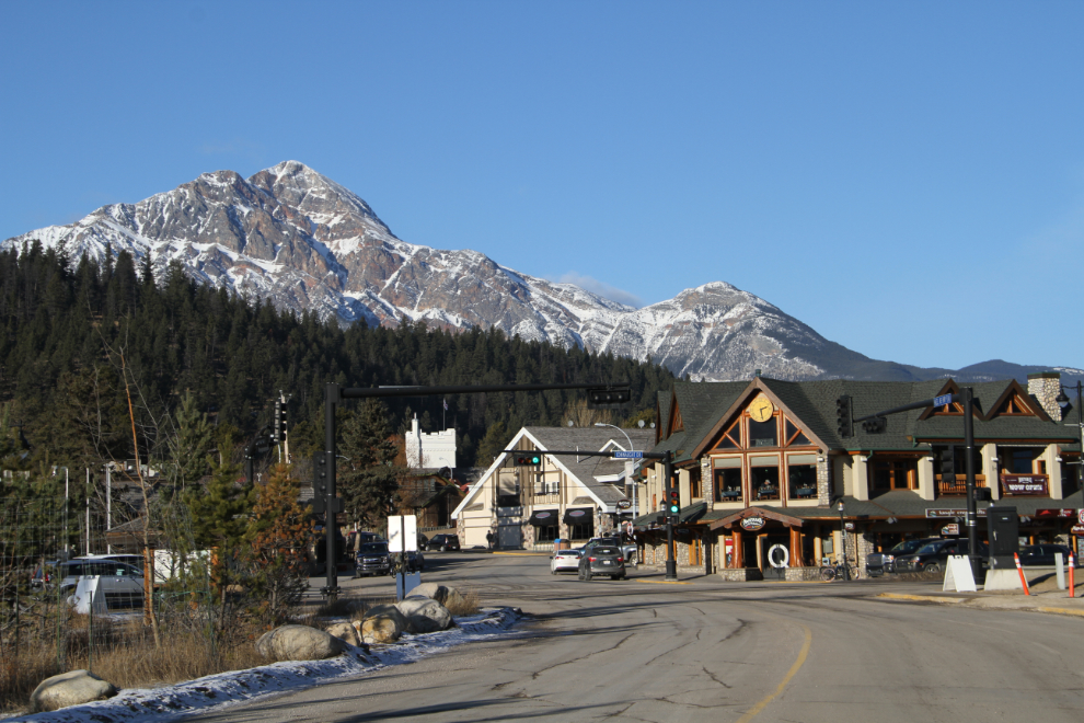
I reached Jasper just after noon. It was just a fuel stop and I continued on, but I’ve cut the post here because it quickly became a very different drive from here on due to weather.