Photography in the Yukon at -37 degrees
This has been a very dreary winter so far in the southern Yukon, with very little sun and lots of snow. Our winters used to be clear and cold – invigorating rather than dreary.
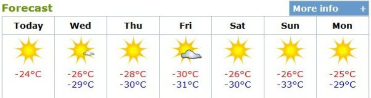
When I saw this weather forecast yesterday morning, however, my world brightened up considerably – this is the Winter I love! And, of course, my reaction to sunshine is… Road Trip! 🙂
I’d planned on getting away early, well before the sunrise at 10:08, but I got delayed by having to fire up the compressor to pump up a couple of low tires. It was only -12°C (+10°F) in the garage but the compressor still wasn’t happy about being asked to work.
This first shot was taken at 09:51, looking back up our street towards the house (which is hidden in the trees). The temperature was -37°C (-35°F).
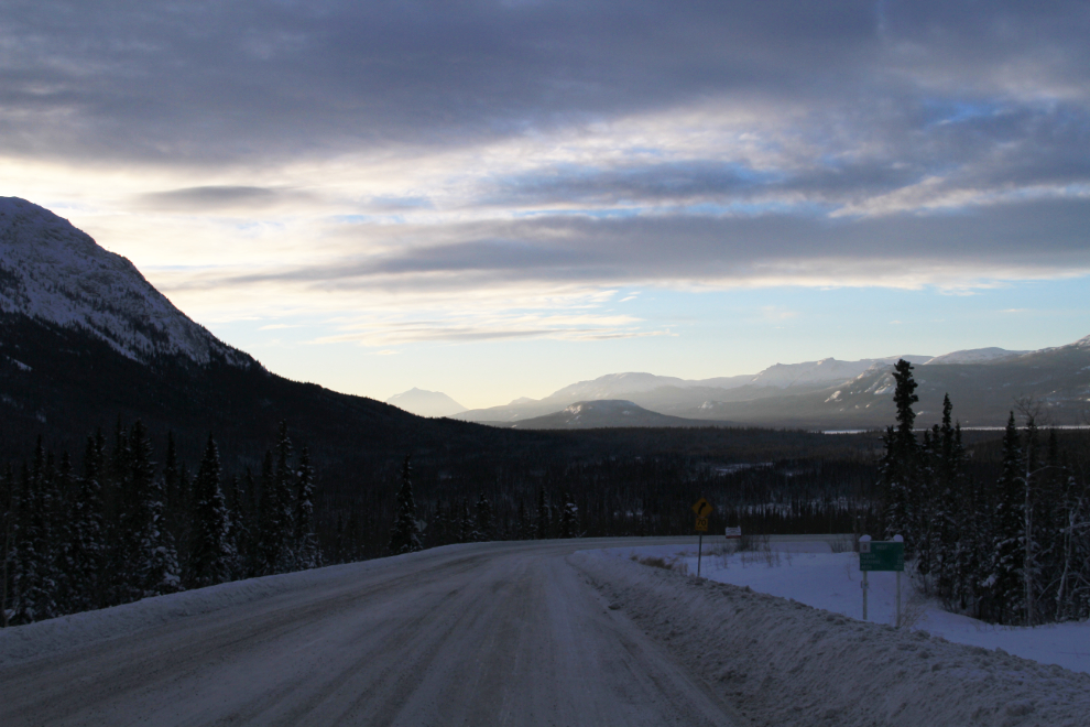
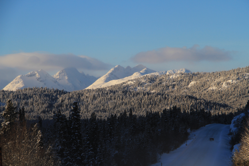
I had to drive towards Whitehorse for a few miles to get gas, then stopped to get some sunrise photos from a high spot above the Alaska Highway. This was taken at 10:03.
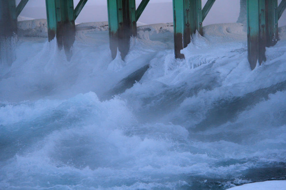
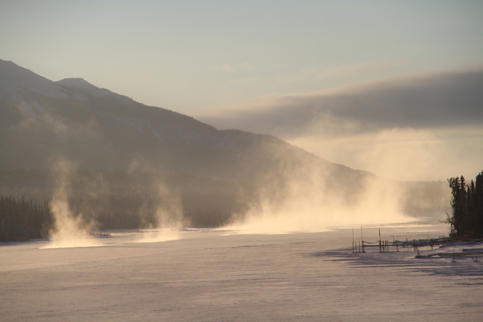
I had some stuff to pick up in Skagway so that was the obvious choice for a destination, but I decided to take the long way there, via the Alaska Highway and Tagish Road. The first photo stop was the Lewes River Dam, which controls the water levels for the Whitehorse power dam.
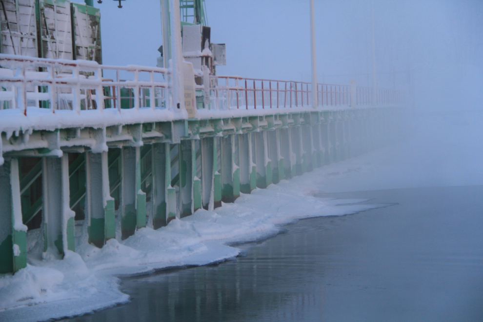
There’s still plenty of water flowing through the dam (more properly called a “control structure” apparently), causing fog that fills the valley.
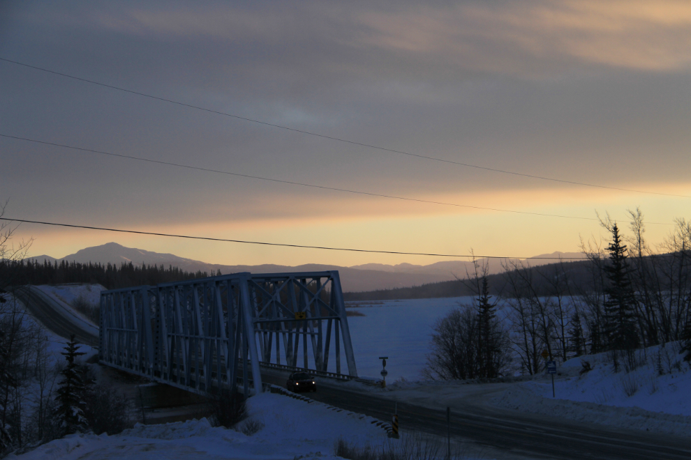
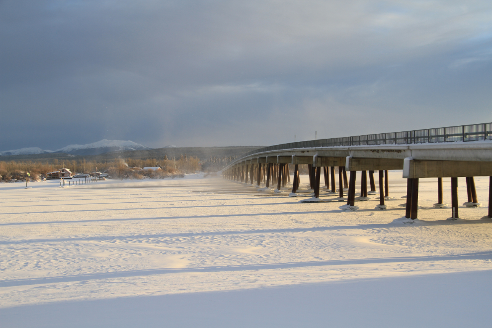
The Yukon River Bridge and Alaska Highway, looking upriver towards Marsh Lake.
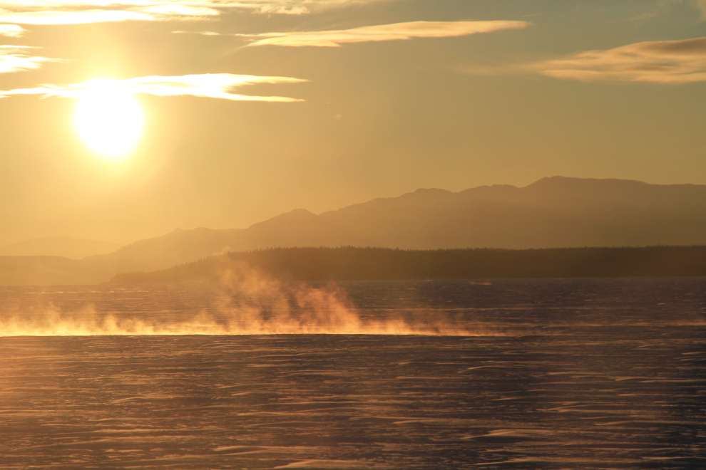
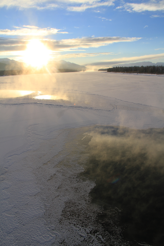
Little patches of open water steaming on Marsh Lake, at 10:43. If you are into photgraphy at all, you’ve no doubt seen “Photography Rule #1” many times: “Never shoot directly into the sun”. Like the Pirate’s Code, it should be taken more as a guideline 🙂
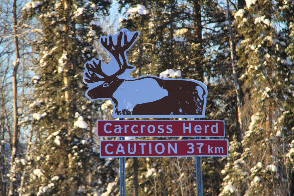
Turning south onto the Tagish Road at Jake’s Corner, I thought about going to Atlin instead of Skagway (Atlin is about 100 km down the valley ahead), but decided to see Atlin another day.
One of the reasons for taking this route is the potential to see caribou, and less likely, moose. Although I saw lots of tracks, no animals appeared.
Nearing Tagish.
Crossing the Tagish or Six Mile Bridge, photo ops were everywhere, so I stopped to go for a walk. The dogs quickly decided that it was too cold, and waited for me in the car. Sissy huskies!
Open water upriver from the bridge.
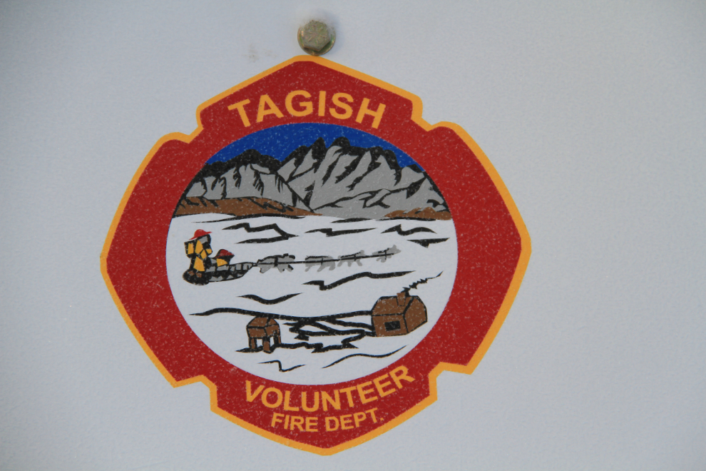
I love the Tagish Volunteer Fire Department’s logo.
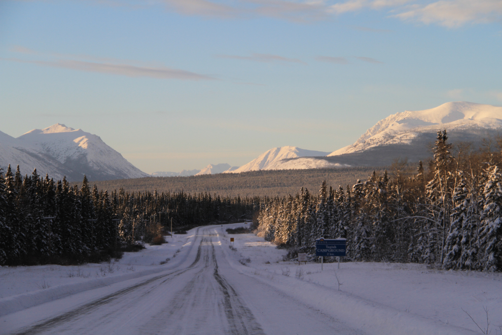
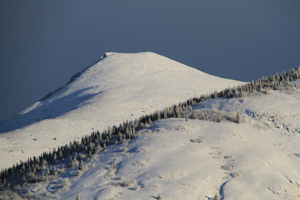
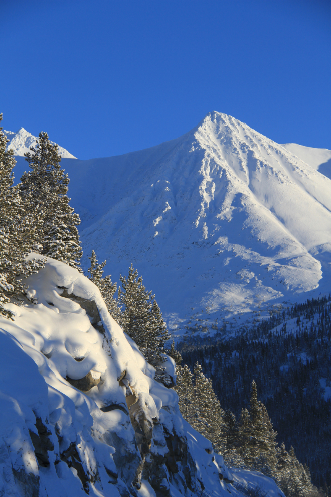
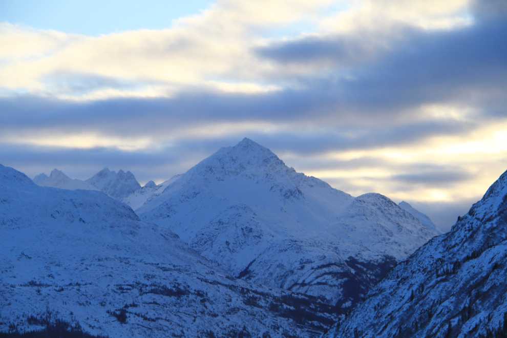
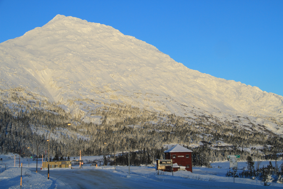
I turned onto the South Klondike Highway at Carcross a few minutes after noon, stopping to take a few shots of the high country on Nares Mountain.
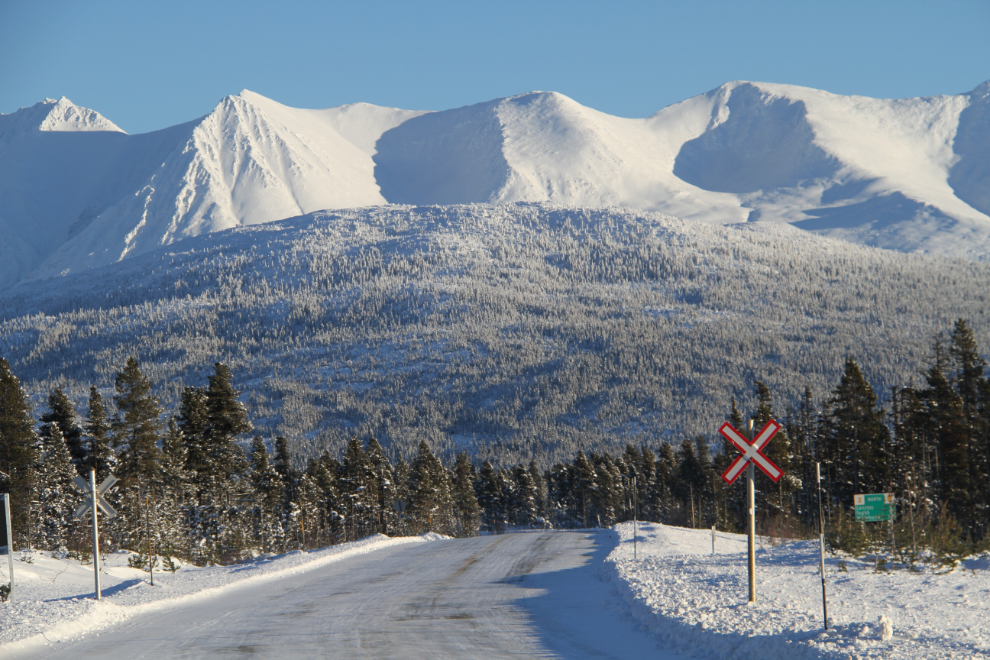
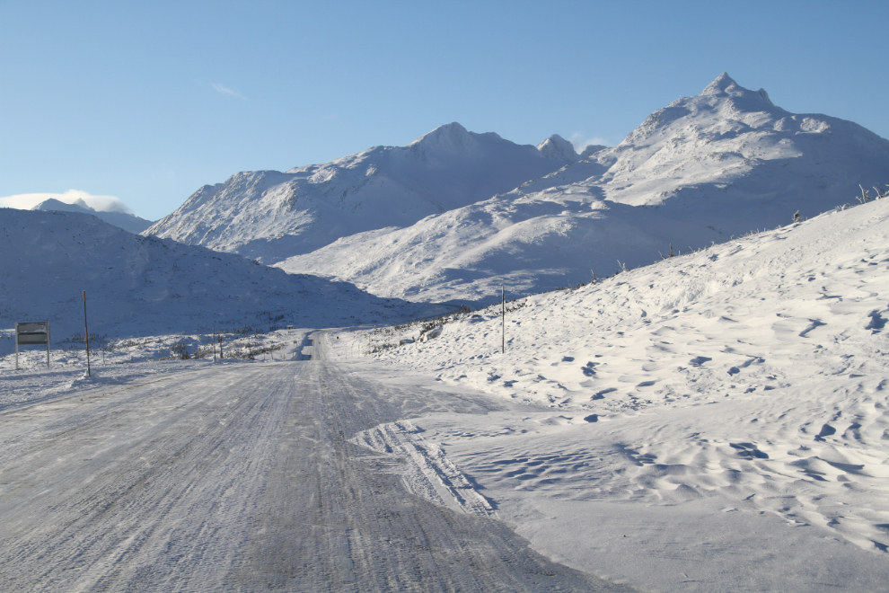
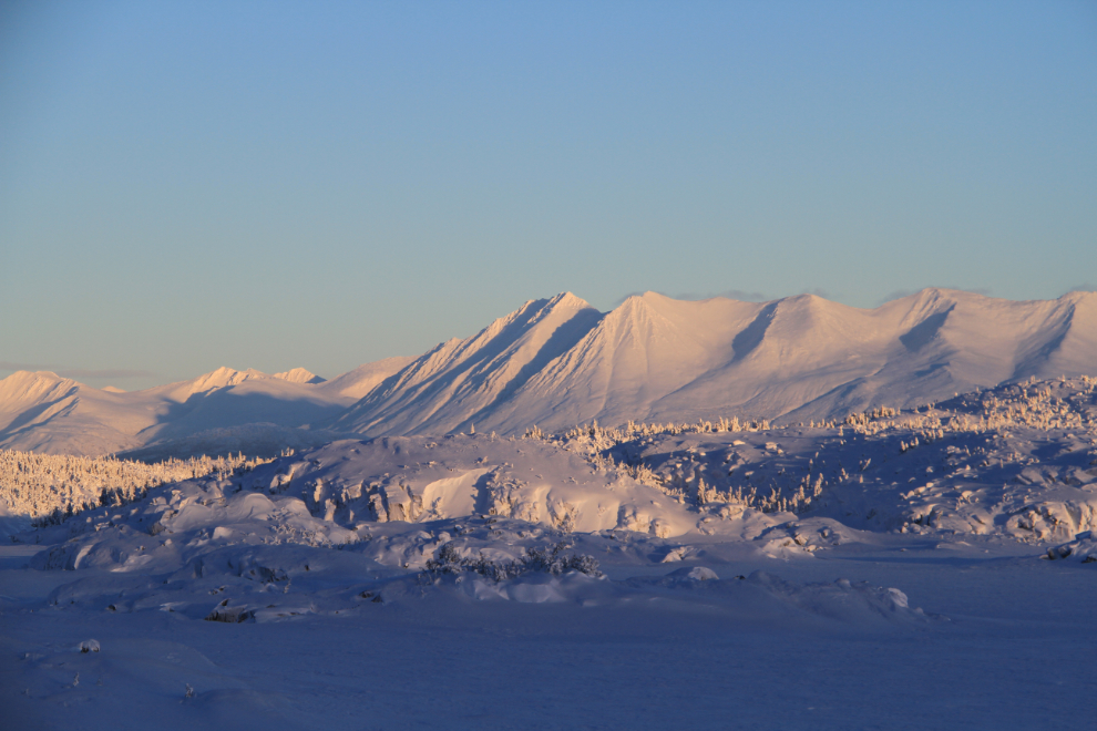
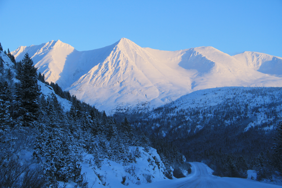
The view ahead south of Tutshi Lake, BC, at 12:43 pm.
The view back to the north from the same spot as the photo above.
The WP&YR railway crossing at Log Cabin, looking north (the trains don’t run in the winter).
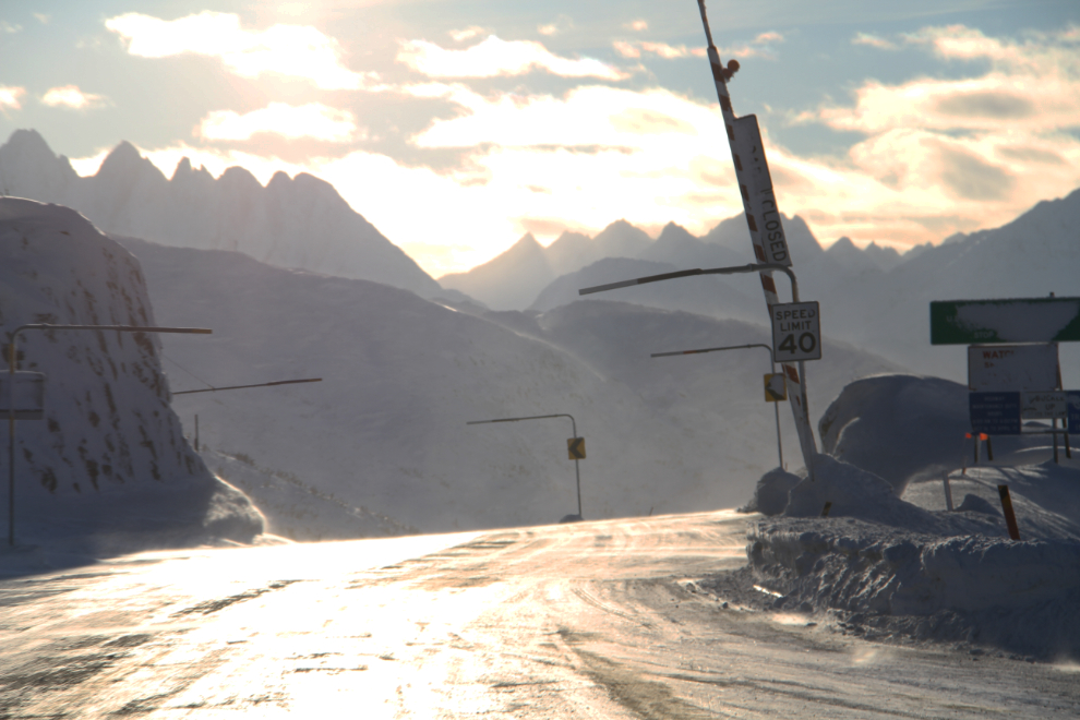
Fraser, British Columbia, the highway maintenance camp and Customs crossing when you enter Canada from Skagway. That’s the railway grade curving at the bottom.
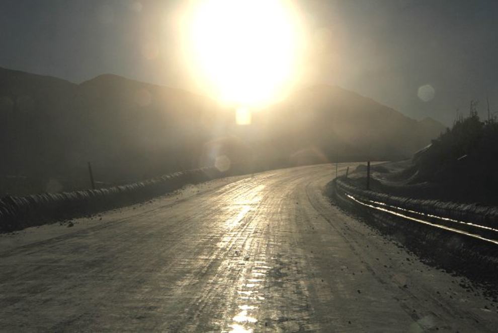
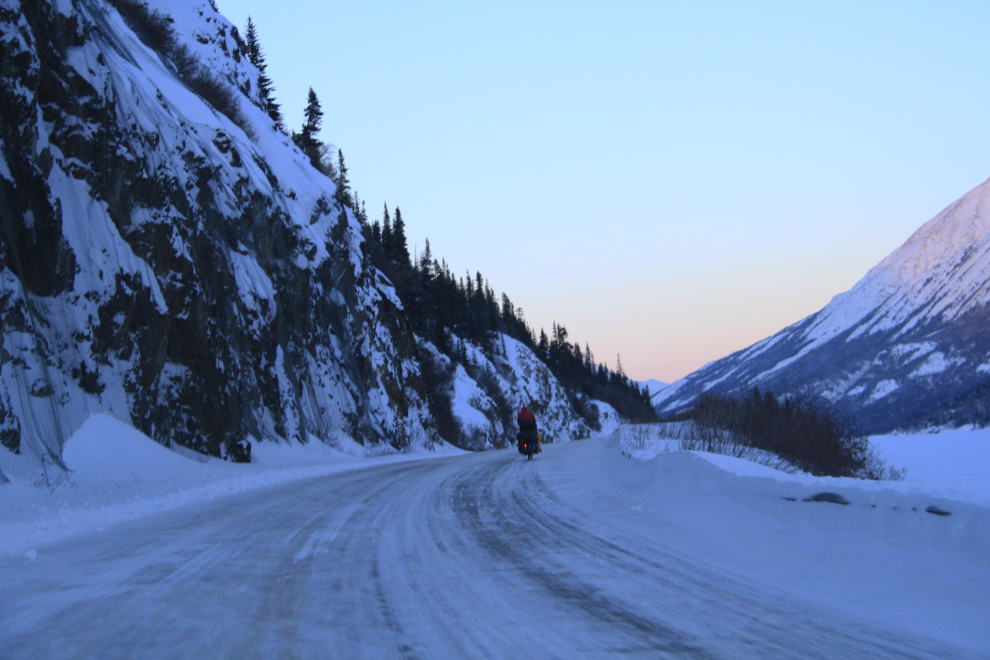
The combined glare of the sun, and the sun reflected off the ice on the road, was blinding at times.
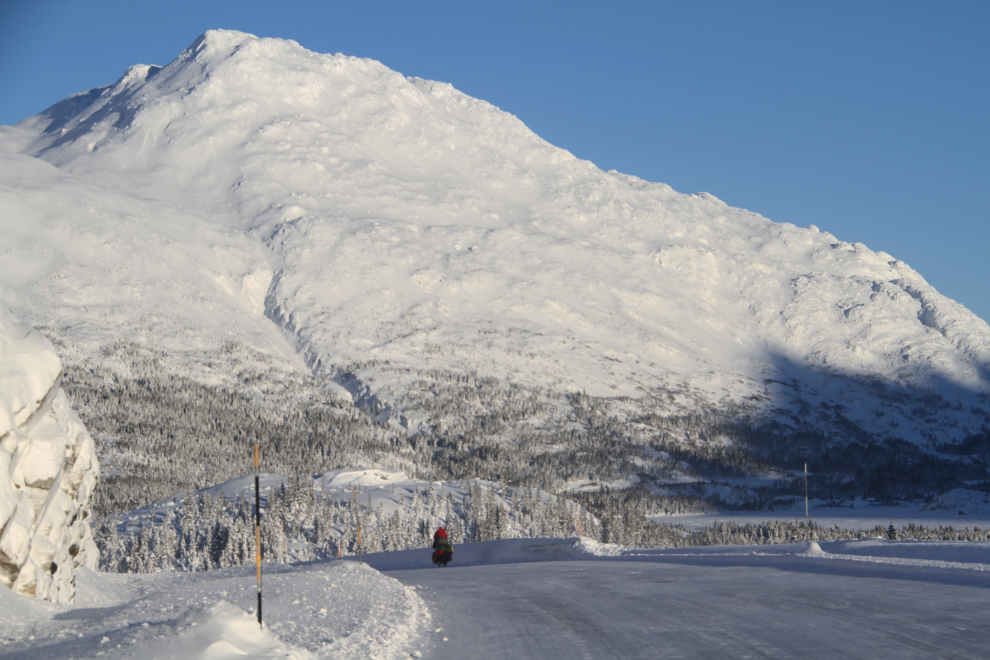
To say that I was surprised to see this guy a few seconds after taking the blinding-sun photo is an understatement! Cycling the White Pass at -30+ with a strong headwind on a very icy highway – wow, that must be fun!
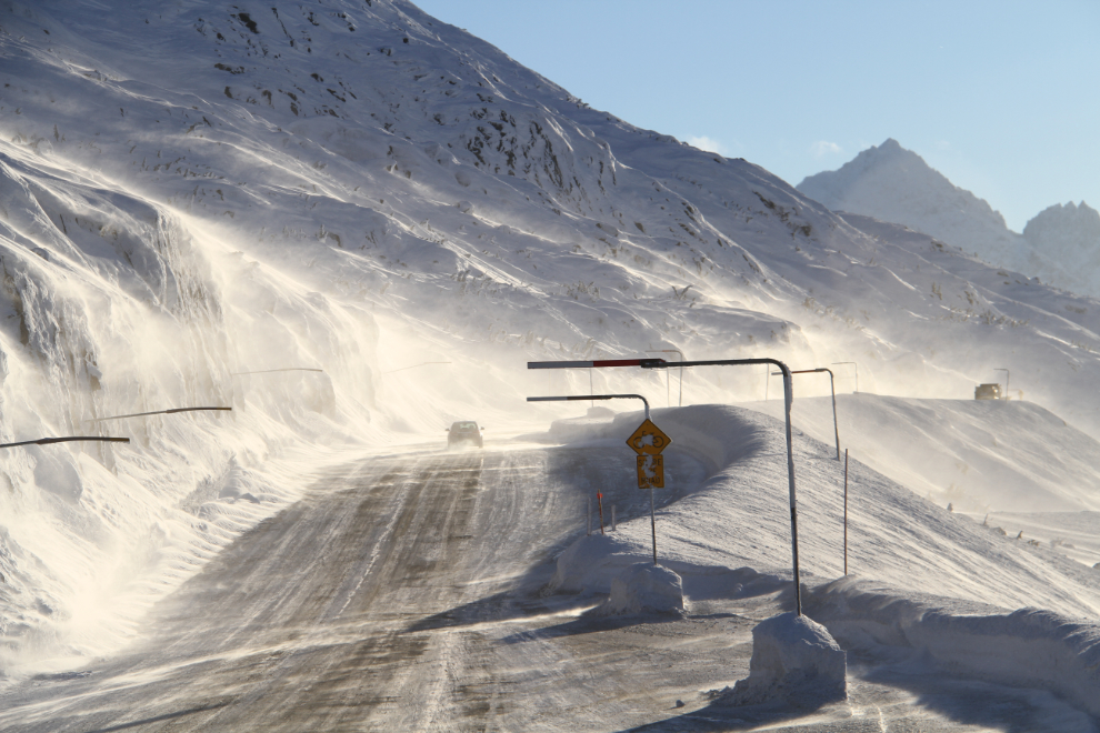
The strong north wind was creating drifts across the highway. When I shot this, I had just passed a snowplow dealing with them.
Entering Alaska.
Any wind gets funneled through these narrow passes, and the venturi effect increases its speed dramatically.
Driving through the ground blizzard.
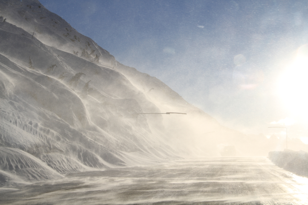
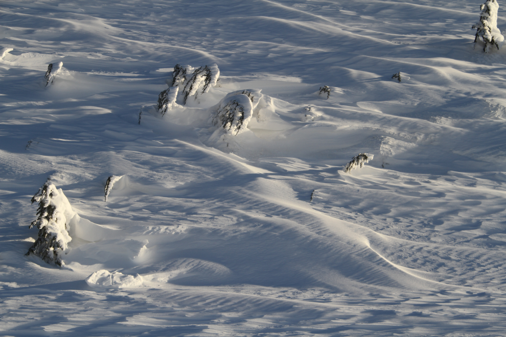
I love the shapes that the wind creates with the snow.
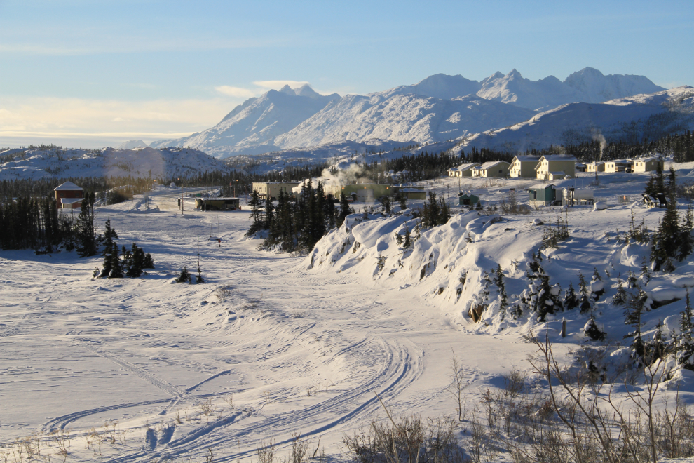
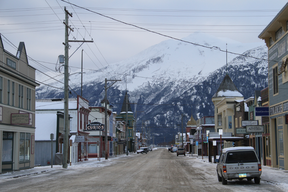
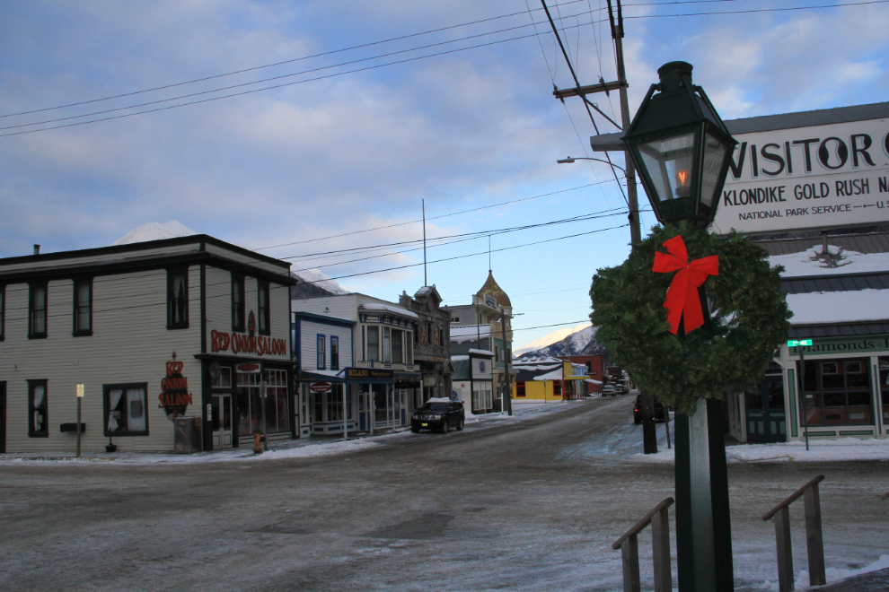
Looking down Broadway in Skagway. It was -13°C (+9°F), but the wind made the wind chill temperature much lower.
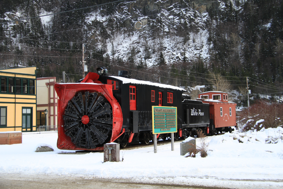
The White Pass’ historic rotary snow plow. I posted a video of the plow in action last Spring – it’s a very impressive old beast.
Another shot of Broadway, from the National Park Service headquarters.
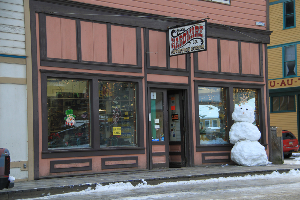
Cute decorating 🙂
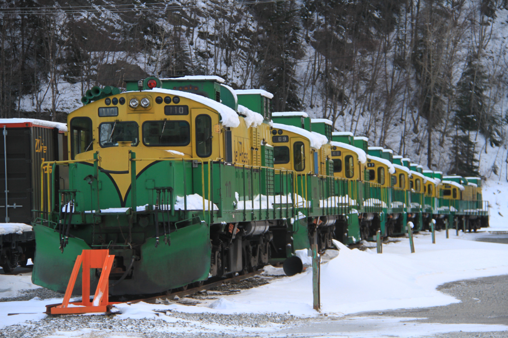
Locomotives resting for the winter.
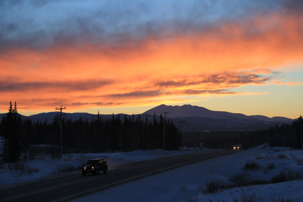
Heading home, looking back towards Skagway at 2:43 pm.
Here’s a couple of minutes of video to show you exactly what the drive was like near the White Pass summit. Meeting an Alaska Highways rotary plow was just luck 🙂 And I don’t know what that was playing on my iPod!
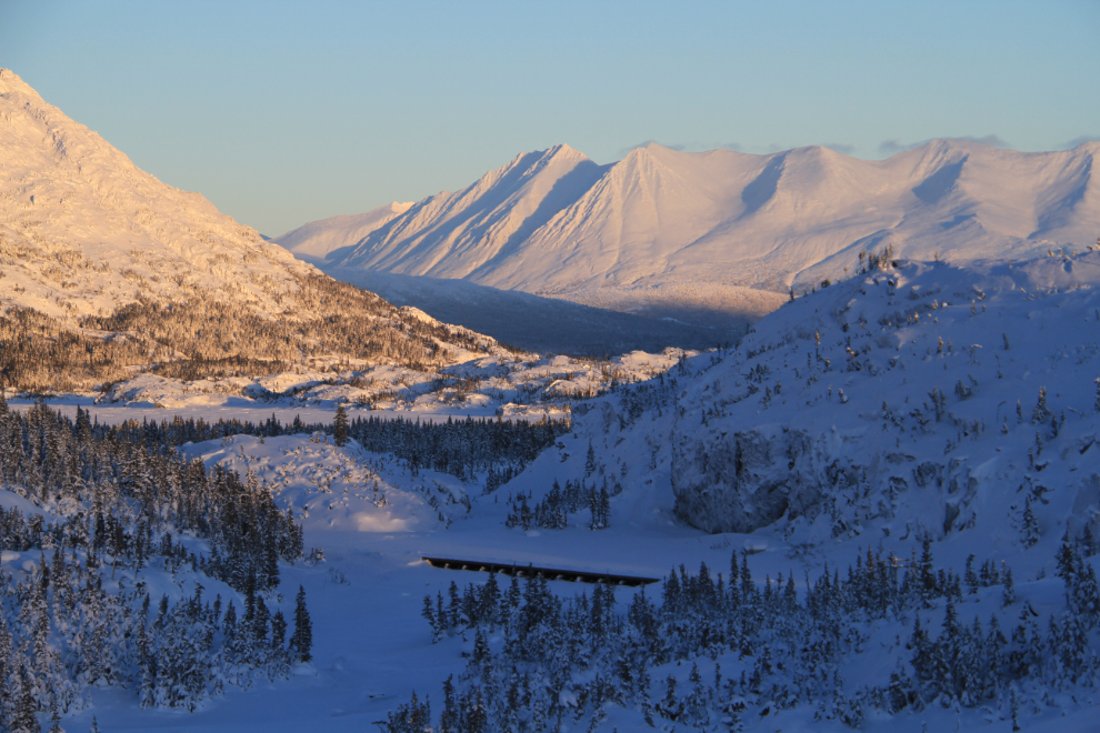
Looking north from the Summit Lake area.
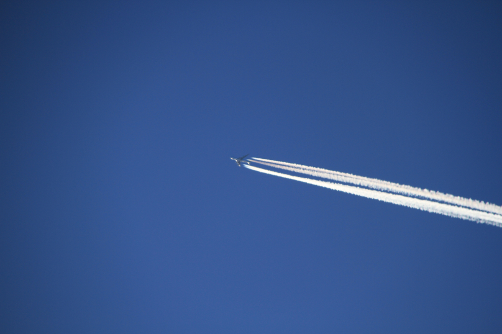
What a day to be flying over this country – the visibility looking back up at them was amazing!
The Thompson River.
Approaching Canada Customs at Fraser. The square building to the right is the historic WP&YR water tower from their steam-engine days (still used for their two remaining operable steam locomotives)
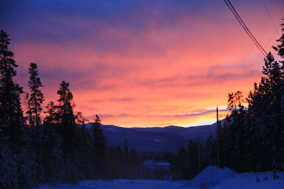
Wonderful evening light at 3:24, 23 minutes before sunset.
Still chugging along, at Tutshi Lake. It took me a while to get my head wrapped around why he’d do this. I do difficult, dangerous, and even painful things when that’s what it takes to accomplish certain things, but I always take an easier way if it’s available. Some people just need to do things that nobody else does, though – whether it’s taking a dog sled to the summit of Mt. McKinley or kayaking the Northwest Passage. Good luck, whereever you’re going!
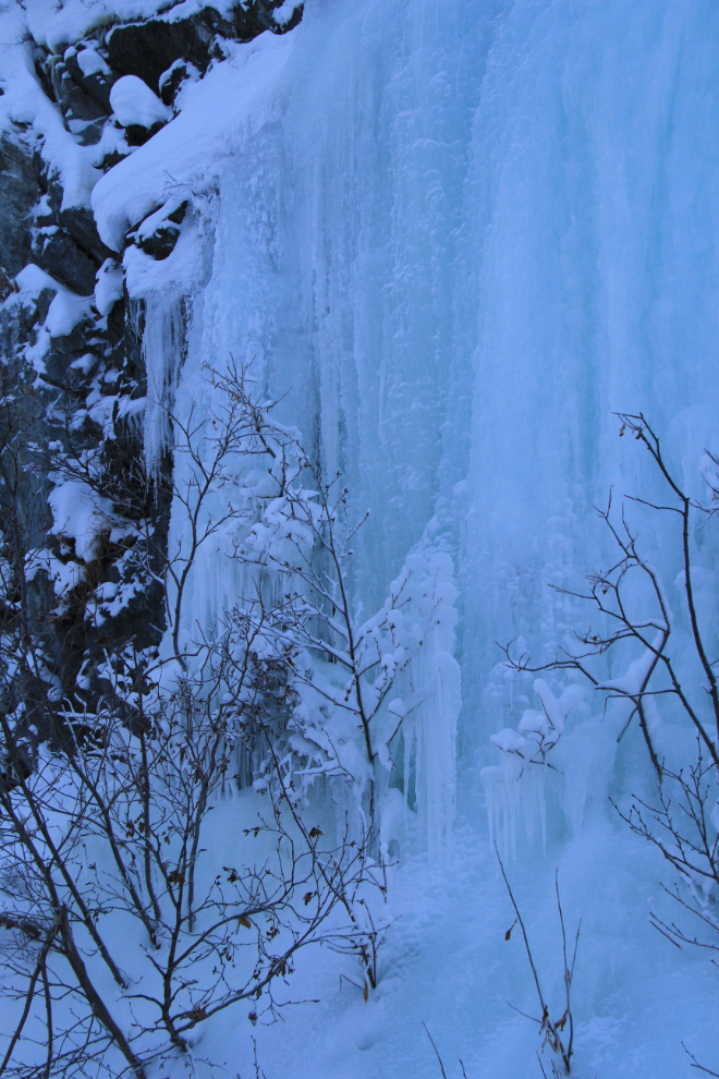
There are some lovely ice-waterfalls along the highway.
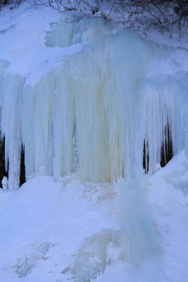
I could hear a lot of water running behind this curtain of ice.
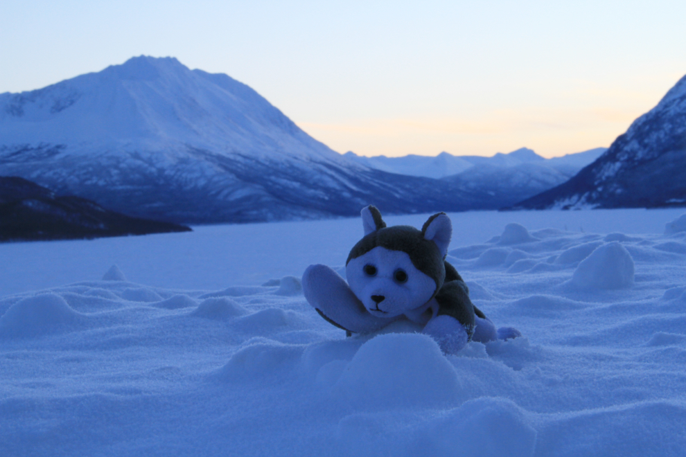
Tutshi Lake, 2 minutes after sunset.

Nanook says “good night” from the shore of Tutshi Lake – thanks for joining us on our little adventure 🙂