Hiking to the upper Venus Silver Mine, Yukon
On Thursday I returned to the historic Venus silver mine, but this time planning on a full day of exploring, with the 1905-1909 Venus No. 2 workings being the goal. There was a larger goal as well, to see if I still have enough passion about this mine (these mines, actually) to re-write my book about them and get it back into print.
With a forecast for a mostly-sunny day, I was away from the house just after 9:30, and at 10:50, started hiking up the gated mine access road at Km 82.2 of the South Klondike Highway.
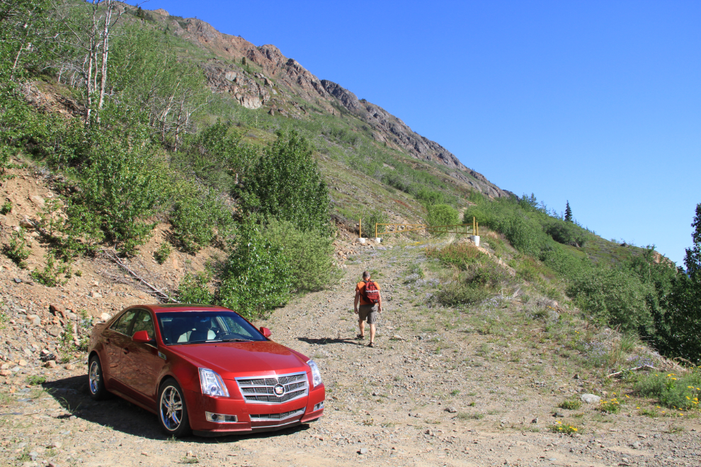
Twenty minutes later I reached the junction where I had turned left on my hike 2 weeks ago. This time I went to the right, and 5 minutes later reached the area where I’d start going vertical, though I wasn’t sure exactly where yet.
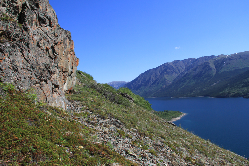
I wanted to get close to the route of the 2,500 foot long aerial tramway that took the silver ore from the mine to the wharf and later the concentrator on the lakeshore, and the base of the rocks in the center of this photo looked like a good place to start.
Starting up, at 11:25. I was hiking alone as I almost always do. My “safety partner” on these hikes is always Spot, my Satellite GPS Messenger. Some of you have no doubt noticed that I seldom take either dog with me. The reason is simply that the country I usually go into is simply too hard and/or dangerous for Monty and Bella and I need to focus on taking care of myself.
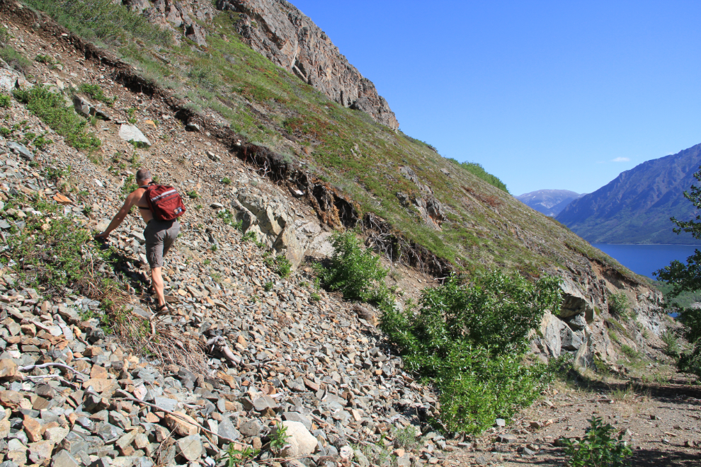
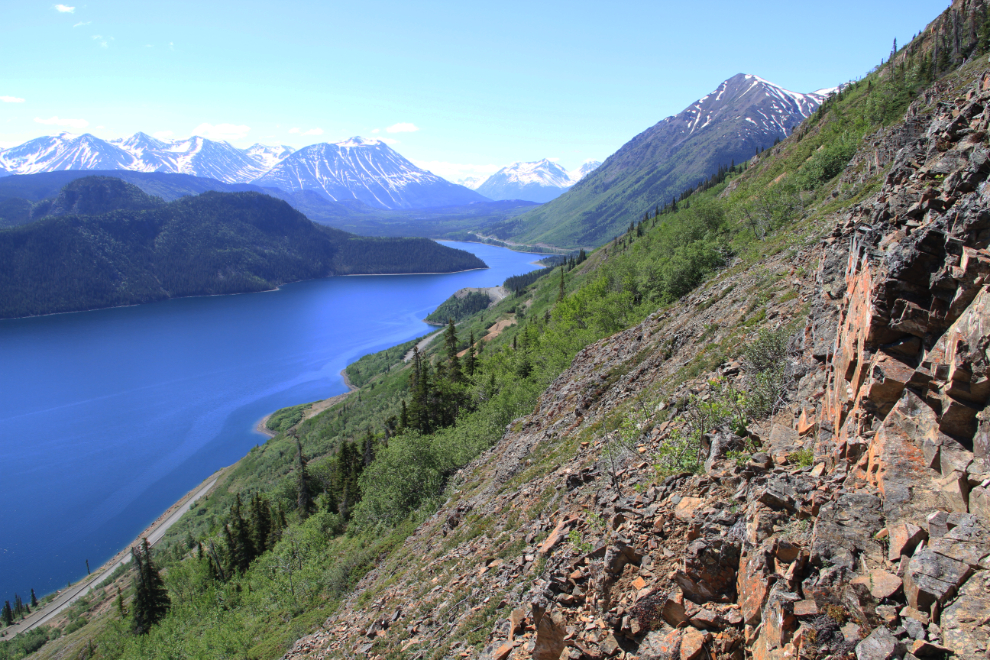
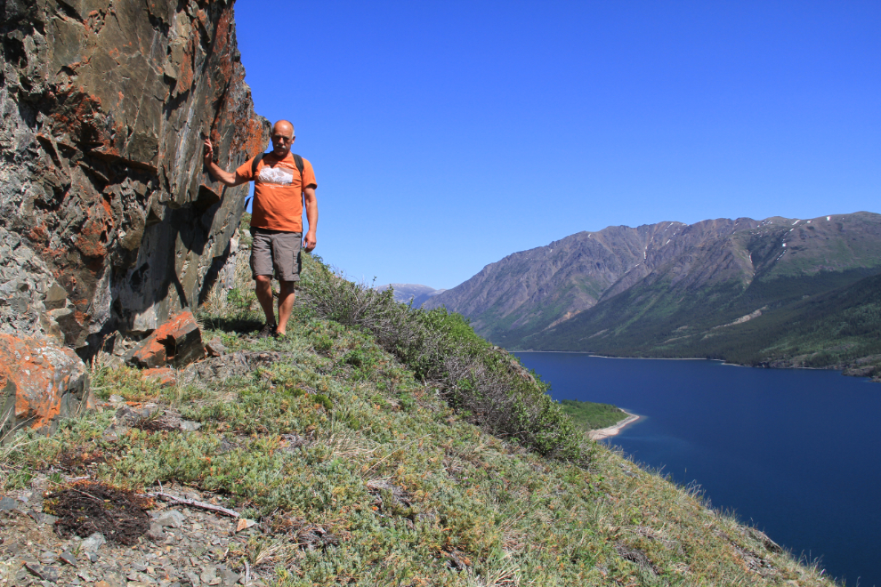
While historic ruins were my main reason for being here, the views are a big part of what makes this slope so rewarding to hike. Just around that rock face, though, the route went vertical and there was no time to enjoy the view or take pictures. It was a hands-and-feet scramble up about 400 feet of mostly juniper and loose rock with the odd firm rock for relief.
The piece of wood in the foreground was a claim post from the main staking of this slope in 1905. Some of these posts on the mountain have Roman numerals carved into them that are still legible after 110 years, but this one was too badly weathered.
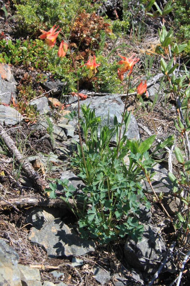
Flowers were quite plentiful, including a few Western Columbine (Aquilegia formosa Fisch). Alaska’s state flower, the Alpine forget-me-not (Myosotis alpestris) was by far the most prevalent flower, but there were close to a dozen species in bloom.
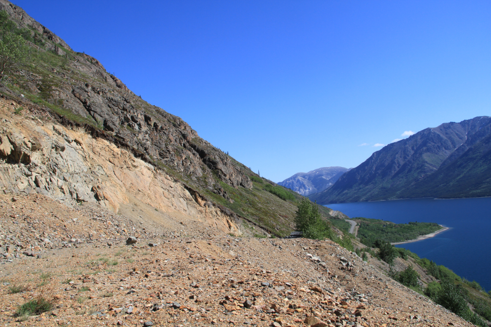
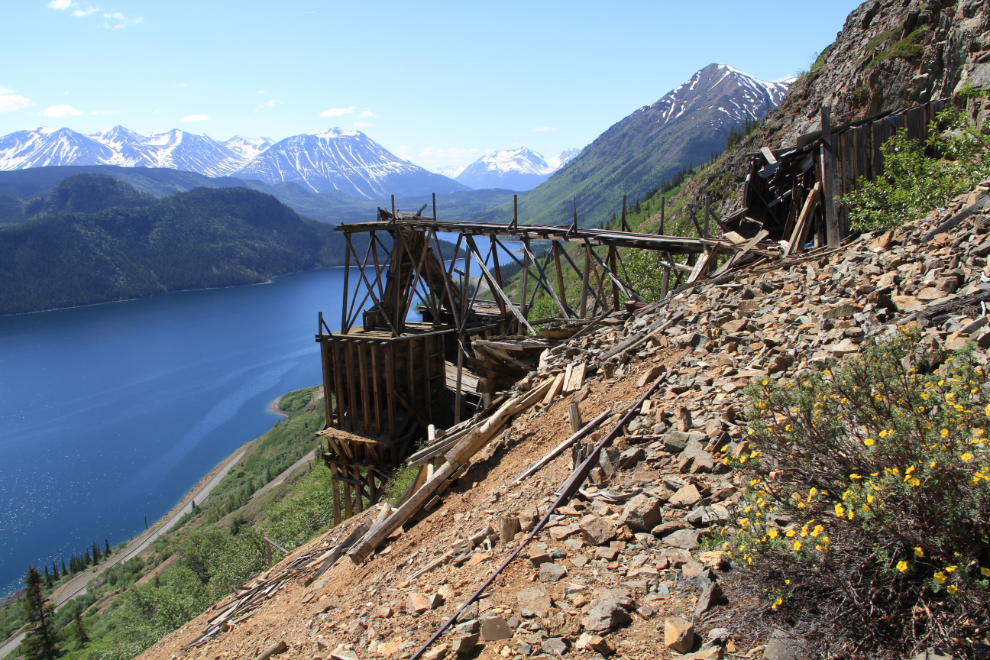
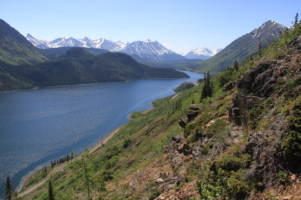
Within 25 minutes of starting up, the views of the mine workings were excellent, though a ravine full of brush kept me from the tramway route. I could have fought through it, but it wasn’t that important – there was plenty to see anyway.
The piece of land sticking out into the lake to the north is the delta of Pooley Creek, the site of several support operations for the Venus and other mines over the years, including the warehouse and shop for the Venus in the 1970s. Now privately owned, one of my friends’ private home is the only building in use.
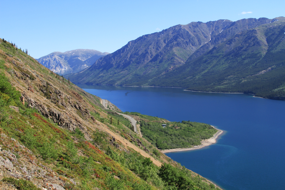
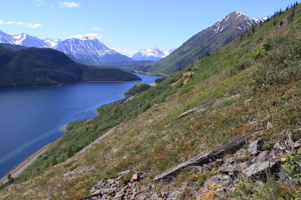
The view to the south, along Windy Arm and the South Klondike Highway towards Skagway.
At 12:30 I was at the mine and it was time for a leisurely lunch break – “a table with a view please, garcon” 🙂 The collapsed building I’m standing on was the bunkhouse and cookhouse. My younger readers may have a hard time understanding how incredibly good it feels to be able to get to places like this at 64 years old. When I first started hiking this mountain 25 years ago it was a given that I’d be able to get wherever I wanted. That’s no longer true – now I celebrate days like this.
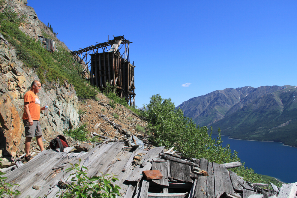
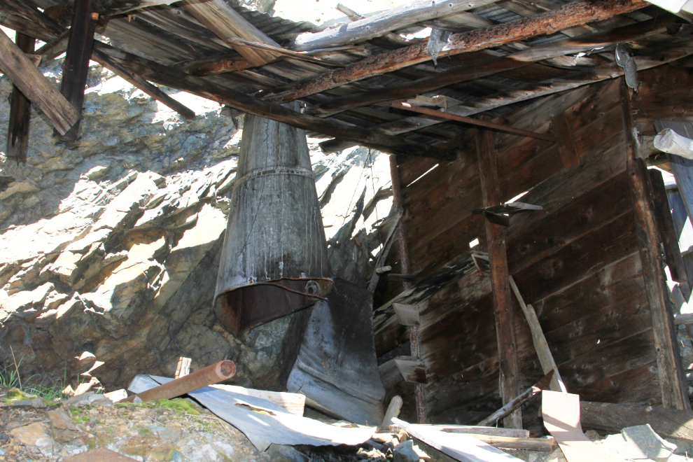
Time to dig into the details. The building was a small shop which included a forge.
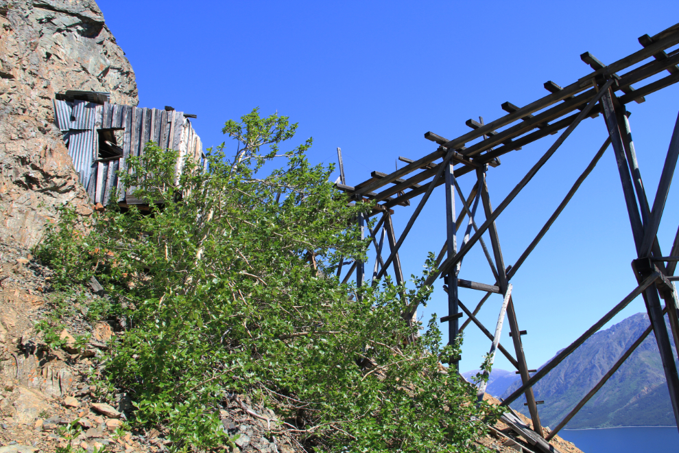
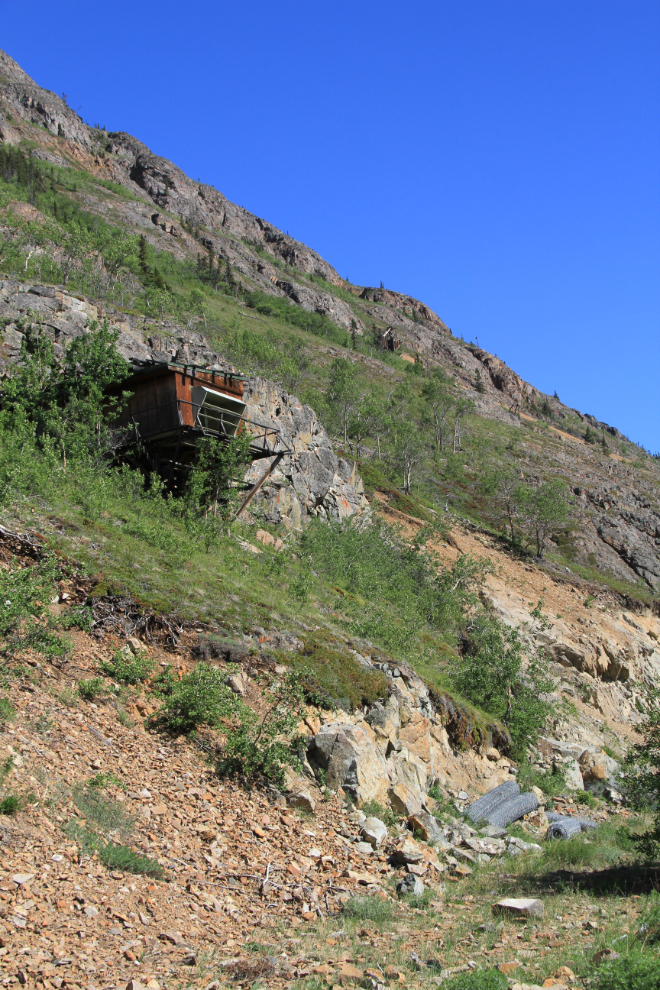
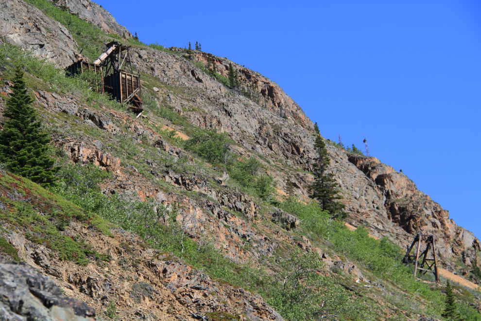
This is the location that really excites me at this site – the control station for the aerial tramway. Imagine working here not just on a spectacular day like this, but when you’re in thick clouds with an icy rain or snow being driven in by a strong wind. Today, every step needs to be considered, with hazards everywhere.
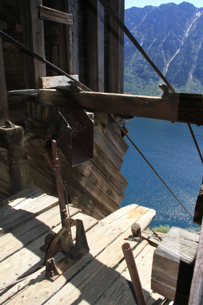
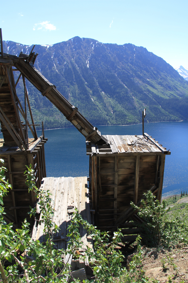
Ore storage bins flank the tramway control station. Depending on the quality of the ore being brought out, some would go straight into the bins, some would have to be hand-sorted so that only the high grade ore was sent down the tramway. That was particularly true in the early days when the ore was all shipped out. Once the concentrator was put into operation, lower qualities were sent down.
Inside the workshop beside the adit, with the blacksmith’s forge still in place.
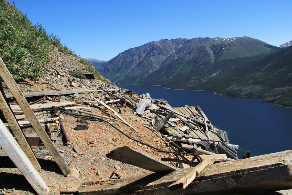
This once-level area used to have tracks running its length – this is where the hand sorting of the ore was done before sending the ore cars out to the storage bins. I need to check my photos from the 1990s, but I’m quite sure that the tracks were still in place then, and that subsequent slumping of the slope resulted in this wreckage.
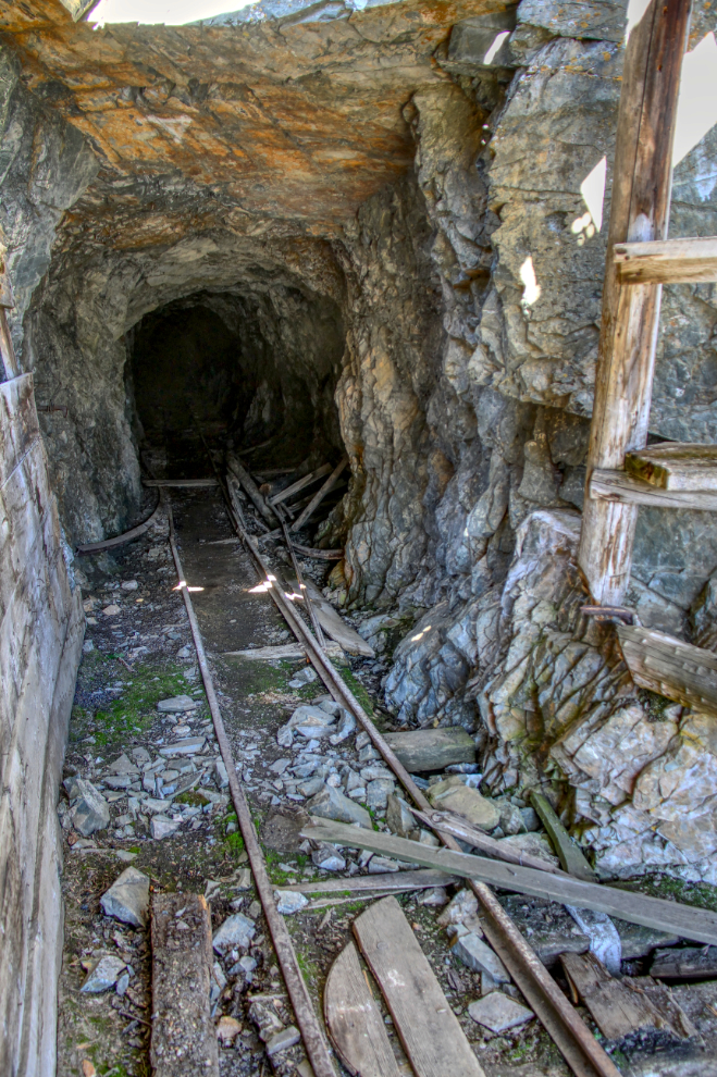
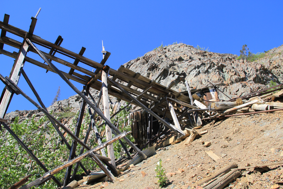
The adit. In mining terminology, an adit is open at one end (and is by far the most common form of drilling on a sloped property), while a tunnel is open at both ends. A shaft is vertical. This is by far the best-preserved of the many adits on Montana Mountain. No, I’ve never been in it – having worked far underground at the Granduc copper mine, I have great respect for such places. To bring out the detail, this is an HDR image created with 3 photos with varied exposures.
Finding garbage at a site like this really upsets me. What is wrong with people who come to a place like this and then trash it? I packed it all out.

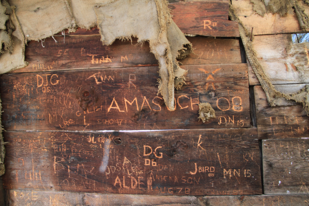
And I mean this sort of juvenile disrespect as well.
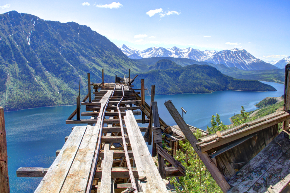
This is the route the ore took from the adit or sorting area to the storage bins. Any volunteers to push the ore cars out there? Nobody was ever killed at the Venus mine.
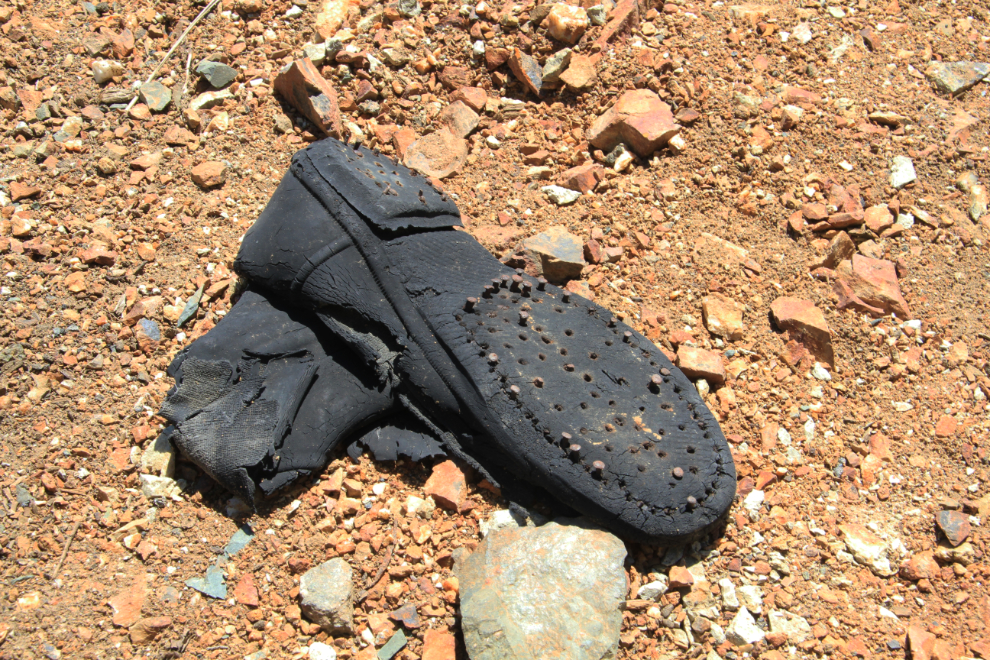
The very dry climate has allowed even items like this to survive.
A broad view of the site from the end of the ore sorting area.
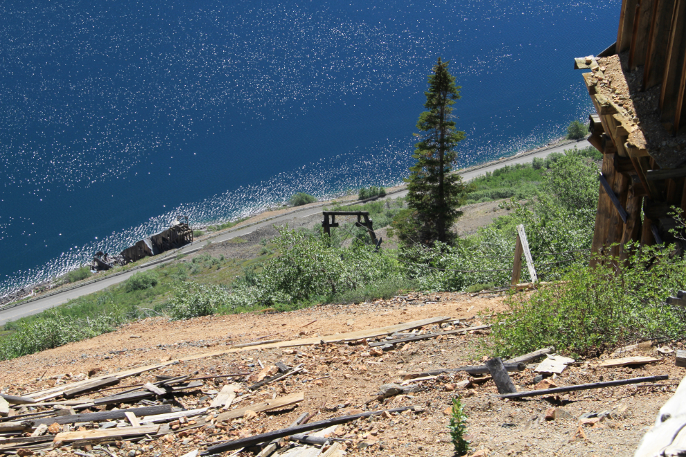
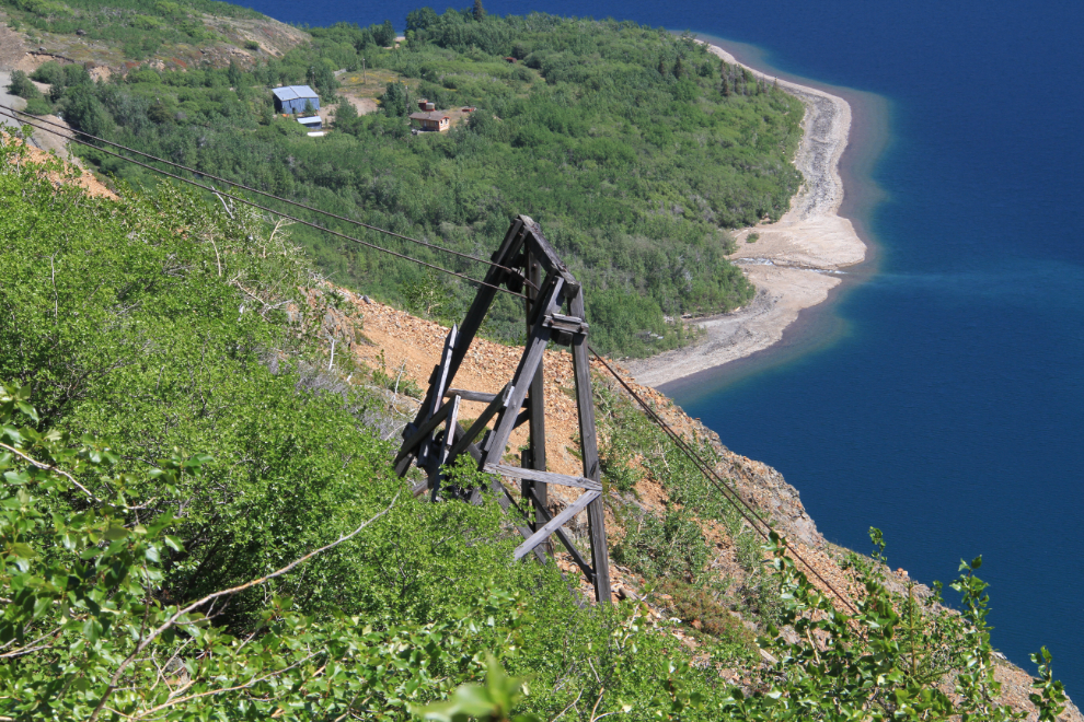
Looking down over the only standing tramway tower to the highway and the concentrator.
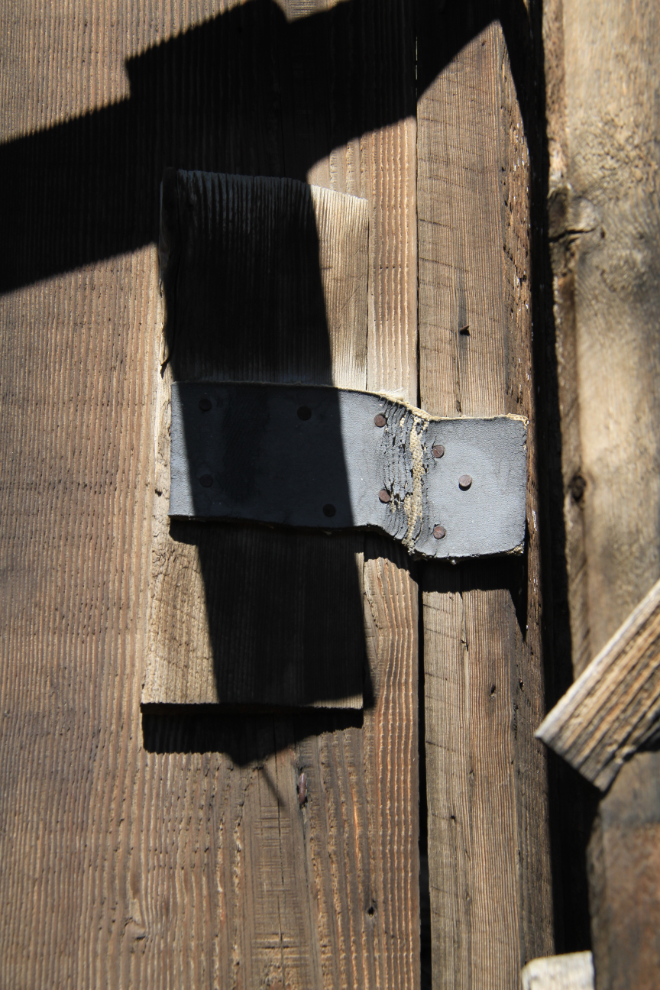
Even some of the door hinges made from heavy belting are still intact. Metal hinges were used on the doors at some of the other Conrad mines in the area.
No photos seem to exist of the construction of any of these mines. After the huge timbers were brought to the beach below by sternwheeler, how did the men get them up here? A winch was probably used for many of them, but how did they get the winch up? The slope is certainly too steep for any sort of animal assistance.
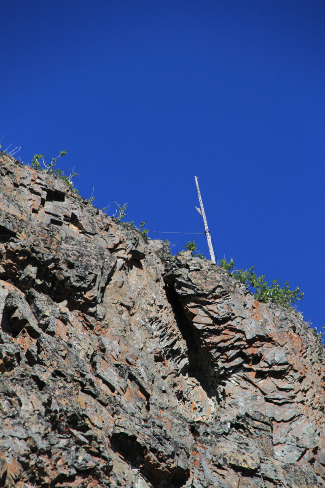
High on the cliff directly above the adit, a telephone poole still stands. All of the Conrad mines were connected by a private telephone system by 1906, and some of the trails along the telephone lines on this slope in particular can still be walked.
I started back down just after 1:30, and got a closer look at the tramway tower, which is under 20 feet tall, one of the smallest on the mountain.
I took a slightly different route down, preferring small scree slopes interspersed with firm rock to the juniper-covered slopes I came up on. I had a fairly constant nag on the way down that I should have kept exploring, but I had come with no detailed plan beyond getting to the main workings, and was basically happy with the day.
My route down took me to the same rock face I had identified as a good starting point on the way up, and only took 40 minutes. At 2:40 I was back to the car, with 164 photos saved in the camera.
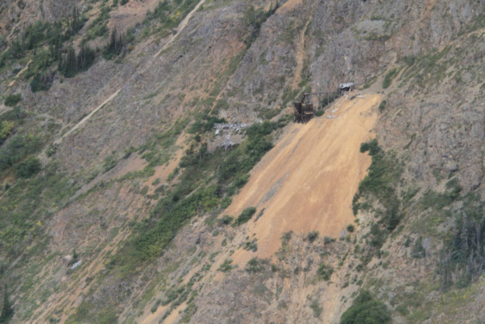
My broader goal of trying to re-kindle the passion I once had for these mines worked. I’m now anxious to get back up there as soon as possible, and have started to develop a much broader plan of exploration and a much longer day. I shot this photo of the site while flying with my friend Kyle Cameron 2 years ago when he invited me to join him and his partner to explore an old logging operation nearby (see “Flight to Yukon History” from August 2013). In this photo and others, the telephone line and other trails can be seen for the next outing.
A couple of days ago, one of my readers pointed me to a project he’s involved in, which provides mapping of hikes and other trips – this is my first test of the system, which creates a track using the waypoints my Spot creates. It will take me a while to fine-tune the output, but it looks like a very useful tool. http://www.track-kit.net/maps_s3/?v=embed&track=207619.gpx
Tomorrow afternoon I’m flying to Kelowna for a week to help my Dad move, but I’ll be back #ExploringYukon soon. A week to Dawson City and back with the family in the RV is the next plan 🙂