Yukon RVing: Carmacks
We’ve just returned home from 9 days on the roads of the Yukon with the RV – our longest trip with it yet. I had little Internet access during that time (and didn’t do any blog writing in any case), so I’m playing catch-up now. Part 1 of the journal takes us from our home in Whitehorse to Carmacks and then to the junction of the North Klondike and Dempster Highways.
It had been a tough week, and I didn’t quite have the rig ready to go on Friday morning. We didn’t get away from home until 12:30, and although it was sunny, the forecast was for thunderstorms through the afternoon and evening. As we reached the airport at Whitehorse, it didn’t look very promising ahead.
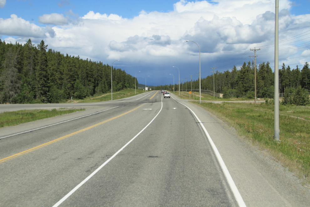
We had some more shopping and other errands to do in Whitehorse, and then stopped at Braeburn Lodge to pick up one of Steve’s massive cinnamon buns. With a series of thunderstorms and 2 long sections of construction, it was a slow trip north, and we didn’t reach Carmacks, only 196 kilometers (122 miles) from home, until almost 4:30. While not my usual way of travelling, this was perfect for our new life – we’ve decided that averaging about 150 miles per day is a good pace.
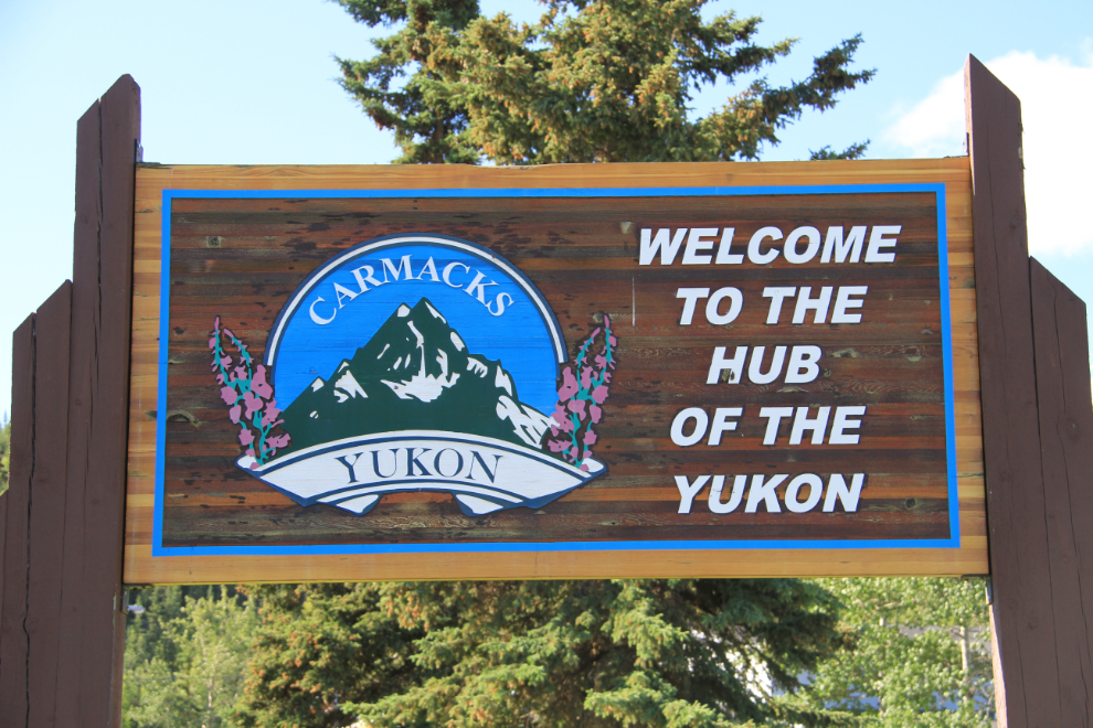
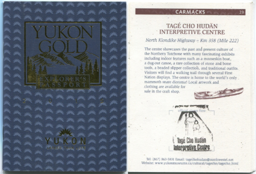
Our first stop in Carmacks, where the weather had improved dramatically, was at the little visitor information booth at the south approach to town. The woman on duty didn’t have the Yukon Gold Explorer’s Passports we wanted to start the trip with (more about that later), so next we went to the Tage Cho Hudan Interpretive Centre towards the north end of town, which she said would have it.
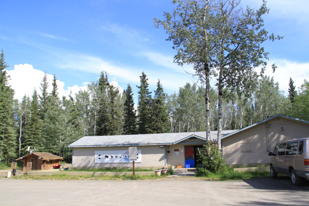
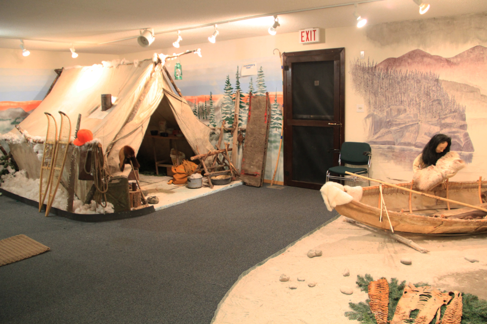
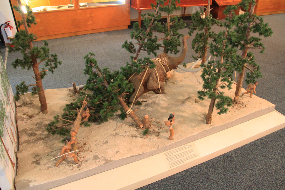
I had never visited this interpretive centre before – one of the very few I’d missed. It’s small, but the exhibits are very good, and it’s worth a stop. I found a diorama showing how the early people killed woolly mammoths to be particularly interesting. Admission is free, but we added to the donation box at the door.
This is my new Explorer’s Passport, with the Tage Cho Hudan Interpretive Centre page and stamp. There are 35 sites around the Yukon that participate in this program. At most of them, you get your passport stamped (at a few you just write down the site number), and at the end of your Yukon visit (or season, in our case), you can drop off an entry for a chance to win one of several prizes of Klondike placer gold. I don’t know that I’ve ever entered the contest, but collecting the stamps is fun, and as intended, is a great way to get us in the door of places we haven’t been to before, or not recently.
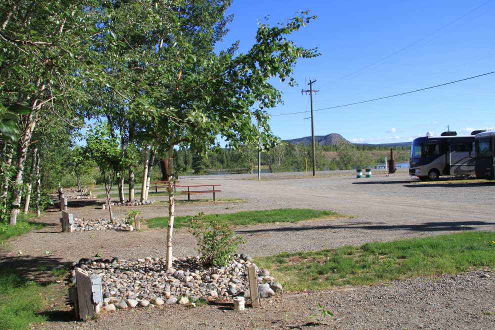
We had decided to stay at the Hotel Carmacks RV Park, mostly because it’s on the 2-kilometer-long boardwalk along the Yukon River. With a Good Sam discount, the pull-through full-service site was $37.80 with tax, and I opted to get the hi-speed Internet access for $10 as I’d seen many complaints about the regular access. While not spacious, the site was almost level, had a picnic table, and there was an unobstructed view of the river. The park has 30 sites in total.
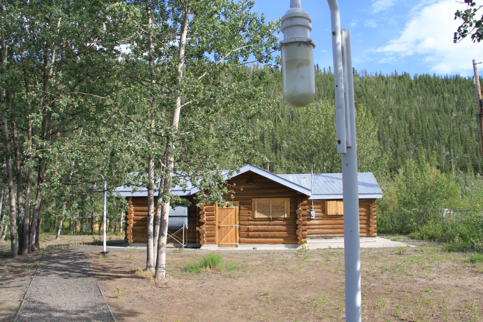
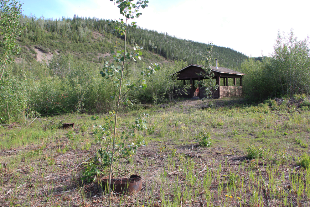
Our first walk was along the boardwalk to the northeast (upriver) to the old government campground. Once one of the largest campgrounds in the Yukon, it was abandoned perhaps a dozen years ago, for reasons I can only guess at. Among the high-quality facilities that were abandoned is this large visitor center.
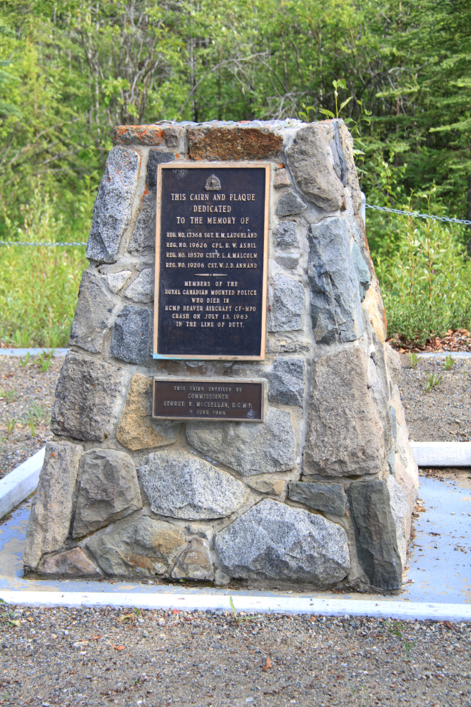
Much sadder is the fact that few people ever see this memorial in front of the abandoned visitor center. It honours 4 members of the Royal Canadian Mounted Police who were killed when their Beaver CF-MPO crashed at Carmacks while attempting to land on July 13, 1963. Killed were Sgt. Morley K. Laughland, Cst. Proctor L. A. Malcolm, Cst. William J. D. Annand, and Cpl. Robert Wiliam Asbil. There have been very few police officers killed in the Yukon since the first 20 members of the North-West Mounted Police (NWMP) arrived in 1895, and this tragedy stunned the entire country. See my Yukon Peace Officer Honour Roll for a complete list.
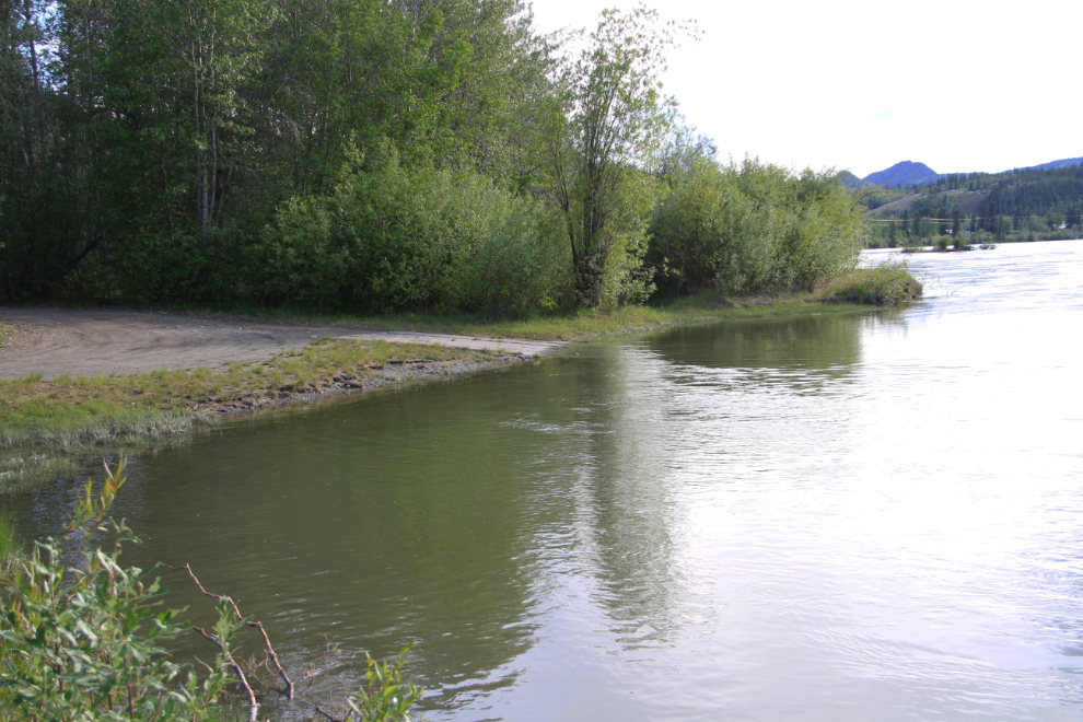
One of the attractions of the campground was this large eddy that allowed canoeists to safely land to camp or re-stock their supplies. This is the half-way point on the river from Whitehorse to Dawson City. It’s now been 18 years since my son and I made that trip, and I’d sure like to do it again (see my account of the 10-day 1997 trip, “Our Time Machine is a Canoe“).
It appears that the campground still gets some semi-official use by boaters, as the area round the picnic shelter has been cleared.
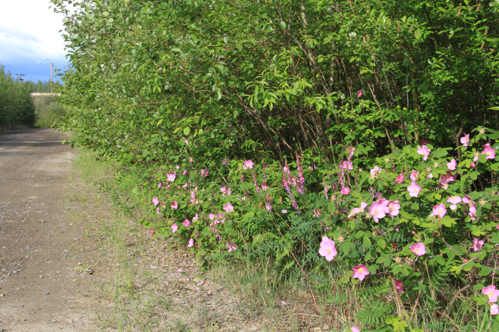
For Cathy and the dogs and I, though, the former campground was just a very nice place to go for a long walk on dirt roads lined with fragrant wild roses.
Saturday was a lazy morning, setting the tone for this holiday. When I finally got moving, I went around the campground for some photos of the facilities. Most other RVers had already left.
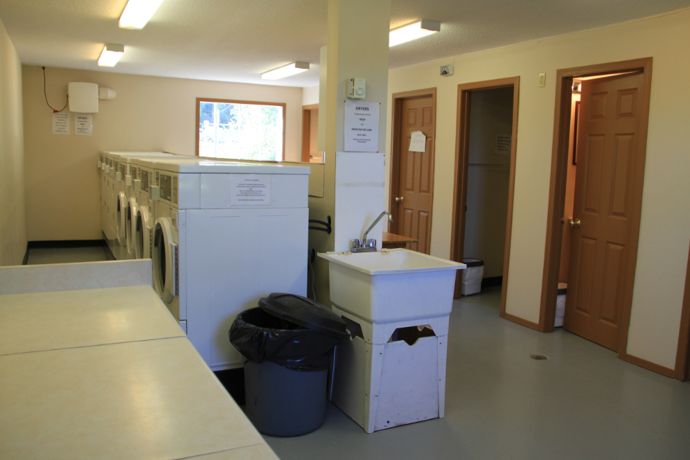
The laundry and bathroom facilities are very nice – large, bright and spotlessly clean.
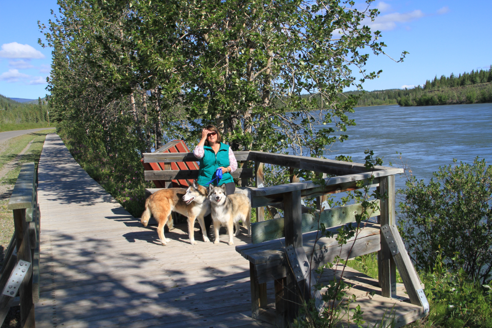
By 10:00 or so, it was time for another long walk, to see the other half of the boardwalk. It was certainly a beautiful morning to do it.
A stop to see my long-time friend Maja at Moose Creek Lodge, another 200 km north, is always a must for us.
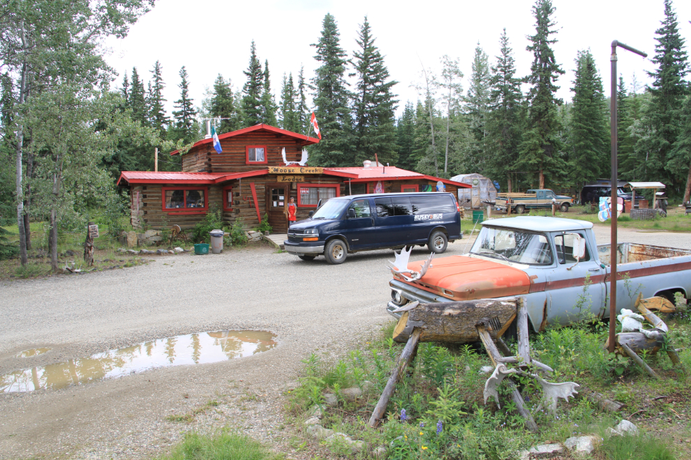
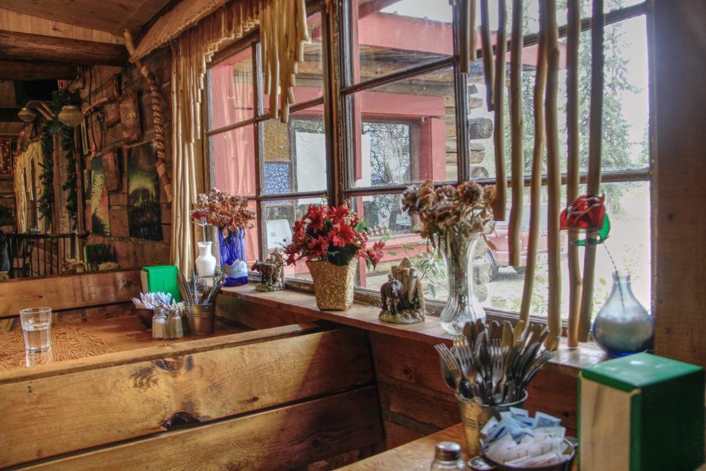
As well as a visit, an afternoon snack was in order, and my soup and Cathy’s pie were both excellent as always. This was the view from my seat, processed as an HDR image.
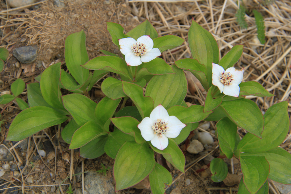
At one of our stops to walk the dogs, at the Gravel Lake rest area, the dwarf dogwood (Cornus canadensis) were plentiful and in beautiful condition.
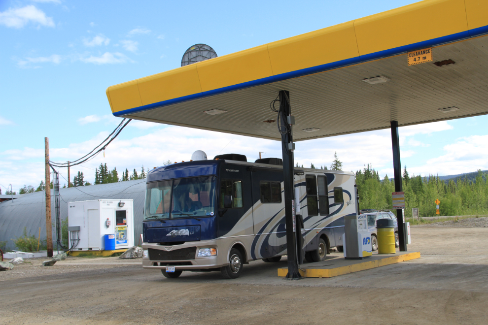
Our campsite for Saturday would be at Tombstone Park up the Dempster Highway, but I’m going to stop this post at the gas cardlock at the junction of the Dempster and North Klondike Highways, which we reached at 4:30. This stop is worth noting because this cardlock has broken the long-standing fuel price gouging in the Dawson area. We paid $1.249 per liter for gas, only 5 cents more than most stations in Whitehorse. Until this AFD operation opened (2 years ago, I think), you could expect to pay 30-50 cents more per liter in Dawson than in Whitehorse. There is a downside, though, and that’s that the cardlock system is lengthy, complicated and confusing – the first twice I tried to use it on previous trips, I gave up.