More wandering & exploring around Dawson City
On Friday, September 23rd, I had set up camp at the Yukon River Campground across the river from Dawson City at 4:00 pm. Although closed, the gate was open so no-services camping is allowed. I had a few hours to explore that afternoon and the next morning, and then I’d have to start back towards Whitehorse.
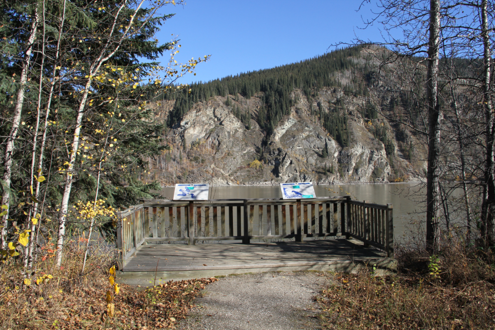
The Yukon River Campground is very nice. It’s the largest one in the territory, with 101 campsites, 22 of them pull-throughs to make things easy for rigs like mine. The two signs at this viewpoint talk about the peregrine falcons that nest on the cliffs opposite. In 1978, only one pair was known to breed on the Yukon River, but a recovery program that started the following year has been incredibly successful, and they’re now fairly commonly seen. When my son and I canoed from Whitehorse to Dawson in 1997, we spent a long time watching a pair of peregrine falcons teaching their young how to hunt shorebirds upriver at Minto.
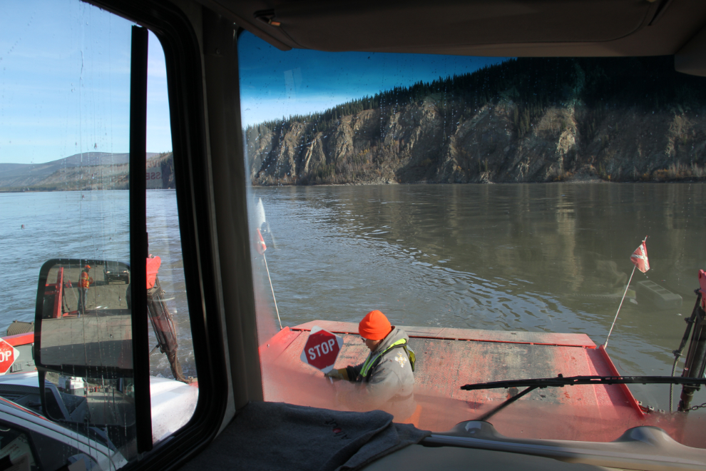
I soon disconnected the Tracker from the RV, and just before 5:00 pm we were on the ferry across the Yukon River to Dawson City.
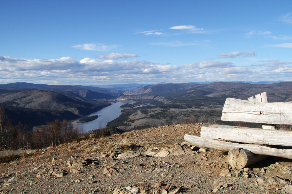
The first stop on the east side of the river was the top of the Midnight Dome. This is the view looking downriver towards Eagle, Alaska.
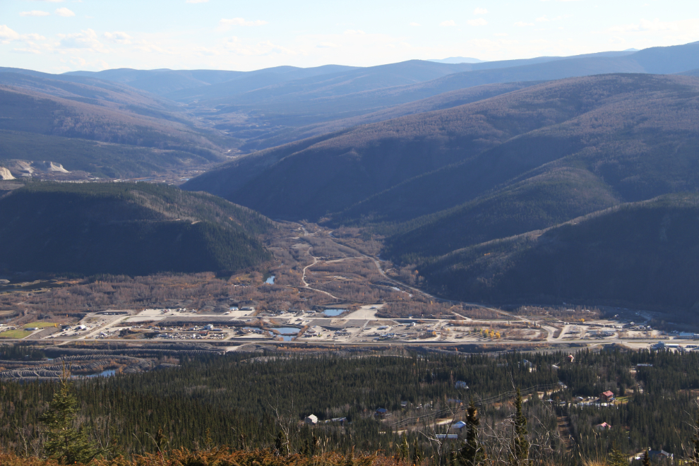
Looking up Bonanza Creek into the Klondike goldfields, with a new industrial park being developed along the North Klondike Highway.
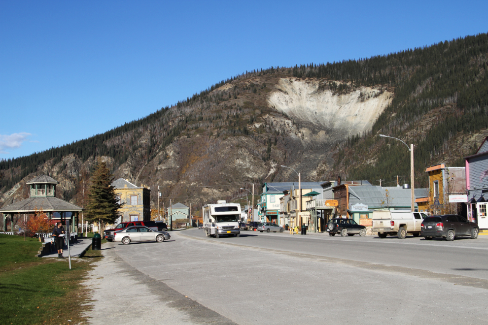
Back in town, I walked along Front Street to see what was new, then drove back to the ferry. The Moosehide Slide on the mountain is Dawson’s definitive geographic feature.
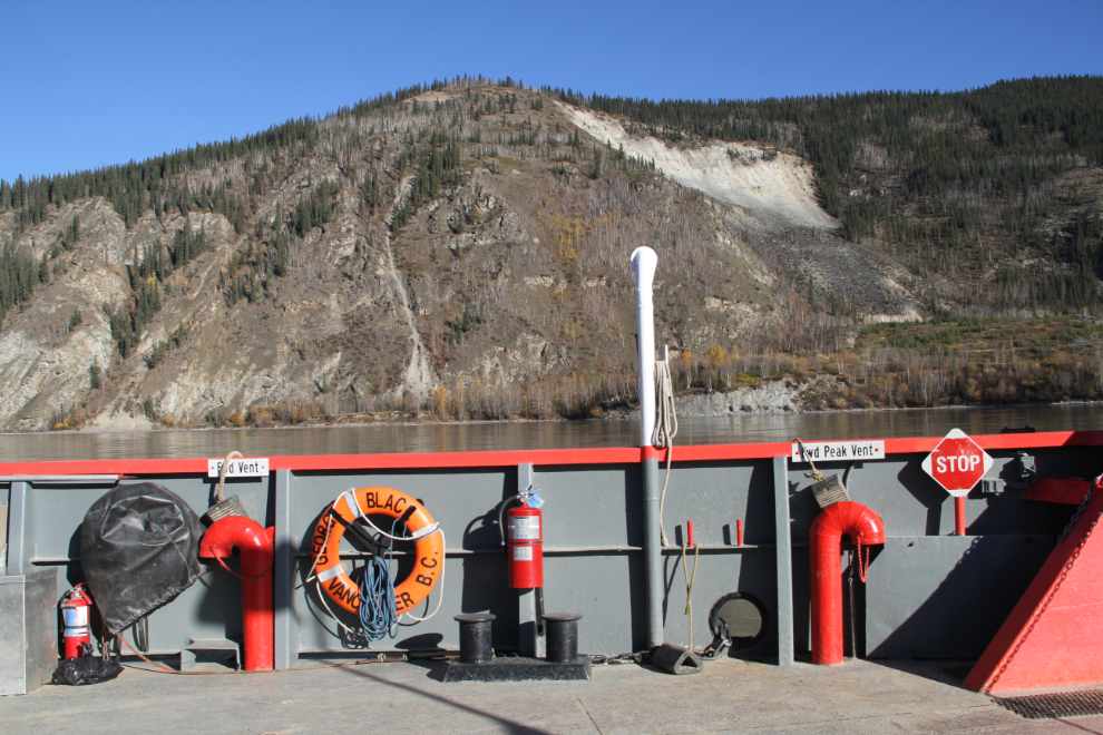
Back at the ferry landing at 6:10. As the river level goes up and down, which is does a lot, the loader adjusts he height of the loading ramp.

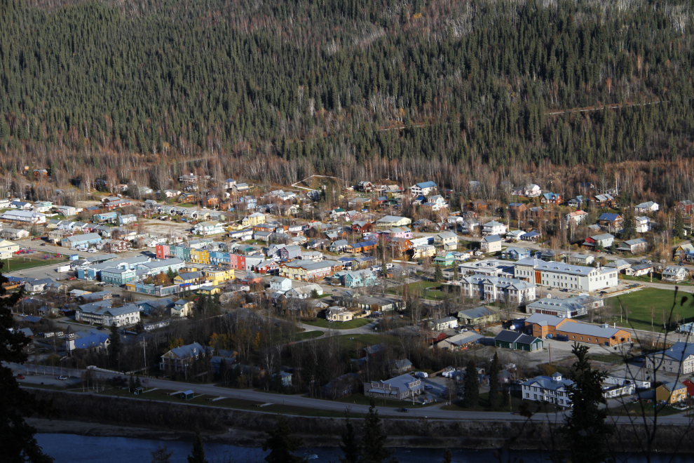
From the Midnight Dome, downtown Dawson City was backlit, so not good for photos, so I drove back up the Top of the World Highway a couple of kilometers to a viewpoint with good light.
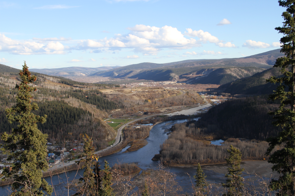
Looking up the Klondike River from the same spot.
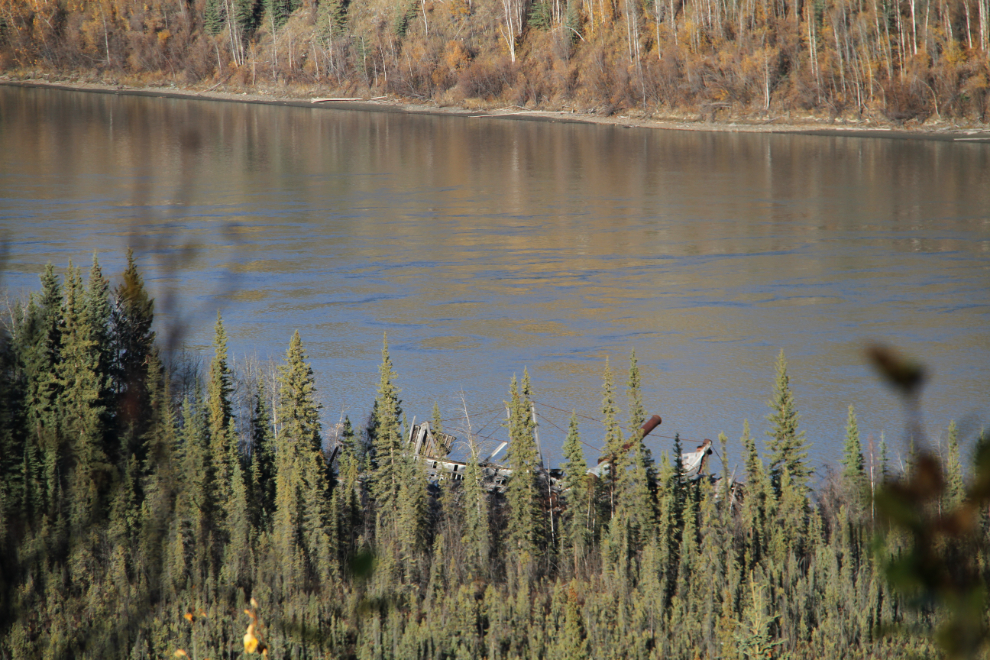
Halfway back down the highway to the campground, I pulled over and walked a block or so to a spot where some of the boats at the Sternwheeler Graveyard can be seen.
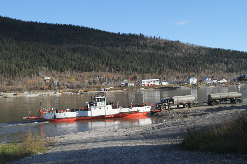
A fuel tanker from Fairbanks went by as I was shooting the sternwheelers, so I went down to the ferry landing to watch him load. It just barely fits, and no other vehicles are allowed on the ferry with him.
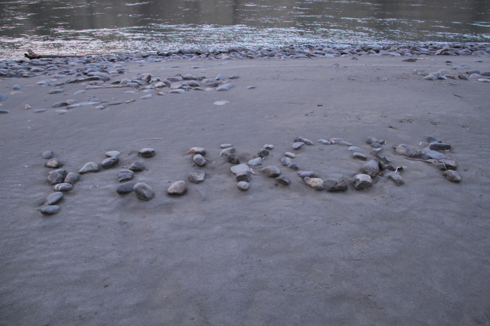
Late that evening, I decided to walk down the bank of the Yukon River to the Sternwheeler Graveyard, to get a plan for flying the drone there on Saturday morning. Along the way, somebody had created a “YUKON” title for their photo album.
Looking from the stern of 3 of the sternwheelers, back up the river towards Dawson.
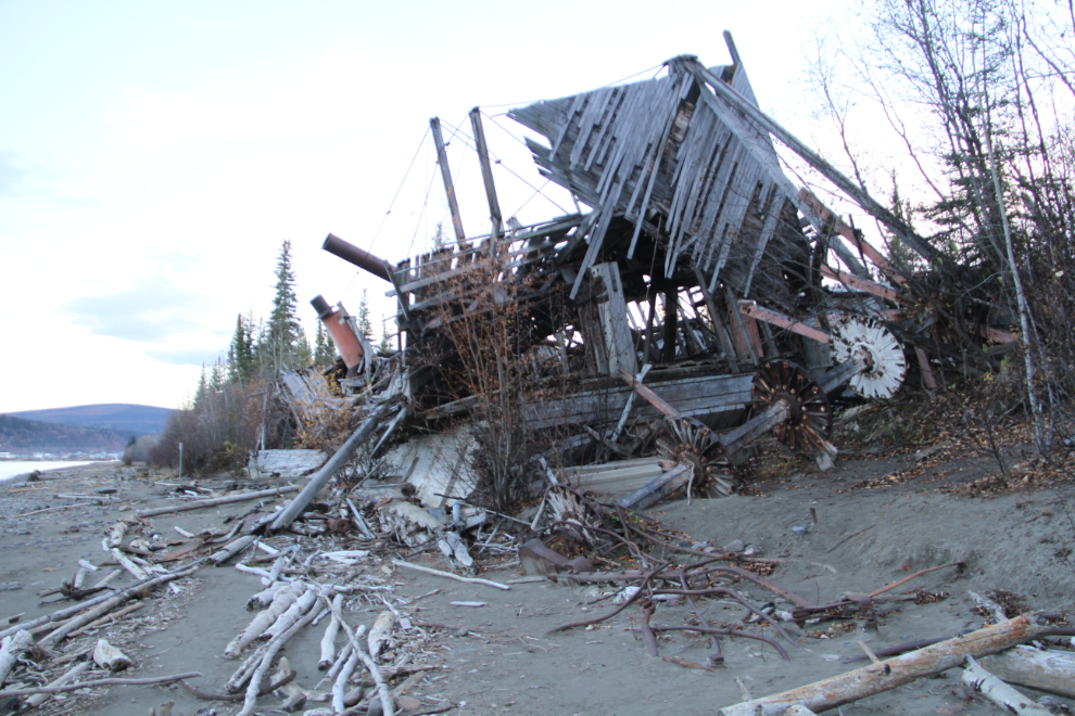
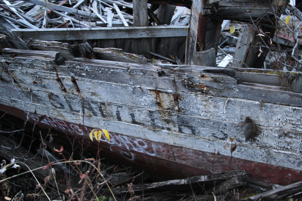
The Seattle No. 3. When I first visited the Sternwheeler Graveyard in 1990, you could still go through parts of the boats and some of the wheelhouses still stood – those days are long gone.
On Saturday (September 24th), it was almost noon before the sun hit the sternwheelers so it was worth launching the drone.
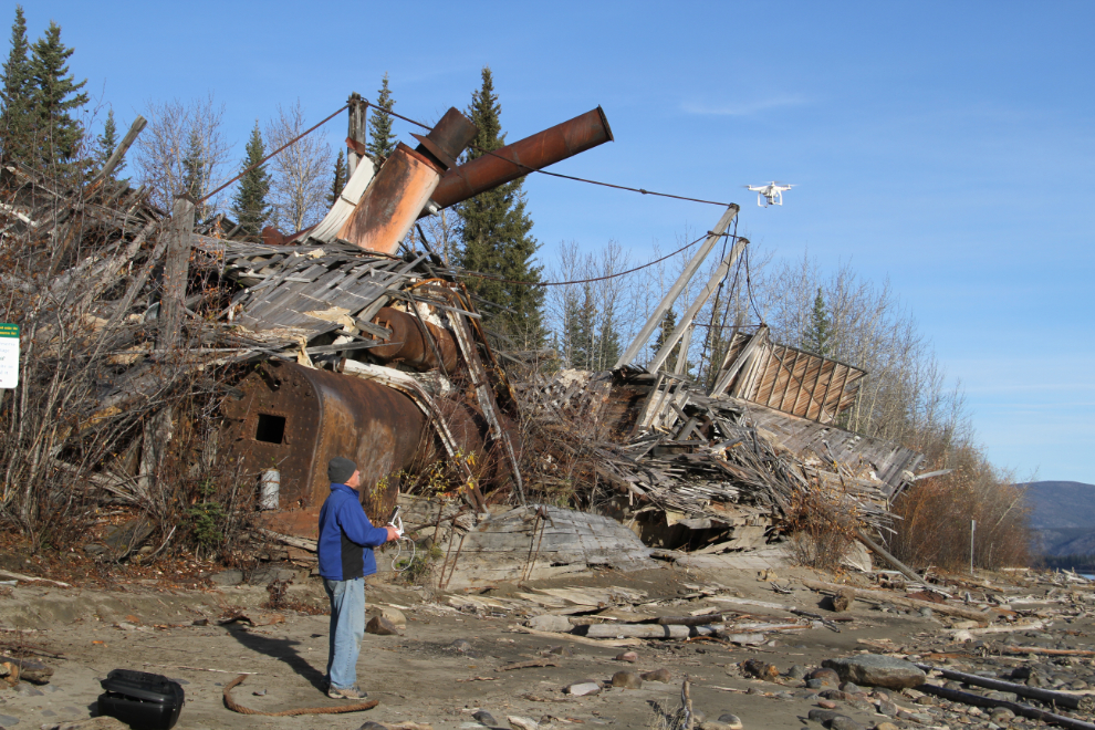
I’m still getting used to the controls on the drone – a DJI Phantom 3 Professional – but here’s the video I shot. The music I used is “Almost A Year Ago”, by John Deley and the 41 Players.
With that filming feeling good, I packed up, and we were back on the ferry “George Black” just after 1:00 pm. The guy loading vehicles said that they were surprised to see me drive up, that I was probably the last big RV of the year on the Top of the World Highway.
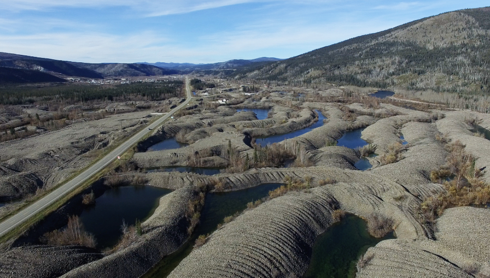
On the way south, I stopped at the “Welcome to Dawson City” pullout to fly the drone over the gold-dredge tailings. Vast areas of them are being levelled for housing and industrial lots, but I haven’t given up hope that the City will see the light and build a viewing tower with proper interpretation showing how important these piles of gravel are in Dawson City’s history. This drone flight didn’t go well at all. It lost satellite contact, then I had only erratic control of it, and as I got it close to landing, it flew into a tree. It may be damaged – I need to check it out carefully.
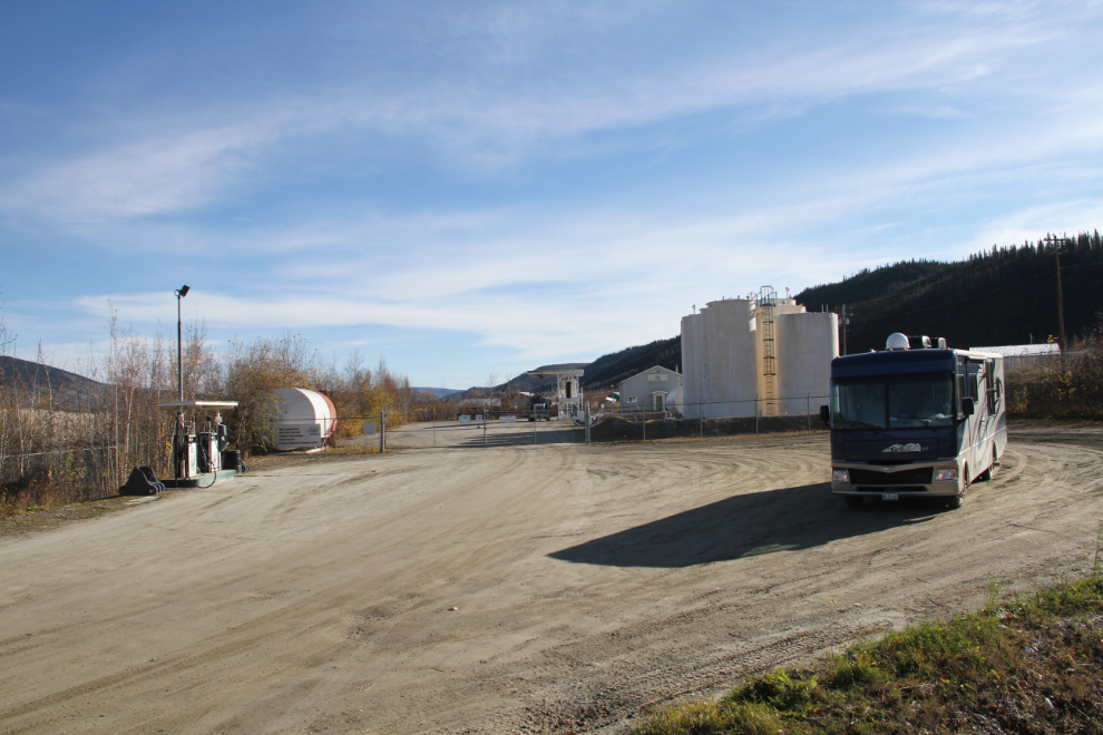
I had one final stop to make in Dawson, to fuel up at the North 60 commercial cardlock in the Callison industrial area. Just after 2:00 pm, we left Dawson City, probably for the last time until I return with a group in February to watch the Yukon Quest sled dog race.
With a few more short stops, we were now on our way home. I wanted to get there mid-afternoon on Sunday so could get some cleanup done on the rig and car before meeting Cathy at the airport at at 11:00 pm.