Exploring along the Tutshi River
I had to drive down to Skagway yesterday to pick up some stuff from the post office before we go on vacation next Monday. The weather report for Skagway showed clear skies and the forecast was for sunshine and 42 degrees, so it looked like a great day to do it.
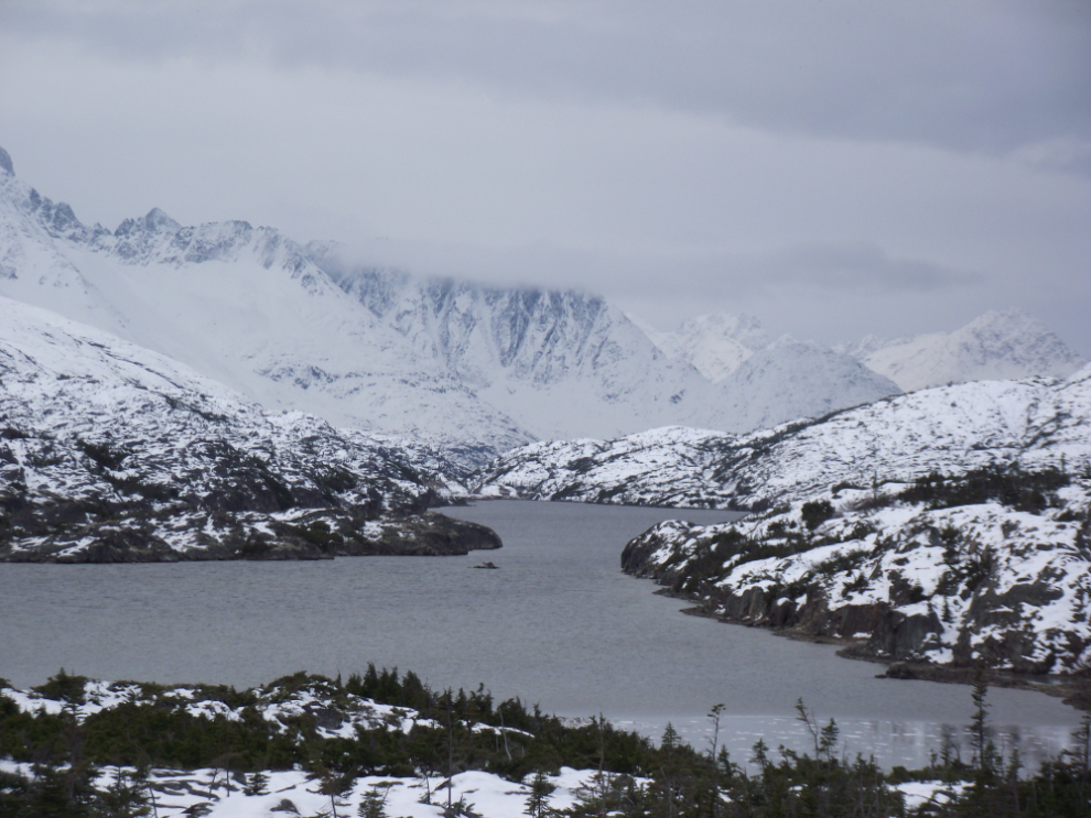
I was away from the house a few minutes before sunrise, which was at 09:07. Although the dawn light was lovely at times, by the time I reached Summit Lake it was clear that there was unlikely to be any sunshine this day! The temperature stayed within a couple of degrees above and below the freezing point all the way to the White Pass summit. Some of the sheltered bays on many of the lakes are iced over already – you can see ice on the nearest bay in the photo below.
The temperature did a nice climb as I descended to sea level – it was -1°C at the summit, +3 at US Customs and +7 (45°F) in downtown Skagway. That’s a rise of 1 degree Fahrenheit per mile 🙂
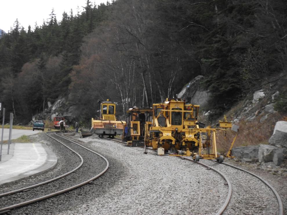
With the cruise ships gone, the White Pass crews were hard at work on the tracks by the dock.
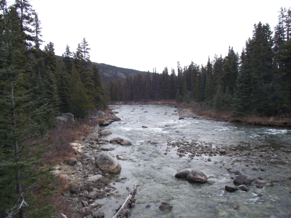
I got my stuff from the post office, had a big breakfast at the Sweet Tooth Cafe and was headed north by a few minutes past noon. I stopped at Km 49.4 and walked over to the Tutshi River to see how low the water was. This is a really lovely scene on a nice day but the flat light and clouds yesterday did nothing for it. I decided, however, that as I was still early this would be a good day to hike down to the section of the river where the best waterfalls were when I rafted it 4 years ago
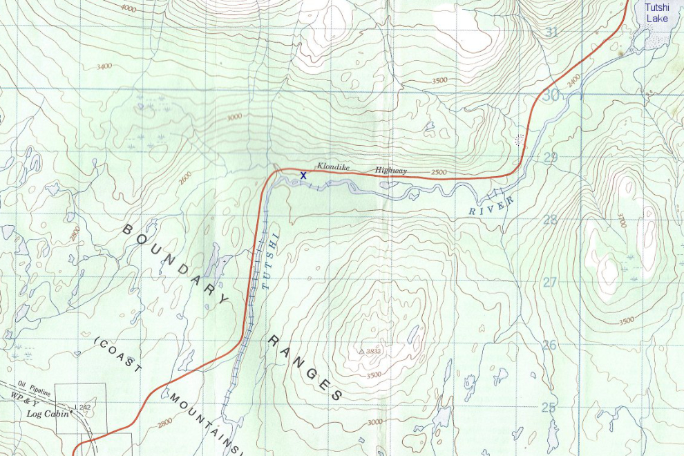
Here’s a topographic map of the Tutshi River area. Along the section of the river where it runs horizontal (ie west > east) there’s a small “x” – that’s where this hike took place.
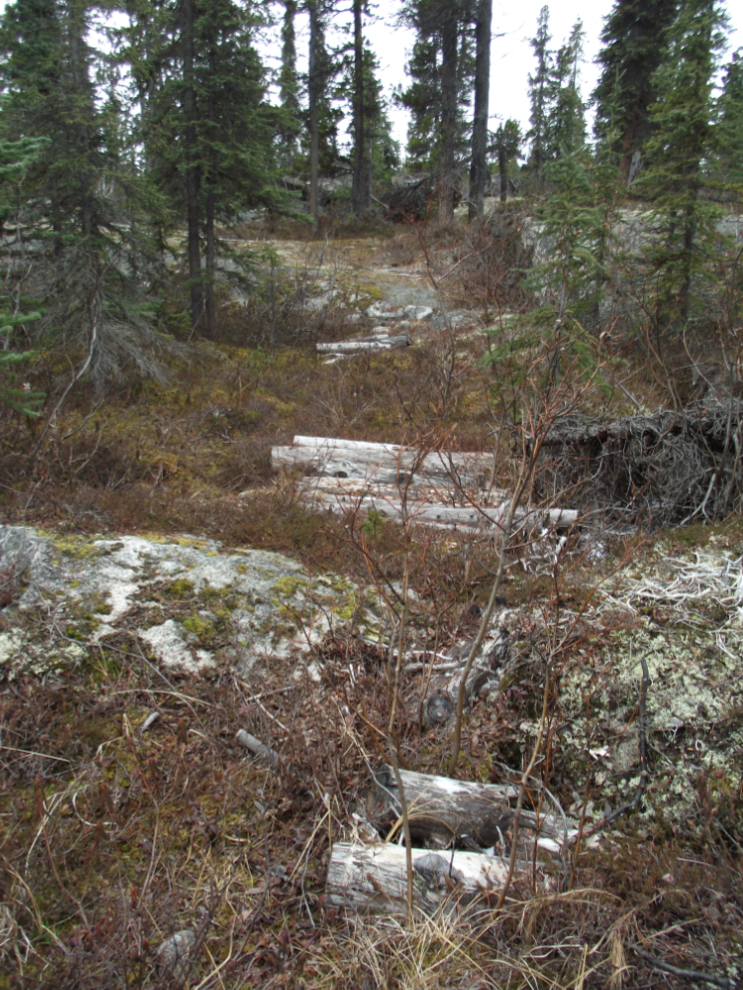
I parked the car half a kilometer further along the highway and headed off into the forest towards the sound of the roaring river. About 5 minutes later, half-way to the river, I came across this sight – a corduroyed trail! This country never ceases to surprise me. I tried to follow it in both directions but quickly lost it – I can’t imagine why it was built or when.
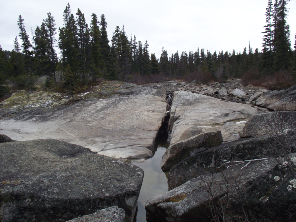
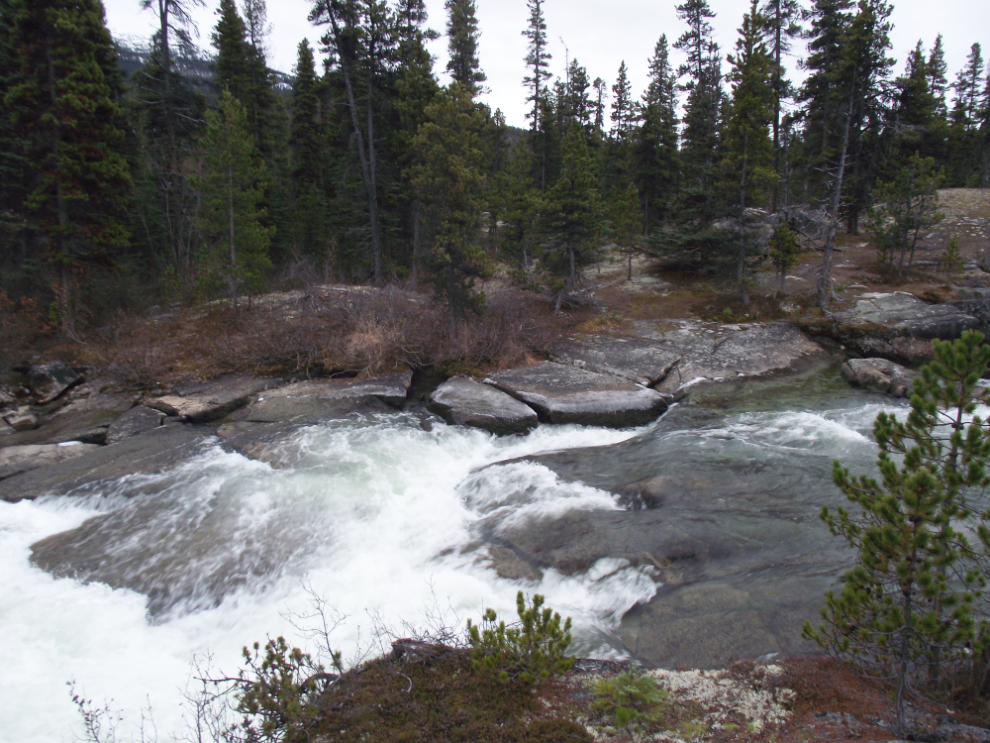
At this point, the upper end of this series of rapids and falls, one channel of the river is dry. That’s the island seen on the map to the left of the “x”. I think that even at high water the rafts take the main channel – this looks like it could be a tough spot to navigate!
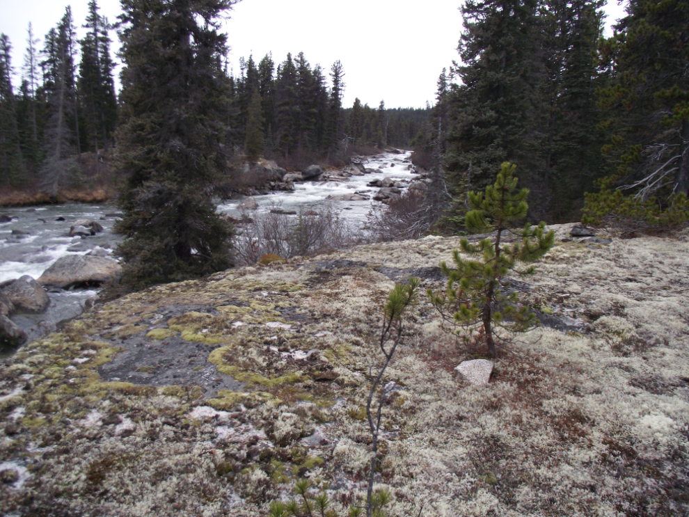
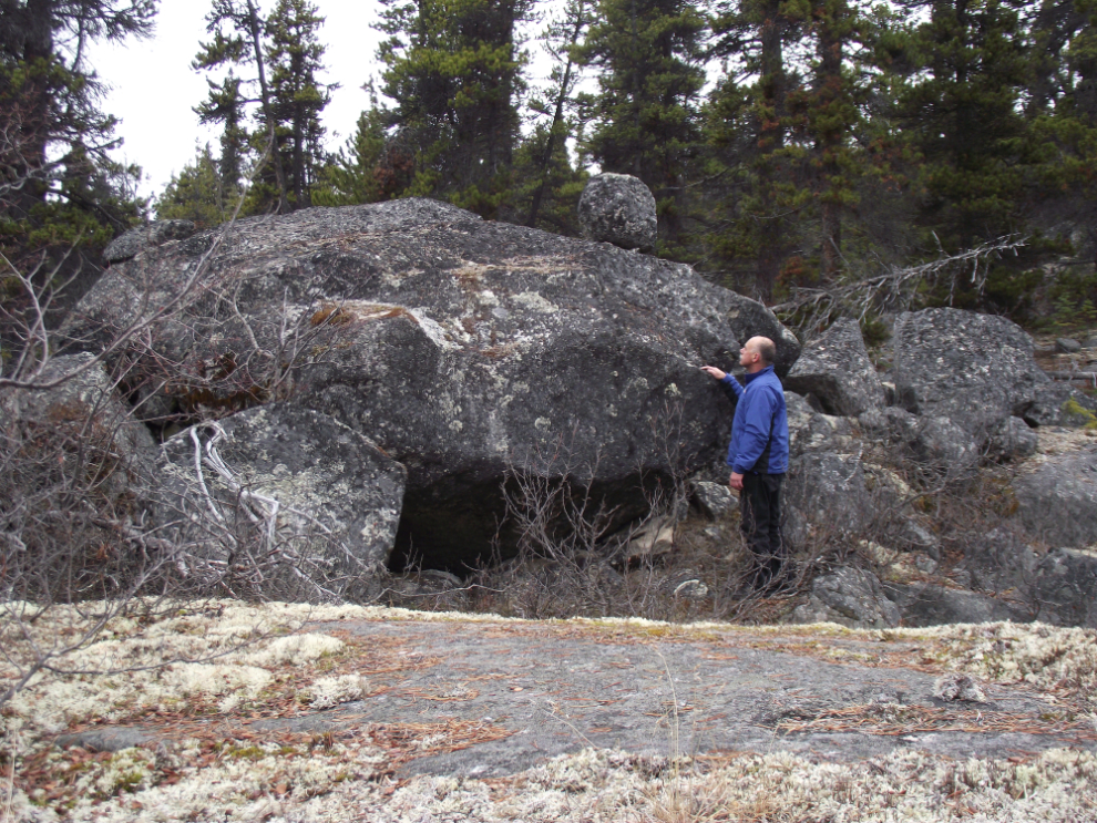
I then walked down almost to the downstream end of the rapids and took this shot from a massive moss-covered granite boulder. The geology here is fascinating, but I can no more figure out its details than I can the corduroyed trail.
Here’s the upper end of the rapids. I do remember this spot – this is where the adrenalin really started pumping again!
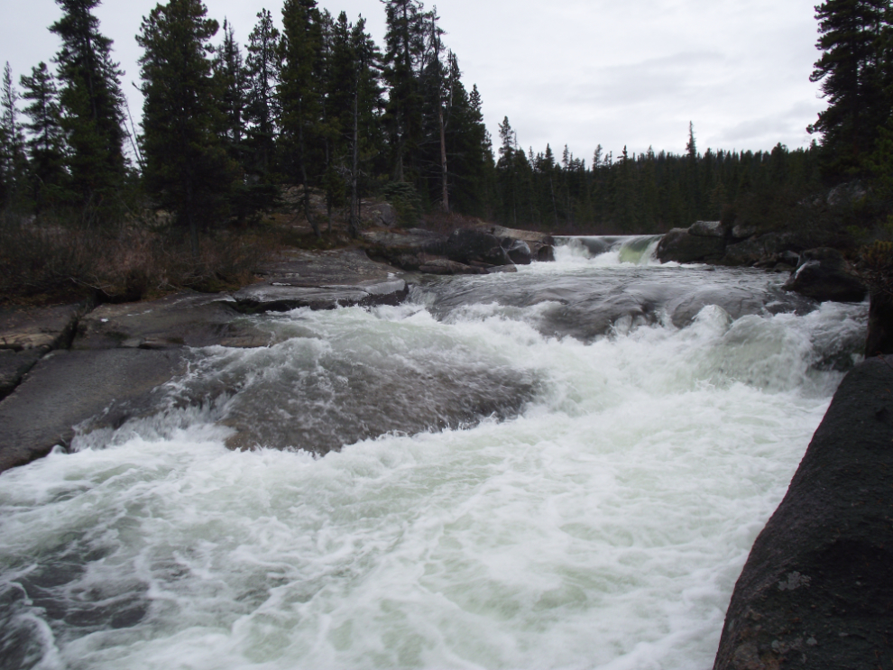
This may be a short run but it is excellent. I must do it again next summer.
Hiking back to the car, I wondered again about these massive granite blocks. How did they get here? The rounded boulder balanced on top of this one makes it even more interesting 🙂 [Edit – these are glacial erratics, dropped by glaciers as they retreated]
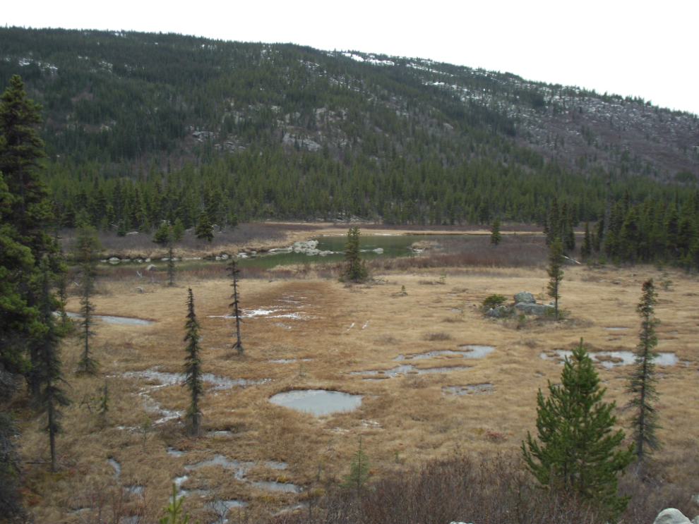
I was only gone from the car for a half hour, but was very pleased with what I’d seen. Heading north again, I stopped for a shot of the meadow at Km 52.3 where the rafts are pulled from the river and dragged back to the trailer.
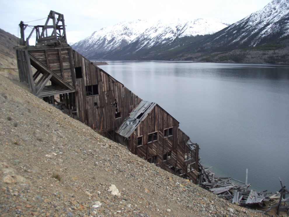
I had noticed on the way south that a large section of the roof of the Venus mill has collapsed – recently, I think, as it was quite noticeable.
I stopped at Carcross to get some more photos of the work going on there, but I’ll save those for another post in a few days.