Hiking to the Yukon’s historic Venus silver mine
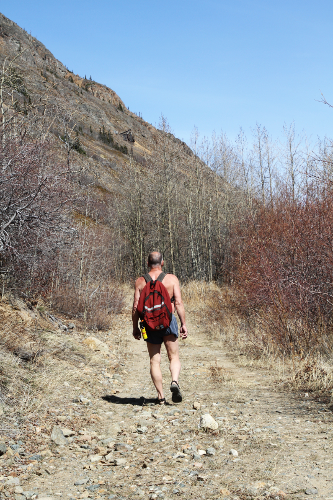
A couple of weeks ago (April 30th), I was working around the house doing various projects. Every time I went outside the sun got warmer and warmer, and I finally decided that I needed to get out hiking and soak up more of those rays. The Venus mine was the choice, and just before noon, I was on my way south.
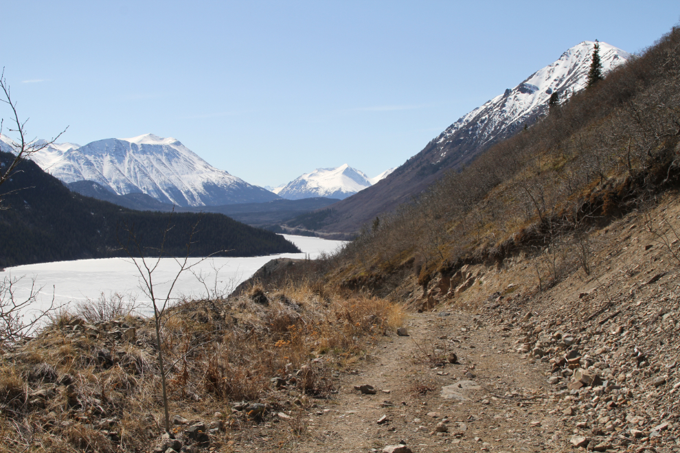
At 1:40 I was parked at the trailhead, near Km 82 of the South Klondike Highway. The first photo is looking north. Starting up the old road, I noted that there was a new chain and lock on the gate. Interesting…
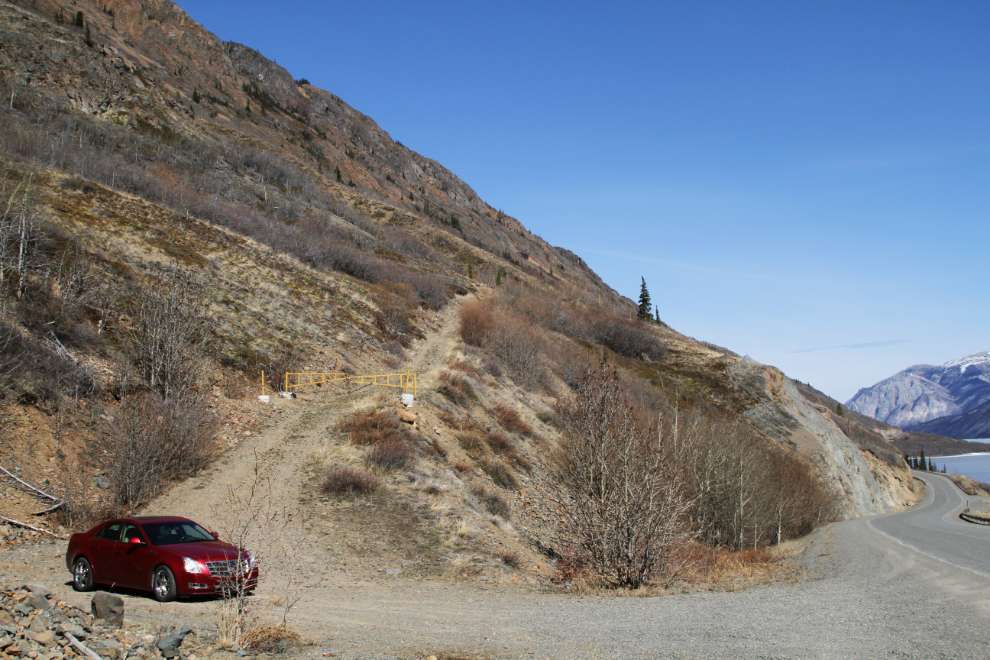
The road has seen some traffic recently, and I wondered if I might meet someone up ahead. It’s a nice hike, with a reasonable grade and spectacular views across Windy Arm of Tagish Lake.
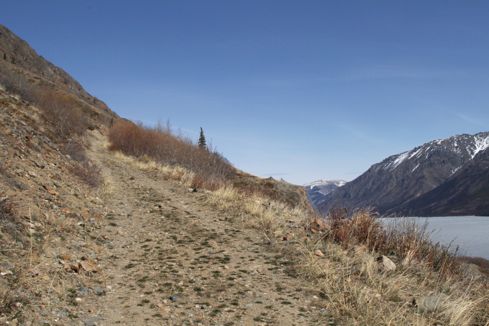
The next photo is looking north, but looking back down the road after making a switchback. The land sticking out into the lake is the delta of Pooley Creek.
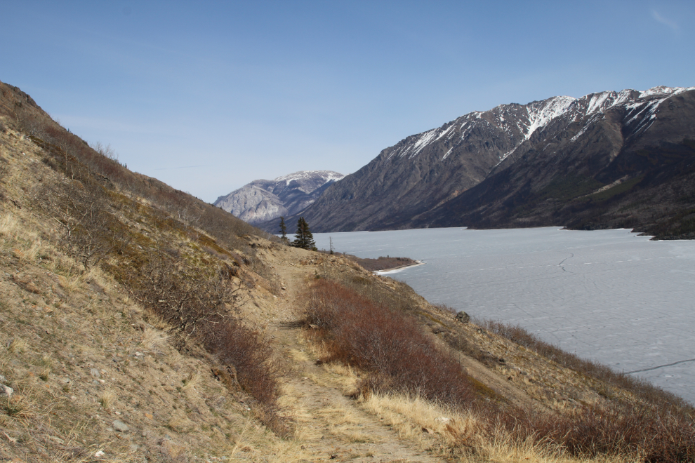
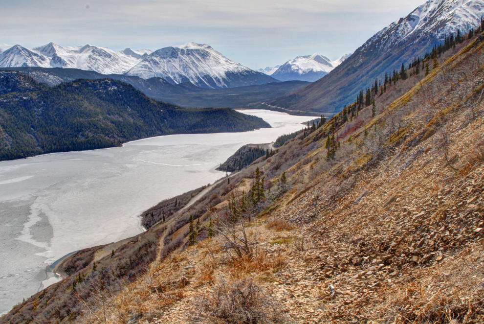
The view to the south, again looking back down the road after making another switchback. The Yukon/BC border goes across Windy Arm just this side of the curve in the lake.
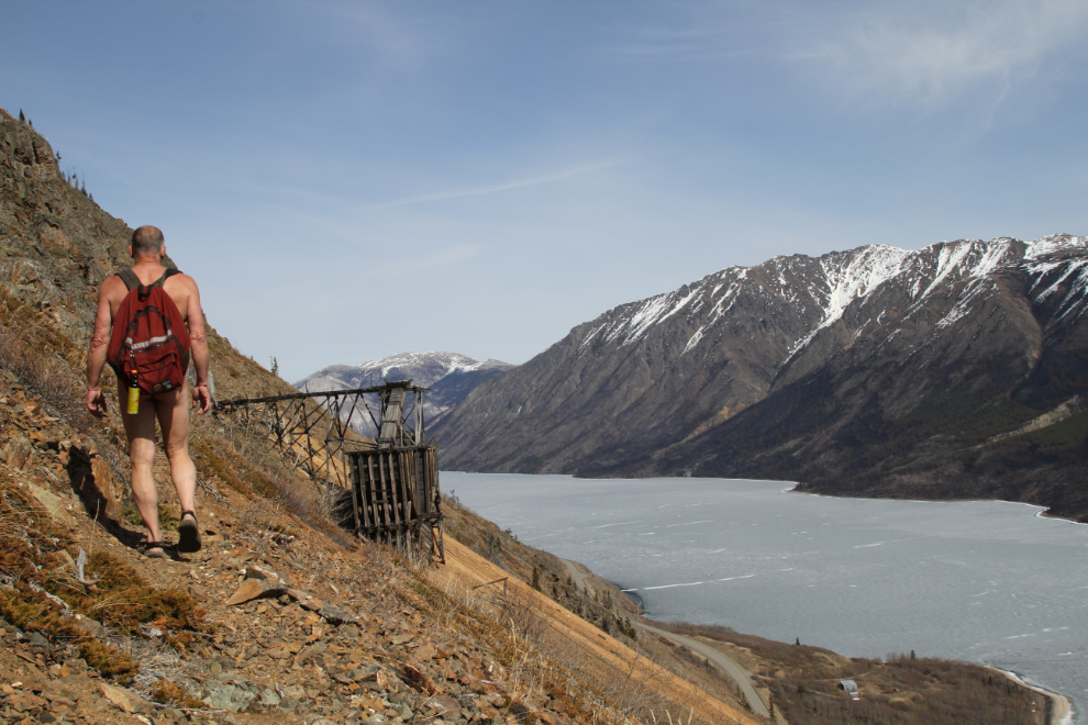
Less than 20 minutes into the hike, the destination, the 1906 working of the Venus mine, could be seen directly ahead, though there was a lot of vertical to come.
My plan was to hike to the mine on my usual route, which is pretty much vertical, then come down via the road/trail that a friend and I had hiked last July.
From the 1970s mine manager’s office, the 1906 workings can be seen above, marked by the arrow. My unmarked vertical route starts just north of this building, the only one remaining on the property.
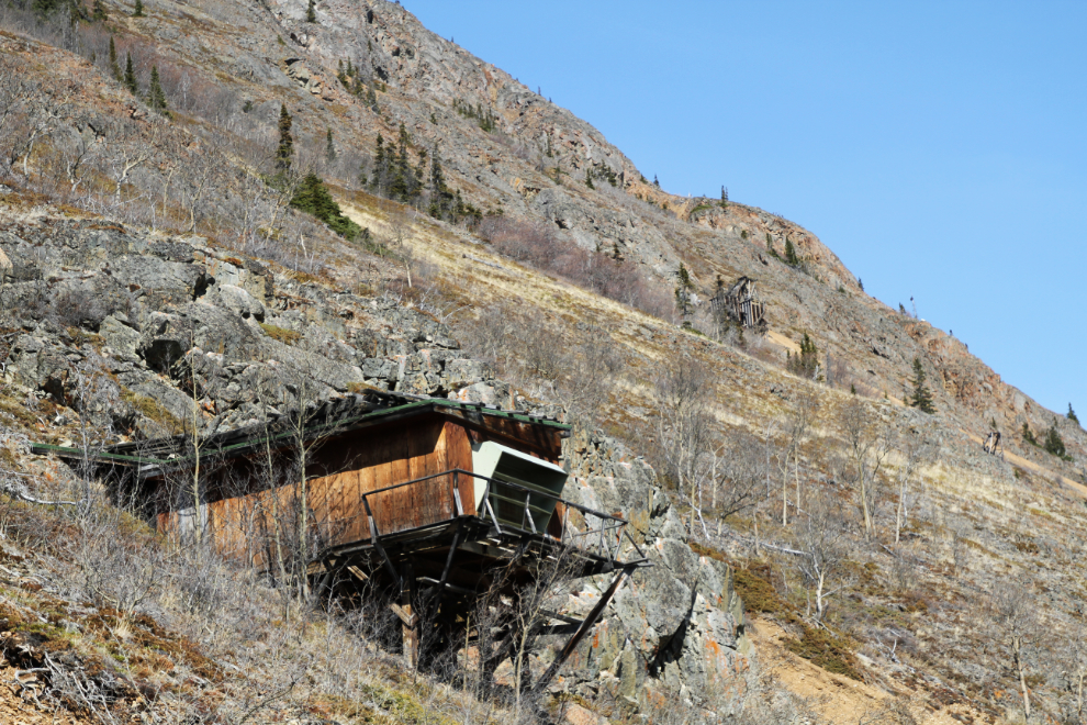
The rock outcropping to the left is my landmark to start climbing, first scrambling up from the mine road, going across the slope to this outcropping, then straight up just past it.
The straight-up route eventually intersects a trail from 1905-1906, and it leads across the slope to the mine.
In photos the trail is barely visible, and caution is needed while on unstable rock. Below the trail in the next photo, the collapsed bunkhouse/cookhouse can be seen.
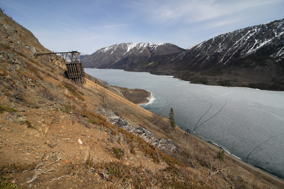
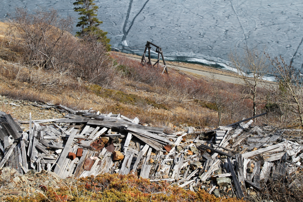
The collapsed bunkhouse/cookhouse, and a tower for the aerial tramway that connected the mine to the mill that still stands on the shore of Windy Arm.
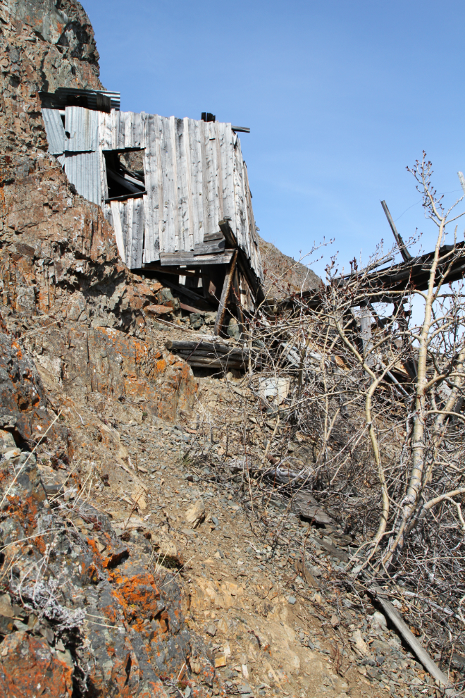
The final 50 feet or so up to the mine entrance is quite treacherous, over pieces of steel and century-old wood. This is not a place for kids or dogs. The building in the next photo was the blacksmith shop. I reached the mine at 3:05, an hour and 25 minutes after leaving the car.
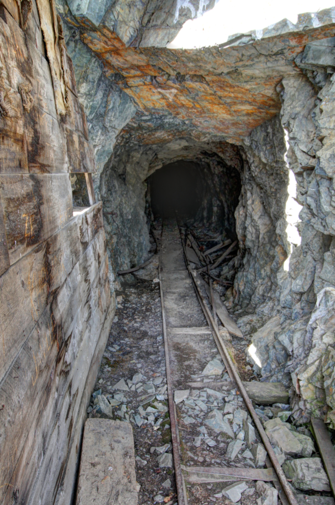
While the adit looks solid as far as you can see, I’ve never gone in more than 50-60 feet. Having worked underground at Granduc copper, I have great respect for such places.
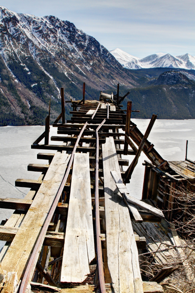
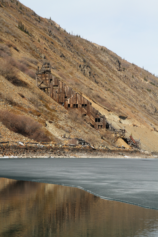
Ore cars were run out on this trestle, dumped into two storage bins below, and from there the ore went into the buckets on the aerial tramway.
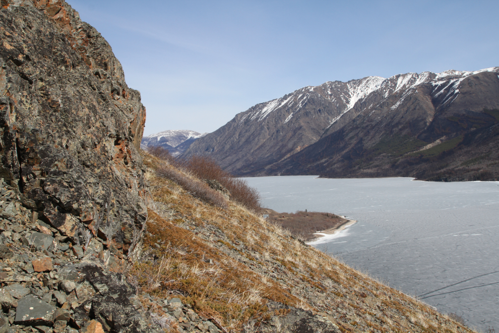
The next photo is a good overall view of the workings, looking south. There used to be a rail line from the mine to where I was standing, but it has slid down the slope in recent years.
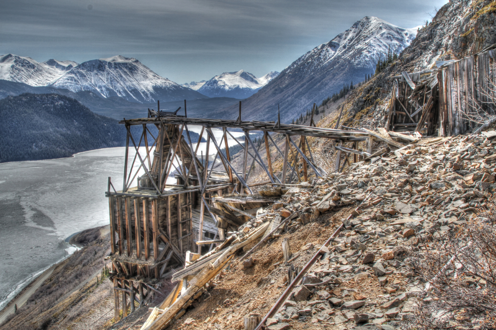
If you fell here, I don’t now if you could stop yourself from sliding on that extremely steep slope of mine waste. The mill can be seen on the lakeshore near the upper centre.
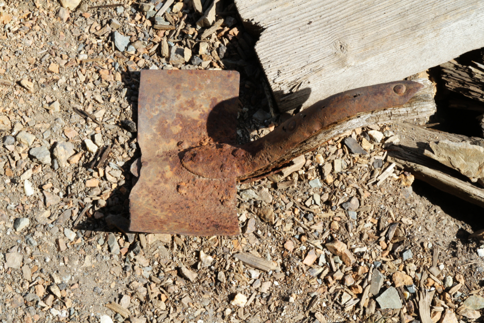
Remains of an ancient shovel. It’s about the only artifact left – 25 years ago, there were lots of tools and pieces of equipment laying around.
I explored around the mine for half an hour then started down. What a stunning place!
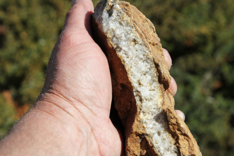
Rockhounding around all of the Montana Mountain mines is quite good. This bed of quartz crystals is a beauty.
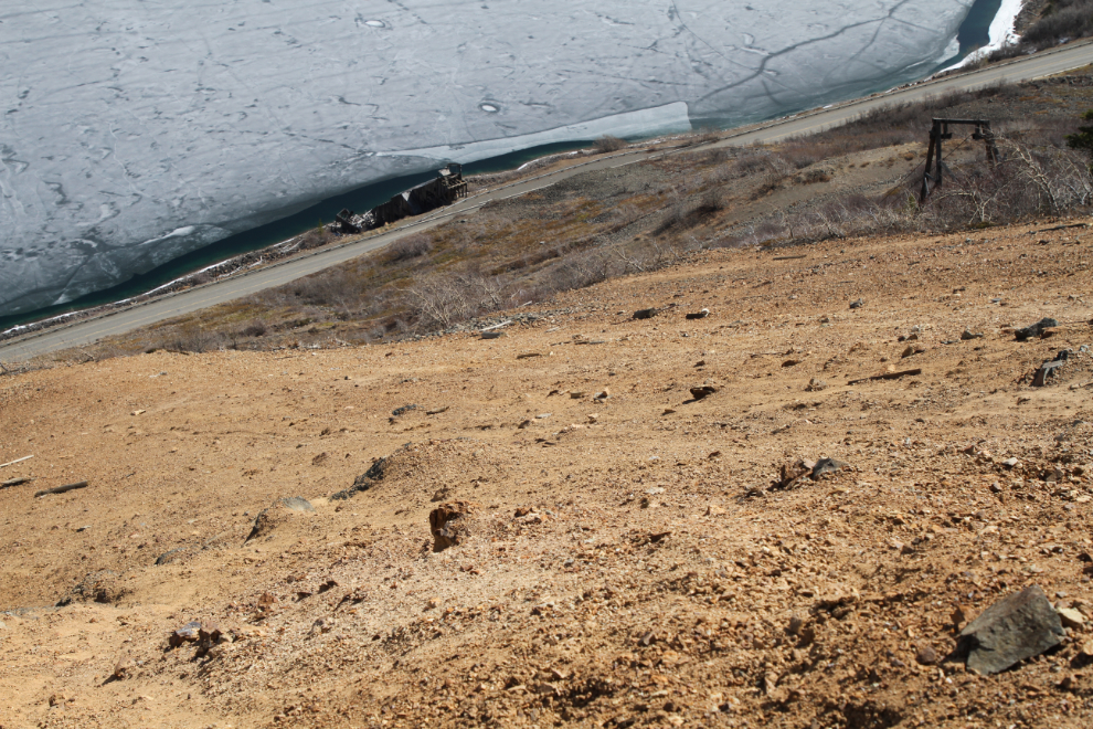
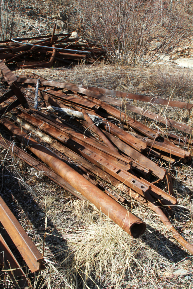
It only took 20 minutes to get back down to the 1970s Venus workings. A lot of cleanup was done here about a decade ago, but a lot of stuff was piled up but not hauled away.
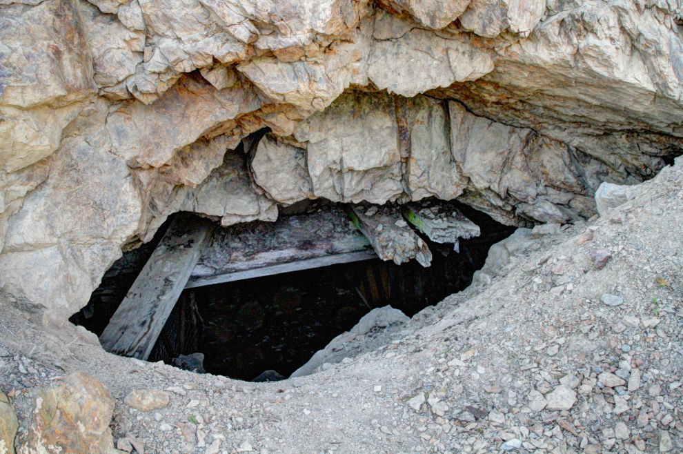
The main adit was sealed but is now open a bit. A monitor for little brown bats was at the mouth of it for a while in recent years.
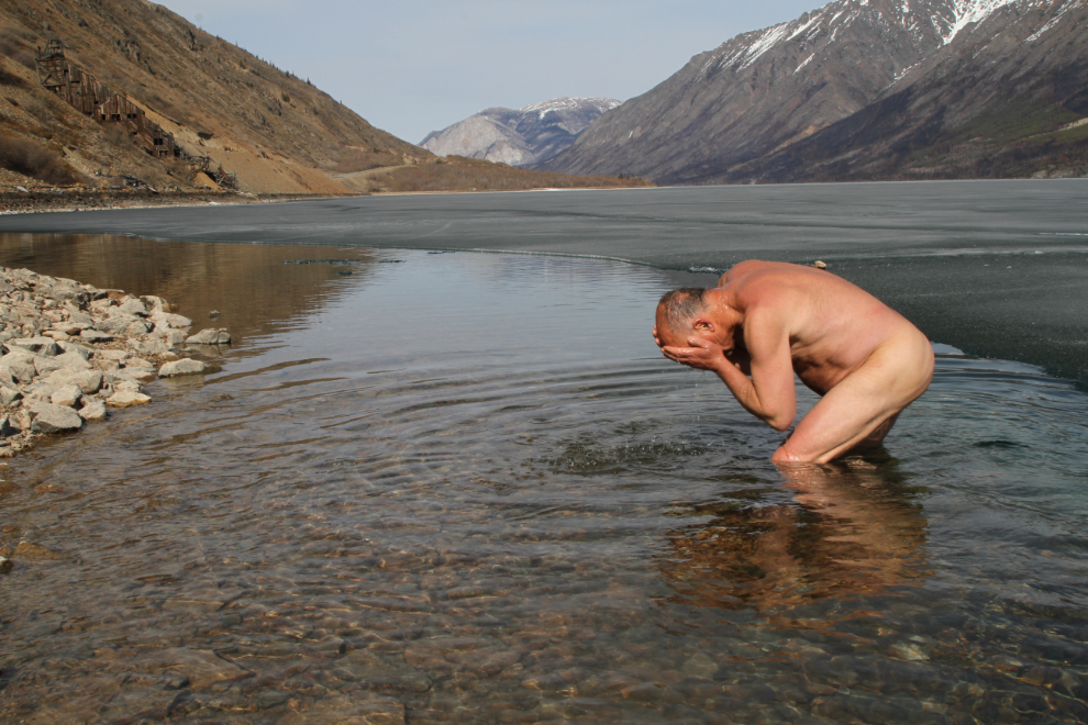
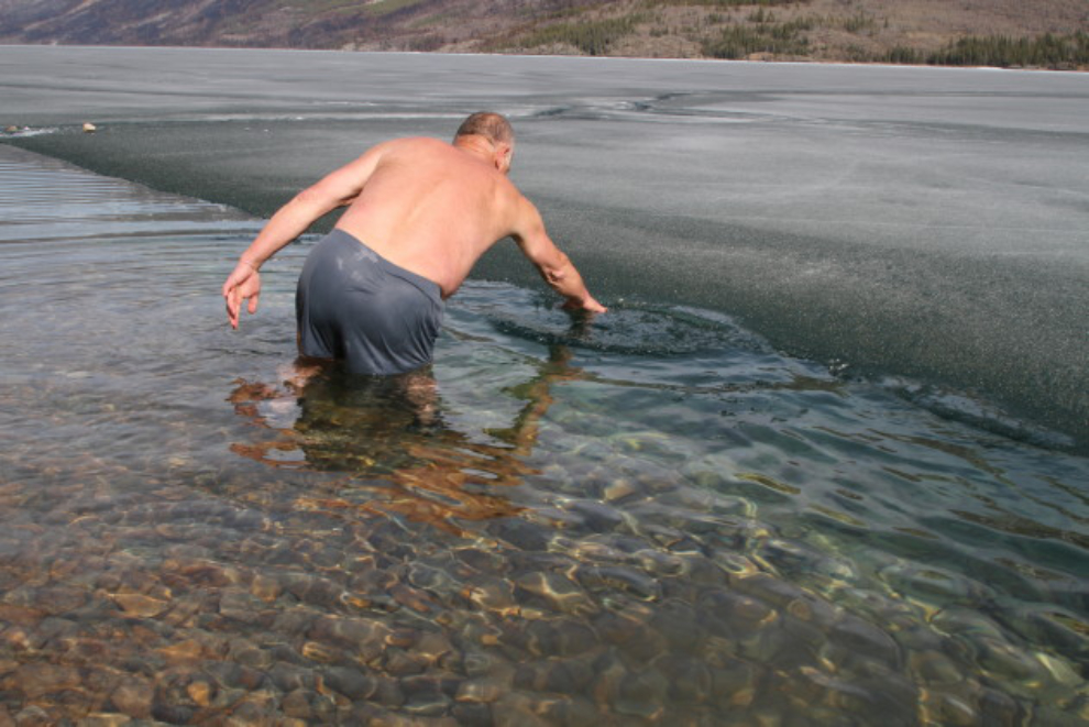
I got back to the car at 4:10 – 2½ hours in total. From there, it’s not easy to get down to the lakeshore, but I wanted some new photos of the mill from that angle, and the ice intrigued me. Some rock scrambling and bushwhacking got me there.
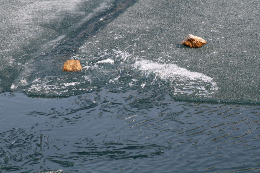
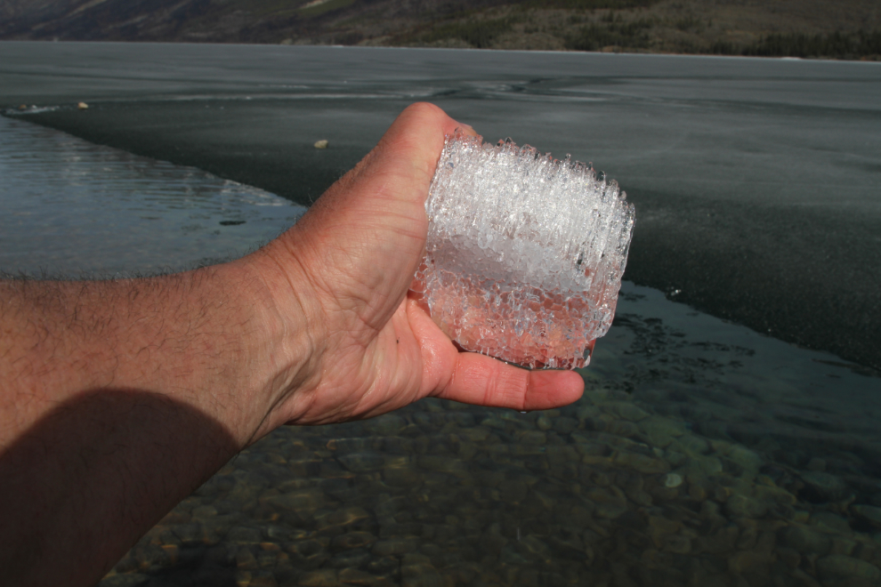
In the spring, the ice turns into long slender “candles” – I threw some rocks to break pieces off.
It was much too cold to go swimming, of course, but ahhhhh that water felt good!
I had to go in to get some candle ice to show you.
Candle ice is made up of candles as long as the ice is thick – so can be several inches long. When breakup happens, the candles sound rather like wind chimes as they bump into each other. I shot a video of it at Carcross 5 years so you can hear the sound – it’s at https://www.youtube.com/watch?v=ASmIsh-q68w.
I headed home just after 5:00, very pleased with the way the day had gone. I had planned to have a new edition of my book about the Venus and other mines in the area out about now, but too many things got in the way. Oh well – some day…
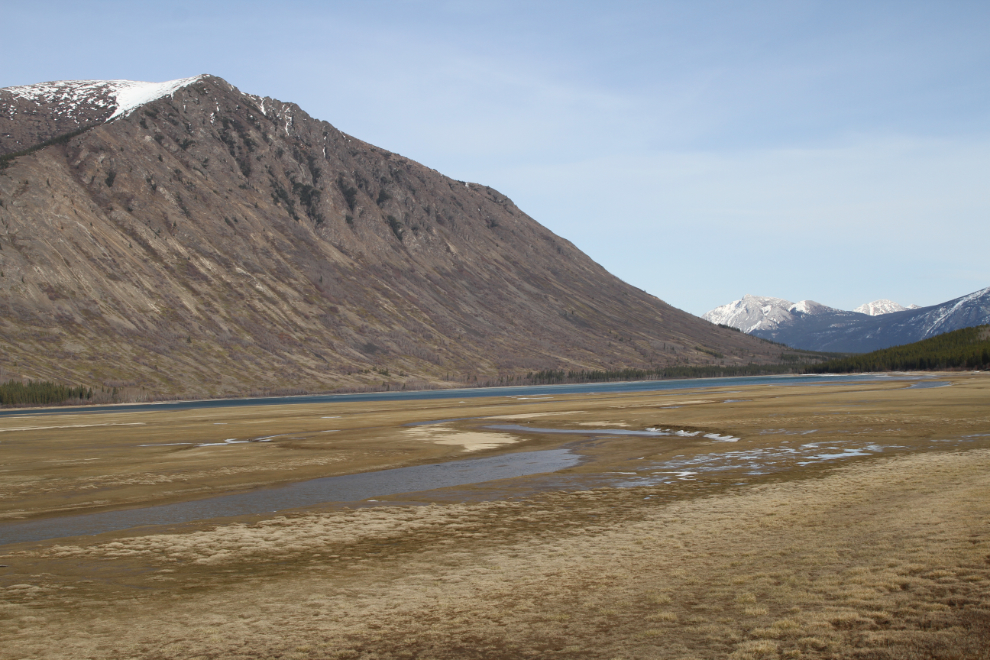
On the way home, I stopped at Nares Lake at Carcross. At low water levels like we have now, it looks more like Nares Meadow.