A day in the Atlin back country
The weather in Whitehorse on Sunday was cool and wet but we really needed to do something interesting! A look at the weather reports showed that Atlin had potential weather-wise, and we both love Atlin, so that became the target of the day.
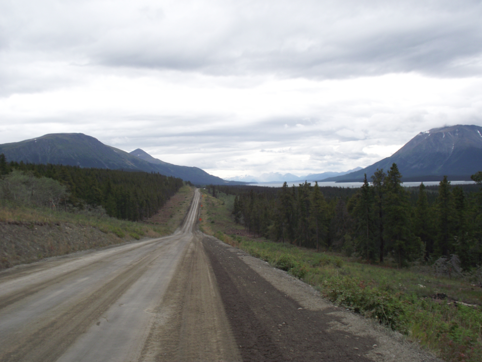
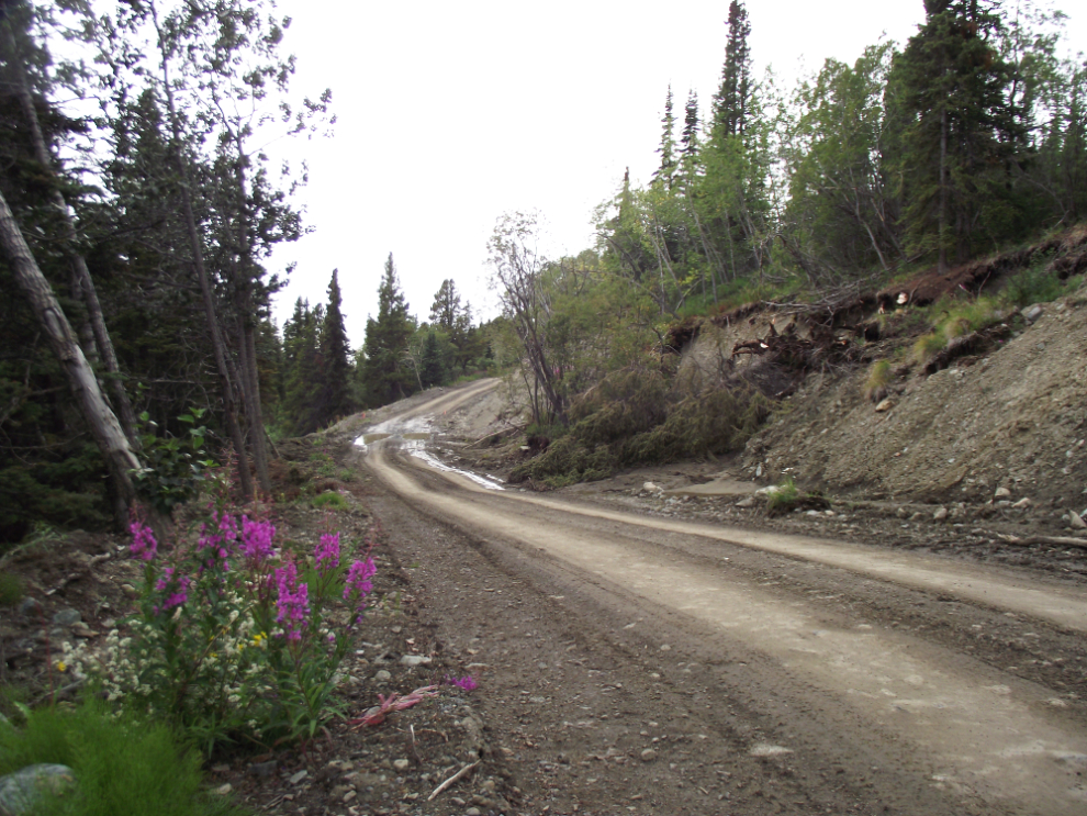
We got off to a very late start, and the first great view down the Atlin Road didn’t appear until 12:48 🙂 We’d heard that there was a lot of construction and that it was really messy, but we didn’t find it bad at all – too bad to take a motorcycle down, though.
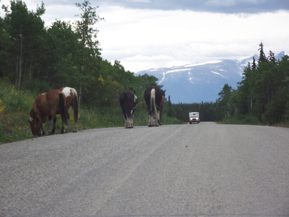
Just south of the Indian River Ranch at about Km 66, these horses (one of whom was belled) weren’t in any hurry to move off the road.
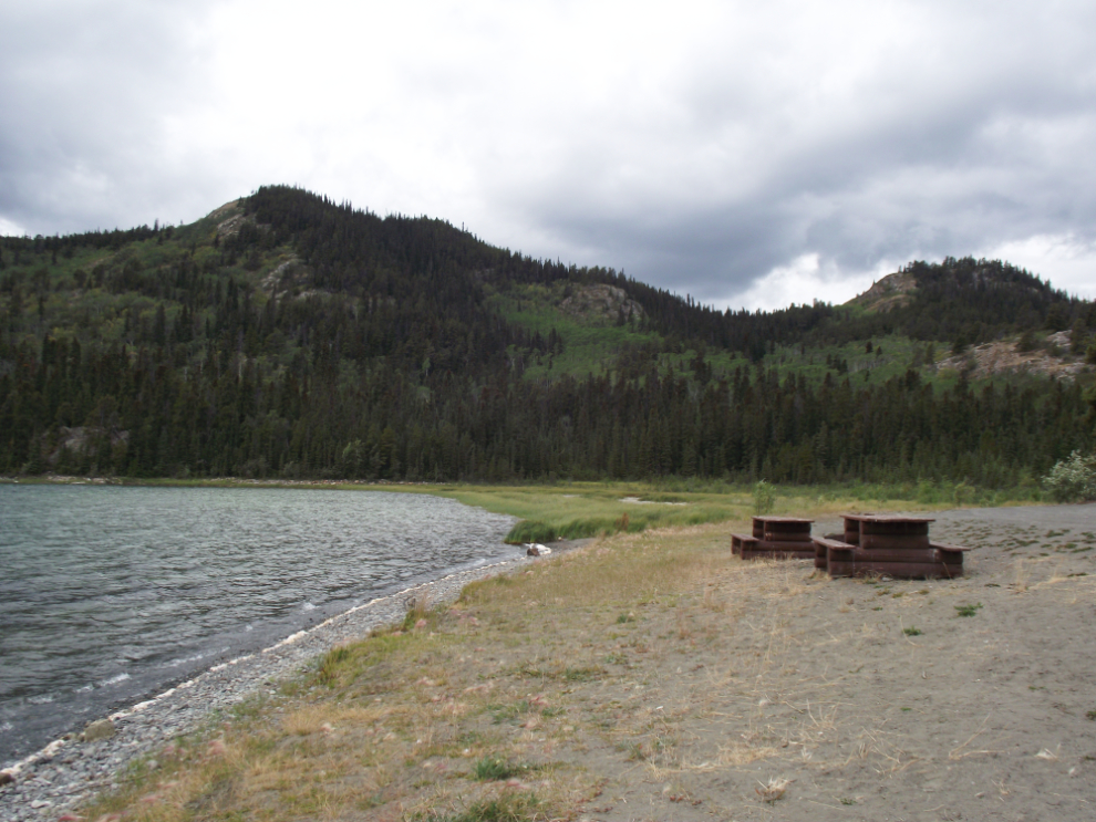
The Como Lake Recreation Site was a good place to run the dogs before reaching Atlin, where we planned to have lunch before heading into the back country.
We went to the Atlin Inn for lunch – but no luck, the kitchen was closed. So we ended up at our usual place, the Pine Tree, which was crowded. Good food but high prices.
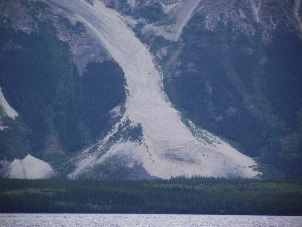
We made a quick loop around town and were surprised by the number of “For Sale” signs. Atlin has such potential! There was a time when I thought about moving there, and for many years I had the Web domain Atlin.com for my Atlin stuff, but I even sold the domain a few months ago. This is the classic Atlin photo, of the “rock glacier” across the lake.
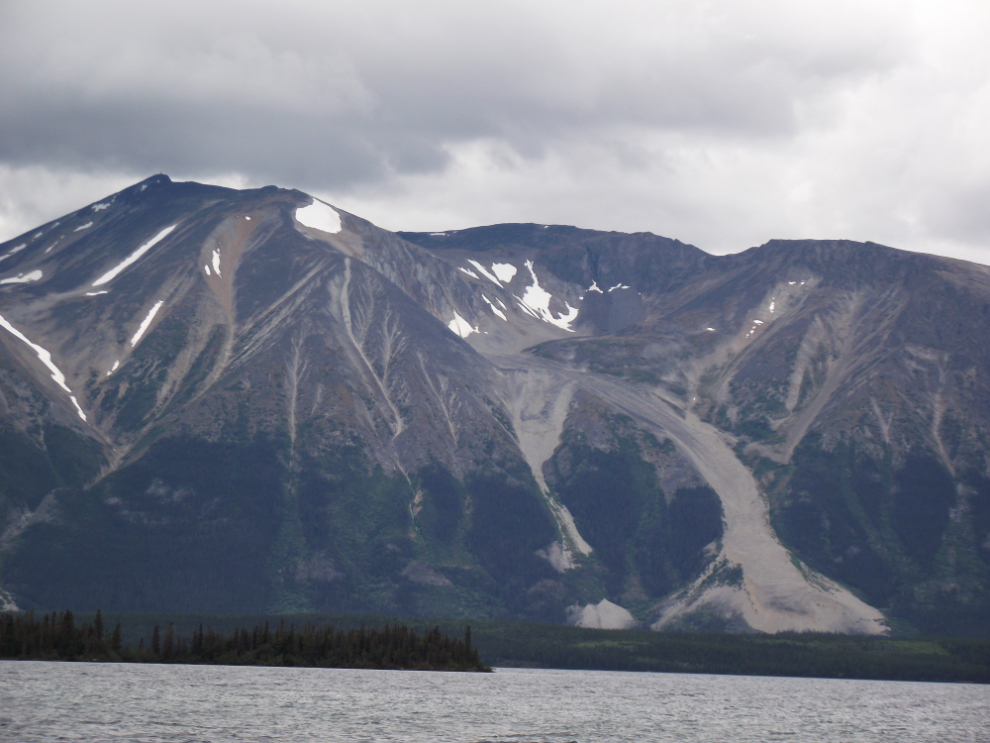
I thought that the rock glacier had been studied in great detail but I’ve been unable to find much about it. My recollection is that there is enough ice in what is basically a rockslide to make it flow like a glacier – the lack of vegetation makes an active flow seem likely.
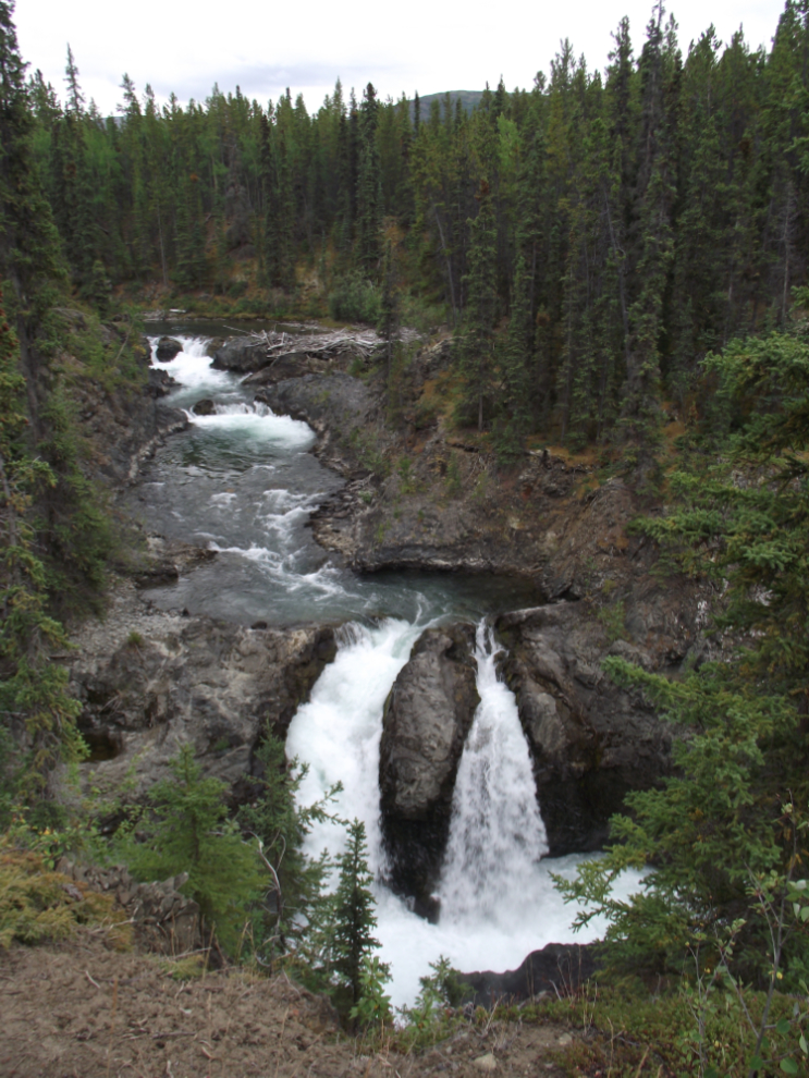
We had decided to explore up the Spruce Creek Road, into the gold mining region. The first stop was at Pine Creek Falls. Concrete barriers have been put up, and to get a view of the most impressive section of the falls requires you to cross the barrier and walk about 100 feet along the cliff.
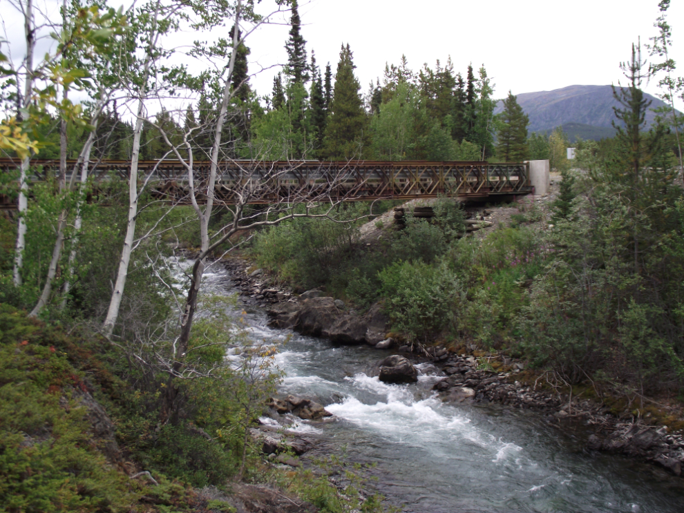
This is Pine Creek, with “Halfway Bridge”, a Bailey bridge on the Spruce Creek Road, crossing it.
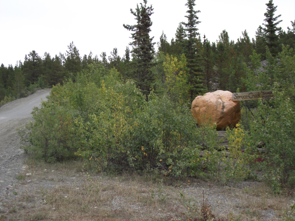
Finally at 3:00 we started off into the real back country. A quick stop to get a photo of the “Spruce Creek Sample Nugget” was, of course, a must 🙂
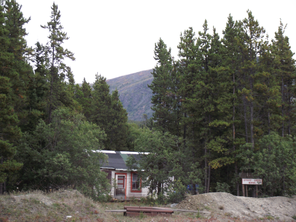
The sign to the right of this old cabin says “Spruce Creek Mining” – someone is currently living in an RV behind the cabin.
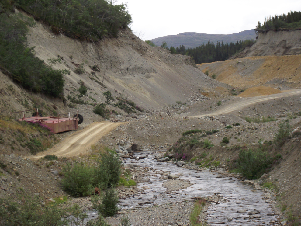
A view up Spruce Creek as we got into an active mining area. To the left of the road is a large hull for a gold dredge – the dredging equipment from it has all been removed.
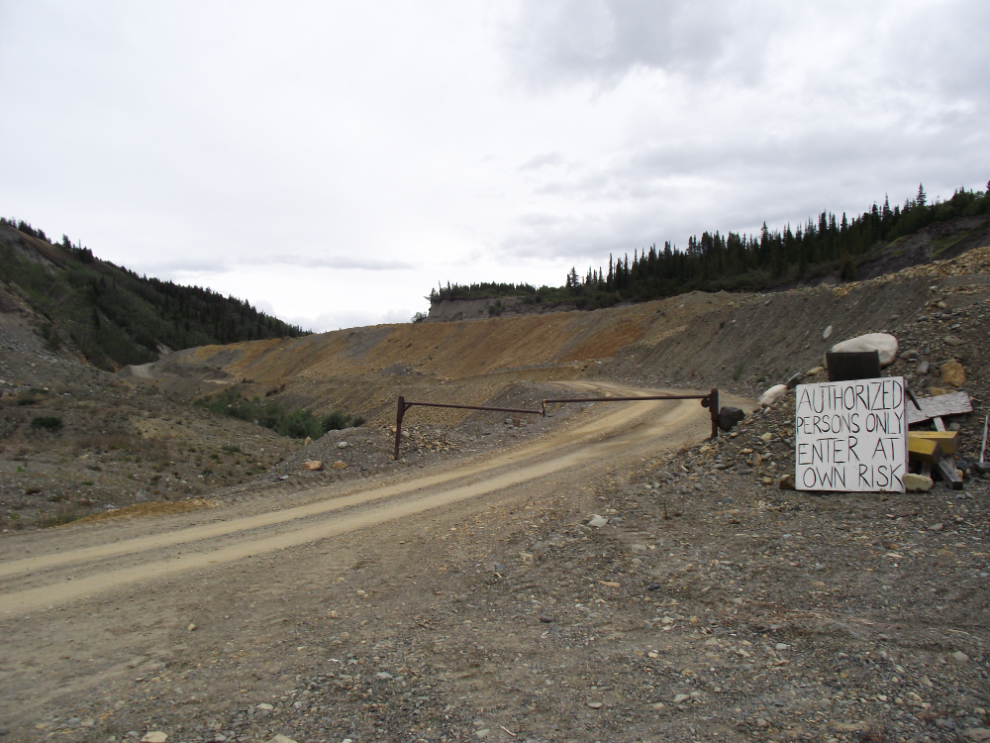
This was a surprise – I thought that the Spruce Creek Road was a public road (actually I still think that it is and that this gate is illegal). This was shot at 3:20. So much for exploring Spruce Creek…
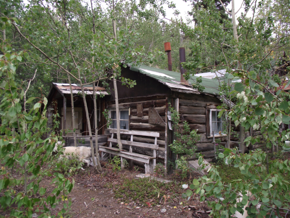
It soon became apparent that we should have brought our GPS, and checked for a topo map of the area in my collection. I saw the roof of a cabin below the road so we went for a walk and found this wonderful old place, seemingly not used for many years but signed as the summer cabin of a family in Atlin.
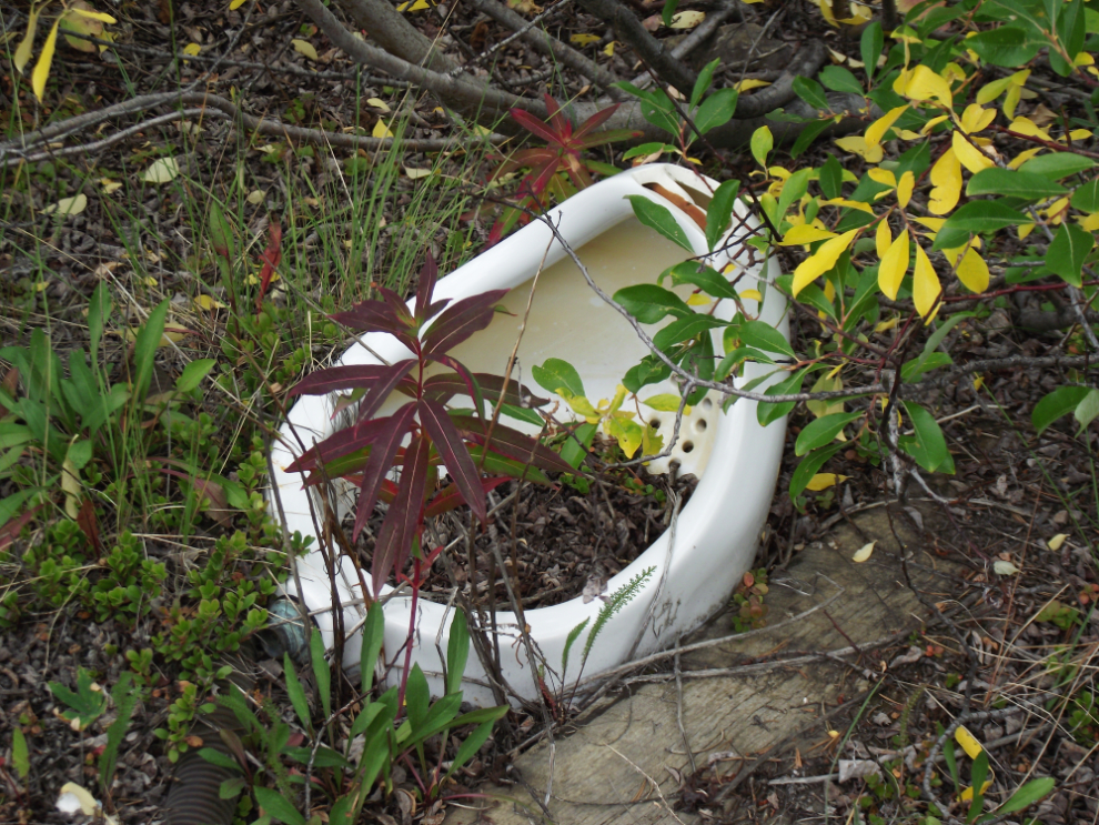
Across the main road from the cabin above was the wreckage of a much newer camp – the sort of wreckage that makes all miners look bad. If Cathy hadn’t been with me I may have added this porcelain “planter” to my collection 🙂 (yes, it is a urinal, which is why Cathy thought it was a poor idea – no imagination!)
We headed back towards Atlin and turned up the Otter Creek Road. We were soon distracted by some timbers off in the bush, which turned out to be the remains of a bridge on a very old, grown-over road.
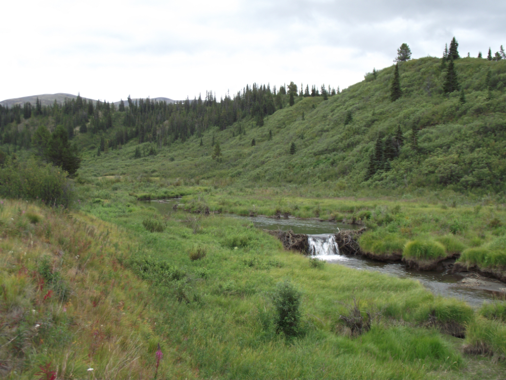
By 4:00 we were in a lush valley that is home to a large number of beaver. There seems to have been a great deal of rain here lately, as there were several beaver dams partially washed away or completey breached.
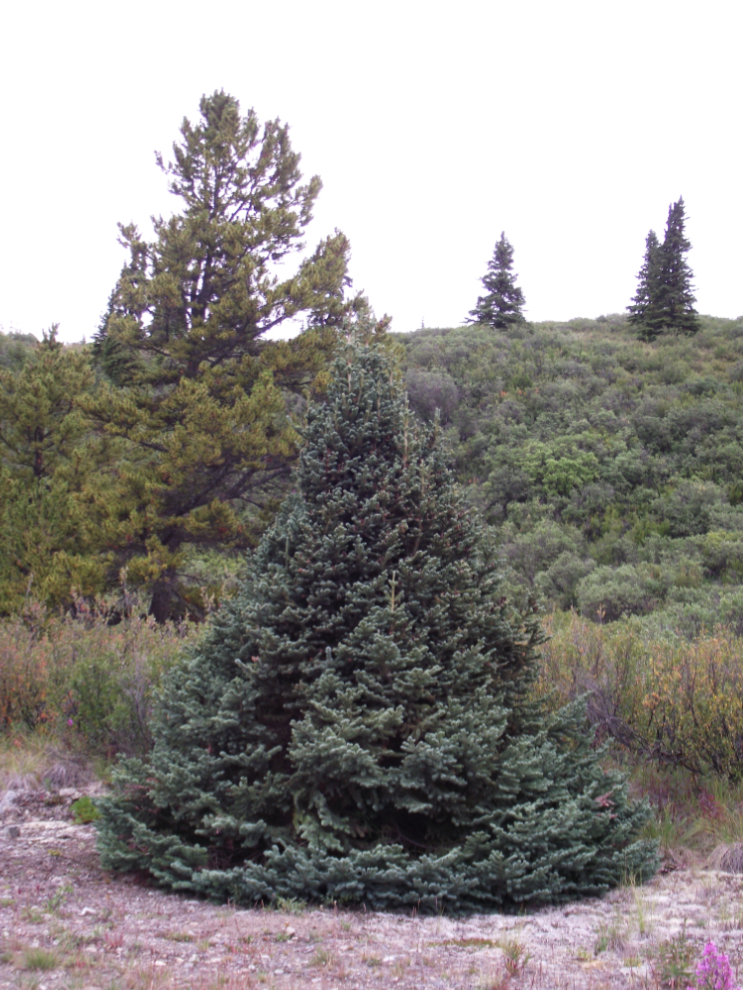
There are some fine-looking trees in this valley!
One of the reasons I wanted to come up here was because a friend who used to live in Atlin showed me a photo a few weeks ago of an old gold dredge. Although she said it was on Coal Creek, we came around a corner and there it was! More research to do…
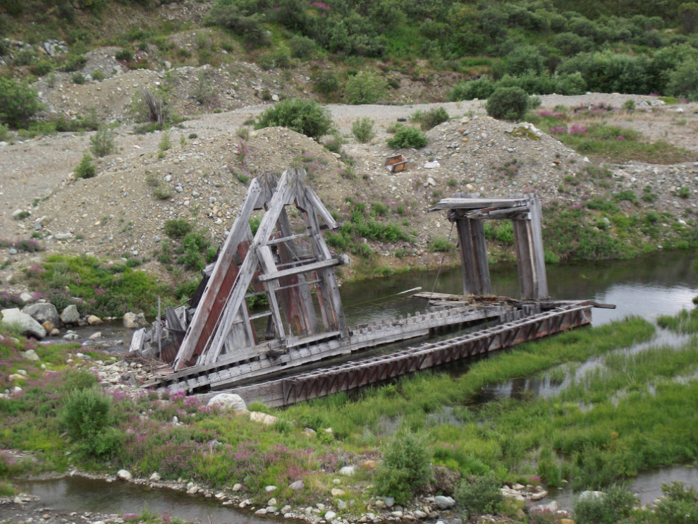
The view up the valley from the dredge.
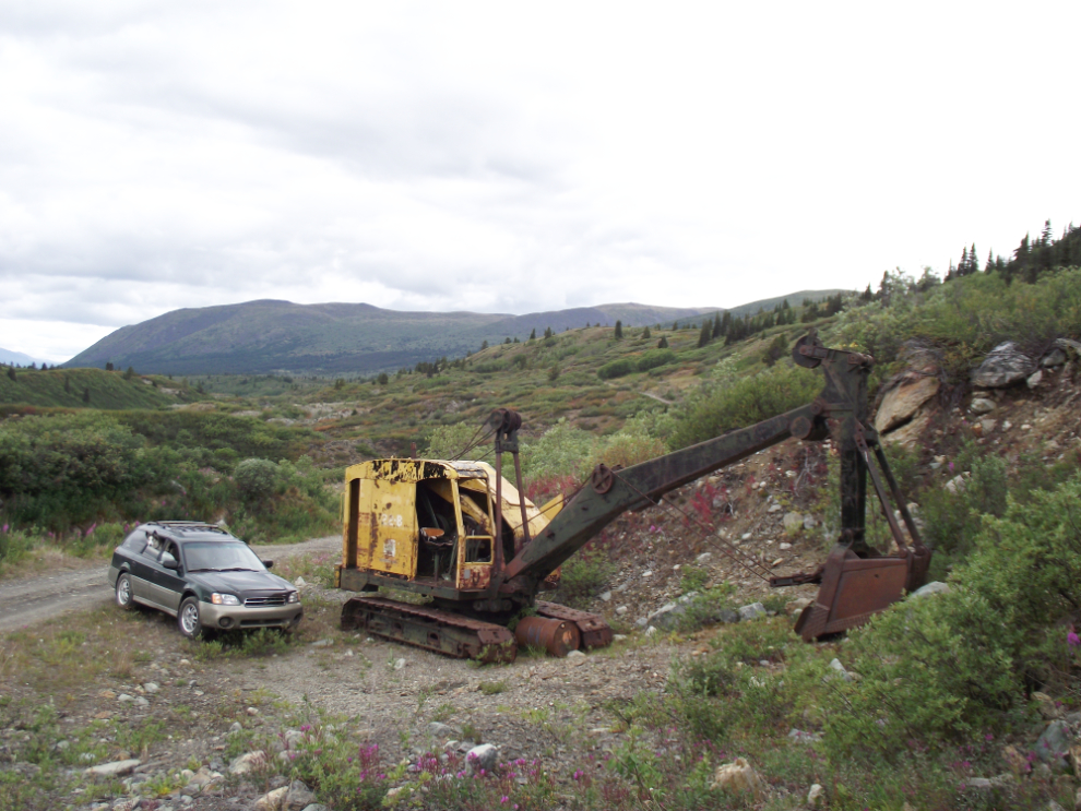
A Bucyrus Erie 22B crane – it looks like it could be fired up with little work. From the serial number, it was built in the mid-1950s.
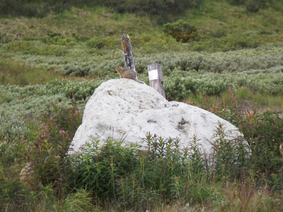
An Arctic ground squirrel with a couple of mining claim posts.
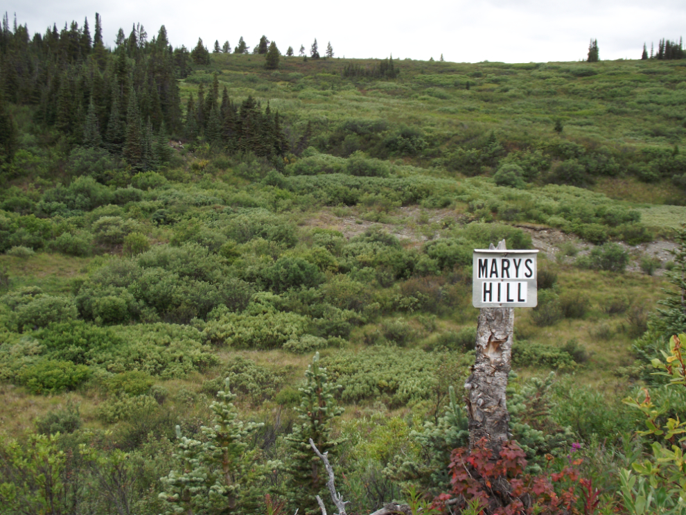
I wonder who Mary is/was, and what was special about this hill?
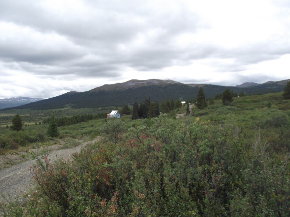
Out in the middle on nowhere, 25 km from the Spruce Creek Road, we came to a little community of cabins, most of which had people in them!
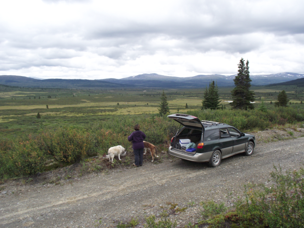
We chose this spot, just past the “community”, as our turn-around spot. I had brought the kids’ dinner (and left a full bowl at home for Molly) so we wouldn’t feel guilty about them being hungry (as we did on our recent South Canol day in particular).
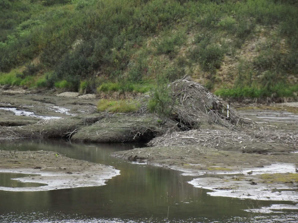
Like an iceberg, much of a beaver lodge is underwater. This recently-drained pond showed us what’s usually hidden.
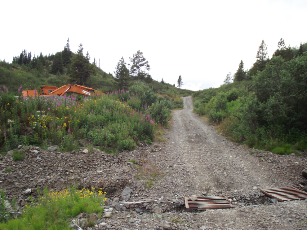
Some spots on the road, such as these grates, made we wish that we’d brought the Tracker instead of Subie. A bit of extra clearance would certainly reduce the potential for trouble.
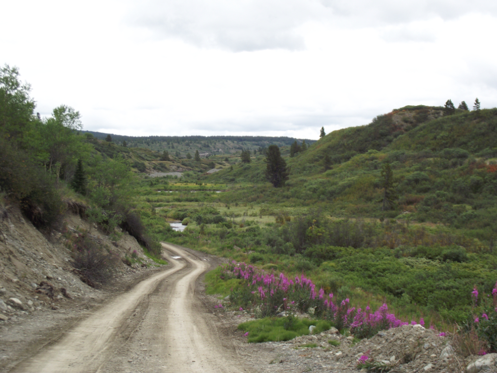
For a mile or so, the road is built on top of a meandering esker, a remnant from the days (ca. 10,000 years ago) when glaciers covered this region.
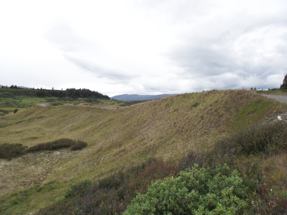
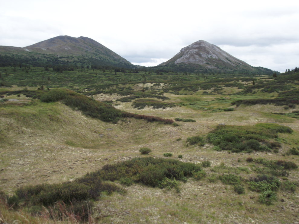
Glacial landforms – fascinating country!
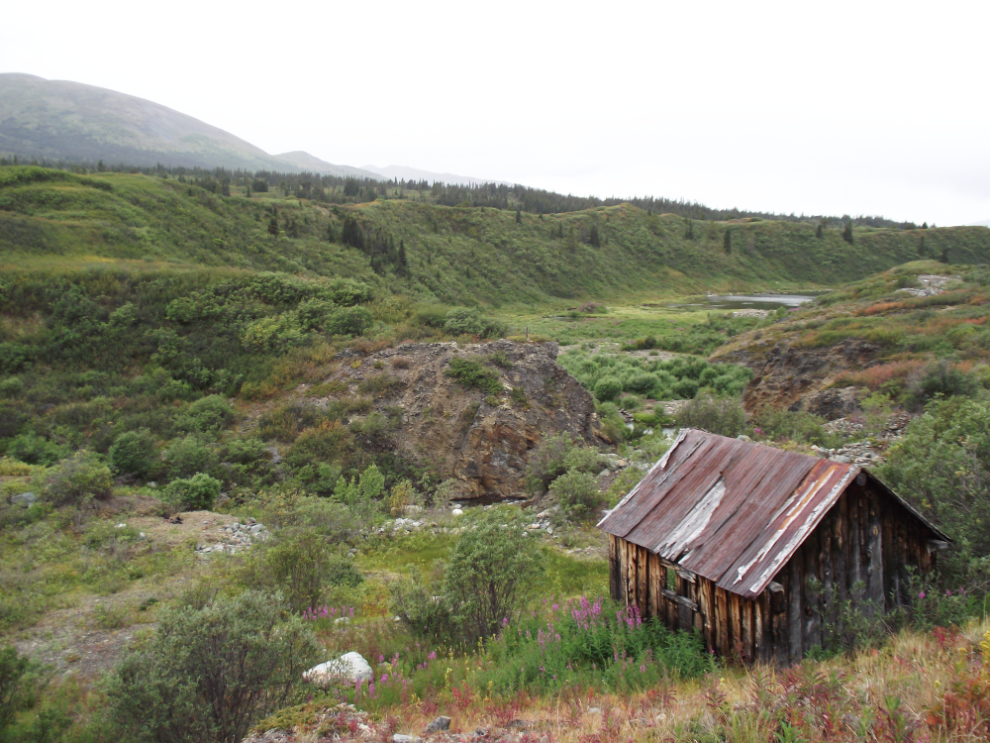
Another old cabin overlooking the little canyon they were mining, probably pre-WWI. We had run out of time (this was shot at 6:07 pm) so didn’t go down for a look. This canyon appears to be what stopped the gold dredge shown above from proceeding any further up the creek.
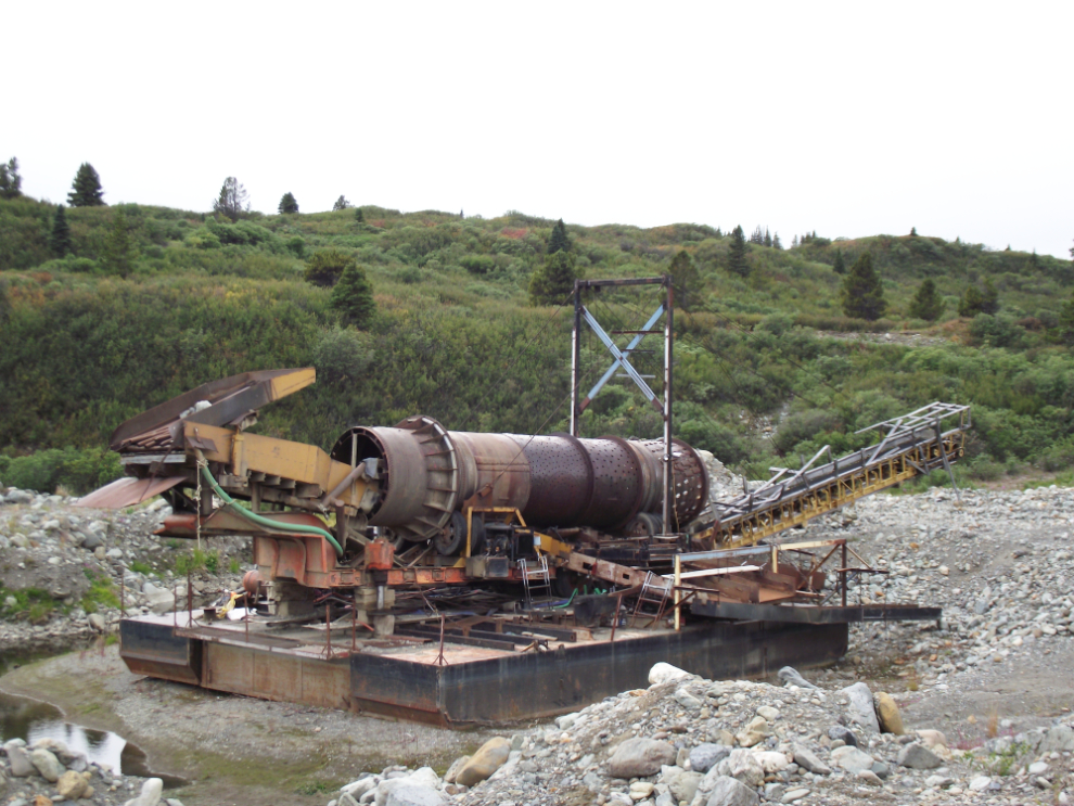
A much newer and quite complex gold dredge alongside the creek. Built on a steel hull similar to the one we’d seen on Spruce Creek, it seems to have not been used in many years. [Edit: this is not a dredge but a floating trommel that was fed by an excavator which feeds and pulls the trommel along a “ditch” dug as they went, ahead of the trommel, which then was fed and discharged out behind it, refilling the “cut” as it went. (thanks to Drew Clarke for that explanation]
This large mudslide appears to have been cleared in recent days.
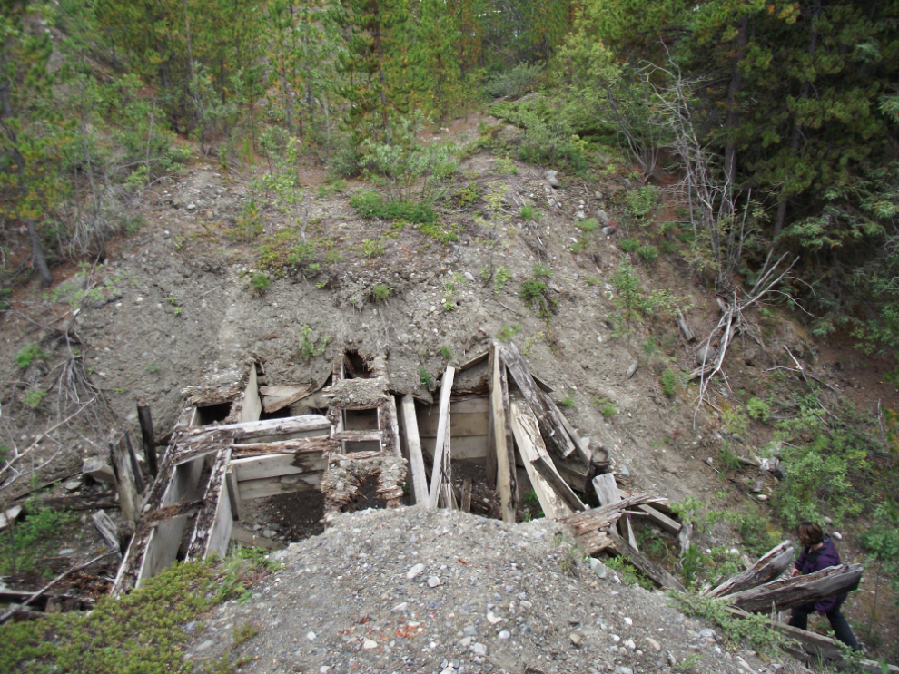
Almost back to the Spruce Creek Road at 6:45, I stopped to get a photo of what appears to be the remains of a hydraulic mining operation.
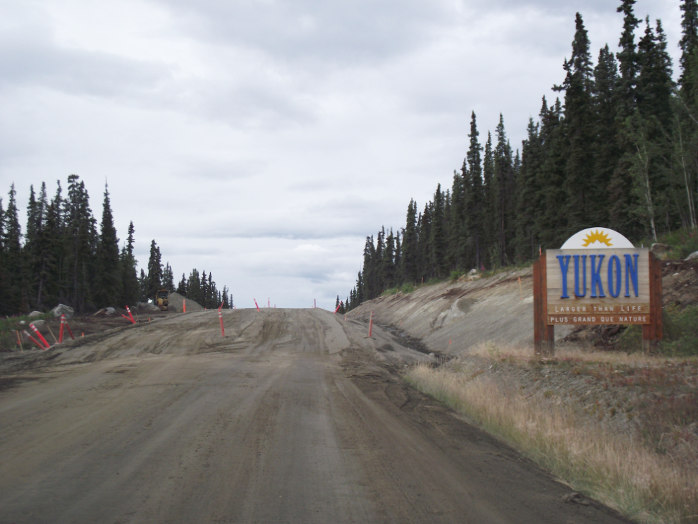
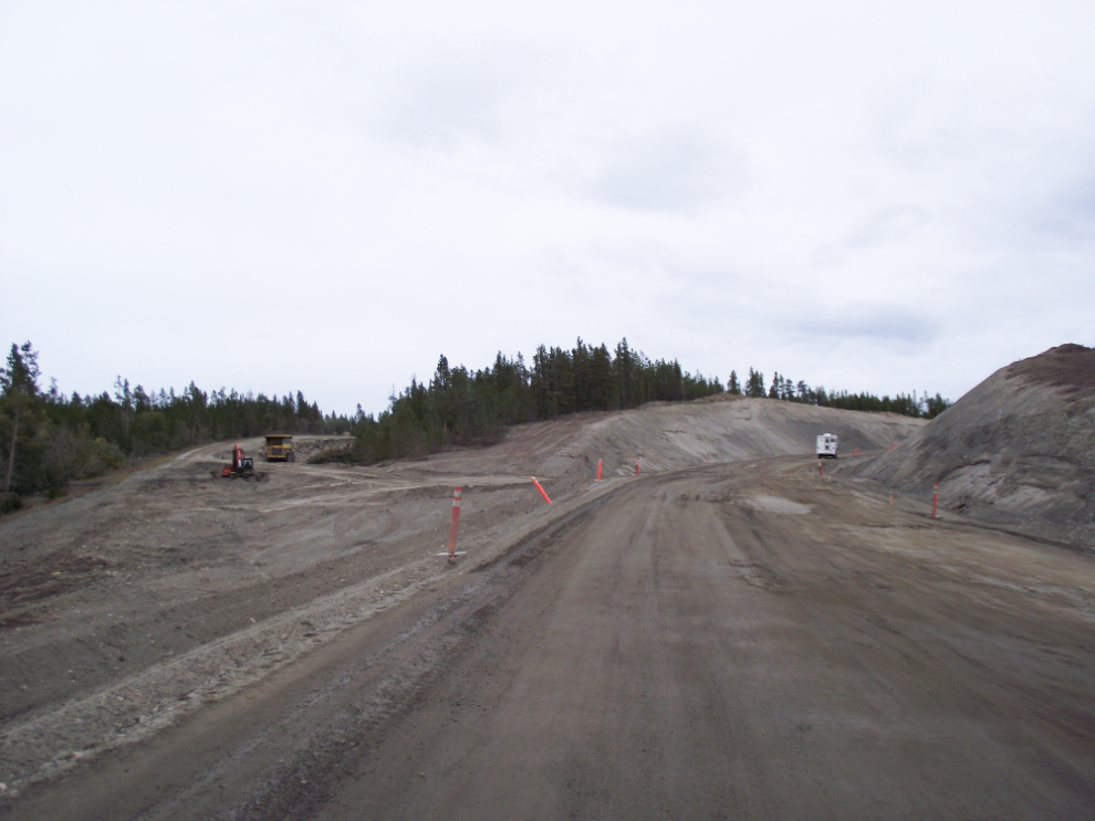
Back on the Atlin Road. Right at the BC/Yukon border, 4.4 km of construction begins. The project sign says that the cost is $1.23 million, which we both thought is very low given the scale of the work.
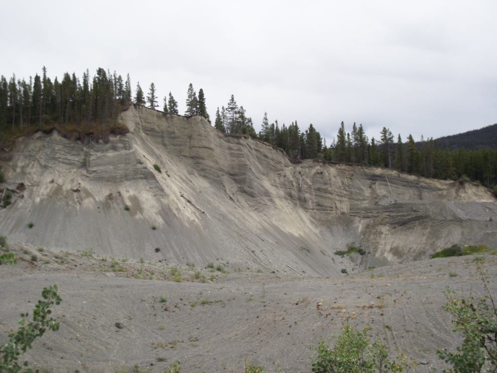
A separate project is the re-routing/reconstruction of the huge hill at about Km 9. Quite impressive.
And that was it – we arrived home a few minutes after 9 pm. We had hoped for some sunshine today – well, more than the few minutes we got – but it was an excellent day even without it 🙂