Hiking Border Ridge in the White Pass again
On the afternoon of Saturday, July 17th, our third day in the White Pass, I took Tucker on a big hike up what I call Border Ridge. It doesn’t have a name and pretty much nobody else goes there so I get to call it whatever I want 🙂
This is blog post #1,329 since the first one on April 25, 2006. I’ve now completed the rebuild of almost half of them into the new design – 608 of them – with a total of 11,543 photos. The complete post archives can be seen at https://explorenorth.com/blog-posts.html.
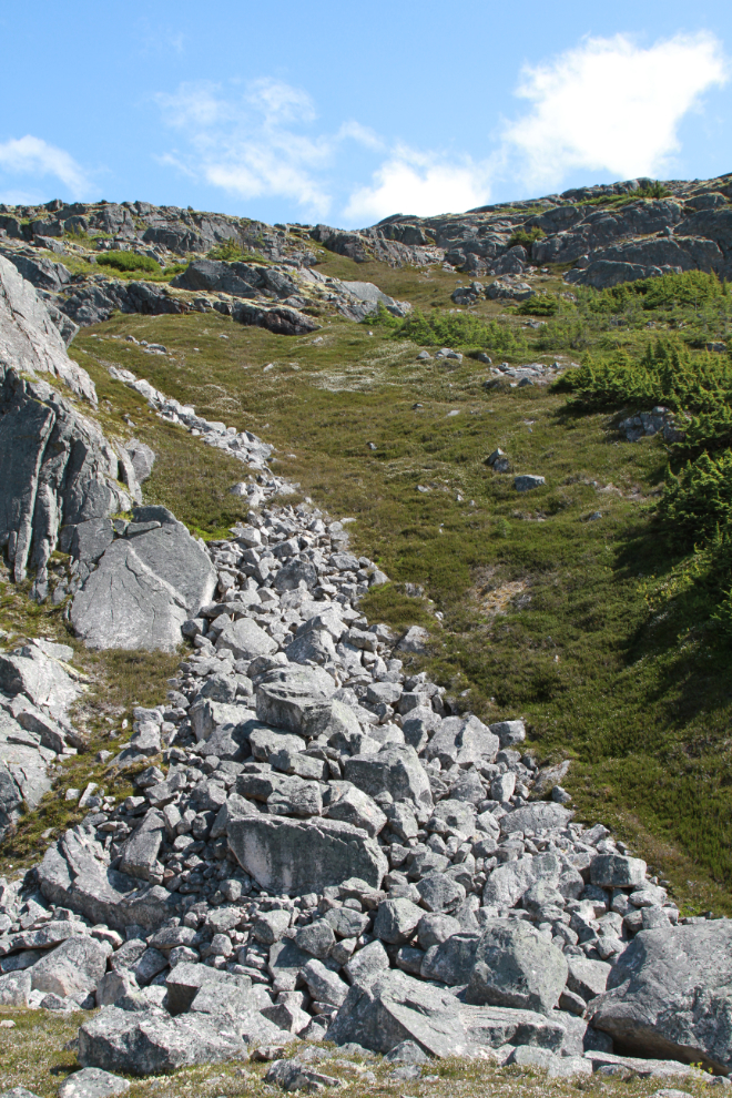
The first photo shows the steep avalanche chute I use to access the ridge. A few people start up it but the trail soon peters out and there’s soon no trace that anyone else has been there. That’s my kind of hiking.
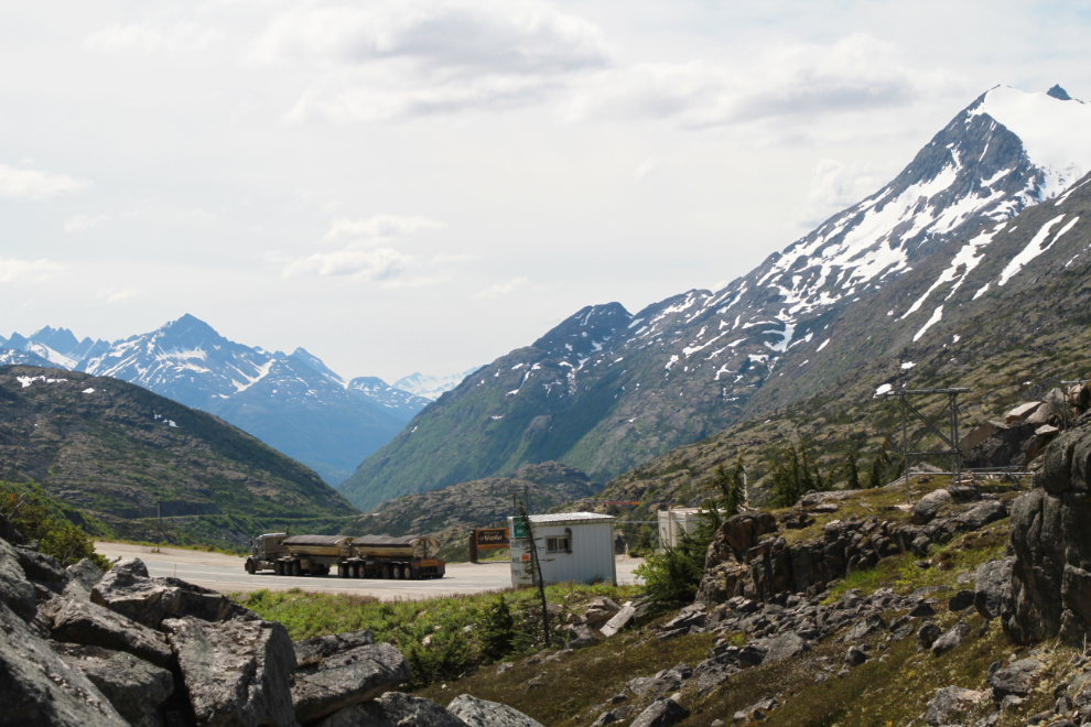
Starting up at 1:48 as a loaded ore truck on its way to the Skagway ore dock goes by the “Welcome to Alaska” sign.
I only took Tucker because Bella was still hurting a bit from her fight to get out of the Summit Lake quicksand the previous day. Cathy said when we got back that Bella had made no fuss about being left – perhaps there was even a sigh of relief.
Right at 2:00, looking down at the lower part of the International Falls trail, and the highway – my RV is at bottom left, the trailhead parking at the far right, with 8 vehicles there (a very busy day by our standards).
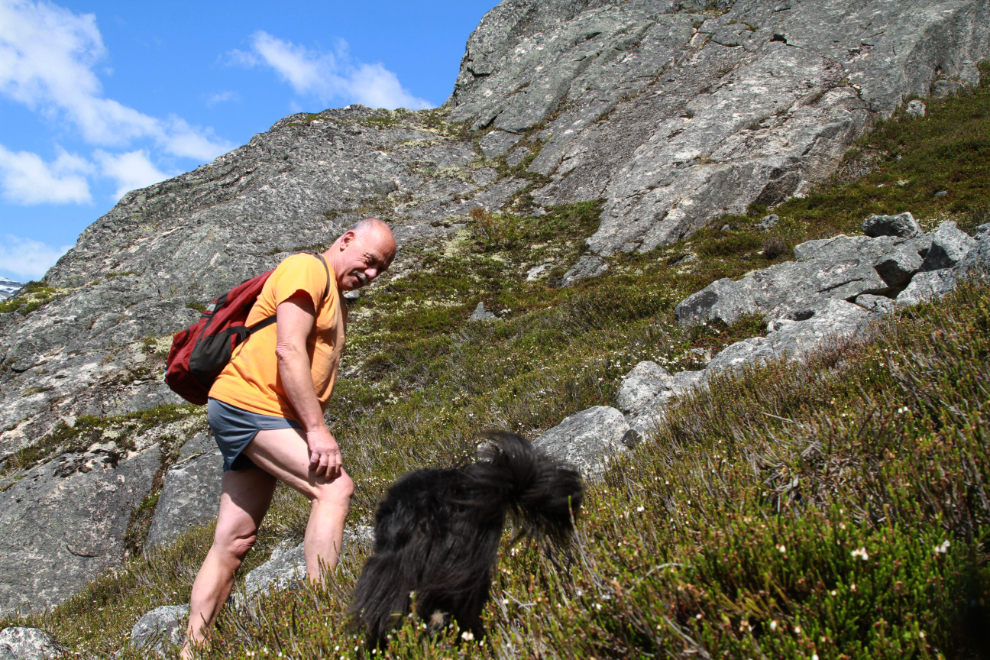
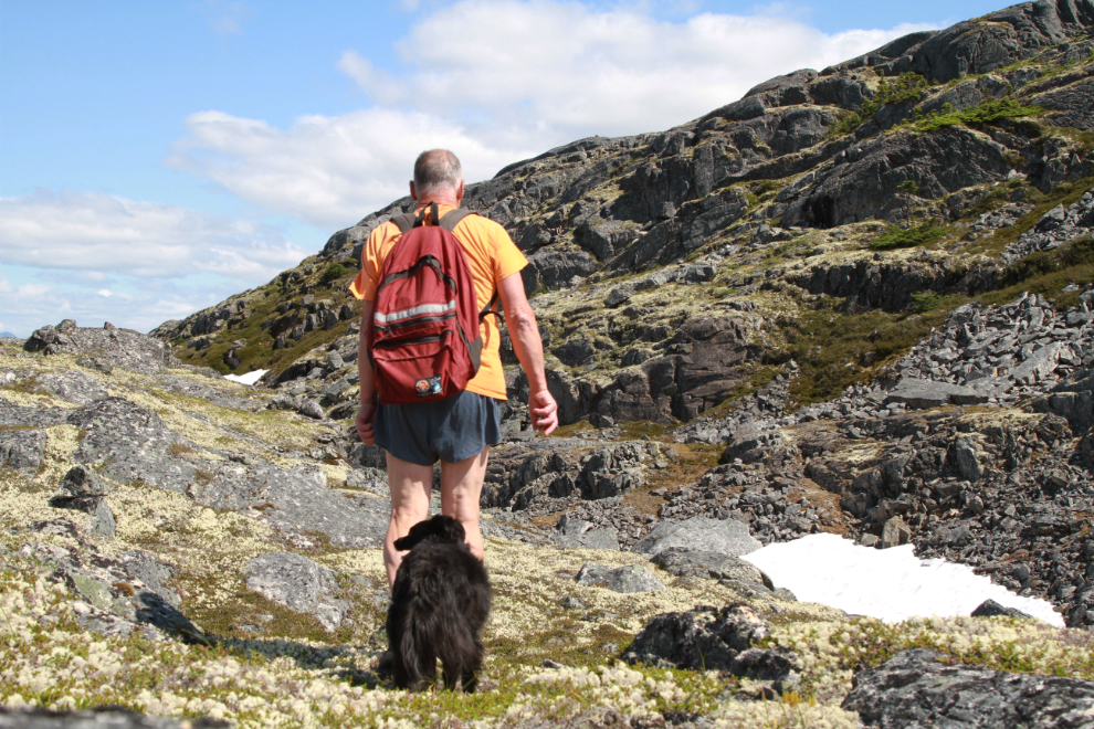
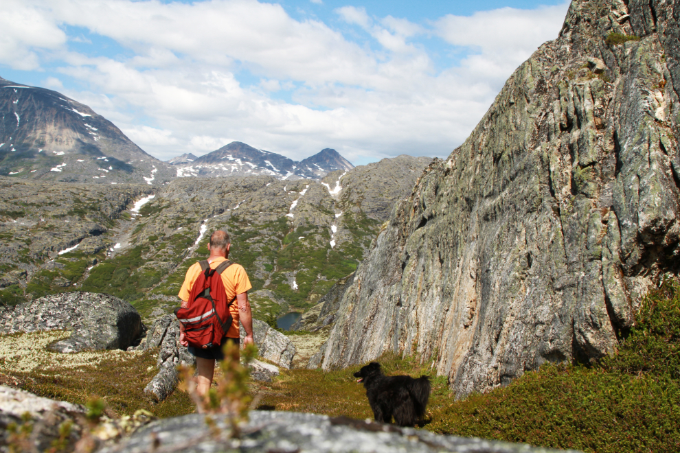
Eight minutes later, Tucker and I were on a bit of almost-level ground. He is a wonderful trail dog – he’s pretty much always right where you see him in this photo, and when he’s not his recall response is perfect.
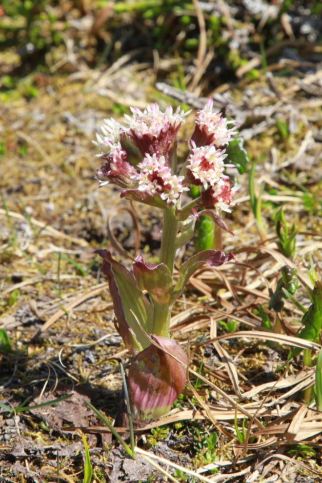
The PlantSnap app says this is Pestilence wort (Petasites hybridus) but although it seems similar, I’m not convinced. iNaturalist led me to Arctic sweet coltsfoot (Petasites frigidus), which seems right.
At 2:16, that virtual sidewalk on the left was very welcome. Some of these seemingly easy routes dead-end, but this one was actually a great route.
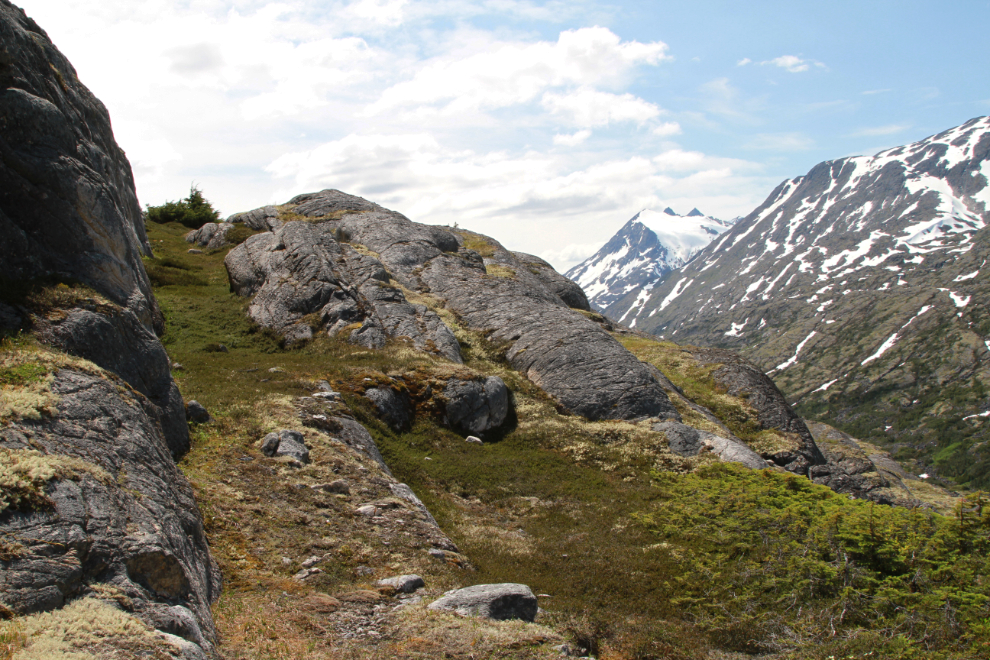
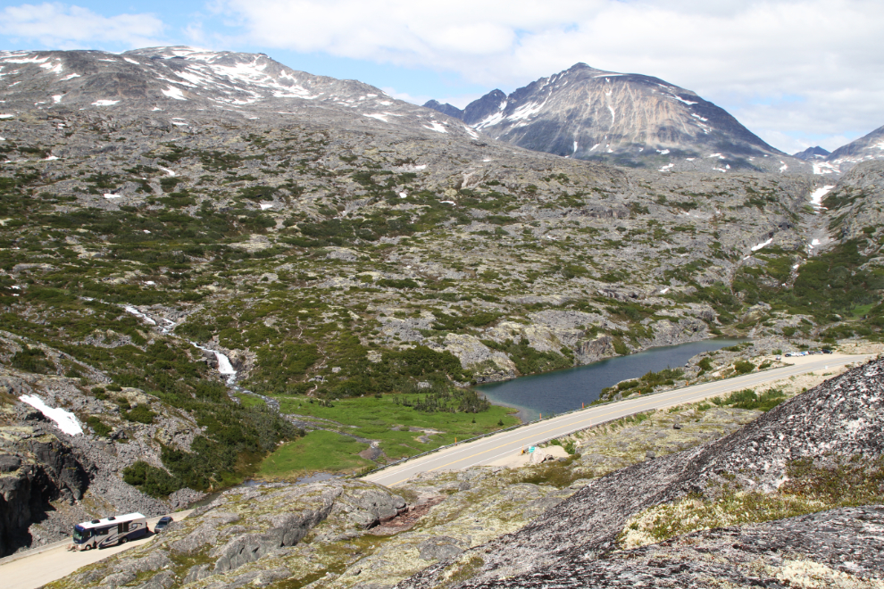
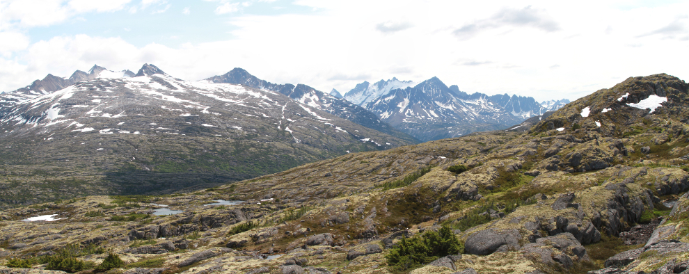
At 2:24 I was into fairly-easy-navigation country, at about 3,550 feet elevation. This was the view to the north, looking over the highway and Summit Lake. The mountain closest to the left is Summit Creek Hill, which I haven’t found a route to the top of yet.

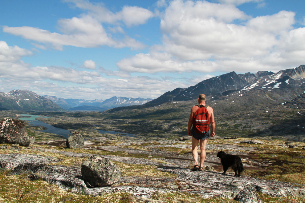
This is what I hike up there for. As well as the incredible views, I can hike in perfect comfort up there, though I occasionally put shorts on (sometimes even a tshirt!) to get a photo. While millions of people around the world like nudist resorts, I’ve tried that a few times and this is my preference 🙂
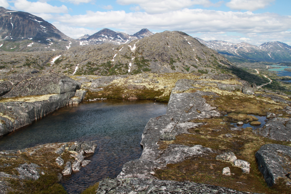
Something about the lay of the land gets me to this granite swimming pool on many of my hikes here. The strong north wind discouraged me from going for a dip this day.
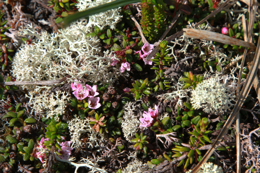
A close look at some of the alpine vegetation.
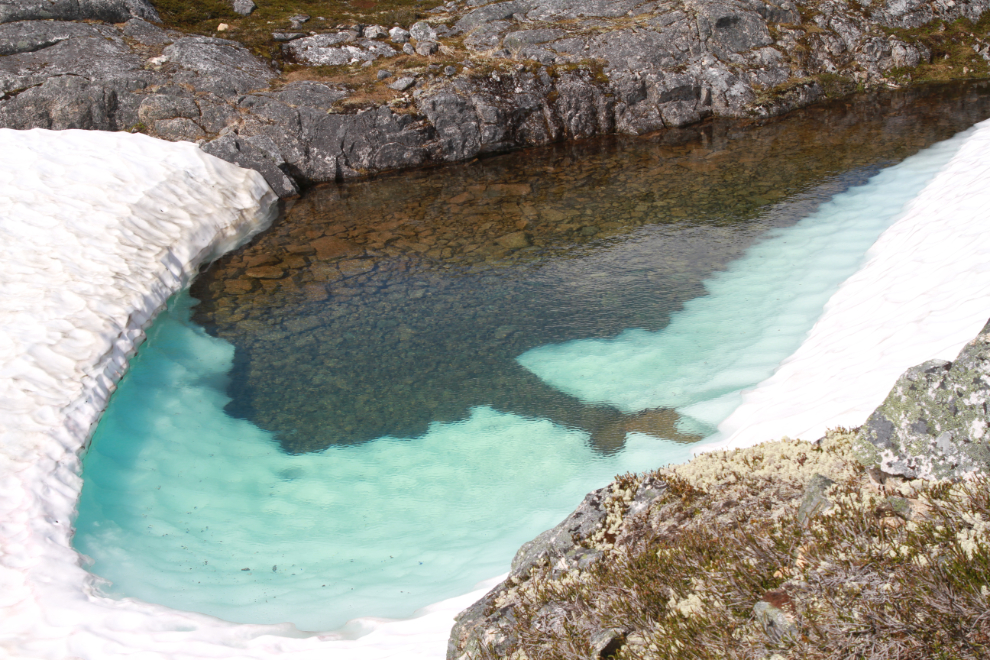
A few of the ponds have the wonderful colour of glacial water.
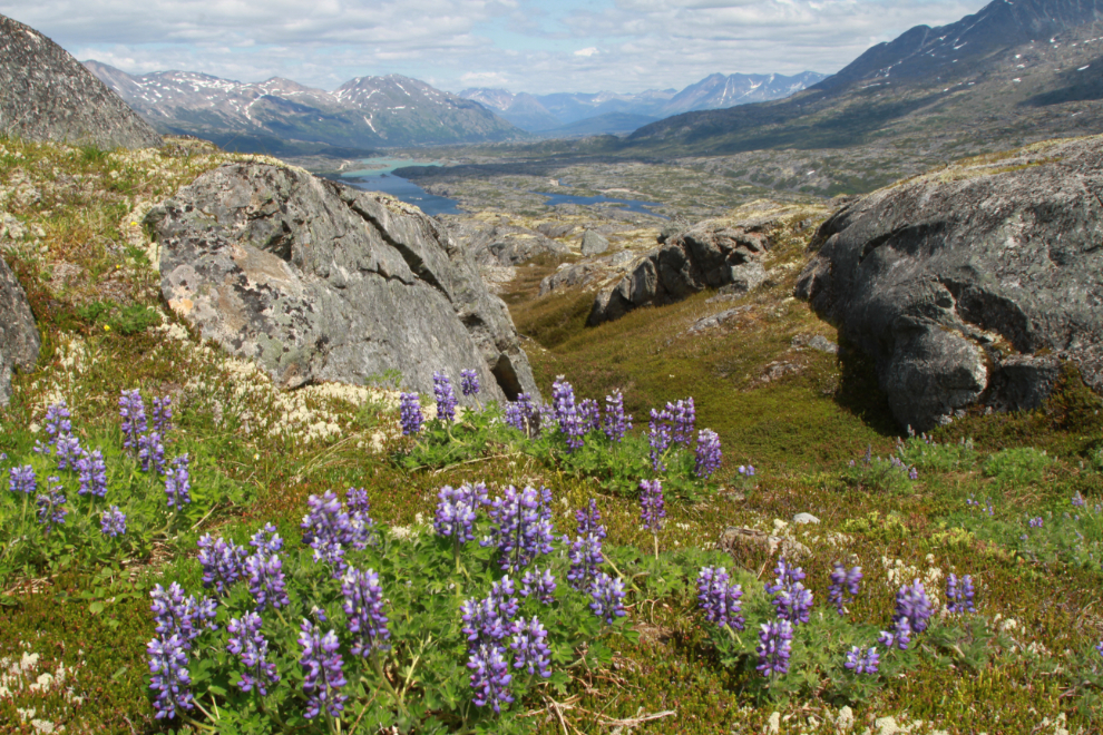
Though their home is only hospitable for a few short weeks each year, these lupine looked very happy with it.
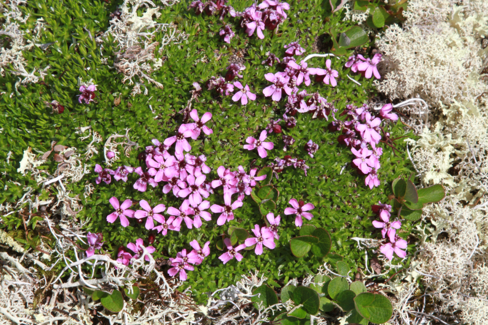
Moss campion (Silene acaulis) is seen often in the high country here.
For no particular reason, border monument 118 would again be my turn-back point.
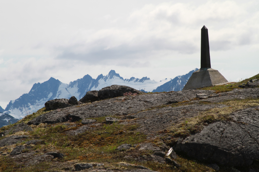
It was now 2:49 – 1 hour and 1 minute from the start of the climb.
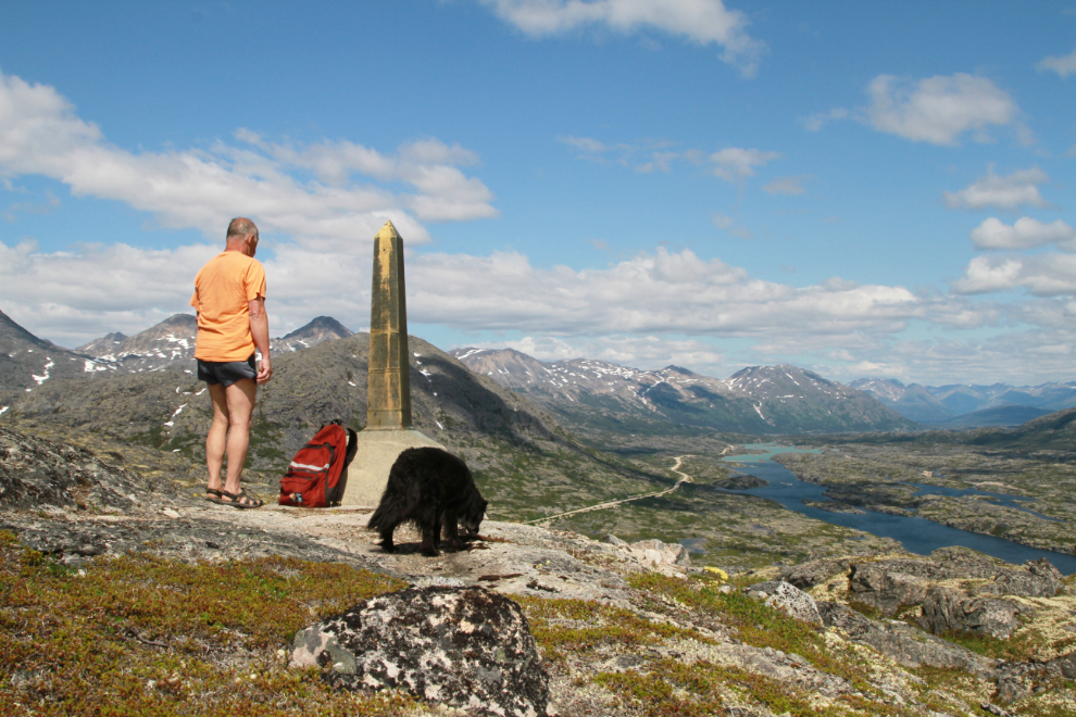
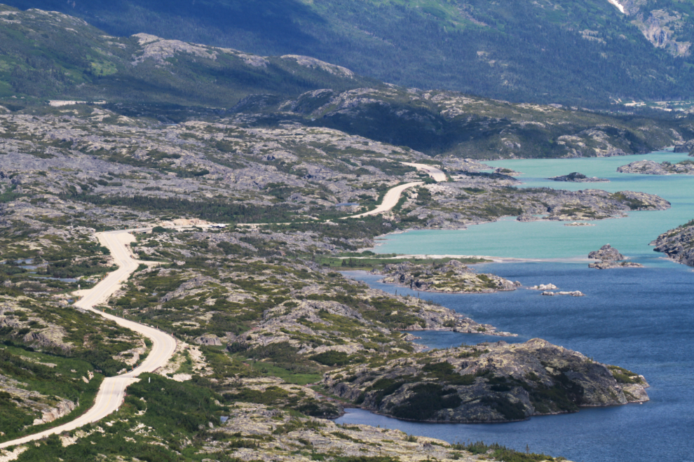
A closer look at Summit Lake from the border monument, with the 100-400mm zoom lens at 227mm.
A 2-photo panorama looking to the southeast from that same spot.
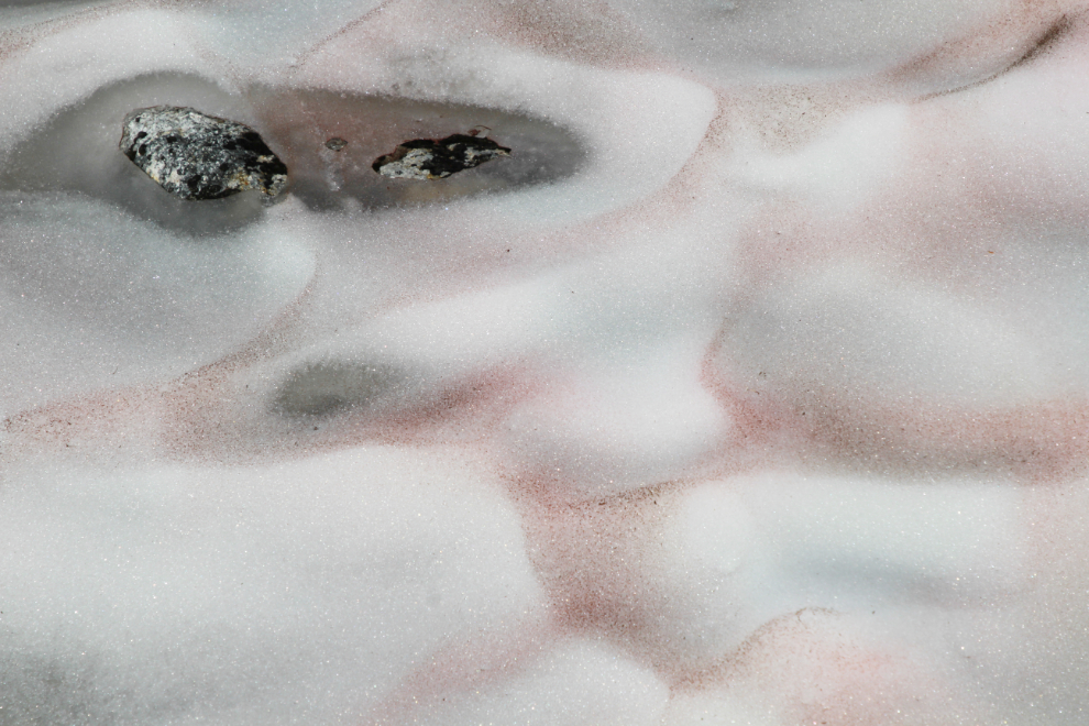
There was red snow, a.k.a watermelon snow, caused by the growth of the algae Chlamydomonas nivalis, in a few places.
At 3:20 we were walking down that wonderful “sidewalk” I showed you from 2:16. Navigational in country like this with no paths and few distinct landmarks is a skill that gets rusty and I’m quite out of practice, so I was pleased to make it back to this spot.
I may be more than just out of practice with navigation. I’ve come to realize that memories from the 20 months I was sickest with a brain injury aren’t just fuzzy, they’re gone. I read my few blog posts from that period, and see FB Memories, with no actual recall of those things happening once the traumatic hospital stays were past. I find it quite unnerving.
I helped Tucker over tough spots 3 times on the way down. The first time he was a bit reluctant to accept my carry but did, the second time he asked for help, and the third time, when I tried to lift him down from a sheer drop almost 6 feet high, I scared him and he screamed at me. I felt really bad and found him a path he could jump down. He then apparently felt bad about screaming at me and did a minute of “zoomies” around me 🙂 Trust is crucial in the backcountry, and you could ruin a dog pretty quickly with mistakes like that.
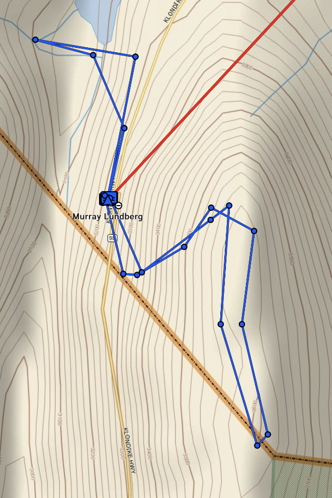
We got back to the RV at about 3:50 – it had been an excellent 2 hours. I am beyond-words grateful that I can once again do hikes like this. Here’s a map of the route produced by my Garmin inReach – the interactive map is here.
Another wonderful travelog, Murray. I am so glad to have hiked with you a handful of times. You know the terrain and the best unpopulated paradises. Also, despite the evidence thus far, I hope your lost memories begin to trinkle back to you soon.
Thanks, Ryan. I hope that some day soon the world will be normal again and we can get out on more hikes. I’m hoping that the two lost years return to me bit by bit.