Exploring the Tumbler Ridge Geopark – Kinuseo Falls and the Stone Corral
Just after noon on Day 51 of the trip – Friday, June 15th – I began to explore the Tumbler Ridge area, led by local photographer Collin Ball. The area has incredible and incredibly varied terrain to explore, encompassed by Monkman Provincial Park and the much broader Tumbler Ridge UNESCO Global Geopark. An indication of how significant this area is, is the fact that on September 23rd, 2014, the Tumbler Ridge Geopark became a Global Geopark, supported by UNESCO.
A UNESCO Global Geopark is an area recognized as having internationally significant geological heritage. Geoparks aim to reconnect people to the earth, whether through hiking trails, learning about mountain building, eating food grown in the local soils, or celebrating the stories of the people who have lived here since time immemorial. The geology in a Geopark may be linked to sites with interesting archaeology, wildlife, history, folklore and culture. Tourism industry promotion in a Geopark focuses on highlighting the geographical character of a place.
The Wolverine Nordic and Mountain Society, made up entirely of volunteers, designs, builds and maintains a network of 30 hiking trails (almost 100 km of them), in cooperation with BC Rec Sites & Trails, BC Parks, etc., and there are many other trails as well. In the 3 days we had, Collin was determined to show me some of the best.
Kinuseo Falls
I had visited Kinuseo Falls on my initial 28-hour discovery of Tumbler Ridge in May 2016, but it’s too amazing to not return to, so that’s where we began. It’s a 65-km drive to the falls from Tumbler Ridge, 48 km on gravel, some of which was rather surprisingly rough. The brochure Visiting Kinuseo Falls (pdf, 1.2 MB) has a lot of information about the history, and what to see at the falls and in the area around them.
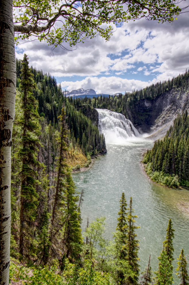
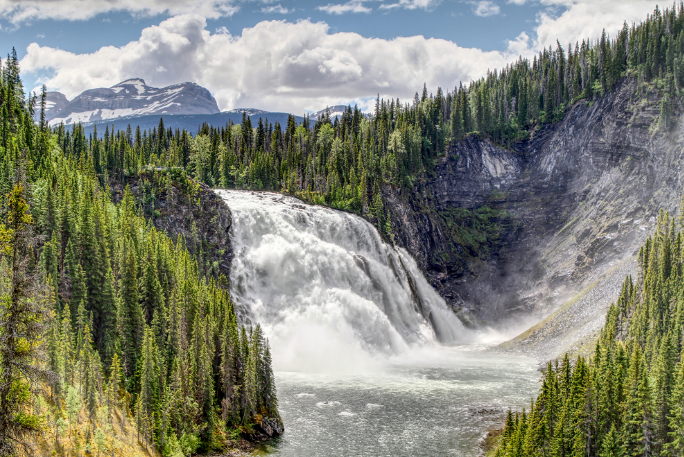
For most people, this is the first view of the waterfall – looking down the Murray River and over the lip of the falls while on the way to the first viewpoint, a large viewing platform.
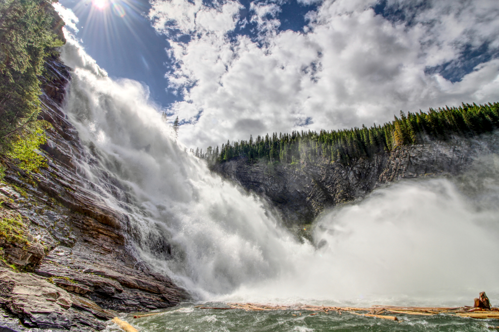
It’s about 70 meters (230 feet) to the bottom of Kinuseo Falls. By comparison, Niagara Falls is 51 meters high (167 feet).
A 10mm lens is needed to get the whole scene in from the Upper Viewpoint, one of the 5 main viewing locations.
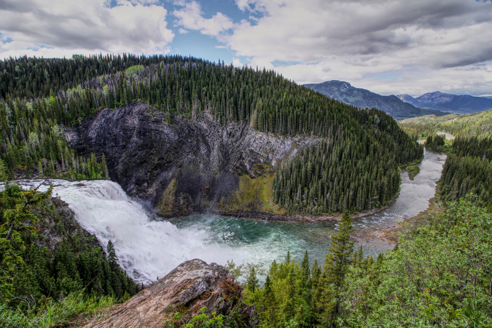
The Leake Viewpoint provides what many consider to be the classic view of Kinuseo Falls. It was first captured by professional photographer R. E. Leake in 1938.
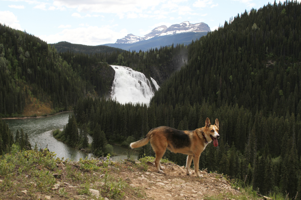
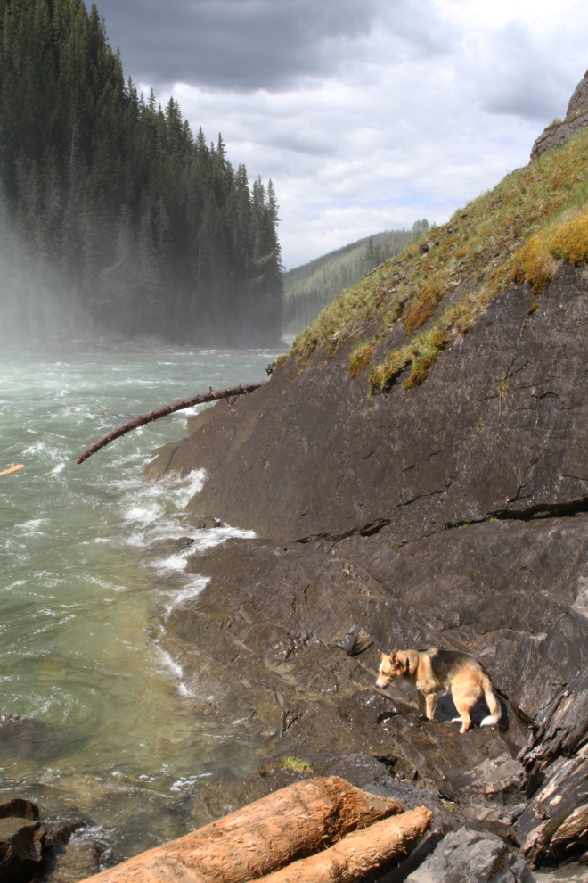
Collin had brought his buddy Jewel along, and she was having a ball. This is the view from the Downstream Viewpoint.
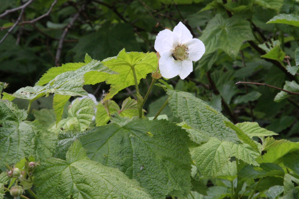
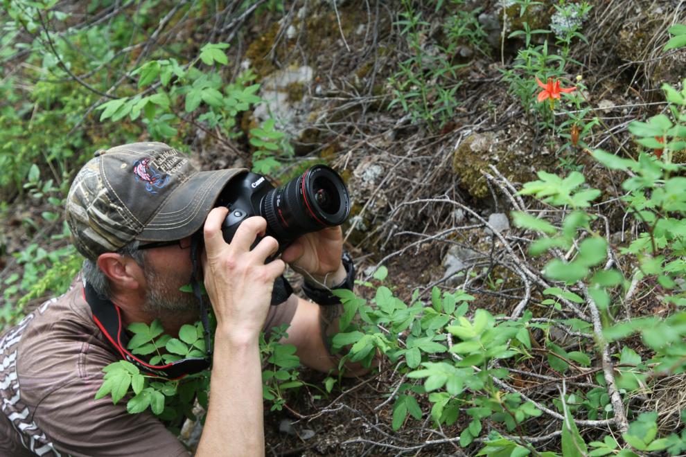
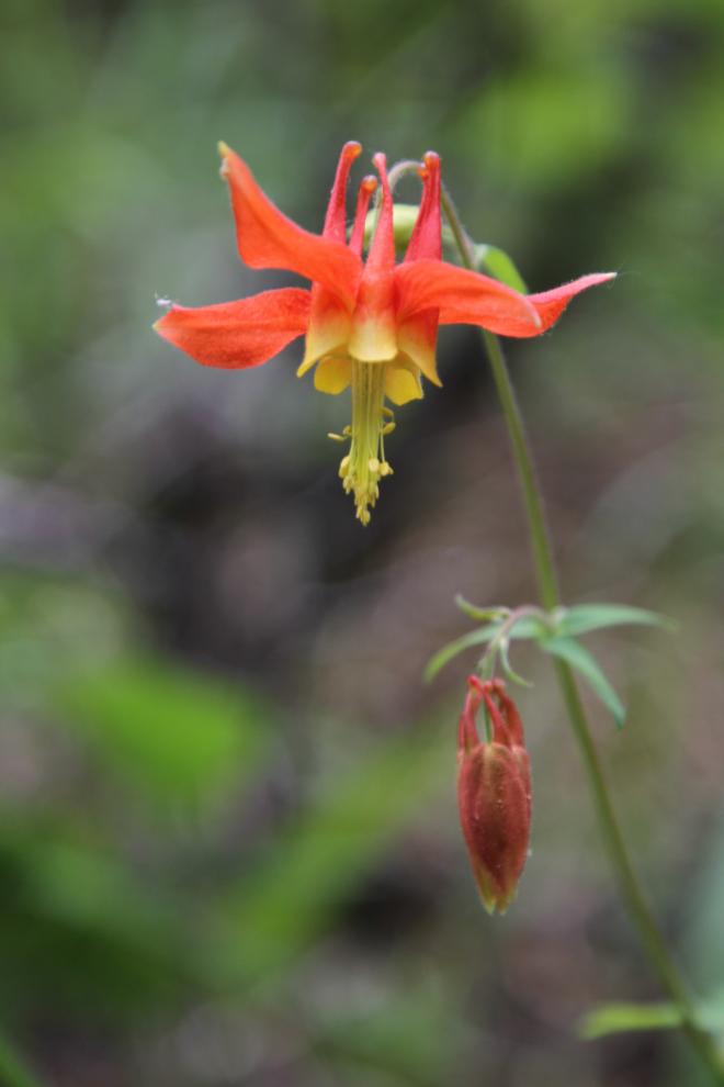
Along the trails, a wide variety of flowers were in bloom, including this salmonberry.
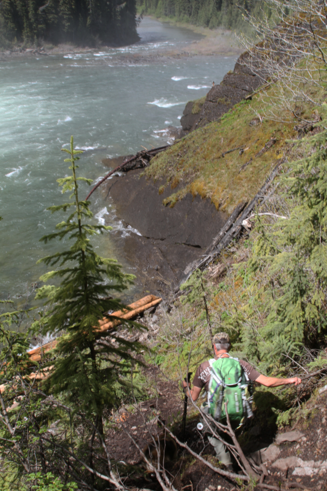
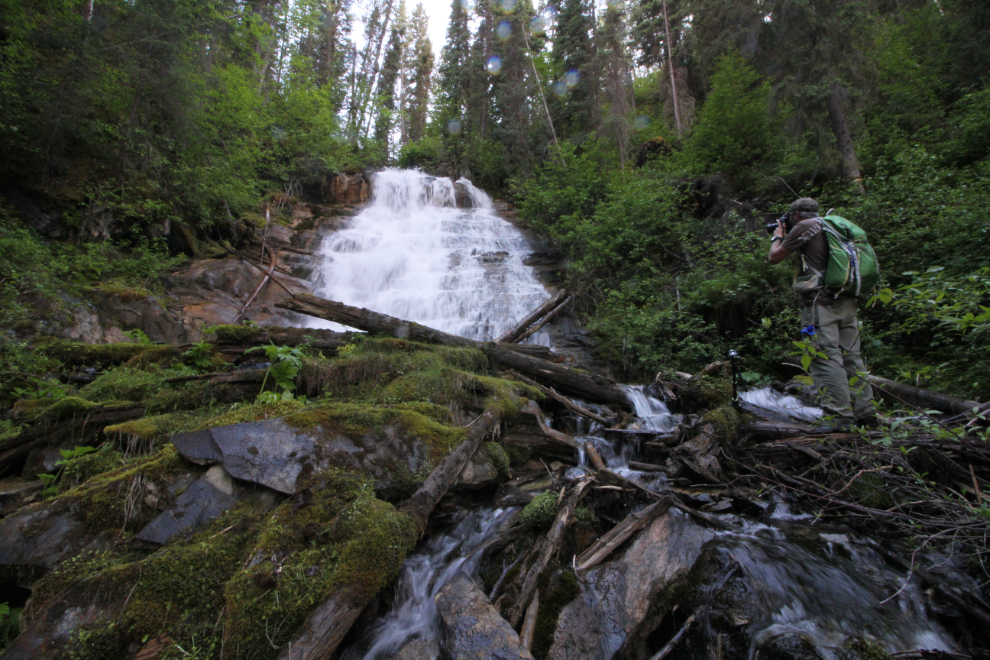
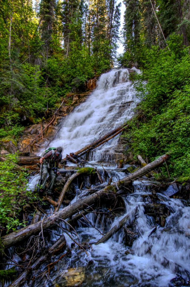
Our final trail was steep and rough, down to the base of the falls. On my previous visit, I hadn’t found this unmarked trail, so didn’t get very close to the base of the falls.
Jewel quickly proved to be quite an adventurer! Forest, granite, water – it’s all fun. Especially water 🙂
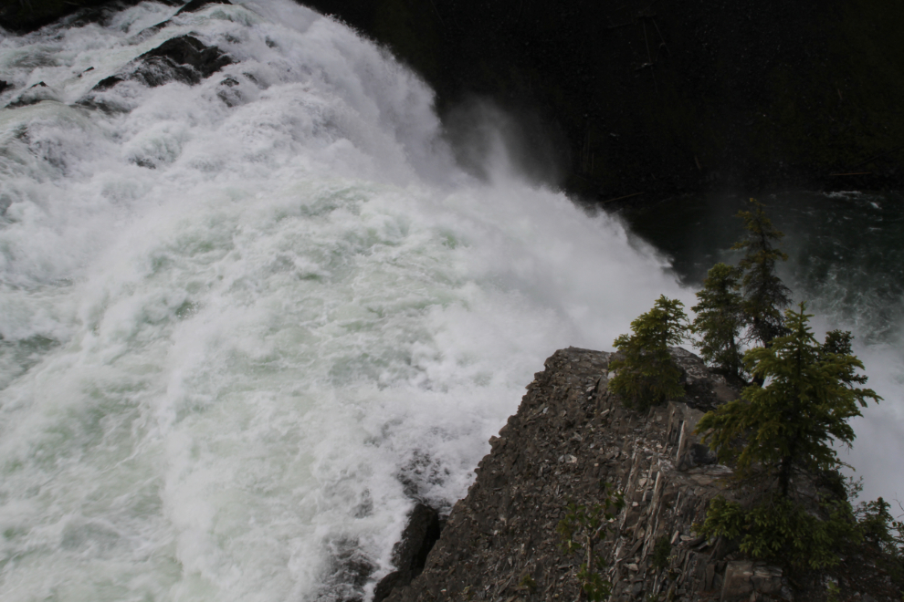
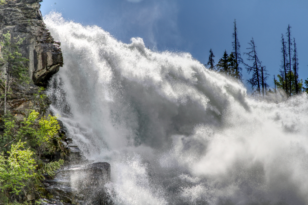
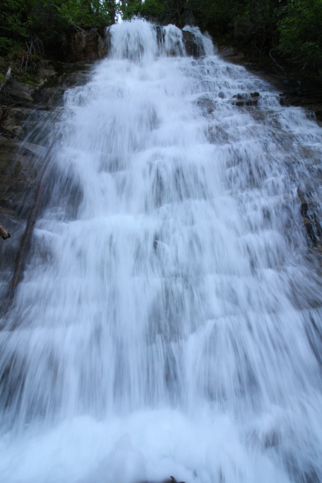
The base of the waterfall was the highlight for me. The power is stunning. The amount of spray made photography difficult, especially when looking up at the lip of the falls, but I got quite a few photos.
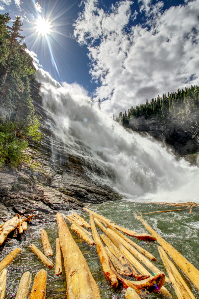
This may be my favourite photo from the entire 59-day trip. My second visit to Kinuseo Falls certainly won’t be my last.
Are you tired of photos of Kinuseo Falls yet? 🙂
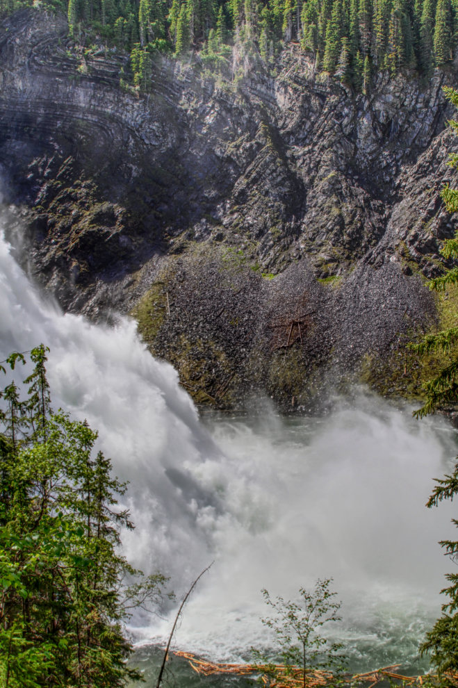
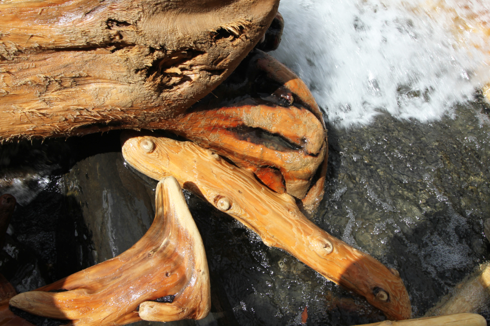
Even the wood at the base of the falls caught my attention for a few photos, with logs and smaller pieces polished by the pounding of the water.
This one-minute video I shot at the base of the falls with a super-wide 10mm lens will give you a better idea of the power of Kinuseo Falls.
The Stone Corral
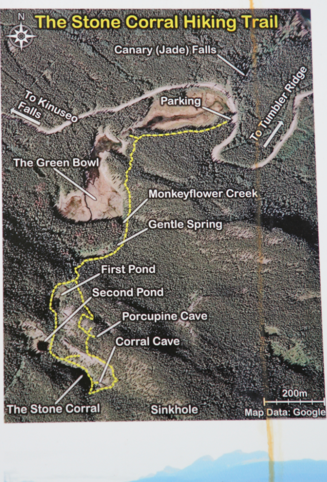
From Kinuseo Falls we backtracked 3 km to the Stone Corral trailhead. A 16-page brochure as well as interpretive panels help visitors understand the trail network that totals 4.5 km, and 20 of the features they’re seeing.
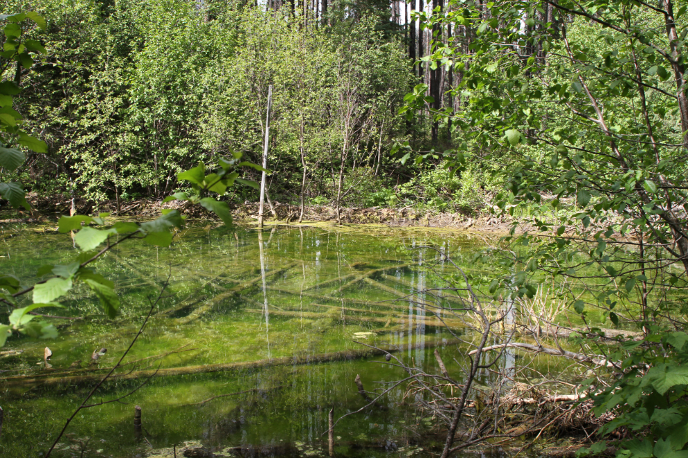
The trail starts off quite level, and goes by the beaver dam at the far end of this pool.
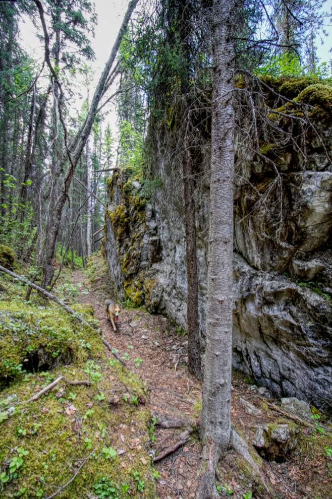
Like most of the trails in the Geopark, assists such as stairs and ropes have been installed where appropriate, but the trails are as natural as possible.
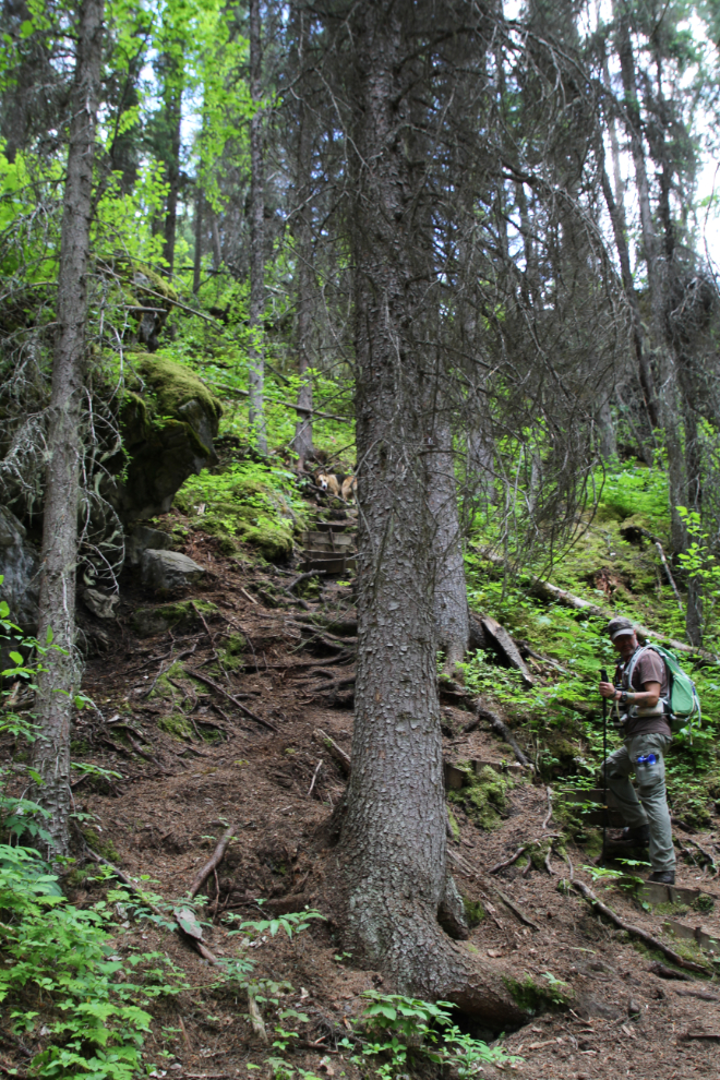
Collin and I had quickly found out that our interests and hiking abilities are extremely similar. For someone like me who spends 95% of my hiking time alone, that was quite a surprise – a very welcome one.
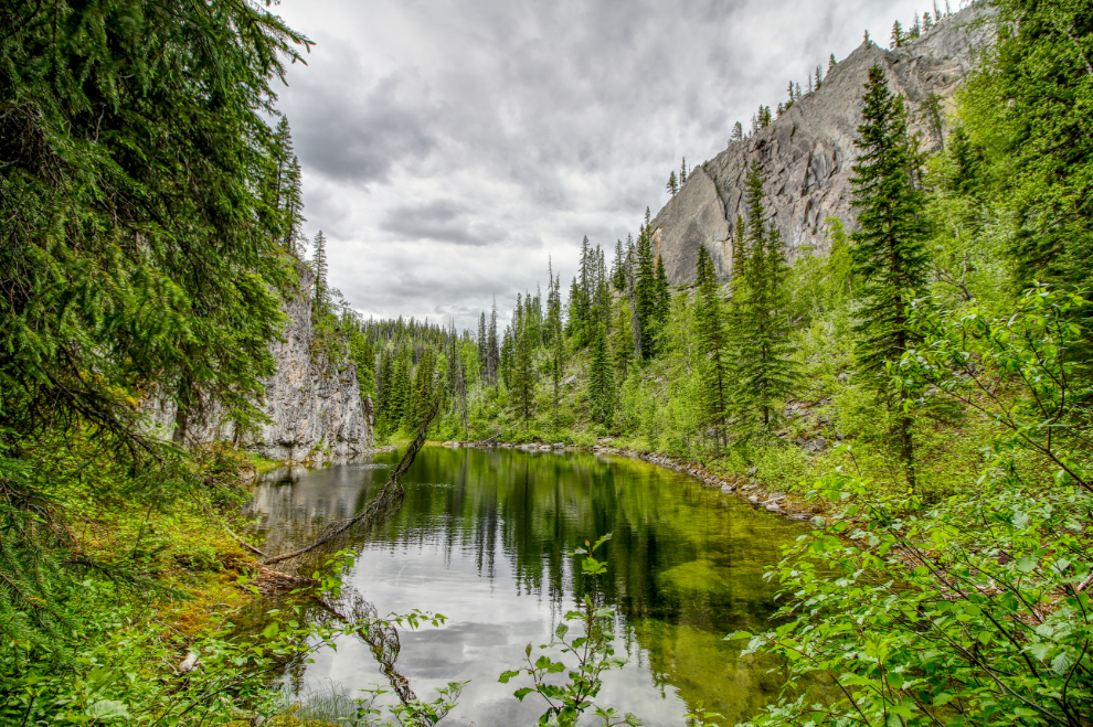
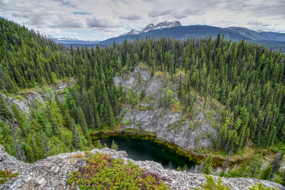
This is the Stone Corral, fenced on 3 sides by impressive limestone cliffs. “This is a good example of a doline or sinkhole that forms in areas of weaker limestone rock where the surface caves in.”
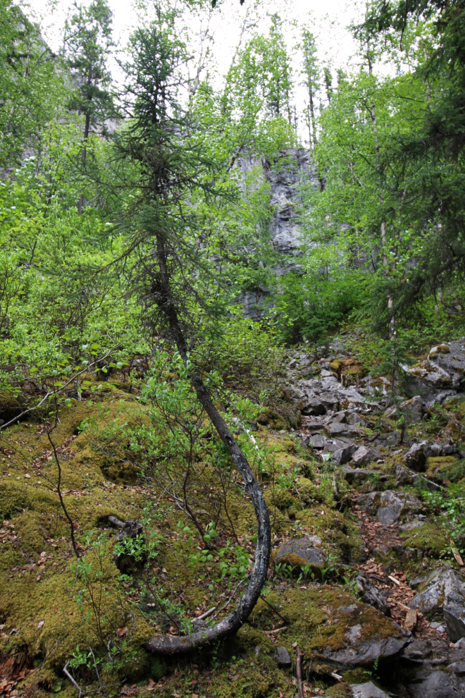
“You can bend me but you can’t break me,” this hardly little tree seems to say.
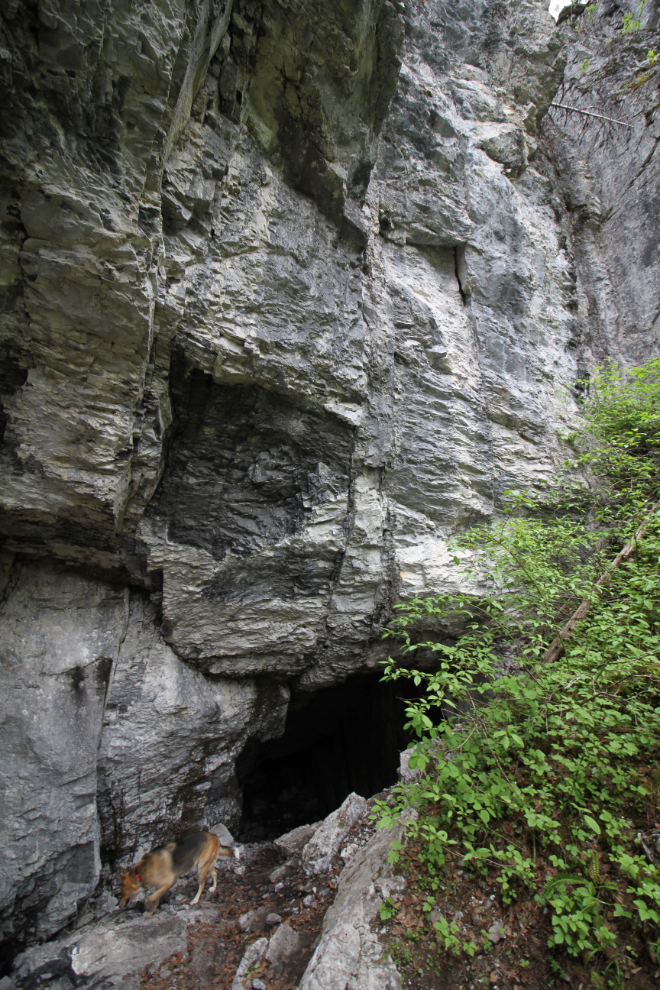
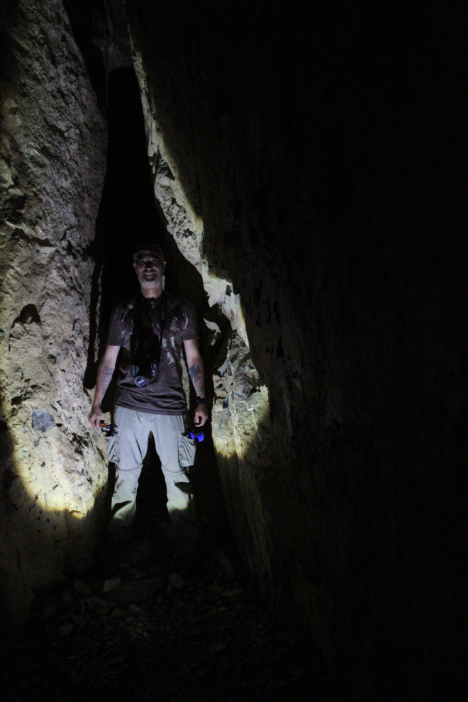
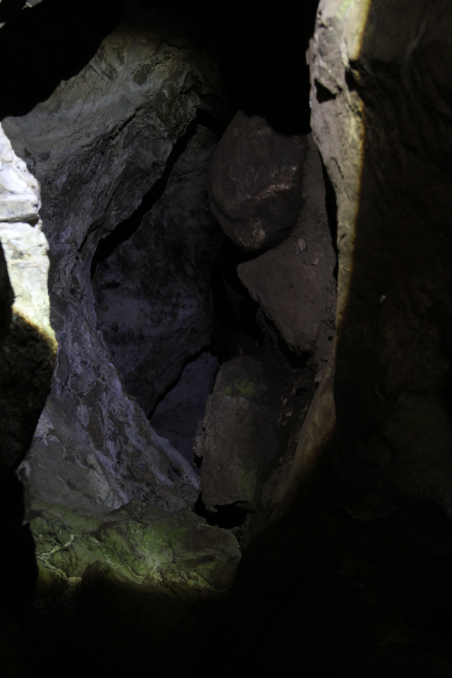
It was fun to walk into the Corral Cave. It’s only 20 meters deep, but the ice, the smooth limestone walls, and the embryonic stalactites were interesting. Luckily, Collin had brought a small flashlight.
Jewel is well used to the pace of a photographer, and a little break high above the Stone Corral while Collin was shooting seemed to be welcome.
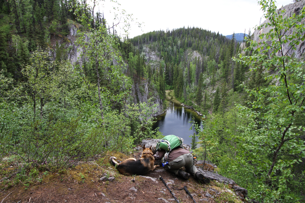
The vantage point high above the Stone Corral shows the 3 walls of the corral, with Castle Mountain in the distance.
This little sinkhole is the exit of the Porcupine Cave. It’s just large enough for a smaller adult to get out.
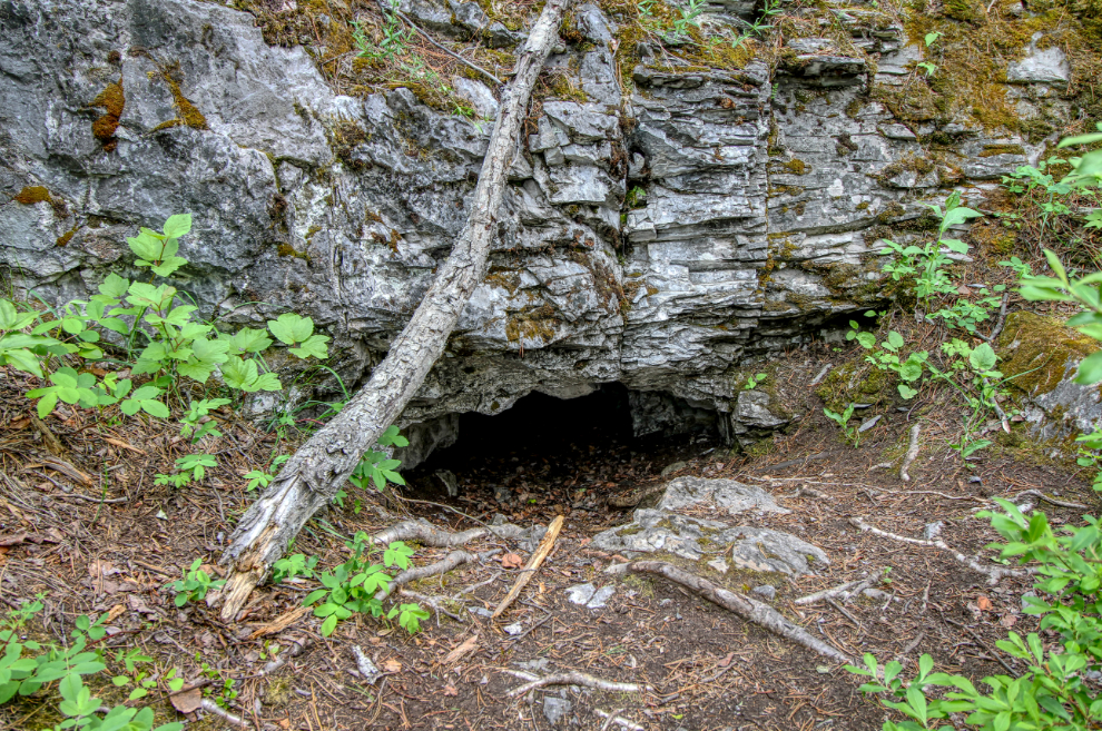
The entry to the Porcupine Cave is larger…
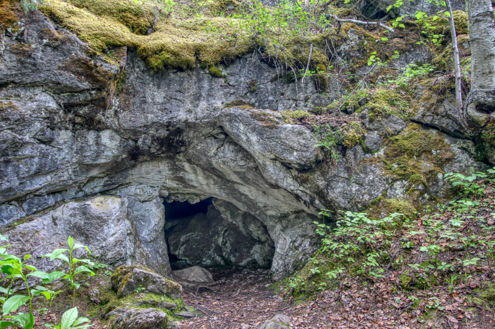
…but I still wasn’t going in 🙂 The cave is about 10 meters long, and there’s a chamber in the middle that you can stand up in, though.
Many of the limestone cliffs have fossils, the best being a high face known as The Mural.
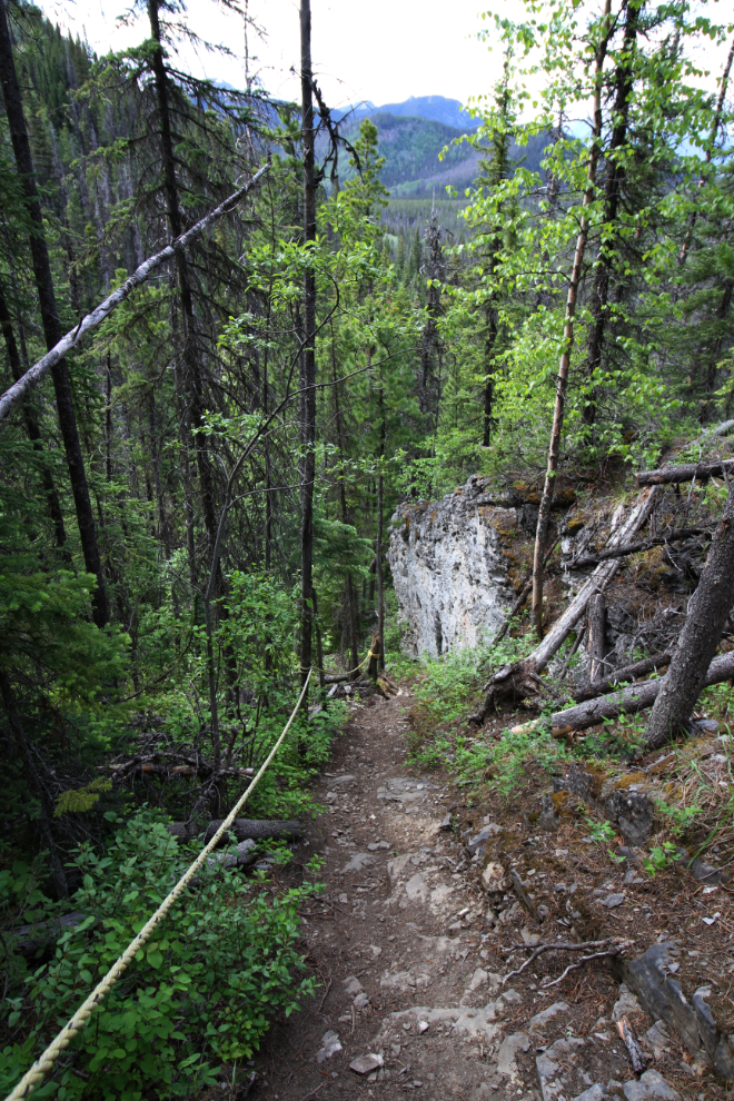
For part of the descent, the trail is steep enough that ropes are welcome.
We spent a total of 2 hours and 20 minutes on the Stone Corral Trail, about normal according to the brochure which says 2-3 hours. Next on Collin’s list was Canary Falls, accessed from the same small parking lot as the Stone Corral.
Canary Falls (a.k.a. Jade Falls)
The lip of Canary Falls is only about 100 meters/yards off the road, then the trail drops very steeply down the slope alongside the waterfall. Rope assists have been installed at the steepest sections.
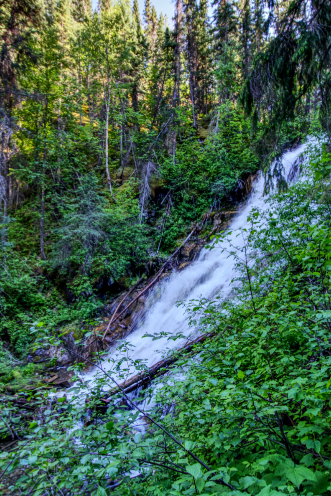
Even Collin was surprised by how beautiful this waterfall was, as it had a much higher volume of water going over it than he’d seen before. In the deep shadows, getting the long exposures needed to silken the water was simple. The next photo was shot at 1 second and f22, with the zoom lens at 14mm.
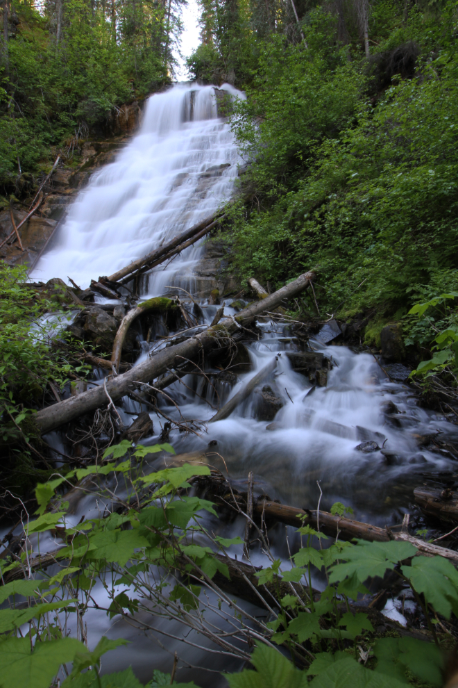
There were lots of angles to shoot from. Having my Keen sport sandals on (as usual) made crossing and getting into the creek to shoot easy.
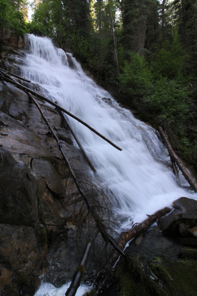
Getting right into the spray 🙂
Two final photos of Canary Falls, and we began the 62-km drive back to Tumbler Ridge.
We were both very pleased with how this day had gone, and made plans to meet early the next morning to continue exploring.