Hiking 7 of the Canyons at Muncho Lake, BC: Part 1
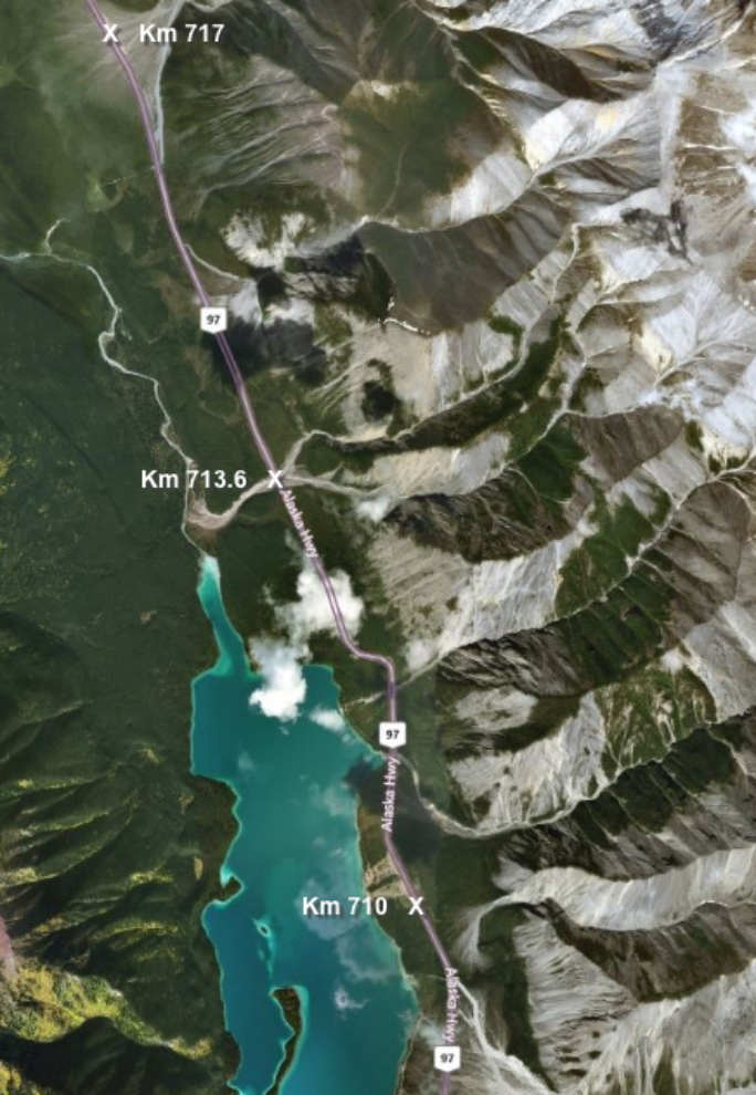
On Thursday, August 24th, I finished the drive to Muncho Lake with a 270-km (168-mi) leg down the Alaska Highway from the Watson Lake Campground. I parked the motorhome at a huge pullout at Km 717, which would put me in the heart of the best of the canyons that I wanted to explore.
My initial plan to was to spend a couple of days at Muncho Lake and then move down to Summit Lake in Stone Mountain Provincial Park, but as it turned out, I stayed at Muncho for 4 nights, and another few would have been great. I just discovered how incredible these canyons are during a trip two years ago, and now am really anxious to see all of them, and more of each of them (many of the canyons could be multi-day trips).
Tourism Northern Rockies has published an exceptional 90-page Hiking & Motorized Trail Guide. I’ve posted a digitized version of it – it’s a 9.1 MB download.
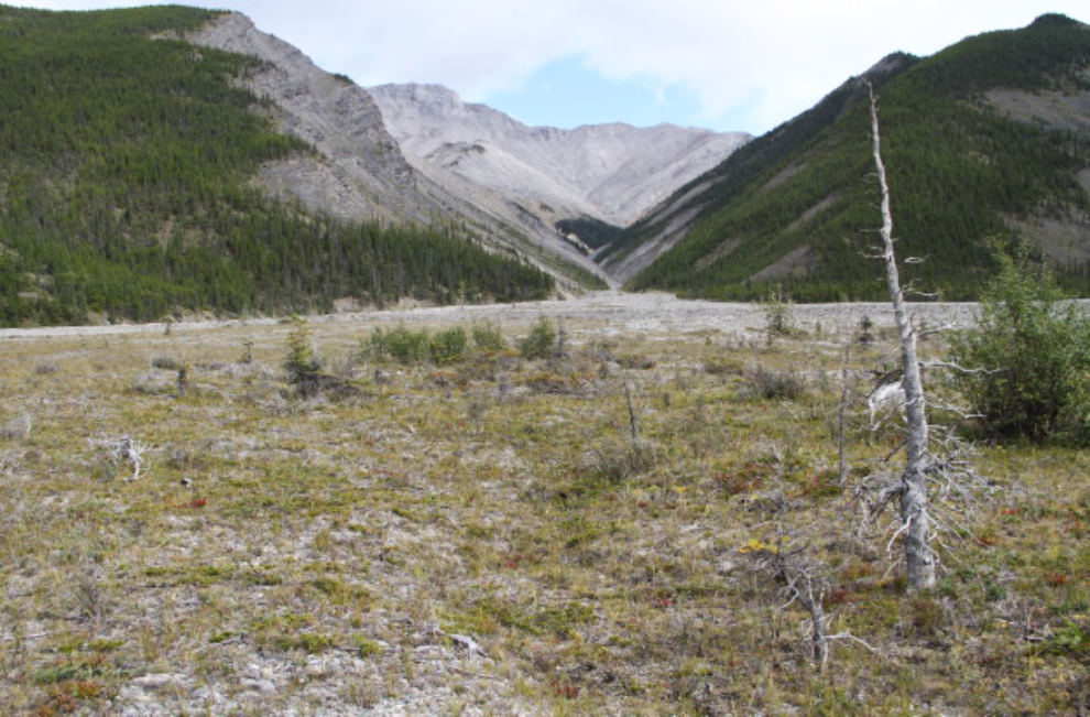
Between Km 726 and Km 697, there are 14 main canyons, of which I hiked 7 ( also hiked two non-canyon trails). Each of the 7 canyons that I hiked will be described below, listed from north to south. None of the canyons except Boulder seem to have names. I’ve added 3 of the significant Km points, including my parking spot, to the map below – click here to open an interactive version in a new window.
Km 725.6 Canyon Hike
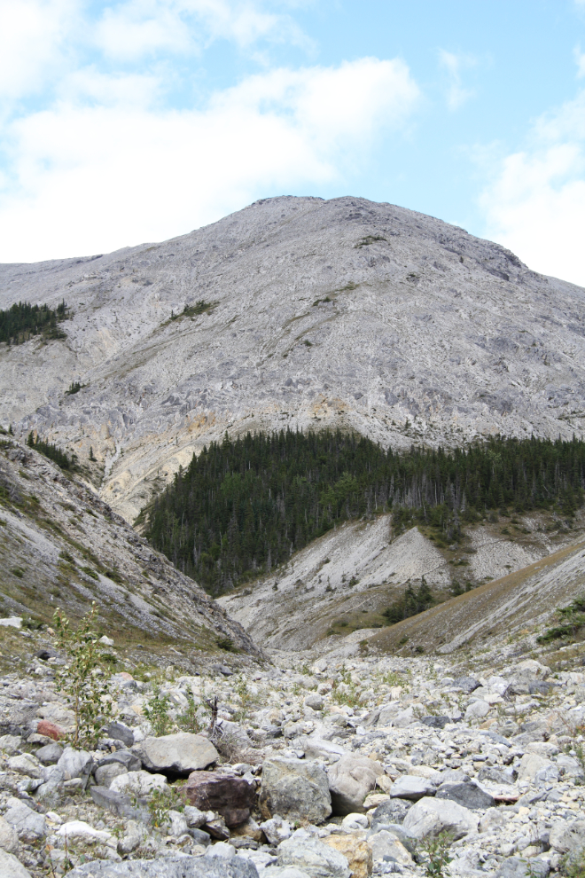
The furthest-north of the canyons was the first one I hiked, late on Thursday afternoon (August 24th). It taught me that the tight canyons are no place for Bella in particular. She hates the rocks, and even Tucker isn’t a big fan. I was going to park at a pullout on the highway, but then decided to drive up the road/trail a ways (a few hundred meters/yards).
The first few minutes was really nice walking for all of us.
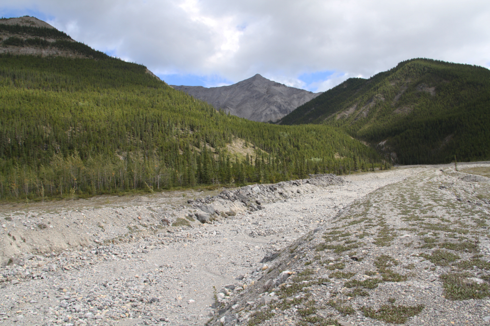
As we found out later during our stay, violent storms with heavy rain are common here. The rain does a lot of damage within the canyons, and until massive berm systems were built 15-20 years ago, the Alaska Highway was closed a few times by floods.
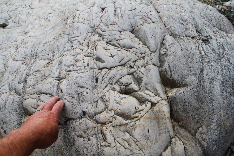
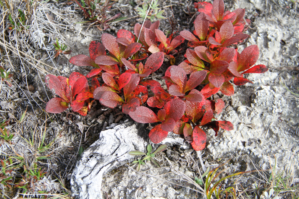
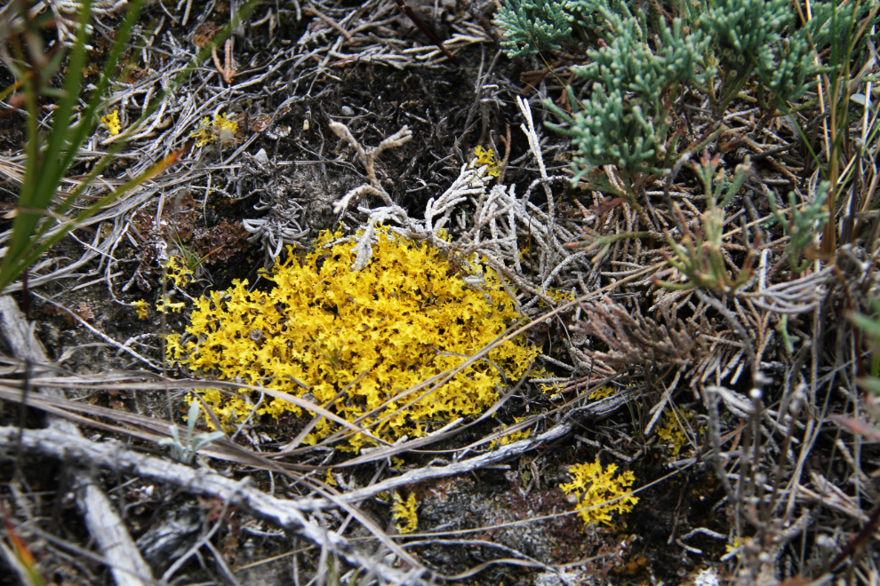
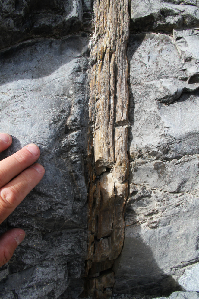
The geology of the region is complex and fascinating – a rockhound’s dream location. I took many photos of rocks in all of the canyons.
This is as far as we went – just 20 minutes from the car. It was just too hard on Bella. The aerial photos, though, show that it splits into a couple of exceptionally interesting canyons further up, so I’ll definitely be back to this one, by myself.
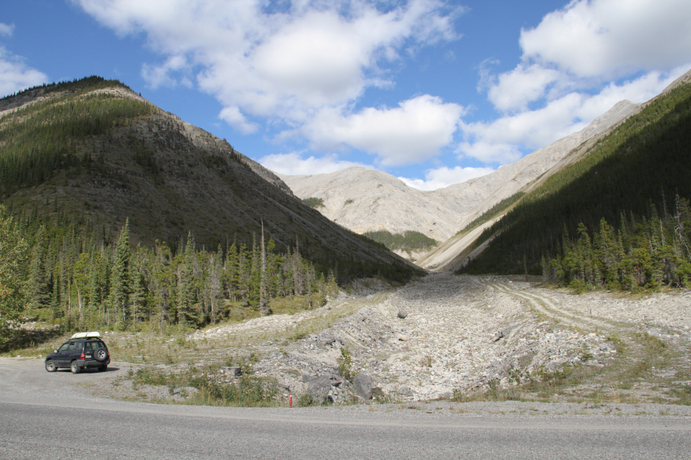
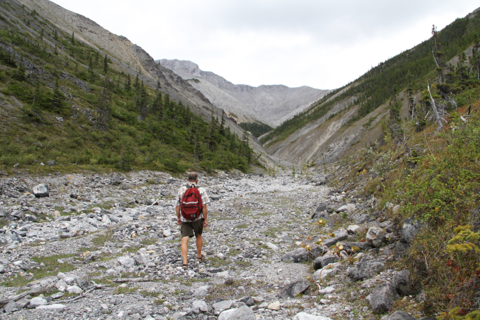
Km 720 Canyon Hike
From the highway, it can be seen that a wall of rock isn’t too far away, so I left the dogs in the motorhome for this hike on Saturday afternoon (August 26th). The creek is just a few yards south of the Km 720 post. Most of the walk to the canyon is very easy, on the berm along the creek.
The first look at the canyon, just over 10 minutes from the car. It didn’t look promising.
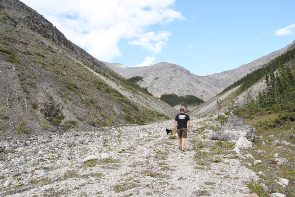
Going in for a look. I had no real plans for any of the canyons, and was open to anything – these hikes were just meant as initial reconnoitres.
That was certainly the end! It must be an incredibly beautiful spot when the water is flowing.
Checking out a possible route around the cliffs. It seems doable. The aerial photos show that the cliff section is very short, and getting around them gives you access to a large network of canyons.
Walking back to the car, 40 minutes after leaving it.
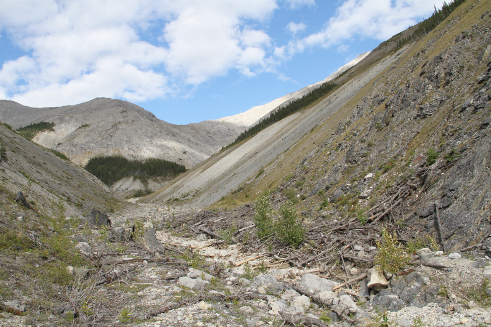
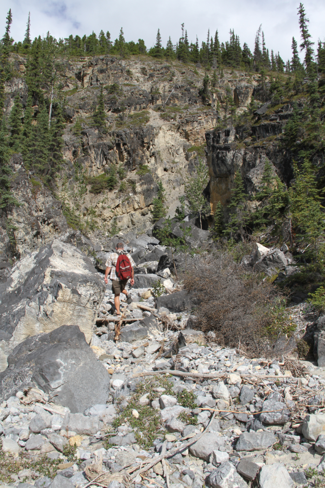
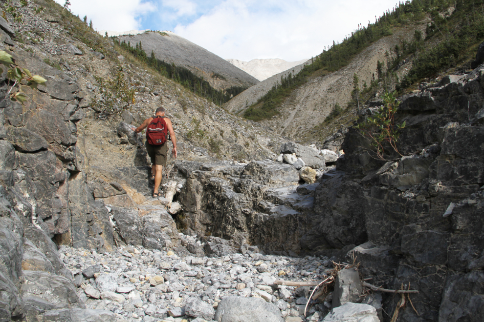
Km 718.4 Canyon Hike
After the 40-minute hike at Km 720 on Saturday afternoon (August 26th), I drove 1.6 km to the next canyon. I expected that this one would take me longer to do my initial exploration of.
Although the country looks dry and drab from the highway, there are some brilliant colours when you get a close look.
The creek has a large double set of berms to protect the highway from flooding. It must have caused some big problems in the past. Neither of the berms are walkable (with level tops) – you have to go up and over them.
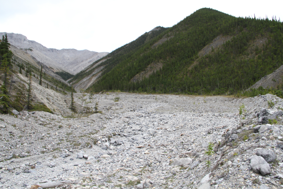
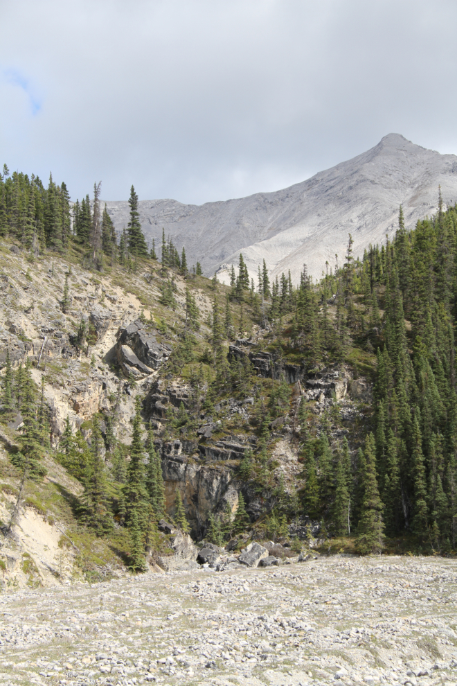
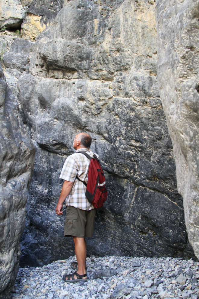
Entering the canyon proper, 30 minutes from the car. The weather had been erratic, from heavy cloud and cold wind to warm sun. Some of the clouds looked like rain.
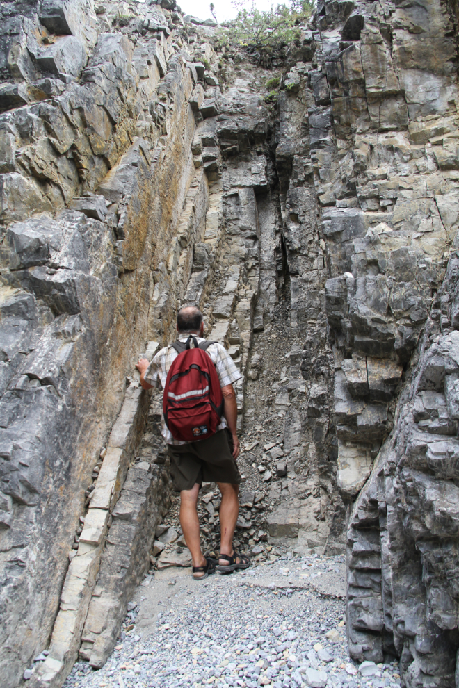
Almost an hour from the car, some hard rock shelves to climb over.
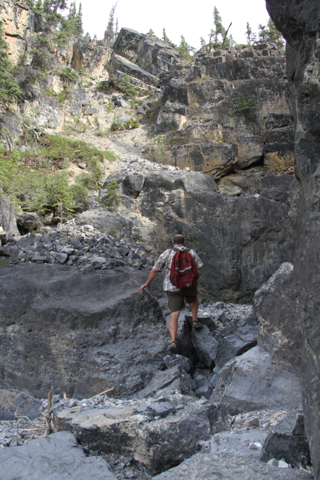
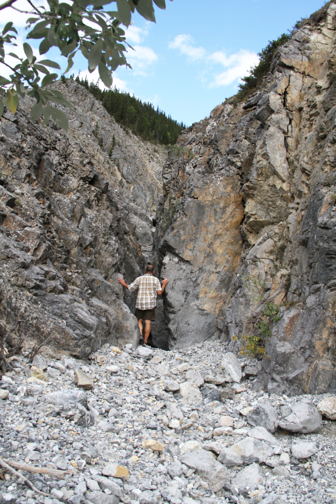
Ten minutes later, this impressive little slot canyon required me to climb up and around it, but the going was fairly easy, with a sheep trail as a guide. I had learned not to trust sheep trails too much, though – they sometimes lead to places that only sheep should attempt.
An hour and 10 minutes from the car, the canyon split. The next photo is a panorama created from three 18mm vertical photos – it’s quite tight in there.
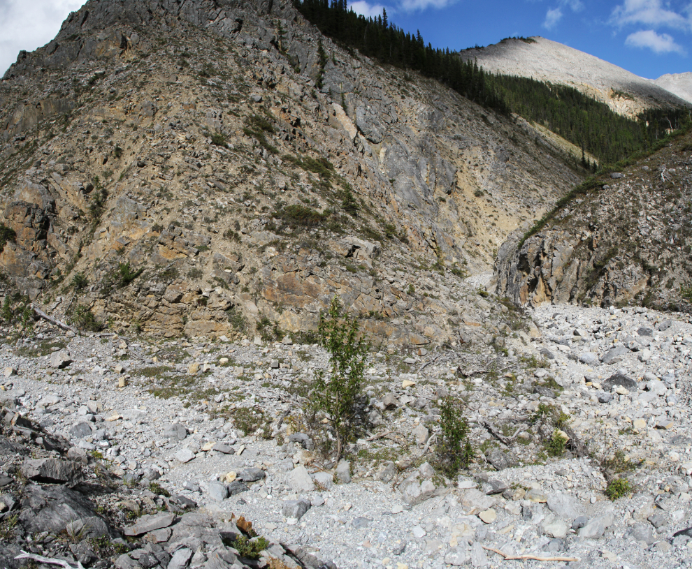
As in all of the canyons around Muncho Lake, the geology is complex, and many of the rocks quite fascinating. The mountains are primarily limestone, but many of the most dramatic parts of the canyons have been created by intrusions of shales and chert.
I managed to hike up and around this wall, but got stopped by another just a few minutes further along. The aerial photos show that there is a lot of rugged hiking ahead in both the main canyons. By the time I got back to the car, this canyon had taken me 2 hours and 20 minutes.
The next post, Part 2, will be the Boulder Canyon hike…