Exploring the Tumbler Ridge Geopark – the Boulder Gardens and the Shipyard
Day 52 of the trip – Saturday, June 16th – was my second day exploring the Tumbler Ridge Global Geopark with local photographer Collin Ball. The first day had been incredibly varied, with waterfalls, caves, and limestone cliffs. This day would be spent mostly among the wild rock formations at the Boulder Gardens and the Shipyard, finishing off at Babcock Falls and Flatbed Falls.
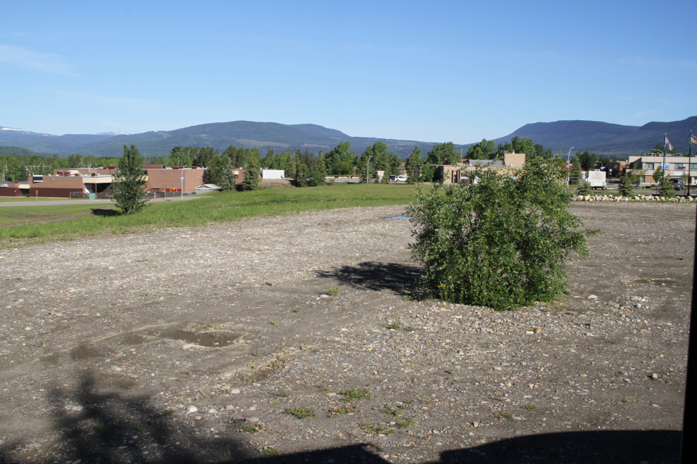
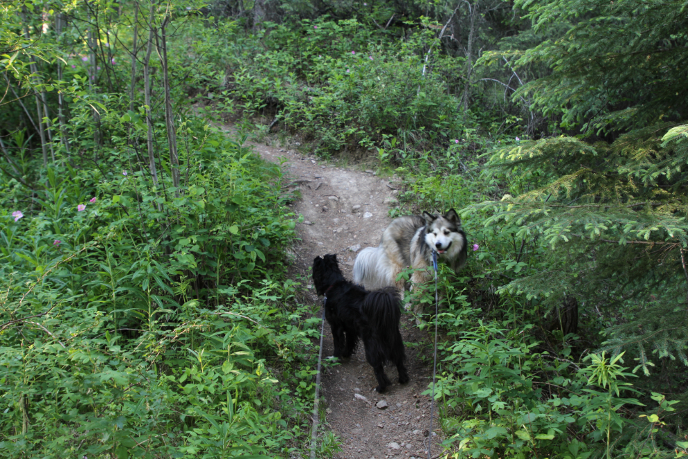
The first photo shows the view to the west from my motorhome, parked behind the visitor centre, at 09:10, as Collin and I were about to leave. It sure looked like we were in for a gorgeous day. Once again, Bella and Tucker would not be coming with us – the warm sun on bare rocks would be too much for Bella. Collin’s dog Jewel, though, got to come with us. I was really pleased to find that after hiking 11 km the previous day, I wasn’t stiff and sore once I got moving.
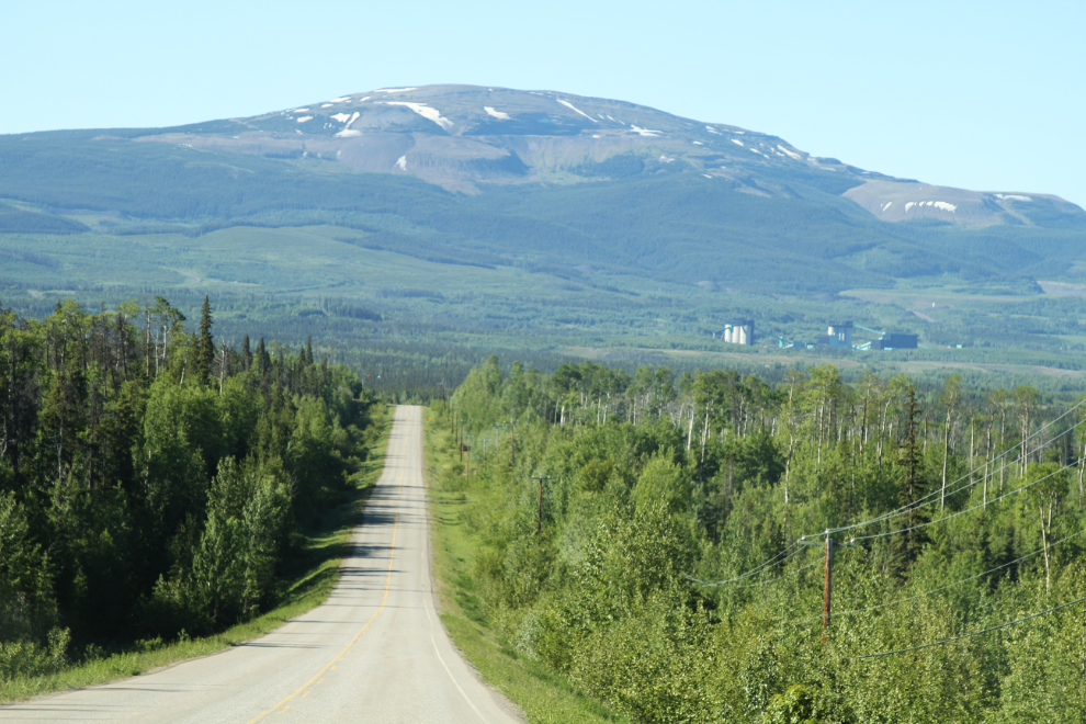
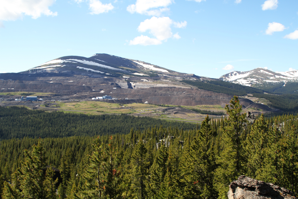
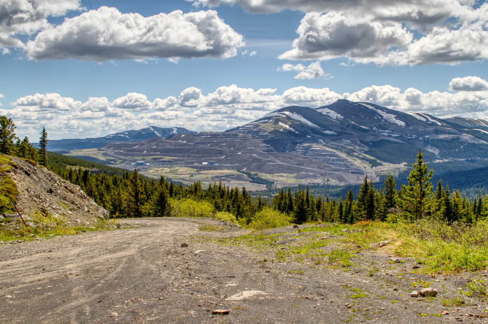
Driving south on Highway 52, the way I came into Tumbler Ridge. That’s the Quintette coal mine in the distance. It’s a steelmaking coal project, currently on “care and maintenance” so that it can be easily re-opened when conditions are favourable.
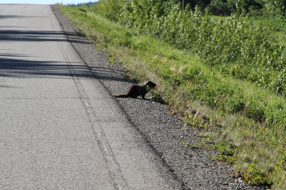
A marmot! What an odd place to find a marmot – they’re usually up in the alpine.
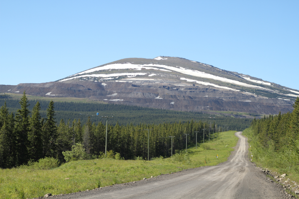
About 19 km from Tumbler Ridge, Collin turned onto the Core Lodge Road. A dozen km up that road, we came into sight of Peace River Coal’s Trend Mine, which isn’t currently operating either.
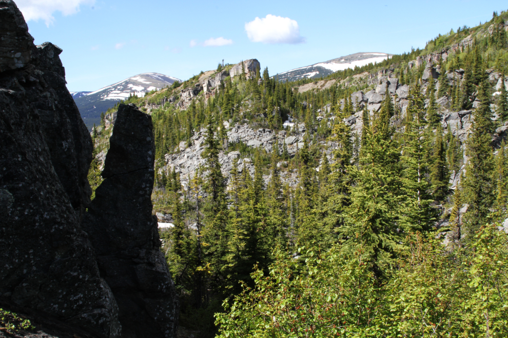
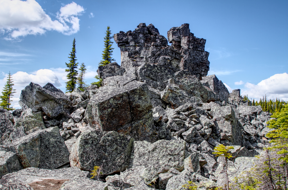
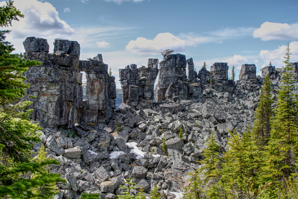
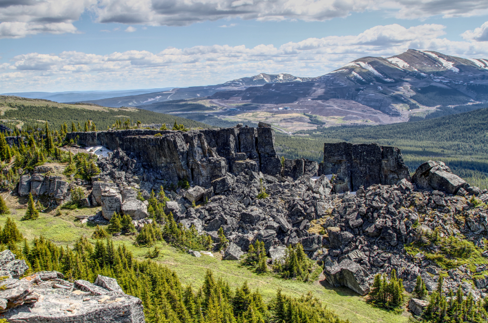
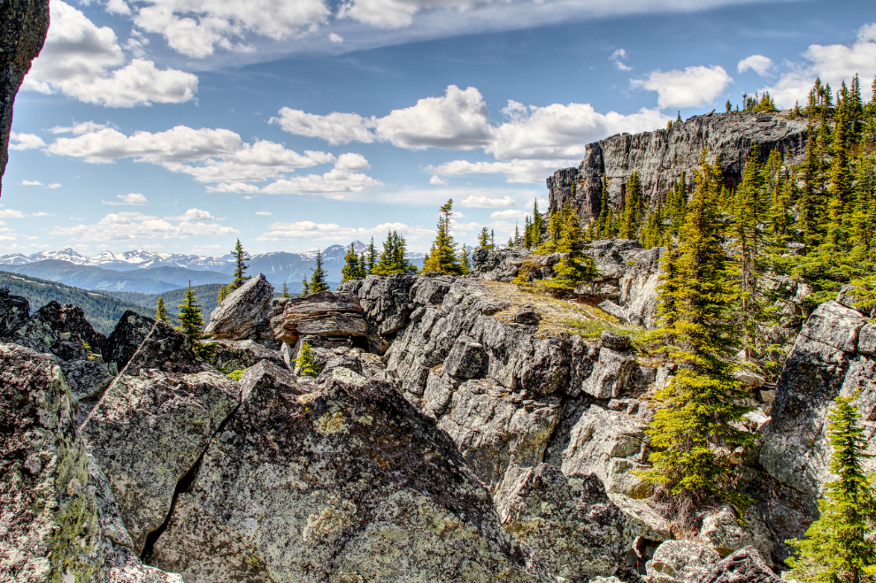
Across the valley from the Trend Mine, we began our hiking day at the Boulder Gardens, a large and complex jumble of sandstone rock formations on Mount Babcock. The altitude at the parking area is 1,457 meters (4,780 feet)
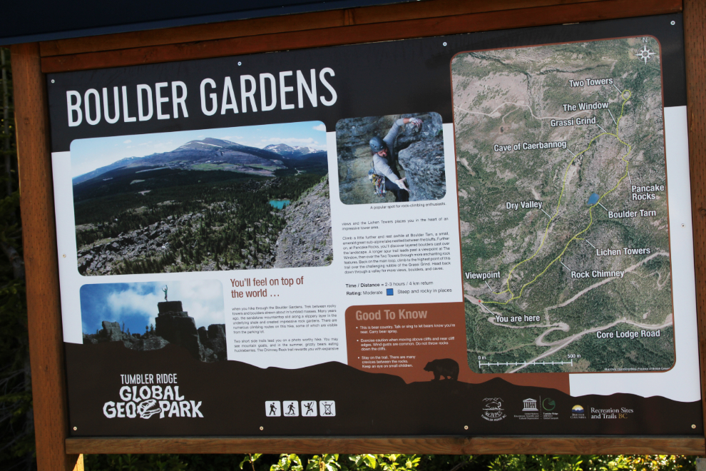
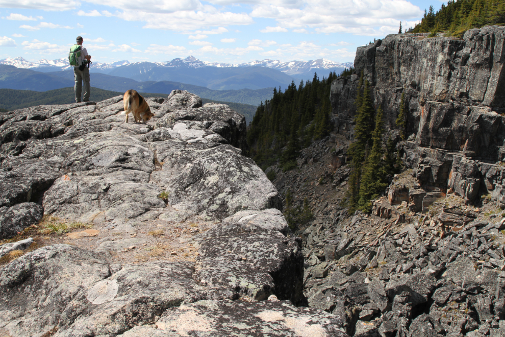
There is a Circular Route and 3 official side routes that total about 5 km in length. Many sections require a great deal of care to navigate.
Spring-fed Boulder Tarn would be a great place to cool off on a hot day, but just 20 minutes after starting the trail, I wasn’t into it yet.
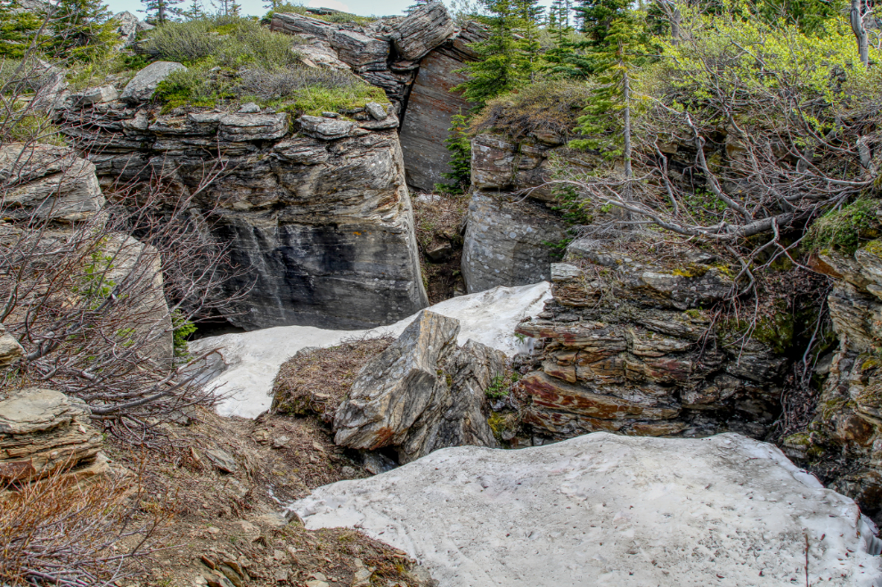
There were still some sizeable patches of snow, some of which the trail crossed. Despite the altitude and snow, the bugs were bad, even once we got up into the higher rocks.
The coal mine is visible to varying degrees from much of the Boulder Gardens and the Shipyard.
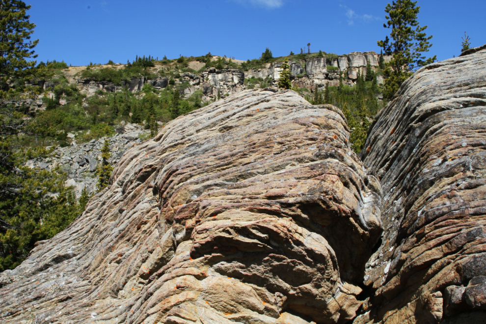
The large, layered Pancake Rocks, which cover a fairly small area of about 50 meters square, are a good indication of the variety of rocks in the Boulder Gardens.
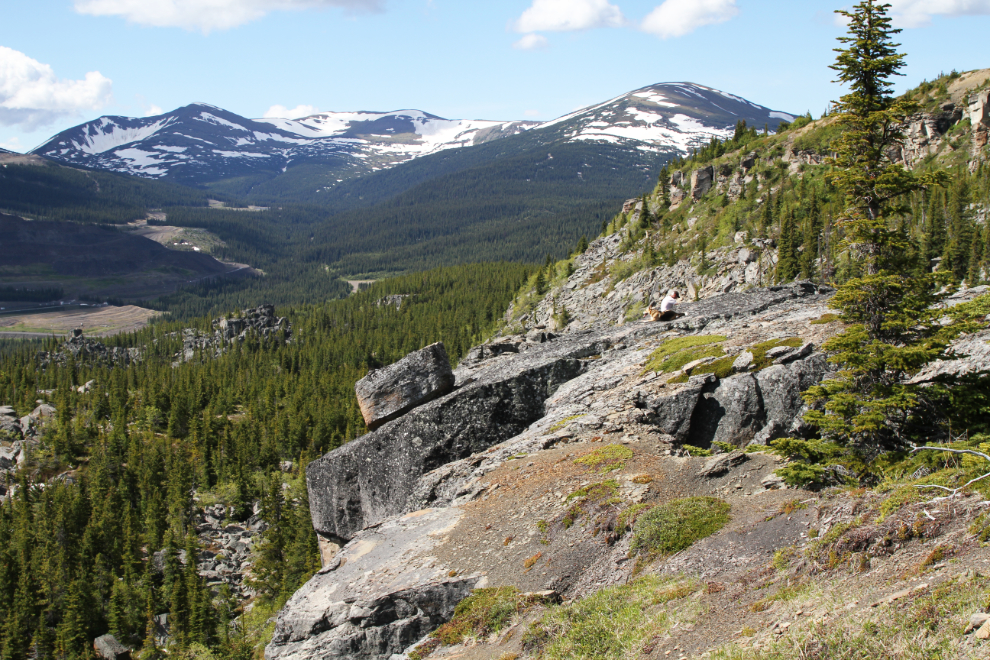
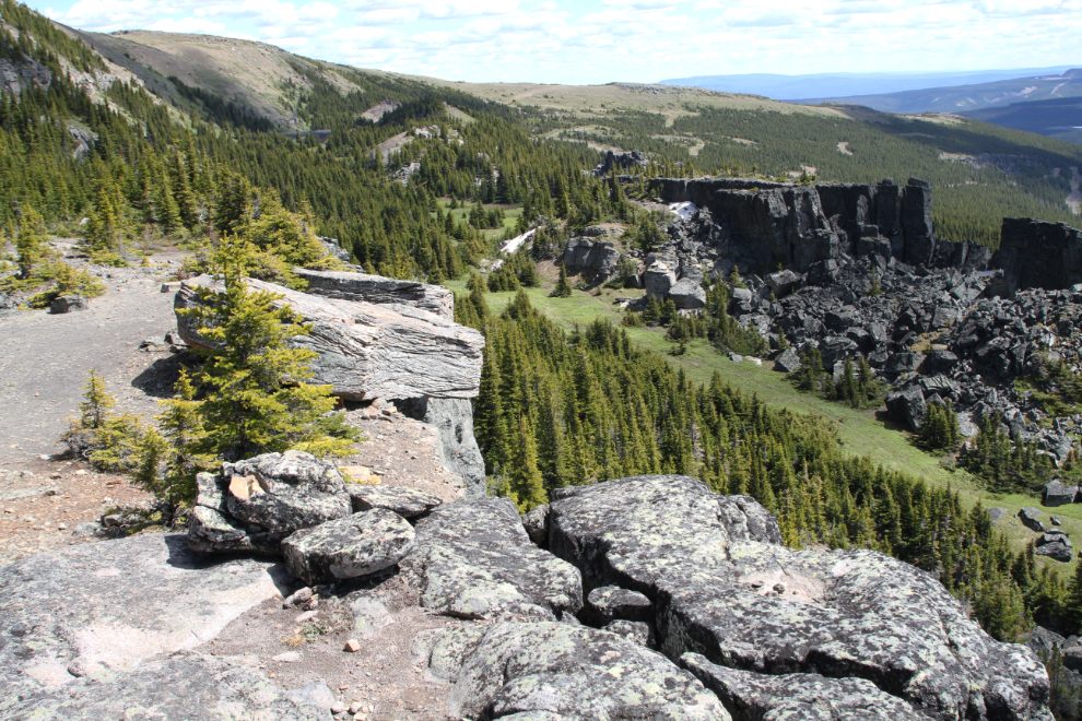
The view to the southwest from up around 1,525 meters (5,000 feet) elevation.
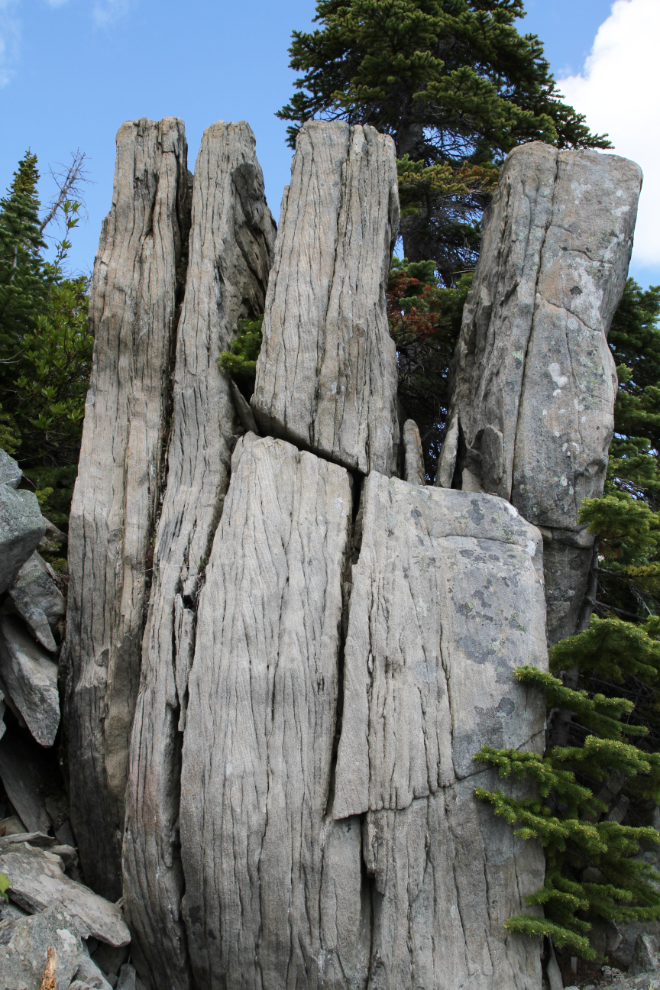
Over and over, I found myself wondering aloud how a certain rock was formed or why it sits where it does.
Tumbler Ridge must not get earthquakes! 🙂
How is that possible??
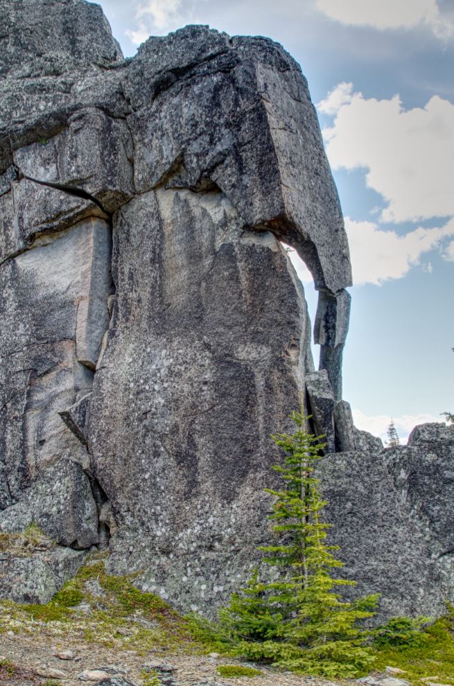
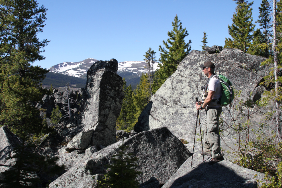
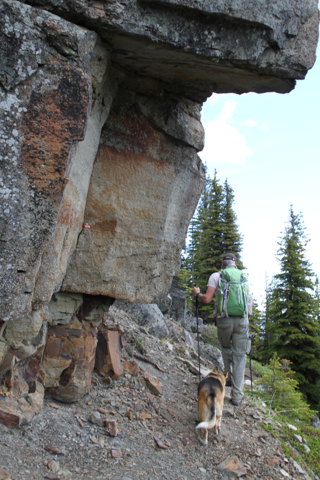
Getting a closer look or better camera angle for particularly strange rock formations often took me off the trails.
The formation called The Window is best seen from back quite a way.
The entrance to the Cave of Caerbannog still had about 7-8 feet of snow, so we didn’t get a look at it. In the film Monty Python and the Holy Grail, the Cave of Caerbannog is the home of the Legendary Black Beast of Arrrghhh (named for the last utterance of anyone who ever saw it). 🙂
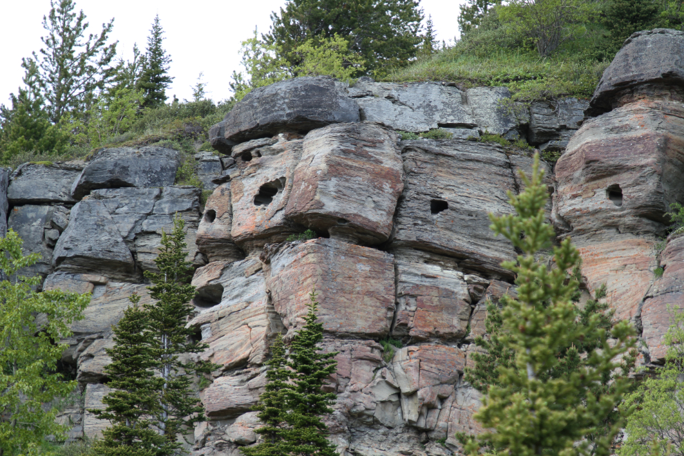
I’d like to have had a close look at the holes in the sandstone seen in the next photo but there were far above us and inaccessible.
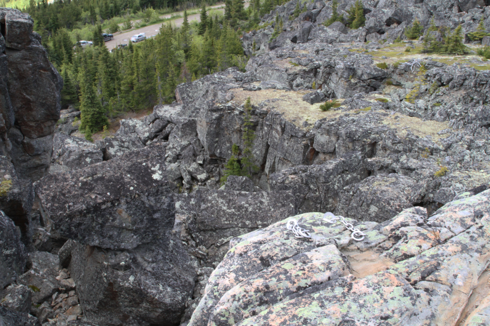
The Boulder Gardens are a popular rock climbing area, and there are more than 60 routes, many with bolted anchors as seen in the foreground of the next photo.
We spent 2 hours and 40 minutes in the Boulder Gardens (the brochures say to figure on 2-3 hours), then made the short drive to the Shipyard – Titanic area. The next view of the Trend coal mine was shot from the Shipyard parking area, which is at 1,617 meters (5,305 feet) elevation.
The Shipyard is one of the places that Collin spends a lot of time in all seasons, so he did little photography here.
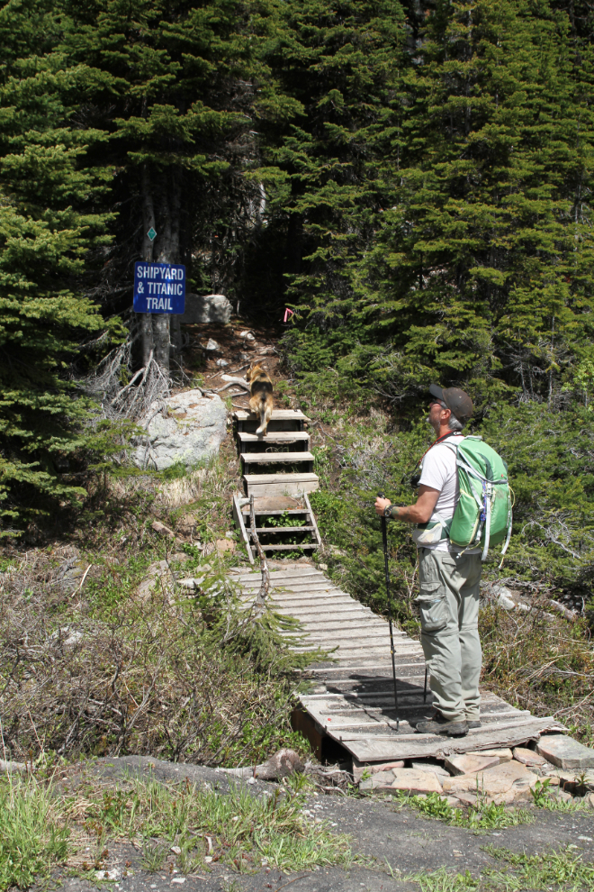
With some side routes, you’ll cover about 4 km to see the various parts of the Shipyard.
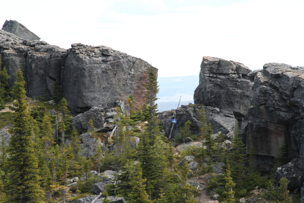
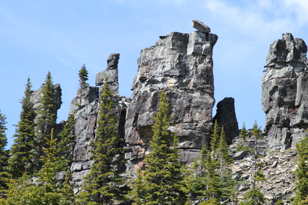
The next photo was our first good look at The Armada, or Armada Ridge, with it’s complex of stacked and balancing rocks.
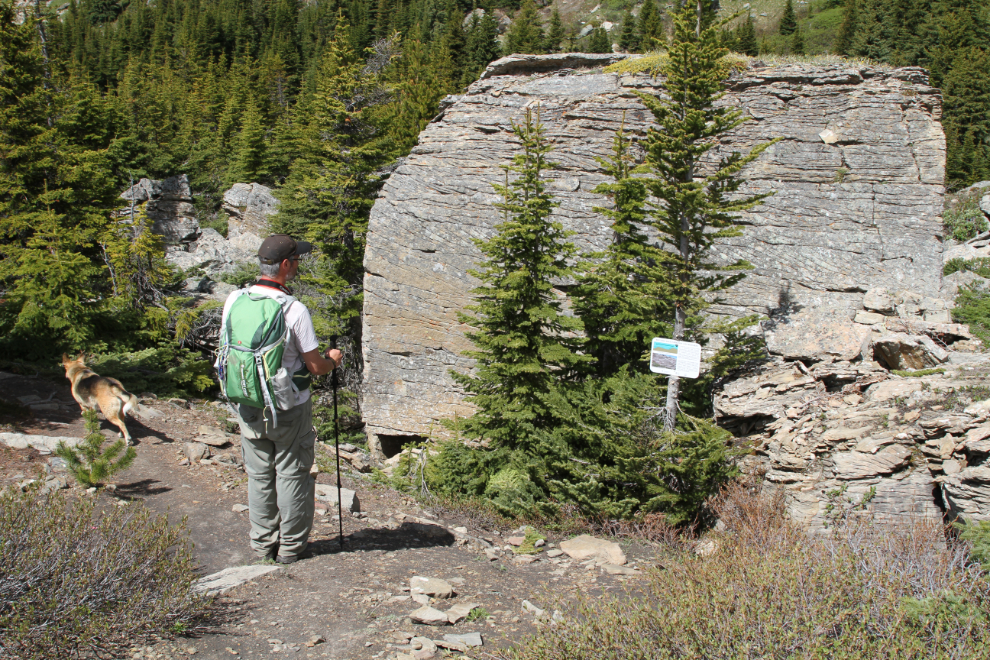
As with all the trails in the Tumbler Ridge Geopark, signage, both directional and interpretive, is very good. The sign that Collin is reading describes the Boulder Creek Formation of sandstone and siltstone, and the creation of cross beds, inclined layers formed by ripples of sand washing downstream some 100 million years ago.
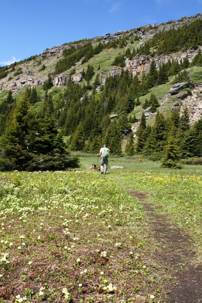
All of a sudden among the rocks and more than a mile in elevation, the trail crossed a large flower-filled meadow. What a treat! Jewel enjoyed a dip in the creek at the far end of it, too 🙂
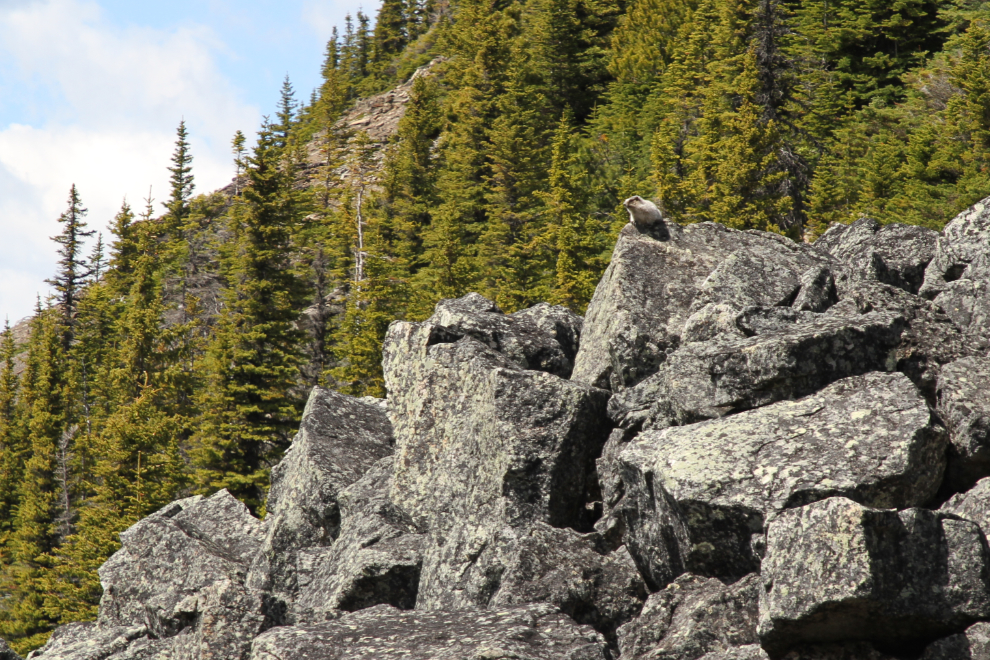
Here’s a marmot living in a more suitable habitat. He made it very clear that he wasn’t pleased with our presence, and even less pleased with Jewel.
The variety of terrain within the Shipyards/Titanic area is perhaps even more broad than at the Boulder Gardens.
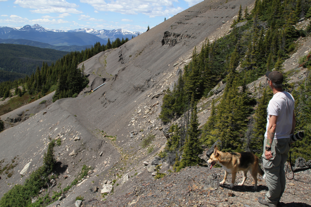
As well as the coal mine across the valley, coal, oil, and gas operations have left other scars right up to the Shipyard.
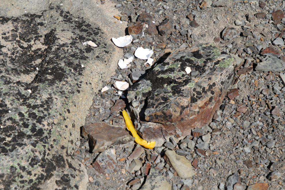
In an entire day of hiking, this was the only garbage I saw except for a couple of small pieces of paper that I put in my pocket. What in hell is wrong with the person that did this, in a place like this? It’s simple Respect to take everything back out with you.
Beyond the rock formation called The Bismarck, the Trend coal mine can be seen.
The high point of the hike, in the elevation sense, was the prow of The Titanic.
Looking back at The Bismarck from The Titanic.
Navigating beyond The Titanic would be a challenge!
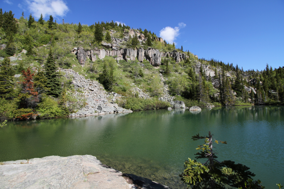
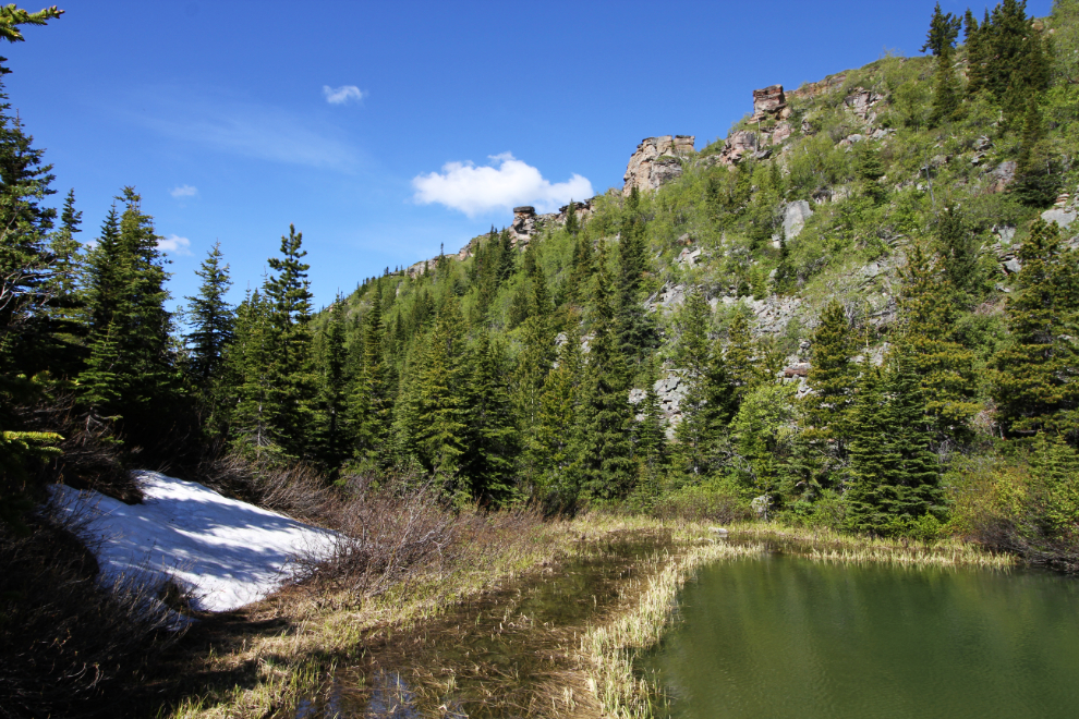
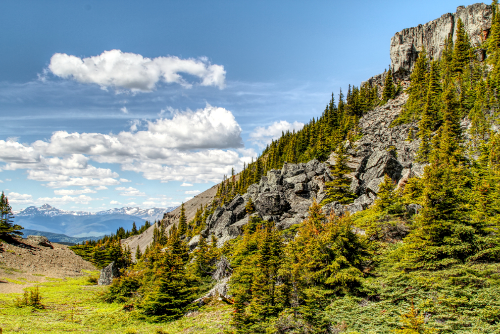
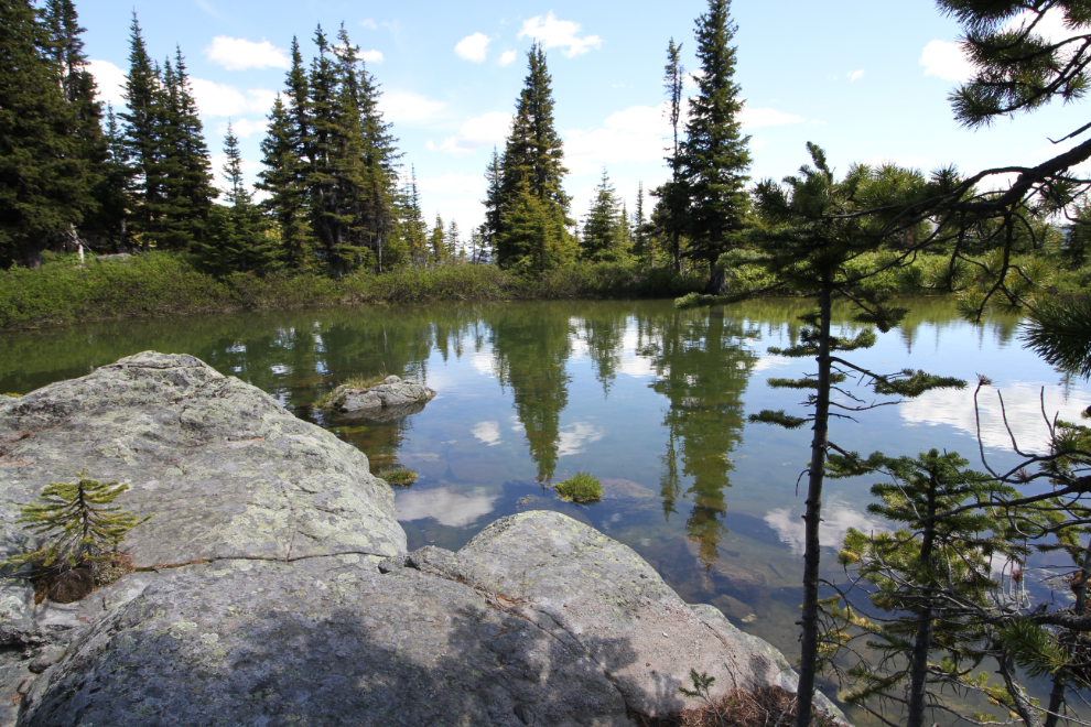
From back down near the parking area, we took a side trail, the Tarn and Towers Trail. It took us to some great views of Armada Ridge.
And this is the tarn on the Tarn and Towers Trail.
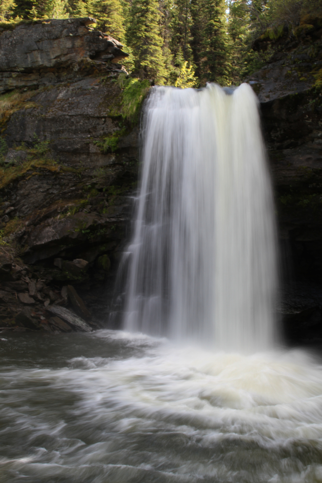
As at the Boulder Gardens, we spent 2 hours and 40 minutes in the Shipyard/Titanic area. With about 9 km under our belts at 3:40 pm, we were both game for more, and the 2.5-km route to/from nearby Babcock Falls looked like a good option.
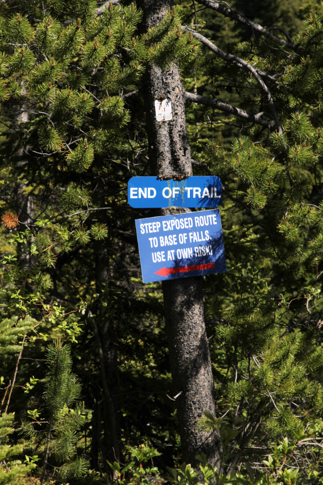
The official trail ends at the top of the waterfall, but a very steep trail with rope assists installed took us to the base of the falls.
We had been told that the pool at the base of Babcock Falls was suitable for taking a dip, but at the high water levels when we were there, it definitely isn’t. It would be far too easy to get sucked into the Babcock Creek outflow, and there would be no surviving that ride.
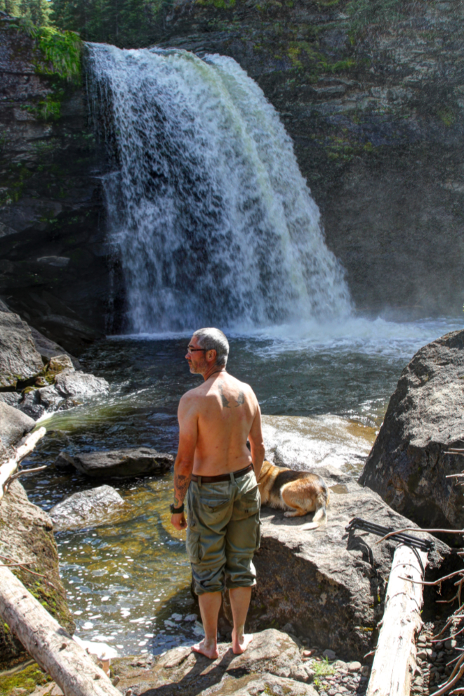
It was a wonderful place to just sit and enjoy the warm sun and cold mist, through.
Collin dropped me back off at the motorhome just before 6 pm, and now feeling really bad about having left Bella and Tucker for 2 rather long days in a row, I took them for a long hike down to Flatbed Falls. The trailhead was only about a kilometer from where I was parked, right at the edge of Tumbler Ridge.
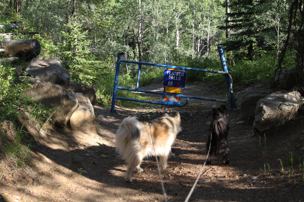
Flatbed Falls gave us a good opportunity to play in the water a bit, though a couple with a loose and annoying dog limited our options somewhat and we didn’t stay long.
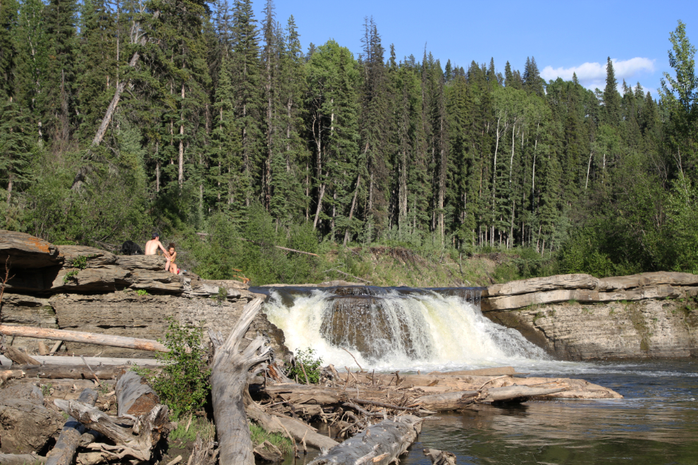
Bella and Tucker throughly enjoyed themselves, so I felt much better.
We had a calm night, and I got ready for another long hiking day – the longest yet – to Bergeron Falls the next day.