Exploring the mining history of the Greenwood area
We had a brief look at Greenwood when we arrived, but on Day 17 of the trip – Saturday, May 12th – I wanted to see a lot more of Greenwood and the area. In particular, I wanted to see the famous mountaintop mining area of Phoenix, where 4,000 people lived a century ago. I don’t know why I ever thought that a one-night stay at Greenwood might be enough 🙂
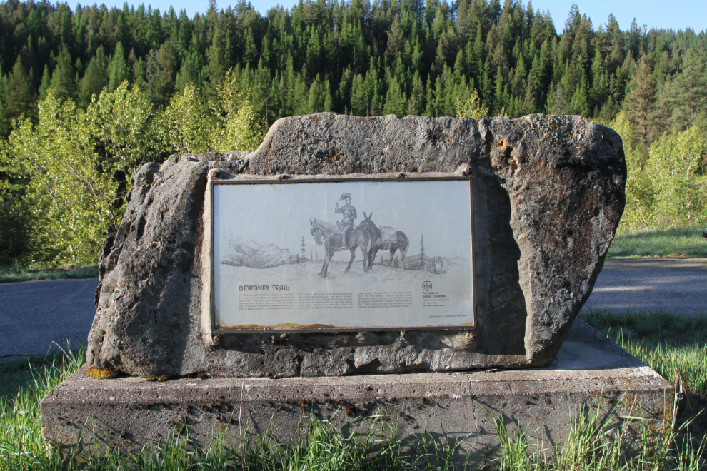
I was away from the motorhome at 07:00, leaving Cathy and the fur-kids to start the day in a more normal way. I wanted to start the day by finding Boundary Falls, which is marked on some maps, but isn’t signed, and is barely mentioned online.
Boundary Falls seemed to be somewhere close to a Stop of Interest pullout with interpretive panels about the Dewdney Trail and the Boundary Falls Smelter.
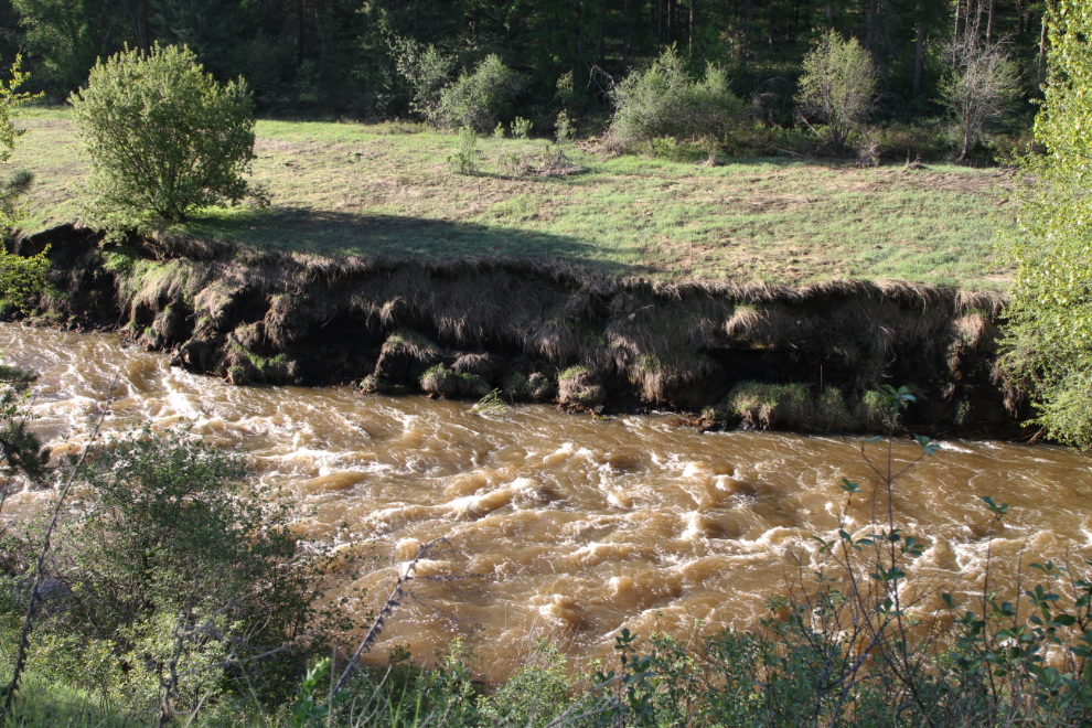
This is what Boundary Creek looked like below the pullout. The flood stage is doing a lot of damage, but I could see no hint of a waterfall either upstream or down.
I continued west on Highway 3, past the Boundary Falls Ranch, and was soon at the town of Midway, where there was a museum, the Kettle River Museum, which I also wanted to see. It was, of course, closed, but I had a look around the property.
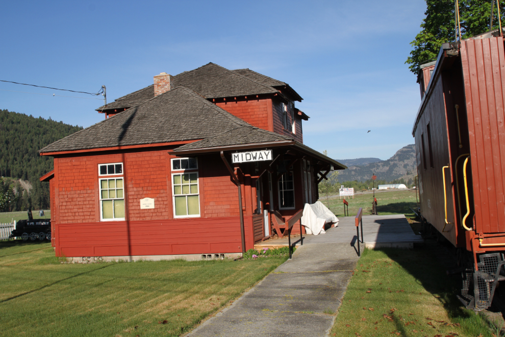
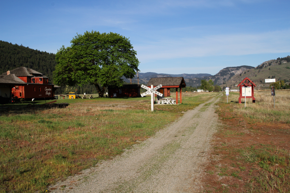
Much of the Kettle Valley Railroad (KVR) grade is now a cycling trail, and it seems to be a big deal in Midway.
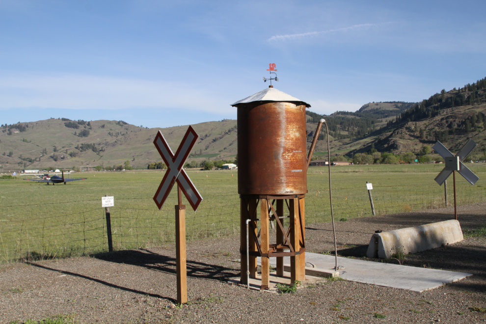
Poking around Midway, I found the most unique RV dump I’ve ever seen, by the little grass-strip airport.
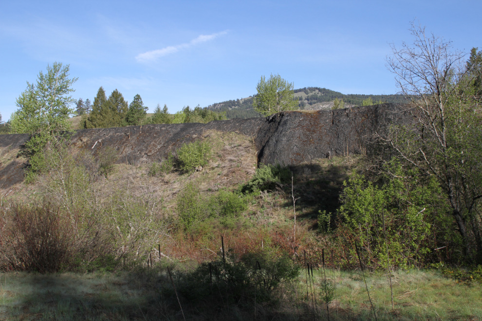
On the drive back to the Boundary Creek Provincial Park campground, I stopped for a look at the small slag pile from the Boundary Falls Smelter, which only operated from 1902 until 1907.
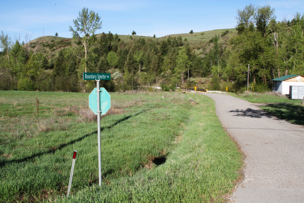
I couldn’t resist seeing what was up Boundary Smelter Road. Nothing – it dead-ends at private property in half a kilometer or so.
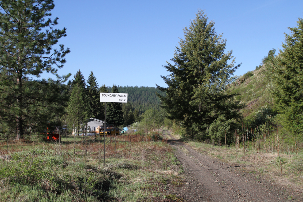
This point on the KVR cycling trail is called Boundary Falls (the community at the smelter was also called Boundary Falls), but there’s no clue as to where the falls might be.
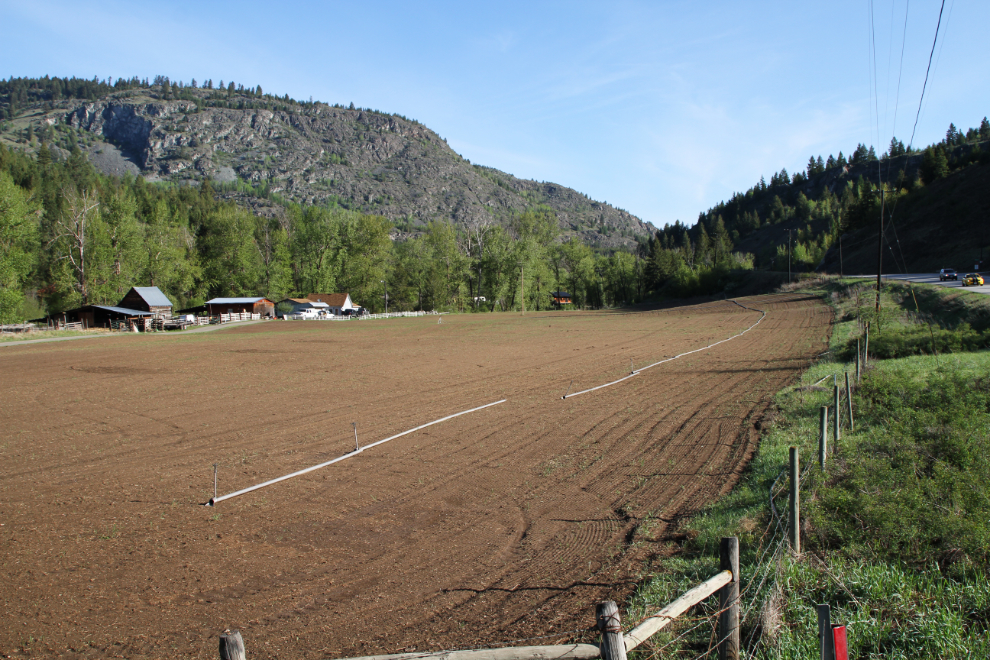
The farm at the intersection of the Boundary Smelter Road and Highway 3 looked wonderful in the morning light.
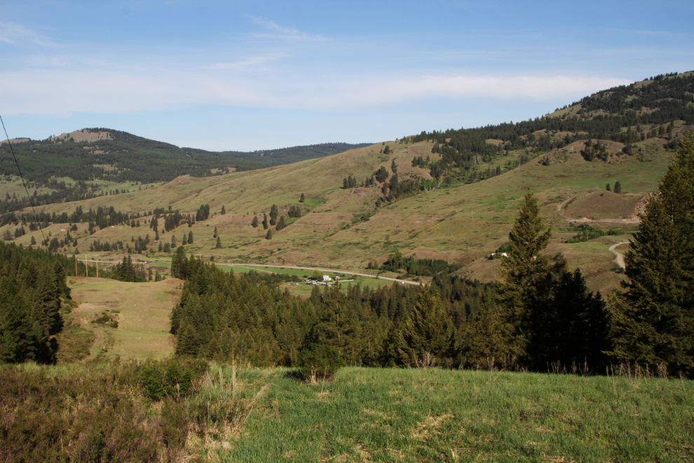
One of the maps hinted that Boundary Falls might be up a side road, so I headed up a logging road. It offered some great views of the valley, but after about 4 km I turned around.
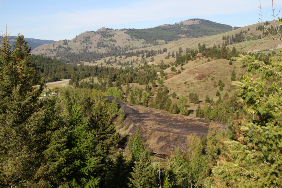
One of the views was of the Boundary Falls Smelter slag pile.
I went back to the motorhome, fed the dogs and then headed back out with them. By 08:45 I was back in Greenwood, where the light was perfect to get some photos of the Welcome to Greenwood interpretive area.
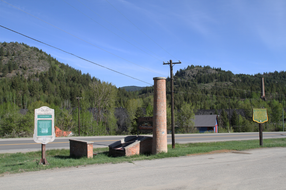
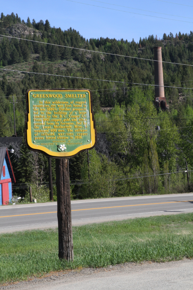
This heritage marker is about the Greenwood Smelter:
In this wilderness of rugged mountains, ore was first found in the late 1880s. Further prospects led to the building of a large smelter by the B.C. Copper Co. From 1901, copper, gold, and silver poured from its furnaces. Fed by the great Motherlode Mine, it employed 400 men. The collapse of inflated war-time copper prices forced closure in 1918.
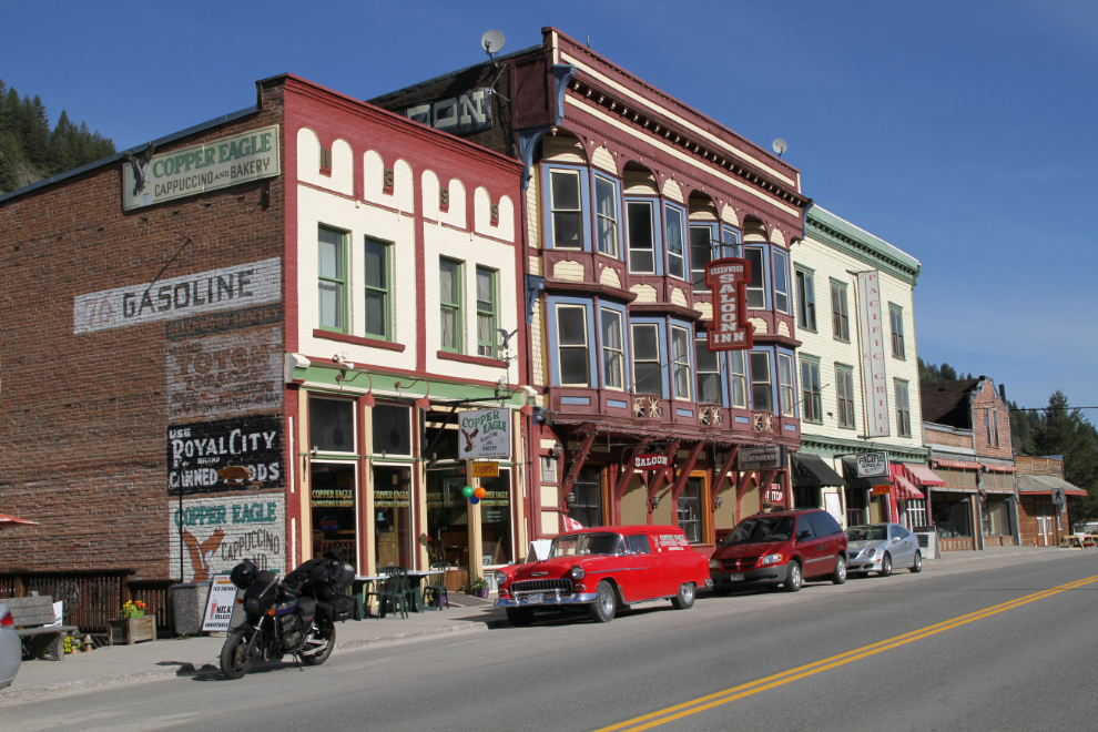
What photographer could resist a photo of the Greenwood Inn and the highly-rated Copper Eagle Cappuccino and Bakery when the bakery’s ’55 Chevy is out front?
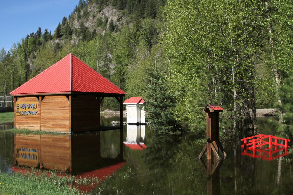
The flooding in downtown Greenwood is pretty bad. The Nikkei Legacy Park is completely inundated. The park was created to honour the Japanese-Canadians from coastal BC who had all of their assets seized and were sent to Greenwood and other internment camps during World War II. About 1,200 were sent to Greenwood.
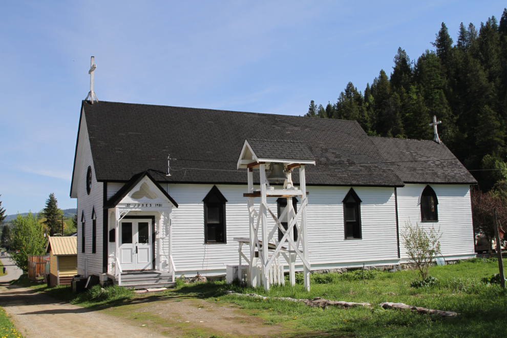
This is St. Jude’s Anglican Church.
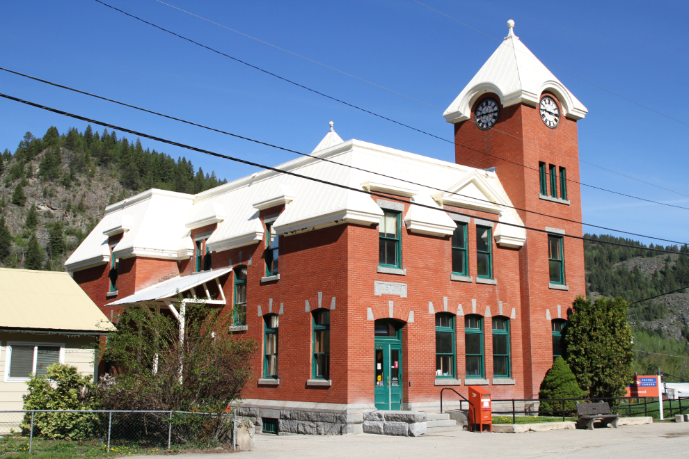
The federal government building, now the post office, is the most imposing of the brick buildings in Greenwood.
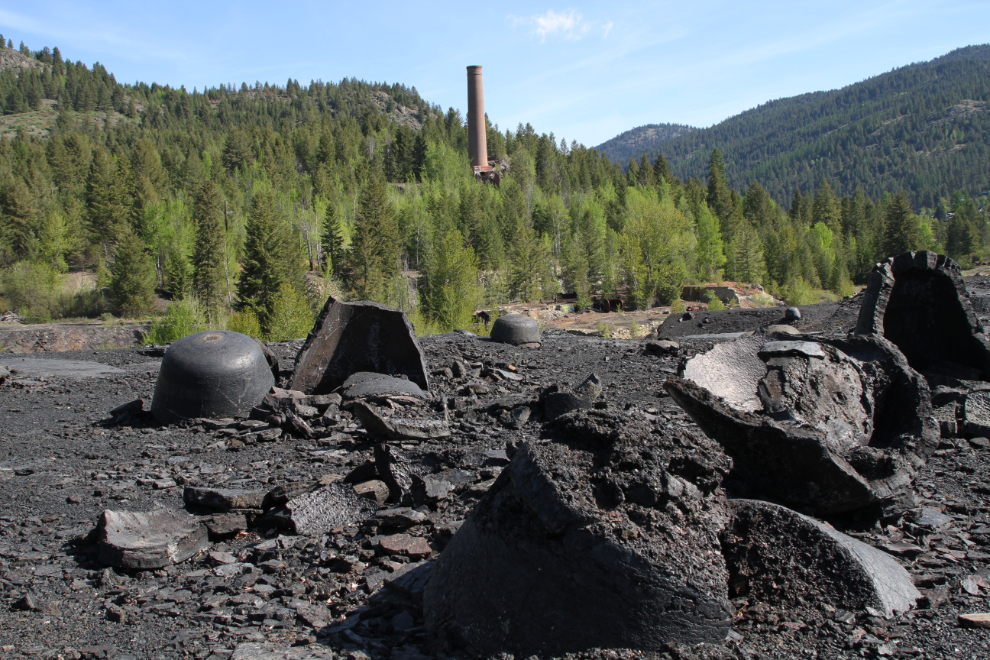
By going back to the vistor centre and studying the map out front, I was able to find the smelter park. It was named the Lotzkar Memorial Park after Leon Lotzkar, who bought the smelter after it closed, sold the equipment, and then donated the land to the city. There are no signs pointing the way to the park, and even at the gate, it’s not clear that visitors are welcome.
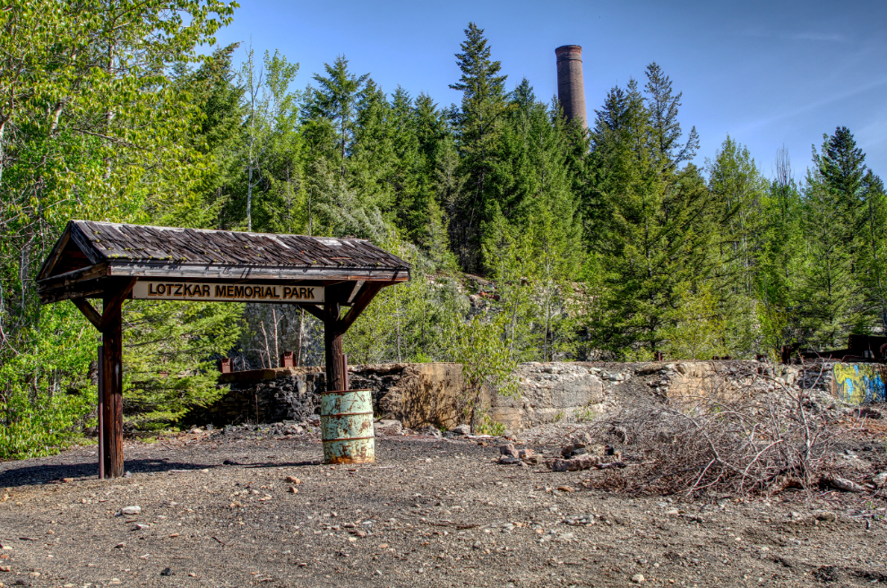
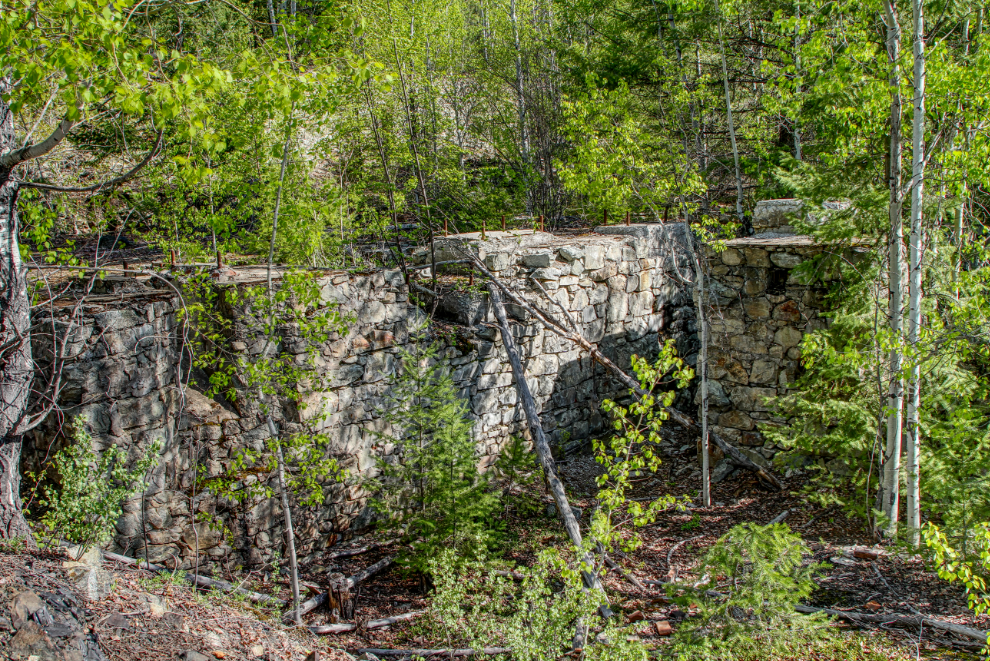
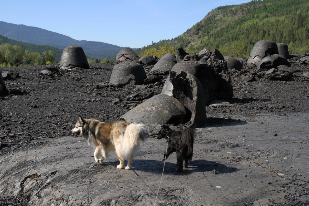
This must have been a very impressive operation – the ruins are massive. The smelter had its own community, called Anaconda.
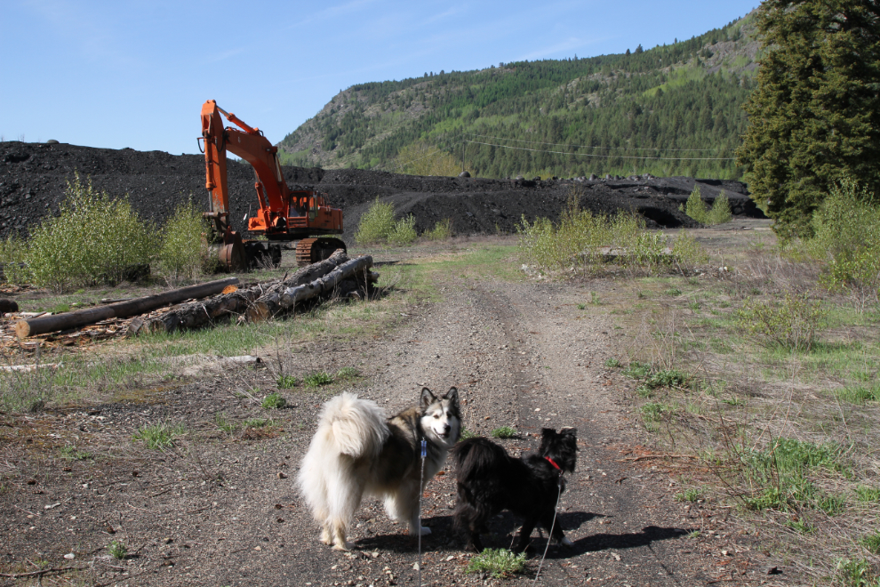
Bella and Tucker finally got to go for a little adventure at the smelter park.
There are some very sharp shards on the slag pile, so we didn’t walk very far on it, but you can see how large the “hell’s bells” are. The molten residue from the furnaces was brought out here in bell-shaped rail cars, and some cooled enough to maintain that shape. When the smelter was operating, the slag pile glowed red at night because it was still so hot.
I cut our visit short so haven’t been up to the chimney yet. When it was built in 1904, it was the tallest in the province at 36 meters. It took 250,000 bricks to build it.
Returning to the motorhome, Cathy and I had breakfast and got ready for a big day of exploring. We were at the visitor centre just after it opened at 10:00 and got directions to the road to Phoenix (which isn’t signed), and to Boundary Falls (though those directions were vague and confusing).
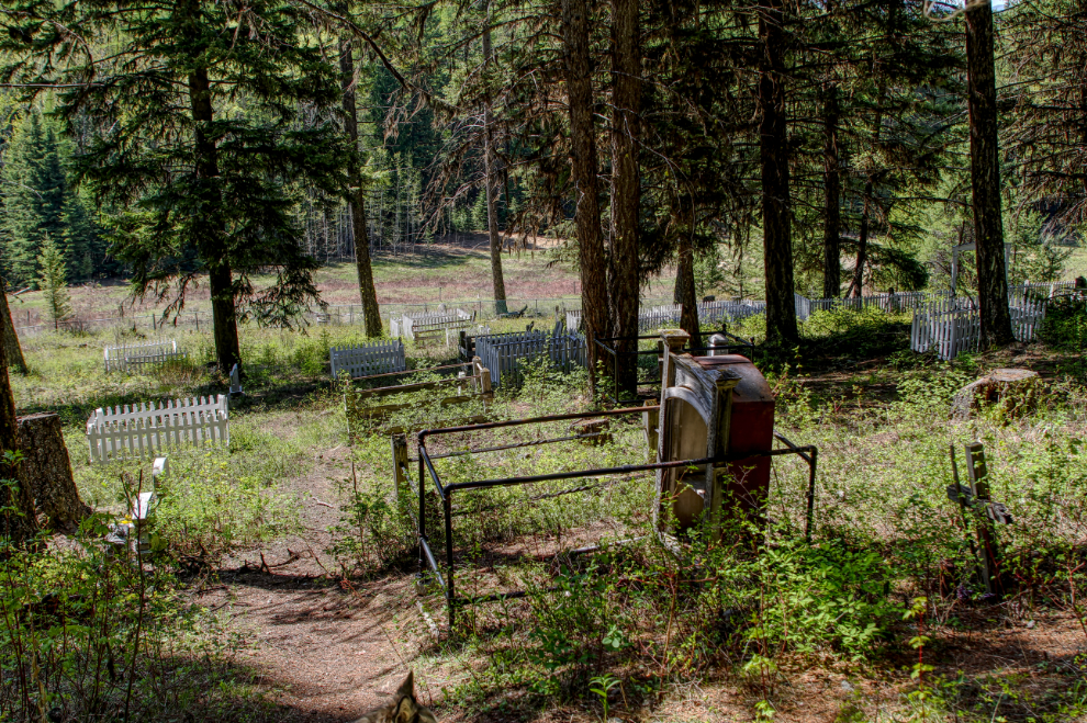
An 8-page handout gives 14 points of interest along the Phoenix road, which is about 22 km long from Greenwood to its eastern junction with Highway 3 north of Grand Forks. The first one we stopped at was the Phoenix Cemetery, which was open from 1901 until 1919. The next photo shows the cemetery looking down from the road. Findagrave lists 201 burials here, with the first in January 1902.
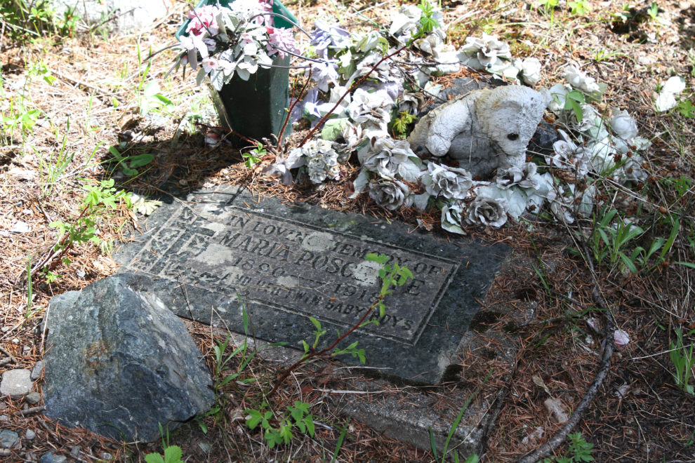
The first grave we came to was for 28-year old Maria Poscente and her twin boys, who died in 1918. That was a sad start to this look at Phoenix.
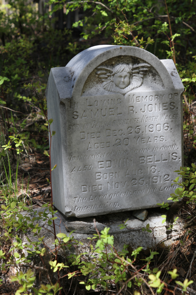
Headstones sometimes hint at interesting stories. Why does this one have the names of 20-year-old Samuel B. Jones who died in 1906 and 3-month-old Edwin Bellis who died in 1912? Jones died after one of his legs which had developed gangrene was amputated following a mine accident.
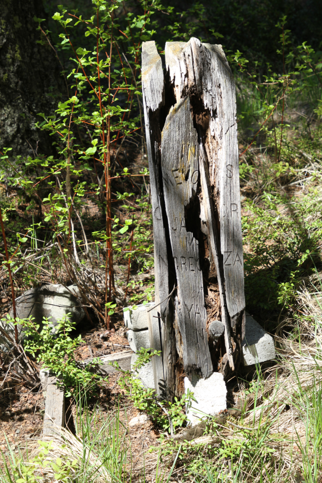
Most of the 40 or so graves that are marked have marble headstones. This is one of the very few wooden markers remaining, and it’s not legible.
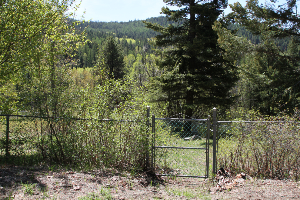
I was very surprised to find a second cemetery just a few meters from the first. Only 4 graves are marked in this fenced area – 2 from the period when the first cemetery was in operation, one from 1948 and one from 1951.
About 300 meters past the cemetery is a large field with the ruins of a building. The road guide says that this was a farm that supplied eggs, milk, and vegetables to Phoenix.
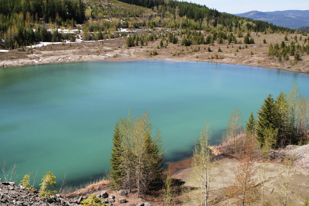
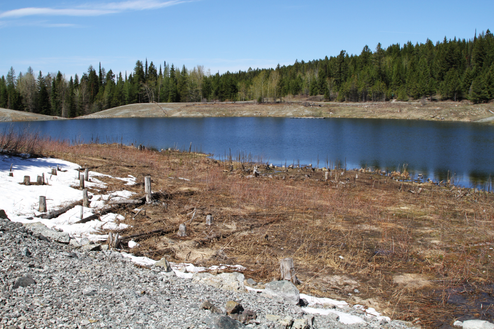
In the distance to the right in the next photo is a massive wall of rock. It’s a dam built in the 1950s to contain a tailings pond.
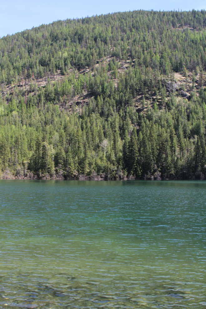
This lovely lake covers part of the 1950s tailings pond.
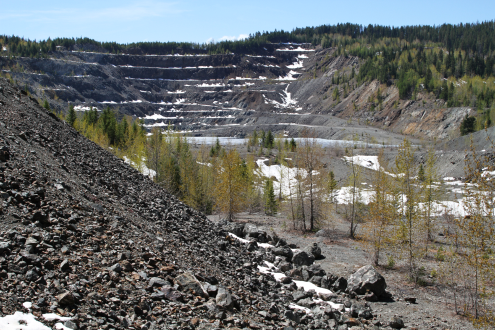
This is where the community of Phoenix was located. It was completely swallowed by this open-pit mine. Once referred to as “The Mile High City”, the elevation of Phoenix was actually 1,450 meters (4,757 feet).
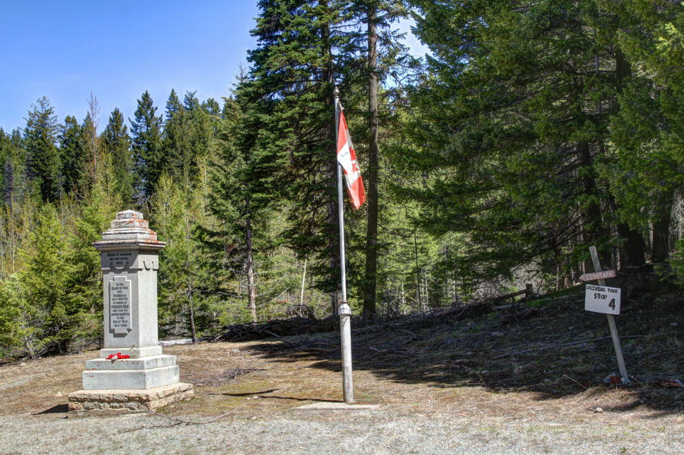
The only things that remains from Phoenix other than the cemetery is this cenotaph. It lists the names of 15 men from Phoenix who were killed in World War I. For us, this was a nice place to have the lunch we’d brought.
We made a detour to Marshall Lake, which was created for use by the 1950s Phoenix mine. The dam was reduced in size in 2012 due to concerns about its possible failure. The area now has 17 km of cross-country ski trails.
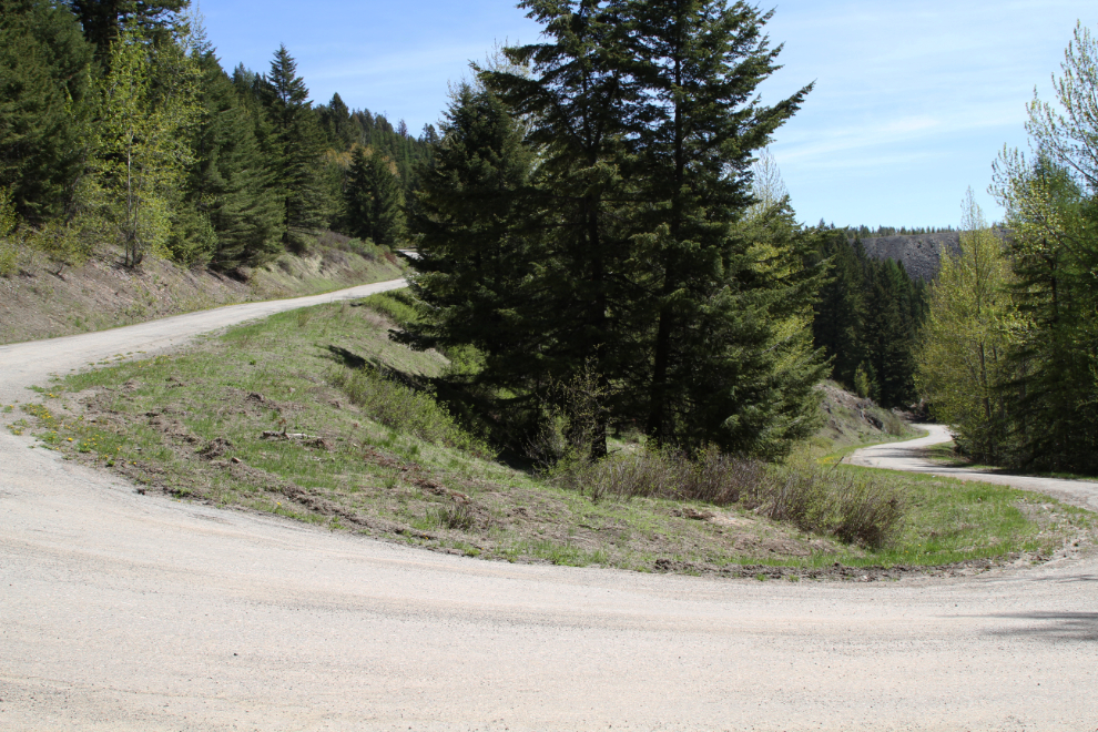
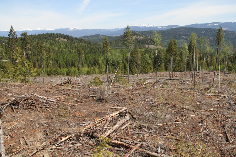
There are a few logging cuts as the road descends towards Highway 3 north of Grand Forks. On a side road just above this cut is the Phoenix Ski Hill, built in 1969 on and donated by Granby Mining.
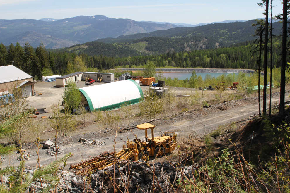
Testing of the tailings seen in the next photo, from 1959-1962, indicated that enough gold, silver, and copper was missed by the original processing methods to make re-processing them viable, and that’s now being done.
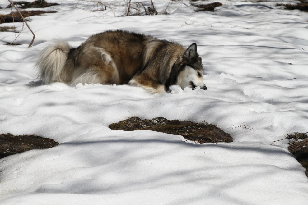
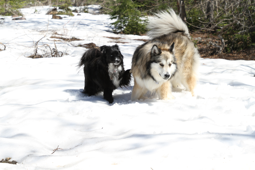
Making a circle drive for part of the drive back to Greenwood, we came to an area with enough snow to let Bella and Tucker out for a play. It had gotten very warm, perhaps 25°C (77°F).
Once we got back to Greenwood, we headed a few miles north to our final destination, Jewel Lake Provincial Park. The park was still closed, and a lot of trees that had come down over the winter needed to be cleared from the roadways.
There’s a very small beach at the day-use area, but we didn’t walk that far. The small-boat launch provided enough access to the water to allow Bella and Tucker to play in it for a bit, fetching a ball and sticks. I was in the water playing with them for a few minutes, but only up to my knees – the water was very cold.
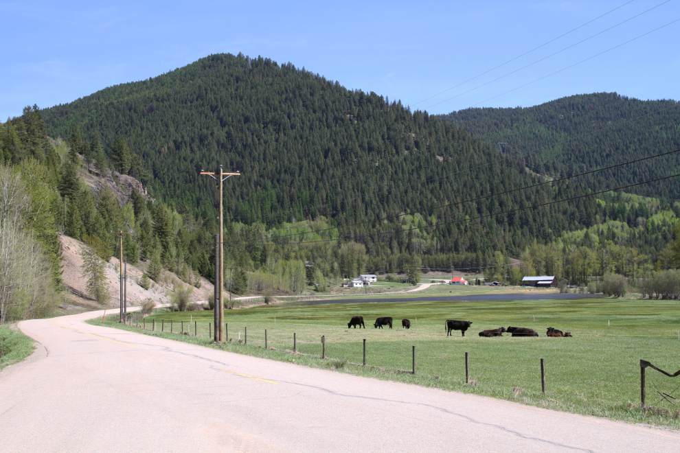
The next photo was shot along the road back to Highway 3. Before going back to the motorhome, I made one more short search for Boundary Falls, to no avail. By 3:00 pm, we were back at Boundary Creek campground, me suntanning and the others relaxing in the shade overlooking the creek.
Just after 7:00 pm, I saw the park operator doing some work on an adjacent campsite, and decided to give Boundary Falls another try. Dan was able to give me detailed instructions on how to find them, also warning me about very dangerous cliffs there. Though it would soon be dark, I immediately headed out.
Just west of the Dewdney Trail Stop of Interest, I saw the canyon Dan mentioned, and close to it, this very old road that he described. Finally, some progress! 🙂
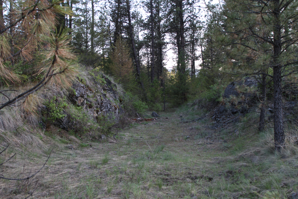
The old road and then possible pack trails led me into the Boundary Creek canyon, but though I walked down it quite a way, I couldn’t find the waterfall that I’d seen historic and current photos of.
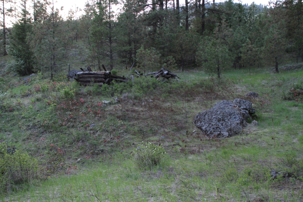
Was this log cabin connected to the Boundary Falls power operation, or to the Boundary Falls Ranch? It wasn’t clear.
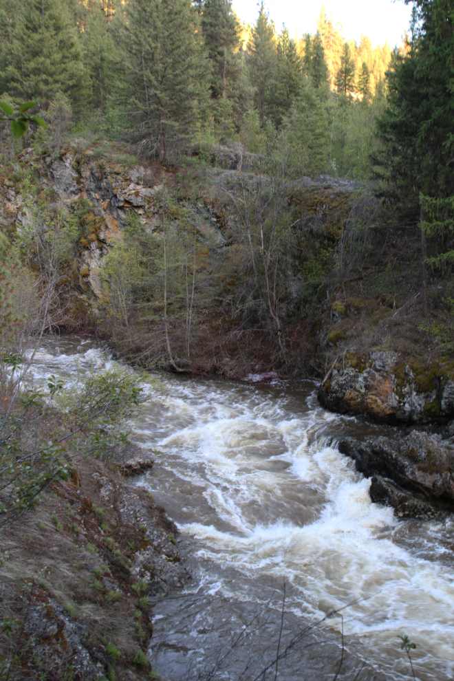
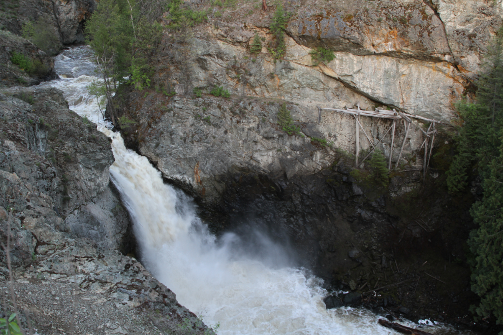
With darkness setting in, I made a fast hike up the canyon, and a couple of minutes after 8:00 pm, I came to Boundary Falls. Not only is the waterfall itself worth seeing, the ruins of the dam and power plant add great historical interest.
I had a quick look at the site, then headed back towards the highway on the shortest route. I soon came to an old road, and it led me right to the west end of the Dewdney Trail Stop of Interest site. For a future trip, I now have a short and easy way to reach the falls. The explanation is very simple – walk down the road at the west end of the Dewdney Trail Stop of Interest site for about 10 minutes, then follow the sound of the waterfall for another couple of minutes.
Well satisfied with our two days and nights at Greenwood, I was content now to continue on to Nelson the ext day.