Day 16 – Into the Kootenays, to historic Greenwood
After delaying our departure from Penticton by a day so we could tour more wineries, I was content to head south and east into the Kootenays on Day 16 of the trip – Friday, May 11th. The destination was probably Greenwood, only 140 km away. The abandoned mines and ghost towns high above might make it a 2-night stay, depending on what water and snow conditions we found.
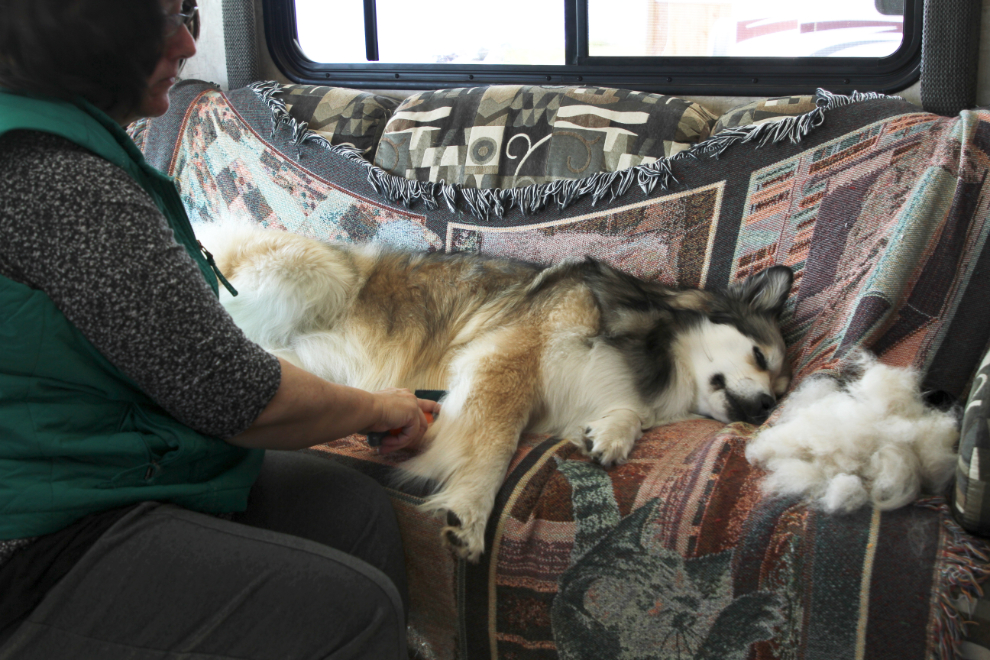
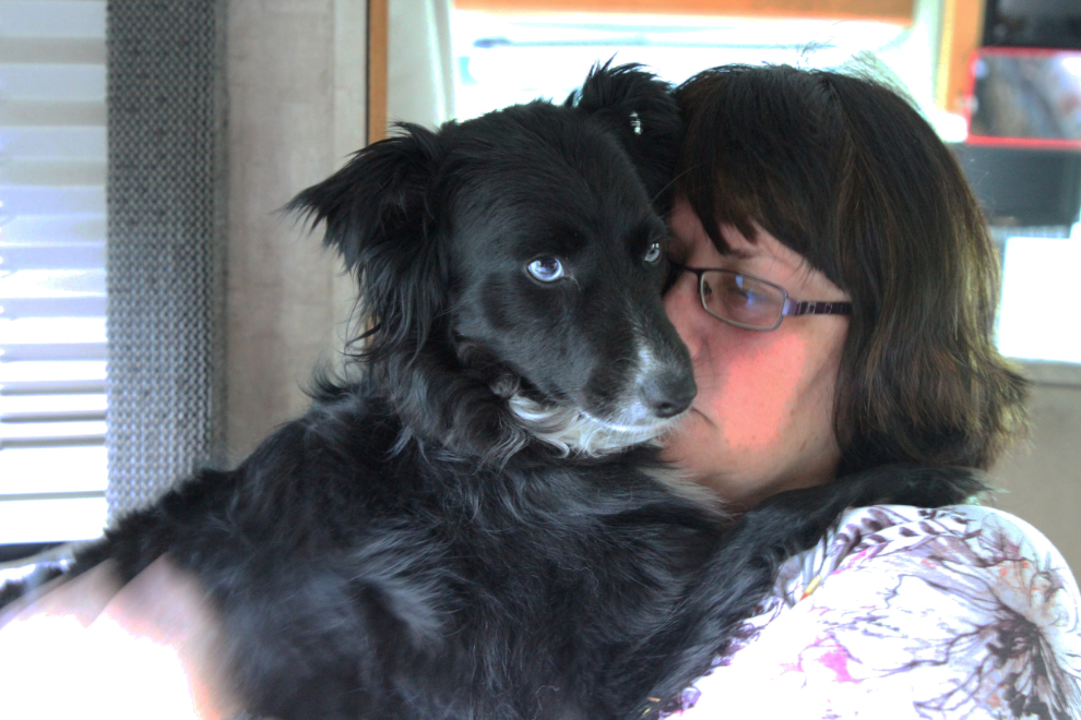
Friday morning was grooming time for Bella, who takes to it like a spa day. She just melts, lifting a leg or rolling over when appropriate. Although Cathy soon had enough hair to knit another dog, Bella still has most of her winter coat and the hot weather ahead will be really uncomfortable for her. We’ll be watching for good swimming lakes to help with that.
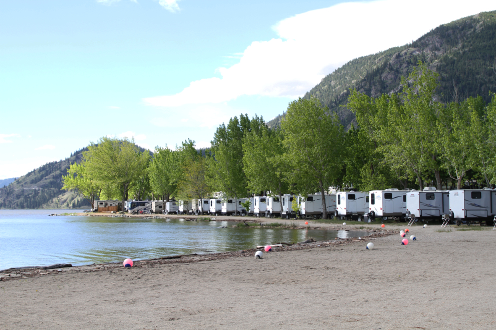
Before leaving Wright’s Beach Camp on Skaha Lake, I walked around getting a few more photos. Our motorhome is near the end of the line of trailers in the next photo. Almost all of the trailers were unoccupied. We would definitely come back here off-season, but I’m willing to bet that it’s way too busy for us in the summer.
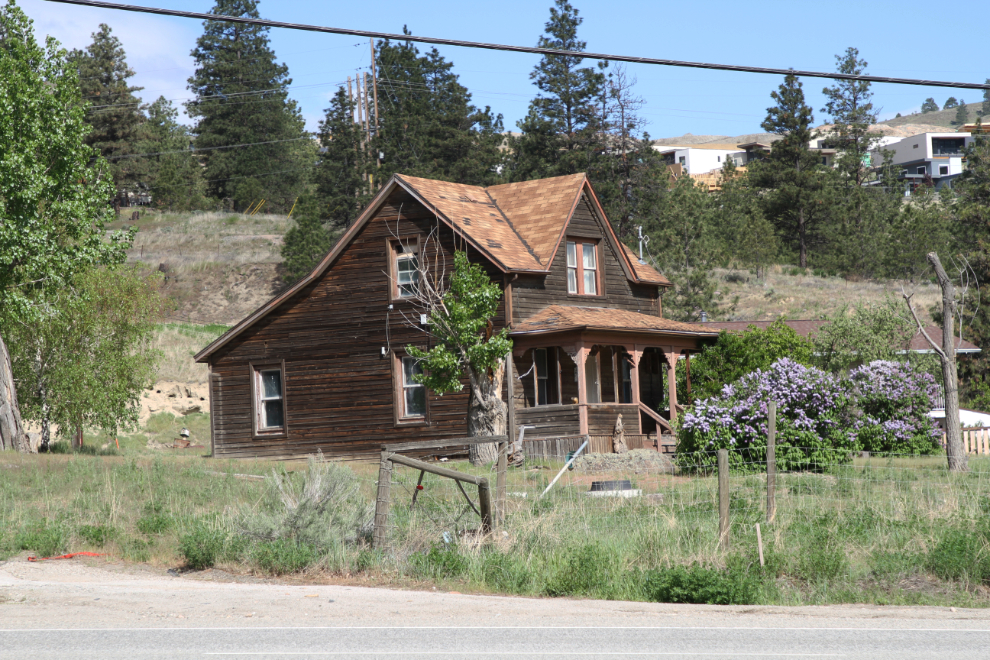
Right across highway 97 from the campground is this lovely farmhouse dating to about 1910-1915.
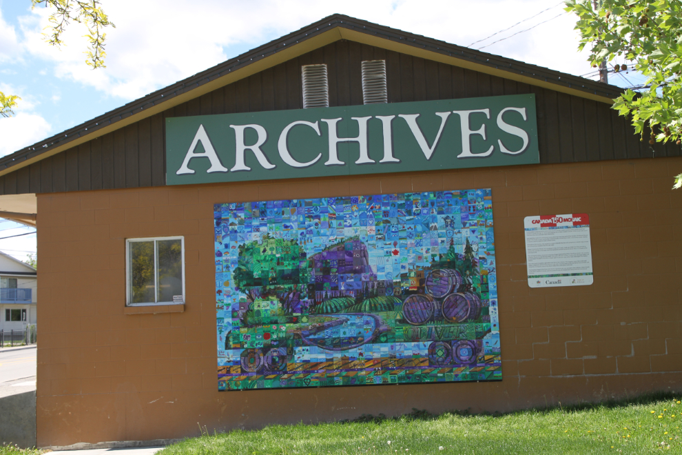
I stopped for a big load of fuel at Kaleden ($331 worth at $1.409/liter), then our next stop was at the Oliver Archives. Here, I donated some documents from the historic Haynes Ranch that Dad had collected from the abandoned ranch house in 1966 or ’67. He just took a sampling of about 25 documents from the many hundreds lying scattered around the house. Together, they now give a very interesting look at the ranch and the family. I was with Dad at the ranch, but when he started going through the papers one by one, I went for a drive 🙂
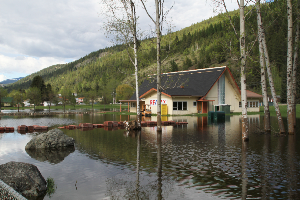
We had heard about flooding and evacuations in the Osoyoos area, and although it didn’t impact the highway, we could see on side streets and along the lakes that the flooding is serious for thousands of people and dozens of businesses – lakeshore hotels and motels in particular.
There were several other places along the route that were hard hit by flooding, with the community of Rock Creek being particularly bad. The highway was sand-bagged or bermed in a few places, but only one spot had a bit of water from an overflowing creek going across the highway.
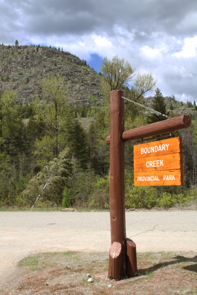
At about 1:30, we arrived at the 17-site Boundary Creek Provincial Park campground, just 4 km from Greenwood.
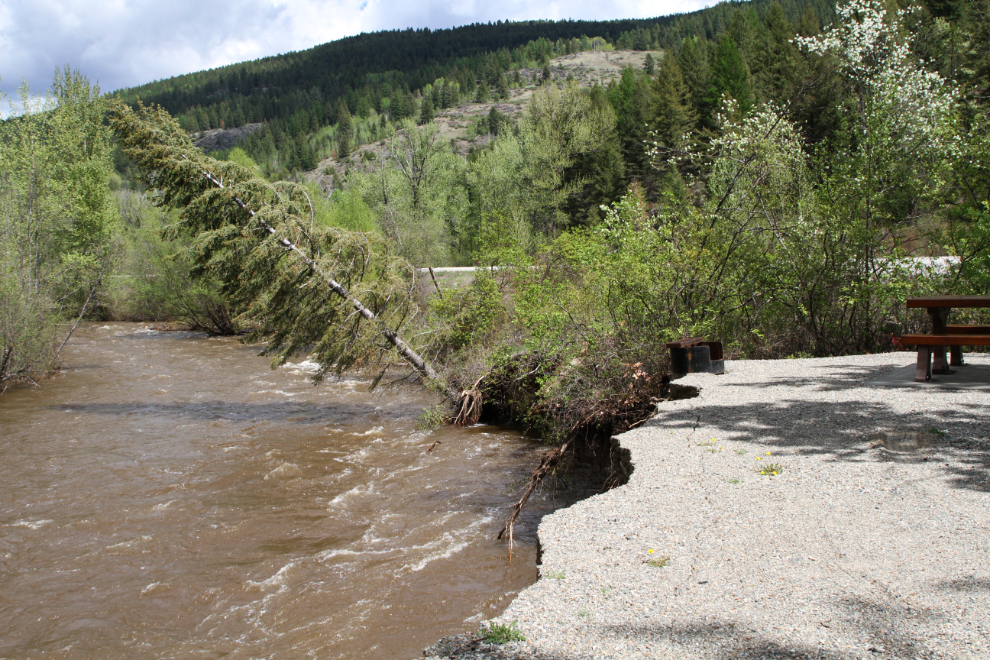
The campground actually only has 16 sites now, as much of site #1 has been washed away in the past few days. The firepit is about to drop 6 feet into Boundary Creek.
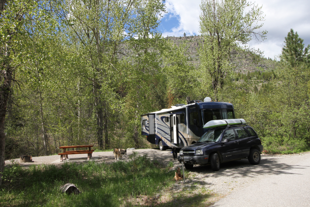
We picked site #10, about 30 feet from the creek – close enough for the sound to be loud, but far enough away to be safe. The nightly fee is $18 – I just paid for one night because I’m not sure yet whether it’ll be one or two nights.
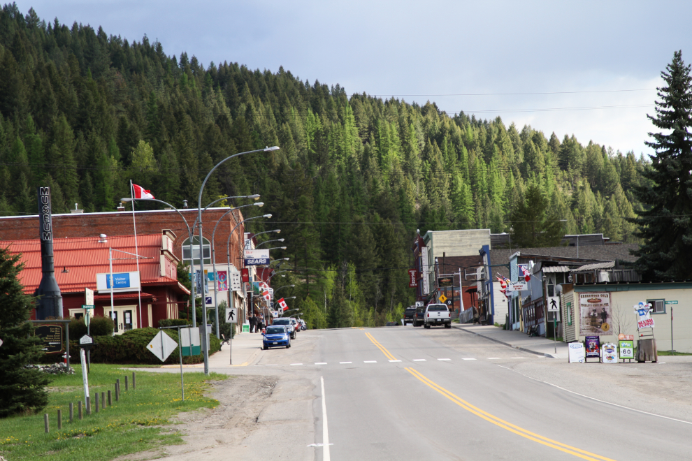
After lunch and then a nap when a rainstorm hit, we drove into Greenwood. There, we found that the Visitor Centre is open 10-4, and we missed it by a few minutes.
We continued through town, and found that all of the parks and many homes toward the north end of town are flooded.
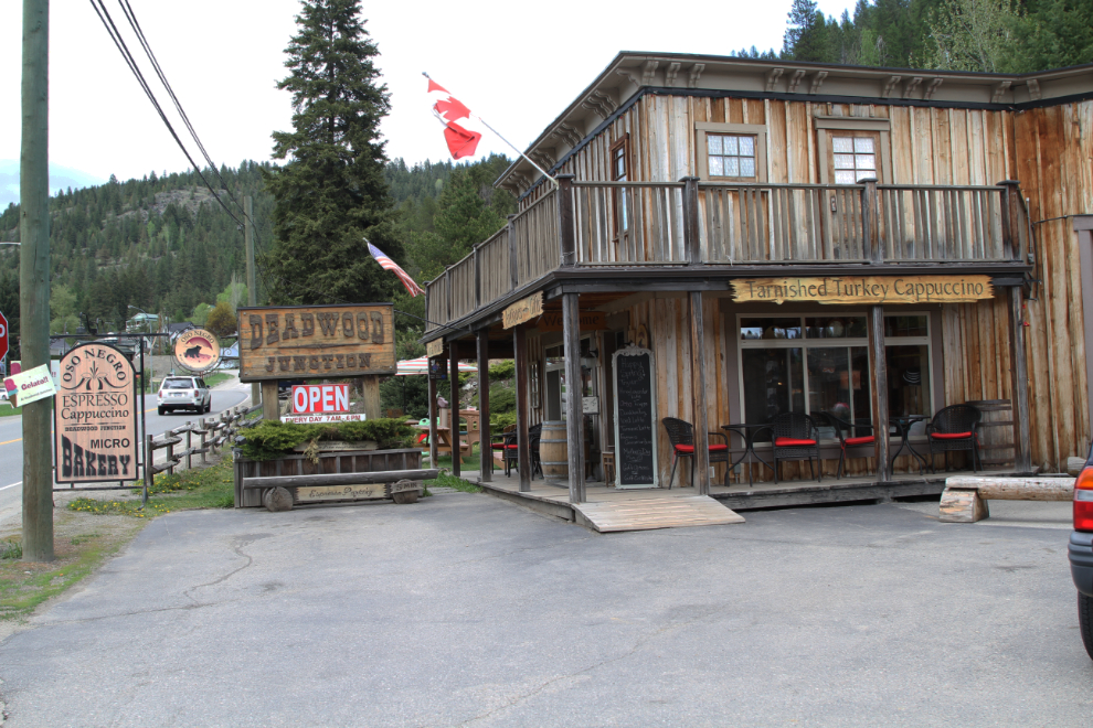
We went back to Deadwood Junction, where we’d seen a sign advertising cappuccino. The business was named for Deadwood, a small mining town in the mountains west of Greenwood – there’s nothing remaining now.
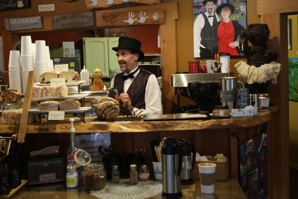
The proprietor/barrista at Tarnished Turkey Cappuccino in Deadwood Junction is quite a character. We heard him tell another customer that somebody they knew had lost his house to floods 2 days before, and the next day, he’d lost his business as well. With a couple of lattes and some excellent pastries, we were ready for a bit of a walk through town. Cathy is still having a lot of trouble with a knee, so walks are slow and short.
Things are quiet now, but in 1899, the population of copper-mining boomtown Greenwood, founded in 1895, was 3,000. There were 16 hotels, 3 banks, 15 general stores and a host of other businesses in a town that stretched through the narrow valley for 2 miles. A few very interesting buildings remain from those days.
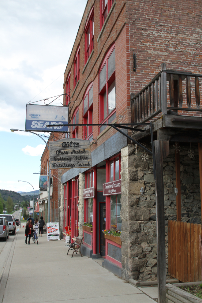
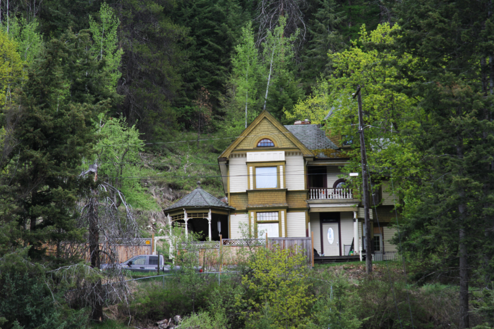
Some very high-quality homes remain as well as the commercial and government buildings.
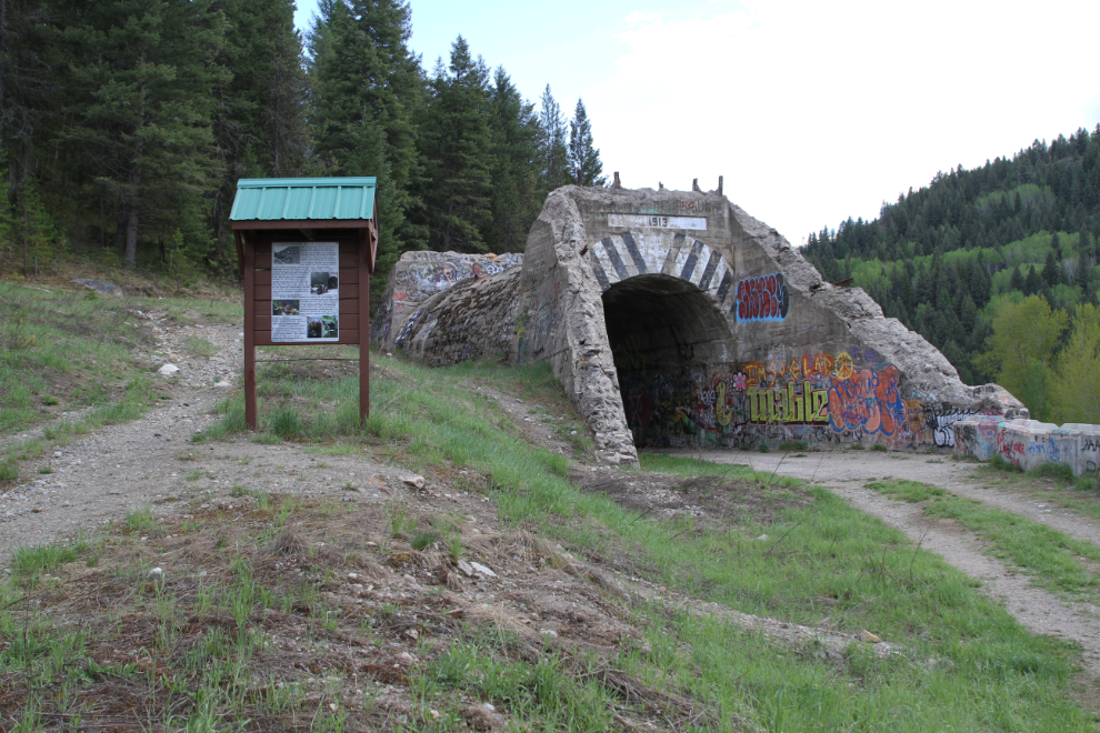
Driving north of Greenwood on Highway 3, I stopped at what I assumed was a tunnel for one of several railways built in the area. An interpretive panel beside it explains that it was, however, a road tunnel that was built in 1913 – the railway ran above it.
Back at the motorhome, Tucker started trying to convince us to go bed at about 7:00. With some snuggling, Cathy convinced him to stay up until just after 8, then he went to bed without us. We weren’t too far behind. I’m finishing the first day of this post just after 06:00 on Saturday – it’s looking like a great day coming, with sunshine and a high of 25°C. It’s a rather chilly 5°C outside at the moment.
The next day, we’d explore the mining history of the Greenwood area in more depth.