Exploring Lytton and the Thompson River Canyon
After some exploring in the Cache Creek area on the morning of Day 7 of the trip – Wednesday, May 3 – we continued south from the Redhill Rest Area. I didn’t know how far we’d be going, just that it wouldn’t be far.
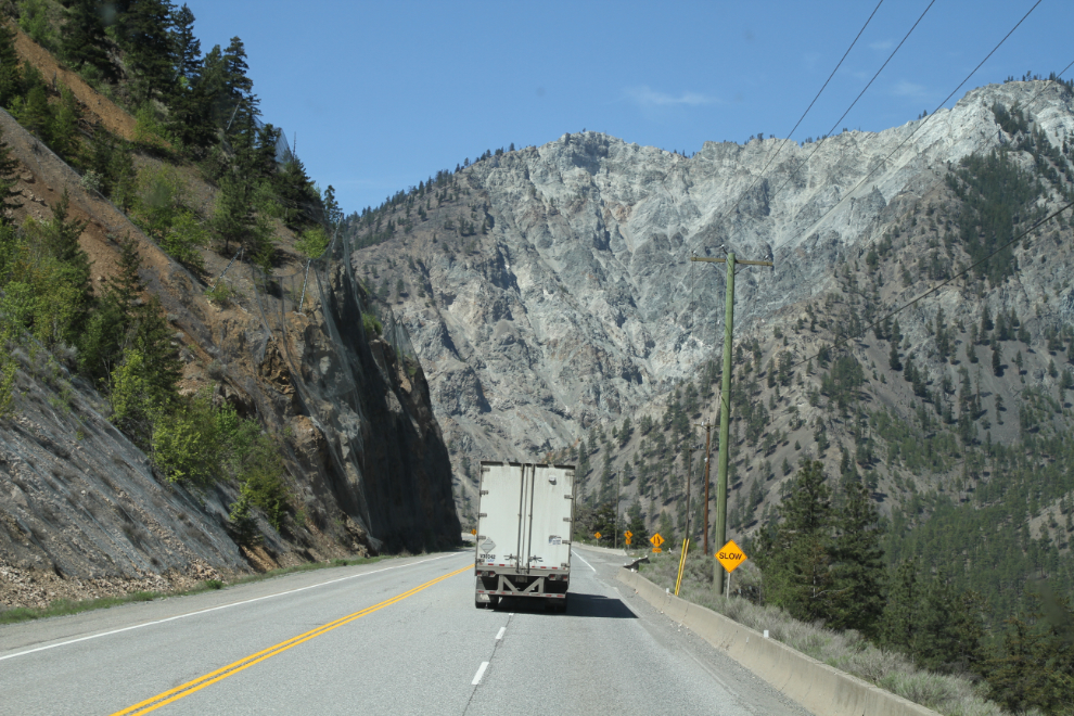
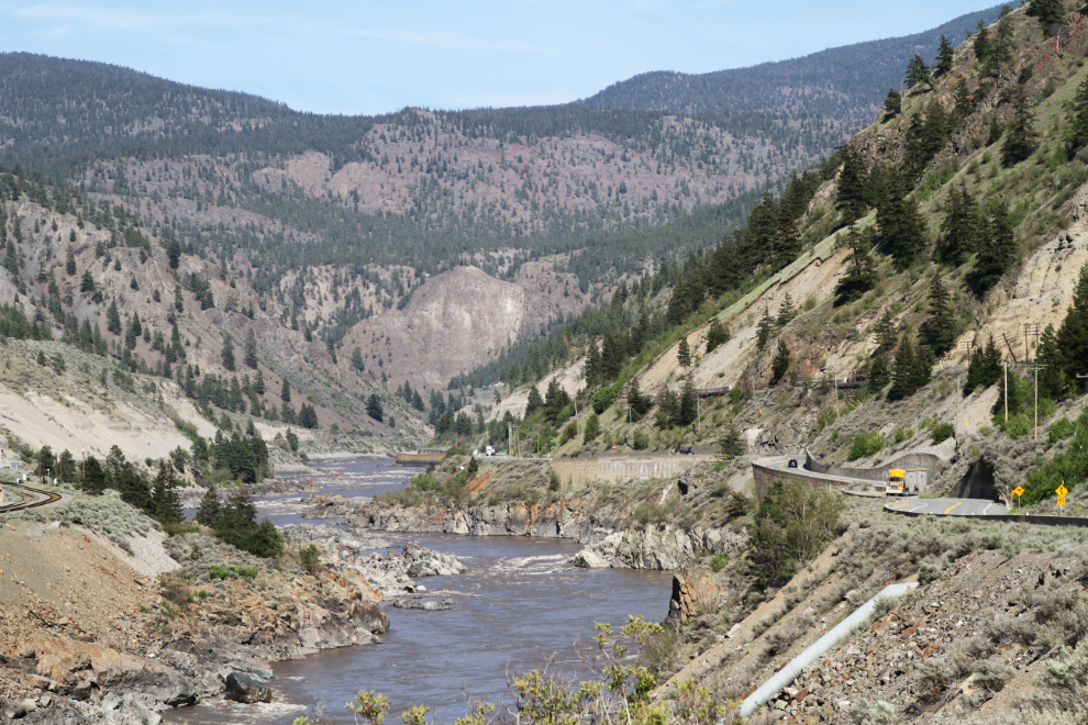
At Cache Creek, the highway going straight south had changed from Highway 97 to Highway 1 (the Trans Canada) as it wound its way down the Thompson River and Thompson River Canyon. There’s an incredible variety of terrain here in a very short distance. As I came to this spot last year, there was a large landslide on that slope ahead – it raised a whole lot of dust but didn’t reach the railway below.
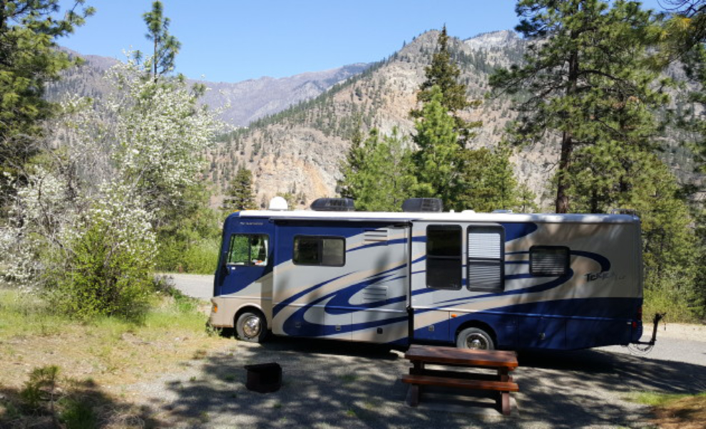
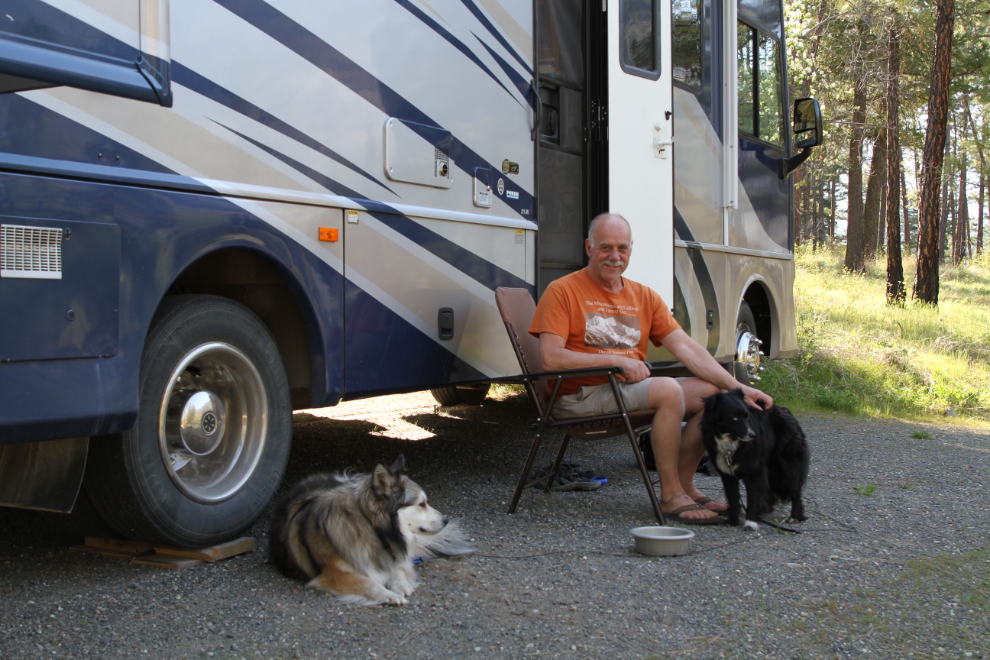
Just after noon, we arrived at Skihist Provincial Park, which I had checked out last year and decided it would be nice to stay at. The total highway mileage in the RV for the day would be 58 🙂
I quickly found a site (#7) that had a great combination of shade and view, and registered for 2 nights, at $23 per night. There are a total of 56 very large sites climbing the slope.
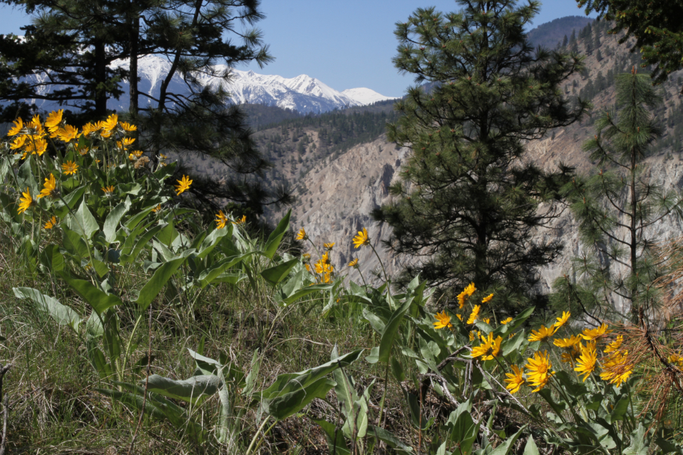
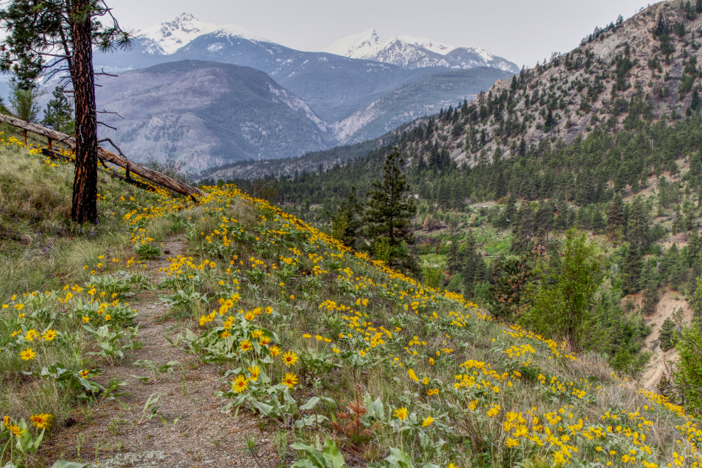
The arnica were at their peak in the campground, and the dogs and I went for a walk to immerse ourselves in Spring colours and smells. This view was about 200 meters/yards from our campsite. I thought briefly about moving to the campsite that had this view, but it had more shade than I wanted, and more highway and railway noise.
Looking down into the canyon from a trail near where the flower photo was shot.
I unhooked the Tracker and we drove to the Skihist day-use are across the highway, where there’s lots of soft green grass for dog feet 🙂
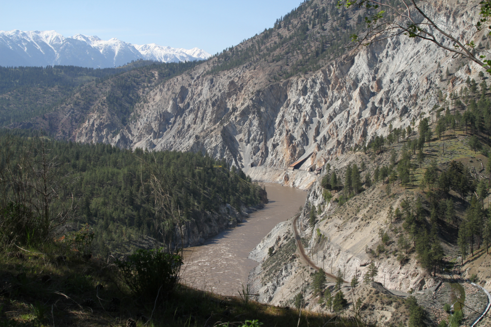
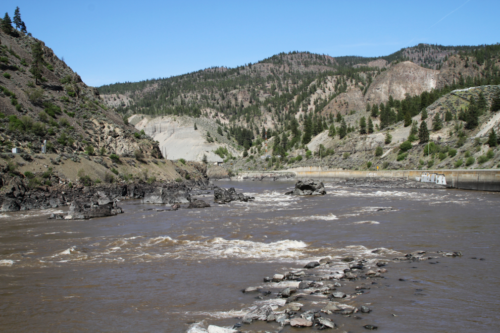
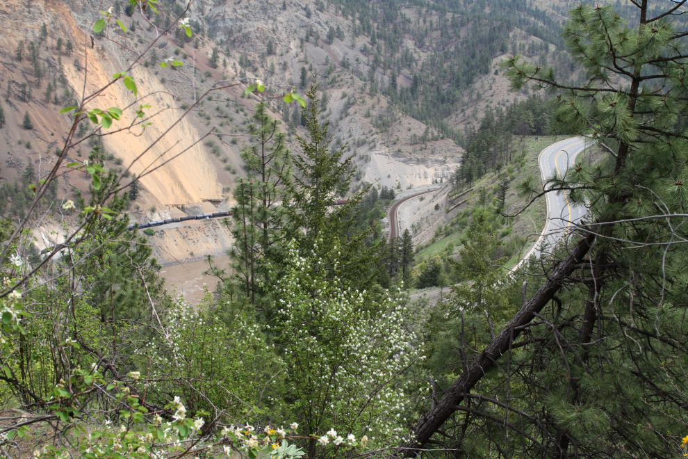
The view of the canyon from the day-use area.
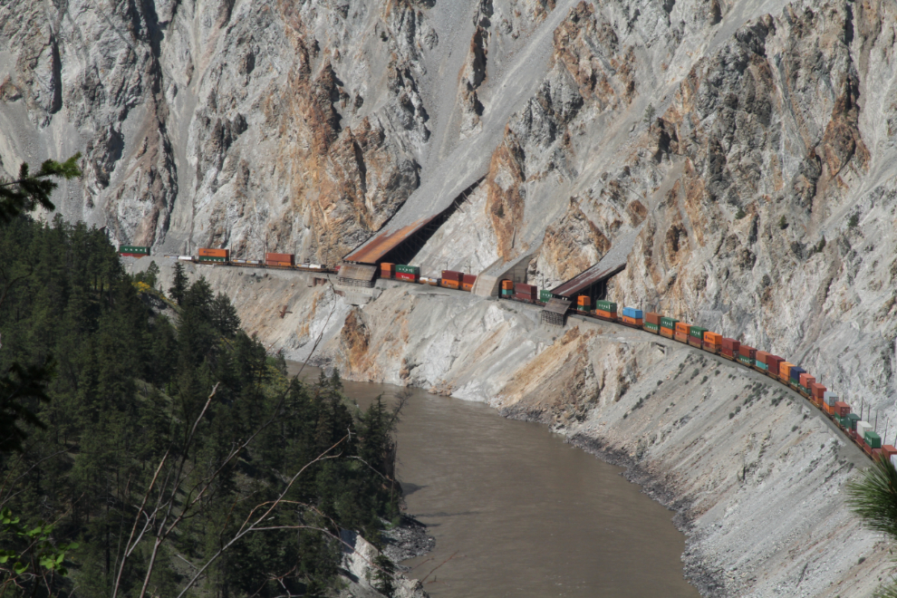
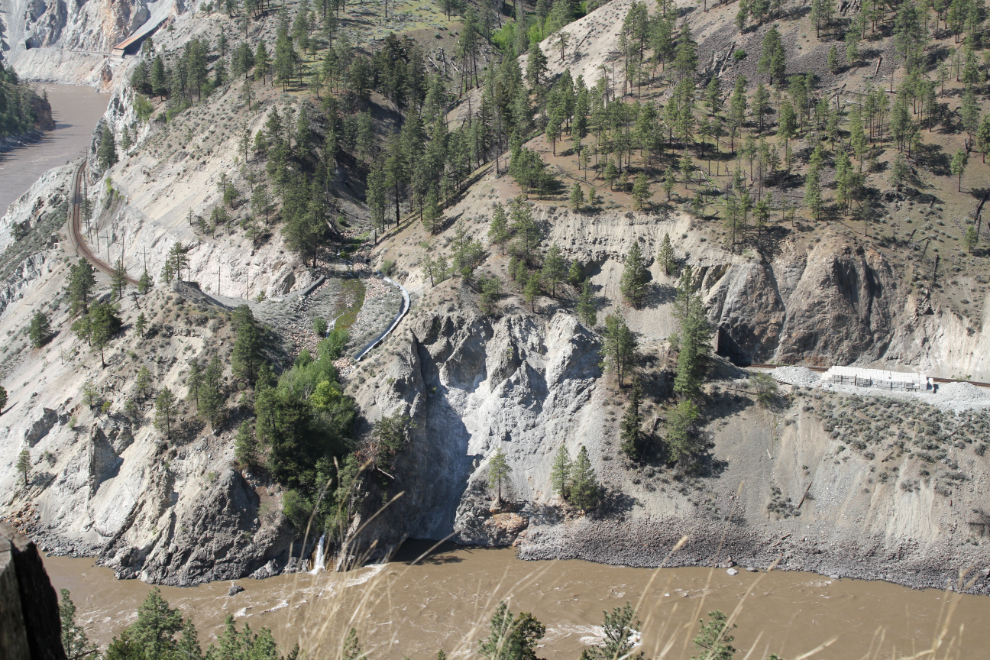
The railway engineering in the canyon is fascinating. It’s hard to make out, but the railway goes through a tunnel in the next photo, and a controlled creek flows over the top of it.
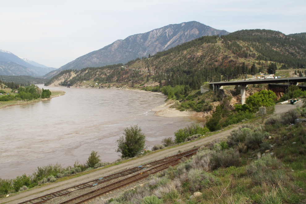
Just after 3:30, we headed north in the Tracker, retracing the route along the Thompson River to get some photos. The river isn’t nearly as attractive with its muddy Spring runoff flow, but it’s impressive.
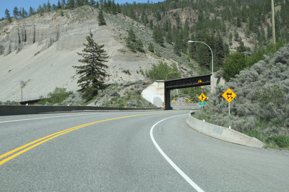
The river, road, and 2 railways fight for the best position. The river always wins, the railways get the next best positions, and the roads gets fit into whatever space is left. That leads to some tortuous curves, overpasses/underpasses, and very narrow stretches.
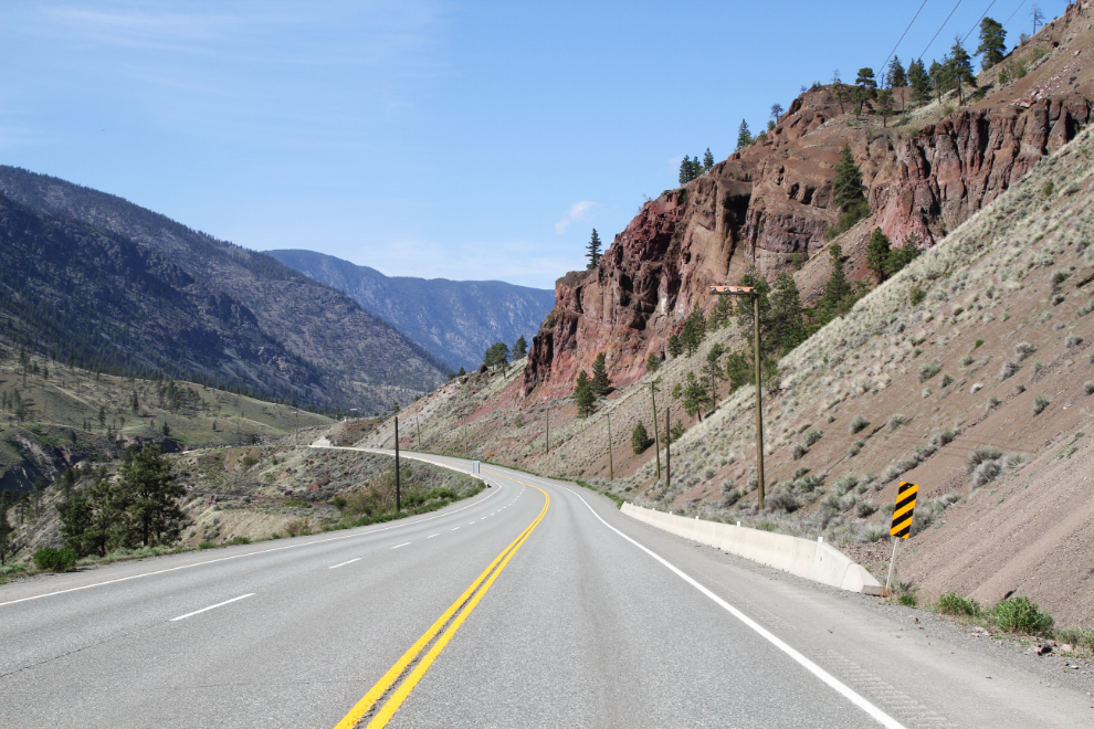
Once out of the canyon proper, things get easier for engineers, but there’s still some wonderful geology, like the red cliffs ahead in the next photo.
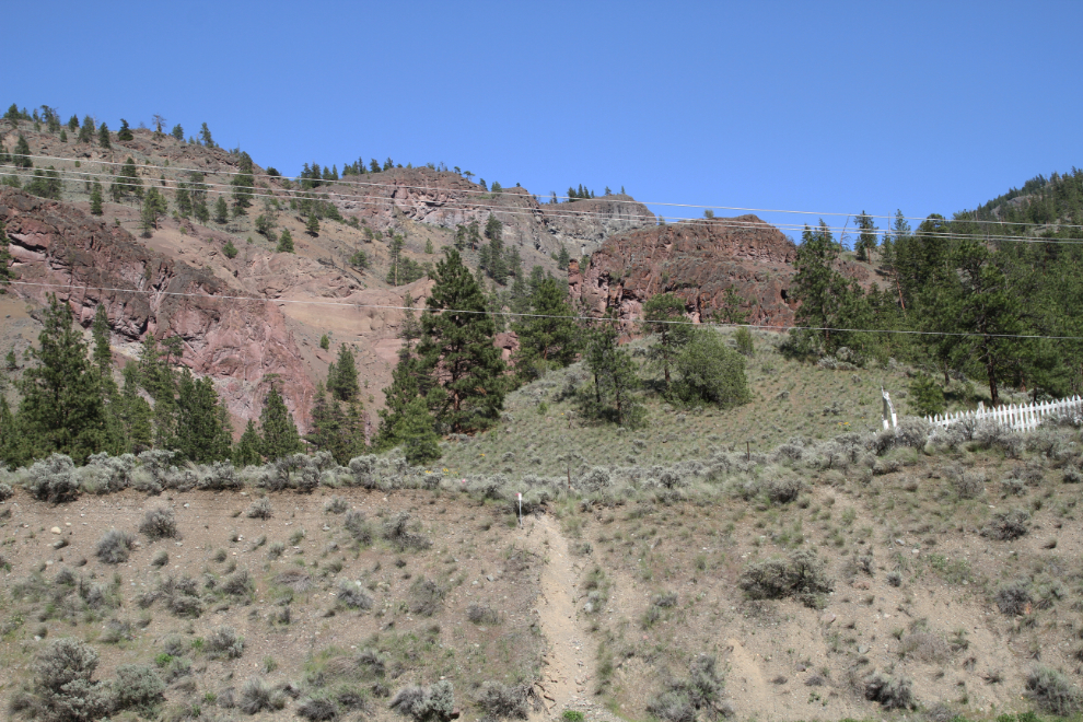
There are cemeteries and solitary graves scattered everywhere along the Thompson and Fraser. I climbed up to the one in the next photo last year – it’s a Native family cemetery with about 40 graves dating back 130 years or so. I posted some photos of the cemetery and graves on the blog post from that visit.
Only an aerial shot (or a dashcam video) would show you how crazy the road ahead is.
By 5:00 pm, we were back at the RV, relaxing in the shade, with a nice breeze blowing. The temperature was about 22°C (72°F) – perfect.
The next morning – Thursday, May 4 – I left the dogs in the motorhome and drove into Lytton to do some exploring. I got sidetracked by a little hike that offered flowers and great views, though 🙂
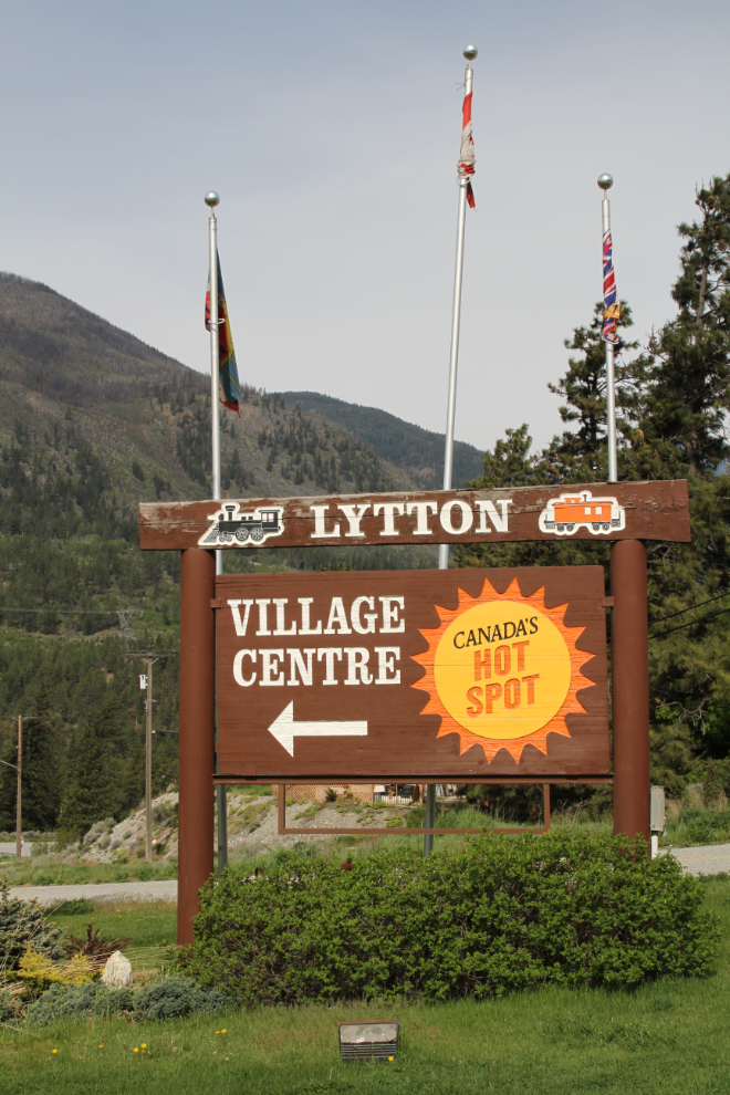
Entering Lytton from the north end of town.
My Lytton exploring very quickly got sidetracked when I looked up the Fraser River and saw a tiny ferry. A memory from decades ago told me that it was one of the last reaction ferries remaining in BC – ferries that are operated by the current of the river, with no motors. That I had to see again. It was so cool that I’ve posted it separately at The Lytton Reaction Ferry.
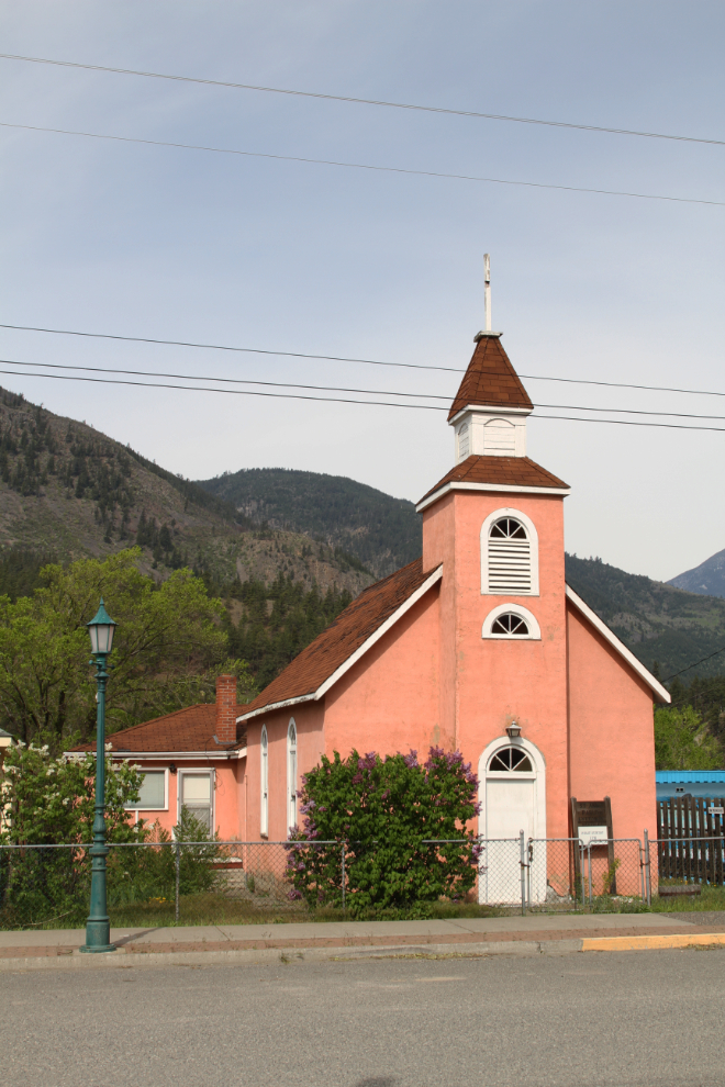
This lovely little church is the St. Ann’s Parish Roman Catholic church.
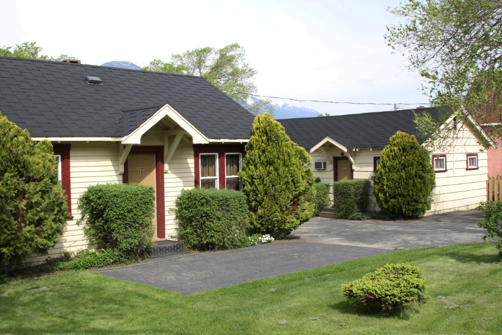
The cottages of the Totem Motel next door to St. Ann’s are equalling as charming.
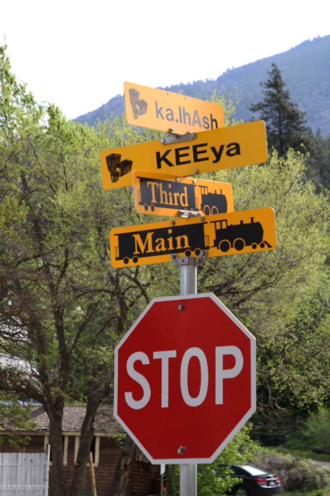
Street signs in Lytton are in both English and the local Nlakapamux language.
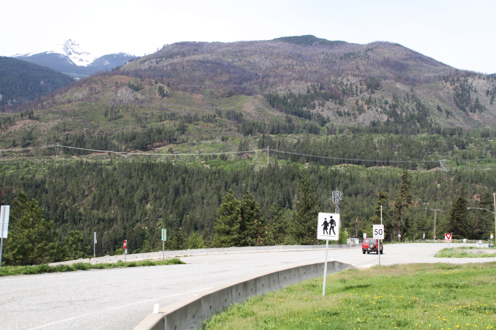
Next I drove up to the south access to Lytton from the Trans Canada Highway. This is obviously considered to be the primary access to town for tourists, as there’s no sign at the north access road.
This is the south access to Lytton, seen from the welcome sign.
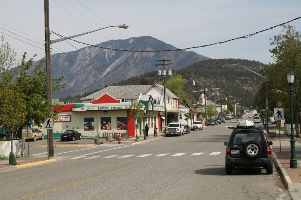
Main Street in Lytton.
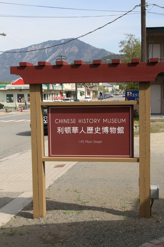
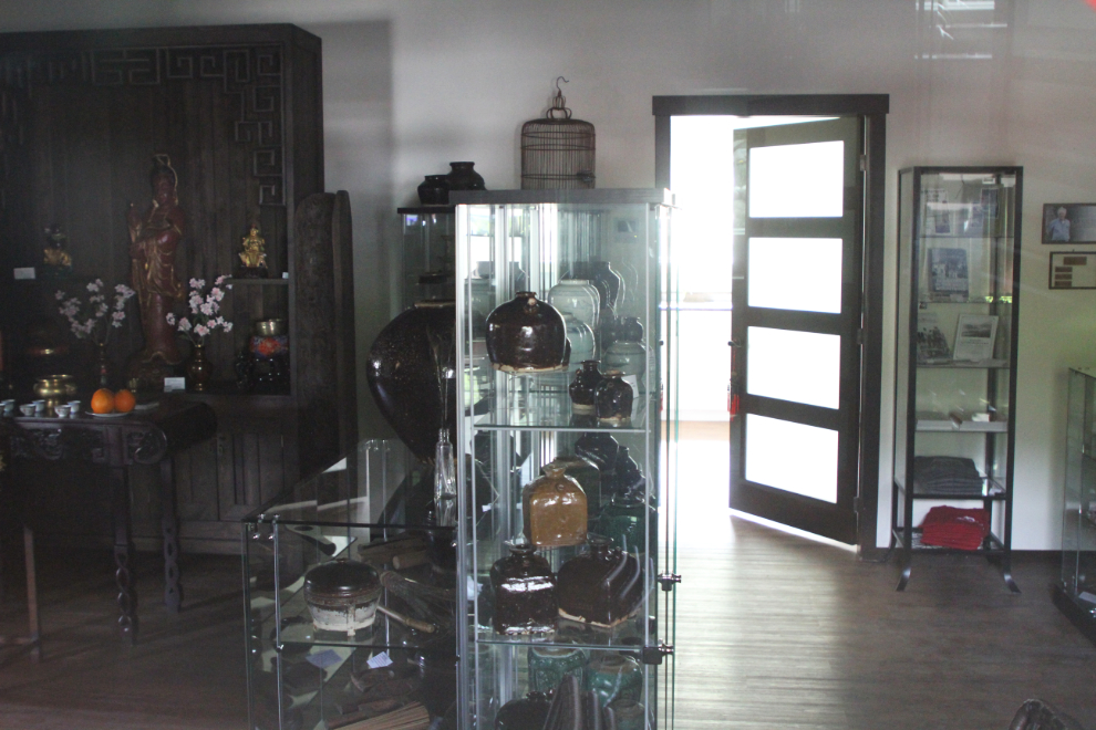
One of main goals in Lytton this time was to visit the new Chinese History Museum, which opened a couple of weeks after my visit last year. This year, it’s closed for the month of May. Well okay, next year!
I took a couple of photos of the Chinese History Museum through the windows before leaving.
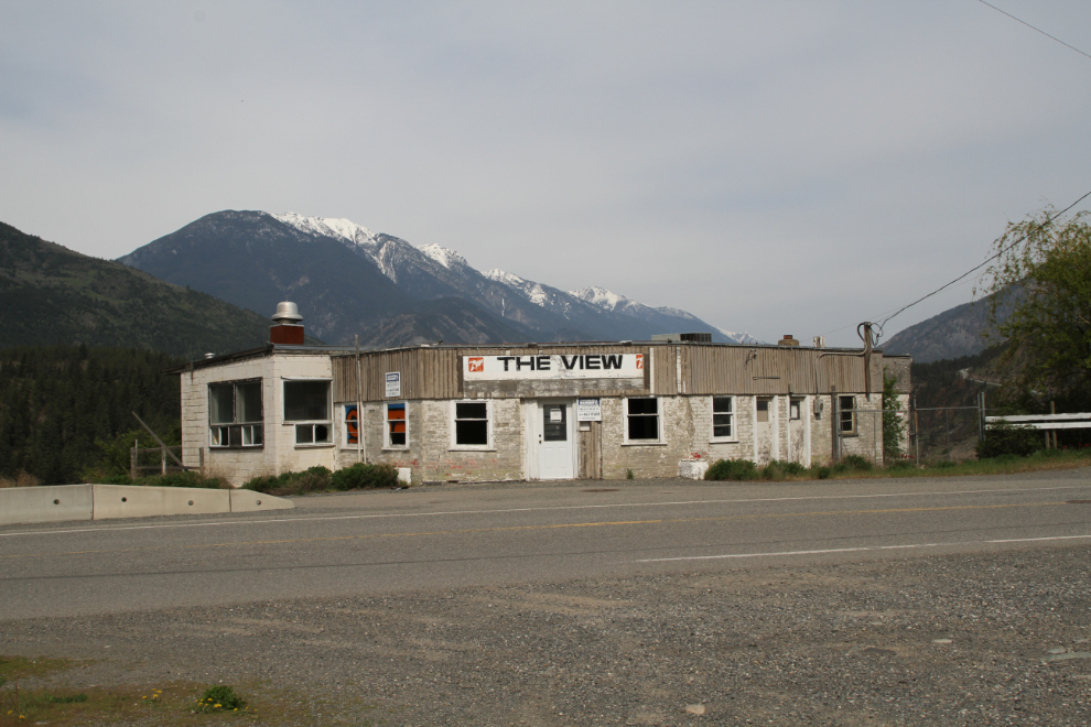
Driving through town on my way back to the campground at 10:45, I had to get a photo of this little building, which overlooks the confluence of the Thompson and Fraser River – the best view in Lytton. The building looks like it’s been empty for a long time, though.
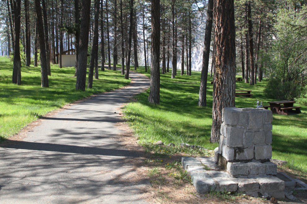
Back at the campground 10 minutes later, it was time for a long dog-walk. One of the things that had attracted me to Skihist was the fact that section of the Cariboo Wagon Road, built in 1862-1864 to access the gold mines of the Cariboo, runs through the park and is maintained as a hiking trail. How perfect is that for someone like me?
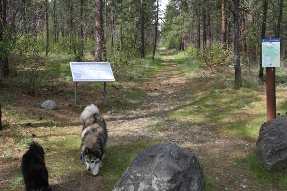
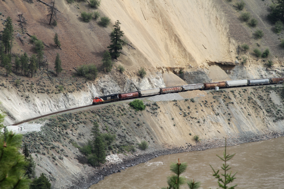
Bonus – there are some great train views along the Wagon Road trail as well.
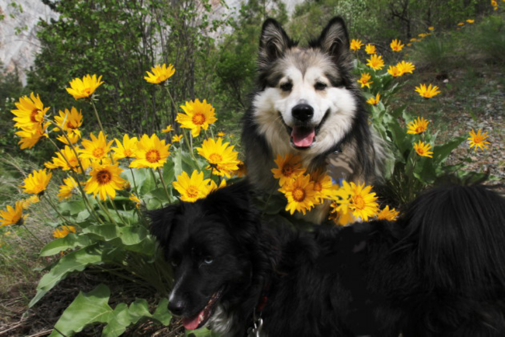
And flowers – oh my, the flowers along the trail!!
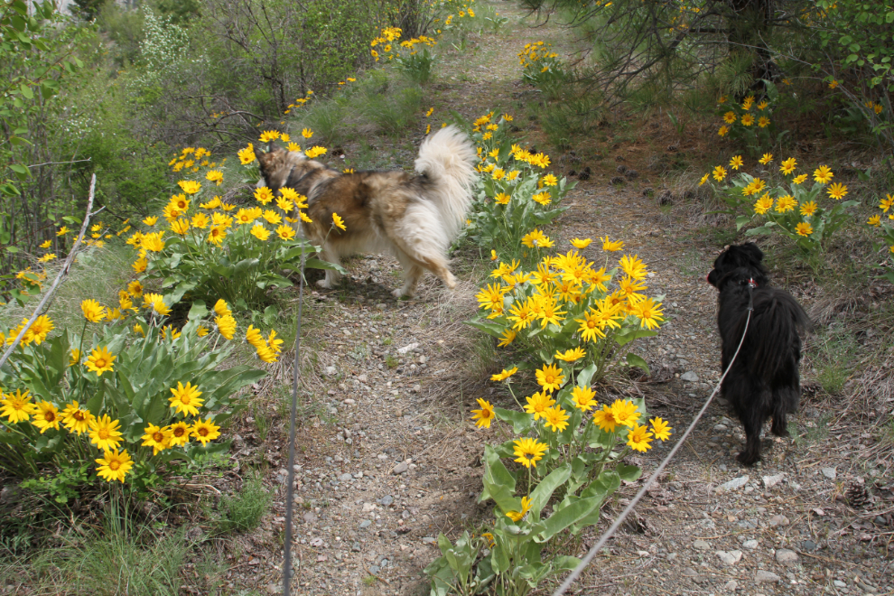
It was getting pretty warm so we didn’t walk very far – Bella is having a tough time when it gets into the 20s. But it looks like she’s having fun anyway, doesn’t it?
Many reviews of Skihist comment on the train and highway noise. This view from the Cariboo Wagon Road trail shows you why. The two main Canadian railways and the Trans Canada Highway traversing a narrow canyon with few trees, just bare rock to bounce the noise off. For me, the noise isn’t even a consideration in how amazing this park is.
Despite all the fun, I had work to do on both the Tracker and the motorhome. First the Tracker, whose electric window panel had died a few months ago. The Whitehorse GM dealer found the part in Quebec for $400, I found one in China for $34. The part was in my mailbox when I checked it the day I left Whitehorse, and it was pretty easy fix. It looks and works like new. With labour, my half-hour of work saved almost $500.
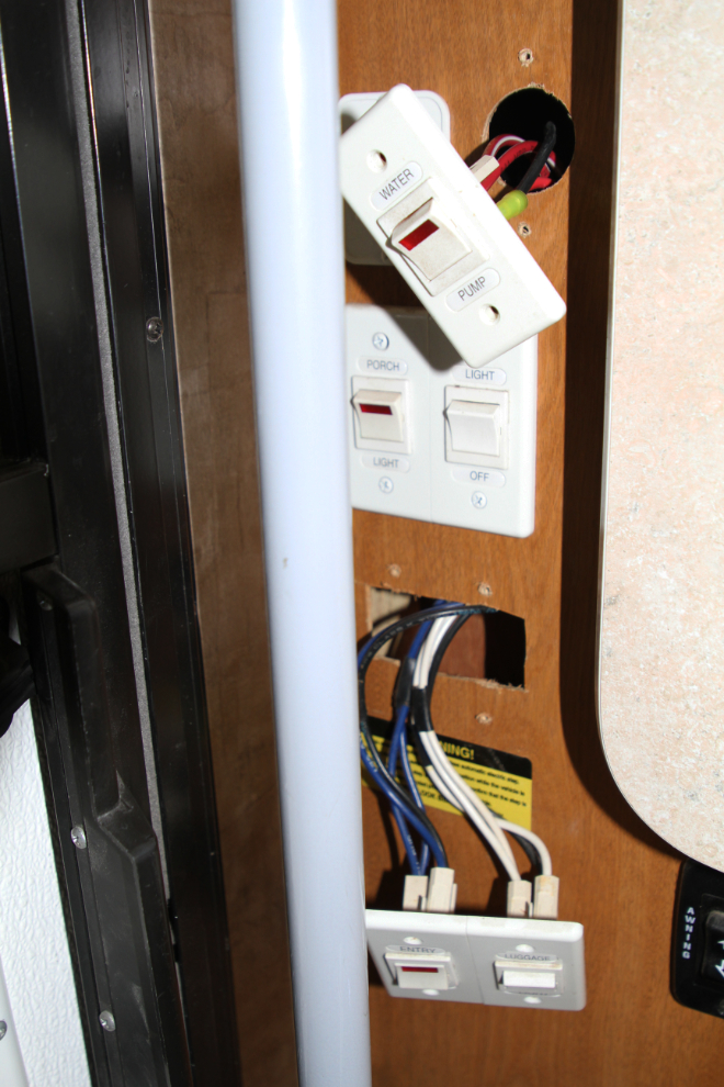
Operation of the water pump in the motorhome has been getting increasingly erratic, and it’s time to get it figured out. I started to replace the pump, then realized that it’s electrical – the water pump switch sometimes operates the stairs! Hoping for an easy solution, I pulled the water pump and stair switches. Nope, nothing obvious. Trying to get a shop to look at it in Kelowna was unsuccessful – everybody is too busy to fit in what could be a complicated job.
The rest of the day was a lazy one, enjoying the warmth, the flowers, and the views. For Day 9, I had another short highway day planned, with lots more exploring.