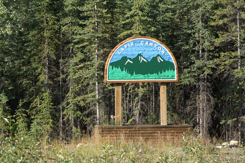
Exploring Lapie Canyon Campground and Ross River
We stopped early on the second day of this RV trip – Wednesday, July 25th. By 3:00 we were settled in at campsite #5 in Lapie Canyon Campground, just west of the access road to Ross River from the Robert Campbell Highway. With no firm plans again for Thursday, I had lots of time to explore at my leisure.
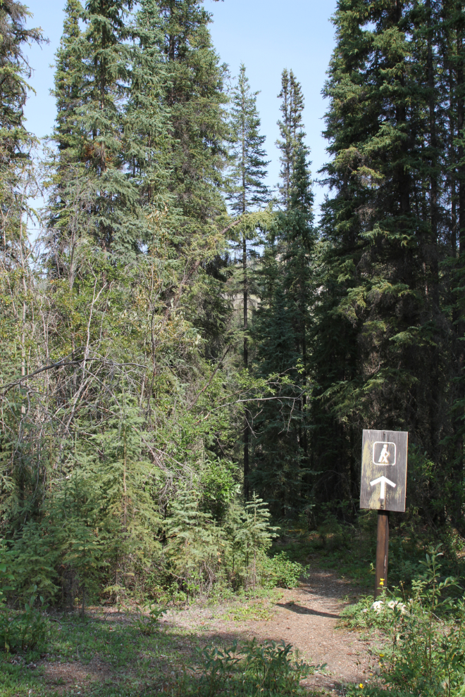
The first place on my list of places to see was, of course, Lapie Canyon. Two trails led to it from a couple of hundred meters on either side of my campsite. I chose the trail leading towards the bridge first.
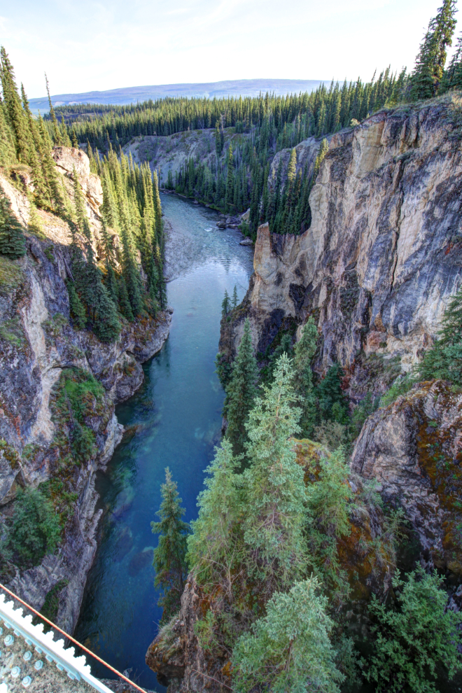
That trail led through the forest and then along an open slope to the top of the canyon, which was created when the Lapie River cut through a wall of limestone.
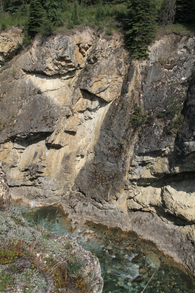
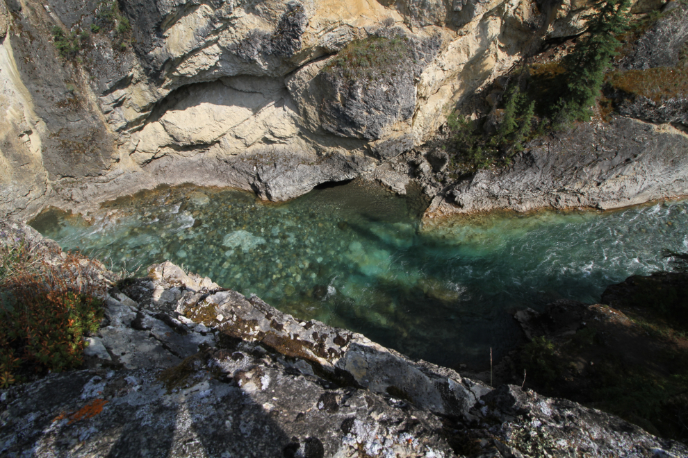
The water looked incredible from up there – a clear turquoise colour.
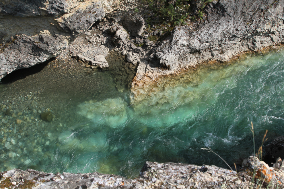
Looking over the edge with my 10mm lens.
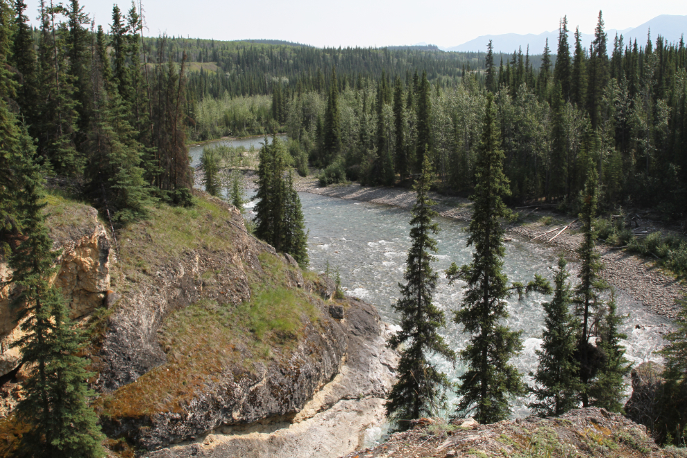
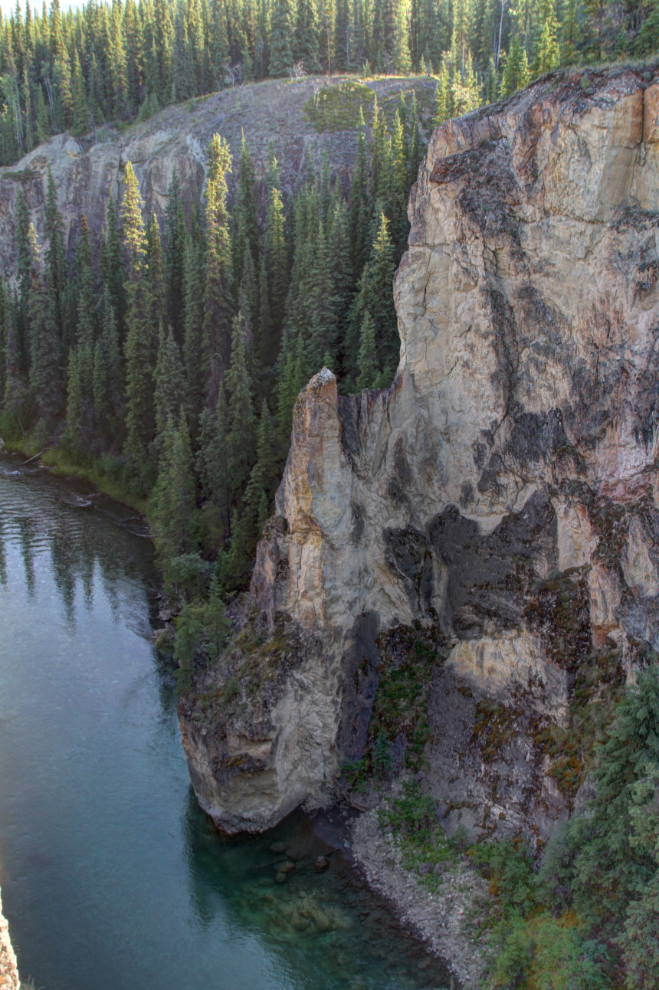
Looking up the Lapie River to where the lower part of the campground is.
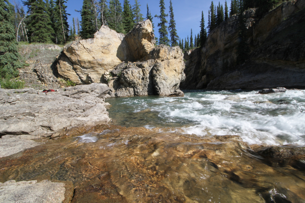
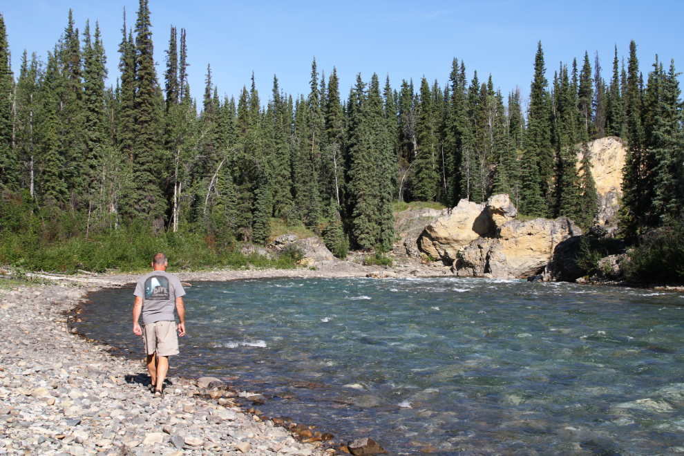
A side trail led down to the river. The light was perfect for photography, and the water was surprisingly warm.
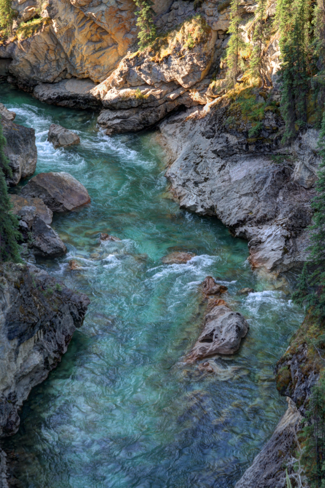
The only calm pool, right the head of the canyon, was occupied by a guy who was having some success catching Arctic grayling, which he was releasing. The pool wasn’t big enough to go for a dip anyway 🙂
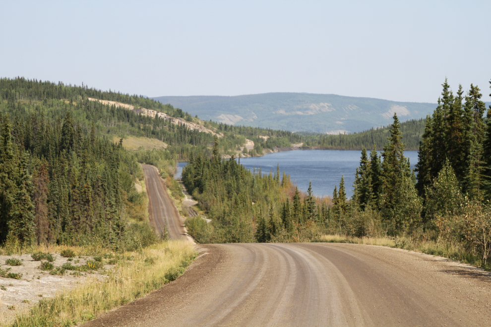
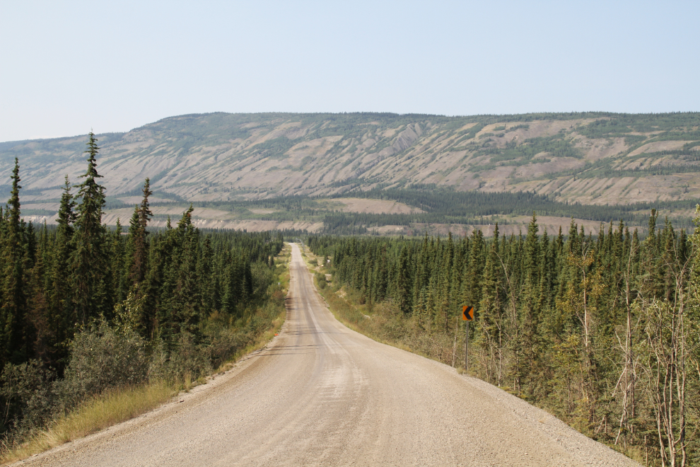
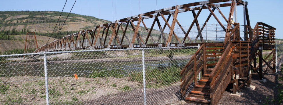
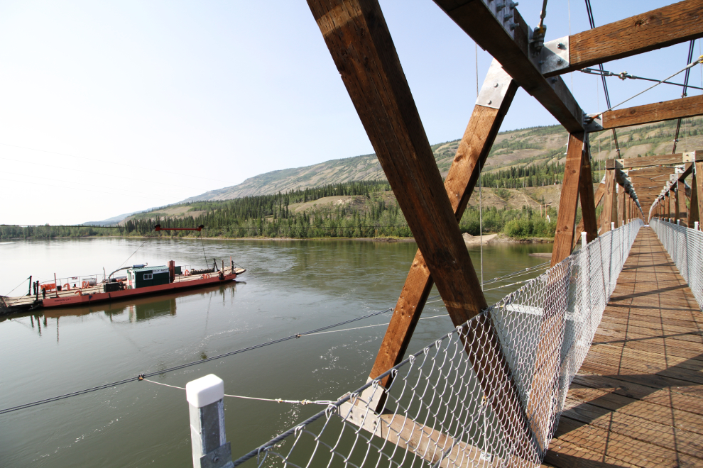
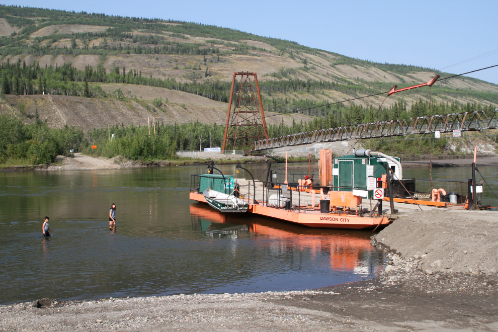
Just before 4:30, I decided that the light was perfect to photograph the newly-restored footbridge at Ross River. The next photo was shot along the access road to Ross River, which is 11 kilometers north of the Robert Campbell Highway.
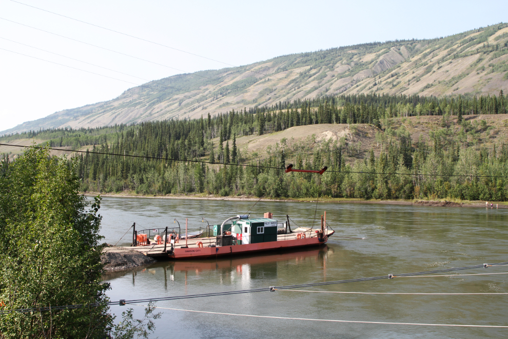
The road ends at a ferry that crosses the Pelly River. As I was taking this photo, a couple of guys in a pickup stopped to ask if I was okay. Real Yukoners always keep an eye out for people who need assistance.
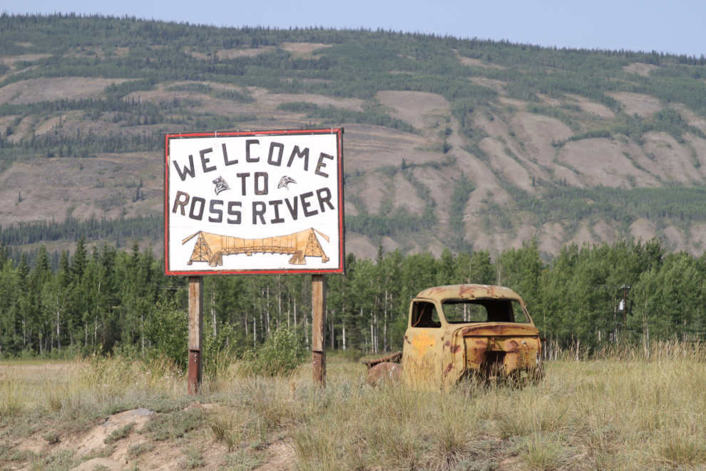
Welcome to Ross River, which was founded as a trading post on the north side of the river, then moved to the south side in the 1960s, to eliminate reliance on a ferry or ice crossing. The community is most well known for its part in the World War II Canol oil project which took oil by pipeline from Norman Wells on the Mackenzie River to a refinery at Whitehorse.
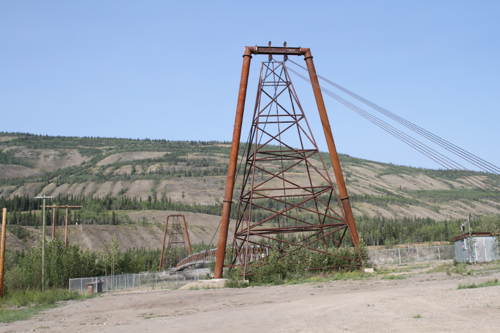
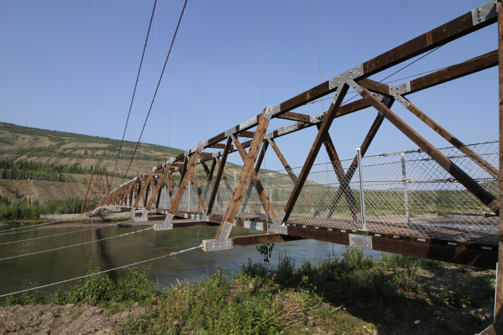
The Ross River suspension bridge was built in 1943 to carry the Canol pipeline across the Pelly River, but was converted to a footbridge after the war, and has recently been restored to its footbridge status.
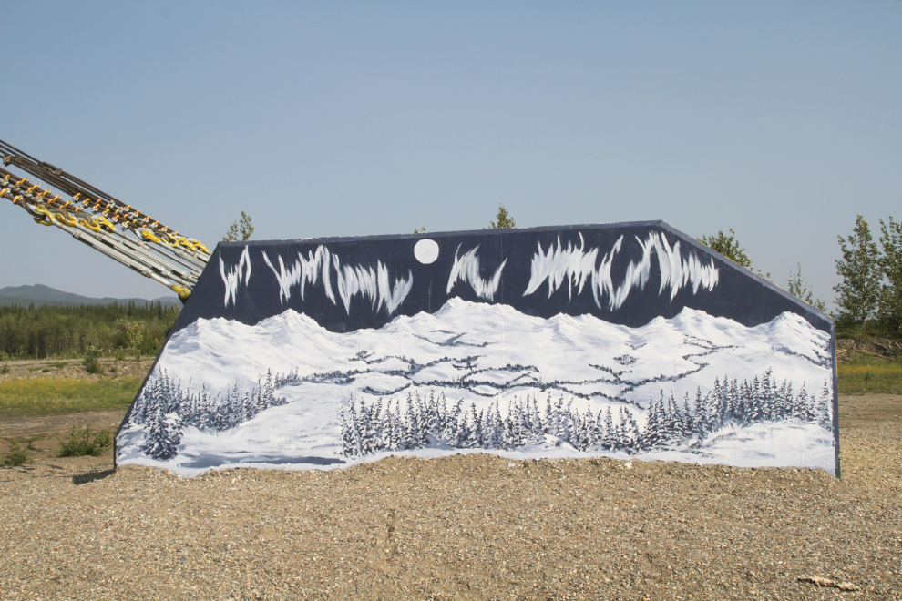
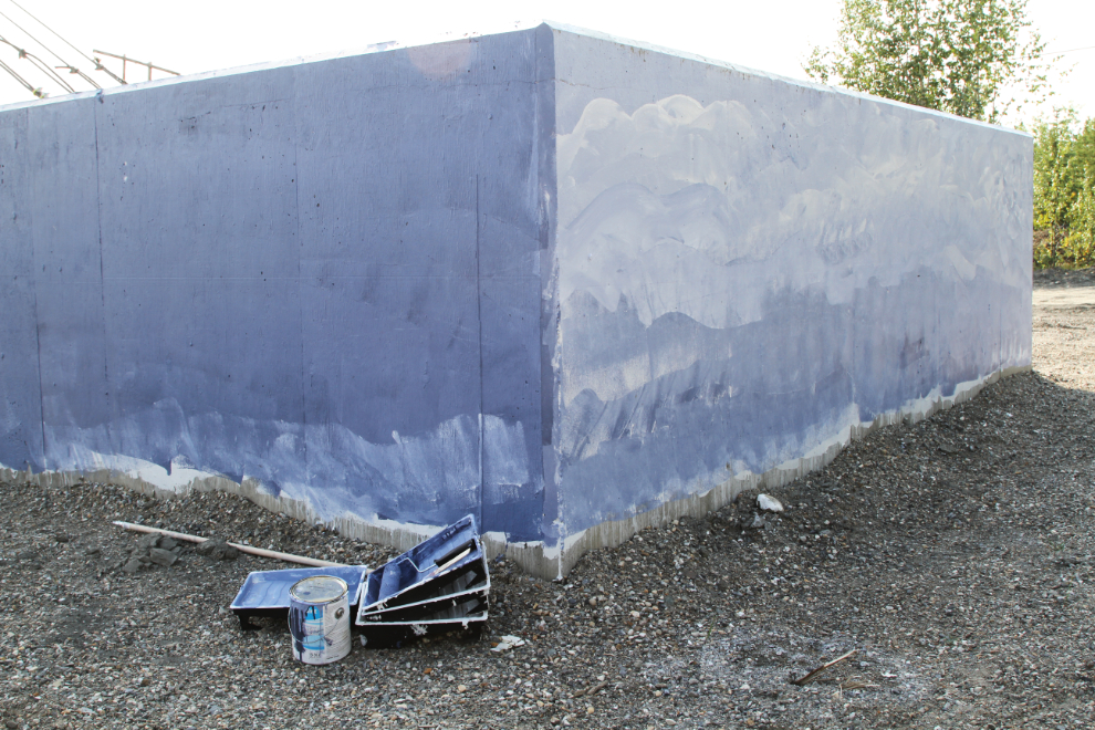
I’m not normally okay with painting murals on a historic structure, but it’s a safe bet that the concrete tower anchors had been tagged by “grafitti artists”, so murals are a much better option.
The bridge is 316 meters long (1,036 feet), with a centre span of 192 meters(630 feet).
The Pelly Barge takes vehicles across the river, where the North Canol Road runs 232 km (144 mi) to Macmillan Pass at the Northwest Territories border. Beyond that, the road is a hiking trail at best, but even that isn’t maintained and is rarely used.
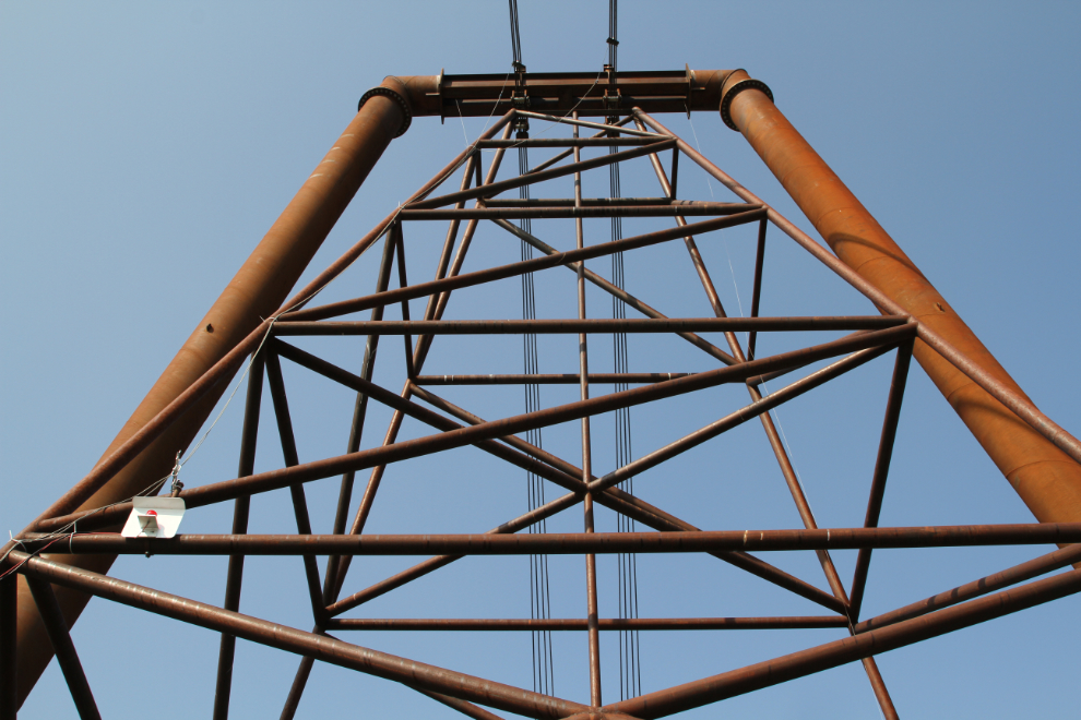
The bridge support towers are impressive, especially when you consider the conditions in which they were built.
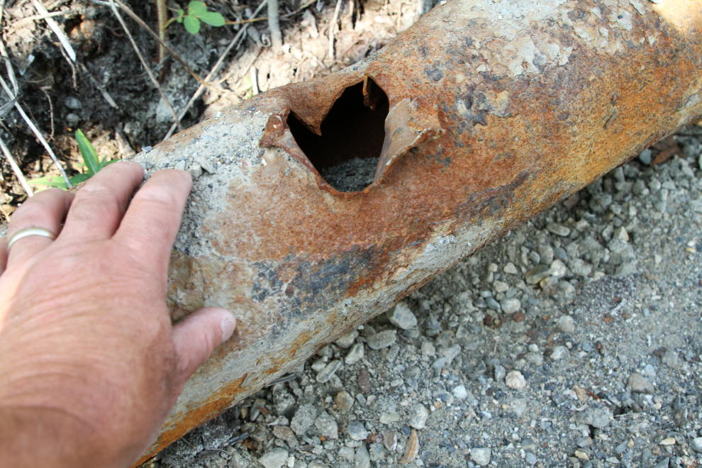
A section of the 6-inch Canol pipeline, which was just laid on top of the ground. Before the suspension bridge was built, it ran across the Pelly River on the ice. An interpretive panel at the bridge says that the pipeline from 4 inches from Norman Wells to Johnsons Crossing, then 6 inches from there to Whitehorse, but this is clearly 6 inches.
The concrete tower anchor on the north side of the river was starting to get its murals. I couldn’t find an artist’s signature on the completed murals on the south side.
I switched to my 10mm lens to get some broader photos of the bridge, and the bridge with the ferry.
There were quite a few people cooling off in the muddy waters of the Pelly River.
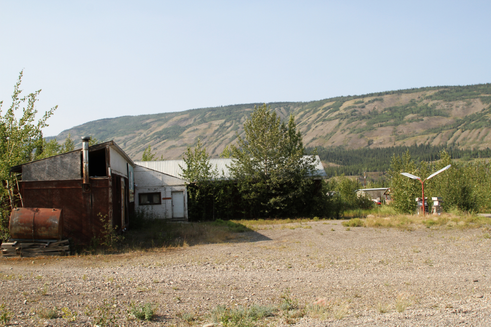
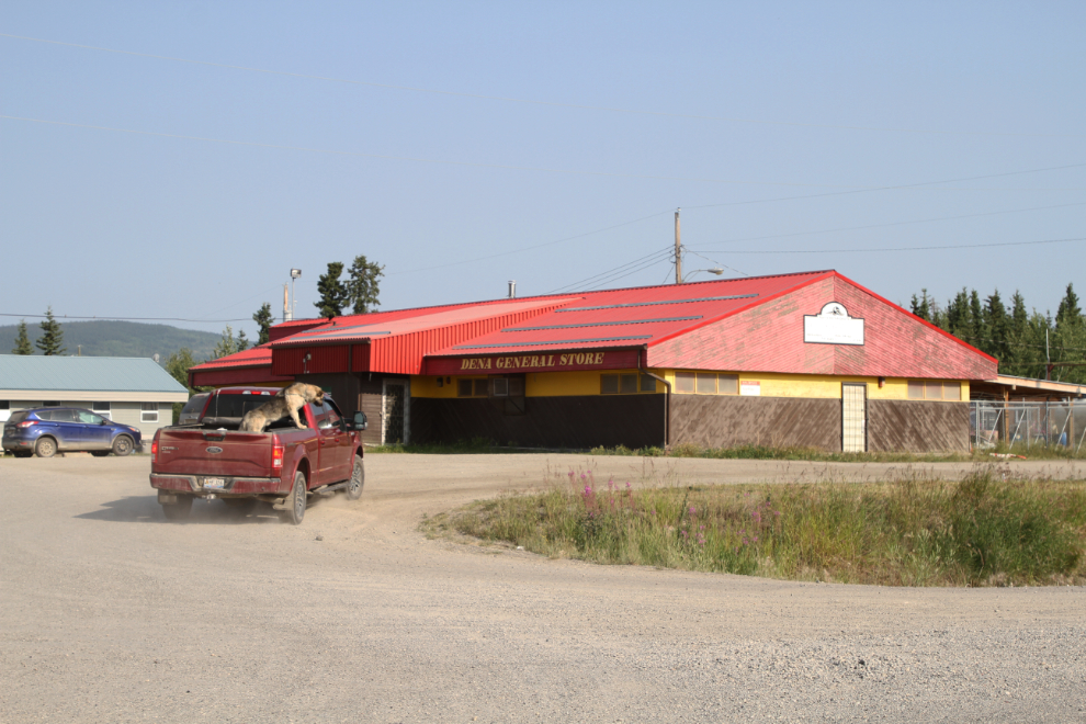
In about 1995, I drove the regular passenger, freight, and mail bus service to Yukon communities including Faro and Ross River, which I visited twice a week. I went looking for the businesses I used to serve, and all are now abandoned and derelict. The Ross River Service Centre (“Groceries, gas, fishing, hardware”, the sign says) was in pretty rough shape even 23 years ago.
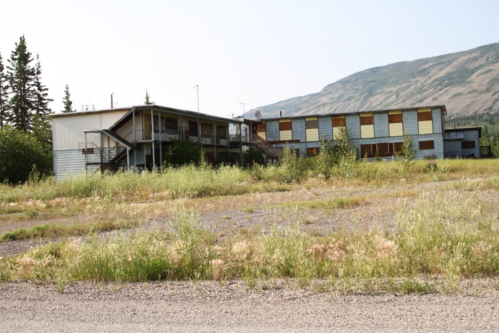
The Welcome Inn hotel closed about 15 years ago. I quite liked the bar there – it had lots of character and characters. I never drank there but it was a regular place to visit with freight deliveries 🙂
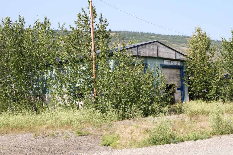
I had freight for the tire and mechanical shop pretty well every trip. With Greyhound now cancelling service to hundreds of communities in western Canada, this is a good reminder of how you keep passenger busses in business – with mail and freight contracts.
The grocery store now.
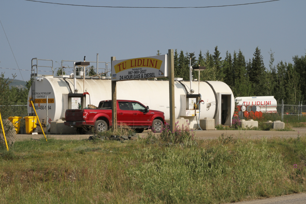
And the 24-hour cardlock fuel service beside the grocery store.
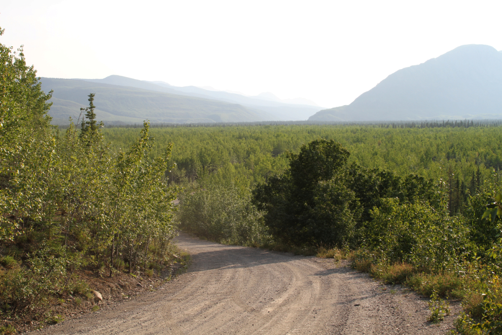
I’ve only driven the entire South Canol Road once, and I went for a look. It’s not suitable for the motorhome, and there are too many bears to tent, but maybe I could take the Jeep and sleep in it…
There appears to be minimal maintenance on the South Canol now – the Quiet Lake highways maintenance yard was closed a few years ago. The next photo shows the view from as far as I went. That misty valley is a magnet to me…
It was very warm that evening – the temperature in the motorhome hit 29.2°C. Bugs have been very bad during the day all along the Robert Campbell – not so much mosquitoes, but the huge deer flies or horse flies that take a chunk of meat out when they bite. They make poor Tucker frantic, so inside is better.
The next morning, I drove over to the Lapie Canyon Bridge to get some photos of that part of the canyon before the bridge repair crew got there.
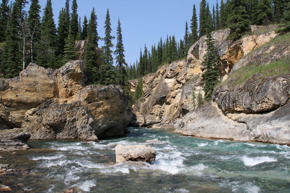
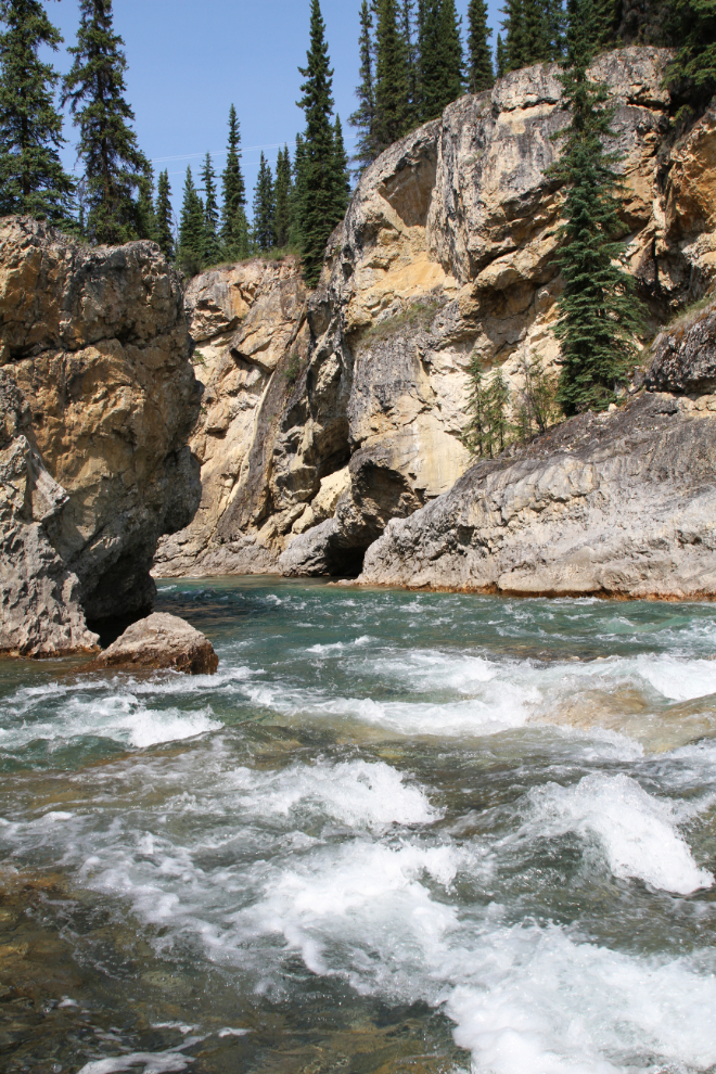
These 3 photos of the canyon were all processed as HDR images to bring the details out with the deep shadows.
The 2 photos above were shot looking down the Lapie River from the bridge, and the one below was shot looking upstream.
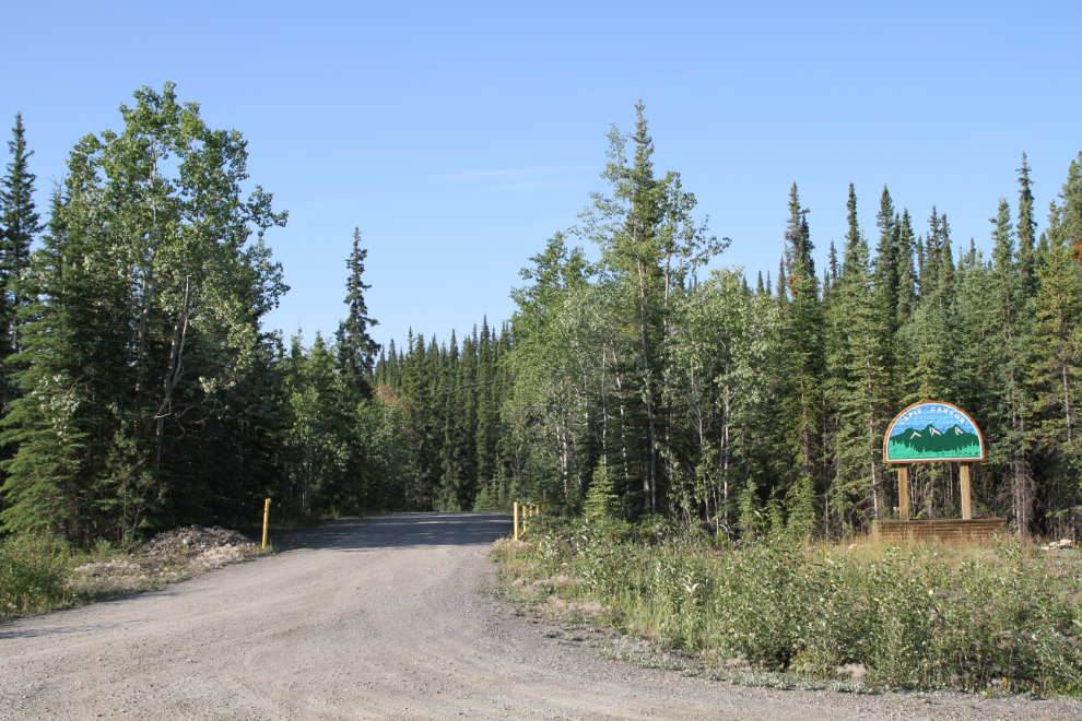
The entrance to the Lapie Canyon Campground is right at the bridge.
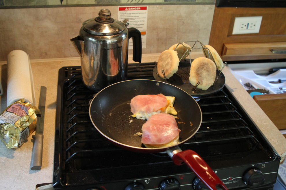
Time for breakfast! Note, no generator is needed, everything is done with propane.
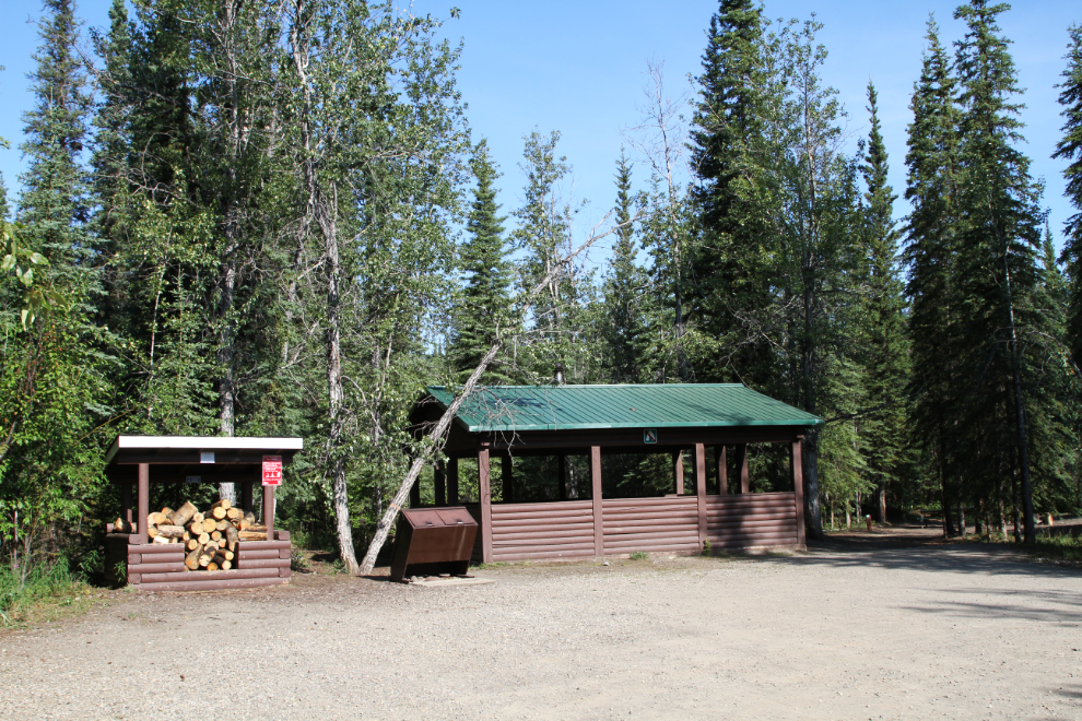
Just after 10:00 am, I drove down to the campground’s lower level, which had been very busy with the 14 bicyclists I met along the highway. They were gone now, and I had the place to myself. The next photo could have been taken at pretty much any Yukon government campground – those are the standard facilities.
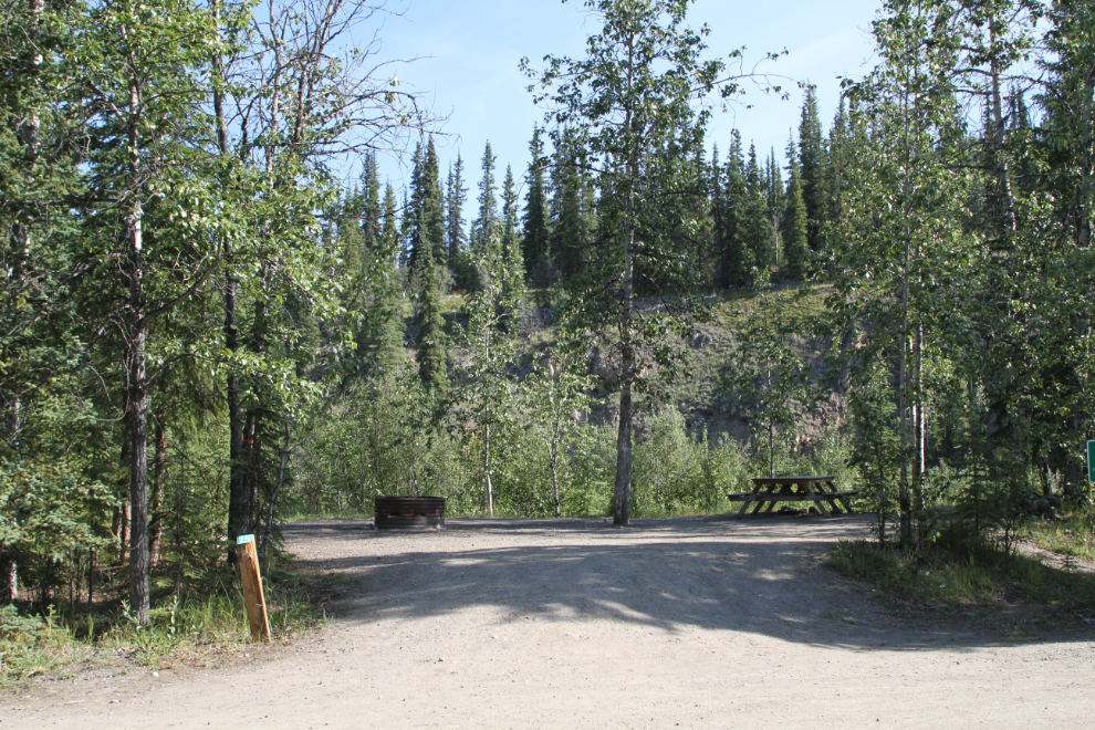
By my standards, the best of the 18 campsites at the Lapie Canyon Campground is #15, but it’s only suitable for very small RVs or car/tent campers. The best river access trail in the campground goes right through the campsite, though – not well thought out. The next site, #16, is also very nice and can handle larger RVs, though not as large as mine. Like many of the older Yukon campgrounds, Lapie Canyon is not very big-rig friendly – with one exception, even the pull-throughs are tight.
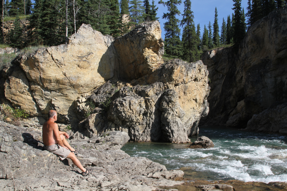
Lapie Canyon has a wonderful vibe when there’s nobody else around, and I wanted to spend more time there.
The head of the canyon is a wonderful place to just sit and enjoy the hot sun and the sounds of the rushing water.
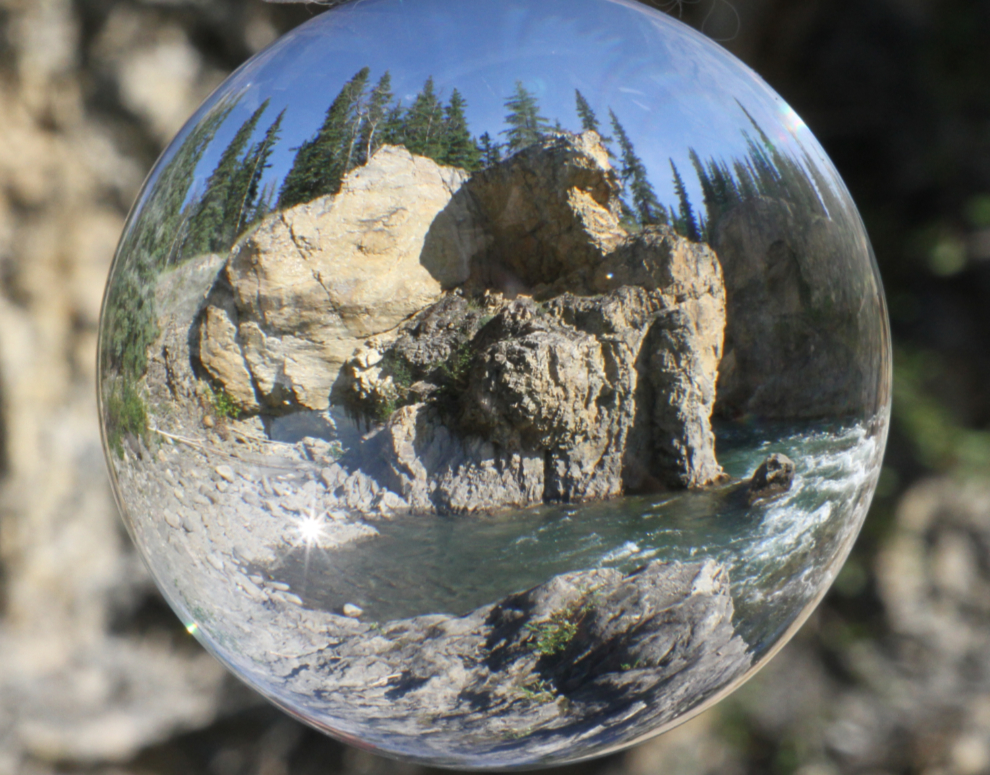
I brought my Lensball with me, and Lapie Canyon was the perfect place to work with its unique talents. I’ll let Lensball users try to figure out exactly how I got that shot (with no hand holding it) 🙂
One more photo and it was time to get packed up and hit the road.